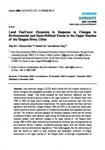
Journal of Geography and Regional Planning Vol. 4(2), pp. 77-86, February 2011 Available online at http://www.academicjournals.org/JGRP ISSN 2070-1845 ©2011 Academic Journals
Full Length Research Paper
Assessing land use changes in Ardakan area using remote sensing Moradi, H. R.*, Fazelpur, M. R. and Sadeghi, S. H. R. Department of Watershed Management Engineering, College of Natural Resources and Marine Sciences, Tarbiat Modares University, Noor, Zip Code: 46414, Mazandaran, Iran. Accepted 26 August, 2010
More than one-third of the land worldwide is located in areas with arid and semiarid climates. Desertification has been increased in these areas during the recent decades. About 80% of that of Iran is located in the arid and semiarid areas. Sand dunes, as an indicator of desert land, cover an area of about 32 million hectares, out of which 12 million hectares have not been stabilized yet. Advancing sand dunes have resulted in much more damage to the agricultural products and urban areas of the region. In this survey, satellite images and aerial photos were employed to evaluate the role of land use changes on desertification within the years 1955, 1997 and 2002. Therefore, IRS (International Revenue Service) images of 2002 and available aerials photos of 1955 and 1997 were used. After making the aerial photos mosaic, processing was dose using ILWIS software. The needed data were completed by field surveying and the land use map was produce for two decades. To produce the land use map using digital processing methods, 10 sample sets (training points) were selected uniformly in the area. After preprocessing including geometric correction, image enhancement and band composition, image classification was done by maximum likelihood method and the land use map was produced. In this phase, the obtained land use map corresponded to the ground truth map, which was achieved using field surveying and recording of the coordinates of the points with GPS pixel to pixel, and accuracy obtained from the numerical classification was estimated to be 0.3%. Then, due to the obtained low accuracy, the visual interpretation method was used to produce the land use map, so the accuracy of 78.5% was achieved. Finally, the area of each land use and the rate of changes were calculated. The results indicated a decrease of 2000 ha in the desert area from 1955 to 1997 and of 160 ha from 1997 to 2002 as well as an increase in the area of the other land uses. The results showed no desertification in the study area, even though land degradation could obviously be identify in the area, resulting from the changes of gardens and agricultural land uses to industrial and urban areas. Key words: Desertification, land use, remote sensing, IRS images, Ardakan, Iran. INTRODUCTION Desertification is the relation between climatic long-term changes and human activities changes. Anthropogenic activities beside population density, increase livestock (Mamdouh Naser, 1999). Desertification is an old phenomenon, but global data on its control is new. UNEP defined Desertification in 1992: Desertification is the soil degradation in arid, semi-arid and semi-humid areas due
*Corresponding author. E-mail:
[email protected]. Tel: 0122-6253101-3. Fax: 0122-6253499.
to various factors such as climate change and human activities. Based on FAO/UNEP definition, desertification is the unbalancing in soil, vegetation and climate in arid areas and persistency in this condition causes decrease of biological activity on land, suitable life condition and increase of undesirable desert landscapes (GEF-IFAD, 2002). Desertification is a continuous and complex phenomenon and includes some stages. The next stage starts before the finishing of the previous stage, and its resulted changes are inevitable. Some natural changes exist in this trend (historical events, such as social,
78
J. Geogr. Reg. Plann.
economical and geographical changes) and they can increase desertification flow or fix it. Desertification is the result of natural process and performance of population pressure of human and livestock, but just human activities can slow or stop desertification flow. Various researches were performed across the globe due to important issue like this (Edoardo et al., 2003; Hill et al., 1998; Rubio and Bochet, 1998; Puigdefabregos and Mendizabel, 1998) with the aim of showing the occurrence of environmental changes in the Mediterranean ecosystems in South Europe using remote sensing data. Their methodology was based on landform, and satellites recorded for proper monitoring of vegetation. They found continuous grazing and farmland development as effective factors in desertification. Diouf and Lambit (2001) showed rarely, linear relation between the land degradation in arid areas and annual vegetation changes. Bo and Ci (2002) analyzed satellite images, historical maps, climatic and socio-economic data for estimating land changes during the period of 1950 to 1990 in MUUS in an ecoton of Rangeland-grassland in North China. Land units showed considerable changes in 35 years. Callado and Camarasa (2002) showed desertification stage by analyzing the remote sensing data in the central part of Sun Louis in Argentina. They defined vegetation decrease and changes in water debit to be as a result of differences in rainfall and land use. Xio and Anthony (2004) and Yang et al. (2004) performed some researches on desertification in China. They studied land use, which changes in two different periods with an emphasis on the effect of management activation on landform units. United Nations conference on desertification stated that this phenomenon threatens the life of some 785 million people (equal to 17.77% of the world population) living in arid and semi arid areas. Sixty million to hundred millions of this are under the direct effect of decreasing land fertility. This phenomenon causes about 50000 to 70000 2 km fertile lands unusable per year. In Iran, about 80% of the total land surface are dominated by arid and semi arid climate. Sandy areas cover 32 million hectares of which 12 million hectares is not stable (Moradi, 1998). Each year land use changes of these areas causes many damages to settlement and agricultural lands. The study of desertification phenomenon and its effective factors is important, therefore, the main goal of the present research is to investigate the effect of land use on desertification in Ardakan area for the monitoring and evaluation of desertification phenomenon. The main question of this research is “how was the process of desertification in the region during the period studied”? Ardakan region was chosen as the study area due to relatively good statistical data and the conditions being dry, as well as the desert climate of the region. MATERIALS AND METHODS Ardakan City with an area of 23400 km2 represent about 31.77% of Yazd Province. The study area is located in the northern part of
Yazd province between 53˚ 3' to 55˚ 4' E and 32˚ 3' to 33˚ 12' N (Figure 1). Ardakan City has warm and dry climate where the maximum temperature is 46°C and minimum temperature is -14°C. The mean of annual temperature and annual rainfall are 18.8°C and 50 mm, respectively. The mean of wind speed is 13.7 knot. The most humid month is Feb and the minimum relative humidity is July. Table 1 shows the mean of relative humidity. Total agricultural land of Ardakan is 12590 ha, out of which 2800 ha are under farmland, 7600 ha are under gardens and 2190 ha are under shifting agriculture. Tables 2 and 3 show the surface of agricultural land in Ardakan. In this research, we used the aerial photos of the 1950's and 1990's and images of the year 2002 of IRS. For image processing, various methods of imaging enhancement and band composites were used, (Figures 2 and 3). The aerial photos were scanned and saved into PC. For showing geographic coordinates on the aerial photos, some control points were selected on both land and photos. To distinguish their coordinates on the site with GPS (Global Position System), their coordinates were indicated based on UTM (Universal Transverse Mercator) and defined using ILWIS software. The number of the entered points was included based on the fact that it reached an error less than 1 pixel. Then, we defined point data and line numeric data for the land use borders. The land use maps were prepared by overlaying two layers of the borderlines and the point data. For classification of the images with attention to the land use number, we selected 10 samples per land use, based on homogeny distribution in the area (Hosseini, 2002). The situation of vegetation and soil were also considered based on the type of land used. Coordinates of these samples were record using GPS. The coordinates were then indicated on the image and accordingly, the type of the land use was determined using ILWIS software. The number of the used pixels was 10 times more than the used bands (Najafi, 1997). The classified areas based on the aerial photos and IRS image include: 1. Urban areas: Including all the settlement and urban regions, 2. Garden lands: This land use was the most important land use in the study area. Most of the gardens in the area were under pistachio and pomegranate. The garden lands located in the urban areas were not considered as gardens, but as urban areas. 3. Farm lands: they were divided into two forms of planted and ready for planting farmlands. The main product was wheat land and alfalfa. 4. Industrial areas: They included factories, animal husbandry and industrial centers. 5. Bare lands: They included desert and areas with low product potential. Software of Idrisi 2 and ILWIS 3 were used for data analyzing of aerial photos and satellite images, and Excel software was used for statistical analysis.
RESULTS AND DISCUSSION Surfaces per land use were calculated using ILWIS software and the obtained graphs were prepared using Excel software in 1955, 1997 and 2002. Table 4 and Figures 4, 5 and 6 show the results. The changes of land use in the considered periods based on the land use maps are illustrated in Figures 7 and 8. Based on the results in the period of 1955 to 1997, the most important land use changes of the study area included:
Moradi et al
79
Table 1. Relative humidity in Ardakan station.
Annual 34.8
Jan 54.5
Fed 55.5
Mar 43.2
Apr 31.4
May 29.1
Jun 22.6
Jul 21.2
Aug 21.5
Sep 21.8
Oct 29
Nov 37.3
Dec 49.9
Table 2. Surface of agriculture land in Ardakan.
Crop type wheat grain alfalfa Fodder cluster maize Other fodder plants Patch product Vegetable type cotton runes Oily semen Saffron Other product Total area
Farm surface (ha.) 670 460 345 30 360 145 70 145 435 105 26 9 2800
Annual production (ton) 2070 1290 4730 1100 11585 2710 1830 280 1900 175 6 -
Percentage of surface area 23.93 16.43 12.32 1.07 12.86 5.18 2.5 5.18 15.53 3.75 .93 .32 100
Table 3. Surface of under garden land in Ardakan.
Crop type Pistachio Pomegranate Almond Nut Grained fruits Grape Palm others Total area
Farm surface (ha.) 6300 850 34 14 10 37 220 135 7600
Annual production (ton) 3300 6600 55 10 31 350 350 190 -
1. Changing of farmlands to gardens: The total surface of the farmlands decreased by 2175.7 ha and the gardens increased by 2694 ha. 2. Changing of farmlands to urban land use: Urban area had 1400.8 ha increase on the account of the farmland during the considered period. 3. Changing of desert to other land uses: 2000 ha of desert land had been shifted to other land use type. In the period between 1997 and 2002, the most important changes were: 1. Changing of gardens to urban land use: Gardens had 324.8 ha decrease and urban areas showed 300.44 ha increase.
Percentage of surface area 82.9 11.18 .45 .19 .13 .49 2.89 1.77 100
2. Changing gardens to farmland in 147 ha. 3. 160 ha of the desert lands changed into industrial, settlement and agricultural area. Conclusion The obtained results showed that desert land in the study area decreased in the period between 1955 and 2002. The urban and industrial land use increased, most part of the decrease in surface of the desert changed into urban and industrial lands and the garden land use, especially pistachio gardens, increased as much as 2694 ha between the years 1955 and 1997 (Figure 7). The latter case was mainly due to the high price of pistachio and
80
J. Geogr. Reg. Plann.
Figure 1. Location of the study area in the country and province maps and satellite image.
ground water availability. The farmlands also decreased in this period. This trend was opposite between the years 1997 and 2002 probably due to the decrease of ground water and changing of the gardens to farmlands. Most of the conducted researches defined anthropogenic factors and over grazing as the main causes of desertification (Hill et al., 1998; Puigdefabregas and Mendizabal, 1998). In the present study, over grazing was not an important factor. The main factors of land degradation in the present study area were un-controlled urbanization and changing of the gardens and farmlands
to urban land use. Mohammad and Kharesat (1998) found similar results in Jordan. In this study, the urban and industrial centers surface increased in the period of 1955 to 2002. In this period, the surface of desert decreased considerably. These data did not show occurrence of desert rehabilitation in the study area, because rehabilitation of desert needs rehabilitation of vegetation and increase of soil product potential that do not exist in this area instead. Increase of urban and industrial land use occurred. The studies conducted by Xia and Anthony (2004) in Parl River Delta
Moradi et al
Figure 2. False color composite of bands 2, 3 and 4.
Figure 3. False color composite of bands 3, 4 and 2.
81
82
J. Geogr. Reg. Plann.
Table 4. Surface of land use in 50 and 90 decade in ha.
Area of land use Area in 50 decade in ha
Area in 90 decade in ha
2872 366.9 81.2 9516
696.38 3061.50 1482 37 7550.5
Land use type Agronomy land Garden City area Industrial area Wasteland
A r id la nd ( C ha m p ) A gr ono m y la nd G a rd e n C it y ar e a Indus t ria l a r e a Figure 4. Land use map of Ardakan in 1955.
Moradi et al
Arid land (Cham p) Agronomy land Garden City area Industrial area Figure 5. Land use map of Ardakan in 1997.
83
84
J. Geogr. Reg. Plann.
Ari d land (Champ) Ag ronom y lan d Garden C ity area Indu st ri al area Figure 6. Land use map obtained from of image processing 2002 by IRS satellite.
Space in hectare
Moradi et al
85
Garden
Land use Figure 7. Land use Changes of Ardakan within the period of 1955 and 1997.
Space in hectare
40 0 30 0 20 0 10 0 0
-1 00
Ga rde n Agro nom y l an d
In dus tri al a rea
Wa stela nd (cha mp)
Ci ty ar ea
-2 00 -3 00 -4 00 Land use
Figure 8. Land use changes of Ardakan within the period of 1997 and 2002.
in China (the pioneer area in economic development and urbanization) using remote sensing and GIS, showed similar results. They showed that land management activities could affect landform changes, so that paying attention to economic trading, destroys agricultural structures and could cause change of the rice farmlands to more economic land uses such as gardens. The same reason might cause change in agricultural lands and gardens land use in Ardakan between 1955 and 2002. The structure of Ardakan old town made by bricks is very similar to the soils and deserts in light reflection. It causes error in image classification by numeral processing. The
existence of houses in the gardens increases this error. Based on this problem in preparing land use map, the visible processing methods were use and suitable results were obtained. The study of Akbari (2004) showed the same results in the arid area of northern Isfahan. REFERENCES Akbari M (2004). Evaluation and classification of desertification in northern Isfahan, using RS and GIS techniques. MSC thesis, Natural Resources Faculty of Isfahan University of Technology, p.177. Bo W, Ci l (2002). Landscape change and desertification development in the Mu Us sand land, Northern China. J. Arid Environ., 50: 429-
86
J. Geogr. Reg. Plann.
444. Callado D, Camarasa A (2002). Satellite remote sensing analysis to monitor desertification processes in the crop-rangeland boundary of Argentina. J. Arid Environ., 52:121-133. Diouf A, Lambit F (2001). Monitoring land–cover changes in semi arid regions remote sensing data and field observation in the Ferlo, Senegal. J. Arid Environ., 48: 129-148. Edoardo AC, Constantini MB, Givannil AAF (2003). Mapping the state and risk of desertification in Italy by means of remote sensing, soil GIS and the EPIC Model, Methodology validation on the Island of Sardinia, Italy, Experimental Institute for soil study and conservation P.Za D Azeglio 30, Firenze 50121, Italy. www.soilmaps.it. GEF-IFAD (2002). Talking land degradation and desertification. GEFIFAD PARTNERSHIP, p. 10. Hill JP, Hostert G, Tsiourlis P, Kasapidis T, Udelhoven C, Diemer C (1998). Monitoring 20 year of increased grazing impact on the Greek island of Crete with earth observation satellites. J. Arid Environ., 39: 165-178. Hosseini SZ (2002). The consideration of capability of land sat ETM data in preparing land use map. MSc thesis, Natural Resource Faculty of Tehran University, p.120.
Khresat S, Mohammad M (1998). Land degradation in northwestern Jordan: Causes and processes. J. Arid Environ., 39: 623-629. Mamdouh N (1999). Assessing desertification and water harvesting in the Middle East and north Africa. Center for Development Research. Honn, p. 50. Moradi HR (1998). Desert and desertification. J. Geogr. Growth, 49: 22-27. Najafi M (1998). The computerized processing of remote sensing images. Tehran University Publication, p. 250. Puigdefabregas J, Mendizabal T (1998). Perspectives on desertification: Western Mediterranean. J. Arid Environ., 39: 209-224. Rubio J, Bochet E (1998). Desertification indicators as diagnosis criteria for desertification risk assessment in Europe. J. Arid Environ., 39: 113-120. Yang M, Shoaling W, Tandong Y, Xia L (2004). Desertification and its relationship with permafrost degradation in Qinghai-xizang (Tibet) plateau. Cold Region Sci. Technol., p.12. Xia L, Anthony C (2004). Analyzing spatial restructuring of land use patterns in a fast growing region using remote sensing and GIS. Landscape and Urban planning, 69: 335-354.