For railroad applications, the GPR equipment is mounted on a hy-rail vehicle with ... rail. Antennas are located at both ends of the ties as well as in the center of ...
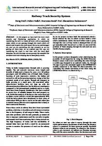
ASSESSMENT OF RAILWAY TRACK SUBSTRUCTURE CONDITION USING GROUND PENETRATING RADAR
by James P. Hyslip1 Stanley S. Smith2 Gary R. Olhoeft3 Ernest T. Selig1 1 2
Ernest T. Selig, Inc., Hadley, MA
Geo-Recovery Systems, Inc., Arvada, CO 3
Colorado School of Mines, Golden, CO
(Text = 2,500 words) (6 Figures)
August 2003
ABSTRACT Ground penetrating radar (GPR) has been employed to assess railway track substructure (ballast, subballast, and subgrade) conditions. GPR involves transmitting radar pulses into the substructure and measuring return signals that have reflected off boundaries between substructure layers with different electromagnetic properties. The principle electromagnetic property of the layers is the dielectric permittivity, which is a function of the density, water content, and type of material. For railroad applications, the GPR equipment is mounted on a hy-rail vehicle with clearance between the antennas and the track surface, which permits continuous measurements to be made from above the top-of-rail at normal vehicle speeds. The antenna configuration and surveying procedures are optimized to account for the influence of ties and rail. Antennas are located at both ends of the ties as well as in the center of the track, so the variations of conditions laterally across the track are seen. Studies have demonstrated the ability of GPR to distinguish between the different substructure layers as well as areas of trapped water and fouled ballast. Images from field measurements on track will be given to show the GPR capabilities. Observations from inspection trenches excavated under the track are compared with the radar measurements to validate the effectiveness of the technique.
Hyslip, et. al.
1
1.0 INTRODUCTION
Ground penetrating radar (GPR) can provide a rapid, nondestructive measurement technique for evaluating railway track substructure condition [1, 2]. Methods of applying GPR to railways are being developed to provide a continuous evaluation of the track substructure conditions relative to subsurface layering, material type, moisture content and density. The effectiveness of the GPR method is being proven in an ongoing study to develop GPR for defining the condition of the railway substructure.
2.0 GPR FUNDAMENTALS 2.1
GPR Applications Since the early 1970s, GPR has been found to be useful in many areas of
nondestructive subsurface investigations [3]. Highway examinations using radar have determined pavement layer thickness and deterioration, and extensive work has been performed for bridge deck and scour evaluations. In environmental surveys, GPR is useful in detecting underground storage tanks, buried drums, and debris as well as detecting other contamination not visible from the surface. Archeological and forensic surveys have produced dramatic results. Radar has commonly been employed to detect reinforcing steel, post-tension members and conduits within concrete structures and pavements as well as identifying voids and loss of support beneath slabs. Geologic investigations have profiled bedrock and the water table, while hydrologic studies have examined lake, river and sub-bottom features. GPR is also being used on railroad tracks
Hyslip, et. al.
2
to provide continuous measurement of the condition of track substructure layers and thereby provide information for maintenance and rehabilitation decision making. 2.2
GPR Principles The GPR method requires transmitting pulses of radio energy into the subsurface
and receiving the returning pulses that have reflected off interfaces between materials with different electromagnetic properties. This is depicted on Figure 1(a). It is a pulseecho technique using radio energy as shown in Figure 1(b). Antennas are moved across an area with a continuous series of radar pulses, giving a profile of the subsurface. The key material properties are the dielectric permittivity, the electrical conductivity, and the magnetic permeability. These control the velocity with which the radio pulses travel through the material and the decay in amplitude of the pulse with distance. The pulse travels faster through a low dielectric permittivity material than a material possessing a higher dielectric permittivity. In contrast to permittivity, the conductivity of the material dictates how quickly the pulse of radio energy decays in amplitude (attenuates) with distance and thus controls how deep the pulse will penetrate. These two properties are mostly independent. For example, freshwater and salt water have essentially the same dielectric permittivity (salt water is slightly lower); however, salt water exhibits a much higher conductivity than freshwater. GPR pulses travel at similar speeds through both types of water; however, in salt water the energy is attenuated very quickly and does not penetrate deeply. Reflections of the GPR pulse occur at boundaries in the subsurface where there is a change in the material properties. Only a portion of the pulsed signal is reflected and the remaining part of the pulse travels across the interface to again be reflected back to
Hyslip, et. al.
3
the receiver from another interface boundary. The time it takes the pulse to travel through the layer and back is controlled by the thickness and properties of the material. The travel time between upper and lower boundaries of a layer can be used to calculate the layer thickness employing a known velocity.
3.0 GPR EQUIPMENT FOR RAILROAD APPLICATIONS 3.1
Antenna Choices Antennas are used to transmit and receive the radio pulses. The antennas are
controlled by the GPR control unit, which also measures the time and amplitude of the returned signals. Antennas are designed to operate at various frequencies from tens of MHz (megahertz) to several GHz (gigahertz). The antenna’s operating frequency must be considered for a given investigation. The antenna choice must take into account the trade-off that exists between resolution and depth of penetration. The higher the antenna frequency is the greater the resolution; but higher frequency antennas have less depth of penetration compared to lower frequency antennas. Lower frequency antennas penetrate deeper than those at a higher frequency, but they have reduced resolution. A second consideration for antenna selection relates to how the antenna is deployed. The two basic categories of antennas are air-coupled and ground-coupled [4]. Antennas that are air-coupled are designed to be used suspended above the ground surface, with an air gap. Ground-coupled antennas are designed to be in direct contact with the ground surface, with no air gap. Air-coupled antennas are particularly suited to railroad applications since they are suspended above the ground and thereby allow high-
Hyslip, et. al.
4
speed measurement and clearance for turnouts, grade-crossings, wayside detection devices, trash, etc. 3.2
Project-Specific Equipment For the present railway GPR development project, three sets of GSSI 4208 1-GHz
horn antenna pairs are used. A pair of antennas is deployed outside each rail at the ends of the ties, and a third pair is positioned between the rails along the centerline of the track. The antennas are supported on an adjustable frame that is mounted on a hy-rail vehicle, as shown in Figure 2. The frame is made of high-strength fiberglass tubing to minimize the interference that would occur from a metal frame. This arrangement permits three profiles to be collected at the same time as the pairs of antennas are moved longitudinally along the track. This provides three continuous parallel longitudinal images along the track, providing information on the lateral cross-track variability. Presently, the data are processed on a computer off of the track after data acquisition and available within a few hours; however, a current research goal is to develop data processing software that will produce substructure conditions in real-time. The GPR data collected on railroad track is processed to remove the effects of the ties and running rails to produce a clearer image of the substructure conditions. An accurate accounting of the locations of the GPR measurements is critical to an effective investigation. The system employs an integrated wide area augmentation system (WAAS) differential global positioning system (DGPS), and a distance measuring instrument (DMI) synchronized with the vehicle transmission. The DGPS can provide location information with accuracy error of less than 3 feet, but it can be adversely
Hyslip, et. al.
5
affected by bridges, tunnels, and radio frequency interference. The DMI provides continuous positioning information to supplement the DGPS data, but with an accumulating error of about 0.2%. Digital video images of the track are collected to further refine location information through identification of fixed assets along the track. The DGPS data are verified against 1-meter USGS aerial digital orthophoto quadrangle maps.
4.0 APPLICATION TO RAILWAYS 4.1
Substructure Investigation
The track substructure, consisting of the ballast, subballast, and subgrade layers, has a profound influence on track performance. Accurate knowledge of the substructure condition is important in effectively assessing the potential for service interruptions and the need for slow orders. A significant part of a railroad’s track maintenance budget is allocated to correct rough track that is caused by movements in the substructure under repeated train loading. The substructure performance is significantly affected by moisture accumulation and thickness of the roadbed layers [5]. Thus the hidden and hard-to-monitor substructure conditions are important to railway track performance. Appropriate tools for field investigation of railway substructure problems include cross-trenches, cone penetrometer tests, test borings, characterization of track geometry data and deterioration trends, track stiffness measurements, and ground penetrating radar [6, 7]. GPR surveying provides a continuous survey and characterization of the track substructure, quickly locating areas of potential trouble for further investigation or maintenance.
Hyslip, et. al.
6
Material and moisture variation within the track substructure causes distinct material differences that are easily recognized by GPR. Water has the highest dielectric permittivity of the materials found in the substructure and produces a strong effect on the GPR profiles. In an area where water has been trapped in the substructure, the dielectric permittivity is increased, resulting in a stronger reflection than if it were dryer. The texture of the radar record allows the relatively coarse-grained ballast layer to be recognizable from the comparatively finer-grained subballast layers. Likewise, subgrade material is typically very distinct from the upper granular layers. In the case of fouled ballast, the normal layering is disrupted by fine-grained materials in the otherwise coarsegrained matrix. By quantifying the GPR pattern scattering textures, determinations can be made regarding the amount of fouling in the ballast layer. The GPR profiles are manipulated to extract layer thickness and permittivity (related to the material density and water content). In addition, the profiles are examined to determine anomalous variability in contrast and texture, and relate these anomalous areas to the presence of fouled ballast. To verify and calibrate the railway GPR data, it is currently necessary to excavate cross-trenches (inspection trenches) in locations with key substructure conditions to correlate the actual conditions with the radar data. Figure 3 shows a typical GPR image example along a 500 ft section of track. Figure 3 also shows photos of the cross-trenches that were excavated and logged for calibration of the GPR data. Depths to key substructure layers are measured in the cross-trenches and used with travel times from the radar data to determine average velocities. The velocities are use to calculate the material properties values such as dielectric permittivity.
Hyslip, et. al.
7
Once enough GPR data has been calibrated with inspection trench information, the need for inspection cross-trenches will diminish from what is presently required. Eventually, quick assessments of subsurface conditions over large distances will be made with minimal invasive cross-trenching. 4.2
Substructure Management Using GPR GPR data have been used in site-specific engineering investigations to determine
root-cause of specific problems and develop engineering solutions at specific locations. The present ongoing project is also developing condition indicators and performance indices based on the GPR measurements. GPR is particularly useful for large-scale surveys to develop subsurface indicators for wide-area planning and allocation of resources. 4.2.1
Engineering Solutions
Figure 4 shows a typical example of the subsurface conditions along three parallel longitudinal profiles at two road grade-crossings, as detected by GPR. Trapped water immediately adjacent to the crossings is apparent in the images. This water is trapped due to nonexistent lateral drainage out of the track. The low point on the relatively impervious subgrade surface is shown about 300 ft to the left of the main road crossing. This information is useful for the design of an effective drainage system that will improve the subsurface condition and to thereby solve a chronic maintenance problem. In this case, the GPR indicates that the trapped water can be drained longitudinally away from the crossings to a positive outlet point, as depicted on the bottom image in Figure 4.
Hyslip, et. al. 4.2.2
8 GPR Substructure Indices
One approach to developing meaningful substructure indices based on GPR requires matching the information from the GPR measurements to known characteristics of different types of substructure problems and then quantifying the GPR data to depict these characteristics. An example of this approach can be seen in Figure 5. Figure 5 shows a GPR scan with a varying thicknesses of ballast and subballast which, in this example, are an indication of a problem associated with lateral subballast spreading on top of a clay subgrade. The problem with the spreading subballast shown in Figure 5 was prevalent throughout a 2-mile section of track. GPR data were used to develop an index based on the relative thicknesses of the ballast and subballast layers. The index is shown as a continuous trace on the middle plot in Figure 5, and as a “bar code” image in the bottom plot. The bar-code image is a convenient way to view the extent of the problem for a particular section of track. The dark bands in the bar-code image indicate areas where the subballast has thinned considerably, and similarly, the lighter banding indicates less thinning. Remedial work was planned based on the condition of the track as depicted by the bar-coded image. Another example of a condition index based on GPR information is depicted in Figure 6. Figure 6 shows three parallel longitudinal GPR profiles indicating ballast pockets that have developed in an embankment under the influence of heavy axle load traffic. A ballast pocket is formed by the greater load-induced settlement of the subgrade surface directly under the track. As downward infiltrating water ponds in the depression that is created, the fill continues to soften and further deformation occurs. As the track settles due to the fill deformation, additional ballast is added and tamped under the ties to
Hyslip, et. al.
9
raise the track, resulting is a thick ballast pocket. A common, simple remedy to minimize the continued development of the ballast pocket is to drain the ballast pocket with a cross-drain (essentially a ballast-filled trench) excavated perpendicular to the track. GPR can delineate the bottom of the pockets to ensure that lateral drainage is put at the most effective location, i.e., at the lowest point of the ballast pocket. The banded image in the bottom of Figure 6 shows the depths of the subgrade surface added together in order to accentuate the areas with the ballast pocket condition. This information is portrayed in the color-coded bar scale plot in Figure 6 which depicts the worst areas (deep ballast pockets) with dark banding and good areas with white. Automated measurement and analysis techniques are being developed to produce quantitative indices of track substructure condition that will enable improved cost effectiveness of maintenance planning, increased safety, and reduced train service interruptions. These indices will be based on such things as layer contours, moisture content in the different substructure layers, and amount of fouling material in the ballast. In developing wide-area indices, the Optram Right-of-way Infrastructure Management (ORIM) system is being used to help correlate the substructure characteristics derived from GPR with other measurements such as geometry, features, maintenance records, and other known subsurface conditions of the track. This allows seeing the relationship of GPR to track condition and features, as well as visualizing substructure effect on geometry trends and maintenance effort.
Hyslip, et. al.
10
5.0 CONCLUSIONS GPR images can give a good indication of the subsurface layer configuration, and patterns within the data can give a good indication of subsurface condition. GPR provides continuous, top-of-rail measurements of substructure layer conditions, with the potential to measure: • • • • • •
substructure layer thicknesses; water content and density of the ballast, subballast, and subgrade; trapped water from poor drainage; soft subgrade from high water content; nonuniform and deformed substructure layers and variations in substructure conditions across the track (with multiple antenna pairs); and fouling condition within the ballast. With proper application of GPR, very useful image cross-sections of the track
substructure can be obtained which show variations in conditions along and across the track, and with depth, indicating differences in track performance. Simultaneous recording at the three transverse locations (both edges and centerline) offers significant advantages: track occupancy is greatly reduced and precise correlation between the positions is achieved.
Acknowledgments The project described in this paper was jointly funded by the Burlington Northern and Santa Fe Railway, through Mr. Robert J. Boileau, AVP, and the Federal Railway Administration through Mr. Mahmood Fateh, Office of Research and Development. Optram, Inc. provided the ORIM system for displaying the GPR results.
Hyslip, et. al.
11 References
1. Olhoeft, G. R., and Selig, E. T., 2002. “Ground penetrating radar evaluation of railroad track substructure conditions”. Proc. Of the 9th Int’l Conf. on Ground Penetrating Radar, Santa Barbara, CA, April, S. K. Koppenjan and H. Lee, eds., Proc. of SPIE, vol. 4758, p. 48-53. 2. Selig, E. T., Hyslip, J. P., Olhoeft, G. R., and Smith, Stan, 2003. “Ground penetrating radar for track substructure condition assessment”. Proc. Of Implementation of Heavy Haul Technology for Network Efficiency, Dallas, TX, May, p. 6.27-6.33. 3. Olhoeft, G. R. and Smith III, S. S., 2000. “Automated processing and modeling of GPR data for pavement thickness and properties”. GPR2000, Proc. Of the 8th Int’l Conference on Ground Penetrating Radar, Gold Coast, Australia, May, D.A. Noon, G. F. Stickley, and D. Longstaff, eds., SPIE vol. 4084, p.188-193. 4. Smith III, Stanley S., 1995. “Detecting pavement deterioration with Subsurface Interface Radar”. Sensors, vol.12, no. 9, p.29-40. 5. Selig, E. T. and Waters, J. M., 1994. Track Geotechnology and Substructure Management. Thomas Telford Services Ltd., London. 6. Selig, Ernest. T., 1997. "Substructure maintenance management". Proc. 6th International Heavy Haul Railway Conference, International Heavy Haul Association, Cape Town, South Africa, April. 7. Hyslip, J. P. and McCarthy, B. M., 2000. “Substructure investigation and remediation for high tonnage freight line”. Proc. of the 2000 Annual Conference, AREMA, Dallas, TX, September.
Hyslip, et. al.
12
Figure Captions
FIGURE 1 The generation of a GPR profile. FIGURE 2 GPR hy-rail setup with three pairs of 1-GHz horn antennas. FIGURE 3 GPR image example with cross-trenches for calibration. FIGURE 4 Three parallel, longitudinal GPR images near two road crossings. FIGURE 5 Subsurface Index based on thinning subballast condition. FIGURE 6 Subsurface Index based on depth of ballast pocket.
Transmit
Receive
Air Surface Ballast Top of Subballast Subballast Top of Subgrade
Subgrade
Figure 1. The generation of a GPR profile. (a) Transmitted energy is reflected off the boundaries in the substructure. (b) A single trace or scan composed of the reflection amplitudes as a function of time for the reflections in (a). (C ) Adjacent scans are combined to build a profile.
Figure 2: GPR hy-rail setup with three pairs of 1-GHz horn antennas.
Ballast, Fouled with Engine Sand, Moist Ballast, Clean, Small-sized, Moist
~100 ft
Old Roadbed (Cinder Fouled Ballast)
Figure 3: GPR image example with cross-trenches for calibration.
Ballast, Fouled with Engine Sand & Ballast Breakdown, Wet
Lateral Drainage Begins
Road Crossing
No Lateral Drainage away from track
Longitudinal GPR Image of Eastside of Track
Road Crossing
Trapped water due to no Lateral Drainage
Centerline (middle of gage)
Punt.
Westside of Track
al Drain Longitudin tlet point e ou to positiv
~100 ft
Low point in subgrade & positive outlet point Note: Possible solution shown on bottom image only. Drainage improvement prescribed for entire width of track.
Figure 4: Three parallel, longitudinal GPR images near two road-crossings.
GPR Scan: Ballast
Subballast Clay Subgrade
Condition Index:
“Bar-Code” Index:
Figure 5: Subsurface Index based on thinning subballast condition.
Centerline (middle of gage)
Eastside of Track
Westside of Track
“Bar-Code” Index:
Figure 6: Subsurface Index based on depth of ballast pocket.