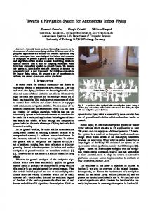
is equipped with an experimental optical navigation camera for imaging Mars' ...... accelerations in the spacecraft's gravitational model (Qa = 3Ã10â13 m2/s3),.
Autonomous Optical Navigation at Jupiter: A Linear Covariance Analysis Nathan B. Stastny∗ and David K. Geller
†
Utah State University, Logan, UT, 84322
On October 24, 1998 NASA launched Deep Space 1 (DS1), an experimental interplanetary spacecraft used to validate future technologies including an Autonomous Optical Navigation (AutoNav) system. Prior to DS1, interplanetary navigation was performed primarily through earthbased measurements to provide accurate position and velocity estimates for interplanetary spacecraft.
Improvements in imaging and computing
technologies, enabling onboard processing and orbit determination (OD), have lead to expanded interest in autonomous spacecraft. Development of AutoNav systems for interplanetary spacecraft requires extensive modeling and analysis to ensure success. This paper, using a Linear Covariance (LinCov) analysis, evaluates the efficacy of using optical angles-only measurements of the moons of Jupiter to determine a spacecraft’s position and velocity during a Jupiter approach. Analysis also evaluates the dominant error sources in the OD calculations for pre-flight performance evaluations.
Nomenclature Tab [A×] ˆ x ¯ x χ RJ
Direction Cosine Matrix from the a frame to the b frame Cross product matrix defined by [A×]B = A × B State vector best estimate Nominal state vector moon phase angle relative to the spacecraft Jupiter position vector relative to the Sun
∗
Graduate Student, Mechanical and Aerospace Engineering Department, Utah State University, Logan, UT, 84322, Member AIAA. † Assistant Professor, Mechanical and Aerospace Engineering Department, Utah State University, Logan, UT, 84322, Senior Member AIAA. 1 of 18
Rm Jovian moon position vector relative to Jupiter Rsc Spacecraft postion vector relative to Jupiter m Apparent visual magnitude H Absolute magnitude dM S Distance from the sun to the Jovian moon dM SC Distance from the spacecraft to the Jovian moon d0 One astronomical unit Subscript sc Spacecraft k Time step rel Jovian moon position relative to the spacecraft Superscript + Pre-update − Post-update Coordinate Frames I Jupiter centered inertial BN Nominal body B True body CN Nominal camera C True camera
I.
Introduction
Optical navigation, the foundation for most terrestrial navigation, has remained a mainstay of exploration even into the Space Age. Aspects of optical navigation were employed on the Apollo missions. The first interplanetary spacecrafts to depend on optical navigation for mission success were Voyager I and Voyager II.1 The first Voyager encounter was in March 1979 when Voyager I navigated past Jupiter on its Grand Tour. Optical navigation methods were also used by the Voyager spacecraft for encounters with Saturn, Uranus, and Neptune, as well as 48 of their moons. While optical navigation techniques have been utilized extensively on interplanetary spacecraft to improve state estimates, the spacecraft generally depended on the Deep Space Network (DSN) and ground processing of data for state estimation. The first spacecraft to attempt autonomous optical navigation was DS1. As a technology validation mission, the Autonomous Optical Navigation (AutoNav) system was given some oversight, through the DSN and ground processing, to evaluate the system’s performance. The DS1 mission successfully validated the AutoNav system while exploring 2 of 18
the asteroid Braille in July 1999 and the comet Borrelly in September 2001. The most recent NASA mission to Mars, the Mars Reconnaissance Orbiter (MRO) launched in August 2005, is equipped with an experimental optical navigation camera for imaging Mars’ two moons, Deimos and Phobos, and providing improvements to the spacecraft’s Mars-relative OD. It is anticipated that future interplanetary spacecraft will require increased autonomy, including autonomous navigation techniques. Autonomous navigation will reduce mission oversight requirements and improve time critical operations such as flybys or atmospheric entry This study is a top level LinCov analysis of an interplanetary spacecraft at Jupiter which employs autonomous optical navigation techniques for orbit determination (OD). It is proposed to show that an autonomous optical navigation system will provide sufficient navigation and orbit determination for mission success. For additional outer planet navigation studies the reader is referred to the works of Ondrasik and Ransford2 and Russell and Ellis.3 Optical navigation consists of line of sight measurements taken from images of the moons of Jupiter. The objective of the research is to determine the efficacy of such a system and the dominant design parameters for possible future missions. Research also evaluates the sensitivity of the OD to predetermined problem parameters and attempts to determine the primary error sources. The research analyzes the spacecraft during a hyperbolic approach to Jupiter, similar to that proposed for NASA’s Juno New Frontiers mission4 and a Jupiter orbit insertions maneuver. The work also includes the use of a high-fidelity model of the Jovian system with a large number of its moons.
II.
Methods
To evaluate the optical navigation technique it is necessary to develop a reasonably accurate truth model and simulation. The truth model includes two parts: 1) a highaccuracy ephemeris model of Jupiter and its moons, and 2) a nominal approach trajectory starting at Jupiter’s sphere-of-influence. It is proposed for this analysis that the AutoNav system employ a continuous-discrete extended Kalman filter.5 Analysis of the AutoNav system’s performance is evaluated using a LinCov analysis. A.
Jovian Moon Ephemerides
The ephemeris model for the Jovian system is based on the SPICE information system provided by NASA’s Navigation and Ancillary Information Facility (NAIF). SPICE (Spacecraft, Planet, Instrument, C-matrix, and Events) is an analysis and planning tool developed by NAIF to aid the scientific community in evaluating mission science and archiving scientific data. Among the archived data are planetary ephemerides derived from high-fidelity mod3 of 18
els. SPICE is available free to the public and scientific communities. Given the available SPICE data, 38 Jovian moons, JI (Io) through JXXXVIII (Pasithee), by Roman numeral designation, were considered as possible navigation beacons. Jupiter is currently known to have 63 moons. B.
Nominal Spacecraft Trajectory
The nominal spacecraft trajectory is a simple hyperbolic approach beginning at Jupiter’s sphere-of-influence (SOI) and running through perijove. Perijove for the approach occurs at a radius of approximately 1.06 Jupiter radii.4 The trajectory, varying from the proposed Juno transit, is based on a 2010 launch and a total transit of 665 days. The Jupiter relative approach eccentricity is 1.035. The spacecraft’s velocity at SOI is 6.653 km/s. The gravitational model of Jupiter, used to develop the trajectory and simulation, is a point mass plus J2 model. The model does not account for higher order perturbation terms or third body perturbations caused by the Galilean moons. This will not affect the navigation analysis results obtained in this study since unmodeled accelerations are accounted for as random accelerations. C.
Kalman Filter Conceptual Design
Kalman filters are commonly used in space navigation applications and are well suited for AutoNav systems. The filter is an optimal recursive data processing algorithm used to propagate the system state and error covariance, and to update them when measurements become available. The system’s state includes the spacecraft’s position and velocity as well as sensor misalignments, �, and a non-constant attitude knowledge error, δθ. x=
h
RIsc ,
VIsc ,
�, δθ
iT
(1)
The non-linear system dynamics and measurement models for the state vector are ˙ x(t) = f(x(t), t) + w(t)
(2)
zk = hk (x(tk )) + vk
(3)
and
4 of 18
where the dynamics for the state vector are given by ˙ I = VI R sc sc I I ˙ V sc = agrav + ao �˙ = 0
(4) (5) (6)
δθ δ θ˙ = − + wδθ τδθ
(7) (8)
The gravitational acceleration on the vehicle, aIgrav , is modeled as a point mass plus J2 gravity field. Additional random accelerations ao are used to represent modeling errors. The covariances of the disturbances are E[ao (t)aTo (t0 )] = Qa δ(t − t0 ). The misalignment error is constant. The attitude knowledge error is modeled as a first-order Markov process driven by T (t0 )] = Qδθ δ(t − t0 ). The time constant τδθ is white noise wδθ , with a covariance E[wδθ (t)wδθ set to one hour which corresponds to the time between attitude updates from a star camera. The camera line-of-sight measurements zk are given by6 zk =
Rx /Rz + νk Ry /Rz
(9)
T where the relative position of the imaged moon, RC rel = [Rx , Ry , Rz ] , in the camera frame, is given by BN CN B I I C (10) RC rel = TCN TB TBN TI (Rmoon − Rsc )
and the covariance of the measurement noise is E[ν k (tk )ν Tk (t0k )] = Rν k δ(tk − t0k ). Using a small angle approximation for the camera misalignment and attitude knowledge errors, the relative position can be rewritten as CN BN I I RC rel = {I − [�×]}TB {I − [δθ×]}TI (Rmoon − Rsc )
(11)
The filter propagation equations for the state estimate and error covariance are ˆ˙ (t) = f(ˆ x x, t)
(12)
˙ P(t) = F(ˆ x, t)P(t) + P(t)FT (ˆ x, t) + Q(t)
(13)
and
When optical measurements are available the filter state update and covariance update
5 of 18
equations are used. ˆ+ ˆ− x zk − zˆk (ˆ x− k = x k + Kk [˜ k )]
(14)
− T T P+ x− x− k ))Pk (I − Kk H(ˆ k )) + Kk Rk Kk k = (I − Kk H(ˆ
where the Kalman gain is T − T −1 Kk = P− x− x− x− k ) + Rk ] k )[Hk (ˆ k )Pk Hk (ˆ k Hk (ˆ
(15)
The linearized dynamics, F, and the measurement sensitivity matrix,6 H, are given by ∂f(x(t), t) F(ˆ x, t) = ∂x(t) x(t)=ˆx(t) Hk (ˆ x− k)
(16)
∂hk (x(tk )) = ∂x(tk ) x(tk )=ˆx−
(17)
k
where
03×3
I3×3 03×3
03×3
∂aI /∂ R ˆ I 03×3 03×3 03×3 grav sc F(ˆ x, t) = 03×3 03×3 03×3 03×3 03×3 03×3 03×3 I3×3 /τδθ and
H=
1/Rz
0
0
1/Rz
2
(18)
i −Rx /(Rz ) h BN CN C C −TI 0(3×3) [Rrel ×] TB [Rrel ×] −Ry /(Rz )2
(19)
The state process noise is given by
03×3
03×3
03×3
03×3
0 03×3 3×3 Qa I3×3 03×3 Q(t) = 03×3 03×3 03×3 03×3 03×3 03×3 03×3 Qδθ I3×3
(20)
It is important to note that for the extended Kalman filter the nonlinear dynamics and ˆ. measurements are linearized about the filter estimate x Obtaining statistically significant pre-flight performance evaluations, as this analysis intends, from an extended Kalman filter typically requires a Monte Carlo analysis. The analysis, requiring perhaps hundreds of simulation runs, would indicate the final covariance of navigation errors and trajectory dispersions or dispersion of the spacecraft from the nominal trajectory at a given time. The downside to Monte Carlo simulations is that they are time
6 of 18
and computationally intensive. D.
Linear Covariance
An alternative method for obtaining pre-flight performance evaluations is a LinCov analysis, generalized by Geller7 and modified by the author. LinCov, based on the continuous-discrete linearized Kalman filter, allows for the final navigation error covariance to be determined with a single simulation run. The key difference between the extended Kalman filter and the LinCov Kalman filter is that the nonlinear functions and measurements are linearized about ¯ , rather than the filter estimated state x ˆ . This method the nominal reference trajectory x eliminates the need to propagate or update the system state, while tracking only the error covariance about the nominal trajectory. Ultimately for most space applications the results are equivalent to those obtained from a similar Monte Carlo analysis.8 Linearized about the nominal trajectory, the error covariance propagation and update equations become ˙ P(t) = F(¯ x, t)P(t) + P(t)FT (¯ x, t) + Q(t)
(21)
and − T T P+ x− x− k = (I − Kk H(¯ k ))Pk (I − Kk H(¯ k )) + Kk Rk Kk
The Kalman gain is T − T −1 Kk = P− x− x− x− k Hk (¯ k )[Hk (¯ k )Pk Hk (¯ k ) + Rk ]
(22)
The new F and H matrices, evaluated at the nominal, are defined as ∂f(x(t), t) F(¯ x, t) = ∂x(t) x(t)=¯x(t)
(23)
∂h (x(t )) k k Hk (¯ x− ) = k ∂x(tk ) x(tk )=¯x−
(24)
k
For the analysis it was assumed that the nominal camera and body frames were aligned. The nominal relative position vector and the measurement sensitivity matrix for the camera focal plane measurement are CN I I N RC rel = TI (Rmoon − Rsc )
H=
(25)
1/Rz
0
0
1/Rz
i 0 h CN CN CN −TI 03×3 [Rrel ×] [Rrel ×] 0 7 of 18
(26)
III.
Error Sources
Given the truth model and conceptual Kalman Filter, there are a series of parameters that effect how the proposed AutoNav system will operate and the performance level of orbit determination.9 These parameters, referred to as the problem parameters, are the primary means of adjusting the analysis algorithms, and for determining the AutoNav system’s performance and sensitivity to them. The evaluated problem parameters are: 1) the a-priori position and velocity knowledge error, 2) the Jovian moon ephemeris errors, 3) the imaging frequency, 4) the camera center-finding bias, 5) the spacecraft’s attitude knowledge error, 6) the static camera misalignment, 7) unmodeled accelerations, 8) measurement noise, and 9) the number of Jovian moons being imaged. Each problem parameter consists of either a nominal and alternative set point, or a set of quantities. The nominal and alternative setting for the analysis are given in Table 1. A notional camera with a 1 degree field-of-view was used. Table 1. Nominal and Alternative Settings for Problem Parameters
Problem Parameter
Nominal Setting (1-σ)
A-priori Knowledge Error
100 km and 10 m/s per axis Estimated Moon Ephemerides 75 km Imaging Frequency 2 hrs Image Center-Finding Biases 1% of moon’s diameter Measurement Noise 0.1 pixels in both pixel and line Unmodeled Accelerations 3 × 10⁻¹⁵ m2 /s3 Attitude Knowledge Errors 1 arcsec per axis Camera Misalignment 0.01 degrees per axis Moons Imaged 12 (see Moon Visibility)
Alternative Setting 1000 km and 100 m/s per axis 250 km 6 hrs 5% of moon’s diameter 0.5 pixels in both pixel and line 3 × 10⁻¹³ m2 /s3 10 arcsec per axis 0.1 degrees per axis 17, 27
The number of moons imaged is based on moon visibility constraints. All other problem parameter settings were based on likely versus worst case assumptions.
IV.
Moon Visibility
Three criteria were applied to determine when a moon would be visible to the spacecraft. To be visible the moon must 1) not be obscured by Jupiter, 2) be outside of a limiting Sun cone-angle, and 3) be of sufficient visual magnitude to be detected with the navigation
8 of 18
camera. A moon’s visual magnitude was determined from the moon’s absolute magnitude, H, and phase angle relative to the sun. The moon phase angle is calculated as χ = cos
−1
�
(RJ + Rm ) · (Rm − Rsc ) |RJ + Rm ||Rm − Rsc |
� (27)
The moon’s apparent visual magnitude is � m = H + 2.5 log10
d2M S d2M SC p(χ)d40
� (28)
where p(χ) is the phase integral of a diffuse sphere and is approximated as � � � � 2 � χ� 1 p(χ) = 1− cos χ + sin χ 3 π π
(29)
Visibility was evaluated for a limiting Sun cone-angle of 45◦ and for apparent visual magnitudes up to 9.5,10 12, and 14. The higher the apparent visual magnitude, the dimmer an object will appear. Moon visibilities, relative to the approach time and nominal spacecraft position, are shown in Figure 1. It is important to note that given a limiting apparent visual magnitude of 9.5, and the additional visibility constraints, only 16 of the included 38 moons are visible to the spacecraft during the approach. Four of these 16 moons, Amalthea (JIV), Thebe (JXIV), Adrastea (JXV), and Metis (JXVI) are within the orbit of Io (JI), and have orbital periods between 7 and 16 hours, making their visibility limited and of negligible benefit. These four moons were not considered for possible imaging, leaving 12 possible imaging targets. Increasing the limiting apparent visual magnitude to 12 and 14 increases the number of moons available for
(a)
(b)
(c)
Figure 1. Jovian moon visibility maps for a limiting apparent visual magnitude of a) 9.5, b) 12, and c) 14. Black regions indicate that the moon is visible to the spacecraft at the given time and nominal position.
9 of 18
imaging to 17 and 27 respectively. The moon visibilities shown are valid for this trajectory only as they are highly dependant on the trajectory geometry relative to Jupiter and its moons and to the Sun. Given the moons available for imaging, a simple imaging sequence was developed for the AutoNav system. The system cycles through the available moons (by Roman numeral designation) selecting a new moon at each imaging sequence. If the next moon is not visible at the subsequent imaging sequence, it is skipped and the next available moon is imaged in it’s place. Though not optimal, this ensures that an image is available at each imaging sequence regardless of the imaging frequency.
V.
Results
The LinCov algorithm was implemented to evaluate the performance of the AutoNav system and determine the sensitivity of the navigation errors to the problem parameters. Results were obtained by performing a total of 11 runs corresponding to the nominal and alternative settings of the problem parameters. In the first run all of the problem parameters were set to their nominal values indicating a likely or best case scenario for the AutoNav system. This run is identified in the results as the nominal result. Runs were then performed by switching each problem parameter, one at a time, to its alternative setting. Each of these runs is identified by the problem parameter that was set to its alternative setting for that run. This approach allows the affects of each problem parameter on the AutoNav navigation error to be evaluated separately. The results were run from Jupiter’s sphere of influence (-72 days) to perijove (0 days) with a time step of 5 minutes. Due to significant differences in the results for the problem parameter of the number of moons imaged compared to the other parameters, its results are evaluated separately. The results in Figure 2 show that for the given parameter settings, the AutoNav system’s performance is considerably degraded over the first forty days of the approach when compared to the a-priori knowledge error. During this phase only five moons, the Galilean moons and Himalia (JVI), are visible to the spacecraft’s camera. The navigation error is most sensitive to camera misalignment, the moon’s estimated position error, and the camera’s centerfinding bias. The parameters to which the AutoNav system shows minimal sensitivity are the a-priori covariance error, which quickly settles to near nominal values, the instrument noise, and unmodeled accelerations. For this phase of the approach the gravitational model would not be expected to introduce large errors due to the spacecraft’s large distance from the planet and steady dynamics. The end of this initial phase is marked by the added visibility of the moon Sinope (JIX) at approximately -42 days to perijove when the position uncertainty drops sharply for each case.
10 of 18
4
2.2
x 10
Nominal A-priori Moon Estimate Imaging Freq. CF bias Instrument Noise Unmodeled Acc. Attitude Error Misalignment
2 1.8
Pos Uncertainty RSS 3-σ (km)
1.6 1.4 1.2 1 0.8 0.6 0.4 0.2 0
-70
-60
-50
-40 -30 Days to Perijove
-20
-10
0
Figure 2. The 3-σ position uncertainty of the spacecraft from Jupiter’s sphere of influence to perijove for each problem parameter setting.
4
2.2
x 10
A-priori
2
Misalignment
1.8
Moon Estimate Pos Uncertainty RSS 3-σ (km)
1.6
CF Bias 1.4
Attitude Error 1.2
Image Freq
1 0.8 0.6
A-priori Inst Noise Unmodeled Acc Nominal
0.4 0.2 0
-70
-60
Sinope (JIX) becomes visible -50
-40
Days to Perijove
Figure 3. The 3-σ position uncertainty of the spacecraft from -72 to -40 days to perijove.
11 of 18
800
Unmodeled Acc Image Freq
700
Moon Estimate CF Bias
600 Pos Uncertainty RSS 3-σ (km)
A-priori
Misalignment Attitude Error
500
400
Nominal
300
Inst Noise 200
Leda (JXIII) becomes visible
100 -40
-30
-20
-10
Days to Perijove
Figure 4. The 3-σ position uncertainty of the spacecraft from -40 to -10 days to perijove. 450
Misalignment
400
Attitude Error Pos Uncertainty RSS 3-σ (km)
350
Unmodeled Acc 300
Moon Estimate 250
Inst Noise CF Bias A-priori Nominal
200
Image Freq 150
100 -10
-8
-6
-4
-2
0
Days to Perijove
Figure 5. The 3-σ position uncertainty of the spacecraft from -10 days to perijove through perijove.
12 of 18
The second distinct phase in the results occurs between -40 and -15 days to perijove. The inclusion of Sinope among the visible moons provides a brief period of increased accuracy followed by a degradation in the position knowledge. While the effect of most of the parameters increases the navigation error at a fairly consistent rate, the effects of unmodeled accelerations shows increased sensitivities in the system during this phase. This phase ends when the moon Leda (JXIII) becomes visible at approximately -15 days to perijove, again providing a sharp drop in the position uncertainty. The final phase of the approach is marked by the spacecraft’s closest proximity to Jupiter and the Galilean moons, its rapidly changing position and velocity, and the availability of an increased number of moons for imaging. This phase incidently shows the highest accuracy results for the AutoNav system. During this phase the AutoNav appears to be most sensitive to the camera mounting misalignment and the spacecraft’s attitude knowledge error, both indicating camera pointing errors. Results also indicate an increased sensitivity to the error in the imaged moon’s estimated position. Given the spacecraft’s proximity to the Galilean moons, increased errors in the position estimates will result in an increased optical deviation presenting itself similar to a pointing error. The AutoNav system shows the lowest sensitivities to the instrument noise and center-finding biases during this phase. The a-priori covariance error has also become negligible as the spacecraft moves to its closest approach. The velocity uncertainty sensitivities are shown in Figure 6. Of notable significance in all of these results is the large spike in the position knowledge error, and velocity knowledge error (see Figures 5 and 6) during the final 6 to 12 hours before Perijove. This spike is a result of the spacecraft’s nominal orbit and rapidly changing dynamics near perijove and is not due to numerical error. 3
0.55
10
2
Vel Uncertainty RSS 3-σ (m/s)
10
1
10
0.5
Vel Uncertainty RSS 3-σ (m/s)
Nominal A-priori Moon Estimate Imaging Freq. CF bias Instrument Noise Unmodeled Acc. Attitude Error Misalignment
Unmodeled Acc (not shown)
0.45
0.4
A-priori Moon Estimate Misalignment Attitude Error CF Bias Image Freq Inst Error Nominal
0.35
0
10
0.3
-1
10
-70
-60
-50
-40 -30 Days to Perijove
-20
-10
0
Misalignment Attitude Error Moon Estimate Image Freq CF Bias Inst Noise A-priori Nominal
0.25 -40
(a)
-30
-20 Days to Perijove
-10
0
(b)
Figure 6. The 3-σ velocity uncertainty of the spacecraft from (a) Jupiter’s sphere of influence to perijove and (b) from -40 days to perijove through perijove, for each problem parameter setting.
13 of 18
For hyperbolic approach trajectories it is of particular importance to understand the amount by which the spacecraft “misses” the planet. This parameter, B, is defined as a vector directed from the center of the central body (i.e. Jupiter) to the incoming asymptote of the hyperbola and perpendicular to the asymptote. An unit vector S is then defined from the center of the planet and parallel to the incoming asymptote. The vector B is resolved into two components, B · T and B · R where T is perpendicular to S and lies in a reference plane such as the ecliptic plane. R completes the orthogonal coordinate frame. The plane defined by the vectors T and R is called the “B-plane” or the aiming plane and is commonly used for interplanetary navigation. During approach the spacecraft’s inertial position error covariance is mapped to the B-plane where it appears as an ellipse. The 1-σ B-plane targeting errors for the nominal parameter settings are shown in Figure 7(a) from -70 to -20 days, at ten day intervals. The corresponding 1-σ time of flight errors are shown in Figure 7(b). Inspection of the B-plane results shows the AutoNav’s sensitivity to the moons being imaged. The significant factor to this sensitivity is the relative geometry of the imaged moons. After an initial growth, the navigation errors show some gradual improvement (60 to -42 days) until Sinope becomes visible and changes the size and correlation of the targeting error. Prior to this event, four of the five visible moons, the Galilean moons, were nearly aligned geometrically relative to the spacecraft. The addition of Sinope provides measurement information perpendicular to the direction of the Galilean moons. The ability to image moons in a variety of favorable locations relative to the spacecraft is one of the strongest contributors to navigational accuracy. Nominal B-Plane Targeting Error (1-σ)
7 6
1000
5 4 3
-20 days
Nominal 1-σ TOF Error (min)
δ Rsc • T (km)
500
0
-40 days
-30 days
-50 days
-500
0 -1 -2
-4 -5
-1000
-1500
1
-3
-60 days
-70 days
2
-6 -1000
-500
0
500
1000
1500
-7
δ Rsc • R (km)
(a)
-70
-60
-50 -40 Days to Perijove
-30
-20
(b)
Figure 7. (a) B-plane targeting errors for the nominal problem parameter settings. (b) Time of flight errors from -72 to -20 days to perijove for the nominal problem parameter settings.
14 of 18
While the ability to accurately adjust the approach trajectory is important to mission success, orbit insertion is primarily dependent on the navigation errors at closest approach, or perijove for this mission. At perijove it is most beneficial to examine the error covariance in a local coordinate frame termed the local-vertical, local-horizontal (LVLH) frame, defined by the radial, downrange, and cross-track directions. The local errors at perijove for the nominal and alternative settings are shown in Figure 8. The significant error, for all parameter settings, is the downrange error. The AutoNav’s sensitivity to most of the problem parameters results in a general growth of the error ellipse over the nominal settings. The navigation error shows the greatest sensitivity in the downrange error to the camera misalignment, attitude knowledge error, and the estimated moon ephemeris errors. The navigation error shows the greatest sensitivity in the radial and cross-track directions to unmodeled accelerations. Also affecting the radial and cross-track directions are the camera misalignment, attitude knowledge error, estimated moon ephemeris errors, and to a lesser extent the imaging frequency. While relevant, the sensitivities in the radial and cross-track directions are an order of magnitude smaller than those in the downrange direction. It is interesting to note that the downrange errors were decreased by reducing the imaging frequency from every two hours to every six hours. This “improvement” is likely the result of the non-optimal imaging sequence and would be negated by an optimal sequence. It was stated above that the variety of moons available for imaging, in terms of relative geometry to the spacecraft, greatly affects the AutoNav’s performance. To view this sensitivity additional LinCov analysis was conducted by varying the number of visible moons (see Error Ellipse at Perijove (1-σ)
20
5
Inst Error CF Bias A-priori Nominal
15
Inst Error CF Bias A-priori Nominal
4 3
Misalignment
10
Misalignment Attitude Error
0
-5
2
Cross-Track (km)
Radial (km)
5
1 0 -1 -2
Attitude Error
-10
Imaging Freq
-3
-15
-4
Unmodeled Acc -20 -300
-200
Moon Estimate -100
0 DownRange (km)
100
200
300
-5 -300
(a)
Imaging Freq Unmodeled Acc -200
Moon Estimate -100
0 DownRange (km)
100
200
300
(b)
Figure 8. Local position uncertainty for the spacecraft at perijove for each problem parameter setting. (a) Radial versus downrange error. (b) Cross-track versus downrange error.
15 of 18
Moon Visibility above). Error covariance magnitudes for the nominal and two off nominal settings are shown in Figures 9 to 10. Figure 9 shows that increasing the camera’s imaging capability drastically improves the AutoNav’s performance during the initial approach phase by a full order of magnitude. Figure 10 also shows improved navigation errors during the second phase, though not as drastic as during the first phase. From approximately ten days until perijove the AutoNav system’s sensitivity to the additional imaging targets is minimal. The difference in the navigation results during this phase would likely be negated through an optimal imaging sequence in lieu of taking a full day or more to cycle through all available imaging targets. 8000 m = 9.5 m = 12 m = 14
7000
Pos Uncertainty RSS 3-σ (km)
6000
5000
4000
3000
2000
1000
0
-70
-60
-50
-40 -30 Days to Perijove
-20
-10
0
Figure 9. The 3-σ position uncertainty of the spacecraft from Jupiter’s sphere of influence to perijove for varying apparent visual magnitudes detectable to the camera.
450
150 m = 9.5 m = 12 m = 14
400
140
350
Pos Uncertainty RSS 3-σ (km)
Pos Uncertainty RSS 3-σ (km)
130 300
250
200
150
120
110
m = 9.5
m = 14
100 100
90
50
0 -40
m = 12 -30
-20 Days to Perijove
-10
0
80 -10
-8
-6
-4
-2
0
Days to Perijove
(a)
(b)
Figure 10. The 3-σ position uncertainty of the spacecraft from 40 days before perijove through perijove for varying apparent visual magnitudes detectable to the camera.
16 of 18
At perijove it is assumed that an impulsive maneuver with zero error can be performed to place the spacecraft into a Jupiter orbit. The desired orbit is a polar orbit with a perijove radius of 1.06RJ and an apojove radius of 39RJ . The orbital period is 11 days. Uncertainty in the spacecraft’s position and velocity when the maneuver is performed will result in uncertainty in the spacecraft’s new orbit. Similar to obtaining the error covariance matrix in the LVLH frame, it is possible to determine the error covariance for the new orbital elements. The orbital elements of greatest interest are the inclination, i, the eccentricity, e, the orbital period, P , and the radius at apojove, Ra . The 3-σ uncertainty in the selected orbital elements, given alternative settings for the problem parameters, are listed in Table 2. The nominal values for the inclination, eccentricity, period, and apojove radius are also listed with the nominal analysis results. Table 2. 3-σ Uncertainty in Post-Maneuver Orbital Elements
Problem Parameter
i
90◦ ±0.0104◦ A-priori Covariance ±0.0104◦ Ephemeris Knowledge Error ±0.0179◦ Imaging Frequency ±0.0161◦ Image Center-Finding Biases ±0.0107◦ Measurement Noise ±0.0113◦ Unmodeled Accelerations ±0.0265◦ Attitude Knowledge Errors ±0.0211◦ Camera Misalignment ±0.0212◦ Moons Imaged (m = 12) ±0.0078◦ Moons Imaged (m = 14) ±0.0078◦ Nominal
e
P
Ra
0.9471 ±5.92 × 10⁻⁵ ±5.92 × 10⁻⁵ ±1.29 × 10⁻⁴ ±5.09 × 10⁻⁵ ±6.39 × 10⁻⁵ ±6.65 × 10⁻⁵ ±8.09 × 10⁻⁵ ±1.43 × 10⁻⁴ ±1.74 × 10⁻⁵ ±4.24 × 10⁻⁵ ±5.08 × 10⁻⁵
11 days ±22.57 min ±22.57 min ±50.60 min ±19.01 min ±24.55 min ±25.36 min ±26.82 min ±55.87 min ±69.35 min ±15.93 min ±19.49 min
39RJ ±0.0382RJ ±0.0382RJ ±0.0856RJ ±0.0321RJ ±0.0415RJ ±0.0429RJ ±0.0454RJ ±0.0945RJ ±0.1173RJ ±0.0270RJ ±0.0329RJ
RJ = 71, 495 km
VI.
Conclusion
This paper presented a top-level study analyzing the efficacy of using an autonomous optical navigation system for the approach and orbit insertion phases of a nominal Jupiter mission. The AutoNav system, using optical images of Jupiter’s moons for orbit determination, was evaluated for its sensitivity to a range of possible error sources. Results indicate that the AutoNav system has the greatest sensitivity to the number of moons imaged, which is a function of the imaging camera’s optical sensitivity. Specifically the AutoNav system’s performance improves when there are moons at a variety of positions
17 of 18
relative to the spacecraft. The system also showed a large sensitivity to line-of-sight pointing errors resulting primarily from attitude knowledge errors of 10 arcsec per axis and camera mounting misalignments of 0.1 degrees per axis. Moderate sensitivities were demonstrated from unmodeled accelerations in the spacecraft’s gravitational model (Qa = 3×10⁻¹³ m2 /s3 ), ephemeris estimation errors of the imaged moons (250 km), and the system imaging frequency (6 hours). The system also showed lower sensitivities to noise in the imaging instruments (0.5 pixels), possible center-finding biases in the image processing software (5% of the imaged moon’s diameter), and a-priori knowledge errors (1000 km and 100 m/s). B-plane targeting and time of flight errors were shown for the nominal trajectory demonstrating the system’s sensitivity in the B-plane due to the moons being imaged. The final navigation errors at perijove in the downrange, radial, and cross-track directions were also shown for each of the sensitivity parameters analyzed.
References 1
Riedel, J. E., Bhaskaran, S., Synnott, S. P., Bollman, W. E., and Null, G. W., “An Autonomous Optical Navigation and Control System for Interplanetary Exploration Missions,” International Academy of Astronautics International Conference on Low-Cost Planetary Missions, AIAA Paper 90-2877, Washington, DC, April 1996. 2
Ondrasik, V. J., Ransford, G. A., and Hildebrand, C. E., “An Analysis of Outer Planet Navigation Systems,” AIAA/AAS Astrodynamics Conference, AIAA Paper 72-926, Palo Alto, CA, September 1972. 3
Russel, R. K. and Ellis, J., “Orbit Determination for a Jupiter Orbiter Tour of the Galilean Satellites,” Journal of Spacecraft and Rockets, Vol. 12, No. 6, 1975, pp. 368–373. 4
Matousek, S., “The Juno New Frontiers Mission,” 56th International Astronautical Congress of the International Astronautical Federation, the International Academy of Astronautics, and the International Institute of Space Law , IAC-05-A3.2.A.04, Fukuoka, Japan, October 2005. 5
Gelb, A., Applied Optimal Estimation, M.I.T. Press, Cambridge, MA, 1974.
6
Pittelkau, M. E., “Rotation Vector in Attitude Estimation,” Journal of Guidance, Control, and Dynamics, Vol. 26, No. 6, 2003, pp. 855–860. 7
Geller, D. K., “Linear Covariance Techniques for Orbital Rendezvous Analysis and Autonomous Onboard Mission Planning,” AIAA Guidance, Navigation, and Control Conference, AIAA Paper 2005-5856, San Francisco, CA, August 2005. 8
Woffinden, D. C. and Geller, D. K., “Relative Angles-Only Navigation and Pose Estimation For Autonomous Orbital Rendezvous,” AIAA/AAS Astrodynamics Specialist Conference, AIAA Paper 2006-6300, Keystone, CO, August 2006. 9
Rush, B., Bhaskaran, S., and Synnott, S. P., “Improving Mars Approach Navigation Using Optical Data,” AAS/AIAA Astrodynamics Specialists Conference, AAS Paper 01-412, Quebec City, Quebec, Canada, July 2001. 10
Bhaskaran, S., Riedel, J. E., Synnott, S. P., and Wang, T. C., “The Deep Space 1 Autonomous Navigation System: A Post-Flight Analysis,” AIAA/AAS Astrodynamics Specialist Conference, AIAA Paper 2000-3935, Denver, CO, August 2000, pp. 42–52. 18 of 18