CHANGE DETECTION FROM IMAGES Costas Armenakis Centre for Topographic Information (CTI) Natural Resources Canada (NRCan)
[email protected]
ABSTRACT Nowadays, the delivery of geospatial data and information is expected in much shorter time periods compared to the past. This is due to expectations generated by the availability of new technology and new data types and sources. More and more emphasis is given in the improvement of processes for updating of the geo-spatial databases and in monitoring of spatial changes. Change detection requires the comparison of two temporal datasets for the identification and location of differences in their spatial patterns. These days aerial and satellite imagery is the main source for change detection. The concepts of the feature-based, region-based and pixel-based approaches for change detection from images are presented in this work. These approaches were implemented and demonstrated in three case studies and their results are given.The work has been conducted under two Programs of the Earth Science Sector of Natural Resources Canada. The Geomatics for Northern Development Program and the Program on Reducing Canada’s Vulnerability to Climate Change.
INTRODUCTION Various programs within the Earth Sciences Sector (ESS), Natural Resources Canada are carried out to address issues such as northern development, of climate change, monitoring of natural hazards and sustainable development. These programs focus on issues related to natural resources requirements for the use of geospatial information to support decision and policy making. The estimation and monitoring of spatial changes are not only required for updating of the databases but also to provide indicators for determining the impact of spatial changes on the various issues for both scientific knowledge and decision-making. Two aspects are influencing the development of the approaches for the detection and monitoring of spatial changes. One is the general requirement for as much as possible automated approaches and the second is the easier availability of multi-temporal airborne and spaceborne imagery. This is due to expectations generated by the availability of new technology and new data types and sources Automated operations for change detection are highly desirable. Significant progress in the has been made for various processes under certain conditions and with specific data types (e.g., Nacef et al., 1998; Heipke and Straub, 1999; Baltsavias, 2004; Walter, 2004). This has been leading to some automated operations but mostly to various semiautomated approaches or to tools that can support various semi-automated processes (Armenakis and Savopol, 2004). An important factor affecting these operations is the high heterogeneity of data and data sources. Data can be vector or raster type, their sources could be geodatabases, raster maps, airborne and/or spaceborne images with various spatial and radiometric resolutions and multi-temporal in nature. Geo-images are the primary source of new data. Therefore, there are requirements to determine spatial changes using recent images to update existing vector databases or to determine change using multi-temporal images. Consequently, robust methods need to be developed for change detection from images. Methods for detection of spatial change are being developed in the project of Local and Regional Geodatabases (ESS Program (Geomatics for Northern Development Program) for providing up-to-date geospatial data for mapping and land and resource management; and in the project Climate Change impacts for other Government Departments (Program on Reducing Canada’s Vulnerability to Climate Change) for coastline monitoring for developing sensitivity and impacts assessments in coastal areas of the Arctic and East coasts of Canada.
SPATIAL CHANGE Spatial change analysis can be defined as the identification and location of differences in the patterns of two temporal datasets at times t1 and t2. Specifically change detection involves the comparison of two datasets and consists of four processes, a) detection, that is the discovery of change, b) recognition, that is the thematic classification of the change,
c) identification, that is the description of the feature of the thematic change and d) quantification, that is the measure of the magnitude of changes. There is a number of types of datasets involved in the detection and extraction of spatial changes. Change detection may be required to be performed between image and vector data, between image and image data, between image and map data, between vector and vector data, and between map and map data. Using the imagery as the new data source we need to distinguish between the vector data, which provides a classified abstract representation of the landscape, and the image data which is a unclassified continuous but resolution-dependent generalized representation of the landscape. The complexity of the comparison of heterogeneous datasets can be reduced if the actual comparison is conducted with homogeneous types of data.
CHANGE DETECTION FROM IMAGES Satellite or aerial imagery is commonly used to determine changes between the image data and existing vector data or between this image data and existing image data. To ensure data type homogeneity we have identified the following three types change detection using imagery: -
feature-based, where thematic feature layers are extracted from the imagery followed by a comparison between the two temporal vector data sets. This usually applies in the change detection between image and vector data;
-
region-based, where thematic class layers are extracted from the imagery followed by a comparison between two temporal class datasets. This usually applies in the change detection between multi-temporal image datasets and in the case where the existing data are or converted to raster type;
-
pixel-based, where the comparison is performed directly between the pixels of two co-registered images. This is usually applies in the change detection between multi-temporal images.
In the case of change detection between multi-temporal images the comparison is affected by factors, such as the image sensor, the location and view angle of the sensor and the atmospheric and environmental conditions. This particularly affects the pixel-based comparison (comparison at data level). For the feature- and region-based approaches already certain processing of the images has already been done and the comparison is done at the information level (use of analyzed data).
Feature-based change detection This involves the extraction of vector-based features from imagery, which afterwards are compared with existing corresponding vector data. For the feature-based approach various functions of spatial analysis are used, such as layer union, layer intersection, buffer generation, and topological overlay. The addition of features is determined as the difference between the new dataset and the common elements between the two temporal datasets, while the deletion is determined as the difference between the old dataset and the common elements between the two temporal datasets. The common elements of the two datasets are determined as the spatial intersection set of the two temporal datasets. The additions Add and deletions Del are defined as (Armenakis et al., 2003): Add = S2 – (S1 S2 ) Del = S1 – (S1 S2 )
(1) (2)
Therefore the spatial change S1,2 is defined as :
S1,2 = Del Add
(3)
A detected spatial change could also be caused by differences in positional accuracies between the two datasets. The significance of change can be expressed based on accuracy tolerances and minimum sizes. To account for positional inaccuracies, appropriate spatial buffers are generated around the two temporal features during the change detection operation, while the minimum sizes satisfying the specifications are handled using appropriate spatial filters. The buffering and filtering operations are used to keep only the actual changes. Whatever vector segments are outside the buffer zones are considered as changes. If the new features from the S2 data are outside the buffer applied to S1 features, changes are considered as the actual additions. If the old features from the S1 data are outside the buffer of the S2 features, changes are considered as the actual deletions.
Region-based change detection The region-based change detection can be applied between two temporal classes R1 and R2 of the same theme extracted from example through image classification from two temporal images (Lampropoulos et al., 2004). For each thematic class –region- the changes can be determined either as: - total change via a simple image frame-to-frame absolute value differencing, that is DR1,2 = R1 –R2
(4)
- or as additions and deletions if we are interested in the components of the changes. In this case their determination is: AR = R2 – (R1 *R2 ) DR = R1 – (R1 *R2 )
(5) (6)
where “*” represents an array type multiplication of the two usually binary datasets R1 and R2, and AR and DR are the additions and deletions respectively. This determination is similar to the one for the feature-based change detection and the total spatial change of this thematic class is then: CR = AR + DR
(7)
Pixel-based change detection If change is to be detected between relatively homogeneous temporal images, then comparison can be done based on the pixel digital values of the two images (Singh, 1989; Peled and Haj-Yechia, 1998). The following are examples of methods that can be used. ▪ image absolute differencing, where the two co-registered temporal images are subtracted pixel-by-pixel. This approach is affected by the various image acquisition conditions and some form of radiometric normalization is applied to both images to reduce these effects. Still the determination of the threshold between change and no-change in the histogram of the difference image is a critical issue for the resulting changes. ▪ image ratioing, where the ratio of the values of corresponding pixels between the two temporal images are computed. If there is no or minimal change the ratio is close to 1. Again some form of radiometric normalization between the two images needs to be applied, while the selection of the threshold is critical as well. ▪ image regression, where the pixel values of the second image are assumed to be a linear function of the corresponding pixel values of the first image. A least squares regression can be used to determine the linear function. Using this function the estimated pixel values for the second image can be computed. The difference image is determined between the estimated second image and the first image using either image differencing or image ratioing. If there is no change the pixel values of the unchanged areas will be close to the estimated pixel values, otherwise there will be changes. ▪ principal component analysis (PCA) for multispectral multitemporal images, which can be applied either to each of the images and the principal component of each data can be compared with one of the above methods, or can be applied to a combined image consisting of the combined bands of the images to be compared. ▪ image correlation, where the correlation coefficient is computed between corresponding image windows in the two images. The difference is greater where the correlation coefficient is minimum. Usually a threshold is applied, below which the differences are significant. ▪ image distance, where the distance of the quadratic differences of the corresponding grey values of two image windows is calculated. Where the distance is minimum, the image similarity is greater.
EXAMPLES Three examples are presented here to demonstrate some of the change detection methods described above. The change detection is performed using the CTI-O feature-based change detection approach implemented in ArcGIS environment and pixel-based approaches implemented in MATLAB environment.
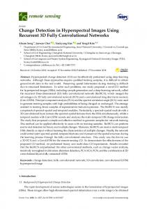
Example 1: Monitoring coastline changes using multi-temporal imagery Multi-temporal imagery has been used to monitor the changes in the coastline in the Arctic south-west coast of Banks Island, Northwest Territories, Canada, where the settlement of Sachs Harbour is also located. Monitoring of coastal changes contributes to the development of various types of assessments (e.g., impacts, sensitivity, vulnerability, erosion hazard) due to climate change including changes in the sea-level. The temporal coastlines were extracted from 1961 and 1985 aerial orthoimages, and 2002 IKONOS and 2003 QuickBird satellite orthoimages, respectively. The feature-based approach was used for the detection of spatial changes. Figure 1 shows the coastline time series layers, which are also superimposed over the IKONOS orthoimage, which provides a contextual background.
Figure 1. Coastal line temporal changes superimposed over orthorectified IKONOS satellite imagery
Example 2: Change detection between new imagery and existing vector data The test area is located in north-east Alberta, Canada and the area covered by the National Topographic Database file 75M03. The panchromatic channel 8 of Landsat 7 ETM+ was used and compared to the existing vector data to detect spatial changes in the water bodies topographic theme. This is in support of the updating of the national topographic data. The vector boundaries of the water bodies were extracted from the imagery using image thresholding, followed by minimum area filtering and boundary vectorization. Having two homogenous temporal vector datasets, the feature-base approach was applied in this case study. Figure 2 demonstrates this application, where Figure 2a shows the existing vectors; Figure 2b shows the new imagery with the yellow arrow pointing at a “new” lake; Figure 2c shows the extracted boundaries of the water bodies from the imagery; Figure 2d shows the existing and new vectors; Figure 2e is the result of the automated feature-based change detection approach, where the vectors in red are the final additions and the vectors in green are the final deletions; and finally Figure 2f shows the additions and deletions superimposed over the new imagery.
(a) (b)
(d) (c)
(e) (f) Figure 2: Change detection between new image and existing vector data
Example 3: Detection of spatial differences between digital orthophotos To determine the spatial differences between two digital orthophotos produced by different DEM grid spacing, the similarity of the orthophotos was examined based on various pixel-based change detection approaches. One orthophoto, (Fig. 3a) was produced with a 10m DEM grid spacing, while the other (Fig. 3b) with a 30m DEM grid spacing. The differences between the two orthophotos were determined using image absolute differencing (Fig. 3c); using image ratioing (Fig. 3d); image correlation coefficients (Fig. 3e); and image quadratic distances (Fig. 3f).
(a)
(b)
(c)
(d)
(e)
(f)
Figure 3: Detection of spatial differences between two orthophotos produced from different DEM
CONCLUDING REMARKS Aerial and satellite images are the main data source to detect spatial changes. Usually the change detection is performed visually and interactively. Limitations in time and resources require the introduction of as much as possible automated approaches. This requires the introduction of rapid change detection approaches. It has been found that improvements can be made if the data to be compared are reduced to the same comparison level and if GIS and image processing techniques are integrated in the process. The concepts and developments of feature-based, region-based and pixel-based change detection approaches from images, based on the homogeneity of the temporal datasets, have been presented. These concepts have been implemented of in three case studies under two Programs of the Earth Science Sector of Natural Resources Canada. The Geomatics for Northern Development Program and the Program on Reducing Canada’s Vulnerability to Climate Change. These examples demonstrate their potential for rapid and efficient process for spatial change detection. This work has also showed that higher levels of automation can be achieved: a) when there is thematic homogeneity and the operations are feature dependent; and b) where tools and synergy of image processing and spatial analysis are applied in the various phases of change detection.
REFERENCES Armenakis C., Leduc F., Cyr I., Savopol F., Cavayas F. 2003. A comparative analysis of scanned maps and imagery for mapping applications. ISPRS Journal of Photogrammetry and Remote Sensing 57(5-6): 304-314. Armenakis C., Savopol S. 2004. Image processing and GIS tools for feature and change extraction. International Archives of Photogrammetry, Remote Sensing & Spatial Information Sciences, Vol. XXXV, Part B4, Com IV, pp. 611616. Baltsavias E.P. 2004. Object extraction and revision by image analysis using existing geodata and knowledge: current status and steps towards operational systems. Inter. Journal of Photogrammetry & Remote Sensing, 58(3-4): 129-151. Heipke C., Straub D.-M. 1999. Towards the automatic GIS update of vegetation areas from satellite imagery using digital landscape model and prior information. International Archives of Photogrammetry and Remote Sensing, Vol. 32, Part 2W5, pp. 167-174. Lampropoulos G.A, Liu T., Armenakis C. 2004. A robust change detection methodology for topographical applications. Proceedings International Archives of Photogrammetry, Remote Sensing and Spatial Information Sciences, Vol XXXV, Part B. Nacef A., Ziou D., Armenakis C., Wang S. 1998. Chance Detection Techniques: An Overview. Technical Report, Département de Mathématiques et d’ Informatique (DMI), Université de Sherbrooke. Peled A. Haj-Yechia B. 1998. Toward automatic updating of the Israeli National GIS-Phase II. International Archives of Photogrammetry and Remote Sensing, Vol. 32, Part 4, pp.467-472. Singh A., 1989. Digital change detection techniques using remotely-sensed data. Inter. Journal of Remote Sensing, 10(6):989-1003. Walter V. 2004. Object-based classification of remote sensing data for change detection. ISPRS Journal of Photogrammetry and Remote Sensing 58(3-4): 225-238.