sands. A. KARNIELI. The Remote Sensing Laboratory, J. Blaustein Institute for Desert Research,. Ben Gurion University, Sede-Boker Campus 84990, Israel.
int. j. remote sensing, 1997 , vol. 18 , no. 6 , 1207± 1220
Development and implementation of spectral crust index over dune sands A. KARNIELI The Remote Sensing Laboratory, J. Blaustein Institute for Desert Research, Ben Gurion University, Sede-Boker Campus 84990, Israel ( Received 26 January 1996; in ® nal form 19 July 1996 ) Abstract. Advantage is taken of a unique spectral feature of soil biogenic crust containing cyanobacteria. It has been shown that the special phycobilin pigment in cyanobacteria contributes in producing a relatively higher re¯ ectance in the blue spectral region than the same type of substrate without the biogenic crust. A spectral crust index (CI) has been developed, based on the normalized di erence between the RED and the BLUE spectral values: CI= 1 Õ (REDÕ BLUE)/( RED+ BLUE). Applying the index to a sand dune environment, it has been shown that the CI can be used to detect and to map, from remote sensing imagery, di erent lithological morphological units, such as, active sands, crusted interdune areas and playas, which are expressed in the topography. As a mapping tool the CI image is much more sensitive to the ground features than the original images. The absence, existence, and distribution of soil crust are an important information for deserti® cation and climate change studies. They are also highly valuable information for developing agricultural regions and/or infrastructures in arid environments since soil crusts contribute to soil stability, soil build-up, soil fertility, and to the soil water regime. The application of the proposed CI can be performed with imagery acquired by any sensor which contains the blue band. Currently, the most common data sources are colour aerial photographs and Landsat TM images as demonstrated in this paper. However, CI should be applicable to other sensors such as the SPOTVEGETATION, MOMS-2P, SeaWiFS and MODIS which will be available in the coming years.
1.
Introduction
Soil crust formation is a common and widespread phenomenon in arid and semi-arid soils. Distinction should be made between physical and biogenical crust formations. Physical crust is de® ned either as one formed by a combination of raindrop impact on the soil surface along with physiochemical dispersion of soil clay, or as one formed by the sedimentation of ® ne material as turbid water in® ltrates following overland ¯ ow (Singer 1991). The biogenical soil (also known as organic or microphytic crust) can be formed by di erent combinations of microphytic communities including mosses, lichens, liverworts, algae, fungi, cyanobacteria (=blue-green algae or Cyanophyta), as well as bacteria ( West 1990). The microphytes can grow on di erent rocky materials such as limestone, chalk, dolomite, ¯ int, sandstones, granite, as well as on di erent soil types such as loess and dune sand ( Evenari et al. 1982, Friedmann and Galun 1974, West 1990 ). They are well adapted for primary colonization of arid environments due to their extraordinary ability to survive desiccation and extreme temperatures (up to 70ß C), high pH and salinity. Consequently, well developed soil crust 0143 ± 1161/97 $12.0 0
Ñ
1997 Taylo r & Francis Ltd
1208
A. Karnieli
microphytic communities are found on soils in arid and semi-arid areas throughout the world. Cyanobacteria are usually the primary components of soil crust ( Booth 1941), but are often accompanied by soil algae, mosses and lichens. Since cyanobacteria colonize the soil faster than the other microphytes and stabilize the surface, they usually represent an early stage in the soil crust succession. Although the crust formation, either physical or biogenical, is an almost negligible portion of the soil pro® le (only one to a few millimetres in thickness) it plays a signi® cant role in desert ecosystems. From the hydrology point of view, it in¯ uences runo , rain interception, water in® ltration and percolation, surface evaporation, water holding capacity and soil moisture content ( Hillel 1980, Lange et al. 1986, Morin et al. 1989, Yair 1990, Stroosnijer and Hoogmoed 1995, Verrecchia et al. 1995 ). Geomorphologically speaking, since the crusted soil layer has more silt and clay material due to the adhesive properties of ® lamentous cyanobacteria and other microphytes than the sandy pro® le beneath, it prevents soil erosion by water or wind, and is responsible for the stabilization of sand dunes ( Danin 1991). Addition of ® ne particles and organic material to the upper soil layer improves soil fertility due to changes in the content of di erent elements such as amino nitrogen, oxygen, organic carbon, nutrients and more (Shields et al. 1957 ). It happens that the existence of microphytic communities in the topsoil provides a starting material for the production of other soil components (Shields and Drouet 1962). Recently, Karnieli et al. ( 1996 ) have shown that when the biogenic crust is wet, its spectral re¯ ectance values can be similar to those of higher plants and therefore may lead to misinterpretation of the vegetation dynamics and to overestimation of ecosystem productivity when using some remote sensing methods such as vegetation indices. However, despite the importance of the soil crust and its vast distribution over arid and semi-arid soils, little is known about the ability to detect and map desert crusts by remote sensing methods. Spectral re¯ ectance curves of di erent desert microphytic communities are presented by Ager and Milton ( 1987), O’Neil ( 1994 ), Tromp and Steenis ( 1995), Karnieli and Tsoar ( 1995 ), Karnieli et al. ( 1996) and Karnieli and Sara® s ( 1996 ). Some e orts to map biogenic crusts based on Landsat MSS images have been made by Wessels and van Vuuren ( 1986) and Tsoar and Karnieli ( 1996 ). The latter works show the capacity to visually di erentiate and classify several types of crusts. The aim of the present work is to map various types of crusts by relating new knowledge about their spectral features to aerial photographs and satellite images. 2.
Study area
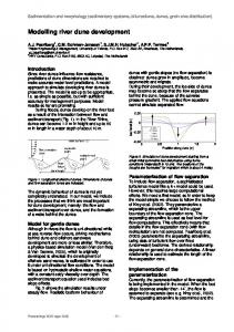
The study area is located in the northwestern Negev desert ( Israel ) and northeastern Sinai ( Egypt) along the desert transition zone ranging between about 100 mm mean annual rainfall in the south to about 200 mm in the north ( Tsoar and Mù ller 1986; Yair 1990 ). Although the sand ® eld of the Negev represents the eastern extension of the Sinai ® elds from the geomorphological and lithological points of view, the area is arti® cially divided by the political border line. The border line is characterized by a sharp contrast, higher re¯ ectance values ( brighter) on the Egyptian side and lower re¯ ectance (darker) on the Israeli side. This contrast has long drawn the attention of many scientists. The traditional and popular explanation asserts that the contrast is mainly due to severe anthropogenic impact of the Sinai BedouinÐ especially overgrazing by their black goat and sheep herds, as well as gathering of
Development and implementation of spectral crust index over dune sands 1209
plants for ® rewood. This interpretation has been pioneered by Otterman since 1974 and summarized in Otterman ( 1996 ). On the other hand a new theory which was recently proposed by Karnieli and Tsoar ( 1995 ) and Tsoar and Karnieli ( 1996) suggests that the contrast is not a direct result of severe overgrazing of higher vegetation but is caused by an almost complete cover of biogenic crust in the Israeli side while human and animal activities prevent accumulation of crust, or trample any existing crust, in the Egyptian side. The sandy area, from the Mediterranean Sea along the Israeli-Egyptian border is not entirely homogeneous but can be subdivided into ® ve geomorphological regions ( Tsoar and Karnieli 1996). These regions are (from north to south): (A) Coastal dunes generated by young sand encroachment; ( B) Sandy soil that underlies the coastal dunes and spreads southwards as a stabilised sandy plain; (C) Low linear dunes with wide interdune areas; ( D) High linear dunes with some vegetated crescent-shaped dunes connecting them in the interdune areas; and ( E) high linear dunes composed of sand that is redder than the sand in the former region and without any crescent-shaped dune in the interdune area. Most of the entire area is characterized by sparse higher vegetation cover on the Israeli side of the border which due to the rainfall gradient gradually increases towards the north. On the average it was found that 26 per cent of the area is covered by higher vegetation comprising 11 per cent of annuals and 15 per cent of perennials as sampled in Spring 1993 along with climatic gradient ( D. Lavee, unpublished data). On the other hand, it is observed that most of the area (up to 90 per cent) is covered by biogenic crust consisting mostly of cyanobacteria where Microcoleus vaginatu s is the dominant species accompanied by Scytonema , Schizothrix , Calothrix , Chroococcidiopsis, Nostoc , and Phormidium . Mosses are relatively rare in the southern part of the study area but are more common in the nothern part. Their dominant species are Pterygoneurum , Aloina , Bryum bicolor, Brachymenium exile and T ortula muralis ( Danin et al. 1989, Danin 1991, Lange et al. 1992). Intensive ® eld work has been conducted in the Sede Hallamish site which belongs to the geomorphological region ( E) (® gure 1 ). (Several previous papers call the same area `Nizzana Site’ ( Yair 1990, Lange et al. 1992, Verrecchia et al. 1995)). The typical sandy dune ridge can be subdivided into several lithologic/morphologic units ( Yair 1990 ): 1. Dune crests: the upper part of the sand ridge which covers some 10 per cent of the area in the Israeli side of the border but expands drastically in the Egyptian side, is composed of about 98 per cent unconsolidated active sand. The organic matter content is very low ( 0´1 per cent). This unit also covers most of the interdune corridors on the Egyptian side. 2. The basal dune and interdune corridors extend over some 85 per cent of the area in the Israeli side and are almost negligible on the other side of the border. The surface is covered by a rather contiguous biogenic crust (as mentioned above) which consists of ® nes (silt and clay, up to about 40 per cent) and has a relatively high organic matter content ( 1± 2 per cent). 3. Playa surfaces: ¯ at whitish isolated patches of up to a few hundreds of square metres in area. These units which exist on both sides of the border are relics of an old ¯ ood plain consisting of up to 70 per cent ® nes and almost does not contain any microphytic communities. Therefore, the playa crust is considered as a physical crust.
1210
A. Karnieli
Figure 1.
Di erent lithologic/morphologic units in the study area.
The biogenic crust of cyanobacteria is mainly associated with the ® ne-grained soil particles. Both the ® nes and the cyanobacteria have been brought from adjacent deserts by winds. As a result of limited human and animal activity in the Negev region, they have been deposited and trapped by vegetation and accumulated primarily in the interdune areas. Due to the gluey nature of the cyanobacteria, the biogenic crust spreads with time, causing aggregation of more ® nes. Danin ( 1991 ) 2 shows that there is a high correlation (r = 0´879) between silt content and percentage of organic material in cyanobacterial crusts. These are results of analyses of 18 crust samples in sites with stable and active dunes in northwestern Negev. 3.
Data analyses and results
3.1. Early observation s and hypothesis Field measurements were carried out in situ by using the Li-Cor Li-1800 portable spectrometer. The instrument was ® xed to 2 nm wavelength spectral resolution increments between 400 and 1100 nm and 15ß ® eld-of-view ( FOV ). The spectrometer was hand held at heights of about 1 m, at nadir. The spectral re¯ ectance was calculated by relating the target radiances to the downwelling irradiation as measured by a cosine-corrected receptor. All measurements were obtained almost simultaneously in the Sede Hallamish site. Five spectra are presented in ® gure 2: interdune playa crust, bare active dune sand, and three cyanobacteria crusts sampled at the north and south facing slopes of the basal dune as well as from the interdune crusty surface. These spectra di er from each other by their ® nes content as presented in table 1. These spectra have a typical soil shape, namely, relatively low in the blue region and increases gradually towards the near infrared region. However, one can notice the slight dip of the crust
Development and implementation of spectral crust index over dune sands 1211
Figure 2.
Table 1.
Spectral re¯ ectance ® eld measurements of di erent lithologic/morphologic units in the study area with the respective values of the calculated crust index (CI). Soil texture analysis of di erent lithological/morphological units in Hallamish site.
Active dune sand Interdune playa Interdune crust South facing slope North facing slope
Sand 0´063± 2 mm (%)
Silt 0´002± 0´063 mm (%)
100´0 32´4 78´0± 84´6 86´1± 86´6 82´1± 84´8
Ð
44´4 13´1± 16´1 10´3± 10´7 11´2± 14´0
Clay