Development of the National Database for Primary Care Groups and Trusts Andrew Wagner, Deborah Baker National Primary Care Research and Development Centre University of Manchester, Williamson Building – 5th Floor, Oxford Road, Manchester, M13 9PL. UK Phone: +44 161 275 7601 Fax: +44 161 7600 Email:
[email protected],
[email protected] Presented at GeoHealth 2002 Victoria University of Wellington December 3-5th 2002
ABSTRACT This paper describes the how the National Database for Primary Care Groups and Trusts was developed to serve the needs of decision makers in response to the re-structuring of primary care provision in England. A core database was established linking primary health care provision and population socio-economic and demographic characteristics. A demonstration of some of the features of the database is provided. We discuss some of the problems of defining Primary Care Group geographical boundaries and adding further datasets, sourced from other administrative geographies. Forthcoming refinements to the user interface and development of the longitudinal datasets are outlined.
Keywords and phrases: primary care groups and trusts, national database, health needs assessment, decision support, administrative boundaries, longitudinal data
1.0 INTRODUCTION: DEVELOPMENT OF THE DATABASE The National Database for Primary Care Groups and Trusts was developed at the National Primary Care Research and Development Centre (NPCRDC) to provide an information resource and decision support facility for National Health Service (NHS) managers, policy makers and researchers in the fields of primary care, epidemiology, public health and public policy. Information from a variety of datasets is available for users to download from the database website via a map-based interface (http://www.primary-care-db.org.uk). Health policy in the UK during the 1990s focused on increasing the contribution made by primary care provision in improving the quality of health care and the health of the population, becoming more responsive to the needs of communities and tackling the unequal distribution and provision of services (Department of Health, 1998, 1999). These aims were centred on major structural change in primary care, predominantly the introduction of 481 Primary Care Groups (PCGs) in England in April 1999. PCGs were fundamentally composed of groups of general practices and their registered patients, serving average populations of approximately 100,000. Decision making and management responsibilities for each PCG rested with its committee, mainly composed of general practitioners but also including other primary care providers such as nurses, social services staff and lay members. By April 2002, PCGs had been replaced by 302 Primary Care Trusts (PCTs), which have taken a fuller and more autonomous role in developing primary care provision and integrating services with other care providing partners. There was a clear need for a national information resource to provide baseline assessments of population needs, to profile the socio-economic and demographic disposition of PCG/Ts and to support the continuing evaluation of primary care organisations’ performance.
At the time of the introduction of PCGs, no comparative national data were available which allowed the systematic association of locality based primary health and social care provision information, population characteristics and health outcomes for populations (Hann et al, 2001). The National Database for Primary Care Groups and Trusts was created in order to fill this gap with the objective of providing a supporting resource that allowed primary care organisations and the academic community to monitor the progress of PCG/Ts through a variety of linked datasets at a local, regional and national level. A series of significant data sets were made available to the NPCRDC, which continue to be augmented in response to the changing information requirements of the primary care environment. Where possible, the data sets are updated annually providing longitudinal data and the ability to map changes in service outputs and health outcomes over time. DEMONSTRATION OF THE MAP INTERFACE The functionality of the map-based interface is demonstrated at various levels of data aggregation. An example of the link between deprivation, limiting long-term illness and ‘single-handed’ general practices is described, as is that of deprivation, prevalence of female general practitioners and immunisation provision. Reflecting the requirement for baseline data at the earliest stages of primary care re-structuring, a core database was established in 1999 which provided baseline descriptions of the socio-economic and demographic characteristics of PCG populations, linked to generic health status and to the organisation, resourcing and activities of general practice. From this foundation, more data sets have been added about health need, prescribing, PCG/T resourcing, deprivation and population need, morbidity and mortality. In view of the volume of data, variety of available administrative geographies and time periods, the implementation of a mapbased user interface via the internet has been found to be best suited to interrogating the database. The web interface uses MapGuide from Autodesk with the database system managed Cold Fusion from Allaire. The underlying structure of the database readily lends itself to other national health systems though is dependant on the availability of area-based measures of deprivation and health outputs and outcomes. What has become clear from constructing the core elements of the database is that a coherent geographical basis for integrating data from different sources and for defining geographical boundaries is necessary to make such an information system viable.
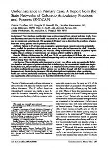
2.0 CHALLENGES TO PROGRESS It is likely that development of similar frameworks in other countries would encounter comparable issues of data quality and compatibility and constantly changing geographical boundaries. Configuration of the original data set, particularly estimation of PCG population sizes, was complicated by the lack of defined and coherent PCG geographical boundaries. This consequently affected the core function of providing analysis of population need. The problem was overcome by using the NHS Postcode Directory (NHSPCD) as an integrating framework to construct PCG boundaries. There are approximately 1,440,000 current postcodes in England, each postcode covering an average of 16 postal delivery points. The NHSPCD links every postcode unit to a PCG/T identity code, as well a 1991 Census ward code which allows the aggregation of wards to their constituent PCG/Ts. Figure 1 shows a simple single postcode link to PCG, 1991 Census ward and current electoral ward. There were approximately 9,000 wards at the time of the 1991 Census used for the collection and reporting of Census data. Census wards were administrative areas of various geographical size containing populations of approximately 5,000 people. From this model, ward level information about local populations, including age, sex, ethnicity, occupational groups, unemployment and other proxy measures of population characteristics were attributed to PCG/Ts (Hann et al, 2001).
Postcode unit M13 9PL
PCT code (name) 5CL (Central Manchester PCT)
1991 Census (name) 00BNFW (Hulme)
Code
Current Ward (name) 00BNFA (Hulme)
Code
Figure 1: NHS Postcode Directory extract These data were linked to primary care service provision data extracted from the annual General Medical Services Statistics for England (GMS) which contains information about staffing of general practice, activity levels, medical services provided, age and sex of registered practice populations. The geographical location and,
therefore, PCG of each of the approximately 9,000 practices could be identified by postcode. This methodology provides a fairly robust framework for estimating PCG populations though accuracy is dependant on the validity of GMS sourced practice postcodes and the affect of constantly changing postcodes (Barr 1993a, 1993b). The process of expanding the database has been hampered by issues surrounding data availability and compatibility. Matching PCG/T boundaries with other administrative boundaries has been problematical and this is illustrated by the relationship of PCG/T boundaries with those of other administrative boundaries. A key component of primary care development in England is increasing partnership and joint working with local government authorities. Local government authorities are district and regionally based organisations, responsible for supplying community-based services such as personal social services. There is clearly an operational interface between the health care provision of PCG/Ts and social services provided by local authorities, that requires shared locality based information. However, PCG/T geographical boundaries and local authority boundaries tend not to be coterminous which hampers the ability to expand the database with potentially useful data about community care provision, residential and nursing care for the elderly and disadvantaged sections of the population. Only 23 PCGs shared boundaries with local authorities creating the problem of attributing social services data to PCGs nationally. An important task of the database in ensuring provision of longitudinal data for analysis of change over time, is to keep abreast of boundary changes caused by mergers of PCG/Ts and administrative adjustments to wards and to postcodes. The staggered evolution of 481 PCGs into 302 PCTs has presented the problem of creating comparative data over time, though assuaged by PCTs having geographical boundaries defined by contemporary electoral wards. The value of using a geographical information system (GIS) for accessing data simplifies the access process for users, though it is recognised that information by itself is not always enough to enable database users to identify and to analyse which data are relevant to them. An essential component of the continued development of the national database is to further refine its functionality and ease of access to relevant data.
5.0 FUTURE DEVELOPMENTS From the core database, further linked data sets continue to be added with target objectives of supporting service and health evaluation, decision-making and policy implementation. The core database has been supplemented with datasets including clinical health outcomes, prescribing measures, financial resource allocation and several measures of population need and deprivation. The fundamental value of the database is that it provides a longitudinal study of change in primary care outputs and outcomes and their relation to improvement in population health and reduction in health inequality. Release of the 2001 Census of Population data set by the Office for National Statistics is expected in 2003, which will provide a significant longitudinal addition to the core database. Further longitudinal data will be integrated into current datasets as they become available, particularly with the addition of the 2001 Public Health Compendium of Clinical Health Indicators (Department of Health, 2002), which provides a comprehensive collection of clinical health outcomes through mortality and morbidity indicators. With an ever-expanding population of database users, informal feedback about the service, via e-mail and general comments, has been extremely positive. Of the approximately 750 registered users, two thirds are based in the NHS with the remainder based in academic institutions. Analysis of intended use of the database have shown a range of projects, chief amongst which are health needs assessment, supporting the commissioning of services and development of primary care services, performance management and analysis, benchmarking and human resource information. It is intended to make a detailed user-orientated assessment of the database and website in 2003 with a view to targeting more specific data requirements through a more powerful and flexible user interface. The first stage of this development is the introduction of a reporting function, which provides comparative information and performance measures derived from key variables. The reporting facility is made available through a thematic map interface, which allows users to select data sets, variables and geographical areas of interest.
REFERENCES National Database for Primary Care Groups and Trusts (2002), Homepage of the primary care database resource, based at the National Primary Care Research and Development Centre, University of Manchester, UK.
Barr R. (1993a) Census geography: a review. In: A.Dale and C. Marsh (Eds) The 1991 Census User’s Guide, pp. 70-83. HMSO, London. Barr R. (1993b) Mapping and spatial analysis. In: A.Dale and C. Marsh (Eds) The 1991 Census User’s Guide, pp. 248-268. HMSO, London. Department of Health (1998) The New NHS: Modern, Dependable. The Stationary Office, London. Department of Health (1999) Saving Lives: Our Healthier Nation. The Stationary Office, London. Hann M., Baker D., Hayes J., Wagner A., Barr R. (2001) Methodological issues in the development of a national database for primary care groups and trusts. Health and Social Care in the Community, Blackwell Science, 9:5, pp. 286-293.