AGPCS - An Automatic GSM-based Positioning and Communication System Zoran Salcic The Auckland University, Department of Electrical and Electronic Engineering, 20 Symonds St., Auckland, New Zealand E-mail:
[email protected] Presented at the second annual conference of GeoComputation ‘97 & SIRC ‘97, University of Otago, New Zealand, 26-29 August 1997
Abstract
both positioning and communication based on the single
A novel approach to automatic positioning and communi-
GSM technology.
cation is presented in this paper. The approach is using single GSM (Global System for Mobile Communication) technology to achieve both positioning of the mobile station and communication with the other parties in a system containing a number of mobile stations. The paper deals with the overall system architecture, and briefly describes the aspects of positioning, communication and application of the system, without describing the low-level details applied in system operation. It also describes implementation of two experimental versions of the mobile stations, self-positioning and remote positioning, that integrate positioning information in the platform ready to use for different purposes. The approach is applicable to GSM and its other more recent derivatives.
1.1 Global Positioning System The most accurate positioning today is achieved using satellite-based global positioning system (GPS) (Kapplan 1996). However, the GPS has two important disadvantages. First, the information on position usually has to be transmitted to some other party requiring that the mobile station provides data communication facilities. Most often, it is provided using some sort of radio system based data transfers such as radio modems which communicate with specialised radio system infrastructure (such as trunked radio), or using an existing public cellular system. In the former case, this introduces the problem of radio coverage, and requires investment into radio transmission systems. Further costs are incurred by data communication devices. In
1. Introduction
the latter case, the positioning and communication facilities are at present implemented by two separate devices.
Automatic positioning (estimating location) and data com-
The second disadvantage of GPS is that it is usable only
munication is of great importance for many areas and ap-
for the case of “clear sky”, which makes it hardly usable in
plications, such as automatic vehicle locating and tracking,
urban areas, mountainous terrain, and in closed/covered
remote equipment and property locating and monitoring,
space.
boat, yachts, and cargo tracking and monitoring, remote patient tracking and monitoring, various types of dispatch-
1.2 Radio Signal Propagation Models
ing and distribution systems, etc. Integration of positioning
Other methods for mobile station positioning are based
and communication into a single system is a goal not
on radio signal propagation such as signposts, dead reck-
achieved in the contemporary positioning systems. Hence,
oning, circular or hyperbolic trilateration systems, etc. Many
it is the aim of our AGPCS (Automatic GSM-based Posi-
methods and systems have been proposed based on radio
tioning and Communication System) project to integrate
signal strength measurement (Figel 1969, Ott 1977, Hata
Proceedings of GeoComputation ‘97 & SIRC ‘97
15
1980) of a mobile object’s transmitter by a set of base
protocols. Other data services include G3 facsimile, and
stations. Recently, adaptive schemes based on the use of
Short Message Services (SMS) which is a bi-directional
cellular systems and on fuzzy logic (Song 1994), hidden
service for short alphanumeric (up to 160 bytes) mes-
Markov models, and pattern recognition methods
sages. Messages are transported in a store-and-forward
(Kennemann 1994) have been used to estimate the posi-
fashion. For point-to-point SMS, a message can be sent to
tion of mobiles. The most recent one (Hellebrandt 1997)
another subscriber, and an acknowledgment of receipt is
is based on a multidimensional scaling technique. A mo-
provided to the sender. SMS can be used in a cell-broad-
bile’s position is determined in a such way that the meas-
cast mode, for sending messages such as updates of differ-
ured signal strength of a certain base station in the GSM
ent sorts. Messages can also be stored in the SIM card for
system is best fitted to the known average signal strength
later retrieval.The SMS service provides a basic means to
at this point. The performance of the method was tested
transfer data used to estimate position or coordinates of
by simulation for different simulated scenarios (Hellebrandt
the mobile station.
1997).
1.3 Personal Communication Systems The personal communications industry is one of the fastest growing industries in this decade (Feher 1995). The cellular market, as a part of this industry, is growing at the rate of almost 50 percent a year. The market offers a huge opportunity for many industries, including network service providers, software and hardware developers, and those who will upgrade the services offered by the basic net-
Besides voice and data services, GSM system provides data that might be used for radio signal strength measurements and positioning.The GSM mobile station receives each 0.48 seconds the downlink signal levels from the serving and up to six neighbouring base stations in a discrete scale. The GSM mobile station applies a complex signal processing algorithms to determine the signal strengths. This information is a part of GSM system and is used in our system to estimate position of the mobile station.
work service providers. GSM, or other technologies derived from it, has become one of the prevailing cellular technologies worldwide.
1.4 GSM GSM (Scourias 1995, Redl 1995) initially handled basic voice services and some emergency calling features, but has already added improvements in subscriber identity module (SIM) cards, which contain a microchip with the information on the caller. From the user point of view, the obvious difference between GSM and other cellular technologies is that GSM cellular phones operate only digitally, enabling both voice and data to be transferred directly digitally, without using modems, providing the backbone of the mobile
1.5 New Approach - the AGPCS By using, combining and integrating two inherent features of the GSM system (measurements of radio signal levels and ability to communicate directly digitally), we propose a novel Automatic GSM-based Positioning and Communication System (AGPCS) technology. The AGPCS is a realtime system built on top of the GSM system, and can be considered as an application layer to standard GSM. The first working versions of systems using AGPCS technology have been developed and tested. The AGPCS technology can be used for various applications, including control, as it may be easily incorporated into the standard hardware/software environments or used in the embedded form.
communication network. Our first goal was to obtain technology to estimate moA variety of data services are offered in GSM. GSM users
bile station position with the accuracy that can be consid-
can send and receive data, at rates up to 9600 baud, to
ered sufficient for a number of applications. The current
users on POTS, ISDN, Packet Switched PDN, and Circuit
model provides accuracy, which is almost always below
Switched PDN using variety of access methods and
16
Proceedings of GeoComputation ‘97 & SIRC ‘97
270m, and usually around 200m. Integration of position estimation and communication between mobile objects,
2. The base station subsystem that controls the radio link with the mobile station
or between mobile and stationary objects, has become
3. The network subsystem performs the switching of us-
feasible now. An integrated positioning and communica-
ers and mobility management in the mobile services
tion system, which can incorporate control features as well,
switching center.
is being obtained and used in a number of pilot applications. The AGPCS, including a brief overview of key technologies that take part in its implementation, is described in this paper.
The mobile station and base station subsystem communicate across the Um, or radio link, interface. The base station subsystem communicates with the network subsystem across the A interface. The International Telecommunication Union allocated the bands 890-915 MHz for the
2. The AGPCS Framework
uplink (mobile station to base station) and 935-960 MHz
In this section the AGPCS framework is described. First, we introduce some features of the GSM that are relevant for AGPCS. Then, the architecture and main features of
for downlink (base station to mobile station). GSM is using a combination of Time- and Frequency-Division Multiple Access (TDMA/FDMA) method. At the 900 MHz range, radio waves bounce off everything - buildings, hills, cars,
the AGPCS are described.
airplanes, etc. Thus, many reflected signals, each with a different phase, can reach an antenna. Equalization is used to
2.1 Brief Overview of Relevant GSM Features
extract the desired signal from the unwanted reflections. It works by finding out how a known transmitted signal is
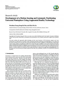
A GSM network is composed of several functional entities. It is illustrated in Figure 1., which shows the layout of a generic GSM network. The network is divided into three
modified by multipath fading, and constructing an inverse filter to extract the rest of the desired signal. To minimize co-channel interference and to conserve power, both the
major parts:
mobile and the base transceiver station operate at the
1. The GSM mobile station subsystem.
lowest power level that will maintain an acceptable signal
Mobile station
Um Base station
Mobile station
Mobile station
BSC
A
Um MSC
Base station
Mobile station
Other types of networks
BSC
Figure 1. General architecture of a GSM network
Proceedings of GeoComputation ‘97 & SIRC ‘97
17
quality. The mobile station measures the signal strength or
features such as power control is performed in this
signal quality (based on the Bit Error Ratio), and passes
sublayer.
the information to the base station controller (BSC), which
•
Mobility Management which manages the location up-
decides if and when the power level should be changed.
dating and registration procedures, as well as security
Besides ensuring the transmission of voice and data of a
and authentication
given quality over radio link, the functions of mobile cellu-
•
Connection Management which handles general call
lar network are the implementation of a handover mecha-
control, and manages supplementary services and short
nism, registration, authentication, call routing and location
message service.
updating functions.
Obviously, from the AGPCS point of view, the most impor-
The signaling protocol in GSM is structured into three
tant is Layer 3, at which the AGPCS technology is hooked-
layers. Layer 1 is the physical layer, which uses the channel
up to GSM.
structures of GSM. Layer 2 is the data link layer. Across the Um interface, the data link layer is modified version of the
2.2 AGPCS Architecture and Operation
LAPD protocol used in ISDN, called LAPDm.Across the A
The AGPCS represents an application technology built on
interface, the Message Transfer Part layer 2 of Signalling
the top of standard GSM. It performs the positioning of
System Number 7 is used. Layer 3 of the GSM signaling
the mobile station in the coverage area of the GSM net-
protocol is itself divided into three sublayers:
work. The logical structure illustration of an AGPCS system is given in Figure 2.
•
Radio Resource Management which controls the setup, maintenance, and termination of radio and fixed chan-
The AGPCS mobile station consists of the GSM mobile
nels, including handovers. The management of radio
station (actually handset) and a mobile computer connected
Network Center (NC) GSM Network AGPCS MS and its neighboring base stations
AGPCS Mobile Station Base Station Wireless Connection
Figure 2. The AGPCS system illustration
18
Proceedings of GeoComputation ‘97 & SIRC ‘97
to it. Depending on the power of the mobile computer,
tioning model can run on the mobile computer, and esti-
various degrees of intelligence and application complexity
mate the distances to the base stations, or position, which
can be achieved within the AGPCS mobile station. The
are then sent to the NC.The NC plays supervisory role in
AGPCS mobile station performs continuous radio signal
the AGPCS system. It is connected by wireless connection
strength measurement and acquisition of measurements
to the GSM. Further refinement of position can be done
to estimate its position. The position is estimated by ap-
and the corresponding database is updated.The NC main-
plying a combination of mathematical and statistical
tains data on positions of a number of mobile stations, and
modeling, augmented with the use of artificial neural net-
provides the means for presenting positions on geographic
works to determine position or area in which is the AGPCS
map display, but can be used for various other purposes.
mobile station. The model is based on current signal
The NC and a number of the AGPCS mobile station make
strength measurements, history of signal strength meas-
an AGPCS system. Obviously, the number of independent
urements, as well as some a priori knowledge of the envi-
AGPCS systems or their architecture is not limited, be-
ronment. The mobile computer collects signal strength
cause it depends only on the application requirements. Both
measurements from serving and up to six neighboring base
scenarios involve transfer of messages between the AGPCS
stations, together with time stamps, and evaluates the dis-
stations or between stations and the network center. This
tance of the mobile station from the neighbouring mobile
communication is performed without employing GSM voice
stations. This operation is performed in real-time. Radio
channels. It is based on short message service (SMS) that
signal strength measurements are performed with the sam-
provides exchange of short messages without using any
pling interval between 0.5s and 1.0s.All calculated distances
additional interface equipment.
are used to determine an area (if there are just three distances it is a point) in which the mobile station might be. The distances of the AGPCS station from the base sta-
3. Position Estimation
tions are calculated from the radio signal propagation model
Mobile station positioning is carried out by a complex
with parameters which are determined and subsequently
combination of three types of models:
changed by a training process using artificial neural networks.
1. Geometric model based on trilateration, which gives accurate position given the distances of mobile station
Two scenarios are used from this point on. First, if the
from the base stations.
computational power of the mobile computer is sufficient,
2. Radio signal propagation model, which is of empirical
it performs further calculations, determines the estimated
character and includes many uncertain or unknown
position, and displays it on the geographic map. It is also
elements changing in time randomly.
able to transmit its estimated position, as well as signal
3. Artificial Neural Network (ANN) model, which is used
strength measurements, if needed, to any party in the
to reduce uncertainties by learning from the previous
AGPCS system, including supervisory center. This scenario
experience gained at the training station or mobile sta-
leads to self-positioning and communication system, or SPCS.The SPCS is useful in applications in which the AGPCS
tion itself. Although the combination of these models carries certain
mobile station and its user want to know current position.
level of redundancy, this is desirable in order to reduce
In the second scenario, the mobile computer has a mini-
the influence of the randomness, which is very high in the
mum of intelligence and input/output devices. It is used
area of radio signal propagation and makes its modeling a
just to collect signal strength measurements, preprocess
very difficult task.
them and transmits to a network center (NC), where they are used to estimate position.A simplified version of posi-
The main problem affecting the estimated position accu-
Proceedings of GeoComputation ‘97 & SIRC ‘97
19
racy is the high uncertainty and randomness of radio sig-
Genetic algorithm ranks the BP ANNs the according to
nal propagation process. Using ANN modeling (Braspenning
values of the fitness function. Finally, the best of selected
1995, Swingler 1996) proved to have some advantages such
ANNs are used to implement the positioning model. In
as not requiring a priori knowledge of the relationship
the current version of the AGPCS, the selected ANNs are
between dependent and independent variables. First, the
implemented in software.The software implemented ANN
model is run to learn using past and current positioning
is capable of estimating position in real-time. The whole
data including signal strengths and actual positions deter-
process of signal strength measurements and measurement
mined by more accurate GPS technique, or computer-sup-
data preprocessing, and application of ANN’s model is per-
ported and generated maps. Then, the model is validated
formed in real-time using a standard PC-compatible note-
using another set of measurements. Finally, the model is
book as the mobile computer. Further details of our model
used to estimate positions.At this stage, the back propaga-
will not be discussed in this paper and will be reported
tion ANN model is used in estimating AGPCS station po-
elsewhere.
sition. It is an adaptive multilayer feedforward network modeling technique, which is often used in non-linear sys-
4. Communication
tem modeling and time-series prediction. Two approaches The short message service (SMS) is a unique service prohave been used in estimation of AGPCS station position: 1. Signal strengths and desired AGPCS position input-
to-point alphanumeric messages of the length of up to 160
output pair. In this case, ANN learns to predict the
characters. It allows two-way messaging, store-and-forward
position from relationship of signal strengths and ac-
delivery, and acknowledgment of successful delivery. This
tual position determined by GPS or obtained with high
service is performed within GSM control channels and does
accuracy from the computer generated map.
not require the use of the voice channels.This further means
2. Trilateration. In this approach, ANN is used to model
that no special equipment for data service, like modems
the distance between the AGPCS station and
or special data cards, is needed.The SMS service operates
neighboring base stations from actual measurements/
by sending a message to the service provider message
positions process. Results obtained using two described approaches are better than some other reported in literature (Song 1994). The accuracy of estimated position is better than 270m. This is still worse than those reported in (Hellebrandt 1997). However, results from this reference must be taken cautiously, because they are obtained in a fully simulated environment. All our results refer to the real system experiments with real-time estimation of position.These re-
center, and it is forwarded to the destination using service provider network. A problem that can arise is the delay in delivery of the message to the destination. Although delays of this type occur occasionally, most deliveries are performed within actual real-time constraints. However, delivery cannot be guaranteed within very strict time constraints.The SMS service is used to sending position information, signal strength measurements, or to exchanging other information between the AGPCS mobile station such as telemetry measurements, or control information. An
sults have been tested on limited area of about 3 x 3 km.
application layer of the communication protocol has been
The implemented model is obtained by training process
developed that provides transfers of two types of mes-
on the AGPCS station itself.The AGPCS station moves in a
sages:
specific area and signal strength measurements together with actual positions are recorded automatically.Then, the training process starts. It first includes analysis of various types of BP ANNs using genetic algorithm (Goldberg 1989).
20
vided in GSM that allows users to send and receive point-
Proceedings of GeoComputation ‘97 & SIRC ‘97
1. Short messages of the length of up to 160 characters representing a computer supported version of GSMprovided SMS service. Software in the form of a dy-
namic link library supports sending and receiving of
5. Implementation and Application
short messages, management of message buffers and
Aspects
GSM mobile station local memories.This software provides a number of functions that can be used from
The first implementation of the AGPCS system uses the
high-level programming languages.
AGPCS stations consisting of the GSM mobile station
2. Long messages of almost arbitrary length. Because of
(handset) connected to the PC-compatible notebook com-
the limited data transfer speed in GSM network, the
puter. The whole software is developed to run in the MS
length of the long message is practically limited to the
Windows operating environment. A small real-time ker-
values that depend on specific application. The soft-
nel-like application collects signal strength measurements,
ware layer for long message transfers provides frag-
and prepares them to be either sent to the network su-
mentation and defragmentation of messages, ordering,
pervisory center, or used to estimate position locally. The
and checks for correctness of transfer, if required.
application can decide what to transfer to the NC depending on the criteria set up by the application.The other
Another important feature of the AGPCS communication is ability to create own AGPCS systems (closed networks). Once the NC is created it knows which AGPCS stations are authorised to take part in the system. The AGPCS sta-
application software is used to display the current position on the geographic map. This operation is not time critical, and software reads the current position from the file that is optionally used to log (keep track of) all posi-
tion must first register to the NC, and report to it at the agreed time intervals or at the NC request. Otherwise,
tions.
the NC may unregister it from the system. This feature is
Maintaining the database of the AGPCS stations including
important to reduce the frequency of traffic to a mini-
position and other information can be done in the NC. In
mum, because sending messages is associated with the cost.
this case the AGPCS station can be reduced to the GSM
Each AGPCS station can be brought in a sort of dormant
mobile station and an embedded system used just to col-
state, and awakened by the NC when needed. Also, through
lect measurements, perform estimate of position, and send
its own intelligence it can demand communication with
that information to the NC. The tasks performed at the
the NC when predefined changes in the positions or other
level of network center become more computationally and
monitored variables occur.
time consuming.The communication aspect becomes very important. It is the responsibility of application developer
The AGPCS allows yet another type of message exchange. This alternative way is using point-to-point transfers that are performed after establishing connection by dialing.The
to keep number and frequency of transferred messages low enough to avoid bottleneck at the point of connection of the NC to the GSM.
transfers are done using voice channels and actual air-time. However, this option requires additional data card plugged
Based on GSM, the AGPCS provides and guarantees the
into the notebook computer. In the current implementa-
highest level of security through the application of
tion of the AGPCS system, this software relies on the com-
encryption algorithms and frequency hopping which are
plex Microsoft Telephony Application Programming Inter-
fully transparent to application developers.Also, the AGPCS
face (TAPI). Once the connection is established, it enables
is internationally applicable, enabling completely new glo-
guaranteed data transfers between parties at the maxi-
bal applications without using specialised equipment or
mum data transfer speed in GSM of 9,600 baud.
investing in expensive infrastructure.
Proceedings of GeoComputation ‘97 & SIRC ‘97
21
6. Conclusions
Kapplan (1996) Kapplan E., Understanding GPS: Principles and Applications, Artech House, 1996
The AGPCS technology for positioning, communication and control of mobile objects is described in this paper. The AGPCS uses standard GSM to perform all functions, making simpler combination of those tasks than in other contemporary systems. New positioning method allows to position mobile stations within 270m accuracy making tech-
Kennemann (1994-1) Kennemann O., “Pattern Recognition by hidden Markov models for supporting handover decisions in the GSM system”, in Proc. 6th Nordic Seminar Dig. Mobile Radio Comm., Stockholm, Sweden, 1994, pp.195-202
nology applicable for many existing needs. Current imple-
Kennemann (1994-2) Kennemann O.,”Continuous lo-
mentations of the AGPCS mobile station and network
cation of moving GSM mobile stations by pattern rec-
center use PC-compatible/MSWindows hardware/software
ognition techniques”, in Proc . 5th Int. Symp. Personal, In-
platform. They have been chosen as suitable for compat-
door, Mobile, Radio Comm., denHaag, Holland, 1994, pp.
ibility with many other development tools and applications.
630-634
However, the AGPCS mobile station can be redesigned to the form of embedded solution.The main future research directions are further improvement of positioning model accuracy, implementation of mobile station as embedded solution, and new applications of the AGPCS technology.
Ott (1977) Ott G.D., “Vehicle location in cellular mobile radio systems”, IEEE Transactions on Vehicular Technology, vol.VT-26, Feb. 1977, pp. 43-46 Redl (1995) Redl S.H., Weber M.K., Oliphant M.W., An Introduction to GSM, Artech House, 1995
References Braspenning (1995) Braspenning P.J., Thujisman F.,
System for Mobile Communications”, University of
Weijters A.J.M.M., Artificial Neuran Networks: An Intro-
Waterloo, Canada, Technical Report, May, 1995, pp. 25
duction to ANN Theory and Practice, Springer, 1995 Feher (1995) Feher K. Wireless Digital Communications, Prentice-Hall, 1995 Figel (1969) Figel et. al. “Vehicle location by a signal attenuation method”, IEEE Transactions on Vehicular Technology, vol.VT-18, Nov. 1969, pp.105-109 Goldberg (1989) Goldberg, D.E.: Genetic Algorithms: in Search, Optimization and Machine Learning. AddisonWesley, 1989. Hatta (1980) Hatta M., Nagatsu T.,“Mobile Location Using Signal Strength Measurements in a Cellular System”, IEEE Transactions on VehicularTechnology, vol.VT29, pp245252, May 1980, pp. 245-252
22
Scourias (1995) Scourias J., “Overview of the Global
Proceedings of GeoComputation ‘97 & SIRC ‘97
Song (1994) Song H.L., “Automatic Vehicle Location in Cellular Communication Systems”, IEEE Transactions on Vehicular Technology, vol.43, pp902-908, Nov. 1994, pp. 902-908 Swingler (1996) Swingler K., Applying Neural Networks, Academic Press, 1996