The geoid plays a very important role in geodesy. It can not only be seen as ...
space in the Stokes-Helmert technique for geoid determination. Annual scientific
...
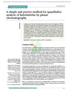
An Introduction To The Stokes-Helmert’s Method For Precise Geoid Determination Huaining Yang, Petr Vanícek, Marcelo Santos, Robert Tenzer University of New Brunswick, Department of Geodesy and Geomatics Engineering, Fredericton, N.B., E3B 5A3, Canada, Email:
[email protected] Introduction The geoid plays a very important role in geodesy. It can not only be seen as the most natural shape of the earth, but it also serves as the reference surface for most of the height system. Geoid is the equipotential surface of the Earth gravity field that best approximates the mean sea level. Such a reference surface is needed for a number of modern mapping, oceanographic and geophysical applications.
Concept of geoid
The way to understand Stokes-Helmert’s method
Methods to compute the geoid Ø
gravity potential on geoid
∇ T =0 2
Level Surface = Equipotential Surface, N (geoid height) = Distance along ellipsoid normal (P0 to Q0), H (orthometric height) = Distance along plumb line (P to P0), h (gedetic height) = Distance along ellipsoid normal (P to Q), These quantities are related by the expression H = h-N.
=
R 4π
∫∫ ∆ g (Ω' ) ⋅ S (Ω, Ω' )dΩ ' Ω'
mean earth radius computation point
spherical Stokes function
∆g = g − γ
Gravimetric solution
Stokes -Helmert’s method, one of gravimetric solutions, is adopted and developed in University of New Brunswick.
normal potential on geoid
T g = W0 − U
Unfortunately this solution can not provide high-resolution geoid, due to the distribution of the GPS/leveling points. Ø
Normal gravity on ellipsoid
N = Tg / γ 0
Geometric method (GPS/leveling)
The simplest method is to use GPS/leveling points, where both the geodetic and orthometric heights are given. From these data the point geoid height can be calculated with a simple subtraction. Orthometric heights can be derived from a surveying technique called “leveling”.
Disturbing potential on geoid
geoid height
∆g t =
R ∆g g ⋅ K ( r, ψ , R ) dΩ ' 4πr ∫∫ Ω'
Poisson kernel radius of a point spherical distance
Downward continuation
∆g t
integration point normal gravity on ellipsoid gravity anomaly on geoid gravity on geoid gravity anomaly on the earth surface
explanations in detail
Conclusions
The geoid could be regarded as a reference surface for georeferencing, positioning and navigation, and also be used in conversion of GPS heights to orthometric height. parts of preliminary results Base on this theory the UNB geoid software package (SHGeo The theory and the software package of Stokes-Helmert’s method for precise geoid determination have been developed to enable the software) for precise geoid determination was developed geoid computation to an accuracy of one centimeter in grid spaci ng covering all aspects of the gravimetric geoid computations. 5’ by 5’. The actual accuracy will, of course, depend on the available This software uses standard input data. data, their accuracy and their spatial distribution. Because the computation of several programs is done in 1 by 1 arcdegree regions it is rather time consuming. It would take a few rt (Ω ): a point at the earth surface,rg (Ω) : a point at the geoid,NH (Ω) : months to finish the geoid computation covering the whole Canada co-geoid height in Helmert space, (H0 (Ω))H : orthometric height in in full-time work. (a) Helmert space, ∆g(rt (Ω)) : gravity anomaly on earth surface in re al (b) space, ∆g NT (rt (Ω)) : gravity anomaly on earth surface in NT space, and ∆gNT(rg(Ω)) : gravity anomaly on geoid surface in NT space, Reference and ∆gH(rg(Ω)):gravity anomaly on geoid surface in Helmert sp ace. Tenzer R. et al., 2003: Stokes-Helmert’s Geoid Software Reference The space characterized by the mass distribution obtained after Manual I Helmert’s condensation is called Helmert’s space. The quantities (c) (d) Vanícek P., Tenzer R., Huang J., 2003: The role of No Topography given in Helmert’s space are denoted by superscript h. Compare space in the Stokes-Helmert technique for geoid determination. with this, the space is called real space, and the space after Annual scientific meeting, Canadian Geophysical Union, May 10 being removed all topographical masses is called No 14, 2003, Banff, Canada. (oral presentation) Topography space (NT space) or Bouguer space. Vanícek P., Martinec Z., 1994: The Stokes-Helmert scheme for the NT At first we can get ∆g(rt (Ω)). Then ∆g(rt (Ω)) is transformed to ∆g (rt (Ω)) . (e) (f) evaluation of a precise geoid. Manuscripta Geodaetica, No. 19, This step is numerically realized by subtracting the effect on the (a) Free-air gravity anomaly on the earth surface, Springer, pp. 119-128. gravitational attraction of the topographical and atmospheric (b) Secondary indirect effect of topographical masses attraction, Vanícek P., Huang J., Novák P., Pagiatakis S.D., Véronneau M., masses. Thus the gravitational field in NT space becomes (c) Geoid-quasigeoid correction, Martinec Z., Featherstone W.E., 1999: Determination of the harmonic. To obtain ∆gNT(rg(Ω)) , ∆g NT (rt (Ω)) is downward continued (d) Helmert’s reference gravity anomaly, boundary values for the Stokes-Helmert problem. Journal of from the earth’s surface onto the geoid surface. ∆gH(rg(Ω)) are (e) Reference co-geoid height, Geodesy, Vol. 73, Springer, pp. 180-192. evaluated by adding the effect of the condensed topographical (f) Primary indirect topographical effect. and atmospheric masses on the gravitational attraction to the geoid-generated gravity anomalies. NH (Ω) is calculated by solving Acknowledgments the Stokes formula in the Helmert gravity space. To obtain the The authors that the research described here was conducted under final geoid in the real space, the primary indirect topographical effect on the geoidal heights is subtracted from NH (Ω) . auspices of the “ GEOIDE Network of Centers of Excellence”.
ACQ#SID
GEOIDE Sixth Annual Scientific Conference, May 30, 31, June 1st, 2004, Gatineau, QC