Data management in mobile ad-hoc ocean sensor networks Silvia Nittel∗ , Niki Trigoni† , Neal Pettigrew∗ ∗ University of Maine, Orono, ME, USA
[email protected],
[email protected] † Birkbeck, Univ. of London, London, UK
[email protected]
Establishing a fine-grained model of local ocean currents is important since currents carry nutrients and other substances, which affect ecosystems in coastal regions. For example, researchers are interested in establishing current models for the Gulf of Maine (US) since they distribute a specific type of algae to shellfish off the coast of Maine during the warm summer months; the shellfish consuming the algae turn toxic for humans (’red tide’ phenomenon)[1]. Today, major ocean currents are established using coastal radar; however, the information is spatially and temporally too coarse. We are investigating the alternative deployment of a fleet of inexpensive ocean drifters which are passively propelled by the current and report their GPS-based location and trajectories to the end user. Today, large-scale sensing platforms such as stationary moorings, research vessels, costal radar (CODAR) or large gliders are state of the art in ocean monitoring. In the future, they will be combined with new technology developments such as small-scale, inexpensive drifters and/or autonomous underwater vehicles (AUVs) such as gliders [2]. A drifter is a small computing platform the size of a basketball which floats on the ocean surface, usually equipped with a long underwater peddle which moves the sensor as the ocean current moves (instead of the wind). Sensor boards can be attached to detect phenomena such as oil spills or marine microorganisms [3]. In contrast to drifters, AUVs are self-propelled and determine their movement direction and travel speed in an autonomous way. Both types of platforms contain a battery supply, a GPS device, and wireless communication. Wireless communication media for shallow areas use acoustic signals with a communication distance of 10-90 Miles (shallow water areas are regions of the ocean that do not exceed depths of 100m) [4]. Deploying a fleet of passively propelled drifters poses interesting novel research questions in the realm of spatiotemporal modelling, spatio-temporal queries and in-network, energy-efficient query processing [5]. A fleet of inexpensive wireless drifters can be seen as an alternative flexible infrastructure for fine-grained ocean monitoring. We view the fleet of drifters as a wireless ad-hoc sensor network with two types of nodes: i) a few powerful drifters with satellite connectivity, acting as mobile base-stations, and ii) a large number of low-power drifters with short-range acoustic or radio connectivity. Our objective is twofold: using a fleet of small-scale sensor nodes that communicate with each other using lower-energy acoustic signals instead of a satellite uplink saves large amounts of energy. Additionally, the fleet provides more detailed information by covering an ocean region in high density. Deploying a fleet of mobile ad-hoc sensor nodes on the ocean surface to track and monitor ocean currents in a fine-grained, near real-time scale is a novel research problem, both from the perspective of computer science and oceanography. Currently, we explore communication connectivity and sensing uniformity of a fleet of a mobile ad-hoc sensor network using real datasets from the Gulf of Maine (US) and the Liverpool Bay (UK). The challenge is to design, build and deploy drifter platforms that despite involuntary, passive movement over long time periods (up to 3 months) preserve energy power, long-term network connectivity, and sensing uniformity. Using simulation and real datasets, we are investigating the effect of deployment strategy, weather conditions, and seasonal current changes on the ability of drifters to relay readings to the end-users, and to provide sufficient sensing coverage of the monitored area. Our empirical study provides useful insights on how to design distributed routing and in-network processing algorithms tailored for ocean-monitoring sensor networks. Multi-hop connectivity is clearly improved by the increase in the number of available base-station drifters; an average connectivity of around 60% with one basestation becomes around 80% with two base-stations and almost 90% with three base-stations based on our Liverpool Bay measurements. Given a fixed number of base-stations, we observed that different deployment
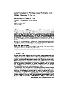
Fig. 1.
”holey sock” drifter design
locations and deployment periods play an important role in the network’s multi-hop connectivity, with connectivity varying between 60% and 100%. Sensing density is drastically affected by the deployment period and by the initial drifter location. Moreover, generally, the difference between sensing density and network connectivity increases with time, indicating that drifters may stay highly connected in several cases after a long period of time (over one day) but this does not necessarily mean that they are kept inside the corresponding area of interest. Actually, in most cases, sensing density decreases significantly after the first 24 hours. In the future, we plan to verify our findings by deploying a real network of drifters and investigating the communication connectivity and sensing coverage in a real scenario. After verifying our findings, we would like to take them into account in designing routing and in-network processing algorithms that are particularly tailored for ocean monitoring applications. This will lead us to investigate important tradeoffs between delay, communication cost and reliability of disseminating sensor data from drifters to end-users. R EFERENCES [1] N. Pettigrew, J. H. Churchill, C. Janzen, L. Mangum, R. Signell, A. Thomas, D. Townsend, J. Wallinga, and H. Xue, “The kinematic and hydrographic structure of the gulf of maine coastal current,” Deep Sea Research II, vol. 52, pp. 2369–2391, 2005. [2] I. F. Akyildiz, D. Pompili, and T. Melodia, “Challenges for efficient communication in underwater acoustic sensor networks,” ACM SIGBED Review, vol. 1, no. 2, pp. 3 – 8, 2004. [3] e. a. J. Gould, “Argo profiling floats bring new era of in situ ocean observations,” EOS, vol. 85, no. 19, pp. 179–184, 2004. [4] I. F. Akyildiz, D. Pompili, and T. Melodia, “Underwater acoustic sensor networks: research challenges,” Ad Hoc Networks, vol. 3, no. 1, pp. 257–279, 2005. [5] B. Zhang, G. Sukhatme, and A. Requicha, “Adaptive sampling for marine microorganism monitoring,” in IEEE/RSJ International Conference on Intelligent Robots and Systems, 2004.