SPECIAL SECTION: GROUND PENETRATING RADAR IN HYDROGEOPHYSICS
Identifying Unsaturated Hydraulic Parameters Using an Integrated Data Fusion Approach on Cross-Borehole Geophysical Data Majken C. Looms,* Andrew Binley, Karsten H. Jensen, Lars Nielsen, and Thomas M. Hansen Cross-borehole geophysical data can provide valuable information concerning hydrologic properties of the unsaturated zone. Such data are most often used sequentially, where images of soil physical properties are obtained through numerical inversion and then converted to hydrologic state properties using petrophysical relationships. If not accounted for, inversion artifacts are transferred to the resulting hydrologic images. We propose a framework in which multiple geophysical data sets can be incorporated using an integrated data fusion approach. The geophysical data collected are integrated in a forward modeling approach to evaluate a series of plausible hydrologic models. The approach permits an evaluation of the sensitivity of geophysical data for constraining hydrologic model parameters. We illustrate the approach using geophysical data collected during a dual water and solute tracer experiment in the unsaturated zone. Cross-borehole ground penetrating radar and electrical resistivity tomography, measuring electromagnetic travel time and electrical transfer resistances, respectively, were collected during a 20-d period. As a first approximation, one-dimensional flow was considered and three models (one, two, and five layers) of the subsurface were evaluated. The five-layered model was found to be the only model capable of mimicking the infiltration pattern satisfactorily. The results showed that only the hydraulic conductivity and one of the parameters (empirical parameter n) describing the soil moisture release curve for three of the five layers could be constrained by the data, illustrating the nonuniqueness of the problem. The data fusion approach proved, however, that application of multiple geophysical methods may reduce hydraulic parameter uncertainty. ABBREVIATIONS: ERT, electrical resistivity tomography; GLUE, Generalized Likelihood Uncertainty Estimation; GPR, ground penetrating radar; ZOP, zero-offset profile.
C
ross-borehole geophysical methods are increasingly used to estimate hydrogeologic properties of the unsaturated zone. These methods provide high-resolution in situ information for large support volumes of the subsurface with minimal intrusion and thereby have obvious advantages over other more traditional methods such as neutron probe and time domain reflectrometry. In particular, cross-borehole electrical resistance tomography (ERT) and ground penetrating radar (GPR) have become very popular in the past decades. Applications of these methods range from characterization of permeable pathways in fractured basalt (Hubbard et al., 1997) and monitoring preferential flow during early stages of snowmelt (French et al., 2002) to following the effect of different remediation processes (Daily et al., 1995; M.C. Looms, K.H. Jensen, and L. Nielsen, Univ. of Copenhagen, Dep. of Geography and Geology, Øster Voldgade 10, DK-1350 Copenhagen K, Denmark; A. Binley, Lancaster Univ., Dep. of Environmental Science, Lancaster, LA1 4YQ, UK; T.M. Hansen, Univ. of Copenhagen, Niels Bohr Institute, Juliane Maries Vej 28, DK-2100 Copenhagen Ø, Denmark. Received 11 May 2007. *Corresponding author (
[email protected]). Vadose Zone J. 7:238–248 doi:10.2136/vzj2007.0087 © Soil Science Society of America 677 S. Segoe Rd. Madison, WI 53711 USA. All rights reserved. No part of this periodical may be reproduced or transmitted in any form or by any means, electronic or mechanical, including photocopying, recording, or any information storage and retrieval system, without permission in writing from the publisher.
www.vadosezonejournal.org · Vol. 7, No. 1, February 2008
238
LaBrecque et al., 1996). The moisture content estimates derived from GPR have been shown to have a high reproducibility and accuracy (Parkin et al., 2000; Ferré et al., 2003). As a result, water front movement caused by natural infiltration can be monitored successfully despite just slight variations in moisture content (Binley et al., 2002b). Cross-borehole GPR and ERT are especially suitable for monitoring relative changes in soil moisture and electrical conductivity, since local variations in the petrophysical relationships are, in this way, reduced or completely avoided (Binley et al., 2002a). Therefore many studies have been performed using the two methods to investigate the flow dynamics of the unsaturated zone resulting from forced loading to the system (e.g., Daily et al., 1992; Binley et al., 2001; Alumbaugh et al., 2002). Water flow patterns have been visualized and attempts have also been made to quantify important flow and transport parameters, especially the effective hydraulic conductivity (Ks) (Binley et al., 2002a; Cassiani et al., 2004: Kowalsky et al., 2004, 2005; Rucker and Ferré, 2004; Cassiani and Binley, 2005; Cassiani et al., 2006). Estimation of subsurface hydraulic parameters can be performed by combining moisture content data from cross-borehole GPR with collected bulk electrical resistivity data obtained from crossborehole ERT data (Winship et al., 2006). Looms et al. (2008) applied the two methods simultaneously for determination of fluid conductivity and thereby tracer concentration, which was subsequently used for moment analysis of the evolving plume. The tomographic images resulting from cross-borehole geophysical surveys are, however, subject to several uncertainties and artifacts caused by the inversion techniques used to invert the
collected data. The inverse problem often consists of a mixeddetermined problem, and to solve this, regularization (e.g., Constable et al., 1987) of the problem is normally performed. As a result, the images are typically smooth, minimum-variance estimates of the subsurface parameters and cannot capture the fluctuations of the true model parameters (Hansen et al., 2008). Varying resolution of the model parameters can also affect the images and the results (Singha and Gorelick, 2005), and model resolution is an important factor to consider if the inversion images are used for further analysis. In addition, combining geophysical images from multiple methods in any analysis is nontrivial because of the method-specific resolution and sensitivity, as illustrated by Day-Lewis et al. (2005). Various techniques have been proposed to account for the varying resolution of the tomographic images, including random field averaging (Day-Lewis et al., 2005), apparent petrophysical relations (Singha and Gorelick, 2006; Singha and Moysey, 2006), and full-inverse statistical calibration (Moysey et al., 2006). Also, joint inversion of different types of geophysical data with complementary resolution properties can help produce more reliable geophysical models (Kowalsky et al., 2005; Linde et al., 2006). Using an “integrated data fusion” approach, the geophysical data are not inverted to create images of the subsurface but are solely used to evaluate the likelihood of a series of plausible hydrologic models with varying unsaturated hydraulic parameters. This approach was used with one-dimensional GPR data collected during natural infiltration in previous work by Binley and Beven (2003). The Generalized Likelihood Uncertainty Estimation (GLUE) method (Beven and Binley, 1992) was used as a basis for this approach. They found that it was difficult to determine the hydraulic parameters based on the data collected, as the natural changes in moisture content during the data collection period were very small. Even multiple profiles with time appeared to offer very little additional information. In this study, we applied the integrated data fusion approach presented previously to a new data set describing large dynamic changes in unsaturated sand. The data were collected during a forced infiltration experiment using both solute and water as tracers. To resolve the concentration changes and the moisture content variations, two different data types (cross-borehole ERT and GPR) were included in the analysis. The sensitivity of the two data types to constrain the unsaturated hydraulic parameters of the subsurface and the limitations connected to the data fusion approach can thereby be evaluated.
2005 to create dynamic flow conditions in the subsurface. During a period of 20 d, ?95,000 L of clean water was irrigated through 484 drippers over a 7.33- by 7.33-m area. After 4 d of infiltration, 890 L of saline tracer was added through the drippers. The saline tracer had an electrical conductivity of 10.54 S m−1 and was produced by adding 75 kg NaCl to 890 L clean water (76 mS m−1). During the field experiment, 14 measurement surveys were performed, including a background (pretracer and preinfiltration) survey. The background moisture content profiles estimated by GPR and ERT, shown in Fig. 2a, were found to be consistent, exhibiting similar trends throughout the measurement depth. Furthermore, the preinfiltration moisture content profiles were found to be in good agreement with grain size analysis results from samples extracted from a nearby borehole, Fig. 2b, since high values of moisture content were observed at depths containing fine sediments and vice versa. Moisture content and tracer mass profiles estimated from inverted cross-borehole GPR and ERT data collected during the 20-d experiment showed that large quantities of water were diverted out of the area. During the first 8 d, a 50% water loss
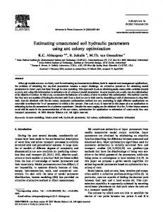
FIG. 1. Schematic drawing of the field site setup at Arrenæs, Denmark. The light gray area indicates the infiltration area.
Field Site and Field Experiment A field site was established at Arrenæs, Denmark, on a 20- to 30-m unsaturated deposit of alluvial sediments, consisting mainly of sands. In June 2004, the field site was instrumented with eight 12-m-deep boreholes with the purpose of studying the flow and transport processes through the unsaturated zone. The eight boreholes formed a cross consisting of two lines (see Fig. 1). Along each line, the two outer boreholes (7 m apart) were equipped with ERT-instrumented polyvinyl chloride (PVC) tubes (electrodes every 50 cm), while the two inner boreholes (5 m apart) had PVC access tubes for GPR antennae. Initial GPR and ERT measurements showed a very low seasonal variation in moisture content at the field site. A forced infiltration experiment was therefore conducted in the autumn of www.vadosezonejournal.org · Vol. 7, No. 1, February 2008
FIG. 2. (a) Background moisture content profiles estimated using cross-borehole ground penetrating radar (GPR) and electrical resistivity tomography (ERT); (b) sediment samples from a nearby well (d10, d50 and d90 are the 10th, 50th and 90th percentiles of the grain size distribution; data provided by Copenhagen Energy), and (c) the five-layered model used in the hydrologic forward simulation. The boundaries of the different materials were deduced from (a) and (b). 239
was observed. The consistency of this observed trend has led us to believe that the observed water loss was caused by lateral flow occurring just below the ground surface, and the collected data therefore describes flow patterns resulting from half the applied irrigation. For more details of the infiltration experiment and results, see Looms et al. (2008).
as widely as possible in order to not exclude plausible parameter values, and the minimum value of hydraulic conductivity has been lowered several orders of magnitude to better describe potential fine-grained materials near the surface. Furthermore, ERT and GPR moisture content profiles indicated background moisture contents down to 0.07 (see Fig. 2a). As a result, the range of the residual moisture content, θr, was limited to