Department of Geomatic Engineering, University of Melbourne, Victoria 3010 ... Key words: teaching and learning, survey networks, design, simulator, web delivery .... provide the background material to support teaching by academic staff and ...
Learning Design of Survey Networks using a Web-based Simulator Mark Shortis Department of Geomatic Engineering, University of Melbourne, Victoria 3010, Australia
Neil Woodhouse Department of Geomatic Engineering, University College London, London WC1E 6BT, United Kingdom Abstract: This paper will describe a transformation of the curriculum delivery of field survey practice that addresses the teaching and learning problems associated with survey network design. A web site has been created which combines a rich resource of theory material, an equipment database, animations of essential field procedures and, most importantly, three dimensional simulations of real world survey design problems that provide immediate feedback. Realistic problem simulations allow students to investigate the design and practice of survey networks at their own pace, before attempting surveys in the field. Key words: teaching and learning, survey networks, design, simulator, web delivery
1 Introduction One of the fundamentals of the execution of field surveys is the effective and efficient design of survey networks. This combination of knowledge and design skill underlies much survey work, and is a strategic area of teaching for tertiary courses in surveying and geomatics. The essential issue is that a feasible design must consider many factors, including : • • • •
the shape of the terrain surface and prevailing environmental conditions, inter-visibility and accessibility of survey stations, specifications for the required precisions of station locations, and the cost effectiveness of the network based on equipment, field time and access costs.
The typical practising surveyor can carry out this task based on their professional experience and a rapid reconnaissance of the survey area. Imparting this high level decision making process to students is extremely difficult and when faced with this problem students tend to over-design to be sure of meeting specifications. However this is unrealistic in terms of professional practice where the cost of surveys is frequently a primary consideration. In addition, when faced with the many and varied demands of surveying in the field, students often make poor decisions in network design or fail to include essential measurements. These errors are generated primarily because synthesis of new knowledge and new skills, combined with the management and operation of complex survey equipment in the field, and the design and operation of field surveys, is often overwhelming for inexperienced students. In this environment the educational objectives can become completely obscured by the overload and the student does not learn the basic concepts of network design and survey measurement.
Further, the requirements for survey networks can vary incredibly, such as the contrast between a surveillance network for a large water storage dam (which has stringent accuracy requirements, a medium demand on cost efficiency and frequent line of sight problems) and an urban fringe subdivision (which has low level accuracy requirement, a high cost efficiency expectation and generally few line of sight problems). The range of realistic scenarios that can be directly experienced by undergraduate students during a tertiary degree program is severely limited by the logistics of and resources demanded by site visits. Although some students do gain limited work experience in the measurement of survey networks, direct participation in the design process is generally not possible. Survey network design is typically taught, using "stand and deliver" techniques, by the combination of lectures for the delivery of theory and supervised practical classes for the development of field measurement and network computation skills. The network design component is imparted through static examples using network diagrams and other graphics. Survey network computation software is also used where appropriate to simulate designs and, for example, predict GPS satellite visibility, however typical graphics presentations are crude at best. The worst aspect of the current teaching methods is that survey network design is divorced from the realities of site constraints such as the work environment, local terrain characteristics, access to survey instrument stations, line of sight visibilities and other factors such as vegetation cover. Further, the cost of surveys is not considered in any depth within the course due to lack of suitable analysis tools.
2 Revised Learning Approach A much more effective method of learning design skills is to expose students to a series of case studies and problems within a realistic environment that provides interactive guidance on the efficiency and effectiveness of the survey network design. Networks can be designed by identifying station locations and measurements within a three dimensional virtual landscape produced by terrain modelling software, and real-time feedback on design outcomes can be generated by survey network analysis software. Guidance on the design effectiveness is provided using identified deficiencies, as compared to appropriate design specifications, in the simulated network. Ideally, the efficiency of the network design could be based on an assessment of the amount of field time required, by a comparison with standardised costings of the number of survey stations occupied and the number of measurements taken. This type of problem based approach has proven to be effective in many disciplines, such as medicine [1] and economics [2], and has also been successfully applied to simple plane surveying tasks [3]. The use of simulations for teaching and learning is widespread, and simulated site visits often have a spatial nature, such as uses in architecture [4], mining [5] and geography [6]. Although the revised approach has more emphasis on student-centred learning, lectures remain a vital component of the learning process and concentrate on the theoretical aspects of survey networks, such as algorithms and analysis. Similarly, practical work in the field is an equally vital component to reinforce practical skills, and site visits give a taste of realistic environments. The survey network simulator builds on these other components, enhancing the students knowledge and understanding of survey networks and, in particular, gives the students an understanding of the intelligent and cost-effective design of networks.
However, it is widely accepted that lectures and practical classes do not readily cater to the learning needs of individual students. The problem simulations allow students to investigate the design and practice of survey networks at their own pace, before attempting surveys in the field. This self-paced learning process allows those students with weaker backgrounds in geometry and survey methods to explore or re-acquaint with the fundamentals of field survey techniques and error propagation. In addition, the use of self-paced learning allows the more capable students to proceed to more advanced problems and concepts with a minimum of supervision, allowing the concentration of tutorial and demonstrator effort towards the students whose need is greatest. Further reinforcement of design skills can be facilitated by using realistic virtual models of sites where students subsequently practice survey network measurement in the field. The students therefore have the advantage of implementing a survey network design in an area for which they already have some familiarity. Although no virtual model is perfect, the overview of the network design will generally still be valid. In fact the lack of perfection of the model can have the side benefit of requiring students to modify their design to suit real conditions, perhaps because a specific line of sight is blocked by vegetation not included in the virtual model. Not only is this the reality of planning survey networks, regardless of whether planning is done using virtual site visits or topographic maps, but there is also the requirement for the designer to contemplate and analyse the impact of the variations on the initial design.
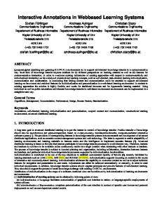
3 Multimedia Implementation A web site has been created to implement the revised approach, and combines a rich resource of theory material, an equipment database, animations of essential field procedures, Virtual Reality Markup Language (VRML) [7] representations of example survey sites and, most importantly, the survey network simulator. The web site uses the metaphor of a survey instrument console (see Figure 1) to provide a consistent "look and feel". Whilst the metaphor is useful, the restrictions forced by the fixed size of the console subsequently proved to a problem that outweighed the other advantages.
Figure 1. Survey networks console
Figure 2. Equipment database
However, the metaphor does allow a very consistent and familiar approach to navigation throughout the site. Two levels of console buttons (see Figure 2) are used to navigate to primary and secondary sections within the web site, regardless of the current location within the site. The second level of console buttons changes in context with the section of the site
being accessed. Both sets of buttons remain highlighted after selection as an indicator of the location within the site. The theory material and equipment database, as well as help pages, Frequently Answered Questions (FAQ) lists and links to other relevant sites, are straightforward web pages written in HyperText Markup Language (HTML). This component of the web site is important to provide the background material to support teaching by academic staff and learning by students. In particular, the comprehensive equipment database (see Figure 2) provides an essential resource to allow students to become familiar with the range of instrumentation used for the measurement of survey networks. Embedded in the theory pages and the equipment database are many interactive animations illustrating theoretical concepts and field survey procedures. The animations were created by Macromedia Director and stored within the web pages as Shockwave applets. A number of animations make use of simulated survey instruments (Figure 3), created and animated using CAD software and then imported into Director as image sequences.
Figure 3. Scene from an animation of horizontal angle measurement.
Figure 4. Scene from a tutorial on intersection geometry and precision.
Other animations demonstrate the relationship between typical survey measurement geometries and the resultant station location precisions (Figure 4). In all cases the relationships are presented in the context of a real world problem, and the precision information is shown as error ellipsoids. The relative sizes and the shapes of error ellipsoids are a universal mechanism used to evaluate the global uniformity and local strength of survey networks. 3.1 Survey Network Projects The problem oriented approach to the design of survey networks is encapsulated in the concept of survey projects. Again, this is in accord with the nature of survey instrumentation, such as GPS navigators, that tend to categorise data storage in terms of projects. The initial design of the web site incorporated a survey network simulator and a separate model viewer, indicated by "Open Project" and "View Project" respectively in terms of the console. The latter was included (see Figure 5) to allow students to browse VRML models of survey network case studies using any plug-in viewer, such as CosmoPlayer or WorldView [8]. The browser plug-ins are widely available on Windows, Macintosh and Unix systems, and interface seamlessly with most browsers, including Internet Explorer and Netscape. Hence
students could explore the virtual models in "read only" mode from any computer with a network connection. The example survey sites used for the projects were either created manually or exported from CAD software packages such as Microstation and StudioMax3D. To provide an even greater variety of terrain and models, a terrain generator was developed. Written in Java, this application allowed control over terrain extent and roughness, tree cover, the number of buildings and the number of survey stations, and exported a VRML model that could be viewed. However, as discussed later in the paper, this facility subsequently proved to be redundant. The most challenging and complex component of the web site is the survey network simulator. To provide the interactivity not available in standard VRML viewers, several different approaches were considered, including a separate application program, a solution based entirely on VRML interaction such as the External Authoring Interface [9], and the development of a specific plug-in for web browsers.
Figure 5. View Project mode showing a dam surveillance model viewed using CosmoPlayer.
Figure 6. Open Project mode showing aspects of a building model viewed using the TerrainVis plug-in.
The decision to opt for the development of a plug-in was adopted to retain the look and feel of the site and, more importantly, because the simulations must be supported by a survey analysis tool. This tool processes the simulated survey networks and produces essential feedback in the form of location results and the precisions of computed locations. The requirement for communication of complex data structures between the simulator and the analysis tool demanded a close relationship between the two components, and this was either not feasible or not optimal for the alternative solutions. The TerrainVis plug-in (see Figure 6) is written in Visual C++ and calls the survey analysis tool through a dynamically linked library. Like any other plug-in, TerrainVis must be installed and associated with a browser. TerrainVis currently works only with Netscape due to limitations on the resources available to develop the software. This underlines the importance of the View Project mode, so that students can at least view the survey network examples if Netscape is not available. TerrainVis uses VRML files to define the terrain model, to take advantage of the clearly defined specification and allow the models to also be read by standard VRML plug-ins.
TerrainVis allows the user to : • • • • • •
Navigate around the VRML model Import and export files of survey station and measurement data (in a standardised format [10]) Occupy and sight to specific survey stations in the network Add new survey stations and add or delete survey measurements Compute the survey network solution Display feedback from the survey analysis tool including error messages and error ellipsoids
The error ellipsoids (see Figure 5) show the precision of location of the survey stations. Students use this information, and the network computation results written to a log file, to compare and assess their network design against pre-defined specifications. Based on the principles of error propagation and demonstration of survey network geometries, given within the web site and used in lectures, students can incrementally improve their network designs. As noted previously, wide exposure to a range of realistic problems builds up a core of knowledge and experience that can be applied to new situations. The use of the simulated problems allows this experiential learning in the absence of the practical problems and field management issues that may otherwise obscure the intended learning outcomes.
4 Use by Students The web site and simulated survey network problems were integrated into a compulsory second year level unit within the Bachelor of Geomatics program at the University of Melbourne toward the end of semester 2, 2000. The group of 40 students was exposed to the web site during eight hours of lectures, and two associated assignment problems required the use of the TerrainVis simulator. Access logs for the web site showed relatively little activity outside of tutorial classes, although several downloads of the TerrainVis plug-in indicated some self-paced exploration of the survey network examples by students. Other hits on the site suggested that the lecture notes and assignment sheets received the most attention. 4.1 Evaluation of Simulator Use The most useful information on student use of the site and the simulator was gained from observations during formal tutorial classes, held in a computer laboratory in which the plugins had been pre-loaded. The two assignment problems were to design a survey network for the measurement of new survey stations on a building (see Figure 5) and statistically analyse an existing survey network for surveillance of a dam wall (see Figure 4). Students worked on the problems in groups of three or four and submitted a group report. The most positive aspects of observed behaviour were that some groups of students understood the problems and the use of the simulator very rapidly, and there was genuine interaction within most groups of students on various aspects of the designs. Unsolicited comments repeated the theme that the ability to visualise the survey network allowed the design problem to be clearly understood and discussed. Further, project reports indicated a strong grasp of the design issues from the uniform error ellipsoids just within specifications, and only one or two cases of manifestly over-designed networks were evident.
The least positive aspects were that some groups had difficulty with the TerrainVis interface, despite a comprehensive help page, and large tracts of the web site were not used at any stage. The former problem might be diminished on the basis that in any sample of software users there is a range of response to any particular interface. It is encouraging that some users found the interface straightforward, whilst the lessons from the difficulties experienced by some users cannot be ignored. In comparison, the lack of exploration of the site is a more complex issue, but factors such as the learning culture of the students and the focus on completion of assignments cannot be discounted. This issue requires a more comprehensive evaluation and analysis of web site logs before concrete responses can be framed. 4.2 Discussion and Future Developments The initial design of the site was prefaced on extended use of the material in three units within the Bachelor of Geomatics program. Like all projects, the scope was modified during the development to suit changes in the structure of the course and an increasing appreciation of the resource requirements of the development work. Although there is scope to include further enhancements, the intent and extent of the simulator has been refined to service a specific component of the Geomatics program. Simultaneously, it has been recognised that the learning culture of campus-based students is still in transition and relatively few students have the enthusiasm and self-management skills required for extended exploration of web resources and multimedia demonstrations. These two aspects in particular resulted in the discontinuation of the terrain generator, primarily because it was predictable that this tool would have little actual use. Experience with observed and logged use by students has confirmed this prediction. Future development of the site is likely to concentrate on a stronger presence for the multimedia demonstrations and the simulator, rather than the overall emphasis on a rich educational resource. Notwithstanding the potential for change in the attitude of students to their own learning, for the sake of efficiency the most frequently used components of the site should be in the forefront. Other enhancements may include the inclusion of a simulator for GPS satellite signals to engender a broader appeal for the simulator, and the cost functionality included in the initial design of the site and simulator. The cost function in particular will be valuable to increase the realism of the feedback provided to students on their designs.
5 Conclusions This project has shown significant promise for the enhancement of student learning of survey network design concepts. In particular, the facility for students to readily visualise a realistic, three dimensional model of a survey network and the associated error ellipsoids, based on a network adjustment computation, is the most valuable feature of the simulator. Whilst there are some improvements that could be made to the web delivery of the simulator, the fundamental usefulness of the learning tool is not in question. Although further evaluation and development is warranted, the concept of problem based learning has again proved to be a successful transformation of a curriculum.
Acknowledgements The research and development work described in this paper was supported by a project grant from the Teaching and Learning (Multimedia and Educational Technologies) Committee of the University of Melbourne. The enthusiasm and support of project team members Joiana Nascarella, Iestyn Polley and Jessica Smith, and the in-kind support of the Department of Geomatic Engineering are also acknowledged.
References 1.
Finucane, P. M., Johnson, S. J. and Prideuax, D. J., Problem based learning: its rationale and efficacy, Medical Journal of Australia, 168: 445-448 (1998)
2.
Johnston, C., James, R., Lye, J., and McDonald, I., An evaluation of the introduction of Collaborative Problem Solving for Learning Economics. Journal of Economic Education, 31, 13-29 (2000)
3.
Shortis, M. R., Ogleby, C. L. and Kealy, A., Self-paced learning of plane surveying concepts and field procedures, International IT Conference on Geo-spatial Education, Hong Kong Polytechnic University, Hong Kong, pp 171-180 (2000)
4.
Newton, C., Simulated site visits, International Conference on Computer and Visualization and Graphics, IEEE Computer Society, London, England, pp.62-66 (1999)
5.
Russ, K. and Wetherelt, A., Large scale mine visualisation using VRML. IEEE Computer Graphics and Applications, 19 (2): 39-44 (1999)
6.
Virtual field course, Department of Geography, University of Leicester, www.geog.le.ac.uk/vfc/
7.
Virtual Reality Markup Language, Web 3D Consortium, www.web3d.org/vrml/vrml.htm
8.
CosmoPlayer and WorldView, Cosmo Software, www.cai.com/cosmo/home.htm
9.
VRML External Authoring Interface, Murat Aktihanoglu, members.nbci.com/muratak
10. Shortis, M. R. and Seager, J. W., The use of geographic and map coordinate systems for geodetic network adjustments, Survey Review, 32 (254) : 495-511 (1994)