Chin. Geogra. Sci. 2012 Vol. 22 No. 2 pp. 196–209 doi: 10.1007/s11769-012-0528-y www.springerlink.com/content/1002-0063
Major Function Oriented Zone: New Method of Spatial Regulation for Reshaping Regional Development Pattern in China FAN Jie, SUN Wei, ZHOU Kan, CHEN Dong (Key Laboratory of Regional Sustainable Development Modeling, Institute of Geographic Sciences and Natural Resources Research, Chinese Academy of Sciences, Beijing 100101, China) Abstract: Newest planning methods implemented by Chinese government are promoting a coordinated regional development and shaping an orderly spatial structure by applying the regulation of territorial function. This article analyzes the problems of spatial planning and regional strategy caused by the wrongly-set primary goal of economic development; it states that the three-fold objective of competitiveness, sustainability, and welfare fairness shall be the principal for China to implement the spatial regulation in the new era; it discusses about theoretical thoughts and technology framework of conducting the ′Major Function Oriented Zone′ based on their different major functions that each region plays in urbanization and industrialization, ecological constructions, grain productions, and protection of natural and cultural heritages; it introduces the new concept of ′Major Function Oriented Zone′ that include the major functions category, the stereo regional equilibrium mode, the two-level zoning specification, and the territorial development intensity; it offers a zoning scheme that defines development-optimized and development-prioritized zones as regions with massive urbanization and industrialization, development-restricted zones as ecological constructing or grain producing regions, development-prohibited zones as natural and cultural heritage protecting regions; and finally it addresses the main obstacle for implementing ′Major Function Oriented Zone′, which is the institutional arrangement of the supreme goal of high GDP growth rate that is currently being implemented. Keywords: Major Function Oriented Zone (MFOZ); spatial regulation; regional development; China Citation: Fan Jie, Sun Wei, Zhou Kan, Chen Dong, 2012. Major function oriented zone: New method of spatial regulation for reshaping regional development pattern in China. Chinese Geographical Science, 22(2): 196209. doi: 10.1007/s11769-012-0528-y
1
Introduction
′The Five-Year Plan for National Economy and Social Development′ is at the highest level among all types of planning established by Chinese government (Finance & Economy Committee Office of the National People′s Congress of the People′s Republic of China, National Development and Reform Commission, 2008; Yang, 2010). ′The Outline of The Twelfth Five-Year Plan for N ation al Econo my a nd Social Deve lop ment ′ (2011–2015) published in 2011 has sent a signal: the spatial regulation will play an increasingly important role in China′s planning. It stresses the issue of forming the regional development pattern through two strategies,
′The Overall Strategy of Regional Development′ and ′The Strategy of Major Function Oriented Zone′ (The National People′s Congress of the People′s Republic of China, 2011). For the first-proposed ′Major Function Oriented Zone′ (MFOZ), it clearly states that China shall achieve a coordinated regional development by reinforcing the spatial regulation, and the spatial regulation shall be based on the territorial function. That is to say, the increasing spatial regulation is the primary method applied by China in forming an orderly spatial structure and a reasonable pattern of the population and economy (Lu and Fan, 2010). The Major Function Oriented Zone (MFOZ) divides the nation into two regional categories: the protected zone and the developing
Received date: 2011-10-16; accepted date: 2011-12-27 Foundation item: Under the auspices of Key Project of National Natural Science Foundation of China (No. 40830741), National Key Technology R&D Program (No. 2008BAH31B01) Corresponding author: CHEN Dong. E-mail:
[email protected] © Science Press, Northeast Institute of Geography and Agroecology, CAS and Springer-Verlag Berlin Heidelberg 2012
FAN Jie et al. Major Function Oriented Zone
zone. The protected zone includes major grain producing zone, key ecological function zone, and natural and cultural heritage protected zone. The developing zone mainly refers to the metropolitan areas with fast industrialization and urbanization that lead China to become global, and the urban agglomeration regions that support China′s fast economical growth and further aggregation of the population (The State Council, 2010). Entrusted by the Chinese central government, the research team lead by Professor Fan Jie has worked for ′National Development and Reform Commission′ to research on the MFOZ. Not only are the proposed main theories and methods recognized by the decision-making departments and is the ′Technical Specification for the Zoning of MFOZ′ implemented by the whole nation, the zoning scheme of the MFOZ is also adopted by the national plan. For example, the scheme of key ecological function zone published by the nation comes from the team′s research results. This article reflects partial outcomes of the research. This article, through analyzing current main issues of promoting coordinated regional development, firstly reviews the strategic mistakes in the last century that aimed to achieve regional economic development when seeking for an appropriate method of spatial regulation. Then based on the discussion about the formation of territorial function, an analysis about the strategic mission and the main method of China′s spatial regulation is stressed by combining with an explanation for the technical specification and zoning scheme of the MFOZ. At last, through resolving the gap between scientific research plan and the reality of China′s regional development, the article points out the possible obstacles for the implementation of the MFOZ and offers a comprehensive evaluation and consummate suggestions.
2 Current Problems in China′s Spatial Regulation Since the People′s Republic of China was founded in 1949, the central government has always sought for improvements and transforms in spatial planning and the regional development strategy. For a long time, it could not find a rational method to achieve qualified spatial regulation. Some main attempts throughout the past 60 years are listed below. During the early period of PRC, there were the layout of the ′key 156 programs in the
197
1950s, the ′Third-Front Construction starting in the 1960s′ (Chinese military industrial system and national defence construction were arranged in the coastal area, central section and western section of the mainland of China), and the ′Massive Import of Equipments in the 1970s′; for the post era of the Reform and Opening-up, there were the ′China′s Western Development, Revitalize Northeast, Rise of Central China, and The East Coast Leading the Development′. In recent years, there were the Regional Planning of Beijing-Tianjin-Hebei metropolitan areas, Yangtze (Changjiang) River Delta, Liaoning Coastal Economic Belt, Yellow (Huanghe) River Delta Efficient Ecological Economic zone, etc. For all the programs above, China′s spatial planning and regional development strategy always emphasize on economic development (Fan et al., 2009). Local governments of province, city, town and county all commit to accelerate industrialization and urbanization and set the GDP growth rate as the main objective of development, or even the unique goal. From 1981 to 2010, China's GDP and urbanization rate have been increased by 16.86 times and 2.48 times respectively (National Bureau of Statistics, 2011). However, with rapid economic growth, the out-of-control regional development is increasingly prominent as follows. 2.1 Issue of competitiveness Caused by the economic globalization, the improvement of the regional competitiveness is increasingly influenced by the geographic location, aggregation, and spatial distance (The World Bank, 2009). Different nations, regions, and cities have distinct competitiveness, and hence they are significantly varied in the amount of development opportunities they can get from the international trade and global market. This differentiation is the main power to change the pattern of the global economic geography, and also determines the basic tendency of how this pattern will be changed in the future (Dicken, 2003; Friedman, 2005). Therefore, in the era of globalization, chasing the high degree of competitiveness is the primary objective of China′s spatial regulation. However, by far, even in the relatively developed coastal regions including Yangtze (Changjiang) River Delta and Pearl (Zhujiang) River Delta, the mode of reaching fast economic growth at the cost of resources and environments has not been changed. The contribution rates of science and technology progress to economic growth for the provinces in these regions are
198
Chinese Geographical Science 2012 Vol. 22 No. 2
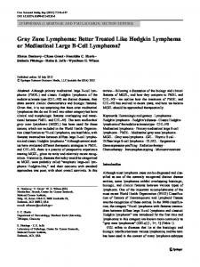
generally below 40%, and the shares of tertiary industry in GDP are generally below 45%, all much lower than the average levels of developed countries (Tang and Yu, 2006; Li et al., 2011). 2.2 Issue of sustainability Due to the lack of management of environment and resources, the economic development was suffered from increasingly serious conflicts with resource protection, environmental capacity, and ecological security (Fig. 1). To the year of 2010, the national per capita cultivated land was 0.091 ha, which is 10% less than it was 10 years ago; the share of per capita water resources was at 28% of the global average level (Research Group of China's Sustainable Development, 2011). The total area of lakes has decreased by one fifth since the 1950s. The contaminated area of national coastal water quality is as high as 63%; in 90% of the cities, the air quality does not comply with the European Union and the World Health Organization standards. The development in China is facing to a serious issue of ′sustainability′ that will eventually weaken the ′competitiveness′ of the national development in the long run.
Source: National Bureau of Statistics of China, 2010
Fig. 1
Change of recourses and environment situation of China
2.3 Issue of fairness of welfare The enlarging gap between different regions has always troubled the central government. On one hand, there is an economic development gap between the coastal region and the inland region. On the other hand, the income level of urban residents also holds a disparity over the rural region (Liu, 2008; Chen and Fan, 2011). The superimposed gaps of coastal-inland disparity
and urban-rural disparity create a significant feature of Chinese regional development gaps: the poorer the region is, the huger the urban-rural income gap is, and the more unfair the welfare is. This feature can not only be observed from the national province-analysis, but also from the internal analysis within impoverished provinces (Fig. 2). Further research shows that this unbalanced development also correlates with the distribution of ethnics and ecological vulnerability. Spatial statistics show that usually the impoverished region and the region with distinct urban-rural differences tend to be regions for gathered minorities or regions with a fragile ecological environment and cradles of major rivers. Among the 592 nation-level poverty counties, 245 of them happen to be minority and fragile ecological counties at the same time (Fig. 3). If a reasonable regional development strategy can not be established, the unfairness of welfare and imbalance of economic development could possibly induce a social unstableness and also affect the sustainability, for the ecological damage caused by the unreasonable development will lead to a national ecological crisis (Chen, 2008). Therefore, China′s regional development strategy and spatial regulation are facing to a three-fold objective: the competitiveness, the sustainability, and the welfare fairness. This is a complicated spatial decision-making system that seeks for the most optimal solution for multitargets under a series of constraints (Lu and Fan, 2010). Facing to urgent social needs and a potential transform that will significantly impact China′s economic geographic features, our scientific issue is: in the current period of development, what kind of method of spatial regulation should be implemented to effectively improve the nation′s competitiveness, to achieve the sustainable development in terms of social economy, resources, and the environment, and to solve the welfare fairness issue by reaching a balanced development pattern?
3 Theoretical Thinking and Methodological Framework of Major Function Oriented Zone Through a long process of research and practices, a consensus is being formed among both of the academia and the decision-makers: a decent spatial regulation method, regardless of whether it is a strategy, a planning, a statute or a policy, should always meet the three-fold
FAN Jie et al. Major Function Oriented Zone
199
Source: National Bureau of Statistics of China, 2010
Fig. 2
Comparison of income gap of per capita GDP between urban and rural residents in 2009
need of ′competitiveness, sustainability, and welfare fairness′. Especially those planning with a larger scale of space or a stronger synthesis shall better meet the threefold need. 3.1 Theoretical discussion The principal theory of the physical geography points out that the physical environment on the surface of the earth is not homogeneous but instead has regional differences that are distributed by ′The Law of Zonality′ (Zheng, 1998; Huang Bingwei Anthology Edited Group, 2003). The basic theory of human geography and economic geography states the following: due to the differentiation of the physical environment and the evolution
regularity of the spatial structure of human activities on earth′s surface, location conditions are offered differently by regions to human living and producing activities, and hence the spatial distribution of human activeties has to be heterogeneous as well (Wu, 2008). Ecology further provides an extremely valuable scientific conclusion that as a planet with an ecosystem, there is a close relationship of interdependence and interaction among distributions of all kinds of phenomena and the differentiation of functions. And only if this relationship of cooperation and division of work between regions could be optimized, an overall system with stronger functions could be established (Fu et al., 2001). Based on the above theory, it is quite clear to come up
200
Chinese Geographical Science 2012 Vol. 22 No. 2
Source: Leading Group Office of Poverty Alleviation and Development, the State Council, 2011.
Fig. 3
Types of nation-level poverty counties
with the following conclusion: during China′s modernization, different regions will play a different role and perform different functions since they are differentiated in natural environments, strategic locations, and foundations of development. Although territorial functions are different, they are all indispensable, and people who shoulder these functions will share equal and fair profits from national modernization. Under the existing distribution system, economic benefits gained from ecological construction and fundamental industries are relatively low, which naturally leads to a significant gap between regional economic development levels. This gap will directly generate different living qualities for people. In order to recognize the rationality that different regions shoulder different territorial functions, and to let people who construct different territorial functions to enjoy a fair and equal life quality, the distribution system has to be reconstructed so that current low-profit industry and function regions can also gain enough earn-
ings to operate constantly. 3.2 Inspiration from a phenomenon and a new proposition During the research we found out some new phenomena and propositions, offering crucial inspirations to negative the past spatial regulation method that was oriented by balancing regional economic development and to innovate the idea of the MFOZ. There is an interesting phenomenon that during the process of the enlarging gap between regional economic development levels, the regional disparity of GDP has always been greater than the disparity of local government expenditures and even much greater than the actual disparity of urban-rural residents′ income level. By calculating the variation coefficient, the curve of regional disparity is shown in Fig. 4. Considering the difference between local CPI, the most influential factor of consumption towards people′s living condition is the
FAN Jie et al. Major Function Oriented Zone
housing price. By using the housing price to adjust the income level, an index that is closer to the real quality and condition of livings can be measured, and in this way the regional disparity is narrowed. That is to say, if the focused welfare fairness means the closest index of people′s real living conditions which permits a disparity of regional GDP, there is a lot of space for policies to work on for achieving the welfare fairness. A newly-occurred issue during the research is that in the distribution pattern with huge differences of regional economic development levels, regions of economic backwardness are usually regions with functions of ecological constructions and farm productions. The classical economics at least does not pay enough attention to the ecological products and the ecosystem service function. For example, since the protection forest enhances the function of water conservation and maintains or increases the supply of clear water, how to let the water users offer necessary economic returns to suppliers during the process of ecological construction? Or since the maintenance of grassland ecosystem increases the ability of carbon dioxide absorption and offers carbon-release spaces for the nation, how to honor the reward for providing such public services? When additional expenditures of food safety has to be paid to avoid the risk of supply; when certain ecosystem service functions need to be reinforced due to the global climate changes; when clear water and fresh air also suffer from supply shortage due to the environmental degradation and therefore requires necessary workforce to produce needed and qualified water and air—a series of new propositions that can not be solved by traditional scientific system and governance system is brought for-
ward. Only if reconstructing the distribution system and the regional labor division system and offering reasonable benefits to laborers in regions of different functions could the construction and the implementation of these functions be possibly achieved. 3.3 Basic relational model of Major Function Oriented Zone and research flowchart of zoning Based on the above theoretical discussion and inspiration, a basic relational model is used to express the core content of the MFOZ (Fig. 5): region i has certain functions to generate return Ei. Different regions′ functional returns are differentiated, and there is a close relationship of mutual restraint between regions, which is the basic requirement stated by the dimension of ′sustainability′ to form constraint 1; the welfare level of region i is the function of region i′s functional return, and an increasing ΔFi is needed to achieve a balanced welfare level between different regions, which is the basic requirement stated by the dimension of ′welfare fairness′ to form constraint 2; One of the objective functions that is expected to be achieved under the constraints is to maximize the sum of returns of functional output among different regions, which is the basic requirement stated by the dimension of ′competitiveness′. According to the above relational model, the spatial regulation should solve following major questions: which types of territorial functions should be regulated? For each region, which form of territorial functions should it perform, or mainly focus on? What kind of planning methods could be applied for regulation purpose to prevent the Strategy of MFOZ from being har-
Source: National Bureau of Statistics of China, 2010
Fig. 4
201
Indexes of regional disparity comparison of China
202
Fig. 5
Chinese Geographical Science 2012 Vol. 22 No. 2
Basic relational model of Major Function Oriented Zone
assed? Especially to realize the territorial function pattern, what kind of supporting reform is needed to ensure people in different function regions with fair returns? The research flowchart for answering these questions is addressed below in Fig. 6. 3.4 New concepts of Major Function Oriented Zone On the one hand, the MFOZ has fully inherited the ideas from the existed international planning theory and excellent practice such as regulation on land use functions, regulation by different levels and so on (Sun, 2000; Federal Office for Building and Regional planning,
Fig. 6
2001). On the other hand, combined with the actual demands for spatial regulation and major issues for regional development, the innovation has been carried out, which mainly manifests as four aspects: 1) The value and effect of ecological and agricultural regions have been recognized. Since China implemented the reform and opening up policy in 1978, the ability to supply industrial products has prominently increased, while the ability to supply ecological products and green agricultural products has been gradually reduced, influencing the sustainable development of the whole nation. At present, these regions should be promoted through preferential policy, etc. In the future, with the improvement of people′s living quality, with the increasing market demands for ecological products and green agricultural products, these regions will be more effectively promoted by the commodity transactions. 2) It is the first time that the conventional spatial organization mode emphasizing economic equilibrium has been transformed into a new mode emphasizing comprehensive regional equilibrium
Research flowchart of zoning
FAN Jie et al. Major Function Oriented Zone
or stereo regional equilibrium. By rational flowing of population among regions, fiscal transfers, ecological compensation and other methods, it is possible to realize an appropriate equivalence of percapita level of integrated regional development including economic, social and ecological benefits. The objective for MFOZ is to formulate positive evolution process (bridging the gap) that is in favor of realizing spatial equilibrium through zoning and perfected policies. 3) Considering the multi-need of development and multi-goals of function construction in different region, two levels of zoning have been put forward—the national level and provincial level. MFOZ of the national level incompletely covers the whole national territory, but only involves certain areas that have national significance and relate to the future development of China. Additionally, when selecting functions for these areas, only the major functions would be identified. Based on the premise of not affecting the major functions, the other functions can be effectively brought in. 4) The proportion of spaces for production, living and ecology has been proposed, and the territorial development intensity (i.e. the proportion of the land used for industrialization, urbanization, and infrastructure constructions) is set as the core indicator to regulate the structure.
4 Zoning Scheme of Major Function Oriented Zone and Core Points 4.1 Categories of territorial functions and evaluation of suitability From the macro national scale, Table 1 shows the determined types of territorial functions on the basis of three-fold objective of ′competitiveness, sustainability, and welfare fairness′. It is based on the analysis of the Table 1
property of functions that is endowed by the natural and ecological system as well as human producing and living activities. It also combines with current faced issues of territorial development as well as the future tendency of economic and social development. The territorial function categories first approve the disparity of the major function for different regions. This functional disparity will inevitably lead to a regional differentiation of economic development levels. Then the development-prioritized zones are adopted as a crucial form of spatial organization to reinforce the global competitiveness of China and to accelerate the progress of industrialization and urbanization, which is consistent with methods used by majority of nations in the world (Lu, 2003). Thirdly, it concerns about the issue of governing the development-optimized zones: how to effectively govern those regions with high level of industrialization and urbanization in order to achieve industrial restructuring and territorial function enhancement to prevent them from developing at a high cost of resources and environment? The issue of governing the development-restricted zones and development-prohibited zones is also addressed: how to stably implement the territorial functions of natural and cultural protections to safeguard the deserved ecological and food safety? These questions will become the focus of the MFOZ (Fan and Li, 2009). The identification of types of territorial functions is based on the evaluation of the suitability of territorial function by using the indicator system. The evaluation is classified into single indicator evaluation and composite indicator evaluation. The geographic unit is classified into natural unit (1-km grid) and administrative unit at county-level. The indicator system consists of ten indicators, among which nine are measurable: available land
Types of territorial functions in zoning of Major Function Oriented Zone
Major function
Minor function
Massive urbanization and industrialization
Food production, ecological construction, etc.
Developmentoptimized Developmentprioritized
Ecological safety
Ecological economy
Food production
Ecological construction and moderate industrialization and urbanization Tourism, etc.
Developmentrestricted Developmentrestricted
Protection of natural and cultural heritage
203
Development regulation
Developmentprohibited
Description Focusing on hi-tech industries development to lead China into the global competition Accelerating the industrial economy and urban population aggregation to lead China to achieve a faster industrialization and urbanization Protecting the crucial ecological system and regulating the fragile ecological system Mainly including the national major grain producing counties Including world′s natural and cultural heritages, national nature reserves, national scenic spots, national forest park, and national geological park
204
Chinese Geographical Science 2012 Vol. 22 No. 2
resources, available water resources, environmental capacity, ecological vulnerability, ecological importance, natural disaster hazard, degree of population agglomeration, economic development level, and degree of transportation dominance (Jin et al., 2010; Xu et al., 2011); the 10th indicator, the strategic selection, is a qualitative indicator that monitors the whole evaluation process (Fan et al., 2010). Every indicator is made up by several factors. For example, the indicator of ′ecological vulnerability′ includes three factors of desertification, soil erosion, and stone desertification. Therefore there are two main features of the construction of the indicator system: first, it focuses on the situation of resources and environment and emphasizes on the effect of ′sustainable development′ on the evaluation of different territorial functions; second, it also emphasizes on the function on reinforcing ′competitiveness′ provided by the aggregation of population and economy, the geographic location, and the spatial organization, etc. Based on the comprehensive evaluation, the evaluation result of the suitability of territorial function is shown in Fig. 7.
Fig. 7
4.2 Scheme of zoning Based on the suitability evaluation of territorial function, several back-up schemes of MFOZ are selected. These schemes comprehensively consider the general constrained premise of national fiscal capacity and the requirement of ′optimizing spatial structure, coordinating regional development, securing ecological and food safety, achieving intensive and effective construction′, research the basic pattern of the China′s future spatial structure, coordinate the main goals of urbanization and industrialization, and estimate the basic indicators of ecological safety and food safety. Multiple research methods are applied in forming these schemes, such as the dominant factor analysis, GIS spatial clustering, modeling of spatial interaction (Wang et al, 2011), and the index distinguishing of remote sensing night lights. The final selected scheme of the MFOZ is shown in Fig. 8. Although the above scheme of the MFOZ has already been published to the nation as a planning, it is still uncompleted. First, it only navigates the territorial function for 40% of the national territory, and the rest part is still
Comprehensive evaluation of suitability of territorial function of China
FAN Jie et al. Major Function Oriented Zone
205
Source: The State Council, 2010
Fig. 8
Scheme of Major Function Oriented Zone of China
being determined by each province. Second, for those regions whose functions are measured by the nation, only development-restricted zones with a function of ecological construction have specific spatial locations and ranges, but the rest of the MFOZ only have broad locations with no specific ranges. The basic notion of the MFOZ is very clear: during the future process of reshaping the regional development pattern and implementing the spatial regulation, urban agglomeration regions and metropolitan areas will become regions to shoulder the process of China′s urbanization and industrialization. About 60% of the total population will be distributed among three development-optimized zones and 18 development-prioritized zones. While the economy and the population is further gathering on coastal regions, the balanced-distributed
development-prioritized zones will be located in the central and western regions. Among 2000 counties of China, one fourth of them are zoned as key regions for ecological construction, and an increasing governing intensity toward development-restricted zones is the key to maintain China′s sustainable development. There are totally 25 zones that are development-restricted. Their total area is 3.86 × 10⁶ km2, which is 40.2% of the national land area; and the population at the end of 2008 is 1.1 × 10⁸, which is 8.5% of the country′s total population. 4.3 Method and core point of spatial regulation The proposal of governing the territorial development intensity is considered as a new index in ′the Plan of the MFOZ′. The development intensity is the proportion of the land used for industrialization, urbanization, and
206
Chinese Geographical Science 2012 Vol. 22 No. 2
infrastructure constructions. To make it simple, the development-optimized zone should raise the growth rate of territorial development intensity very slowly; the development-prioritized zone could have the fastest growth rate of territorial development intensity; the restricted and the development-prohibited zones should be strictly controlled on the growth rate of territorial development intensity. According to our research team′s evaluation, the national development intensity is 3.48%. In the future, the land available for industrializetion and urbanization is only 2.8 × 10⁵ km2, which means by 2030 the national development intensity should be controlled at the level of 3.91%. The main method to advance the implementation of the MFOZ by government is to adjust and perfect the current policy system and institutional arrangements. This policy system mainly includes: fiscal policies, investment policies, industrial policies, land policies, agricultural policies, population policies, ethnic policies, environment policies, and policies in response to the climate change. Besides, it is widely recognized that the most crucial policy is to establish a government performance evaluation system based on the feature of China′s political system to propel the implementation of the MFOZ. The recent main task of implementing the MFOZ and strengthening the spatial regulation is to control development-restricted zones, especially those key zones for ecological constructions, to avoid blindly massive industrialization and urbanization occurring in China′s ecological fragile zones and ecologically important zones. Then, the question of how to achieve welfare fairness in development-restricted zones becomes the essence of policy designing in ′The Plan of the MFOZ′. In order to solve this problem, four aspects of solutions are needed: requiring the nation or high income regions
to purchase ecological products from ecological function constructing zones under the market mechanism; national fiscal transfers and horizontal fiscal assistance among regions; cultivating the population migrating ability for development-restricted zones to let people get employed as soon as possible in development-optimized or development-prioritized zones; and supporting the development of local ecological-friendly industries.
5 Obstacles for Implementing Strategy of Major Function Oriented Zone As a new scheme of spatial organizing and regulation, the MFOZ requires a supporting reform of a related system and mechanism. The current system and mechanism is fallen behind the introduced MFOZ, which will create some obstacles for the implementation. The lag of the system and mechanism causes that on one hand the MFOZ is widely accepted by every region, but on the other hand the region still seeks for a high economic growth rate. Although the provincial Twelfth Five-Year Plan proposed the MFOZ which is crucial to optimize the spatial pattern, majority of regions still seek for a fast economic growth. It is clearly stated in the ′National Twelfth Five-Year Plan′ that the annual GDP growth rate should not excess 7% and the annual growth percentage of urbanization should not excess 0.8%. However, expected rates of annual GDP growth and urbanization growth set by provinces are generally higher than the nation-set level. The expected economic growth rates for all regions are higher than the national level, among which 16 provinces′ expected rates exceed the national level by more than 50%. For the urbanization growth rate, only six provinces roughly equal the national level, and 17 provinces exceed the national level by more than 50% (Table 2).
Table 2 Each province′s planning objectives of economic growth rate and urbanization growth rate Indicator
Equal to national level
Economic growth rate Urbanization growth rate
Higher than national level 50%
Jiangsu, Guangxi, Fujian, Anhui, Hunan, Yunnan, Xinjiang, Hubei, Shandong, Henan Hainan, Jiangsu, Shandong, Hunan
Shanxi, Hainan, Chongqing, Tianjin, Shaanxi, Sichuan, Jilin, Heilongjiang, Guizhou, Gansu, Qinghai, Ningxia, Inner Mongolia, Tibet, Jiangxi, Liaoning Shaanxi, Guangxi, Yunnan, Hebei, Henan, Jiangxi, Xinjiang, Liaoning, Sichuan, Fujian, Ningxia, Chongqing, Anhui, Shanxi, Jilin, Qinghai, Guizhou
Note: The related data come from the outline of the Twelfth Five-Year Plan for National Economic and Social Development of PRC and all provinces
FAN Jie et al. Major Function Oriented Zone
The lag of the system and mechanism is reflected in two aspects. The first is the aspect of government performance evaluation system. Since 1949, in order to accelerate the development for relatively backward regions and to enhance competitiveness adjusting to the challenge of economic globalization, ′The Communist Party of China′ has always set the economic development as the Party′s major duty, writing the rule of ′focusing on the central task of economic construction′ into the Constitution of the Party to guide all actions. The party also formulated the corresponding government performance evaluation system as the promoting standard for government officials. For the selection of evaluation indicators, it focused on indicators of economic growth, such as GDP growth rate, the scale of introduced foreign capitals, and fiscal income, etc. (Zhang, 2003; Lu, 2006; Bai, 2008; Wang, 2010). It is fair to say that from the overall perspective the accelerating industrialization and urbanization is a necessary and reasonable choice that is suitable for the current developing stage of China. However, the regional disparity is ignored in the way that all regions are evaluated purely by their economic growth indicator. As the ′baton′ to regulate and guide governmental behavior, the evaluation system would directly affect the implementation of the MFOZ if the mechanism was not reformed. The second aspect is the fiscal income redistribution system. Due to the long-term objective presence of the regional development disparity, the fiscal income redistribution system is the key to achieve welfare fairness among regions. Currently there are two orientations for massive flows of fiscal funds transferring among different regions. The first is political orientated, such as programs of Xinjiang and Tibet Assistance. The second orientation is to meet the need of disaster relief. The flow of fiscal funds has two channels: the vertical fiscal transfer from the central government to local′s, and the horizontal fiscal assistance among regions. The vertical flow is directly controlled by the central government, and the horizontal flow is also restricted in terms of its amount and direction by the central government′s political requirement. Therefore, the national vertical fiscal transfer accounts for more than 90% of Tibet′s total fiscal income and becomes its main source for economic growth (Fig. 9). Although Xinjiang has a relatively high per capita GDP (19 942 yuan per capita in 2009), after the riot
207
took place in 2009, the nation required 19 provinces to support Xinjiang′s economic and social development. Among these supporting regions, Jiangxi (per capita GDP: 17 335 yuan) offered 3‰ of its fiscal income. Comparing with programs of Xinjiang and Tibet Assistance and the reconstruction after disasters, the flow of fiscal income has a limited role in supporting the ecological protection and the construction of major grain producing zones. From 2008 to 2011, the central government has provided reconstruction program of Wenchuan Earthquake Region with 3 × 10¹¹ yuan, and each resident in the region has received nearly 5000 yuan annually; in 2009, the per capita fiscal subsidy from central government to Xinjiang exceeded 4000 yuan, and the per capita subsidy to Tibet exceeded 16 000 yuan; however, in 2010, the per capita national subsidy on agricultural zones, pastoral zones, forest zones, and reclamation zones was less than 200 yuan. If the subsidy standard toward ecological protection and major grain producing zones could not be increased remarkably, and if residents in these regions could not enjoy significantly better living conditions, the objective of the MFOZ could hardly be reached.
Source: Tibet Bureau of Statistics, 2010
Fig. 9
6
Growth of Tibet total fiscal income
Conclusions
The strategy of achieving coordinated regional development by territorial function regulation is a more strategic and forward-looking planning, since its applicable time is much longer than the ′The Strategy of Four Major Plates′ which is ′China′s Western Development, Revitalize Northeast, Rise of Central China, and The East Coast Leading the Development′. At the same time, it also has a stronger guidance and binding function, since it applies the function regulation on every single county
208
Chinese Geographical Science 2012 Vol. 22 No. 2
level and hence becomes a more targeted policy focusing on a narrower region than ′The Strategy of Four Major Plates′. In the past ten years, China′s identity has been transformed. It is no longer a country that did not attach importance to the national regional development strategy and the planning of spatial regulation, but a nation that is capable to establish ′The Plan of the MFOZ′ — a spatial planning of trinity that focuses on ′competitiveness, sustainability, and welfare fairness′. This planning is considered as an advanced and rational strategy for its concept of development, planning techniques, policy tools, and other tools as well. A judgment can be made that without ′The Plan of the MFOZ′, after 50 years China′s regional development pattern will be much more disordered, and even suffer from an obstacle of spatial regulation that makes it impossible to overcome the ′middle income trap′. The major barrier for the implementation of the Strategy of the MFOZ is a series of reforms of the system and mechanism. To make it simple, the current system and mechanism aim at driving all parts of the country to achieve a fast GDP growth and set it as the main objective. Since sacrificing the GDP growth rate is unavoidable when optimizing the industrial structure, the developed region along the east coast is not motivated enough to achieve an active industrial restructuring and an accelerating transformation of economic development. As a consequence, this will significantly affect the realization of the development-optimized function. A greater resistance comes from the development-restricted zones and the development-prohibited zones in the inland. Since series of fiscal assistances can not be complied at once, these regions may not strictly follow the spatial regulation policy required by ′The Plan of the MFOZ′, and therefore negatively influences the implementation of the ecological construction, agricultural products supply, and the protection of the natural and cultural heritage. Of course, due to the reality of China, although it will be a long process to realize the construction and the overall reform of the policy system, the implementation of MFOZ can be ensured as long as it is closely linked to the government performance evaluation system. There are many countries—especially the developed ones—using the spatial planning as a government regulation method to build up reasonable spatial structure and regional development pattern. Spatial planning is
usually stratified: From the national planning to the regional planning and the urban planning, it forms a complete series. Planning of different levels is differentiated by its regulating objects, methods, and targets. Besides, a good coordination is hold between upper and lower level planning, and between the different types of horizontal planning as well. In this way, a complete system of planning is set to regulate the regional development and spatial structure. However, China has not fully established a system of spatial planning. ′The Plan of the MFOZ′ is defined as the highest level of national spatial planning, but without the support from lower level planning, it is still an ′aerial′ planning. Meanwhile, there are various other kinds of spatial planning coexisting together, such as regional planning, urban system planning, and land-use planning. More research are needed to link these planning to ′The Plan of the MFOZ′. Due to the past experience of China′s spatial regulation, the main lesson is ′decentralizing then messed; unifying then depressed (If the power is decentralized to the local government, the spatial regulation process usually gets messed and disoriented. If a strict unified principle is set, the local development will lose its vitality)′. Therefore, ′The Plan of the MFOZ′ as an upper planning has to face the same challenge if China could not strengthen the system of the spatial planning.
Acknowledgement Chen Tian, Jin Fengjun, Liu Yansui, Zhang Wenzhong, Xu Yong, Li Lijuan, Wang Chuansheng, Dai Erfu, Ouyang Zhiyun, Xu Weihua, Tao Anjun, et al. are also researchers participating in this project. They have significantly contributed to the research shown in this article. Sincere gratitude to them hereby! References Bai Yunping, 2008. A scientific analysis of the result of the appraisal system of leading cadres. Leadership Sciences, (20): 22–23. (in Chinese) Chen Dongsheng, 2008. Discussions on constructing a coordinated development for the new pattern of regional economy. The Contemporary Finance, 280(3): 5–13. (in Chinese) Chen Dong, Fan Jie, 2011. Interregional capital flows and regional development gap: Analysis of the inter-bank credit flows. Acta Geogaphica Sinica, 66(6): 723–731. (in Chinese) Dicken P, 2003. Global Shift: Reshaping the Global Economic
FAN Jie et al. Major Function Oriented Zone Map in the 21st Century. London: SAGE Publications. Fan J, Li P X, 2009. The scientific foundation of Major Function Oriented Zoning in China. Journal of Geographical Science, 19(5): 515–531. doi: 10.1007/s11442-009-0515-0 Fan J, Tao A J, Ren Q, 2010. On the time background, scientific intensions, goal orientation, and policy framework of Major Function Oriented Planning in China. Journal of Resources and Ecology, 1(4): 1–11. doi: 10.3969/j.issn. 1674-764x.2010.04.001 Fan Jie, Sun Wei, Chen Dong, 2009. Technological innovations of regional and spatial planning during ′The 11th Five-Year Planning′ and its proposal to the policy of ′The 12th Five-Year Planning′. Bulletin of the Chinese Academy of Sciences, 24(6): 601–609. (in Chinese) Federal Office for Buiding and Regional Planning, 2001. Spatial Development and Spatial Planning in Germany. Available at: http://www.bbsr.bund.de/cln_032/nn_26208/BBSR/EN/Publications/Berichte/2000__2007/DL__Berichte7,templateId=raw,property=publicationFile.pdf/DL_Berichte7.pdf Finance & Economy Committee Office of the National People's Congress of the People's Republic of China, National Development and Reform Commission, 2008. The Compilation of the Key Documents in Each Five-Year Plan for National Economy and Social Development. Beijing: China Democracy and Legal System Press. (in Chinese) Friedman T L, 2005. The World is Flat: A Brief History of the Twenty-First Century. New York: Farrar, Straus and Giroux. Fu Bojie, Liu Guohua, Chen Liding et al., 2001. Scheme of ecological regionalization in China. Acta Ecologica Sinica, 21(1): 1–6. (in Chinese) Huang Bingwei Anthology Edited Group, 2003. Integrated Studies of Geography. Beijing: The Commercial Press. (in Chinese) Jin F J, Wang C J, Li X W et al., 2010. China′s regional transport dominance: Density, proximity, and accessibility. Journal of Geographical Sciences, 20(2): 295–309. doi: 10.1007/s11442010-0295-6 Leading Group Office of Poverty Alleviation and Development, the State Council, 2011. The Nation-level Poverty Counties. Available at: http://59.252.32.30/ publicfiles/business/htmlfiles/ FPB/qtzlcx/201103/161949.html. (in Chinese) Li Lanlan, Zhu Kejun, Guo HaiXiang, 2011. Empirical research on calculation of contribution rate of science and technology progress in provinces in China. China Population, Resources and Environment, 21(4): 55–61. (in Chinese) Liu Hui, 2008. Factor decomposition of rural regional income inequality changes in China. Acta Geogaphica Sinica, 63(8): 799–806. (in Chinese) Lu Dadao, 2003. The Theory and the Practice of Regional Development in China. Beijing: Science Press. (in Chinese) Lu Dadao, Fan Jie, 2010. Regional Development Research in China: A Roadmap to 2050. Beijing: Science Press.
209
Lu Xiuping, 2006. The reconstruction of the indicator system of the appraisal system of leading cadres. Development and Research, (12): 92–94. (in Chinese) National Bureau of Statistics of China, 2010. China Statistical Yearbook 2009. Beijing: China Statistics Press. (in Chinese) National Bureau of Statistics of China, 2011. China Statistical Yearbook 2010. Beijing: China Statistics Press. (in Chinese) Research Group of China's Sustainable Development, Chinese Academy of Science, 2011. Strategy Report of China's Sustainable Development. Beijing: Science Press. (in Chinese) Sun Tan, 2000. Territorial development and management in France. Scientific and Technological Management of Land and Resources, (4): 21–24. (in Chinese) Tang Qi, Yu Xiaogan, 2006. Development trend and existing problems of the developed areas in the southeast coast of China. Resources and Environment in the Yangtze Basin, 15(5): 650–653. (in Chinese) Tibet Bureau of Statistics, 2010. Tibet Statistical Yearbook 2010. Beijing: China Statistics Press. (in Chinese) The National People′s Congress of the People′s Republic of China, 2011. The Outline of the Twelfth Five-Year Plan for National Economy and Social Development. Available at: http://www. gov.cn/2011lh/content_1825838.htm. (in Chinese) The State Council, 2010. Planning of Major Function Regions Zoning. Available at: http://www. gov.cn/zwgk /2011-06/08/ content_1879180.htm. (in Chinese) The World Bank, 2009. World Development Report 2009: Reshaping Economic Geography. Available at: http://www. worldbank.org/ Wang Aiying, 2010. Innovations of political achievements assessment for promoting the change of economic development pattern. Leadership Sciences, (33): 10–11. (in Chinese) Wang L, Deng Y, Liu S H, Wang J H, 2011. Research on urban spheres of influence based on improved field model in central China. Journal of Geographical Sciences, 21(3): 489–502. doi: 10.1007/s11442-011-0859-0 Wu Chuanjun, 2008. Man-land Relationship and Economic Layout. Beijing: Academy Press. (in Chinese) Xu Y, Tang Q, Fan J et al., 2011. Assessing construction land potential and its spatial pattern in China. Landscape and Urban Planning, (103): 207–216. doi: 10.1016/j.landurbplan.2011. 07.013 Yang Weimin, 2010. The Theory and Practice of Development Planning. Beijing: Tsinghua University Press. (in Chinese) Zhang Tiewang, 2003. The Reform and Innovations of the Appraisal System of Leading Cadres. Beijing: CCP Central Party School Press. (in Chinese) Zheng Du, 1998. A study on the regionality and regional differentiation of geography. Geographical Research, 17(1): 4–9. (in Chinese)