On the Use of Location-Based Services and Geofencing Concepts for Safety and Road Transport Efficiency Ahmed Nait-Sidi-Moh1, Wafaa Ait-Cheik-Bihi2, Mohamed Bakhouya3, Jaafar Gaber4, and Maxime Wack4 1
Université de Picardie Jules Verne, 48 Rue Raspail, 02100, Saint-Quentin, France
[email protected] 2 Itris Automation Square, Square Roger Genin Grenoble, France
[email protected] 3 Aalto University, FIN-00076 Aalto, Finland
[email protected] 4 Universite de Technologie de Belfort-Montbéliard, 90010 Belfort Cedex, France {gaber,maxime.wack}@utbm.fr
Abstract. Advanced systems to assist drivers and increase road safety and efficiency are developed in recent years using new technologies, such as navigation systems, embedded systems, communication technologies, and web-based applications. However, the implementation of new solutions using these technologies requires concepts based on information and resources sharing and inter-services communication. Sharing information between services allows acquiring more knowledge about the current events on the road that helps participants making appropriate decisions. The paper introduces a service-oriented platform integrating Geofencing techniques for real-time tracking of mobile devises. A prototype was developed and deployed within the EU project ASSET-Road1, and preliminary experiment results are reported to show the feasibility and the impact of this solution on safety and road transport efficiency. Keywords: Geofencing, Web services, Location-based services, Service composition, Navigation systems, Communication technologies.
1
Introduction
Advanced cooperative systems using new technologies are needed to assist drivers and increase road transport safety and efficiency. Communication technologies combined with global navigation satellite systems (GNSS) are among the powerful technologies that can be used to meet the new safety challenge and transport efficiency. However, the design and implementation of collaborative systems using distributed architectures aiming to compose various services that interact and cooperate to accomplish certain tasks is required. For example, among techniques and approaches used are service-oriented architecture (SOA) principles [1, 2]. 1
http://www.project-asset.com
M. Matera and G. Rossi (Eds.): MobiWIS 2013 Workshops, CCIS 183, pp. 135–144, 2013. © Springer International Publishing Switzerland 2013
136
A. Nait-Sidi-Moh et al.
In this work, an interoperable and cooperative platform [10], based on Web-service principles and Geofencing techniques [11], is used for real-time tracking of mobile devices. The platform uses mobile and embedded communication systems, positioning and navigation techniques using GNSS, and techniques and standards of web services [12]. The objective is to share information and ensure the synchronization and the coordination between involved services. In this work, we focus mainly on the development and the integration of a geofencing application and its related services into a unified platform in order to allow defining virtual perimeters and controlling mobile devices. The remainder of this paper is organized as follows. Section 2 presents the related works. Geofencing prototype and preliminary results from real experiments are reported in Section3. Finally, Section 4 gives some conclusions and future work.
2
Related Work
New communication technologies and navigation satellite systems for business services collaboration and composition have recently attracted extensive research and development [5, 7]. GNSS systems and location-based services are used for information and navigation services to provide end-users with required information. These technologies are also used in emergency assistance where the location of mobile users in case of distress is provided. For example, approximately 5000 lives could be saved each year in the Europe with automatic positioning of emergency calls using E-112 [8]2 with the intention of the European Commission to mandate the emergency call by the end of 2015, and E-911 in USA [9]. Another application of these technologies concerns tracking and monitoring services. For these business services, the system consists of GNSS receiver integrated with GSM/GPRS module and embedded into the vehicle for V2I communications [3, 6, 7]. Other tracking applications have been recently developed, such as taxi monitoring and dispatching, workforce management, mobile supply-chain management, child support and security, tracking of elderly persons, and goods and package tracking [5]. However, business services are developed independently from each other and there are no platforms or standardized architectures developed for making inter-service collaboration simple and automatic in order to better achieve specific goals and tasks. The development and the deployment of such approaches to combine distributed applications in heterogeneous environments and to compose various services can considerably provide to users added-value services and relevant information [4, 10]. Furthermore, the use of information systems and communication technologies associated with GNSS and embedded systems represent a primordial task for development of innovative solutions for mobility management and road transport. GNSS systems provide vehicle positioning information and status of infrastructures, which can be accessed by service providers and end-users. The purpose of inter-service communication is to ensure the dissemination of the pertinent information for all local services in order to improve road safety, such as car accident avoidance [3, 7, 8]. In [6], two applications of automatic vehicle location applications have been developed. The first 2
http://www.telefot.eu/
On the Use of Location-Based Services and Geofencing Concepts
137
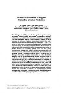
one concerns the management and control of fleet vehicles displacement for a public transportation company. In this application, a software package, integrating GNSS coupled with web Geographic Information System, was developed to manage and improve the efficiency of many operations in public transportation system, such as the optimization of services and transport costs, and the management of traffic and time schedules. The second application consists of a police traffic information system, wherein all information about an occurred accident should be localized and sent to the police station server via wireless communication. However, most applications developed in this context do not focus on collaboration and interaction between different location-based services and applications to provide more pertinent information. In order to address this gap, a prototype platform, called TransportML, was developed and presented in [10], to enable collaboration between road-related services. Web service technology is used to develop actual LBSs in a standard and interoperable manner. TransportML platform interacts with mobile users using any technology allowing an Internet connection. In order to exchange data between services and the platform, a specific language, called Transportation Markup Language (TML), was developed to support these exchanges. The work presented in this paper concerns the integration of Geofencing techniques for real-time tracking of mobile devices. Geofencing is an acronym of two words:"fence", which means an enclosure or perimeter, and the prefix "Geo" which means that this perimeter is built from geographical data. Geofencecan be then defined as the delimitation of a geographical area using a virtual perimeter. The idea of Geofencing or Geocorridor, is used in several applications based on GNSS systems [5]. It can be used, as depicted in Figure 1, to define a virtual perimeter around a geographic zone, and then to associate objects, such as vehicles or people, with this zone, and finally to generate an alarm when these objects cross the border of the perimeter.
Fig. 1. Detecting the entry of a mobile into a forbidden area
3
Geofencing Prototype and Experiments
3.1
Geofencing Prototype Architecture
Geofencing application operates and interacts with different location-based services using GNSS and communication technologies. The concept is based on an in-vehicle embedded device, which allows determining, and sending regularly its location to the
138
A. Nait-Sidi-Moh et al.
management center. More precisely, each vehicle is equipped with an embedded computer, a GPS receiver, and a 3G communication module for data transmission. The in-vehicle embedded application receives data from the GPS receiver and sends it through the communication module to the server for processing. As illustrated in Figure 2, the Geofencing application runs on a server. Once the vehicle characteristics are registered in a database, its current position is known (using GPS/3G module embedded into the vehicle) and sent to server via internet relying on a network based on 3G. The management center is regularly informed about current positions of the registered vehicles. When, for example, a vehicle deviates from its allowed itinerary, the management center takes decisions and suggests appropriates solutions.
Fig. 2. The architecture of Geofencing application
3.2
Vehicle Compliance Verification
As previously mentioned, the adequate itinerary is computed and sent to the vehicle. The vehicle follows the suggested itinerary with a permanent display on a geographical map. The main issue is to verify if the vehicle follows the assigned itinerary. The vehicle compliance verification is illustrated in Figure 3. When a vehicle deviates from its geo-corridor, alerts are sent to the in-vehicle computer to warn the driver and to the management center to generate a new alternative itinerary. The proposed algorithm allows supervising the vehicle motions. After registering the vehicle with its characteristics (e.g., departure point, destination, nature of transported goods), an adequate itinerary is defined by the platform while considering incoming information from all involved LBSs. This itinerary is saved as a sequence of points (A0, …, AN), with and AN represent respectively the departure point and the vehicle’s destination. As given in Figure 4, each two successive points Ai and Ai+1 represent a section (line segment) of the itinerary. A rectangle (Geofence) is formed from these two points whose the length and width are given, respectively, by S and (algebraic measure of the line segment [AiAi+1]). The non negative integer S represents a fixed threshold. A vehicle is represented by the point M(XM(t), YM(t)) whose components are the Cartesian coordinates (XM(t), YM(t)), which are calculated from GPS coordinates of the vehicle at time t. The translation method is detailed hereafter in Section 3.3. The vehicle’s position M(XM(t), YM(t)) is updated each Δt time units. We assume that during Δt (a short time) an eventual deviation of the vehicle from its itinerary will not be too large.
On the Use of Location-Based Services and Geofencing Concepts
139
Fig. 3. Vehicle compliance verification
(a)
(b)
Fig. 4. The vehicle follows its assigned itinerary
Using the verification algorithm, the application checks if the vehicle position M(XM(t), YM(t)) is inside or outside the defined rectangle from the two points Ai(XAi(t), YAi(t)) and Ai+1(XAi+1(t), YAi+1(t)) and the parameter S. By applying the algorithm, two cases are envisaged. If M(XM(t), YM(t)) is inside the rectangle, this means that the vehicle follows the predefined itinerary by the application (Figure 4-a). Otherwise, the vehicle deviates from its Geo-corridor as illustrated in Figure 4-b. In this case, an alert is issued. The platform receives the current position of the vehicle, and invokes all services in order to compute a new itinerary from the received location. The current position M of the vehicle, which lies outside the rectangle, becomes A0 and the algorithm restarts while considering the coordinates of the new position. More precisely, monitoring the vehicle movement and checking if the vehicle moves inside or outside its predefined itinerary are based on the following process. It receives as inputs the coordinates (A0(XA0(t), YA0(t))…, AN(XAN(t), YAN(t))), S, XM(t), ) OR ( YM(t) and for each coordinate, it checks if ( (t)) is valid, in this case if
)
S
140
A. Nait-Sidi-Moh et al.
the next coordinate will be checked, otherwise an alert is submitted and a new itinerary needs to be computed. Each line segment [Ai fined by the equation:
,
] is de-
(t), where
. In order to optimize the algorithm, when the veand hicle exceeds the line segment [Ai, Ai+1] in a moving direction, which means XM(t) > XAi+1(t), or YM(t) > YAi+1(t), or XM(t) > XAi+1(t) and YM(t) > YAi+1(t), the point Ai will be removed from the table of the itinerary coordinates. The next line segment to be considered and analyzed is [Ai+1, Ai+2], and so on until the destination point AN. 3.3
Conversion of GPS Coordinates to Cartesian Coordinates
Conversion of GPS coordinates of a position on the earth to Cartesian coordinates is based on Geodesic systems, also known as datum. World Geodesic System 1984 (WGS84), is one of the space systems, which is characterized by certain accuracy (one meter), and three-dimensional coordinates (longitude, latitude, ellipsoidal height) [13]. Based on a reference Geoid, using a reference ellipsoid, WGS84 defines a reference frame for the earth. It is the most used system in the world, due to its accuracy of the order of one meter, and also it is used by the GPS as a standard. WGS84 is an extended version the first system WGS72 with a transformation of seven parameters. It is used to express the GPS broadcast ephemeris. For more details and information about WGS84, we refer the reader to [13] and [14]. In what follows, we recall formulas we used to translate GPS coordinates of the position M of a vehicle to its Cartesian coordinates M(XM(t), YM(t)). Let us recall that decimal degrees of GPS coordinates express latitude and longitude geographic coordinates as decimal fractions and are used in many geographic information systems. GPS coordinates may be expressed in three ways: • • •
decimal degree : # ddd.ddddd° degrees and minutes decimals: # ddd°mm.mmm' degrees, minutes and seconds: # ddd°mm'ss.sss"
In order to obtain the Cartesian coordinates (X,Y) of a given position, we need first to convert its GPS coordinates (# ddd°mm'ss.sss" or one of other formats) into geographic coordinates (λ, φ, h) and then convert these last to Cartesian coordinates. If a vehicle position is expressed by GPS coordinates # ddd°mm'ss.sss", these coordinates can be translated into the longitude (λ) and the latitude (φ) geographic coordinates according to the following expressions: Longitude = λ = ddd°mm'ss.sss"= ddd + Latitude = φ = ddd°mm'ss.sss"= ddd +
.
+ +
.
(1) (2)
On the Use of Location-Based Services and Geofencing Concepts
141
The third component h of geographic coordinates is the ellipsoidal height. This parameter is defined in a geodetic reference and may differ from the height of several tens of meters. According to the expressions of equations (1) and (2) and the parameter h, the Cartesian coordinates (X, Y) are given as follows:
where :N =
,W=
1
X = (N + h) cos(λ) cos(φ)
(3)
Y = (N + h) sin(λ) cos(φ)
(4)
,
=
, a and b are constants and given
according to the used geodesic system. For WGS84, the exact values of the two constants a and b are given by: a = 6378137,0 m and b = 6356752,314245179 m [13,14]. 3.4
Experiment Results
Experiments are conducted based on a scenario with four web services that are developed, implemented and invoked via the platform. These services are defined as follows: 1) Road status service which provides in real-time required information regarding the road status, 2) event recording service which records events when the route status changes (e.g., accident, traffic jam). Using information provided by this service, Geofencing application informs vehicles and regenerates new itineraries, 3) Geofence service which defines allowed and prohibited areas based on the registered vehicle characteristics, and 4) Itinerary computation service which computes the fastest and safest itinerary. This service allows defining waypoints and advised and discouraged itineraries using information provided by all invoked services. In order to compute an itinerary, the four defined Web services are involved and should interact with each other to give the most appropriate route depending on the vehicle characteristics. The various exchanges between these services, the platform, and the requester are illustrated in Figure 5. As illustrated in this figure, the proposed scenario is described as follows. To define a Geofence, the requester, registered vehicle, has to report all required information, such as the weight, the height, the transported goods, the limit speed, the type of vehicles needs to avoid while moving if the transported good is dangerous, etc. After verifying all these characteristics, Geofencing application communicates this information to the platform. The platform sends then the TML document to the itinerary service to calculate the adequate itinerary taking into account the content of TML document. Finally, the platform sends the defined Geo-corridor to the requester, and then proceeds to a tracking process of the vehicle travel from its origin to its destination. A Web application for visualizing Geofences and defined itineraries on the map was developed. This application can be seen as a Web service client with a Web interface for map visualization. Figure 6 illustrates the use of Geofence service to define forbidden areas to be avoided using parameters, such as Geofence title, Geofence color, speed limit, maximum weight, and maximum height. Taking into consideration all these information, each area is defined by a colored polygon as displayed on the map and saved in a database in order to be considered when computing the required itinerary.
142
A. Nait-Sidi-Moh et al.
Fig. 5. Geofencing architecture
Fig. 6. Definition of Geofences
It is worth nothing that other types of Geofences can be used according the handled situation. For example, the surveillance of a geographical zone, which is accompanied by scheduled time slots. This means that the behavior of the geofence evolves in time. The Geofence may be active during certain time slots (at night for example) and inactive during the rest of the day. More details about other types of Geofences are presented in [11]. Figure 7(a) presents an example of computed itinerary without considering any forbidden or discouraged area. However, in order to avoid forbidden areas provided by invoked web services (road status for example), defined itinerary may be changed. With the aim to illustrate the feasibility and the consequence of the application, discouraged areas cover a part of the advised itinerary. As result, as shown in Figure 7(b), a new optimal itinerary is computed while avoiding forbidden areas.
On the Use of Location-Based Services and Geofencing Concepts
143
Fig. 7. Itinerary computation: (a) Without considering defined Geofences, (b) With Geofences
We have also developed an application for real-time tracking of snow plows using the geofencing concepts. The real-time positions of vehicles are shown in Figure 8. From experiments, we noticed that sometimes vehicle positions are inaccurate and exceed assigned itineraries. To correct GPS coordinates, the compliance verification algorithm is used to attach the current position of each vehicle to its trajectory based on the traveled distance and travel direction. The red lines represent the unclear sections and as long as the vehicles start removing snow, cleared sections become green.
Fig. 8. Tracking of snow plows
4
Conclusions and Future Work
In this paper, a prototype of Geofencing application is developed and integrated into the TransportML platform for sharing road-related information. The application allows defining adequate and safe itineraries for specific vehicles. Each itinerary is computed and controlled while considering all provided information by other interacting services. A compliance verification algorithm is developed and tested. Some preliminary results are reported and show the feasibility and the effectiveness of using LBS interaction and Geofencing techniques. In the case of TDG, this solution might have a great impact on safety and road transport efficiency. Future work includes more experiments and the development of further services to be integrated into the platform.
144
A. Nait-Sidi-Moh et al.
References 1. Erl, T.: Service-Oriented Architecture: Concepts, Technology, and Design, 656 p. Prentice Hall PTR, Upper Saddle River (2005) 2. Papazoglou, M.-P., Traverso, P., Dustdar, S., Leymann, F.: Service-oriented computing: A research roadmap. International Journal of Cooperative Information Systems 17(2), 223–255 (2008), doi:10.1142/S0218843008001816. 3. Bakhouya, M., Gaber, J., Lorenz, P.: An Adaptive Approach for Information Dissemination in Vehicular Ad hoc Networks. Network and Computer Applications 34(6), 1971–1978 (2011) 4. Ait-Cheik-Bihi, W., Nait-Sidi-Moh, A., Bakhouya, M., Gaber, J., Wack, W.: Performance Study of Web Service Composition based on Formal Modeling of Workflow Patterns. In: 8th International Conference on Mobile Web Information Systems, Procedia Computer Science, vol. 10, pp. 728–735 (2012) 5. Nait-Sidi-Moh, A., Bakhouya, M., Gaber, J., Wack, M. (eds.): Geopositioning and Mobility. Wiley-ISTE (2013) 6. Sadoun, B., Al-Bayari, O.: Location based services using geographical information systems. J. Computer Communications 30(16), 3154–3160 (2007), doi:10.1016/j.comcom.2007.05.059 7. Dar, K., Bakhouya, M., Gaber, J., Wack, M., Lorenz, P.: Wireless Communication Technologies for ITS Applications. IEEE Communications Magazine 48(5), 156–162 (2010) 8. Ait-Cheik-Bihi, W., Chariette, A., Bakhouya, M., Nait-Sidi-Moh, A., Gaber, J., Wack, M.: An In-vehicle Emergency Call Platform for Efficient Road Safety. In: The Proceedings of the 8th ITS European Congress, Lyon, France (2011) 9. Caller Location in Telecommunication Networks in View of Enhancing E112 Emergency Services: Recommendation Towards a European Policy and Implementation Plan, Helios Technology Ltd. Prepared on behalf of the DGISiety, Brussels, Luxembourg (2002) 10. Ait-Cheik-Bihi, W., Nait-Sidi-Moh, A., Bakhouya, M., Gaber, J., Wack, M.: TransportML platform for collaborative location-based services. Journal of Service Oriented Computing and Applications 6(4), 363–378 (2012) 11. Reclus, F.: Geofencing. In: Geopositioning and Mobility. Wiley-IST (2013) ISBN-13: 978-1848215672 12. Roxin, A., Gaber, J., Wack, M., Nait-Sidi-Moh, A.: Survey of wireless geolocation techniques. In: IEEE Globcom/Workshop ICPS 2007, Washington DC, USA (2007) 13. http://education.ign.fr/sites/all/files/geodesie_systemes.pdf (last visit on July 2013) 14. Transformation entre systèmes géodésiques en France Métropolitaine. IGN/SGN/PMC report, V2.0 Copyright I.G.N. 1999/2009 (2009)