Optimal navigation of first responders using DBMS Sisi Zlatanova Delft University of Technology, Jaffalaan 9, 2628 BX Delft, The Netherlands
[email protected]
Safiza Suhana Kamal Baharin Delft University of Technology, Jaffalaan 9, 2628 BX Delft, The Netherlands
[email protected]
ABSTRACT Decision-making in crisis situations requires a good positional awareness about all the emergency response units (fire brigade, paramedics, police and municipality). Since locations of first responders may change frequently, they are referred as to moving objects. Generally, locations of mo ving objects can be continuously recorded and dynamically visualized (a service available also in command and control software), but still a limited attention is given to real time analysis and simulation. Dedicated software (usually available for one emergency sector and even for a specific region) allows for mo re elaborated route calculations taking into account traffic jams and street blockings, but computations are usually completed for one vehicle and on a predefined road network. In large emergencies, much more complex questions need to be answered such as ‘which ambulance is closer to the place of incident’, ‘how to send in the quickest way three fire trucks to the place of incident’, ‘what is the closest meeting point’, etc. This paper reports initial results on performing complex analysis in a Database Management System (DBMS). Keywords Navigation, moving objects, analysis, data modeling, DBMS, disaster management
1.
INTRODUCTION
The major goal in case of emergency is to safe lives, reduce the number of injuries and casualties, and limit damages on the property (Kevany 2008, Jafari et al, 2003, Neuvel and Zlatanova 2006). To succeed in this , the decision-making process requires excellent information preparation. The information must be appropriate, complete, actual and correct. Research is currently going on regarding various aspects of managing and analyzing of emergency response data. Special attention is given to the spatio-temporal component of data (Brecht, 2008, Diehl et al 2006, Kevany 2008, Zlatanova et al 2007, Lee and Zlatanova, 2008). One of the success factors in decision-making is situational awareness, which is related to the activities of rescue units. Location information about mobile rescue units (cars, trucks or people) can be obtained through various technologies outdoor and indoor like GPS, UMTS, and WiFi, but disaster management institutions hardly analyze this data. The moving point information is used only for visual monitoring and tracking. Dynamic analysis can greatly facilitate the decision-making process by providing information about hospitals and possible shelters in vicinity, selecting the best routes, estimating time of arrival, etc. which can be derived from typical spatial operations like proximity, navigation, tracking, fencing, etc. Employing such dynamic analysis will also allow for making predictions and simulations. Besides location awareness, information about the context in which information is requested, is often critical. Environmental conditions (smoke, rain, darkness), task assignment, used hardware (handheld or laptops), communication networks (UMTS, WLAN), vehicle type, condition of patients, etc can influence the way data is provided to the user. These context factors are important as they might change dynamically and therefore may influence the location or moving direction of mobile objects. We believe that a better decision can be made by integrating information about moving objects with context data, as it will be adapted to dynamic changes within the incident area. Many researches have been working on managing moving objects but mostly for transportation tasks. Wolfson et al. (1997) presented a model to manage location of moving objects in a DBMS. This model is capable of tracking moving objects and predicting near future positions, but the context of objects is not considered. The researches do not discuss other spatial analysis than the simulation. Zhang et. al (2002) reported a similar approach for management and prediction. They use the bound of deviation of given number (i.e. 1 mile) to determine location of vehicles, which accuracy is practically insufficient for emergency situations. Baars (2005)
presented a spatial schema for management and analysis of driver’s behavior on high ways in peak hours. Approaches for modeling and analysis of moving objects are discussed also by Meratnia (2005) and Laurini, et al, (2005). Much research has been reported in analyzing moving objects with respect to existing road networks, represented as linear referencing network. Sutton and Wyman (2002) reported an approach to synchronize locations of moving objects with a network road model. Nornha and Goodchil (2000) discussed the accuracies of maps represented by topological and network models with respect to vehicles locations. Ahlers et al (2008) discussed matching of GPS tracks with existing road network. Although related to analysis of moving objects in emergency situations, these works are not intended to represent the high diversity and dynamics during emergencies. Therefore we have initiated a research on management and analysis of moving objects for emergency response. This paper gives first insights on the model and a set of analysis related to optimal navigation of mobile rescue units. The paper begins with formalization of the navigation cases for emergency response. Section 3 discusses the management of moving objects with their context in database management system. Existing spatial data types for points and lines represent moving objects and road networks. The model and the functions are implemented in PostGIS. Section 4 presents first tests with the model. The results are visualized in the freeware software uDig. 2.
TAXONOMY OF NAVIGATION
Togt et al. 2005 suggested four main groups of analysis, which might be of interest for moving objects namely position, fencing, navigation and tracking. In this paper we concentrate on navigation assuming moving objects are continuously tracked. Generally, navigation requires start and end points, a network, a cost function (defining criteria for arrival) and an algorithm to compute the shortest path. Many commercial navigation systems have been developed in the last years (Tom-Tom, Mio, Garmin), which can provide personalized routing on static (pre-defined) network making use of cost function based on shortest distance, shortest time, preferred roads. Some of the systems are even able to incorporate information about blocked by traffic jams areas and suggest alternative routes. But these systems are mostly for personal use and cannot provide sufficient flexibility for emergency response. Successful navigation of mobile units in emergency situations depends on many factors, which can be subdivided into three general groups: spatial, user and event information. Although present in all other navigation systems, these factors are slightly complicated compared to other ‘daily’ applications as transportation or tourism. Spatial information refers to the possibilities to move through using roads (different categories), pedestrian areas, bicycle paths, etc. In contrast to road networks for transportation purposes, emergency cars and trucks have quite high driving freedom. They can use networks originally not intended for vehicles. Some of the units (e.g. fire brigade) possess road maps for particular types of vehicles, which are generally not in the national road network. Additionally, some vehicles can and are allowed to drive though green areas. This means that the road network (and therefore computed routes ) can be dynamically changed and adapted to different driving alternatives. The information about users (defined in the user context ) can include personal data such as (age, gender, health conditions, disabilities, etc.), location (obtained from GNSS, UMTS, WLAN), personal handheld devices (type, used communication channel, preferences for alerting, etc.) and performed task. Personal information generally influences the way of presenting the navigation, e.g. by giving possibility to replace graphics with text (or voice) instructions. In emergency situation, the user information can influence the optimal route for navigation. For example, depending on the health condition of a patient, the ambulance may be re-routed to a new hospital. The last aspect, event (threat) information comprises all the information that may disturb the travel. In a normal situation this might be information about traffic congestion. In emergency, this information ranges from data about disaster/incident itself like pollution areas, flooded areas, spread of fire, smoke, rain, wind, etc. to information about the damaged infrastructure. This information is critical for accessibility and/or availability of parts of the network and therefore has direct impact on the routing. For example, depending on the water level, parts of the road network can be still available for fire brigade trucks, while not recommendable for regular cars (Mioc et al 2008). In emergency situation, response units need to cooperate and perform tasks together. They need to obtain individual routes (optimized with respect to all above-mentioned criteria) but also taking into consideration other units in the area. To be able to reflect the cooperation aspect we classify the navigation problem with respect to multiplicity of moving objects and destinations (end points). We suggest that destination points can
2
Zlatanova et al
Optimal navigation of first responders using DBMS
either be static or dynamic (moving) objects. We distinguish between seven different navigation cases as follows: 1.
One moving object has to be navigated to one static point (e.g. one ambulance should be guided to a given hospital) under a certain condition. This is the most trivial case, similar to possibilities in commercially available systems. However in emergency situation the user information and the event conditions have to be continuously monitored and in case of change a new route have to be computed. For example, an ambulance is given the route to the best hospital (in terms of facility provided) for certain patients based on location of ambulance. But if the condition of the patient is getting worse (i.e. user profile changes), a new route to the nearest hospital should be provided.
2.
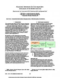
One moving object has to be navigated to the best (out of many) static points according to a set of criteria (Figure 1). A decision has to be taken which of the available destinations meet the set of criteria. For example, it should be possible to provide the list of hospitals within 5 km from current location of an ambulance. The ambulance may select the appropriate hospital based on the condition of the patient at current moment (for example the shortest route). Only after that the navigation to the dedicated hospital will be delivered. Similarly to the first case, as conditions change, the system should be able to re-direct to a second or third choice with respect to an initially provided lis t.
Searching for nearest hospital
Navigate to particular hospital
Figure 1: Case 2: One moving object has to be navigated to one of many points.
3.
One moving point has to visit several static points in the best possible way. This situation may occur, when a decision-maker or officer needs to visit several affected areas, e.g. locations of emergency teams, field hospitals , shelters, etc. If the moving object is a truck carrying first aid medicaments, food, cloths, etc., this case becomes identical to one of the variants of transportation problems in which goods have to be delivered to several destinations.
4.
Many moving objects have to be navigated to one static point (figure 2). A very typical example is guiding five fire trucks to the place of fire. The system should be able to compute the routes to the fire destination simultaneously, taking into account that the trucks should not drive after each other. Monitoring the location, and the event, the system should find the nearest fire brigade that could arrive
3
at destination at certain time, or, alternatively, compute the paths in such a way to allow all trucks reach at destination simultaneously. Fire trucks within 5 km .
5 km
Observing trucks on monitor.
Car accident Addapt according to the scenario.
Figure 2: Case 4: Many moving objects have to be navigated to one static point
5.
Many moving objects have to be routed to many static points. The moving points may have started either from the same source point or from different. For example, ambulances have to bring patients to different hospitals, of several supply trucks have to vis its shelters. If the starting and arriving criteria (e.g. time) of the different moving objects are not mutually related, most probably this case can be restructured to one the previously mentioned cases. If such relation exist (e.g. time should be the same, type of goods to be delivered are depended), the case will need simultaneous solution for all moving objects. Similarly to case 3, if product (food, clods, medicaments) have to be delivered, the problem becomes very similar to the well-know transportation problem (http://www.ii.metu.edu.tr/~ion562/demo/Section1/page2c.html). The major difference will be in computing the transportation cost, which will depend on the spatial and even parameters and may need to be computed dynamically.
6.
Many moving objects have to be navigated to one dynamic point. This situation could happen when the best meeting point has to be found as the mobile objects move through an area. The meeting point has not been fixed and can change with respect to the conditions. For example, two teams have to exchange equipment and they have to meet somewhere. Distance of team 1 to a meeting point might be far more compared to the second team, but they can arrive simultaneously because one of the teams can drive through free of traffic area. Another very interesting example is following and trying to block criminals (for example with a stolen car).
7.
Many dynamic objects have to be routed to many dynamic points is the last most complex case. Such situation may occur when first responders have to be evacuated from a fast developing flooding but to meeting points, which may change with the time.
4
Zlatanova et al
Optimal navigation of first responders using DBMS
The optimal path for arriving at a given destination is based on a multi-criteria analysis (e.g. shortest path, fastest path, condition of patient, emergency conditions, use of different network, etc.).
3.
MANAGEMENT OF MOVING OBJECTS IN DBMS
In our research, we assume locations of moving objects are continuously recorded in a DBMS and organized according to a predefined spatial-temporal schema. The manner of recording, as well as dealing with failures in tracking is outside the scope of this research. DBMS was selected for the management of the moving objects because of many attractive characteristics for crisis situations, e.g. management of large amounts of data; good protection of data in case of power breakdown, wrong operating by the user, or hardware errors; support of spatial data types and spatial functions. Many DBMS have provided navigation models (e.g. Network model in Oracle Spatial 10g, PGrouting in PostGIS) which permits managing networks (topology and geometry) and performing network operations (Pu and Zlatanova 2005). Several algorithms for shortest path computations are readily available in DBMS. Depending on the complexity of the analysis and/or the size of the resulting data set, this approach may even contribute to reducing the response time. The rest of the paper concentrates on the freeware DBMS PostGIS (http://www.postgis.org/). PostGIS extends the PostgreSQL (http://www.postgresql.org/) with support of geographic features, which are implemented according to the Simple Feature Implementation Specification for SQL (SFS) of the Open Geospatial Consortium (http://www.opengeospatial.org/standards/sfs ). PostGIS is also open source software released under the GNU General Public License (http://www.opensource.org/licenses/gpl-2.0.php).
Figure 3:Architecture of PostLBS (courtesy http://www.postlbs.org/)
The network model to be used here comes from another extension of PostGIS, PostLBS (http://www.postlbs.org/). PostLBS aims at providing routing and geo-coding (Figure 3). Presently, geo-coding is only available for Japan. The data stored in PostGIS can be visualized either in a freeware software (uDIG, QGIS, GRASS), or commercial software (e.g. ESRI products). In this paper uDIG (http://udig.refractions.net/) is used. The software has been selected to be freeware and open source by purpose; one of the goals of our project is to investigate the applicability of such software for disaster management. Freeware software is easy to employ and configure, which makes it an attractive option in cases of partial or complete destruction of existing computer networks. Indeed freeware software could be more prone to bugs and malfunctioning compared to commercial software. 3.1.
Emergency response network model
The data model is designed to represent the user, event and spatial information. These groups are termed ‘packages’ and are named Network, Event, Route and User (Figure 4). Each package contains a set of feature classes and the relationships between those classes. The Network represents the Spatial component, the Route is result to be provided to the mobile users (mo ving objects), the Event contains the environmental conditions and the User contains the context information related to the user. The models used for the tests presented in this
5
paper are relatively simple. For example, we consider only one Network to be available, the Event components are limited to only unavailability of nodes/edges of the Network and the User context contains only location.
Figure 4: The Four packages in PostGIS
The Network package has two classes which are Network and Geometry (Figure 5). The Network package contains the classes that are used to define the spatial aspects of road netowrk. Roads (streets), cross roads and objects of interest along streets are the most important spatial features defining the Network In the real world, road or street features are usually described by their name, physical location and by their ability to connect both physically and logically to other features. Thus a ‘road feature’ in the network model has the same attributes: name, geometry representing its physical location, topology (connectivity) to represent how it is physically connected to other features and relationships to represent logical connections with other features (Chunithipaisan, et. al., 2002). In many cases the length is also stored as an attribute. There are two options to represent road (street) network: either using geometry or graph. The geometry representation provides means for quantitative description to define the shapes and location of features. The geometry representation can be taken from existing maps, representing road (street) networks. Road (street) networks can be described with points, lines and polygons. The graph representation deals with the relationships between geometric features (in our case roads, crossroads). The graph model contains only nodes and edges , and represents the connectivity between nodes and edges.
Figure 5: Network class
There are three basic elements in the network package: nodes, edges and paths. The nodes correspond to the object of interest and crossings, the edges represent relationships between nodes, and the paths are parts of the network with a particular meaning. Edge, node and path can have a weight, which represent the impedance cost of traversing them. In our case only the edge has a weight, which is the length of a street segment. 6
Zlatanova et al
Optimal navigation of first responders using DBMS
Event package contains conditions, which are result of the incident and which may influence the normal network. These can be result of flooding, smoke, meteorological conditions (wind, heat), traffic accidents or other types of blockings and closings. There could be also planned actions like closing roads for renovation, reconstruction of houses along streets, etc. We believe many events and objects can influence the transportation network in case of disasters and therefore a special package is devoted to them. These event objects are dynamic (temporal) and are not part of the network. Conceptually, this package has to record the event objects as they are defined by the users, i.e. either by points, lines or areas and with a description about the type of event. Spatial analysis between these objects and the network will derive which nodes and edges are not available for what kind of mobile objects. For example, a road flooding of 50 cm, which might be problematic for personal cars, will not be a problem for the trucks of the fire brigade. The Event package contains currently only EventFeature class (Figure 6), which represents nodes, edges and paths, which are not accessible during disaster.
Figure 6: EventFeaure class
Figure 7: RouteFeature class
Figure 8: UserFeature class
The package Route contains the optimal routes delivered to the moving objects with respect to the cost function. The cost function for emergency response should reflect the type of the network and its availability, event conditions and context of the users. All the routes are persistency stored in the database not only for real-time analysis and prediction (e.g. to compare alternatives) but also for post-disaster analyses. The package as presented here is relatively simple and contains only the computed routes with indication to the mobile object
7
they are computed for (Figure 7). The cost function includes only the length of the edges (i.e. shortest distance is computed). The last package is User and it is intended for the context of the user like location, used personal device, personal data etc. (Figure 8). The user model presented here has location (given within the Dutch coordinate system) and time for a given moving object. Other context parameters are not of interest for the scope of this paper.
3.2
Building the Network model in PostGIS
The Network model can be represented in PostGIS in relational tables, which can be queried either using SQL or pgSQL functions. The street/road geometry is stored in the PostGIS geometry model and the network model is derived from the geometry using pgSQL functions. The network model consist of four tables one for the geometry of the edges and the geometry of the nodes and two giving connectivity between nodes and edges. The model is created with three functions freely available from PostLBS. The text bellow describes the step needed to create the four tables in PostGIS.
Figure 9: PostGIS network model The geometry of the streets can be imported in several way in PostGIS, using different loaders. In our cases, we have used ESRI shape file format. Shape files can be imported in PostGIS using the function shp2pgsql. Shp2pgsql is a data loader that converts ESRI shape file into SQL scripts, which can be executed into the PostGIS enviroment. For example , the shape file named TUDelft_Rd.shp is used to create the script file TUDelft_Rd.sql, which is executed in PostGIS database (named Network): # shp2pgsql -i -D -s 28992 TUDelft_Rd.shp TUDelft_Rd > TUDelft_Rd.sql # psql -U postgres -f TUDelft_Rd.sql -d Network
The loader creates the tables according to the geometry stored in the shape file. In our case all the streets were represented as loose lines and they were stored in one table (tudelft) using multilinestring data type. This table contained around 36 columns. For this research, only ID of objects and their geometry was copied in a table tudelft_street, which was created to contain columns that are needed for the PostGIS Network, as follows: create table tudelft_street ( gid int UNIQUE, x1 double, y1 double, x2 double, y2 double, source_id bigint, target_id bigint, length numeric, edge_id numeric, ); select AddGeometryColumn('tudelft_street','the_geom',28992,'MULTILINESTRING',2); Insert into tudelft_street(gid,the_geom)(Select gid,the_geom from tudelft);
8
Zlatanova et al
Optimal navigation of first responders using DBMS
The new table tudelft_street contains columns for network id, coordinates of first and second point, IDs of source and target nodes, length, and edge ID, but only geometry and ID are filled out with data after this step. The fields with the x1, y1, x2 and y2 is filled out using a PHP script. These coordinates are needed to define the edges of the network. A fragment of the script for X1, Y1 is shown below: $start = "SELECT astext(StartPoint(the_geom))as startpoint from tudelft where gid='$x'"; $res_start= pg_query($con,$start); $start_point = pg_result($res_start,"startpoint"); $array_01=array("POINT(",")"); $array_02=array("",""); for($r=0;$r