Baghapour et al. Journal of Environmental Health Science & Engineering (2016) 14:13 DOI 10.1186/s40201-016-0254-y
RESEARCH ARTICLE
Open Access
Optimization of DRASTIC method by artificial neural network, nitrate vulnerability index, and composite DRASTIC models to assess groundwater vulnerability for unconfined aquifer of Shiraz Plain, Iran Mohammad Ali Baghapour1, Amir Fadaei Nobandegani1*, Nasser Talebbeydokhti2, Somayeh Bagherzadeh3, Ata Allah Nadiri4, Maryam Gharekhani4 and Nima Chitsazan5
Abstract Background: Extensive human activities and unplanned land uses have put groundwater resources of Shiraz plain at a high risk of nitrate pollution, causing several environmental and human health issues. To address these issues, water resources managers utilize groundwater vulnerability assessment and determination of protection. This study aimed to prepare the vulnerability maps of Shiraz aquifer by using Composite DRASTIC index, Nitrate Vulnerability index, and artificial neural network and also to compare their efficiency. Methods: The parameters of the indexes that were employed in this study are: depth to water table, net recharge, aquifer media, soil media, topography, impact of the vadose zone, hydraulic conductivity, and land use. These parameters were rated, weighted, and integrated using GIS, and then, used to develop the risk maps of Shiraz aquifer. Results: The results indicated that the southeastern part of the aquifer was at the highest potential risk. Given the distribution of groundwater nitrate concentrations from the wells in the underlying aquifer, the artificial neural network model offered greater accuracy compared to the other two indexes. The study concluded that the artificial neural network model is an effective model to improve the DRASTIC index and provides a confident estimate of the pollution risk. Conclusions: As intensive agricultural activities are the dominant land use and water table is shallow in the vulnerable zones, optimized irrigation techniques and a lower rate of fertilizers are suggested. The findings of our study could be used as a scientific basis in future for sustainable groundwater management in Shiraz plain. Keywords: Composite DRASTIC, Nitrate vulnerability, Artificial neural network, Shiraz aquifer
* Correspondence:
[email protected] 1 Department of Environmental Health Engineering, School of Health, Shiraz University of Medical Sciences, Shiraz, IR, Iran Full list of author information is available at the end of the article © 2016 The Author(s). Open Access This article is distributed under the terms of the Creative Commons Attribution 4.0 International License (http://creativecommons.org/licenses/by/4.0/), which permits unrestricted use, distribution, and reproduction in any medium, provided you give appropriate credit to the original author(s) and the source, provide a link to the Creative Commons license, and indicate if changes were made. The Creative Commons Public Domain Dedication waiver (http://creativecommons.org/publicdomain/zero/1.0/) applies to the data made available in this article, unless otherwise stated.
Baghapour et al. Journal of Environmental Health Science & Engineering (2016) 14:13
Background Shiraz plain located in southwest of Iran is highly dependent on groundwater for its economic and demographic development. However, urbanization and agricultural activities have caused groundwater contamination by several types of pollutants such as nitrate. Presence of nitrate in the water resources can pose health risks to humans. Therefore, water resources managers are concerned about health and ecological effects of water contaminated with nitrate [1, 2]. Nitrated water can cause blue baby syndrome and certain types of cancer, including cancer of digestive system, stomach, colon, bladder, ovaries, and testicles [3]. Therefore, assessment of groundwater vulnerability to detect the vulnerable areas of aquifers is very important in order to manage groundwater resources. The concept of aquifer vulnerability was first introduced by Marget. This concept refers to the sensitivity of an aquifer to deterioration due to an external action and is based on the assumption that physical environment may provide some degrees of protection to groundwater against contaminants entering the subsurface zone. Consequently, some land areas are more vulnerable to groundwater contamination than others [4, 5]. There are two main types of vulnerability assessment: intrinsic vulnerability and specific vulnerability. The first term refers to the intrinsic property of groundwater system to human or natural impacts. The most leading model of the intrinsic vulnerability is DRASTIC index. DRASTIC index was introduced by United States Environmental Protection Agency (USEPA) for the first time [6, 7]. It is an abbreviation for seven main parameters in hydro-geological system, which control groundwater contamination. These parameters are Depth to water table (D), net Recharge (R), Aquifer media (A), Soil media (S), Topography (T), Impact of the vadose zone (I), and hydraulic Conductivity (C). In contrast, specific vulnerability is defined as the risk of pollution due to the potential impact of land uses. Based on this definition, it seems that model used in the specific vulnerability are more appropriate for forecasting groundwater vulnerability to nitrate pollution [8]. The Composite DRASTIC is the most widespread method of evaluation of the specific vulnerability. The CD model for the first time was proposed by Secunda et al [9]. In this model, in order to evaluate the potential risk of groundwater nitrate pollution, land use parameter is added to seven main hydrogeological parameters of DRASTIC index, then they were integrated through an additive formulation to estimate the specific vulnerability of a certain area. This model was successfully applied in Sharon region of Israel [9], Azraq basin of Jordan [10] and Hajeb-Jelma aquifer of Tunisia [11]. However, it was claimed that the additive formulation might fail to reflect the protective effect of land uses that do not have any adverse effects on
Page 2 of 16
groundwater quality [12]. Thus, a new approach based on a multiplicative model and focused on nitrate pollution has been proposed which is called Nitrate Vulnerability (NV) index. For the first time, Martinez-Bastida [12] suggested to utilize the NV index for assessing the risk of nitrate pollution in Central Spain. He declared using the NV index results in greater accuracy in estimations of specific vulnerability and designation of nitrate vulnerable zones in comparison to the CD index. Both NV and DC methods rely to expert for assigning weights and rates of the parameters. Recently artificial intelligence (AI) models including artificial neural networks successfully utilized to decrease subjectivity in assessment of groundwater vulnerability [13–15]. ANN is a universal approximator to surrogate complex systems [16]. The most commonly used neural network is the multi-layer perceptron (MLP) with supervised training method that consists of one input layer, hidden layers, and one output layer [17, 18]. To apply ANN to the DRASTIC index, there are seven neurons in the input layer corresponding to the input data (D,R,A,S,T,I, and C), four neurons in the hidden layer, and one neuron in the output layer. There is an ongoing discussion in the literature regarding the performance of different models in generating the specific vulnerability maps. This study aims to clarify the issue by comparing the results of CD, NV and ANN models for specific vulnerability assessment. The study uses Shiraz unconfined aquifer as a real world example for conducting this comparison.
Methods The study area
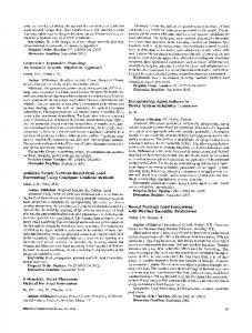
The study area was Shiraz plain located in Fars province, Iran (Fig. 1), which is a part of Maharlu lake catchment. The Shiraz plain area is approximately 300 km2 and it lies between longitudes 520 29′ and 520 36′ E and altitudes 290 33′ and 290 36′ N. From the north and northwest, the Shirza Plain, is limited by the Baba Koohi Kaftrak mountain heights and Drak Mountain, respectively. From the south, the Shiraz Plain extends to the Maharlu Lake. Studies have shown that Shiraz plain is an alluvial aquifer with sequences of sand and clay, where the groundwater exists in the sand layers. Alluvial deposits are a sequence of sand and clay/silt layers with various thicknesses. In addition, geophysical explorations in the plain have demonstrated that Shiraz plain's water-bearing layer in greater depths, it suffers from inappropriate quality. Previous studies indicated that the Shiraz Plain groundwater system is consist of a surface unconfined aquifer and a deep aquifer. Shallow groundwater goes down to a water table to the depth of 40 m, while deep groundwater ranges from about 40 m of depth to 200 m [19]. In the present study, three different models; i.e., CD and NV and ANN
Baghapour et al. Journal of Environmental Health Science & Engineering (2016) 14:13
Page 3 of 16
Fig. 1 Satellite image of Shiraz plain
models, were used for assessment of vulnerability and determination of groundwater protection zones of Shiraz plain unconfined (shallow) aquifer. Two seasonal rivers of Khoshkrud and Chenarrahdar exist in Shiraz area. Chenarrahdar River comes from Rahdar bridge area into Shiraz and goes through the southern angle of the city and after absorbing the surface runoff, it joins Maharlu Lake. The seasonal Khoshkrud River starts from Golestan and Ghalat mountains heights and after joining Khoshk River, it enters the Shiraz plain. Agricultural runoff and industrial wastewater enter this river at the south eastern part of Shiraz city and it finally joins Maharlu Lake. With respect to geology, the formations that outcrop in the study area, from old to new, are: Tarbor formation (Campanian to Maastrichtian), Pabdeh–Gurpi formation (Paleocene), Sachun formation (Paleocene), Jahrom formation (Eocene), Asmari formation (Oligocene), Razak formation (L. Miocene), Agha Jari formation (U. Miocene to L. Pliocene), Bakhtyari formation (U. Pliocene to L. Pleistocen), and quarternary alluvial deposits. The Asmari limestone formation has the most outcrops in the study area. The Shiraz Plain is located in a semi-arid climate zone with the average height of 1540 (m), annual mean precipitation of 365.3 (mm) and average temperature of 18.04 °C. The Composite DRASTIC index (additive model)
CD index is an adaption of the DRASTIC index with the addition of a new parameter (L) to define the risk
associated with land use (L). The objective of this approach is to evaluate the potential effect of extensive land use on groundwater quality resulting from alteration of the soil matrix and unsaturated zone media over time. The DRASTIC Index takes into account seven parameters of the geological and hydrological environments, namely depth to water table (D), net Recharge (R), Aquifer media (A), Soil media (S), Topography (T), Impact of the vadose zone (I), and hydraulic Conductivity (C). According to the effects of parameters on the probable vulnerability, a relative numerical weight from 1 to 5 is given to each parameter, with numbers 1 and 5 representing the least and the most effective, respectively. In addition, these seven parameters are divided into ranges and then receive a number from 1 to 10 according their influence on vulnerability. At the end, after collecting and digitizing the hydro-geological information using GIS, in order to prepare vulnerability maps, the information is overlaid and integrated and the result is a new layer called DRASTIC index (equation 1). DRASTIC index ¼ Dr Dw þ Rr Rw þ Ar Aw þ Sr Sw þ Tr T w þ Ir Iw þ Cr Cw
ð1Þ
In this equation: D, R, A, S, T, I, and C are the abbreviations of the seven effective hydro-geological parameters. Besides, subscripts “r” and “w” represent the corresponding ratings and weights in Table 1 [20–22].
Baghapour et al. Journal of Environmental Health Science & Engineering (2016) 14:13
Page 4 of 16
Table 1 Ratings and weights given to the DRASTIC parameters [6] Depth to water table (m) Range
Topography slope (%)
Hydraulic conductivity (m day -1)
Rating
Range
Rating
Range
Rating
0.0–1.5
10
0–2
10
0–4.1
1
1.5–4.6
9
0–2
9
4.1–12.2
2
4.6–9.1
7
6–12
5
12.2–28.5
4
9.1–15.2
5
12–18
3
28.5–40.7
6
15.2–22.9
3
>18
1
40.7–81.5
8
22.9–30.5
2
>30.5
1
Soil media
Aquifer media
Impact of the vadose zone Range
Rating a
1–3 (2)
Confining layer
1
Metamorphic/igneous
2–5 (3)
Silt/clay
2–6 (3)
Weathered metamorphic/igneous
3–5 (4)
Shale
2–6 (3)
8
Glacial till
4–6 (5)
Limestone
2–5 (3)
7
Bedded sandstone, limestone and shale sequence
5–9 (6)
Sandstone
2–7 (6)
Loam
5
Massive sandstone
4–9 (6)
Bedded limestone, sandstone and shale
4–8 (6)
Silty loam
4
Massive limestone
4–9 (8)
Sand and gravel with significant silt and clay
4–8 (6)
Clay loam
3
Sand and gravel
4–9 (8)
Sand and gravel
4–8 (8)
Muck
2
Basalt
2–10 (9)
Basalt
2–10 (9)
Non-shrinking and non-aggregated clay
1
Karst limestone
9–10 (10)
Karst limestone
8–10 (10)
Range
Rating
Range
Rating
Thin or absent
10
Massive shale
Gravel
10
Sand
9
Peat Shiniking and/or aggregated clay
Parameters Depth to water table
a
Relative weight 5
Impact of the vadose zones
5
Net recharge
4
Aquifer media
3
Hydraulic conductivity
3
Soil media
2
Topography slop
1
a
Typical rating in parentheses according to Aller et al. [6]
To determine Composite DRASTIC index, an additional parameter is added to DRASTIC index, which is land use. Therefore, the CD index is calculated using the following equation: CD index ¼ Dr Dw þ Rr Rw þ Ar Aw þ Sr Sw þ T r Tw þ Ir Iw þ Cr Cw þ Lr Lw
ð2Þ
Where Lr is the rating of the potential risk associated with land use, Lw is the relative weight of the potential risk associated with land use (according to Table 2) and the rest of the parameters are the same as equation 1. The final outputs are ranged from 28 to 280 and are classified according to Table 3.
Nitrate vulnerability index (multiplicative model)
NV is another adaptation of the DRASTIC index, which was developed to achieve greater accuracy in estimation of the specific vulnerability to nitrate pollution. NV index is based on the real impact of each land use. This model attempts to integrate the risks of groundwater pollution by nitrate considering the land use as a potential source of nitrogen. The model incorporates potential negative and protective impacts uses that do not contribute to significant quantities of nitrate and do not enhance leaching of land uses overtime, such as the protected natural areas. It is based on a multiplicative model, involving the addition of a new parameter called the “potential risk associated with land use” (LU), which is calculated according to the following equation:
Baghapour et al. Journal of Environmental Health Science & Engineering (2016) 14:13
Table 2 Ranges and ratings applied to the potential risk associated with land use (L) according to the CD index [9]
Page 5 of 16
Land use categorya
Lr
Table 4 Ranges and ratings applied to the potential risk associated with land use (LU) as a source of nitrate pollution for the NV index [12]
Urban areas
8
Range
LU
Irrigated field crops
8
Irrigated field crops
1.0
Orchards
6
Urban areas
0.8
5
Uncultivated land and
0.3
Uncultivated land
Semi-natural areas
Lw = 5 a
Forests and natural areas
Main land uses observed in Shiraz Plain
NV index ¼ ðDr Dw þ Rr Rw þ Ar Aw þ Sr Sw þT r T w þ Ir Iw þ Cr CwÞ:LU
ð3Þ Where LU refers to the potential risk associated with land use (according to Table 4) and the rest of the parameters are the same as equation 1. The final outputs are classified according to Table 3. Preparation of the needed layers Depth to water table (D)
It is the depth from the ground surface to the water table. To get this layer, the most recent data regarding water level of 31 wells existing in the area of Shiraz plain was used. The interpolation method was applied to change the mentioned point data into raster map of water level. Finally, depth layer was prepared and was classified according to Table 1. Net Recharge (R)
Is the amount of surface water that infiltrates to the ground and reaches the groundwater level. This study utilizes the Piscopo method [23] to prepare the net recharge layer for the Shiraz Plain based on the Table 5 and equation (4), below: Recharge index ¼ Soil permeability þ Rainfall þ Slope ð%Þ
ð4Þ
In equation (4), the slope (%) was extracted from a Digital Elevation Model (DEM), which was generated from the topographic map of the Shiraz Plain and the Shiraz Plain soil map, log observations and exploration wells were used to quantify the soil permeability.
0.2
Aquifer media (A)
Is an indicator of material characteristics in the saturate zone. In this study, information from 20 well logs from Fars Regional Water Organization (FRWO) was used to prepare the aquifer media layer. Soil media (S)
Is the top portion of the unsaturated zones that extends to the plants’ roots and organic creatures activity areas. Soil map was prepared by using the soil map of Shiraz plain and log of observation and exploration wells. Topography (T)
Is an indicator of land slope changes in the area. The abovementioned soil layer was used in preparation of this layer. The Topography Layer was prepared using the same method that was used in provision of net recharge layer and was classified based on the Aller table. Impact of vadose zone (I)
Vadose zone is a layer in between the aquifer and the soil zone. The vadose zone characteristics show the attenuation behavior of the materials that are located above the groundwater table and below soil. This study used the lithologic data of 20 observation and exploration wells to develop the vadose zone media of the Shiraz Plain. Then, using this information and Table 1, we designed the raster map of Shiraz plain. Hydraulic conductivity (C)
Table 3 Vulnerability ranges corresponding to the CD index [9] and the NV index [12] Vulnerability
Ranges (CD index)
Ranges (NV index)
Very low