Nat. Hazards Earth Syst. Sci., 9, 2009–2014, 2009 www.nat-hazards-earth-syst-sci.net/9/2009/2009/ © Author(s) 2009. This work is distributed under the Creative Commons Attribution 3.0 License.
Natural Hazards and Earth System Sciences
Brief communication “The integration of remote sensing and meteorological data for monitoring irrigation demand in Cyprus” G. C. Papadavid1,2 , A. Agapiou1 , S. Michaelides3 , and D. G. Hadjimitsis1 1 Department
of Civil Engineering and Geomatics, Faculty of Engineering and Technology, Cyprus University of Technology, 3603, Lemesos, Cyprus 2 Agricultural Research Institute of Cyprus, 1516, Athalassa, Nicosia, Cyprus 3 Meteorological Service of Cyprus, Nicosia, Cyprus Received: 14 April 2009 – Revised: 3 November 2009 – Accepted: 4 November 2009 – Published: 3 December 2009
Abstract. This paper examines and evaluates the integrated use of satellite remote sensing and meteorological data for estimating crop water requirements over agricultural areas of Cyprus. Intended purpose of this project is to estimate evapotranspiration using modeling techniques, satellite and meteorological data for monitoring irrigation demand. ETc was calculated with the FAO Penman-Monteith method by using satellite images acquired from July to December 2008. ETc estimates obtained in this project were compared to previous empirical data found by using in-situ techniques. ETc values have been correlated with the meteorological data to crosscheck the significance of the meteorological inputs.
1
Introduction
In Cyprus, 70% of the total water consumption is spent for irrigation purposes (Hadjimitsis et al., 2008). Currently, the island faces a prolonged period of severe drought which has inevitably revealed a series of irrigation related problems having a detrimental effect on Cyprus’ agriculture. Monitoring of irrigated agricultural areas in Cyprus provides important data for efficient water supply plans and for avoiding unnecessary water losses due to inefficient irrigation systems. From this perspective, satellite remote sensing techniques, in conjunction with meteorological data, are useful as efficient tools for monitoring irrigation demand in agricultural areas. In most of the irrigation projects, irrigation is managed and supplied on the basis of historic precedence and existing conventional data; however, irrigation demand is not adequately met since weather conditions are changing dramatically and water availability deteriorates. Remotely sensed satellite data Correspondence to: G. C. Papadavid (
[email protected])
can be used to accurately identify cropped areas and estimate the needed water quantity for irrigation. If this information is combined with local climatic data, it is possible to identify the seasonal crop water demand in fields through evapotranspiration (ETc) and schedule irrigation, accordingly (Hadjimitsis et al., 2008). A single Landsat-7 ETM+ image of Cyprus covers almost the entire island, and there is generally little or no cloud cover over the island, especially during summer and autumn period. Therefore, it is possible that the use of satellite remote sensing technologies can increase the efficiency and effectiveness of existing irrigation procedures. The FAO PenmanMonteith method (FAO, 1998) adapted to satellite remote sensed data, is widely used as an accurate method to estimate reference evapotranspiration (ETo). The climatic data required for the method are readily available from meteorological stations and from satellite images. The purpose of this study is to employ the FAO Penman-Monteith method in estimating crop evapotranspiration under standard conditions (ETc) for monitoring irrigation demand. The project’s results provide a useful tool for a decision-making policy, since it is possible to determine the irrigation demand and therefore help to avoid any water losses for agricultural purposes. 2
Review and basics
Evapotranspiration is the combination of two separate processes whereby water is lost, on the one hand, from the soil surface by evaporation and, on the other hand, from the crop by transpiration (FAO, 1998; Allen et al., 2000). It is often used to describe the total water escaping from crop to air. Both evaporation and transpiration processes are driven by energy from solar radiation, air temperature, relative humidity and wind speed (Boegh et al., 2004).
Published by Copernicus Publications on behalf of the European Geosciences Union.
2010
G. C. Papadavid et al.: Remote sensing and meteorological data for irrigation demand
Evapotranspiration constitutes one of the main components of the hydrological cycle and its estimation demands auxiliary meteorological data (Telis and Koutsogiannis, 2007). Many formulas have been developed by scientists to calculate ETc taking into account all the energy sources which are available to plants (French et al., 2008). In recent decades, the estimation of ETc by combining conventional meteorological ground measurements with remotely-sensed data has been widely studied, while several methods have been developed for this purpose (Tsouni and Koutsogiannis, 2003). An accurate estimation of actual ETc is necessary for hydro-resources management. ETo values, can be calculated by measuring weather parameters and typical reference crops using specialized instruments, namely, lysimeters. Today, several researchers recommend a breadth of mathematical equations and modelling (Bastiaanssen and Ali, 2003; D’Urso and Menenti, 1995; Menenti et al., 1989). The methods of estimating ETc are generally classified as: a) energy balance methods, b) aerodynamic or mass transfer methods, c) empirical or semi-empirical methods, d) water depletion methods, and e) numerical or modeling methods (Metochis, 1997; Eliades et al., 1995). The analysis of the performance of these models revealed the need for formulating a standard method for the computation of ETo (Tsouni and Koutsogiannis, 2003; Hoedjes et al., 2008). The FAO Penman-Monteith method, which was derived from the Penman-Monteith equation, has recently been recommended as the sole standard method. It is a method with strong likelihood of correctly predicting ETo in a wide range of locations and climates (Aaron et al., 1996; D’ Urso and Menenti, 1995).
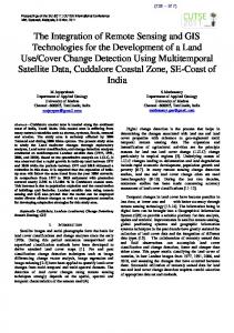
Fig.1.1:Landsat-7 Landsat-7 ETM image of Cypr us.study Thearea study area is marked. Fig. ETM image of Cyprus. The is marked.
3.2
Study area
The study area is located near Paphos International Airport in the Paphos District area in Cyprus (Fig. 1). The area of interest is a traditionally agricultural area where annually crops are cultivated through the whole year. The mild microclimate of the area contributes to the healthy production and full time agriculture activity during the year but especially from July to December in which production is off-season and is very valuable. 3.3
Methodology
The overall methodology consists of the following steps: – Pre-processing of satellite data (images).
3 3.1
Resources and methodology
– Processing the satellite images in order to retrieve surface albedo of crops.
Resources
For estimating ETc, multispectral (visible and infrared bands) Landsat-7 ETM+ satellite images have been used, along with meteorological data. Air temperature, atmospheric pressure, wind speed and other data were collected from an automatic meteorological station (placed at 1.2 m height above ground surface), located at Paphos International Airport, in the vicinity of our study area. These data were interpolated to 2.0 m height as required by FAO Penman-Monteith method. Indeed, these interpolated values were in good agreement with those values found from a customized mobile meteorological station that we employed for calibrating and validating reasons. ERDAS IMAGINE (v.9.3 professional) has been used in the pre-processing and post-processing of the available multi-series imagery. The GER 1500 field spectro-radiometer has been used to assist the application of the atmospheric correction of the satellite images. Nat. Hazards Earth Syst. Sci., 9, 2009–2014, 2009
– Apply the FAO Penman-Monteith method along with crop factors (Kc) to determine ETc. – Compare the results found using the proposed method and the semi-empirical “Epan method” that was widely used in Cyprus, by the Agricultural Research Institute (Metochis, 1997). – Apply statistical analysis for retrieving possible correlation between the meteorological data and the estimated ETc. This will assist the users in order to assess the significance of each meteorological parameter. 3.3.1
Pre-processing of satellite images
Geometric correction has been applied, using standard techniques with ground control points and a first order polynomial fit. All satellite images were geo-referenced at the World Geodetic System ’84 (WGS 84/UTM). www.nat-hazards-earth-syst-sci.net/9/2009/2009/
G. C. Papadavid et al.: Remote sensing and meteorological data for irrigation demand For the radiometric correction, the images were converted from digital numbers (DN) to units of radiance using standard calibration values (Chander and Markham, 2003). The next step was to convert the at-satellite radiance values into at-satellite reflectance using the solar irradiance at the top of the atmosphere, sun-earth distance correction and solar zenith angle. The removal of atmospheric effects, also a part of radiometric correction, has been applied: the darkest pixel (DP) atmospheric correction method, also termed as histogram minimum method, was applied to the multi-series satellite images, since it has been found to be the most effective atmospheric correction algorithm (Hadjimitsis et al., 2004). Finally, the albedo was derived from the satellite images. Albedo was derived using a standard method as described by Liang (2000). Albedo is subsequently used to estimate net radiation at the crop surface, as an input to the FAO model. 3.3.2
The FAO Penman-Monteith method
The FAO Penman-Monteith method has been shown to be a suitable method for this study area (Courault et al., 2005). Indeed, the homogeneity of the area renders the method as the most appropriate for estimating ET, for the various crops cultivated in the area. The estimation of ET focuses only on annual crops cultivated in the area. After preprocessing, the satellite data are ready for extracting the necessary inputs for the irrigation demand model for the area of interest. According to FAO Penman-Monteith method (FAO, 1998), ETo can be calculated from the following equation:
Eto =
900 0.4081(Rn − G) + γ T +273 U2 (es − ea )
1 + γ (1 + 0.34µ2 )
(1)
where, ETo:
reference evapotranspiration
[mm day−1 ],
Rn :
net radiation at the crop surface
[MJ m−2 day−1 ],
G: T:
soil heat flux density is the mean daily temperature
[MJ m−2 day−1 ], [◦ C],
u2 : es : ea : es −ea :
wind speed at 2 m height saturation vapour pressure actual vapour pressure saturation vapour pressure deficit
[m s−1 ], [kPa], [kPa], [kPa],
1:
slope vapour pressure curve
[kPa ◦ C−1 ],
γ:
psychrometric constant
[kPa ◦ C−1 ].
The FAO Penman-Monteith method determines ETc from a hypothetical grass reference surface and provides a standard to which ETc in different periods of the year or in other regions can be compared and to which ETo from other crops can be related. According to Allen (1996), for estimating ETc one should multiply the reference ETo which was found www.nat-hazards-earth-syst-sci.net/9/2009/2009/
2011
through the FAO Penman-Monteith method with the crop coefficient: ET c = Kc × ET o where, ETc: Kc: ETo:
crop evapotranspiration crop coefficient reference crop evapotranspiration
(2) [mm d−1 ], [dimensionless], [mm d−1 ].
The crop coefficient, Kc, is basically the ratio of ETc to the reference ETo, and it represents an integration of the effects of four primary characteristics that distinguish the crop from reference grass. These characteristics are the crop height, the albedo, the canopy resistance and the evaporation from exposed soil. In this research, the Kc was estimated on a daily basis for the entire study period according to the single crop coefficient method and a series of assumptions for the crops of the study area. The crop coefficient Kc, was estimated consecutively, for each image, using remote sensing techniques as described by D’Urso and Menenti (1995). After estimating ETc using satellite and meteorological data, a statistical processing was applied. More specific correlations among the different meteorological inputs – ceteris paribus – where made to justify the relationship between ETc and each input. Finally, a regression analysis was performed to create an empirical equation among evapotranspiration and the meteorological data. 4
Results
The processing of meteorological data along with the satellite data and the FAO Penman-Monteith method have given an estimation of ETc for the area of interest. The results are shown in Table 1 and are contrasted to those of previous research that made use of the empirical Epan method (Metochis, 1997). It is obvious that both methods give comparable results, their difference being less than one mm/day, for all cases. The results represent the crop water requirement for healthy vegetation for the specific place and crop. These data can be used for irrigation scheduling in order to avoid excessive water use in irrigation. The data is useful also in the hands of policy makers, not only for irrigation planning purposes, but also for macroeconomic scheduling in agriculture by excluding crops which have high water requirements. Having examined the relationship between the meteorological parameters (namely, pressure, wind speed, relative humidity and temperature) and ETc within the framework of a regression analysis model, it became apparent that there is a strong relationship between ETc, on the other hand, and relative humidity and wind speed, on the other hand, at the confidence level of 95% and 99%, respectively. The correlation results and the fitted equations are given in Table 2. The statistical F test was employed to verify the significance of each fitted model. The correlations found are acceptable since the corresponding value of F is greater than the given Nat. Hazards Earth Syst. Sci., 9, 2009–2014, 2009
2012
G. C. Papadavid et al.: Remote sensing and meteorological data for irrigation demand
Table 1. Meteorological data from Paphos International Airport station and calculated values of ETc. The results found by applying the FAO 56 method are contrasted to those found by using the Epan method. Date
19 Dec 2008 17 Nov 2008 1 Nov 2008 16 Oct 2008 30 Sep 2008 14 Sep 2008 29 Aug 2008 28 Jul 2008
Sunshine duration
Mean wind speed
Mean relative humidity
Mean station pressure
Mamixum temperature
Minimum temperature
ETo
ETc
ETc found using Epan method
h
m/s
%
hPa
◦C
◦C
mm/day
mm/day
mm/day
9.1 9.2 9.6 8.9 6.6 11.7 11.6 13.3
5.15 2.06 2.06 2.57 7.21 6.18 4.12 4.12
53.0 62.0 64.0 83.0 55.0 66.0 76.0 71.0
1016.4 1016.5 1019.6 1018.5 1016.0 1012.8 1019.0 1017.0
23.0 23.5 25.8 26.6 26.2 29.9 31.4 30.3
9.1 15.5 17.0 20.4 21.1 23.0 23.5 21.7
4.40 2.30 2.20 1.80 4.90 4.20 2.70 2.90
2.89 1.50 1.43 1.18 3.19 2.73 1.75 1.89
2.10 1.41 1.33 1.98 3.30 3.00 2.10 2.20
Table 2. Regression analyses between ETc and relative humidity and between ETc and wind speed (R is the correlation coefficient and R 2 is the coefficient of variation). 3,5 ETc correlated to:
Equation
ETc (mm/day)
3
R2
R
2,5 2
Fobserved
y = -0,0534x + 5,6091 2 = 0,5131 Confidence
FstatisticalR
level
1,5 1
Relative humidity
Y=5.6–0.53X
0.716
0.5130,5
Wind speed
Y=2.37X–0.72
0.938
0.879
6.324
5.99
43.677
0 0
10
0.95
13.75 20
30
0.99 40
50
60
70
80
90
Mean relative hum idity (%)
8
3,5
7
y = -0,0534x + 5,6091 R2 = 0,5131
2 1,5 1
5 4 3 2
0,5
1
0 0
(a)
y = 2,3702x - 0,7225 R2 = 0,8792
6
ETc (mm/day)
ETc (mm/day)
3 2,5
10
20
30
40
50
60
70
80
0
90
Mean relative hum idity (%)
0
(b)
0,5
1
1,5
2
2,5
3
3,5
M e an w ind s pe e d (m /s )
Fig. 2. Relation between (a) ETc and relative humidity, and (b) ETc and wind2:speed. The solid line is the regression line. Fig. Relation between (a)fitted ETc and relative 8 7
ETc (mm/day)
6
y = 2,3702x - 0,7225 R2 = 0,8792
humidity (top), a n (bottom). The solid line is the fitted regression line.
5
4 statistical value of F (Fobserved > Fstatistical , where Fobserved is 3 the value of F which is derived from the results of the statis2 tical analysis and Fstatistical is the value for F from statistical 1 tables).0 The strongest correlation was found between ETc 0 0,5 1 1,5 2 2,5 3 3,5 and wind speed with the coefficient variation, R 2 , reachM e an w ind s peof e d (m /s ) ing almost 88%. Figure 2 shows separately the relation of each of the two variables and ETc.
The results of the separate correlations of ETc to Relative Humidity have shown that they are related by an apparent inverse proportionality: ETc decreases with increasing relative humidity. As expected, relative humidity has a negative effect on evapotranspiration, since it decreases the stomatal flux of water vapour to air through the leaves, due to high level of water vapour concentration in the atmosphere. ConFig. 2: Relation between (a) ETc and relative humiditytrary (top), nd (b)humidity, ETc andwind wind speed to arelative speed has the opposite effect (bottom). The solid line is the fitted regression line. on the water vapour flux to the air, and thus a positive effect on ETc.
Nat. Hazards Earth Syst. Sci., 9, 2009–2014, 2009
www.nat-hazards-earth-syst-sci.net/9/2009/2009/
G. C. Papadavid et al.: Remote sensing and meteorological data for irrigation demand It was expected that ETc would be higher during the summer, when the temperature is higher and sunshine duration is longer. Surprisingly, the higher ETc was calculated in September when the wind speed obtains a higher value (the corresponding calculations are not shown here for brevity). During summer, relative humidity takes higher values and contributes to lower ETc. The least values of ETc were calculated in November when the wind speed was low and relative humidity was moderate.
5
Conclusions and future work
This paper presents a methodology adopted to estimate ETc by using an integration of the following tools: the FAO Penman-Monteith method, remotely sensed and meteorological data. For the first time, all of these data are used in order to estimate ETc in Cyprus since, until now, semi-empirical and field-applied methods have been used. The results are close to the results by previous researchers who made use of the Epan method. This fact validates the methodology employed here. ETc estimations can be used by policy-makers on a technocratic level to apply the most efficient irrigation policy. The results show the minimum and maximum water that the crops require so as to maintain a healthy vegetation. Based on these results, irrigation scheduling can be planned for the specific crops, in order to avoid excess irrigation water usage from the dams. These results can also be the basis for an optimum plan for Cyprus agriculture, which has as a standard constraint the water efficiency of crops (optimization procedures). The paper demonstrates the future potential of the remote sensing methods and water balance models for estimating ETc in agricultural areas of Cyprus, in order to determine the spatial variation of actual evapotranspiration for agricultural areas. Finally, it was found that wind speed and humidity are of great importance in the procedure of estimating ETc, and their values have to be very accurate when collecting the specific data. Future work will comprise further validation of the results, not only by using the FAO Penman-Monteith method for other cultivations but other acceptable methods and models for estimating ETc. An intensive field campaign is planned for collecting more ground data in the next agricultural season, by considering the whole cycle of each crop. Further investigations using parametric analysis of the field and meteorological factors that are interrelated to ETc with irrigation demand, will also be conducted. Finally, lysimeters will be employed in the agricultural fields in order to compare directly the values of ETc obtained both from ground measurements and the proposed methodology. Parametric and sensitivity analysis of the factors affecting ETc are also in the future plans in order to obtain a more detailed idea how these parameters have an effect on ETc. www.nat-hazards-earth-syst-sci.net/9/2009/2009/
2013
Acknowledgements. The authors would like to express their appreciation to the Cyprus Research Promotion Foundation, the European Union (Regional Development Funds) and the Cyprus University of Technology for their funding support. Thanks are also due to the Remote Sensing Laboratory of the Department of Civil Engineering & Geomatics of the Cyprus University of Technology. Edited by: K. Savvidou and F. Tymvios Reviewed by: J.-I. Yano and another anonymous referee
References Aaron, M., Beutler, B. S., and Keller, A.: Implementation of FAO56 Penman-Monteith evapotranspiration in a large scale irrigation scheduling, Water and Environmental Resources Congress, Alaska, 1996. Allen, R. G.: Assessing integrity of weather data for use in reference evapotranspiration estimation, Irrig. Drain., ASCE, 122, 97–106, 1996. Allen, R. G., Pereira, L. S., Raes, D., and Smith, M.: Crop evapotranspiration, Irrig. Drain., 56 pp., 2000. Bastiaanssen, W. G. M. and Ali, S.: A new crop yield forecasting model based on satellite measurements applied across the Indus Basin, Pakistan, Agr. Ecosyst. Environ., 94, 321–340, 2003. Boegh, E. and Soegaard, H.: Remote Sensing based estimation of Evapotranspiration rates, Int. J. Remote Sens., 25, 2535–2551, 2004. Chander, G. and Markham, B.:. Revised Landsat-5 TM Radiometric Calibration Procedures and Post calibration Dynamic Ranges, IEEE T. Geosci. Remote, 41, 2674–2677, 2003. Courault, D., Seguin, B., and Olioso, A.: Review on estimation of Evapotranspiration from remote sensing data: from empirical to modeling approaches, Irrig. Drain., 19, 223–249, 2005. D’Urso, G. and Menenti, M.: Mapping crop coefficients in irrigated areas from Landsat TM images; Proceed, Opt. Eng., 2585, 41– 47, 1995. Eliadis, G., Metochis, C., and Papachristodoulou, S.: Technoeconomic analysis of irrigation in Cyprus, in: Cyprus Agricultural Research Institute Series, Ministry of Agriculture, Natural Resources and Environment Publications, Cyprus, Nicosia 1995. FAO: Crop evapotranspiration, Guidelines for computing crop water requirements, Food and Agriculture Organization of the United Nations, FAO Irrigation and Drainage Paper No. 56, 1998. French, A. N., Hunsaker, D., Thorp, K., and Clarke, T.: Evapotranspiration over a camelina crop at Maricopa, Arizona, INDCRO 5170, 2008. Hadjimitsis, D. G., Clayton, C. R. I., and Retalis, A.: Darkest pixel atmospheric correction algorithm: a revised procedure for environmental applications of satellite remotely sensed imagery, in: Proceedings 10th International Symposium on Remote Sensing, SPIE 5239, 46 pp.4, Barcelona, Spain, 2004. Hadjimitsis, D. G., Papadavid, G., and Kounoudes, A.: Integrated method for monitoring irrigation demand in agricultural fields in Cyprus using satellite remote sensing and wireless sensor network, 4th International Conference on Information & Communication Technologies in Bio & Earth Sciences, Athens, Greece, 2008.
Nat. Hazards Earth Syst. Sci., 9, 2009–2014, 2009
2014
G. C. Papadavid et al.: Remote sensing and meteorological data for irrigation demand
Hoedjes, J. C. B., Chehbouni, A., Jacob, F., Ezzahar, J., and Boulet, G.: Deriving daily Evapotranspiration from remotely sensed evaporative fraction over olive orchard in Morocco, J. Hydrol., 53–64, 2008. Liang S.: Narrowband to broadband conversions of land surface albedo: I Algorithms, Remote Sens. Environ., 78, 213–238, 2000. Menenti, M., Visser, T. N. M., Morabito, J. A., and Drovandi, A.: Appraisal of irrigation performance with satellite data and georeferenced information, Irrigation Theory and Practice, 785–801, 1989.
Nat. Hazards Earth Syst. Sci., 9, 2009–2014, 2009
Metochis, C.: Assessment of irrigation water needs of main crops of Cyprus, in: Cyprus Agricultural Research Institute Series, Ministry of Agriculture, Natural Resources and Environment, Nicosia, 1997. Telis, A. and Koutsogiannis, D.: Estimation of Evapotranspiration in Greece, Ph.D. thesis, University of Athens, Greece, 2007. Tsouni, A. and Koutsogiannis, D.: The contribution of remote sensing techniques to the estimation of Evapotranspiration: the case of Greece, Ph.D. thesis, University of Athens, Greece, 2003.
www.nat-hazards-earth-syst-sci.net/9/2009/2009/