An exciting recent development is the application of formal spatial analysis methods to explain .... information theory:
Running head: YOU-ARE-HERE MAPS
You-Are-Here Maps: Creating Spatial Awareness through Map-like Representations
Alexander Klippel, Stephen Hirtle, Clare Davies
Department of Geography, GeoVISTA Center, Pennsylvania State University, PA, USA School of Information Sciences, University of Pittsburgh, PA, USA Ordnance Survey, UK
You-Are-Here Maps: Creating Spatial Awareness through Map-like Representations
Introduction
Spatial awareness and knowledge about one’s location in an environment is a necessity for successful orientation, wayfinding, and navigation activities. While familiar environments allow us the luxury of unguided success in reaching our destinations, unfamiliar or partially familiar environments require the use of external spatial information in mostly map-like or verbal form. We are living in times where mobile location based services become omnipresent, be it standalone systems such as TomTom or Garmin, or the more recent generic navigation services now being offered by Google and others. We are also living in times where spatial information is available in a much wider array of formats, currency, and fidelity. Hence, it is time to rethink how to provide spatial information for orientation and wayfinding from the perspective of creating spatial awareness. We see a recent development that researchers and observant journalists are becoming concerned about the negative effects of over-dependence on (and even blind trust in) navigation services. Illustratively, an article entitled “Switch your device on and your brain off” compared users of mobile navigation devices to mindless zombies who simply follow instructions (Hillenbrand, 2009). In a similar vein, Brooks (2007) wrote that he quickly attached to his navigation device, and was soon unable to get anywhere without “her.” The scientific community (Bakdash, Linkenauger, & Proffitt, 2008; Péruch & Wilson, 2004; Parush, Ahuvia, & Erev, 2007) has begun studying these issues, and contends that while navigation devices can make it easier to navigate from an origin to a destination, people are less likely to learn environmental layouts and become overly dependent on their devices. When GPS signals are weak or distorted (e.g., by tall buildings), and response time is urgent (e.g., in medical transport), reliance on these devices may lead to dire consequences. Effective solutions to reduce the negative impacts of these navigation services are needed.
Spatial knowledge acquisition
Spatial cognition research in several disciplines provides theoretical foundations for understanding the acquisition of spatial knowledge and how spatial knowledge is employed in wayfinding and route following. Spatial knowledge is most commonly categorized into three kinds: landmark knowledge, route knowledge, and survey knowledge (Siegel & White, 1975). Landmark knowledge allows for identifying entities in the environment that are regarded as salient; route knowledge enables a cognitive agent to follow a specific route; and survey knowledge provides sufficient spatial awareness such that it becomes possible to plan new routes, shortcuts, and detours. Once survey knowledge (or at least extended route knowledge) is established, wayfinding can occur independently of wayfinding support (e.g., maps). The three forms of spatial knowledge provide different levels of abstraction of the spatial environment, both globally and locally. While the sequence in which spatial knowledge is acquired has been contested (Montello, 1998), there is a general understanding that spatial knowledge acquisition is a dynamic process that occurs in a variety of forms. Spatial knowledge is often constructed in hierarchies to organize different features of the environment (Stevens & Coupe, 1978; Hirtle & Jonides, 1985) and simplify complex spatial layouts. The hierarchical organization of spatial knowledge and the ability to flexibly change between different levels of granularity are key characteristics of human spatial cognition and related spatial problem-solving, such as wayfinding (Timpf & Kuhn, 2003; Wiener & Mallot, 2003). For example, in urban environments, hierarchical structures may result from categorizing parts of the environment into units (like districts; see below) or from grouping several consecutive wayfinding actions (Srinivas & Hirtle, 2007), such as turns or non-turns at intersections, into one action (e.g., turn right at the end of the road). Such structuring of spatial information reflects not only cognitive conceptualization processes, but also the organization of spatial knowledge in a cognitively ergonomic way. From the perspective of information system design, even a simple map may provide a user with too much detail, which violates a tenet of cognitive science as discussed, for example, in Clark’s 007 Principle (1989, p. 64): “In general, evolved creatures will neither store nor process information in costly ways when they can use the structure of the environment and their operations upon
it as a convenient standing for the information-processing operations concerned. That is, know only as much as you need to know to get the job done.” Structuring environmental knowledge by taking into account salient environmental features potentially allows for providing a coarser, more focused perspective on required wayfinding actions; it also allows for communicating essential structuring aspects to create spatial awareness. However, the selection of which environmental features and structuring aspects to choose from has to be guided by principles of cognitive information processing (cognitive ergonomics), that is, entities that are cognitively (and perceptually) salient need to be identified to anchor environmental knowledge representation. Focusing on cognitively salient entities allows for abstracting from individual details to form chunks that have a coarser granularity, are easier to cognize, and often sufficient for successful wayfinding. Additionally, not only is the amount of information that has to be memorized and understood reduced, but the information is also structured in a way that is easy to perceive, for example, by using salient landmarks and salient structures. Even leaving off some details and simply providing a map gesture to users, might facilitate both spatial acquisition and usability (Hirtle, 2000). Allen (2000) points out the importance of structuring environmental information for route following and also discusses the importance of the general knowledge of environmental structures and spatial terminology that a wayfinder possesses; this knowledge is activated (or primed) when route directions are remembered or followed. In this constructivist account of understanding route directions, verbal route directions as well as information extracted from a map are the input for a linearly ordered representation that generally corresponds to the perceptual experiences of a traveler along a route.
Maps
Maps, in a variety of formats, are the most common wayfinding support tools. As external artifacts for spatial knowledge, maps at different scales present spatial knowledge across different granularity levels and foster the creation of mental representations of spatial environments, especially survey knowledge (Montello & Freundschuh, 1995). As interfaces between a cognitive system and external environments (Barkowsky & Freksa, 1997), maps allow
people to connect objects and structures in their mental representations of space with objects and structures they perceive in the real world. Traditional paper-based maps used for wayfinding usually focus on the presentation of street and road information and possible landmarks in 2D; some specialized maps like those in tour sites may include 3D views of local attractions, which are often used as landmarks in wayfinding. Digital maps like Google or Bing maps further enhance the use of maps in wayfinding by integrating 3D models of regular buildings or even photo-based street views into traditional 2D maps. Employing a map to create spatial awareness or to provide wayfinding support requires the ability of the map user to establish element-to-element correspondence within and between maps (potentially at different scales) and between objects represented by maps and entities in the real world. The perceptual and cognitive costs of recognizing such correspondences are potentially very high. For example, tying objects on 2D maps with 3D entities in the real world is not an easy task. It has been argued that 2D objects and 3D objects are perceived through different cognitive processes, and these differences lead to significant cognitive loads in building a connection between maps and real-world environments (Oulasvirta, Nurminen, & Nivala, 2007). It is, however, generally questionable—and widely understood by cartographers—that the final goal of designing map-like representation is not photorealism. Recent findings by Hegarty and collaborators (Hegarty, Smallman, & Stull, 2009) clearly show that while photo-realistic representations appeal to users, they often have negative impacts on the users’ performance. Everyone who has tried to use Google street view for wayfinding purposes has potentially had a similar experience that simply providing photorealism is not enough. It has to be embedded in a larger information structure and selectively applied to critical locations. The challenges in establishing correspondences among different entities can be argued to be a problem of creating spatial awareness within a trilateral framework that describes the relationship between wayfinder, world, and map (Liben & Downs, 1993). Classically, this is the area of you-are-here (YAH) map research (Levine, 1982). You-are-here maps are the original form, the grandmother of all location based services. They are a means to create spatial awareness and to plan routes. Design criteria for you-are-here maps have been collected by Klippel and collaborators (Klippel, Freksa, & Winter, 2006) in the form of a checklist that has to be followed to create adequate cognitive information in wall mounted YAH maps. With digital
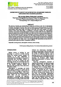
mobile mapping systems, the complexity of the interaction increases as the trilateral correspondence relation is multiplied and an additional relation between different scales potentially has to be established (see Figure 1). Mobile navigation support based on global positioning systems (GPS) allows for continuous YAH information and offers potentially easy to follow, turn-by-turn instructions. As long as people follow a specific route, a complete map is not even required. It has been shown, however, that active learning is important to spatial knowledge acquisition. People can be more engaged in wayfinding tasks when actively exploring a space. New studies show that automatic navigation systems, which discourage engagement, degrade spatial knowledge acquisition (Parush et al., 2007). It is also argued that being able to represent an environment efficiently is dependent upon detecting recurring patterns in the environment (Chown, 1999). It is therefore necessary to respect structurally and cognitively salient patterns when representing environmental information in wayfinding tools such as maps. It becomes critical to find mechanisms that preserve structurally and cognitively salient patterns to enable environmental learning and create spatial awareness.
Figure 1 about here
Formal characterizations of environments An exciting recent development is the application of formal spatial analysis methods to explain spatial behavior. The idea of a more formal characterization of environmental features to predict, for example, wayfinding performance is not new (Gopal, Klatzky, & Smith, 1989), but with advances in spatial analysis the characterization of spatial environments is becoming feasible at a larger scale with the potential to be automatically performed. Given the requirement posed by the ubiquity of navigation services this latter aspect is crucial. The types of analysis that have recently been related to spatial behavior comprise the theory of space syntax (Hillier & Hanson, 1984), the analysis of visual salience (Nothegger, Winter, & Raubal, 2004) and structural saliency (Klippel & Winter, 2005). Here we briefly discuss space syntax theories that originally have been developed to better understand the
relationship between space and society. Space syntax offers several graph-based analysis techniques that allow for identifying strategic spaces (Bafna, 2003) focusing on the accessibility of locations. What makes space syntax measures appealing is that (a) they can be applied to indoor as well as outdoor environments, and (b) a relationship has been found between movement patterns of cognitive agents and between the cognition of space and spatial structures identifiable through space syntax measures (Meilinger, Franz, & Bülthoff, 2007). For example, the fewest line axial map (simply referred to as axial map), is a measure of connectivity in urban street networks. The more connected a certain street (or place) is the more likely (in general terms) is it that this location is also present in the mental representations of inhabitants of this space. This fact has been used in generating coarse directions for city environments (Tomko, Winter, & Claramunt, 2008). Another formal measure—adopted by space syntax researchers— are isovists (also called visibility polygons; see, Turner, Doxa, O'Sullivan, & Penn, 2001). Isovists drawn at eye level allow for capturing the visual field of cognitive agents. It has been found that isovists predict the mental representation that agents have of their environments (Meilinger et al., 2007). However, some experimental work casts doubt on using isovists alone. They may change with different seasons (Davies, Mora, & Peebles, 2007), and appear not to predict many people's performance in tasks where local landmarks may have greater salience than the isovist shape – a concern that Davies and colleagues continue to explore in this special issue (see below).
Contributions in this issue
Daniel Montello provides in the first contribution a comprehensive definition of YAH maps indicating that many principles of YAH maps apply to all maps in which the map user locates her or himself as a first or continuous step in a wayfinding process. In this regard, it is important though to keep in mind the findings by Liben and collaborators (see below) that show how difficult it is for people to locate themselves on a map. Besides discussing several examples of YAH map use, Montello explores the reasons why the alignment effect occurs, or, in other words, why maps that are not aligned cause erroneous decisions, take more time to interpret, and are the reason for feeling lost. The reasons could lie in the characteristics of the human visual
field (Shepard & Hurwitz, 1984) or in the form perception and orientation (Rock, 1973). Overcoming misalignment comprises four steps according to Montello: First, noticing that a map is misaligned; second; realizing the degree of misalignment; third, retrieving an approach to deal with misalignment from memory, and fourth, correctly applying this approach. Strategies to cope with misaligned maps comprise, for example, imagined map transformations or actual map transformation (where it is possible). Montello concludes by pointing out that correctly aligned maps are not always the best solution in supporting spatial cognitive processes. The second contribution by Lynn Liben, Lauren Myers, and Adam Christensen addresses a central question of navigation and wayfinding: how do people locate themselves on a map and how do they identify directions to objects in the environment (potential destinations) while reading a map. An additional important aspect in their research—that is becoming an integral part of spatial cognitive research in general—is the identification of predictors of spatial performance such as different kinds and levels of spatial abilities. They adopt a classification by Linn and Petersen (1985) into: mental rotation, spatial perception, and spatial visualization and use associated tests to check for dependency of spatial performance on spatial abilities. Their findings clearly show that establishing the relationship between one’s location in an environment and the same location represented on a map is a challenging task. They consider three avenues to improve this situation: The first is to improve the education of people’s map reading skills. The second aspect calls for improving the design of you-are-here maps. The third calls for more research on identifying components of cognitive processes (including individual differences) that would allow for deeper insights into how to provide orientation support. The third paper by Clare Davies and David Peebles deepened our understanding of factors that influence the orientation with maps in urban environments for map users unfamiliar with their surroundings. As discussed earlier, the authors' work is particularly addressing the hope of relating formal characterizations of the environment—either space syntax measures of the 2D map or visual salience analyses of the 3D scene—to wayfinding and orientation performance. To this end, they conducted two experiments that were designed to shed light on the question of how 3D environmental features are related to 2D layouts that we find in maps, and which features are used to establish the correspondence between maps and the external world. Most interestingly, the results of their research show that salient (with respect to objects)
does not necessarily correspond to efficient. While people seem to be naturally drawn toward visually salient 3D features, they tend to ignore aspects of the 2D layout that potentially offer greater support for orientation. This research, like research on photorealism discussed in the introduction (Hegarty et al., 2009) reminds us of the importance of behavioral research. If we let users decide what they consider the best representations and visualization we often find that user preferences do not correspond to the most effective and efficient way of representing and visualizing spatial information. Interestingly, these results also indicate that orientation performance is not captured well by formal spatial characterizations such as isovists. Only in cases in which users relied on configurational layout aspects to establish correspondence between a map and a visual scene did isovists predict performance. As most users relied on different strategies focusing more on visual scenes themselves, the isovist measures did not correlate with user performance. The fourth contribution by Bilge and Taylor addresses the critical aspect of environments being organized hierarchically and nested. In our daily spatial activities we often find that we change from outdoor to indoor environments and vice versa. How is it that we keep track of where we are if environments are nested within each other, and how do we coordinate the different scales at which we interact with these environment? Do we still have a sense of an outdoor environment if we enter a building and how does the mode of spatial knowledge acquisition add to this complex question, that is, how is learning through exploration different from learning information from a map? To answer these questions two experiments are reported that had people learn room versus campus environments either through a map-like representation or through direct exploration. The procedure followed a learning – updating – testing paradigm. The findings suggest that the different spatial knowledge sources are differently suited for differently scaled environments. Participants learned campus locations better from a map and room locations better through direct exploration. These finding are an important contribution to how we learn environments and how different scales influence our understanding of where we are in relation to entities at different scales. The final contribution by Schmid, Richter, and Peters addresses the design of maps. Their approach combines central aspects of spatial knowledge organization, particularly the representation of environmental information at different levels of granularity. Granularity and
scale are two important concepts that are often used interchangeably but that are fundamentally different. Scale refers to the actual spatial extent that is represented in a map while granularity characterizes the amount of detail that is offered. In designing maps we often have to make decisions on the right level of detail that is provided and to balance the amount of clutter against the amount of required information. Schmid and collaborators coin the term route aware maps for their work as they implemented an algorithm that allows for balancing the amount of information by tailoring it toward the presentation of essential route features. Other than simply drawing a route on a map (like most navigation services do) they are able to significantly reduce the amount of clutter. However, in contrast to schematization approaches (Agrawala & Stolte, 2000) that focus on the route alone, Schmid and coworkers provide context information that is essential to establish a correspondence relation between the spatial surrounding and the route. This correspondence is important for the acquisition of spatial knowledge and the creating of spatial awareness and offers additional information in case of taking wrong turns. Together, the contributions provide a spotlight on several important issues with regard to the role of YAH maps and the problem of creating a spatial awareness. As the over-dependence on navigation systems becomes more common, the issues raised in this special issue will continue to be of central importance in the years to come.
Acknowledgements This introduction is partially based upon work supported by the National Science Foundation under Grant No. 0948601. The views, opinions, and conclusions contained in this document are those of the authors and should not be interpreted as necessarily representing the official policies or endorsements, either expressed or implied, of the National Science Foundation, or the U.S. Government. References Agrawala, M., & Stolte, C. (2000). A design and implementation for effective computergenerated route maps. In AAAI Symposium on Smart Graphics, March 2000. Stanford. Allen, G. (2000). Principles and practices for communicating route knowledge. Applied Cognitive Psychology, 14(4), 333–359.
Bafna, S. (2003). Space Syntax. A brief introductions to its logic and analytical techniques. Environment and Behavior, 35(1), 17–29. Bakdash, J. Z., Linkenauger, S. A., & Proffitt, D. (2008). Comparing decision-making and control for learning a virtual environment:: Backseat drivers learn where they are going. Human Factors and Ergonomics Society Annual Meeting Proceedings, 52(27), 2117-2121(5). Barkowsky, T., & Freksa, C. (1997). Cognitive requirements on making and interpreting maps. In S. C. Hirtle & A. U. Frank (Eds.), Lecture notes in computer science. 1329. Spatial information theory: A theoretical basis for GIS (pp. 347–361). Berlin: Springer. Brooks, D. (2007). The Outsourced Brain - New York Times. Retrieved December 15, 2009, from http://www.nytimes.com/2007/10/26/opinion/26brooks.html. Chown, E. (1999). Making predictions in an uncertain world: Environmental structures and cognitive maps. Adaptive Behavior, 7(1), 17–33. Davies, C., Mora, R., & Peebles, D. (2007). Isovists for orientation: Can space syntax help us predict directional confusion? In C. Hölscher, R. C. Dalton, & A. Turner (Eds.), SFB/TR 8 monographs: Vol. 2. Space syntax and spatial cognition. Proceedings of the workshop held in Bremen, 24th September 2006 (pp. 81–92). Bremen: Univ. Bremen. Gopal, S., Klatzky, R. L., & Smith, T. R. (1989). NAVIGATOR: A psychologically based model of environmental learning through navigation. Journal of Environmental Psychology, 9(4), 309–331. Hegarty, M., Smallman, H. S., & Stull, A. T. C. M. (2009). Naive cartography: How intuitions about display configuration can hurt performance. Cartographica, 44, 171–186. Hillenbrand, T. (2009). Abgewürgt: Navi an, Gehirn aus: SPIEGEL ONLINE - Nachrichten Auto. Retrieved August 29, 2009, from http://www.spiegel.de/auto/fahrkultur/0,1518,644726,00.html. Hillier, B., & Hanson, J. (1984). The social logic of space. Cambridge, UK: Cambridge University Press. Hirtle, S. C. (2000). The use of maps, images and "gestures" for navigation. In C. Freksa, W. Brauer, C. Habel, & K. F. Wender (Eds.), Lecture Notes in Artificial Intelligence. 1849. Spatial Cognition II. Integrating abstract theories, empirical studies, formal methods, and practical applications (pp. 31–40). Berlin: Springer. Hirtle, S. C., & Jonides, J. (1985). Evidence of hierachies in cognitive maps. Memory and Cognition, 13(3), 208–217. Klippel, A., Freksa, C., & Winter, S. (2006). You-are-here maps in emergencies – The danger of getting lost. Journal of Spatial Science, 51(1), 117–131. Klippel, A., & Winter, S. (2005). Structural salience of landmarks for route directions. In A. G. Cohn & D. M. Mark (Eds.), Spatial Information Theory. International Conference, COSIT 2005, Elliottville, NY, USA, September 14-18, 2005 ; Proceedings (pp. 347–362). Berlin: Springer. Levine, M. (1982). You-are-here maps - Psychological considerations. Environment and Behavior, 14(2), 221–237. Liben, L. S., & Downs, R. M. (1993). Understanding person - space-map relations: cartographic and developmental perspectives. Developmental Psychology, 29(4), 739–752.
Linn, M. C., & Petersen, A. C. (1985). Emergence and characterization of sex differences in spatial abilities: A meta-analysis. Child Development, 56, 1479–1498. Meilinger, T., Franz, G., & Bülthoff, H. H. (2007). From isovists via mental representations to behaviour: First steps toward closing the causal chain. In C. Hölscher, R. C. Dalton, & A. Turner (Eds.), SFB/TR 8 monographs: Vol. 2. Space syntax and spatial cognition. Proceedings of the workshop held in Bremen, 24th September 2006 (pp. 65–80). Bremen: Univ. Bremen. Montello, D. R. (1998). A new framework for understanding the acquisition of spatial knowledge in large-scale environments. In M. J. Egenhofer & R. G. Golledge (Eds.), Spatial and temporal reasoning in geographic information (pp. 143–154). New York: Oxford University Press. Montello, D. R., & Freundschuh, S. M. (1995). Sources of spatial knowledge and their implications for GIS: An introduction. Geographical Systems, 2, 169–176. Nothegger, C., Winter, S., & Raubal, M. (2004). Computation of the Salience of Features. Spatial Cognition and Computation, 4(2), 113–136. Oulasvirta, A., Nurminen, A., & Nivala, A.-M. (2007). Interacting with 3D and 2D mobile maps: An exploratory study (HIIT. Technical Report 2007-1). Parush, A., Ahuvia, S., & Erev, I. (2007). Degradation in spatial knowledge acquisition when using automatic navigation systems. In S. Winter, B. Kuipers, M. Duckham, & L. Kulik (Eds.), Spatial Information Theory. 9th International Conference, COSIT 2007, Melbourne, Australia, September 19-23, 2007 Proceedings (pp. 238–254). Berlin: Springer. Péruch, P., & Wilson, P. (2004). Active versus passive learning and testing in a complex outside built environment. Cognitive Processing, 5(4), 218–227. Rock, I. (1973). Orientation and form. New York: Academic Press. Shepard, R. N., & Hurwitz, S. (1984). Upward direction, mental rotation, and discrimination of left and right turns in maps. Cognition, 18, 161–193. Siegel, A. W., & White, S. H. (1975). The development of spatial representatives of large-scale environments. In H. W. Reese (Ed.), Advances in child development and behaviour (pp. 9– 55). San Diego, CA: Academic Press. Srinivas, S., & Hirtle, S. C. (2007). Knowledge based schematization of route directions. In T. Barkowsky, M. Knauff, G. Ligozat, & D. R. Montello (Eds.), Spatial Cognition V. Reasoning, Action, Interaction. Berlin: Springer. Stevens, A., & Coupe, P. (1978). Distortions in judged spatial relations. Cognitive Psychology, 10(4), 422–437. Timpf, S., & Kuhn, W. (2003). Granularity transformations for routes. In C. Freksa, W. Brauer, C. Habel, & K. F. Wender (Eds.), Spatial Cognition III. Routes and Navigation, Human Memory and Learning, Spatial Representation and Spatial Learning (pp. 77–88). Berlin: Springer. Tomko, M., Winter, S., & Claramunt, C. (2008). Experiential hierarchies of streets. Computers, Environment and Urban Systems, 32(1), 233–245.
Turner, A., Doxa, M., O'Sullivan, D., & Penn, A. (2001). From isovists to visibility graph: A methodology for the analysis of architecture space. Environment and Planning B: Planning and Design, 28(1), 103–121. Wiener, J. M., & Mallot, H. A. (2003). 'Fine-to-coarse' route planning and navigation in regionalized environments. Spatial Cognition and Computation, 3(4), 331–338.
Environment
Wayfinder
Figure 1. The interaction between wayfinder, environment, and map information provided by maps at different levels of granularity and different levels of scale (courtesy: Rui Li).