Early Islamic Settlement in the Southern Negev Author(s): Uzi Avner and Jodi Magness Reviewed work(s): Source: Bulletin of the American Schools of Oriental Research, No. 310 (May, 1998), pp. 39-57 Published by: The American Schools of Oriental Research Stable URL: http://www.jstor.org/stable/1357577 . Accessed: 10/07/2012 17:06 Your use of the JSTOR archive indicates your acceptance of the Terms & Conditions of Use, available at . http://www.jstor.org/page/info/about/policies/terms.jsp
. JSTOR is a not-for-profit service that helps scholars, researchers, and students discover, use, and build upon a wide range of content in a trusted digital archive. We use information technology and tools to increase productivity and facilitate new forms of scholarship. For more information about JSTOR, please contact
[email protected].
.
The American Schools of Oriental Research is collaborating with JSTOR to digitize, preserve and extend access to Bulletin of the American Schools of Oriental Research.
http://www.jstor.org
in
Settlement
Islamic
Early the
Southern
UzI AVNER
Negev JODI MAGNESS Departments of Classics and Art History 321 Eaton Hall Tufts University Medford, MA 02155
[email protected]
Israel Antiquities Authority P.O. Box 3304 Eilat 88133 Israel
During the early Islamic period, the port of Ayla, at the northeastern end of the Gulf of CAqaba,served as an importantcommercial center. This article surveys the archaeological evidence for early Islamic occupation in the southern Negev and the Arabah, a region that D. Whitcombhas referred to as Ayla's "hinterland."This evidence indicates that new settlements were established andflourished throughoutthe region during the 8th to 10th or 11th centuries. Their economic base included large-scale agriculture using sophisticated irrigation systems and the introduction of new crops, copper and gold mining and production, stone quarrying, and the development of a road network used by merchants and pilgrims.
been due, in part, to the misdating of local ceramic types and an overreliance on the numismatic eviithinthelast 20 years,scholarshavecome dence (below). This article surveys the archaeologito realize that the Muslim conquest of cal evidence for early Islamic occupation in the Palestine was not accompanied by wide- southern Negev and Arabah. We shall demonstrate or immediate cultural changes, that new settlements were established and flourished destructions spread and that the country continued to flourish as it had throughoutthe region during the 8th to 10th or 11th under Byzantine rule. There is no doubt that Pales- centuries. Their economic base included mining and tine prosperedunder the Umayyads, benefiting from metallurgy, agriculture,trading, and pilgrimage. its relationship to Damascus, the capital city of the The center of this economic activity was the port empire. The Umayyad caliphs sponsored building of Ayla (modern CAqaba),at the northeasternend of programs around the country, such as the construc- the Gulf of CAqaba.There is no doubt that Ayla tion of the Dome of the Rock and palaces around served as an importantcommercial center during the the Temple Mount in Jerusalem, and at Khirbet early Islamic period. The geographical region that is el-Mefjer and Khirbet el-Minyeh (for references see the subject of this article corresponds with what Grabar 1996; Magness 1991). However, it is still Whitcomb has referredto as Ayla's "hinterland."'A generally held that the transition from Umayyad to review of recently excavated and published material Abbasid rule marked the beginning of a decline in in Israel provides a startlingpictureof this hinterland. the overall prosperityof Palestine, due to the relocation of the capital of the Muslim empire from DaSITES IN THE EILAT AREA mascus to Kufa and Baghdad. In archaeological terms, this has been a self-fulfilling prophecy in Residential and Industrial Villages which Abbasid sites and material culture have not been identified because of the assumption that they Six early Islamic villages have been discovered do not exist (Whitcomb 1990). The failure to identify in the vicinity of Eilat. Three are located near the Abbasid remains in the archaeological record has Gulf of Eilat in Egypt, at the outlets of Wadi Taba, INTRODUCTION
39
40
AVNER AND MAGNESS
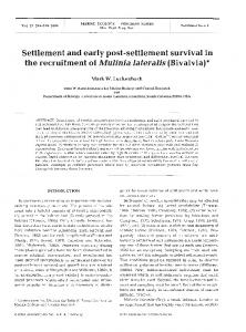
Wadi Tweiba, and Wadi Merah. In the first two, 26 and 22 surveyed buildings were documented,respectively, while the thirdremains unsurveyed. The three other villages are north of Eilat: one is near Kibbutz Eilot, and two smaller ones are in Nahal Shehoret and Be'er Ora (fig. 1).2 The Eilot village was the largest of the six. Today only 15 buildings survive of the several dozen that originally existed. Arrangedin clusters, some buildings consisted of a single room, while others contained up to five rooms with a large courtyard.During the 1960s, the site was surveyed by B. Rothenberg, who identified it as a late Islamic army camp (Rothenberg 1967a: 284-85). In 1971, five buildings were excavated by R. Cohen, who assigned them to the early Islamic period (Cohen 1974: 39). Nine additional buildings were excavated by Y. Rapuano and R. Avner in 1990-1993 prior to the expansion of the Eilat industrialarea (R. Avner 1995: 105-6; Rapuano 1993) (fig. 2). Among the types of installations discovered within the rooms and courtyards were clay and pebble-lined pits dug into the floors (fig. 3). The pits were up to 1.7 m deep and were probably used for food storage (R. Avner 1995: 106). In 1982, Building IX in Wadi Tweiba was partly excavated by U. Avner (in press; fig. 4 here). It measures 15.6 x 20.5 m and consisted of eight rooms around a central courtyard, and had an additional room inside. The 2.25 m high wall on the north side is made of stone instead of the usual mudbrick. Large quantities of shells were prominent among the finds. Although some are edible, the presence of inedible species as well as intentionally broken or retouched shells suggests that they were used primarily for the manufacture of jewelry and inlays. Similar shells were found in surface surveys in the village at Wadi Taba. The degree of uniformity among the buildings in the six villages suggests a common architectural experience and social organization. It probably reflects the initiative of a single body, which perhaps encouraged or sponsored the settlement of one or more ethnic groups. Almost all the buildings are constructed of a stone socle with a mudbrick superstructure that is mostly eroded, although in some cases the stone walls attain a ceiling height of 2.5 m. The rooms were constructed according to several recurringmeasurements,mainly with externaldimensions of 3.2, 3.8, 4.2, or 4.8 m. Finds from the surveys and excavations in these villages attest to both domestic and industrialspheres of activity. The formeris representedby typical early
BASOR 310
Islamic pottery (below), millstones for flour, and small cattle and camel bones. In the sphere of industrial activity, the Wadi Tweiba village is adjacent to copper mines, while the Be'er Ora village lies 1 km south of the "slag valley," the largest smelting camp in the area (below). Approximately 500 kg of copper slag were found in the excavated buildings in the Eilot village, which is 1.5 km south of the copper smelting site at Tel Hara Hadid, and 2 km north of the smelting site at Umm Rashrash. Near the Nahal Shehoret village, two kilns were found, probably for pottery,while the remains of shells in the Tweibaand Taba villages have already been mentioned. All the villages were also situated near main roads (below) and may have provided trading and travel services. Based on demographic estimates (e.g., Hassan 1981: 74; Marfoe 1980; Kramer 1979; 1980) and the number of rooms, the population of each of the larger villages may have reached 250-400 inhabitants and the smaller ones about 70-100 inhabitants. The identity of the population is still unclear. Perhaps they were Bedouin tribe members who underwent a settlement process during the course of the seventh and eighth centuries (Avni 1996; Haiman 1995a: 10; 1995b; Sion 1992; Kennedy 1991: 10513; Helms 1990: 169-71). Indeed, stone-made rope holders for tents found in the Eilot village reflect the presence of tent dwellers or of tents within the villages.3 Even today, tents can be seen adjacent to stone buildings in the modern Bedouin towns of the northern Negev desert. However, neither open air nor built mosques (Avni 1994) have yet been discovered in any of the villages.4 It is also possible that part of the population consisted of prisoners of war brought from foreign countries as laborers. Copper Production Large early Islamic copper mines have been discovered in Nahal Amram. One consists of galleries and halls totaling 3 km in length, while the others, though not yet thoroughly investigated, are probably not much smaller (Willies 1990). The mines were first used by the Nabataeans, and then later in the Mamluke period, but the ceramic evidence indicates that the most intensive mining activity took place during the early Islamic period. Additional early Islamic mines are located in Jebel Merah, Nahal Rehavam, Wadi Tweiba, and Nahal Tsfunot (fig. 1).5 Several copper smelting camps were established in the Eilat area. The largest is located in the slag
EARLY ISLAMIC SETTLEMENT IN THE SOUTHERN NEGEV
1998
"-
!101F i
....,'
1W VII
j/4);
1%i
.~
~""
|K .,.,u
/.r
-.
N1,
i "-,I~o-
...
~ fI Kt.. ..... 7~-;C_., t4
'N:.IX
r
v'
It
92•
"
--)Po N;-v
''>
,,;,-,:;-, • • ?.,,-",•-,4--N4"0 -' " """?Y' ' " b
.
;l
',
,
, ~~r .2
:
---,..i.-=-,
•. •.•>•
-.L~
yYtt
%,,O,• Vt.,
6x
YAt
.
90
,",v .....l. ,''.. ,Kta\N
'•
,
. U...
'?I,'
't'
"?vt7 C-4'
9. -"A..,.r " ' / , '. n.I :F-_•, --~ •. C C' 1.-
fr~ .-