can be used to detect weak GPS signals, often the signals are not reliable enough to ..... Correct stance phase detection is essential in a self- contained inertial ...
Journal of Global Positioning Systems (2011) Vol.10, No.1 :30-38 DOI: 10.5081/jgps.10.1.30
Integrating Low Cost IMU with Building Heading In Indoor Pedestrian Navigation Khairi Abdulrahim1, 2 Chris Hide1 Terry Moore1 Chris Hill1 1 Institute of Engineering Surveying and Space Geodesy (IESSG), Nottingham, UK 2 Faculty of Science and Technology, Universiti Sains Islam Malaysia (USIM), Malaysia.
Abstract This paper proposes an integration of ‘building heading’ information with ZUPT in a Kalman filter, using a shoe mounted IMU approach. This is done to reduce heading drift error, which remains a major problem in a standalone shoe mounted pedestrian navigation system. The standalone system used in this paper consists of only single low cost MEMS IMU that contains 3-axis accelerometers and gyros. Several trials represented by regular and irregular walking trials were undertaken inside typical public buildings. The results were then compared with HSGPS solution and IMU+ZUPT only solution. Based on these trials, an average return position error of below 5 m was consistently achieved for an average time of 24 minutes – at times as long as 40 minutes - using only a low cost MEMS IMU.
Keywords: ZUPT, Kalman Filter, Pedestrian Navigation, MEMS IMU, Heading Drift _____________________________________________ 1.
Introduction
Navigating in indoor environment, particularly inside a building proves to be a complicated navigation problem. An absolute positioning system such as GPS is quite useful and reliable in outdoor environments with a clear view of GPS signals, however using this technology in indoor remains a complicated task. This is because of the fundamental problems of GPS signals, such as low transmission power, which makes it vulnerable to the surrounding environment. As a result, GPS signals will always get attenuated due to reflection and refraction. This is much worse in indoor buildings, where the level of attenuation is significantly higher due to varieties in indoor infrastructures. Until now, using a High Sensitivity GPS (HSGPS) receiver to produce a continuous reliable position solution in indoor building is very difficult. Although it can be used to detect weak GPS signals, often the signals
are not reliable enough to produce good position solutions (Lachapelle 2007). This is partly due to the inability to separate signal errors such as multipath from a good GPS signal. Even if this problem can be overcome, in many situations, there are simply too few GPS satellites in view to be used that have detectable reliable signal and good geometry. A logical approach would be to increase satellite availability. This was investigated by (O’Driscoll et al. 2011) using a combined GPS/GLONASS high sensitivity receiver in urban canyon. However, although the number of detectable satellites did increased, it was found that multipath effect remains a major problem that hinders its advantage. The question is now whether deviating from using GPS by using other type of positioning system - is feasible for indoor pedestrian navigation to avoid the problem mentioned before. RFID, WLAN, WIFI and UWB are examples of systems that do not use GPS signals to compute a position solution. RFID uses absolute position information embedded in it to aid navigation system. WLAN/WIFI provides absolute position information through ‘fingerprinting’ or by using signal strength (Pei et al. 2011). UWB is also using a similar approach of using signal signatures (for example Time Difference of Arrival) to compute position (Kietlinski-Zaleski et al. 2010). All of these however, do require infrastructures, which relates directly to the increase in cost. In some cases – for example during emergency – infrastructures might not be available at all to aid navigation system. This means that resorting to another technology that doesn’t rely on external infrastructures is a reasonable option to decrease the cost and eliminate environment disturbances. A common approach would be to use an Inertial Measurement Unit (IMU), which has the advantage of not relying on external infrastructures. The sensors – normally three accelerometers and three gyroscopes – are small, low power, and inexpensive due to the advances in Micro-electromechanical Sensors (MEMS) technology. Due to its ‘dead reckoning’ approach, once
© [2010] IEEE. Portions reprinted, with permission, from [Abdulrahim, K., Hide, C., Moore, T., and Hill, C., Aiding MEMS IMU with building heading for indoor pedestrian navigation, Proceeding of Ubiquitous Positioning Indoor Navigation and Location Based Service (UPINLBS), 2010].
Abdulrahim, et. al: Integrating Low Cost IMU with Building Heading in Indoor Pedestrian Navigation 31
initialized, the system is totally self-contained. However, the performance of low cost MEMS technology is still relatively low and as a result, their use for positioning applications is relatively limited unless frequent measurement updates from external sensors or technologies are available.
buildings are constructed in this way, a good deal of buildings are. For instance, it was reported that 83.2% of high rise buildings in Kuala Lumpur, capital city of Malaysia, are rectangular or square in shape (Ling et al. 2007). As a result, most of the walking in this kind of building is constrained to only follow this feature.
An example of useful frequent measurement updates is Zero velocity UPdaTe (ZUPT) (Skog et al. 2010), which was used successfully in pedestrian navigation to estimate some of MEMS IMU errors. In order to do this, the IMU was ‘strapped’ on foot/shoe. During walking, the foot has to be briefly stationary (zero velocity condition) in between steps when it is on the ground. These frequent events allow ZUPT to be used to correct the IMU velocity by knowing that velocity should be zero. Furthermore, if the ZUPT measurements are used in Kalman filter, for example in (Foxlin 2005; Godha and Lachapelle 2008; Jiménez et al. 2010), they can not only be used to correct the user’s velocity, but also help to restrict correlated position and attitude errors and estimating the sensor bias errors. Therefore, the frequent use of ZUPT measurements consistently bounds many of the errors and as a result, even relatively low cost sensors can provide useful navigation performance.
Motivated by this useful information on buildings and how it constrains a walk, this paper presents an approach of using ‘building heading’ as a measurement update in a Kalman filter. ‘Building heading’ can be derived automatically from aerial imagery (Abdulrahim et al. 2010), or can also assumed to be known. A new algorithm is developed that integrates the ‘building heading’ information and ZUPTs in the Kalman filter. We simply assume that most of the walking in indoor buildings is straight, restricted to either one of four possible directions (‘4 edges of rectangular’). We argue that when this assumption is invalid, as presented in the result section, the IMU is reliable enough to navigate for a significant period of time without drifting too much.
However, even with the use of frequent ZUPT measurements in Kalman filter, low cost inertial pedestrian navigation systems still suffer from heading drift. This is because of the unobservability of IMU yaw error (assuming that heading drift is primarily caused by accumulation of IMU yaw error). Unobservability is defined as the inability to estimate a state from a given sequence of measurements. In this paper, where only ZUPT is used to aid the low cost IMU, it is then not possible to estimate yaw error using only this measurement. This means that external heading measurements from external sensors are necessary. A common approach is to use magnetometers (Faulkner et al. 2010; Haverinen and Kemppainen 2009; Kemppi et al. 2010; Storms et al. 2010), which is often incorporated with inertial sensors in an IMU, to give the desired heading measurement. However due to significant magnetic disturbances in indoor buildings, this measurement is often unreliable. Instead, it is desirable to use heading measurement updates from other means to properly control heading drift. As the application is intended for indoor pedestrian navigation, we tried to look for ways that could aid heading drift error when navigating inside buildings. We noticed that a common feature often found in most buildings is that buildings are built in such a way they resemble square or rectangular shape, or a combination of both. Interestingly, rooms, corridors and walls inside these buildings are also often consistent with the outer orientation of the building. Although by no means all
Note that using a Kalman filter provides us with the advantage of using other reliable measurements as well – if they are available – to further improve the navigation solution. This could be from occasional reliable GPS positions, to WiFi/RFID ‘finger printed’ positions, or simply a point in a map. This flexibility should provide more integrity and better accuracy to the estimation of system solution, if it can be used reliably to update Kalman filter. However, in our trials, there were no other measurement updates used, except from ZUPTs and ‘building heading’ algorithm. Note also that there is an advantage of using Inertial Navigation System (INS), as in this paper, against basic Pedestrian Dead Reckoning (PDR) algorithms. Basic PDR assumes that all steps detected are forward walking, thus side-stepping and backward walking lead to false measurements, whereas INS, in contrary, is capable to handle this. Trials have taken place in a public hospital in Nottingham and several buildings around the University of Nottingham campus, which represents a typical building. Real world measurements were taken from a low cost MEMS IMU that was attached to a shoe. The data were post-processed using a forward Kalman filter only, so that the results can be applied to a real time system in the future. It was then compared with a HSGPS solution and ZUPT only solution. An improvement of almost thirty fold in return position error was achieved, getting an average return position accuracy of below 5 m from an average distance of about 1500 m using the developed approach, against only 154 m using standard ZUPT only approach. Return position accuracy is the accuracy of start and end position, and not a representative accuracy throughout the whole trajectory. This is because there was no ground truth to
Abdulrahim, et. al: Integrating Low Cost IMU with Building Heading in Indoor Pedestrian Navigation 32
be used as a reference in the trials. Therefore positions were plotted on Google Earth images for visualization purpose and through this visualization, comparison of position errors were then made. Although there is no absolute sense of quantifying the quality of the solution against Google Earth, it is at least useful to see from the visualization where the positioning has been done and how the heading drift has been reduced. In summary, this paper presents an approach of integrating ‘building heading’ information and ZUPT in a Kalman filter, using only low cost MEMS IMU. The idea is to use only IMU for real time navigation, in this paper however, a data logger is used to log the data for post-processing. Using the proposed approach, there is no requirement to have extra sensors to correct heading drift such as magnetometer, camera or optical sensor. There is also no requirement to have a very precise room-level map for navigation. These will be quite convenient for a true low cost pedestrian navigation system in the future. The improvements made in estimating heading error are also analyzed and discussed. True field trials which employ this approach are shown to present the successful implementation of such approach. It is envisaged that a self-contained inertial navigation could be made possible for a longer duration, at least in a typical indoor environment. 2.
Inertial Navigation System (INS)
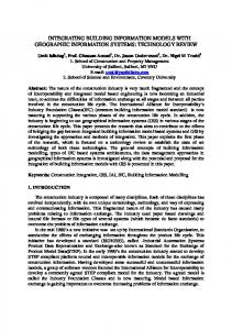
2.1 Equipments A low cost MEMS IMU from MicroStrain (3DM-GX325) was used in the trial. It should be a reasonable representation of a low cost sensor, with typical technical specifications of a low cost IMU grade with a dimension of 44mm x 25 mm x 11mm and weighing only 11.5g. It was strapped on the forefront of a shoe. The accelerometer bias stability is quoted as ±0.01g, and for the 300 degree/s model, the gyro biases are specified as ±0.2degree/s. The particular IMU used has a limit of 1200 degree/s for angular rotation and 18g for acceleration. Although the IMU contains a 3-axis magnetometer as well, only accelerometers and gyros are used for the approach in this paper. Fig. 1 shows the setup. The IMU is shown to be mounted on the foot while the HSGPS receiver and data logger were put inside a backpack. Note that the HSGPS receiver is used only for comparison purpose as presented in result section. 2.2 INS Mechanization This section briefly describes the INS mechanisation and for more details, please refer to for example (Groves 2008; Shin 2005; Titterton and Weston 2004). The INS mechanisation involves initializing the position and attitude of the INS, before the measurements are numerically integrated to produce attitude and position
Figure 1. Example of system setup measurements. The initial position for the IMU was estimated from a GPS position (which assumes that navigation would start in a well received GPS signal area). In practice however, a fully GPS-independent system can only be realized by knowing the initial position, for example by standing on a pre-surveyed coordinate. For the initial attitude, a short stationary condition (