the 3D model to generate a 4D model using specialized software. ..... transportation agency) in order to eliminate the spatio-temporal conflicts between the ...
Discrete event simulation and 4D modelling for elevated highway reconstruction projects Mohammed Mawlana, Amin Hammad, Ahmad Doriani, & Shayan Setayeshgar Concordia University, Canada
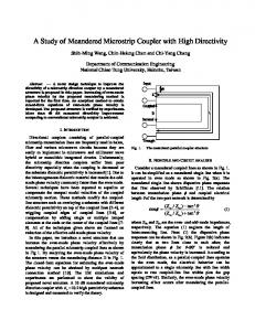
Abstract This paper presents a modelling approach that can be used by contractors to plan elevated highway reconstruction projects. The proposed model estimates the project duration, productivity rate of the operation, and visualizes the output using 4D modelling. In this paper, the focus is on the demolition and construction of a box girder elevated highways as part of an interchange reconstruction project. The demolition method of the elevated highway’s superstructure is done by cutting and lifting. In this method, the elevated highway’s spans that have been cut are taken down by a crane. Launching gantry is used for full span precast box girder erection. Discrete event simulation is used to develop the simulation templates to mimic the elevated highway reconstruction processes. The templates are implemented in STROBOSCOPE. The developed templates can be used to determine the production rate, and duration of an elevated highway reconstruction project. Activity durations are linked with the 3D model to generate a 4D model using specialized software. The 4D model is used for visualization and analysis of highway reconstruction, which can help in resolving constructability issues. A case study is presented to validate and demonstrate the applicability of the proposed approach. Keywords: 4D modelling, Discrete event simulation, Bridge construction, Bridge demolition, Clash detection.
1
Introduction
An intensive amount of reconstruction and rehabilitation work is expected on existing highways because highway infrastructures in North America are approaching, or have surpassed, their service life. Such activities affect drivers, highway workers, businesses and other community functions (Jeannotte and Chandra 2005; Mahoney et al. 2007). Highway construction operations require the use of a large number of construction equipment pieces. Consequently, it is essential for the success of the project to select proper equipment for a specific operation (Lee, 2003). In general, the goals behind selecting a fleet of equipment are: increase work safety, minimize cost, reduce equipment idle time, and maximize productivity. The fact that operation’s cycles have many components, which varies in their values, makes the analysis of productivity very difficult (El-Moslmani 2002; Wright 1995). Therefore, discrete event simulation can be used to measure the productivity of a crew combination and analyse its efficiency. Furthermore, The reconstruction of urban highways, such as the Turcot Interchange project (Transports Quebec, 2009), can get very complicated due to the spatio-temporal conflicts that may result from the limited space available. These conflicts may lead to delays in the project and overrun
in project budget. Simulation and 4D modelling can be applied to detect those spatio-temporal conflicts. In (Hammad et al., 2011), we introduced a new approach based on Monte Carlo simulation and 4D modelling. However, the previously proposed approach does not take into consideration the construction method, the number of crews utilized, and the potential spatio-temporal conflicts between the equipment and the existing structures. Therefore, a new methodology for minimizing the risk of such problems and facilitating the planning process is needed. The objectives of this paper are: (a) to estimate the productivity rate and durations of construction and demolition activities in highway elevated projects; (b) to detect potential spatio-temporal conflicts that can result from variations in tasks durations; and (c) to demonstrate the feasibility of the proposed approach using a case study.
2
Literature review
This section will briefly introduce simulation, Bridge Information Modelling (BrIM), and 4D modelling.
2.1
Construction simulation
Simulation is a powerful tool that can be used to mimic the behaviour of real-world systems over time (Law and Kelton, 1991). Simulation in construction is used for planning and resource allocation, risk analysis, site planning and productivity measurement (Wainer 2009; AbouRizk et al. 1992). The construction processes that have repetitive and cyclic nature can be planned and analysed using simulation (Touran, 1990). Simulation is also used to compare the outcome of different scenarios and alternative construction methods (Oloufa, 1993). Many examples of using simulation can be found in the literature such as earthmoving operations (McCahill and Bernold 1993; Halpin and Riggs 1992), selection of an earthmoving operations fleet (Marzouk and Moselhi, 2003), and construction of bridge deck using cantilever carriage (Said et al, 2009).
2.2
Bridge information modelling (BrIM) and 4D modelling
In traditional practice, the exchange of information during the life cycle of a project is fragmented. The repeated manual data transition from the design phase to other phases of the project life cycle is time consuming and can lead to data entry errors. Bridge Information Modelling (BrIM) is a 3D model including all the data related to all the stages of the life cycle of a bridge project. Implementing BrIM during the whole life cycle of bridge projects facilitates project optimization by including visualization, simulation, and analysis of different aspects, such as bridge rating, permitting and routing. The major issue in order to have an integrated model is related to the method of data representation and exchange between different software in this field. To achieve the desired interoperability between relevant software, an industry consensus on a common language is required (Chen et al., 2006). On the other hand, 4D modelling is one of the recent computer technologies that have emerged into the Architecture, Engineering and Construction (AEC) community. A 4D model can be defined as 3D model linked to the construction schedule (Koo and Fischer, 2000). A 3D model is linked with the desired schedule through specialized software. Navisworks (Autodesk Incorporated, 2011) and ProjectWise Navigator (Bentley Systems Incorporated, 2011) are examples of such programs that provide a collaborative environment to extend, review, and modify the 3D model. Prior research efforts have investigated the application of 4D modelling has been used for resource management (Akinci et al., 2003), coordination of mechanical, electrical, plumbing, and fire protection systems (Khanzode et al., 2005), and constructability analysis in building projects (Ganah et al., 2005). In addition, 4D has been used for visualization and analysis of highway construction projects (Liapi,
2003). Visualization is used to facilitate the communication of project information to project stakeholders (Platt 2007). The analysis is used to examine the constructability and safety issues. Moreover, time and space coordination can be checked to virtually eliminate workflow issues at the planning stage (Kwak et al., 2011). Spatio-temporal conflict analysis, which is one of the key usages of 4D modelling, occur when an activity’s space requirements interfere with another activity’s space requirements, or with work-inplace (Akinci et al., 2002). Two main types of spatio-temporal conflicts have been identified which are: (a) hard conflicts: interferences between physical components (e.g. conflict between old and new elevated highway structures); and (b) soft conflicts: interferences between different clearance volumes and work spaces (e.g. the space clearance required by an equipment) (Staub-French and Khanzode, 2007).
3
Overview of proposed methodology
A discrete event simulation-based 4D modelling approach of elevated highway reconstruction projects is proposed in order to achieve the above mentioned objectives. The main task is synchronizing the construction and demolition activities in order to maintain a smooth traffic flow. The discrete event simulation models are implemented in STROBOSCOPE, an acronym for STate- and ResOurce-Based Simulation of COnstruction ProcEsses (Martínez, 1996). STROBOSCOPE can accommodate deterministic and stochastic modelling of elevated highway reconstruction operations. Discrete event simulation models are developed by breaking down activities into tasks. Each of these tasks’ durations is presented by a probabilistic distribution, such as the triangular distribution, instead of a deterministic one. Discrete event simulation will run a large number of times resulting in a different schedule in each run. These schedules are linked with the 3D model to generate the 4D models. The activities which create conflicts are identified resulting in a list of critical activities which have high potential of creating conflicts. In order to develop the 3D and 4D models of the project, several software packages are used. The first step is to define the alignments and profiles of road and bridge components along the existing terrain in road design software using LandXML format. The second step is to create the 3D models of the existing and new bridges using LandXML files in bridge modelling software such as LEAPBridges software (Bentley Systems Incorporated, 2011). The next step is loading the whole bridge model into the specialized integration software such as Navisworks or ProjectWise Navigator, and linking the 3D model with each schedule by assigning the bridge components to the relevant activity. The last step is running the 4D visualization for each different scenario, and applying clash detection in order to identify any potential conflicts. The proposed discrete event simulation-based 4D model can be considered as a reliable source for decision making in resource allocation and risk management.
4
Simulation modelling
Two simulation models were developed to mimic the construction of a full-span pre-cast concrete box girder bridge using launching gantry and the demolition of a concrete box girder bridge using cut-andlift method.
4.1
Construction operations
The developed simulation model of bridge construction using launching gantry is shown in Figure 1. This construction method has been used in several projects around the world (Hewson 2003; Benaim 2008). The simulation starts by initializing the queues that hold the resources needed for the
construction operations. Next, a trailer will be driven to be loaded with a pre-cast concrete box girder span using a gantry crane available in the yard. Then, the trailer will travel to the construction site where the onsite crane will unload the pre-cast span and load it to a trolley. After being unloaded, the trailer will return to the pre-cast yard to be loaded again. At the same time, the trolley will travel to the point where the span will be launched. When the trolley reaches the desired location, the launching gantry will reposition to the new span’s location. Then, the launching gantry will pick up the span from the trolley. Afterwards, the trolley will return to be loaded again. At the same time, the launching gantry will place the new span in its location. Finally, the stressing crew will post-tension the new span. Yard_Cra ne
Onsite_Tr olley
LC1 Precast_ Spans
LC2 Trailer_Loadin g
PS1
OT1
DT2
Trailer_Haul
Unloadin g_Read
DT3
Trolley_Loadin g
OC1
DT1
Placed_S pans
DT4
OC2 Onsite_C rane
DT5 OT2
Loading_ Ready
DT6
Trailer_Return
OT6
PS2
Stressing
LG4
Place_Span
LG3
Pickup_Span
LG2
LG5
Reposition
Launch_ Ready
OT4
OT3
Trolley_Travel
OT5 Launch_ Gantry
LG1 Trolley_Return
Figure 1. Simulation model for construction operations.
4.2
Demolition operations
The developed simulation model of bridge demolition using the cut-and-lift method (Hammad et al., 2007) is shown in Figure 2. In this method, two crawler cranes are used to lift the span after being Preparing _Team
PT3
PT2
PT1 Existing_ Spans
ES1
Rigging_ Team
RepositionPT
Prepare_Span
ES25
Luffing_R eady
LU3
Reposition_RT
LU1
LU2
RepositionCT Dumped_ Span
ES2
TR5
Span_Dump
Cut_Rea ES4 dy
ES3
Rigging ES26
Trailer_Return
TR6
Cutting_T CT1 eam
CT3
Trailer_R TR1 eady CT2
TR4 DT1
DT2 Dump_Te am
Dump_R eady
TR3
Trailer_Haul
TR2
Load_Trailer
LT3
Load_Re ady
RepositionLT
LT5
Loading_ Team
LT2
Cut_Span
LT4
Figure 2. Simulation model for demolition operations.
LT1
cut by diamond saw wires and place it on a trailer to be transported to the dumping site. The simulation starts by initializing the queues that hold the resources needed for the demolition operations. Next, the preparing team will prepare the span so that it can be ready for rigging before moving to the next span. Then, the rigging team will hook the span to the cranes. After being hooked, the saw team will start cutting the span at both ends. Afterwards, the loading team will place the span on a trailer which will go to the dumping site to be dumped. Then, the loading team will reposition to be ready for the next span. When the trailer is unloaded, it will go back to the demolition site to be loaded again.
5
Case study
The case study is inspired by the Turcot Interchange reconstruction project in Montreal, Canada. This interchange, built in the sixties, has to be reconstructed because of major structural problems (CTV News Montreal , 2010). The interchange provides the connection between three main highways (20, 15, and 720) serving the Island of Montreal. It is composed of several bridge structures located at three different levels, where maximum height can reach 28 meters, and the average height is 18 meters. The estimated duration and budget of the project are about 7 years and $4 billion, respectively (Transports Quebec, 2009). This project is scheduled in four phases, and the durations of the four phases are approximately 3, 2, 1, and 1 year, respectively. Because this high-profile project is still in the planning stage, it was not possible to get any details about the geometry or the scheduling of the project. Therefore, the case study is based on the limited data that were published about the project or obtained directly from the project office. Many assumptions have been introduced to create the geometry of the 3D model and the activity durations used in the simulation. Furthermore, the structural details of the model are simplified in order to focus on the main issues related to spatiotemporal conflicts. Consequently, the case study should be considered as a semi-hypothetical one that does not accurately represent the actual project. The case study aims only to demonstrate the proposed approach; however, it can be applied in the future in the actual project if the detailed data are available. It is assumed that one subcontractor is working on the subproject of constructing segment G of the new interchange, while another subcontractor is responsible of the demolition of segment F of the existing interchange as shown in Figure 3. The general contractor should coordinate the schedules of the two subcontractors while consulting with the management team representing the owner (the transportation agency) in order to eliminate the spatio-temporal conflicts between the subprojects and to reduce the impact on the traffic. Using the steps discussed in the proposed methodology, the 3D models of the existing interchange and some segments of the new interchange have been created using InRoads Suite (Bentley Systems Incorporated, 2011) and LEAPBridges software. Discrete Event simulation is done using STROBOSCOPE in order to generate different scenarios of the schedule. The durations of the tasks used in the construction and demolition operations are presented in Table 1. These data was collected from (Zhang et al., 2008) and the industry. NavisWorks software is used to link the 3D models with the schedules and to run the 4D visualization. The durations of each span’s construction and demolition are directly provided from the results of the developed discrete event simulation models. As shown in Figure 3(a), scenario 1 will not cause any spatio-temporal conflicts between the segment under construction and the one under demolition. On the other hand, scenario 2 (Figure 3(b)) will result in both a soft and a hard conflict. The soft conflict is resulting from the lack of clearance space needed for the launching gantry to progress. Even if the required clearance is available, a hard conflict exists between the ninth span of the new segment G and a pier of the existing segment F. These conflicts will delay the progress of the segment under construction, which in return will delay the project and may cause an overrun in the budget. By applying the proposed methodology, planners can focus their attention on the areas of potential conflicts and avoid these conflicts by, for example, expediting the demolition process.
Table 1. Tasks durations used in the simulation models.
Construction Model Task Duration (minutes) Trailer_Loading Normal[15.03,1.71] Trailer Haul F (Distance, Speed) Trolley_Loading Normal[15.03,1.71] Trailer_Return F (Distance, Speed) Trolley_Travel F (Distance, Speed) Reposition Triangular[180, 210, 240] Pickup_Span Triangular[180, 210, 240] Trailler_Return F (Distance, Speed) Place_Span Triangular[120, 150, 180] Stressing Triangular[360, 420, 480]
(a) No conflict scenario
Demolition Model Task Duration (minutes) Prepare_Span Triangular[10,15,20] Reposition PT Triangular[8,10,12] Rigging Triangular[5,10,15] RepositionRT Triangular[8,10,12] Cut_Span Normal[30,2.11] RepositionCT Triangular[8,10,12] Load_Trailer Normal[15.03,1.71] RepositionLT Normal[17.69,1.42] Trailer_Haul F (Distance, Speed) Span_Dump Normal[5.42,1.3] Trailer_Return F (Distance, Speed)
(b) Conflict scenario
Figure 3. Snapshots of the developed 4D models of the existing and new interchanges at the same point of time.
In order to select the most suitable construction and demolition methods and equipment, a 3D model including the utilized equipment for both construction and demolition operations was created. As mentioned in scenario 2, a space conflict between the gantry and span 8 of the existing segment F was detected by applying 4D simulation (Figure 4 (a)). On the other hand, Figure 4(b) shows two crawler cranes lifting a span as part of demolition operations. This 4D simulation provides a good tool to study the manoeuvring space needed for the equipment and to investigate the impact of the selected construction methods and equipment locations on the construction process. Although space conflict detection is possible by assigning a buffer, representing the erected equipment, to the specific segments, modelling the equipment operation can enhance the visualization provided through the proposed 4D simulation.
6
Conclusions and future work
Discrete event simulation and 4D modeling was used to detect spatio-temporal conflicts between subprojects in complex urban elevated highway projects. The current paper proposed a new methodology for minimizing the risk of such problems by integrating simulation techniques and 4D visualization methods. The following conclusions can be stated: (1) the proposed discrete event simulation-based 4D modeling can be efficiently used to estimate the productivity rate and durations
of construction and demolition activities in highway elevated projects, and to detect potential spatiotemporal conflicts that can result from variations in task durations; and (2) the case study demonstrated the feasibility of the proposed approach by being able to detect and visualize conflicts. By applying the proposed methodology, planners can focus their attention on the areas of potential conflicts and avoid these conflicts.
(a) Launching gantry Figure 4. Visualization of construction equipment
(b) Two crawler cranes
Future work will further investigate the methods of simulation and visualization used in the current paper including: (1) to preform sensitivity analysis to determine the optimum number of the crews; (2) to perform a survey to collect more sound task durations; (3) to further investigate the use of 4D modelling for constructability review considering the positioning and operation of cranes and the spatio-temporal issues related to the construction equipment; (4) to compare the feasibility of different construction and demolition methods such as the safety issues related to the use of hydraulic crushers for the demolition operations.
Acknowledgements The authors would like to acknowledge the Ministry of Transport of Quebec for partially providing the data used in the case study. Furthermore, the discussions with Mr. Adel Zaki from SNC-Lavalin and Mr. Claude Énault from Guay Inc. are greatly appreciated. In addition, the authors would like to thank Mr. Uwe Baier for providing some of the data used in this case study.
References ABOURIZK, S. M., HALPIN, D. W., & LUTZ, J. D. (1992). State of the art in construction simulation. Proceedings of the 1992 Winter Simulation Conference, (pp. 1271-1277). AKINCI, B., FISCHER, M., LEVITT, R., & CARLSON, R. (2002). Formalization and automation of time-space conflict analysis. Journal of Computing in Civil Engineering, 16(2), 124-134. AKINCI, B., TANTISEVI, K., & ERGEN, E. (2003). Assessment of the capabilities of a commercial 4d cad system to visualize equipment space requirements on construction sites. Construction Research Congress, 989 - 995. Honolulu, HI. AUTODESK INCORPORATED. (2011). Autodesk Navisworks Products. Available online: http://usa.autodesk.com/navisworks. Last accessed: November 2011. BENAIM, R. (2008). The Design of Prestressed Concrete Bridges. New York: Taylor & Francis. BENTLEY SYSTEMS INCORPORATED. (2010). About Bridge Information Modeling. Available online: http://www.bentley.com Last accessed: November 2011.
EL-MOSLMANI, K. (2002). Fleet Selection for Earthmoving Operations Using Queuing Method. Montreal: Master’s thesis, Concordia University. CTV NEWS MONTREAL. From $3B Turcot Plans Draw Detractors: Available online: www. http://montreal.ctv.ca/servlet/an/local/CTVNews/20101109/mtl_turcot_plan_101109?hub=MontrealHome. Last accessed: November 2011. GANAH, A., BOUCHLAGHEM, N., & ANUMBA, C. (2005). Viscon: computer visualization support for constructability. Journal of Information Technology in Construction: Special Issue: From 3D to nD Modelling, 10, 69-83. HALPIN, D. W., & RIGGS, L. S. (1992). Planning and Analysis of Construction Operations. John Wiley & Sons, Inc. HAMMAD, A., MAWLANA, M., DORIANI, A., & CHEDORE, D. (2012). Simulation-based four-dimensional modeling of urban highway reconstruction planning. Transportation Research Board (TRB) 91st Annual Meeting. Washington: Transportation Research Board. HAMMAD, A., ZHANG, C., AL-HUSSEIN, M., & CARDINAL, G. (2007). Equipment workspace analysis in infrastructure projects. Canadian Journal of Civil Engineering, 134, 1247-1256. HEWSON, N. R. (2003). Prestressed Concrete Bridges: Design and Construction. London: Thomas Telford Ltd. JEANNOTTE, K., & CHANDRA, A. (2005). Developing and Implementing Transportation Management Plans for Work Zone. FHWA, U.S. Department of Transportation,, FHWA-HOP-05-066. KWAK, J. M., CHOI, G. Y., PARK, N. J., SEO, H. J., & KANG, L. S. (2011). 4D CAD application examples and directions for development in civil engineering projects. 2011 2nd International Conference on Education and Management Technology , 13, 163-167. KHANZODE, A., FISCHER, M., & REED, D. (2005). Case study of the implementation of the lean project delivery system (lpds) using virtual building technologies on a large healthcare project. Proceedings 13th Annual Conference of the International Group for Lean Construction, (pp. 153-160). Sydney, Australia. KOO, B., & FISCHER, M. (2000). Feasibility study of 4d cad in commercial construction. Journal of Construction Engineering and Management, 126(4), 251-260. LAW, A. M., & KELTON, W. D. (1991). Simulation Modeling And Analysis. New York: McGraw-Hill. LIAPI, K. A. (2003). 4D visualization of highway construction projects. Proceedings of the 7'th International Conference on Information Visualization (IV'03), 1093{9547/03. LEE, S.-H. (2003). A Process Model for Controlling Project Productivity of Highway Construction Operations. Ph.D. Thesis, University of Florida. MAHONEY, K. M., PORTER, R. J., TAYLOR, D. R., KULAKOWSKI, B. T., & ULLMAN, G. L. (2007). Design of Construction Work Zones on High-Speed Highways. Highway and Facility Design, NCHRP Report 581. Transportation Research Board of the National Academies, Washington, D.C.: Transportation Research Board. MARTÍNEZ, J. (1996). STROBOSCOPE: State and Resource Based Simulation of Construction Processes. Ph.D. thesis, University of Michigan. MARZOUK, M., & MOSELHI, O. (2003). Object-oriented simulation model for earthmoving operations. Journal of Construction Engineering and Management, 129(2), 173-181. MCCAHILL, D. F., & BERNOLD, L. E. (1993, September). Resource-oriented modeling and simulation in construction. Journal of Construction Engineering and Management, 119(3), 590-606. OLOUFA, A. A. (1993, January). Modeling operational activities in object-oriented simulation. Journal of Computing in Civil Engineering, 7(1), 94-106. PLATT, A. E. (2007). 4d CAD For Highway Construction Projects. Master’s Thesis, Pennsylvania State University. STAUB-FRENCH, S., & KHANZODE, A. (2007). 3D and 4D modeling for design and construction coordination: issues and lessons learned. Journal of Information Technology in Construction, 12, 381-407. TOURAN, A. (1990, September 3). Integration of simulation with expert systems. Journal of Construction Engineering and Management, 116(3), 480-493. TRANSPORTS QUEBEC. (2009). Projet de reconstruction du complexe Turcot à Montréal: Available online: www.bape.gouv.qc.ca/sections/mandats/Complexe_Turcot/documents/liste_cotes.htm. Last accessed: July 2011. WAINER, G. A. (2009). Discrete-Event Modeling and Simulation. A Practitioner's Approach. CRC Press. WRIGHT, P. H. (1996). Highway Engineering. John Wiley & Sons Inc. ZHANG, C., ZAYED, T., & HAMMAD, A. (2008). Resource management of bridge deck rehabilitation: Jacques Cartier bridge case study. Journal of Construction Engineering and Management, 134(4), 311–319.