Research Journal of Chemistry and Environment______________________________________Vol.15 (2) June (2011) Res.J.Chem.Environ
PM10 monitoring using MODIS AOT and GIS, Kuala Lumpur, Malaysia
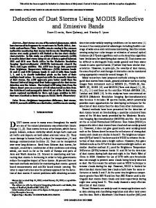
Amanollahi Jamil 1, Abdullah Ahmad Makmom 1, Pirasteh Saeid 2*, Ramli Mohamad Firuz 2 and Rashidi Prinaz 1 1. Department of Environment Science, faculty of environmental studies, Universiti Putra Malaysia, Serdang, MALAYSIA 2. Institute of Advance Technology, Universiti Putra Malaysia, Serdang, MALAYSIA *
[email protected]
(Krewski et al. 2000). Conventionally, pollution of PM kinds has been studied in ground station. But the expense of installing and maintaining the around station is very high. On the contrary, air quality monitoring stations have some problems related to data coverage, and also in the place of studying air quality are in distance from the station, extrapolation of data needs to be done. Recently, remote sensing played a major role in PM pollution monitoring.
Abstract Remote sensing has been increasingly used in retrieval Aerosol optical thickness (AOT) to particulate matter pollution monitoring. In this study, Moderate resolution image Spectroradiometer (MODIS) data were utilized in particulate matter pollution monitoring. Daily aerosol optical thickness (AOT) data retrieved from MODIS in 2004 using NonLinear Correlation Coefficient (NLCC) with polynomial equation were compared with the amount of particulate matter PM10 measured at Three ground Air Quality Monitoring Stations (AQMS)-Victoria Kl, Cheras Kl and Gombak- in Kuala lumpur and surrounding area. The PM10 data were imported in geographical information system (GIS) environment to derive the PM10 maps in Kuala Lumpur stations. Results showed that the amounts of PM10 in dry season are higher than those in rainy season in stations. The NLCC between MODIS AOT and PM10 concentration was obtained higher in Victoria Kl compared to Gombak and Cheras Kl. GIS maps were found to show better distribution of PM10 compared to the ground station data. This study reveals AOT data from MODIS and GIS map can be utilized to study the air quality, especially distribution of PM10 in the places where there are ground measurements.
Moderate resolution imagine spectra radiometer (MODIS) sensor on board national Aeronautics and space administration (NASA’s) Aqua and Tetra satellite can estimate columnar a aerosol optical thickness (AOT) . The importance of this research is evaluating and mapping distribution the pm 10 in tropical region that has a different behavior in refining data. The relation between two phenomena has been studied: pm in the atmosphere and satellite- derived Aot (Chrysoulakis et al. 2003, Gupta et al. 2007, Gupta et al. 2006). Chrysoulakis et al. (2003) showed different location is effective on relation between MODIS AOI and particulate matter. Hutchison et al. (2005) obtained a correlation range from 0.4 to 0.5 between MODIS AOT and particulate matter in Texas and also by means of data averaging over longer time scale, they received more effective correlation beyond 0.9. , Gupta et al. (2007) studied correlation range from 0.11 to 0.48 in Sydney and changes of AOT from below 0.1 to above 1.0 before and during bush fire respectively. Sohrabinia and Khorshiddoust (2007) applied satellite data and spatial modeling by use of GIS for the purpose of study the different pollutants concentration in Tehran , they monitored and mapping air pollutant by use of MODIS data and ground station data. The two main objective of this paper are: (1) To determine the correlation coefficient between MODIS AOT and hourly PM10 data in three satiations in Kuala Lumpur and surrounding area in 2004. (2) To mapping distribution of PM10 pollution over Kuala Lumpur by application of ground stations PM10 data.
Keywords: Aerosol optical thickness; MODIS; Particulate matter; GIS; Malaysia
Introduction Over the southwest of Malaysia October and November are the months with maximum rainfall while the minimum rainfall occurs in February. The maximum rainfall in March and April and minimum in June- and July are indistinct (MMD 2009). Malaysian climate is classified into the rainy season from October to January, and dry season from February to September with regarding the amount of humidity, temperature and rainfall. Sources of air pollution in Malaysia can be divided into three main categories namely industry, motor vehicles, and open burning. The air quality in the Kuala Lumpur and surrounding area were reported to be a good, moderate and unhealthy levels, respectively 23%, 70% and7% of the time in 2006 (EQR 2006). Pm10 is the name of the particles with dimension of less than 10 micron. Besides, the particles less than 2.5 micron dimension are called pm2.5
Data and Material Study area: Kuala Lumpur is located in center part of Klang Valley which is in the west coast Peninsular Malaysia and is delineated by Strait of Malacca to the west and the Titwangsa Mountains to the north and east. There are two Air Quality Monitoring Stations (AQMS) in Kuala Lumpur (Fig. 1b). Gombak sation in the north of Kuala Lumpur was added in this study because may show the air quality and condition in north of Kuala Lumpur (Fig. 1b). (1)
Research Journal of Chemistry and Environment______________________________________Vol.15 (2) June (2011) Res.J.Chem.Environ shows that due to the solar heating, the ABL starts to increase and in the afternoon around 1:00 p.m. to 2:00 p.m. it reaches the maximum value. Therefore, the PM10 mass decreases at the surface from 8:00 a.m. to 12:00 p.m. Increase of longwave radiation emitted from the hot surface and decrease of solar heating cause the ABL to start to decline in the afternoon, subsequently increasing PM10 mass. Maximum and minimum seasonal PM10 mass concentrations have been found to coincide well with the dry and wet seasons respectively. This result is in agreement with findings achieved by other researchers, like (Kim Oanh et al. 2006, and Rashid and Griffiths 1995).
(a) Fig. 1. (a) Peninsular Malaysia with its states. (b) Kuala Lumpur and three air quality monitoring stations.
Research Methodology In this study, hourly PM10 mass concentration was obtained using macro in MC excel for three AQMS in 2004. MODIS level 2 (MYD04_L2) daily AOT onboard Terra satellite were downloaded according to the stations coordinate system in 2004. HDF explorer was utilized to view the (MYD04_L2) daily AOT files. AOT data were refine using macro in MC excel. Non-linear correlation coefficient was used to find relationship between PM10 mass concentration and MODIS AOT data for air quality monitoring stations in Kuala Lumpur in 2004. Trend of PM10 mass concentration measured by Gombak AQMS and AOT measured by MODIS was acquired before, during, and after haze in August 2005. PM10 mass concentrations also were converted to GIS environment to mapping distribution. Decimal degrees system was used to geocoded all of the GIS layers, because the MODIS provide a data according to decimal degrees coordinate. The all degrees, minutes, and seconds of ground station coordinate converted to decimal degrees. Both of data and correspond of their coordinate saved with DBF format for stations. Arc GIS version 9.2 was used for mapping data. The DBF tables were added in Arc GIS using ‘Tools-Add XY data’ capability.
(b)
Fig. 2. (a-b) Hourly mean diurnal pattern in PM10 mass in dry season and rainy season respectively, from three AQMS in Kuala Lumpur and surrounding during 2000 Relationship between AOT and PM10 mass concentration: The Non-correlation coefficient was used to show correlation between AOT value and PM10 concentration in study area stations. The scatter plots of MODIS AOT versus the amount of PM10 at ground station are shown in three stations in Kuala Lumpur and surrounding area (fig. 3). As the results shows the correlation coefficient in Victoria KL is higher compared other stations. Pervious study in United States (Engeli- Cox et al. 2004), and Sydney Australia Gupta et al. (2007) used linear correlation coefficient (LCC) and had been obtained around 0.3 correlation coefficient. They concluded satellite data like AOT is useful to studying PM air quality over in the places where there are not enough ground measurements. Surface maps of PM10 mass were shows in Figure. 5. Surface maps created based on three stations in Kuala Lumpur and surrounding area. As figure 5 shows there is a clear difference between amount of PM10 at the beginning of the week (Monday) and during weekend (Saturday). The high amount of PM10 during the week is may due to the increase of traffic volume during weekday. (Afroz et al. 2003) indicated that the PM10 concentration is mostly influenced by motor vehicles and industry during normal period (without haze).
Results and Discussion The largest diurnal change of PM10 in Kuala Lumpur occurred in the morning, when PM10 concentrations increased from 6:00 a.m. to 8:00 a.m. (Fig. 2). The PM10 decreased between 8:00 a.m. and 12:00 a.m. and had a little change between 12:00 a.m. to 4:00 p.m., then increased again after 4:00 p. m. to 8:00 p.m. The PM10 generally showed little variations in the night from 8:00 p.m. to 6:00 a.m. of the next day. The study reveals that the diurnal changes of SPM in the air are mainly affected by the local traffic flow patterns and diurnal changes of the atmospheric boundary layer (ABL) in line with the findings of a study by (Wang and Christopher 2003). ABL is usually low at night time and early morning, due to the stratified temperature inversions. Inclination and declination of ABL cause the PM10 to rise and fall. Higher PM10 concentration in the morning hours is due to increased traffic. This study (2)
Research Journal of Chemistry and Environment______________________________________Vol.15 (2) June (2011) Res.J.Chem.Environ (a)
(b)
(c) Fig. 3. (a), (b), and (c) the scatter plots of non-linear correlation coefficient for Victoria KL , Cheras Kl, and Gomak stations respectively.
Fig. 4. (a) Higher amount of PM10 mass at the beginning of the week (Monday), (b) relatively lower amount of PM10 mass during weekend (Saturday)
(3)
Research Journal of Chemistry and Environment______________________________________Vol.15 (2) June (2011) Res.J.Chem.Environ quality assessment over the Shoutheastern United States. Atmospheric Environment. 42, 6465–6471.
Conclusion Relationship between MODIS AOT data and PM10 mass concentration were analyzed in three AQMS in Kuala Lumpur and surrounding area in 2004. GIS environment was utilized to show the amounts and distribution of PM10 in a busy day (Monday) and a day at the weekend (Saturday) in Kuala Lumpur. Non-linear correlation coefficient was used to shows the validation between MODIS AOT and PM10 mass. The diurnal changes of PM10 showed that when ABL is low and high PM10 mass concentration increase and decrease respectively. During the haze, AOT were obtained more than 4 times compared to the periods before and after the haze. Surface map of PM10 in busy days showed high level of PM10 than holidays. Validation analysis were acquired the same previous study. This study concludes that remote sensing and GIS has potential capability for monitoring PM air quality. Assessments of PM distribution over large scale are not possible using ground stations measurement alone. Satellite data are useful tool to recognize the distribution of SPM over large scale.
9. Gupta, P., Christopher, S. A., Box, M. A. & Box, G. P. (2007). Multiyear satellite remote sensing of particulate matter air quality over Sydney, Australia. International Journal of Remote Sensing. 20, 4483–4498. 10. Hutchison, K. D., Smith, S. & Faruqui, S. J. (2005). Correlating MODIS aerosol optical thickness data with groundbased PM2.5 observations across Texas for use in a real-time air quality prediction system. Atmospheric Environment. 39, 7190– 7203. 11. Keywood, M. D., Ayers, G. P., Gras, J. L., Boers, R. & Leong, C. P. (2003). Haze in the Klang Valley of Malaysia. Atmospheric Chemistry and Physics. 3, 591–605. 12. Kim Oanh, N. T., Upadhyay, N., Zhuang, Y. H., Hao, Z. P., Murthy, D. V. S., Lestari, P., Villarin, J. T., Chengchua, K., Co, H. X., Dung, N. T. & Lindgren, E. S. (2006). Particulate air pollution in six Asian cities: spatial and temporal distributions, and associated sources. Atmospheric Environment. 40, 3367– 3380.
References 1. Afroz, R., Hassan, M. N. & Ibrahim, N. A. (2003). Review of air pollution and health impacts in Malaysia. Environmental Research. 92, 71–77.
13. Koe, L. C. C., Arellano, A. F. & McGregor, J. L. (2001). Investigating the haze transport from 1997 biomass burning in Southeast Asia: its impact on Singapore. Atmospheric Environment. 35, 2723–2734.
2. Chrysoulakis, N., Spiliotopoulos, M., Domenikiotis, C. & Dalezios, N., (2003). Towards monitoring of regional atmospheric instability through MODIS/Aqua images. In: Proceedings of the International Symposium held at Volos, Greece, 7–9.
14. Krewski, D., Bumett, R. T., Goldberg, M. S., Hoover, K., Siemiatycki, J., Jerrett, M., Abrahamowicz, A. & White, W. H. (2000). Reanalysis of the Harvard Six Cities Study and the American Cancer Society Study of Particulate Air Pollution and 15. Mortality: A Special Report of the Institute’s Particle Epidemiology Reanalysis Project. Health Effects Institute, Cambridge MA, (97pp). Available online at: http://pubs.healtheffects.org/getfile.php
3. Delle Monache, L., Perry, K. D. & Cederwall, R. T. (2002). Comparison of aerosol properties within and above the ABL at the ARM program’s SGP site. Proceedings AMS conference on the application of air pollution meteorology 2002, Norfolk, Virginia, Pp. 78–80.
16. MMD, (2009). Malaysian Meteorological Department. Available online at: http://www.met.gov.my/index.php? Rashid, M. &Griffiths, R. F. (1995). Trends of atmospheric fine and coarse particulates in Kuala Lumpur, Malaysia (1986–1990). Environmental Technology. 16, 25–34.
4. Engeli- Cox, J.A., Christopher, H. H., Coutant, B. W. & Hoff, R. M. 2004. Qualitative and quantitative evaluation of MODIS satellite sensor data for regional and urban scale air quality. Atmospheric Environment. 38, 2495–2509.
17. Sohrabinia, M. & Khorshiddoust, A. M. (2007). Application of satellite data and GIS in studying air pollution in Tehran. Habitat International. 31, 268–275.
5. EQR (2004). Malaysia Environmental Quality Report. Available online at: http://www.doe.gov.my/en/content/environmental-quality-reporteqr-2004.
18. Tanaka, M., Hayasaka, T. & Nakajima, T. (1990). Airborne measurement of optical properties of tropospheric aerosols over an urban area. Journal of the Meteorological Society of Japan. 68, 335–345.
6. EQR (2005). Malaysia Environmental Quality Report. Available online at: http://www.doe.gov.my/en/content/environmental-quality-reporteqr-2005.
19. Wang, J. & Christopher, S. A. (2003). Inter comparison between satellite-derived aerosol optical thickness and PM 2.5 mass: Implication for air quality studies. Geophysical research letters. 30(21), 2095.
7. EQR (2006). Malaysia Environmental Quality Report. Available online at: http://www.doe.gov.my/en/content/environmental-quality-reporteqr-2006.
20. Wendish, M. S., Mertes, M. W., Ruggaber, A. & Nakajima, T. (1996). Vertical profiles and radiation and the influence of a temperature inversion: measurements and radiative transfer calculations. Journal of Applied Meteorology. 35, 1703–1715.
8. Gupta, P. & Christopher S. A. (2008). An evaluation of TerraMODIS sampling for monthly and annual particulate matter air
(4)
Research Journal of Chemistry and Environment______________________________________Vol.15 (2) June (2011) Res.J.Chem.Environ
(5)