Hydrol. Earth Syst. Sci., 15, 3895–3933, 2011 www.hydrol-earth-syst-sci.net/15/3895/2011/ doi:10.5194/hess-15-3895-2011 © Author(s) 2011. CC Attribution 3.0 License.
Hydrology and Earth System Sciences
Potential and limitations of using soil mapping information to understand landscape hydrology F. Terribile1 , A. Coppola2 , G. Langella1,4 , M. Martina3 , and A. Basile4 1 Department
of Soil, Plant, Environment and Animal Production Sciences, University of Napoli Federico II, Portici, Napoli, Italy 2 Department for Agricultural and Forestry Systems Management, Hydraulic Division, University of Basilicata, Potenza, Italy 3 Department of Earth and Geo-Environmental Sciences, University of Bologna, Bologna, Italy 4 Institute for Mediterranean Agricultural and Forestry Systems, National Research Council, Ercolano, Napoli, Italy Received: 31 March 2011 – Published in Hydrol. Earth Syst. Sci. Discuss.: 17 May 2011 Revised: 30 November 2011 – Accepted: 6 December 2011 – Published: 22 December 2011
Abstract. This paper addresses the following points: how can whole soil data from normally available soil mapping databases (both conventional and those integrated by digital soil mapping procedures) be usefully employed in hydrology? Answering this question requires a detailed knowledge of the quality and quantity of information embedded in and behind a soil map. To this end a description of the process of drafting soil maps was prepared (which is included in Appendix A of this paper). Then a detailed screening of content and availability of soil maps and database was performed, with the objective of an analytical evaluation of the potential and the limitations of soil data obtained through soil surveys and soil mapping. Then we reclassified the soil features according to their direct, indirect or low hydrologic relevance. During this phase, we also included information regarding whether this data was obtained by qualitative, semi-quantitative or quantitative methods. The analysis was performed according to two main points of concern: (i) the hydrological interpretation of the soil data and (ii) the quality of the estimate or measurement of the soil feature. The interaction between pedology and hydrology processes representation was developed through the following Italian case studies with different hydropedological inputs: (i) comparative land evaluation models, by means of an exhaustive itinerary from simple to complex modelling applications depending on soil data availability, (ii) mapping of
Correspondence to: G. Langella (
[email protected])
soil hydrological behaviour for irrigation management at the district scale, where the main hydropedological input was the application of calibrated pedo-transfer functions and the Hydrological Function Unit concept, and (iii) flood event simulation in an ungauged basin, with the functional aggregation of different soil units for a simplified soil pattern. In conclusion, we show that special care is required in handling data from soil databases if full potential is to be achieved. Further, all the case studies agree on the appropriate degree of complexity of the soil hydrological model to be applied. We also emphasise that effective interaction between pedology and hydrology to address landscape hydrology requires (i) greater awareness of the hydrological community about the type of soil information behind a soil map or a soil database, (ii) the development of a better quantitative framework by the pedological community for evaluating hydrological features, and (iii) quantitative information on soil spatial variability.
1 1.1
Introduction Hydropedology and landscape hydrology
Soil plays a key role in hydrology since its importance in partitioning water between infiltration and runoff, storage, filtering, physical and chemical support to vegetation, etc. (Dunne, 1978). Soil scientists established a classification long time ago (Yaalon and Berkowicz, 1997). Similarly, there has been an increase of attention to quantitative taxonomy also in hydrology (McDonnell et al., 2007;
Published by Copernicus Publications on behalf of the European Geosciences Union.
3896
F. Terribile et al.: Potential and limitations of using soil mapping information to understand landscape hydrology
Wagener et al., 2007) especially to face predictions in ungauged basins, PUB, (http://eguleonardo2010.lippmann.lu/ objectives.php). To this respect soil classification and soil mapping can also play a role in reducing uncertainty in hydrological predictions especially when hydrological monitoring data are lacking (see general statements of this special issue). In this paper we shall refer to the term “landscape hydrology” (also employed in other hydropedological studies such as Lin et al., 2006; Zhu et al., 2007) rather than the classical watershed hydrology or basic hydrology. This is because many soil hydrological and hydropedological studies/approaches employed in this paper deal with soils in the landscape, which do not necessarily match to actual watershed. In recent years many advances have been attained by soil scientists in ameliorating soil information in both the estimate of hydrological parameters (e.g. by pedotransfer functions, PTFs, early defined by Bouma, 1989, as predictive functions of hydraulic properties from other more available, easily, routinely, or low costly measured properties as texture, organic carbon, structure, etc.) and the spatial inference of soil information (e.g. McBratney et al., 2003; Grunwald, 2009). In this regard, hydropedology (Bouma, 2006; Lin et al., 2006; Lin, 2011) has emerged as a new discipline devoted to the close interaction between soil science and hydrology, embracing multiscale process analysis in saturated and unsaturated soil conditions. This discipline promises to both enhance the understanding and prediction of rainfall-runoff processes (Lin et al., 2008) and to be a powerful tool for environmental policy research (Bouma, 2006). Some evident examples of this potential are given in literature on the relationships between soil (soil architecture) and rainfall/runoff processes. Amongst others, Lin et al. (2008) analysed the contributions of hydropedology to the understanding and modelling of surface/subsurface runoff processes at microscopic (macropores and aggregates), mesoscopic (horizons and pedons) and macroscopic (hillslopes and catchments) scales; Bouma et al. (2008) showed the high potential of hydropedology in addressing end user multiscale land use problems; Bouma (1981) and Ritsema et al. (2005) related preferential flow paths to soil morphology and soil hydrophobicity, respectively; Coppola et al. (2009) studied the effects of a bimodal pore-size distribution and its variability on a hillslope water balance. In an attempt to conceptualize the relationships between hydrology and pedology, Lin et al. (2008) and Lin (2010) have (i) framed hydropedology in the more general domain of earth’s critical zone; (ii) created a hierarchical framework for bridging soil type distribution (forms) and soil processes (functions) in hydropedology; (iii) emphasised soil structural complexity at different scales (aggregates, horizon, profile, catena, etc.); and (iv) defined the Hydrologic Functional Unit (HFU) as the soil-landscape mapping unit with similar pedologic and hydrologic functions (Lin et al., 2008). Despite these Hydrol. Earth Syst. Sci., 15, 3895–3933, 2011
interesting conceptualizations, one basic point yet to be addressed by hydropedologists concerns if/how whole soil data from standard soil mapping databases (which is often the only available soil data) can be usefully employed by hydrologists. To answer this question we need detailed knowledge on the quality and quantity of information embedded in and behind a soil map. 1.2
Soil mapping in the framework of landscape hydrology
Before approaching the use of soil database in hydrology we indeed must report a preliminary synoptic view on soil mapping from a hydrological perspective. A more detailed description of this issue along with a glossary of basic soil science terms (useful for reading this paper) is provided in Appendix A and B. Here we must start acknowledging (Dokuchaev, 1883; Jenny, 1941) that any soil (or soil property) is formed through the interaction of the following environmental (or soil forming) factors: climate, organisms, topography, parent material and time of soil formation (named CLORPT equation). Subsequently the analysis of these factors is indeed a strong help for understanding soils and soil behaviour. This conceptual framework emphasises some important points for hydrologists: (i) if we aim to understand soils, soil (hydrologic) properties, soil functions and soil spatial distribution then we must adopt a robust multidisciplinary approach including the above environmental factors, (ii) as a consequence it is not possible to derive soil information from solely geological or vegetation data, (iii) in real landscape the spatial variability of climate, organisms, topography and parent material indeed forge the soil spatial variability. To this respect the above conceptual framework is very much aligned with some new paradigms looking to the hydrology of the future (McDonnel et al., 2007), more focused to discuss on the “why” the heterogeneity exists rather than the “which” heterogeneity exists. Unfortunately this appealing conceptual framework, where soils and soils distribution are strongly related to the above environmental factors, has also a strong embedded weakness since it is a rather difficult task to know/estimate the state of these factors throughout the long time of soil formation at a specific landscape position. Then it is not surprising that both conventional and digital soil mapping use the above soil forming factors as a very important support (e.g. soil covariates) for determining the soil spatial distribution rather than parameters to be incorporated in a mechanistic soil spatial distribution model. A synoptic hydrological view of soil mapping must emphasise that the production of any soil map include different activities typically performed by different experts, somehow all coordinated by pedologists: (i) describing and sampling soils at specific landscape positions, usually soil profiles (typically performed by pedologists), (ii) performing www.hydrol-earth-syst-sci.net/15/3895/2011/
F. Terribile et al.: Potential and limitations of using soil mapping information to understand landscape hydrology chemical, physical and biological analysis on the sampled soils (respectively performed by soil chemists, soil hydrologists and soil biologists), (iii) classifying soils using international systems (such as WRB, 2006; USDA, 2010) on the base of both field and lab analysis, and (iv) producing a spatial distribution of either/both classified soil types and/or field and lab analysis into a coherent spatial framework as provided by a soil map in an analog form (typically performed by conventional pedologists) or digital form (typically performed by digital soil map experts, geostatisticians, etc.). Of course activity (iv) can indeed instruct activity (i) in locating soils to be described, sampled and then analysed. The results from all these activities/expertise are then summarised in the final soil map and its corresponding soil database. These soil maps, in the last century, have mainly relied on qualitative approaches (Soil Survey Division Staff, 1993; McKenzie et al., 2008), based on standardized survey methods, enabling to analyse and report the spatial distribution of soils (see Appendix A). These maps have been, and they are still, largely employed as indispensable tools for planning proper land management throughout the world (e.g. Stolpe et al., 1998; Herrero et al., 2007). Nowadays, some limitations and drawbacks of these conventional soil maps have become apparent and as a result much advancement have been produced in mapping soils using more quantitative approaches. More specifically Digital Soil Mapping (DSM) has emerged as a credible alternative to traditional soil mapping. It entails the use of new tools and techniques coming from different branches of a broader scientific community (e.g. spatial statistics, GIS, remote and proximal sensing, computer programming) in order to put into a quantitative framework the spatiotemporal study of soils (McKenkie and Ryan, 1999; McBratney et al., 2003). DSM overcomes some serious limitations of conventional soil mapping such as the description of soil variability. DSM emphasises the soil continuum, where soil properties at a given location depend also on their geographic position and on the soil properties at neighbouring locations, and then overcome limitations and coarseness of using large discrete polygons as a means of describing soil variability in the landscape in both the geographic and the attribute domains. One of the most interesting outputs of such DSM methods may be the spatial distribution of the prediction error (soil type and soil attributes); this can be usefully employed in applying hydrological modelling at the landscape scale. Despite all the important advances by DSM, unfortunately it is rather evident (e.g. Jones et al., 2005) that, at the present day, in most countries, regions, municipalities and so forth, classical soil maps still constitute the only real soil data available – and usable – for landscape and watershed hydrology. This is not surprising considering that DSM is still a young approach in soil mapping and typically requires soil datasets with associated higher costs (Manna et al., 2009) that must be www.hydrol-earth-syst-sci.net/15/3895/2011/
3897
counterbalanced by higher earnings to be sustainable (Verhagen et al., 1995). Analysing the relationships between soil maps and hydrology it seems clear that there has been some progress. For instance in Table 1 are given references to few digital soil mapping works providing spatial analysis of soil parameters relevant for hydrology. But despite the progress made on the subject, the scientific literature (e.g. McBratney et al., 2003; Grunwald, 2009) is rather devoid of critical and analytical evaluation concerning the use of soil map information (both traditional and/or obtained by DSM) aiming specifically to contribute in watershed related hydrological studies. The lack of scientific literature on this crucial question is rather regrettable and indeed surprising and it is possibly related to the evidence (by surveying the scientific literature and from the few references quoted above) that at present hydropedology has been very much driven by soil hydrologists rather than pedologists, who are indeed the experts producing soil maps. In this regard, our contribution, which emphasises pedological issues, it may both provide a new outline for hydropedology and a new framework for approaching hydrological problems at the landscape scale. In this context, going beyond the generic statement concerning the importance of hydropedology, we believe it is of the utmost importance to examine whether and to what extent soil maps (and associated soil data), produced in accordance with different aims, scales and procedures (conventional or by DSM), can play a role in hydrological applications at the landscape scale. This work aims to address the above question, focusing on the hydrological potential and limitations of soil surveys and soil mapping. In this paper, having provided in Appendix A the description of the process of making soil maps, we perform an analytical evaluation, from a hydrological perspective, of the database associated to soil maps. We then show ways to reinforce and to rethink the interaction between pedology and landscape hydrology also exploring alternative strategies that can be followed according to the soil data availability, using some relevant case studies from Italy. For the sake of intelligibility we provided in Appendix C a short description of the models applied in the case studies. 2 2.1
An evaluation of soil mapping data from an hydrological perspective Content and availability of soil maps and soil database
The final result of soil surveying and soil mapping is then the production of a georeferenced soil database containing all the information obtained from field work and laboratory analysis, along with GIS vector data containing the geometry of the soil mapping unit polygons (see Appendix A). Hitherto the same information was produced in analog format.
Hydrol. Earth Syst. Sci., 15, 3895–3933, 2011
3898
F. Terribile et al.: Potential and limitations of using soil mapping information to understand landscape hydrology
Table 1. Selection of works involved in soil mapping and hydrologically relevant parameters. Author (year)
Attributes
No observations
Cartographic scale (1:x)
Study Area (km2 )
McKenzie and Austin (1993)
clay content, CEC, EC, pH, bulk density and COLE
224
100 000
500
Zheng et al. (1996)
available water capacity
–
–
–
Cialella et al. (1997)
drainage classes
–
12 000
24
Voltz et al. (1997)
wiliting point
426
100 000
17, 36
Obertur et al. (1999)
soil texture classes
384, 208
100 000
192, 39
Chaplot et al. (2000)
redoximorphic features, hydromorphy index
182
–
0.2
Lagacherie and Voltz (2000)
wilting point
374
100 000
20
McBratney et al. (2000)
clay content, CEC
95 180 734
2000 200 000 500 000
0.42 1100 45 600
Campling et al. (2002)
soil drainage classes
295 + 72
50 000
589
Kravchenko et al. (2002)
electrical conductivity, soil drainage
107
–
0.2
Jost et al. (2005)
water storage
195
Agyare et al. (2007)
texture, pH, OC, CEC, bulk density, saturated hydraulic conductivity
600, 400
–
6, 0.64
Shrestha et al. (2008)
water-holding capacity, saturated hydraulic conductivity, hydrologically active layer depth, soil texture, rainfall
165
–
3550
Joel et al. (2009)
texture, groundwater level, occurrence of poorly permeable layers
–
50 000 to 100 000
7260
Basically, in conventional mapping the final soil map and its corresponding database include (i) n soil mapping units; (ii) one (or more) main soil type for each of these nmapping units (typically named soil typological units); (iii) then at each soil type are assigned field and lab data obtained from a representative soil. The choice of this representative soil (also named benchmark soil) is rather important and it is based on expert (pedologist) judgement aiming to identify which of the n soils of a specific type is both dominant and best represents the modal concept. This soil can be either a true soil (e.g. Soil Survey Division Staff, 1993) or a virtual soil obtained after a weighted mean procedure (e.g. Lambert et al., 2003). Finally, (iv) some interpretations for practical purposes are also provided. In the case of digital soil mapping, such final soil map (produced after a spatial inference system) more often refer to the mapping of specific soil properties but the starting “soil data” indeed include the same soil database of conventional mapping – but can also include (i) and (ii). Then both Hydrol. Earth Syst. Sci., 15, 3895–3933, 2011
0.005
conventional and digital soil mapping rely on the same basic soil database (also in terms of potentials and limitations). Here it is important to emphasise that, typically, the database behind a soil map is rather ponderous. For instance assuming a soil observation (profile) consisting of only three horizons, the potential output for a standard field description may include about 181 field data (31 for site description; 50 characteristics to be described for each of the three soil horizon) and 36 laboratory-based data for “each soil observation”. This ponderous spatial database can be very important for hydrologists because it can be easily assumed that most features are directly or indirectly connected to either/both water fluxes and permanence of water in soils. An example of the kind of soil features that are described and then present in soil databases is given in Table 2 – later discussed – where we have highlighted in bold and italics those features that are of great relevance to hydrology.
www.hydrol-earth-syst-sci.net/15/3895/2011/
F. Terribile et al.: Potential and limitations of using soil mapping information to understand landscape hydrology
3899
Table 2. Example of soil features typically found in a pedological description. Numbers indicate the amount of sub-characters supplying each feature. Field analysis at the soil survey station (31 features)
Field analysis of the soil profile (73 features per horizon)
Laboratory analysis of the soil profile (12 features per horizon)
Process for determining water and temperature regime in soil taxonomy (monthly data from weather stations nearby)
Location Type of observation Soil surveyors Lithology Land use Vegetation Morphology Curvature Erosion 2 Deposition Rotting depth Depth to rock Parent material 3 Elevation Slope Exposure Vegetation cover Rockiness Stoniness 2 Runoff Crack 3 Groundwater Flood Internal drainage Permeability Estimated AWC
Type of horizon Matrix colour 4 Concentrations 5 Coatings 6 Slickensides 2 Biological activity 2 Carbonates Roots 3 Mottles 4 Coarse fragments >2 mm) 5 Texture 3 Consistency 3 Structure 6 Pores 2 Cracks 2 Boundaries 2
pH (H2 O) pH (KCI) CEC Exchangeable bases Carbonates Total N Electrical conductivity Organic carbon Granulometry
Rainfall Temperature ETp
Normal: soil features of low hydrological interest; italics: soil features of indirect hydrological interest; bold: soil features of direct interest in hydrology; underlined: quantitative evaluation; not underlined: qualitative and semi quantitative evaluation.
Examples of such soil databases and vector data themes may be found on the web (e.g. in the USA). Soil maps can be easily accessed through services such as web soil survey programs at national scale (e.g. in the USA http://websoilsurvey. nrcs.usda.gov) or also at regional level (e.g. https:// applicazioni.regione.emilia-romagna.it/cartografia sgss). The availability of soil maps (and associated databases) varies from country to country and their quality is often related to the presence of soil survey agencies. It has been estimated (Dobos et al., 2006) that over 500 000 detailed soil profiles have been described in EU countries in the last 20– 30 years. In the EU despite this potential, unfortunately many national institutions (which typically commissioned soil maps) are unwilling to reveal soil data; they only provide processed generalized products (Rossiter, 2004). By contrast, in the USA soil datasets are easily accessible (http: //www.nrcs.usda.gov). The availability of soil maps obtained through DSM procedures and with a hydrological content is www.hydrol-earth-syst-sci.net/15/3895/2011/
still rather limited (Table 1) but it embeds high potential in future prospects. Despite this complex and heterogeneous scenario, already reported in Dobos et al. (2006) and Jones et al. (2005), many European regions are gradually moving to adopt standardization such as the case concerning the scale of conventional soil maps. At present, the latter are generally produced at the inventory (1:250 000) and semidetailed (1:50 000) scales. The 1:250 000 scale aims at an inventory of regional soil resources. Most European countries either already have such maps or are in the process of obtaining them. The 1:50 000 semidetailed scale, because of their better spatial information (higher number of soil observation per unit area), aims to produce soil information directly usable in planning and land management (mainly in agriculture and forestry) but also possibly in landscape hydrology. Availability of these semi-detailed soil maps varies greatly since there is a marked discrepancy in map coverage from several European regions Hydrol. Earth Syst. Sci., 15, 3895–3933, 2011
3900
F. Terribile et al.: Potential and limitations of using soil mapping information to understand landscape hydrology
and most of the mapped areas refer to plains. This situation, to be regretted from a hydrological viewpoint (plains are just one component of a catchment), is due to the fact that public agriculture departments, aiming at better agriculture management, are the main financiers of such maps. At this scale in many countries, hill and mountain areas are rarely included in such maps. In this paper we do not aim to go further into the subject of soil mapping. However, soil map content (e.g. data from specific soil mapping units) can be easily browsed for specific areas by searching through the many dedicated websites (such as those given above). From this scenario, regardless the scale, it is important to emphasise that soil mapping, being heavily financed by agricultural departments and organizations, is strongly focused on providing answers to agricultural questions (e.g. chemical and physical fertility, C stock, soil productivity) and then hydrological answers must be found from this basis, which is anyway a very valuable basis. Moreover, standard soil mapping does not provide true quantitative information as to ensure detailed soil spatial variability and related spatial uncertainty. In the scientific literature there are a few cases where this information has been produced ex post but in most localities this spatial information cannot be retrieved mainly due to (i) loss of data and (ii) customers (e.g. administrative regions) who commissioned the soil survey (in many cases long ago) only rarely allow access to the original soil information in their possession (if they still have it). In fact standard publication of soil maps, soil reports (both in analog and/or digital format) and even soil database do not include all the produced soil information but rather an extensive summary based on the main soil types (reference profiles) and the related landscape features. Although a fairly standardized process produces this summary (e.g. Soil Survey Division Staff, 1993) where much care is taken to ensure internal consistency, it does not provide a tool to investigate the spatial variability of soils between and especially within the soil mapping units. On this base, it is important to emphasise that in the following sections we shall focus our hydrological evaluation to the only information contained in soil databases. More specifically, we shall not attempt any hydrological oriented examination of other important soil documents such as soil map legends/reports (as typically reported in shape files or in analog maps) or soil classification classes. This is because soil map legends and reports provide a synopsis of soil information where parameters which originally may be important for hydrology are not anymore available being embedded and aggregated along with other information in the process of soil mapping. This situation also applies to soil classification. In fact pedologists typically classify soils, indeed using updated international soil classification schemes (e.g. Soil Taxonomy: USDA, 2010; World Reference Base: WRB, 2006) that are still very much developing in the framework of agriculture/forestry (e.g. FAO, USDA) rather than in hydrology. Then hydrological features (e.g. field estimate of infiltration Hydrol. Earth Syst. Sci., 15, 3895–3933, 2011
and runoff, water retention at specific pressure heads, etc.), if present, in the best of the cases have been employed as one of the many parameters enabling the soil classification. Then, in some cases, the only final soil classification may be far from giving the indication of the soil hydrological behaviour. The worse outcoming result is that soils classified with the same name may have a rather different hydrological behaviour. Then, from our viewpoint, it is better to focus our analysis on actual database rather than on soil classification as given in standard soil legend/report. 2.2
An analytical evaluation of potentials and limitations in using soil mapping data in landscape hydrology
Hydrological analysis of the soil map and its database must really start from its information content. Then in order to shed some hydrological light on these soil features occurring in typical soil databases, we reclassified them in accordance with their direct, indirect and low hydrologic relevance. More specifically, in Table 2 we have highlighted in bold (direct) and italics (indirect) those features contained in the soil mapping databases that are of great relevance to hydrology. This classification has the form of a general suggestion, mainly because in some cases the boundaries between these classes are not sharp. In theory, any of these soil features, also those classified as low hydrologic relevance, have a potential (direct/indirect) interest in hydrology; for instance soil pH, governing the composition of the soil solution and influencing ion exchange on clay minerals, can greatly affect aggregation and hence soil porosity and eventually hydrological behaviour. However, soil pH, even if strongly influencing the soil system and thus potentially the hydraulic properties, has no direct quantitative relationship with them. This is because pH is only one of the many soil features (and processes) occurring at different spatial scales and governing soil porosity and then in turn soil hydraulic properties, infiltration rate, runoff, etc. Then features, such as soil pH, have been considered having low hydrologic relevance. An example of feature having an indirect hydrologic relevance is for instance the occurrence of iron coatings; in fact in many soils they can be assumed as an indirect indicator of severe water stagnation (even if water may be not present at the time of soil observation). Among the data having a direct hydrologic relevance and also directly applicable in hydrological modelling we just recall the texture and organic carbon for an easy estimate of hydraulic properties by PTF (Pachesky and Rawls, 2004), the horizons boundaries for the schematization of the water field flow, and the depth of the water table for fixing bottom boundary condition. Given the complexity of the issue and the need to go into the hydrological usability of data presented in soil databases, we limited our analysis at the only features (19) that have www.hydrol-earth-syst-sci.net/15/3895/2011/
F. Terribile et al.: Potential and limitations of using soil mapping information to understand landscape hydrology
3901
Table 3a. Types of data of great (and direct) hydrological interest contained in soil map databases. Type of soil feature (N. of sub-feature
Description of the feature
Method
Methodological description
Main potential
Main limitations
Cracks (3)
Occurence of cracks at the soil surface
SQT3
Estimate (using comparative tables and metric measurements) of frequency, width and depth of cracks
It is evidence of processes of preferential water and pollutant flows (bypass flow)
It is a strongly anisotropic parameter, nonlinear function of the water content in soil
Groundwater
Occurence of groundwater in the investigated soil profile
QL2
Assessment made both on the basis of direct observations in the soil profile along with indirect information (interviews with farmers, land reclamation consortia, etc.)
Basic environmental data
Strongly quality-based and time dependent assessment
Floods
Flood risk
QL2
Estimate of morphometric, morphodynamic and hydraulic factors governing flood risk
Basic environmental data
Rather subjective evaluation
Runoff
Runoff estimate
QL2
The class of runoff (from very low to very high) is established using a table. Slope angle and Ksat (or its estimate) must be known.
Basic environmental data
It is a subjective measurement because Ksat is rarely known. Hence assessment is made by “expert best estimate”
Internal drainage
Estimate of water removal rate in the soil profile
QL2
Assessment on the basis of slope, texture skeleton, presence of horizons with low permeability and also hydromorphic horizons
It is a feature governing infiltration and runoff process
Strongly quality-based assessment on a parameter which is very difficult to estimate
Estimated AWC
Estimate of Available Water Capacity for vegetation
QL2
Assessment based on texture, organic matter, bulk density, rock fragments, salinity, roots and soil horizon depth. Assessment is made by using tabular data and empirical formulas.
It is a feature governing infiltration and runoff processes
Many of the parameters required for this evaluation are highly subjective and qualitive
Boundaries (2)
Lower limit of horizons. It is the thickness of each horizon
QT1
Metric measurements (cm)
Essential basic information
This parameter can have marked spatial variability
Mottles (4)
Patches of different colours (usually related to Fe and/or Mn), on the surface of the aggregates produced by waterlogging
SQT3
It describes the colour (Munsell Tables), frequency (visual estimate using comparative tables), size (metric measurement), contrast, limits and location of the mottles.
This information enables the assessment of the (relative) degree of water stagnation (even if water is absent at the time of soil description)
The size of the mottles depends also on the soil chamical conditions (e.g. pH) and on the behaviour of the different ionic forms of iron and manganese. The mottles may have been produced in a climate different from the present day (e.g. paleoclimate)
Abbrev: 1 QT: quantitative; 2 QL: qualitative; 3 SQT: semiquantitative.
a great hydrologic relevance. Hence, in Table 3 their main potential and limitations have been reported along with the information if the method by which this data is obtained was qualitative, semiquantitative or quantitative. A detailed analysis of the table shows that at any feature corresponds a hydrological potential; then this potential could become even larger considering that many soil features occur in soils at the same time and then their ensemble can provide integrated hydrological information. But in order to exploit this potential it is also fundamental to understand associated limitations. Then on this base below we discuss, using some examples given in the table, the two main types of limitation that should be taken into account using these data, namely data interpretation and quality of the estimate of soil features. a. Data interpretation Soils are complex bodies and some features need an expert interpretation. In order to show this point, one soil feature worth mentioning, because having a close interaction with soil hydrology, is the occurrence of coatings in soils. Those are soil material typically deflocculated, transported and deposited (flocculated) in lower horizons. Water is a crucial factor affecting the occurrence of these soil features and then we would expect www.hydrol-earth-syst-sci.net/15/3895/2011/
that their occurrence and quantification could help us in understanding underlying soil hydrological processes. Unfortunately the issue is far more complex, in fact we must consider the following: (i) coatings can be of different type such as clay, silt, organic matter etc.; then the physics governing each of these type of materials is different and it is very indeed much affect by the particle size. For instance, the usually called clay coatings are typically fine clay coatings (2 mm
It is essential information for calculating water balance in soil
Visual estimate by comparative tables
Texture (3)
Estimate of soil particles smaller than 2 mm (in the field)
SQT3
Assessment, using standardized tactile tests schemes (e.g. USDA), of textural class and/or % estimate of sand, silt and clay
Essential parameter to estimate many hydrological parameters
Evaluation of % data by tactile test requires much experience an also calibration on the specific soils under investigation
Structure (3)
Analysis of soil aggregates
QL2
Description of type (comparison with diagrams), size (metrical analysis) and degree of destinctness of the aggregates in soils
It is a feature strongly governing the dynamics of water and pollutants in soil
It is a feature described by a strongly qualitative assessment
Pores (3)
Estimate of soil macroporosity (pores >0.1 mm)
SQT3
Description of size, frequency and shape (comparative tables) of macropores, using a magnifying glass (10 X)
It is a feature, connected to structure, which strongly affects water and pollutant dynamics
It is a rather difficult feature to be determined. It is appraised by a strongly quality-based assessment.
Internal cracks (2)
Occurence of cracks within a soil horizon
SQT3
Frequency estimate (comparative tables) of both width an depth of cracks (metric measurements) in soil horizons
Sign of potential bypass flow processes
Parameter strongly anisotropic with nonlinear function of the soil water content
Consistence (5)
Soil features related to cohesion and adhesion
QL2
Description of consistence and plasticity of soil aggregates by means of their resistance to hand breakage, type of breakage, degree of cementation, adhesiveness and plasticity.
It is another feature that, by influencing soil structure, can also affect soil hydrologic behaviour
It is a feature determined by a strongly quality-based assessment
Andic
Occurence of short-range order clay minerals and/or Al/Fe-humus complexes
QL2
Field test by pH estimate (by phenolphthalein indicator) after sodium fluoride addition. Colour intensity of the reaction is correlated with andic properties
It is a feature strongly affecting hydrological properties
It is a property determined by a strongly quality-based assessment
Abbrev: 1 QT: quantitative; 2 QL: qualitative; 3 SQT: semiquantitative.
Nevertheless, despite these cautions, indeed coatings, if well recognized and defined, can tell us something important about which type of hydrological process take (took) place in the soils (e.g. preferential flow) and then their occurrence and their interpretation (between options i, ii, iii and iv) can be much profitable from an hydrological viewpoint. Another case worth mentioning concerns mottles. Their occurrence (frequency, size, location) is a very important index for assessing water saturation patterns, even if water is not present at the specific time of soil survey. This is certainly true, but again some caution must be taken if these mottles refer to iron or manganese: these two elements have rather different solubility at different pH and redox potentials. For instance, if two soils show very different pH values, then the same mottles may indicate rather different hydrological conditions. In addition, mottles can occur as the result of ancient water saturation processes, such as those occurring for instance in many Italian palaeosols in the Po Valley. An expert pedologist knowing the study area can easily make these cautionary interpretations of mottles.
Hydrol. Earth Syst. Sci., 15, 3895–3933, 2011
A special case to be mentioned refers to the occurrence of andic properties (also named here as andic features). In this case much caution should also be used in applying PTF in soils showing marked andic features (see Appendix B) for the occurrence of specific and highly reactive clay minerals, namely low order clay minerals (allophane-like). These specific features lend these soils with distinctive physical and chemical characteristics that are not found in soils derived from other parent materials under the same vegetation and climate. Particularly, they are well structured (at the surface) showing both high specific surface (600 m2 g−1 ) and large volume of micropores and macropores (Yong and Warkentin, 1975). Andic features are then responsible for the high values of water retention and water conductivity but also high Cation Exchange Capacity (CEC); they all strongly affect water and solute fluxes. As consequence (i) in these soils standard PTF cannot be applied because the standard relationships texture-hydraulic properties have been all set with respect to soils having crystalline clays (Basile et al., 1999); moreover, (ii) due to this distinctive features, there are well known artefacts (Nanzyo et al., 1993) in
www.hydrol-earth-syst-sci.net/15/3895/2011/
F. Terribile et al.: Potential and limitations of using soil mapping information to understand landscape hydrology
3903
Table 3c. Types of data of great (direct and indirect) hydrological interest contained in soil map databases. Type of soil feature (No. of sub-features to be described)
Description of the feature
Method
Methodological description
Main potential
Main limitations
Clay coatings (6)
Coatings of clay material (usually fine clay) as occuring in pores and over aggregates
SQT3
It describe the colour (Munsell Tables), frequency (visual estimate using comparative tables) size (metric measurement) and location of clay coatings
It is an evidence of processes of preferential water and pollutant flows
Occurence clay coatings depends also by soil chemisty (e.g. ions in soil solution, exchangeable sodium). Coatings may have been produced in a past climate different from the presend day (e.g. paleoclimate)
Iron (Fe) and manganese (MN) coatings (6)
Fe and Mn coatings are occuring in pores and over aggregates
SQT3
It describe the colour (Munsell Tables), frequency (visual estimate using comparative tables), size (metric measurement) and location of Fe-Mn coatings
It is an evidence of reducing condition as occuring in water stagnation. Fe coatings more pronounced water stagnation as compared to Mn coatings.
Occurence of Fe-Mn coatings depends also by soil chemistry and on the diffent ionic forms of iron and manganese in soil solution. Fe-Mn coatings may have been produced in a past climate different from the present day (e.g. paleoclimate)
Granulometry
Laboratory analysis of the particel size classes (at least sand, silt and clay
QT1
Analysis of frequency of coarse fragments, coarse sand, fine sand, silt and clay (e.g. pipette method or hydrometer method). Since soil particles can be agrregated by organic or inorganic cementing agents, real granulometric analysis (after dissolving all cements) or apparent granulometric analysis (no pretreatments) can be performed.
Basic information for many hydrological evaluations. It is a very robust parameter governing many physical process
Soils with similar granulomatry can still have very different hydrological behaviour This is especially the case for permeability, which depends on meso and macropores, but also for water retention properties, which can change according to clay mineralogy (kaolinite versus smectite ratio)
Organic carbon
Laboratory analysis of organic C content
QT1
% of organic C (e.g. typically performed after dichromate oxidation method)
It is a soil feature that strongly affects soil structure, porosity and hence many physical processes
Soils with the same organic carbon content may have very different physical properties
Water Regime
Simplified water balance
QT1
This analysis is generelly performed to classify soils according to the Soil Taxonomy (USDA) scheme. Examples include Xeric, Ustic, Udic, Aquic moisture regime. This analysis consists in a simplified water balance on the basis of monthly rainfall and evapotranspiration data and of soil AWC. Evaluation is made using bucket-based models (e.g. Billeaux, Newhall) for a specific soil depth (control section)
It is a rather synthetic but very useful assessment. It is strongly associated to the physical reality of soils
The assessment of the “water regime” is very much affected by the coarse quality of inputs (i.e. monthly time based inputs). This is the case for AWC, rainfall and evapotranspiration. It is a description of a rather “static” water balance.
Abbrev: 1 QT: quantitative; 2 QL: qualitative; 3 SQT: semiquantitative.
standard texture analysis due to the dispersion procedure engendering an apparent coarser texture than the real one. Finally, (iii) solute transport in andic soils can be characterized by the occurrence of both chemical and physical exclusion. The presence of large negative charges on some surface particles results in the chemical repulsion of anions from these regions (Bolt, 1982); moreover due to the occurrence of very high average pore water velocity, a portion of the water in the micropores can be considered relatively immobile and therefore excluded by the flow. Such unusual but crucial characteristics of these soils are difficult to be estimated by indirect methods; hence typically they should be determined either experimentally or by carefully studying the limited available literature (Bartoli et al., 2007). Then, as final remarks, all the above examples prove both that some soil features present in soil database can be potentially profitable for hydrologist but also that the help of an expert (hydro)pedologist is a must for a correct interpretation of those features occurring in a specific piece of landscape. This is even more important considering that many soil features (e.g. clay coatings and mottles) can occur at the same time in soils and then their corrected compound interpretation (e.g. preferential flow and seasonal www.hydrol-earth-syst-sci.net/15/3895/2011/
water stagnation) can profit very much from this simultaneous occurrence. Finally the simultaneous occurrences of features (e.g. mottles, Fe coatings) having a similar hydrological meaning (e.g. water stagnation) enable to have a further cross validation for a correct interpretation. b. Quality of the estimate/measurement of soil features In soil databases almost all parameters have a sort of quantitative formalization. In reality, the methods by which this information is obtained may be qualitative, semiquantitative or quantitative, as illustrated in Tables 2 and 3 and these methodological differences are important if this information have to be effectively employed in hydrology (e.g. parameterization of hydrological models). For example, the analysis of water balance, using bucket-based models, might induce one to assume that a soil database provides high quality data for hydrological applications. Unfortunately this is not always the case because, for example, the AWC (Available Water Capacity, the reference water storage in the rhizosphere) is calculated on the basis of particle size classes by means of a not calibrated PTF and not through direct measurement; furthermore, the particle size classes themselves Hydrol. Earth Syst. Sci., 15, 3895–3933, 2011
3904
F. Terribile et al.: Potential and limitations of using soil mapping information to understand landscape hydrology can be obtained by a laboratory measurement or even more by a field estimate (Table 3a). Nevertheless knowing these cautionary notes, indeed simplified water balance as occur in reports and even in some soil type classifications (Soil Taxonomy) can be very informative and useful in hydrology.
other way, if they show an abrupt outline this means that a strong dry period has likely occurred and therefore the unit gradient can be imposed as bottom boundary condition. Another case worth mentioning is the diffuse presence in the soil profile of coatings of manganese; they appear in soils having generally high soil moisture. In this case, the influence of the pressure head on the hydraulic gradient is reduced and therefore a simplified gravitational flow can be cautionary assumed.
In Table 3 are also reported the generic potentiality in using each reported feature. They range from (i) basic environmental information obtained by features such as flood, internal drainage, groundwater; (ii) direct data for inferring hydrological parameters (e.g. hydraulic properties parameters from organic carbon, texture and/or granulometry; modelling dissolved organic carbon concentrations and fluxes in catchments and streams from organic carbon content); (iii) occurrence of distinct water flow processes (e.g. preferential and/or bypass flow in presence of cracks; wet regime for the presence of a shallow water flow impeding horizon). The central point is how such potentiality can actually be transferred in hydrological modelling. While the information of the point (i) are of general interest and those referring to the point (ii) easily and directly applicable, those referring to the point (iii) such as for instance the occurrence of iron mottles (indicating seasonal water stagnation) are not input parameters in any existing physically based hydrological models and therefore need a further explanation to better appraisal the potentiality embedded in soil map and database. In Table 4 we reported how some soil features can be fruitfully employed for conditioning hydrological models. In other words, we reported how distinguish some distinct water flow processes occurring in the soil without make specific hydrological test (e.g. infiltration, test with tracers). In this sense we act at the early stage of the modelling procedure in the definition of which processes (i.e. presence/absence of preferential flow) can (should) be simulated. Then we have defined this step as “conditioning of hydrological modelling” and the list of soil features to be used has been compiled considering a large bulk of literature attesting the relationship between these features and hydrology. Between these features we included living roots (Aubertin, 1971; Warner and Yong, 1991), macroporosity (Lin et al., 1999), mottles (Rabenhorst et al., 1998; Bouma et al., 1990), Fe and Mn concretions (Stoops and Eswaran, 1985; Hseu and Chen, 1996), colour of the matrix (Vepraskas, 2004), Fe and Mn coatings (Linbdo et al., 2010), clay coatings (Kuhn et al., 2010), carbonates coatings (Durand et al., 2010), gypsum coatings (Poch et al., 2010). For example, the presence of the Fe concretions comes from alternating wet and dry condition. If they show a diffuse outline this means that a strong wet period may have occurred and therefore a fluctuating water table could be imposed as bottom boundary condition; Hydrol. Earth Syst. Sci., 15, 3895–3933, 2011
The last example, taken from the Table 4a, concerns biological activity (observed in the field) and occurrence of slickensides; these features are completely different in their nature and genesis but both can produce macroporosity, potentially inducing preferential flow paths. In this situation a model at two pores domains (e.g. composite porosity approach, the double permeability approach) with or without an exchange term between the two domains should be applied. Furthermore, if the macroporosity produced by these two pedological features is anisotropic, a 2-D or 3-D domain of the flow field should be applied even in flat area where the lateral component of the gradient is generally discarded. For all the above cited examples and for many others showed in Table 4a we have to remark that the given hydropedological indications are not real fluxes measurements. These indications can be used but they should take with caution crossing them with any other evidence, both pedological and hydrological, of occurrence of the same process; or they should be used to programming field campaign of fluxes measurements. But despite these cautions, when using hydrological models in ungauged landscapes (such as in PUB), these features can indeed represent a great help in models conditioning. A conclusive evaluation on the features given in Tables 2, 3 and 4 is required and it must emphasise the need for new methods/methodologies aiming to better quantify features described in the field. This need is not new and it is very much under development (e.g. Rossel et al., 2010) in the area of geophysics, geochemistry and spectroscopic analysis but indeed very little is available on soil hydrology. We believe that this area indeed deserves much more emphasis in soil science and it may enable a better interaction between soil science and hydrology. 3
An application of pedological information to hydrological forecasting
In the following we show some examples of interaction between pedology and hydrology toward hydrological forecasting. Unfortunately we do not have a single case study www.hydrol-earth-syst-sci.net/15/3895/2011/
F. Terribile et al.: Potential and limitations of using soil mapping information to understand landscape hydrology
3905
Table 4a. Indirectly usable soil features commonly occurring in databases and exploitable in hydrological modelling. Soil features
Simplified hydrological meaning of the soil features
Examples of modelling conditioning (1-D, 2-D, 3-D)
Mottles
Alternating wet and dry condition with a strongly wet period
Bottom boundary condition: setting high fluctuating water table depth
Fe-Mn concretions (abrupt outline)
Alternating wet and dry condition with a strongly dry period
Bottom boundary condition: setting free drainage (hydraulic head gradient = −1)
Fe-Mn concretions (diffuse outline)
Alternating wet and dry condition with a strongly wet period
Bottom boundary condition: setting fluctuating water table depth
Greysh colour of the soil matrix (not lithochromic)
Strongly redox condition induced by water stagnation
Bottom boundary condition: setting low water table depth
Clay coatings
Abundant water fluxes enable to be moved in macropores
Use of preferential flow approaches (e.g. double permeability, composite porosity, etc.). Occurrence of strong 2-D/3-D flow field (not slope-induced)
Fe coatings
Strongly redox condition induced by water stagnations
Bottom boundary condition: setting low water table depth
Mn coatings
High moisture in soils
Simplified flow field during wet season (e.g. gravitational flow)
CaCO3 coatings
Alternating wet and dry condition with a strongly dry period Stabilization of soil pores
Bottom boundary condition: setting free drainage (hydraulic head gradient = −1)
Gypsum coatings
Very dry soil environment
Bottom boundary condition: setting free drainage (hydraulic head gradient = −1)
High biological activity; high frequency of macropores and living roots
Presence of macropores and potential occurrence of preferential flow paths
Use of preferential flow approaches (e.g. double permeability, composite porosity, etc.). Occurrence of strong 2-D/3-D flow field (not slope-induced)
Slickensides
Strongly alternating wet and dry condition inducing preferential flow paths
Use of preferential flow approaches (e.g. double permeability approach, composite porosity approach, etc.). Occurrence of strong 2-D/3-D flow field (not slope-induced)
High CEC
Filtering ability towards xenobiotics (especially if cationic)
Setting of parameters for solute transport (e.g. retardation factor >1 in convective-dispersive equation)
High andic properties
Filtering ability towards xenobiotics High water retention and hydraulic conductivity
Setting of parameters for solute transport (e.g. retardation factor >1 in convective-dispersive equation). Not applicability of standard PTF
Table 4b. Directly usable soil features commonly occurring in databases and exploitable in hydrological modelling. Soil features Horizon depth Granulometry Organic Carbon Coarse fragments Cracks Electrical conductivity
including all the most important alternatives of interaction but case study 1, which is devoted to a land evaluation exercise for maize production in a typical agro-ecosystem, it is an excellent methodological example to show the overall potential of applying hydropedology even in hydrology. We inserted other two case studies dealing with mapping of hydrological behaviour for irrigation planning and management at the district scale (case study 2) and flood event simulation in an ungauged basin (case study 3). The last case study was developed applying some novel data.
www.hydrol-earth-syst-sci.net/15/3895/2011/
For the sake of paper readability we have reported in Appendix C some further details of the three case studies including a detailed description of the applied modelling. Hereafter, after providing a short description of the case studies, we discuss their relevance for hydrology. This will also be performed following the synoptic scheme reported in Table 5. Here in the first column we report, in an increasing order, the crucial issue concerning which “soil map database is available” for each given case study (including sub-case studies). Then, sequentially, in the other columns we show (i) the questions we have been asked to answer, then from that basis (ii) what we have performed, (iii) the applied model, (iv) how and which hydropedological information have been employed to condition hydrological modelling, (v) what we have obtained, (vi) in general terms what we learn/get for hydrologic applications and finally and most importantly (vii) performance and costs of the given methods.
Hydrol. Earth Syst. Sci., 15, 3895–3933, 2011
F. Terribile et al.: Potential and limitations of using soil mapping information to understand landscape hydrology 3906
Questions to be answered
Case study4
What we have performed ALMAGRA
Applied model N.A.5
Hydropedological information conditioning hydrological modelling
What we have obtained
What we get for hydrologic applications
Performance6
Cost7
∗
∗ ∗
∗
∗
(∗ )
∗∗
∗ ∗
Simple and low cost qualitative evaluation of some hydrologic features or processes at landscape scale (e.g. potential runoff occurrence)
(∗ )
Low cost quantitative evaluation of some hydrologic processes at landscape scale (e.g. daily water storage, actual transpiration, drainage fluxes, etc.)
∗
Simple and low cost qualitative evaluation of some hydrologic features or processes at landscape scale (e.g. potential runoff occurrence)
Quantitative estimation of potential yield (low cost)
∗
∗
None
– Pedological evidence of 1-D flow (absence of horizontal preferential flows) – No impeding layer – data on fluctuating water table
∗
CropSyst
None
Simple and low cost qualitative evaluation of some hydrologic features or processes at landscape scale (e.g. runoff vulnerability)
ALMAGRA + SWAP
Qualitative estimation of land attitude (simple and low cost) CropSyst
In simulating soil water flow processes, the concept (choice) of the representative soil profile is crucial and better performing than averaging procedure of many other soil observations
Quantitative estimation of potential yield (low cost)
∗∗∗
– Pedological evidence of 1-D flow (absence of horizontal preferential flows) – No impeding layer – Data on fluctuating water table
∗∗∗
CropSyst
Quantitative estimation of potential yield (best method on cost/ performance ratio)
USBR Land Suitability ALMAGRA + SWAP
Qualitative estimation of land attitude (simple and low cost)
Table 5a. Synoptic scheme of the hydropedological issues in the 3 case studies.
Soil map database available (rank reflects increasing information)1 1.1
Applying simple multiparametric scheme (FAO-like LE)
1.3
Applying simple multiparametric scheme (FAO-LE)
Simulations modelling of water balance and crop yield
1.5
1.6
Simulations modelling of water balance and crop yield
1.4
1.2
2.1
Scheme A: Only representative soil profiles data2
Land evaluation applied to crop and irrigation suitability (hydrological based approaches)
Scheme B: Representative soil profiles data + all other available soil observations3
Land evaluation applied to crop and irrigation suitability (hydrological based approaches)
– Pedological evidence of 1-D flow (absence of horizontal preferential flows) – No impeding layer data on fluctuating water table
www.hydrol-earth-syst-sci.net/15/3895/2011/
Hydrol. Earth Syst. Sci., 15, 3895–3933, 2011
www.hydrol-earth-syst-sci.net/15/3895/2011/
Discharge and flow peak in watershed
Land evaluation to crop suitability (hydrological based approach)
Scheme C: Representative soil profiles data2 + additional field work (fine tuning) on representative soil profiles to ameliorate hydrological performance
Scheme D: Scheme B and C + additional new soil observations (intensive) to ameliorate spatial inference
2.2
1.9
1.8
1.7
3
Case study4
Simulations modelling of irrigation water requirement
Simulations modelling of water balance and crop yield
Simulations modelling of flood peaks
What we have performed
SWAP
CropSyst
TOPKAPI
Applied model
Representative soil profile and spatial variability
– Spatial variability – Pedological evidence of 1-D flow (absence of horizontal preferential flows) – No impeding layer – Data on fluctuating water table
– Aggregation of soil mapping units according to hydropedological criteria – Recognition of impermeable fragipan layer
Hydropedological information conditioning hydrological modelling
Optimal water management scheme at district level
Quantitative estimation of potential yield (no. 9 was the best method on performance)
Quantitative estimation of discharge and peak flow at watershed closure section
What we have obtained
Definition of HFU Aggregation and disaggregation of soil mapping units
Complex and high cost quantitative evaluation of some hydrologic features or processes at landscape scale including spatial variability issues.
Definition of soil depth. Recognition of impeding layer reducing available soil depth for water storage. Estimate of different drainage capability.
What we get for hydrologic applications
∗∗∗∗
∗∗∗
(∗∗∗∗ )
(∗∗ )
(∗∗ )
(∗∗∗ )
Cost7
Performance6
brackets) were established according to “expert estimate”, following the reasoning given for case study 1.
7 Costs were scaled to the lowest value of cases study 1 (see Fig. 2b). Then the interval was dived in four classes of cost ranging from the lowest (40, ∗∗∗∗ ). This procedure was applied for the only results concerning the case study 1. Evaluations concerning the others case studies (reported between
concerning the others case studies (reported between brackets) were established according to “expert estimate”, following the reasoning given for case study 1.
6 The Pearson correlation index and the Relative variance index were scaled from 0 to 1 and averaged. Then the interval 0–1 was dived in four classes of performance ranging from the lowest (0–0.25, ∗ ) to the highest (0.75–1.00, ∗∗∗∗ ). This procedure was applied for the only results concerning the case study 1. Evaluations
5 N.A. – not applicable
4 The number after the point refers to the method for each case study (e.g. 1.2 means method N. 2 in case study N. 1).
3 All soil observations refer to all soil profiles and minipit described/analysed in the study area regardless of their representativeness and stored in the database.
2 Each representative soil profile refers to a specific soil type occurring in the study area. These soils were chosen for their representativeness.
1 These databases refer to soil map at about 1:50 000 which is considered a suitable scale to address soil hydrological issues at catchment scale.
Details concerning models description are available in Appendix C.
Irrigation management
Questions to be answered
Soil map database available (rank reflects increasing information)1
Table 5b. Synoptic scheme of the hydropedological issues in the 3 case studies.
F. Terribile et al.: Potential and limitations of using soil mapping information to understand landscape hydrology 3907
Hydrol. Earth Syst. Sci., 15, 3895–3933, 2011
3908
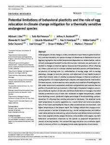
F. Terribile et al.: Potential and limitations of using soil mapping information to understand landscape hydrology
Fig. 1. Case study 1: approaches used and their main characteristics.
3.1 3.1.1
Case studies Comparative land evaluation models: from the FAO framework to simulation modelling
Land Evaluation (FAO, 1976) is defined as “the process of assessment of land performance when used for specific purposes ...”. The Land Evaluation models can be devoted to (i) agricultural and forestry productivity (land suitabilityrelated) and (ii) land use, planning and management for environmental protection (land vulnerability-related). In general Land Evaluation, normally based on morphological, (bio)physical and chemical data derived from soil survey, has been the most commonly used procedure worldwide to address local/regional/national land use planning; it works by using multi-criteria (many soil and land parameters) classification (matching tables, see Appendix C). Generally, this type of models are directly applied to soil map units then to single small and homogeneous area whose suitability or vulnerability is to be determined, without any information on spatial variability. In the current example, elaborated after the paper of Manna et al. (2009) devoted to a land evaluation exercise for maize (forage) production in a typical agro-ecosystem (2000 ha in the Lodi plain, Po valley, Italy), we will show the overall potential of applying hydropedology in hydrology using nine alternative methods (Fig. 1) at increasing level of complexity. They ranged from a simpler standard land Evaluation approach (using ALMAGRA model, De La Hydrol. Earth Syst. Sci., 15, 3895–3933, 2011
Rosa et al., 2004) to a more extensive use of Richards’ based simulation modelling (SWAP, van Dam et al., 1997 and CropSyst, St¨ockle et al., 2003). For a brief summary of the main characteristic of the applied models see Appendix C. Then we evaluated cost/benefit ratio of the different modelling approaches and then whether complex models (e.g. mechanistic simulation models) are really sustainable and appropriate for a specific landscape hydrological task. We used as data input several information reflecting the 4 schemes reported in Table 5: 1. A pre-existing 1:50 000 soil map with 22 soil units. The soil database is constituted by the only representative soil profiles data. 2. Soil database constituted by Scheme A (representative soils) and including all soil profiles and minipit described/analysed in the study area regardless of their representativeness. 3. An additional hydrology-oriented and limited field work (fine-tuning) was carried out on the only representative soil profiles and laboratory measurements of water retention (Dane and Hopmans, 2002) and saturated hydraulic conductivity (Reynolds et al., 2002) were performed. 4. A further additional intensive hydrology-oriented field work of 100 sites located after a stochastic spatial simulation annealing procedure (Aarts and Korst, 1989). www.hydrol-earth-syst-sci.net/15/3895/2011/
F. Terribile et al.: Potential and limitations of using soil mapping information to understand landscape hydrology This procedure was performed on the basis of preexisting soil map, geological data and reference soil profiles data. The corresponding data set include particle size distribution and main chemical parameters (e.g. pH, EC, OC, etc.). On 50 of these 100 supplementary sites bulk density, water retention curve (Dane and Hopmans, 2002) and saturated hydraulic conductivity (Reynolds et al., 2002) were measured. In the remaining 50 supplementary sites, water retention was estimated by the PTF of Vereecken et al. (1989) and saturated hydraulic conductivity by the HYPRES PTF (W¨osten et al., 1998). For modelling purposes, data on groundwater level (lower boundary conditions) were obtained from a monitoring site (Bonfante et al., 2010) and from the soil map report. Daily climatic data were obtained from the meteorological monitoring network of Regione Lombardia (ARPA Lombardia – http://www.arpalombardia.it). An independently estimate data set of maize green biomass was used to test the results of the different models; it was obtained from the relationship (R 2 = 0.83) between NDVI images (several 16-days based MODIS VI, 250 × 250 m; one visible and near IR QUICKBIRD, 2.4 × 2.4 m) and 10 green biomass measurements at ground (Manna et al., 2009). The comparison between the different methods is based on both cost and “predictive performance”, defined as the ability of a specific method to successfully discriminate areas with different forage maize suitability. All the output estimates of the nine methods were expressed as suitability classes with respect to the production of maize biomass. The predictive ability was derived using different statistical indexes including (i) the Pearson correlation coefficient (r) to express the degree of existence of a relationship and (ii) the relative variance (1 − Vcl /Vtot ), given from the complement to 1 of the ratio between within-class and total variance, to express the success of the classification in reducing the variance within classes. In Fig. 2a are shown these statistical indexes vs. land Evaluation methods where the higher is the value the better is the predictive performance. In Fig. 2b is given the final cost per unit area, normalized with respect to the less expensive method. Scheme A deals with the first given example of Table 5 and it shows the case of having a soil map with the only representative soil profiles data and without any additional associated data or hydropedological information to condition hydrological modelling. The outcoming results using a classical Land Evaluation approach – methods 1.1 and 1.2 – are very poor over all the Land Evaluation performance indexes, but indeed these poor results are associated to a very low budget investment (Fig. 2 and last two columns of Table 5). These findings confirm that the worldwide multicriteria FAO-like Land Evaluation approaches best perform at regional scale www.hydrol-earth-syst-sci.net/15/3895/2011/
3909
rather than the detailed scale such as our case study. Despite these results, a coarse hydrologic benefit can still be represented by the simple and low cost qualitative evaluation of some hydrologic features or processes at inventory scale. For example, a simple scheme of Land Evaluation using available data as texture, presence of impeding layers, structure, depth of the profile, morphology, etc. can indeed provide, at the inventory scale, qualitative soil suitability towards potential runoff occurrence. In Scheme A a good alternative to the classical Land Evaluation can be represented by the method 1.4. Here the only soil information is still the soil map database based on representative profiles; but we have applied a physically based model of water balance and crop yield (CropSyst, see Appendix C). In this case a quantitative estimation of potential yield is then obtained and the leap in the predictive performance is evident despite the correlation remain low (Fig. 2a). The good results of the method 1.4 may be explained by some hydropedological evidences applied in conditioning hydrological modelling. Those evidences were based on the following: (i) the rather homogeneous geomorphologic setting consisting in an alluvial plain (but still having two very distinct terracing systems) may have made the 1-D water flow assumption feasible, especially considering the absence of pedological evidences of horizontal preferential flows (e.g. no cracks, no slickensides, very limited occurrence of clay and silt coatings, etc.); (ii) the latter, coupled with no evidence of compacted soil horizons (e.g. iron pan, fragipan, etc.), enabled a more confident applicability of standard PTFs that could easily failed in presence of such features. In fact, despite many PTFs try to take into account the soil structure through the bulk density, this is very often estimated by another PTF (Rawls, 1983) and not directly measured, especially in deeper horizon where, unfortunately for the applicability of PTFs, the occurrence of compacted layers is both more frequent and more difficult to get an undisturbed soil sample. Finally, (iii) the soil map has also some information on fluctuating water table permitting a better definition of the bottom boundary condition. Therefore, in analogy to methods 1.1 and 1.2, this method can be beneficially applied also to coarse hydrology applications. For example, a rather inexpensive quantitative evaluation of some hydrologic processes at landscape scale accounting for large hydrological difference between soils (e.g. daily water storage, actual transpiration, drainage fluxes, etc.) can be easily applied, through the application of a 1-D Richards based model. The Scheme B concerns those case studies (methods) having in addition to Scheme A (soil map database including the only representative soil profile data) an associated database including all other existing soil observations. In this case no improvement was observed after applying averaging procedure (method 1.2 vs. 1.3 and method 1.4 vs. 1.5, respectively) of the soil observations (see Table 5 and Fig. 2a), in agreement with the findings of Heuvelink and Pebesma (1999) Hydrol. Earth Syst. Sci., 15, 3895–3933, 2011
3910
F. Terribile et al.: Potential and limitations of using soil mapping information to understand landscape hydrology
Fig. 2. Case study 1: performance indexes and costs of the tested LE methods in relation to the level of complexity.
concerning the importance of working on real soils and on real measured data rather than processing or averaging observations of several different soils. Scheme C concerns those case studies having the only soil map database of representative soils integrated by an additional fine tuning consisting of an extra field and laboratory work to obtain measured soil hydraulic properties. Models have been conditioned by hydropedological appraisal as reported for the Scheme A. Method 1.6, is the one showing all good performance indexes at the lowest cost (but still 19fold higher than method 1.1). Particularly, it shows a correlation twofold higher than method 1.4 (Fig. 2a) despite the two methods differ by the only hydraulic properties (measured vs. estimated by PTF). In terms of hydrologic application, we can deduce from these findings that in simulating soil water flow processes, the concept (choice) of the representative soil profile, especially if hydrologically characterized, is crucial and better performing than averaging procedure of many new soil observations. Thus, strictly speaking, this method is the lowest cost method to be chosen, producing consistent results. As expected the best prediction results were obtained after abandoning the support of the soil-mapping units, strikingly increasing the number of samplings and analyses and eventually performing geostatistical analysis (Method 1.9, Scheme D) as in the case of digital soil mapping processing (Fig. A1). Needless to say, this approach was 47 times more costly than standard Land Evaluation approaches (Fig. 2b) and poses major questions on its sustainability. Here we must emphasise that this last approach is similar to a large bulk of scientific literature (e.g. Western et al., 1999; Grayson and Bl¨oschl, 2000; Lyon et al., 2006) proving the importance of incorporating spatial variability issues in hydrological applications discharging any evaluation concerning cost benefit ratio. Summing up, comparison between the Land Evaluation (FAO) framework and mechanistic simulation modelling disproved the assumption that an increase in model mechanics and complexity always means an increase in its predictive Hydrol. Earth Syst. Sci., 15, 3895–3933, 2011
ability. Indeed, in this case study, the predictive ability evolves discontinuously with respect to model complexity. Data quality is indeed the leading parameter affecting the performance of land evaluation and also plays a major role in determining final costs. Our findings, being largely based on detailed characterization of soil hydropedological behaviour, show great potential also in other hydrological-based applications. This is the case for instance when addressing environmentally related topics (e.g. groundwater vulnerability, nitrate pollution, rainfall-runoff processes, etc.) where soil functions such as storing, filtering, transformation and interface for runoff generation are important. 3.1.2
Mapping of soil hydrological behaviour for irrigation management
One typical issue in landscape hydrology applied to agriculture is both the planning and management of irrigation at the district scale (which are typically smaller than 104 ha). This is traditionally achieved by using soil information to derive in a simplistic way the land suitability classes for irrigation (USBR, 1981 and Appendix C). The purpose of this suitability approach is to assess whether a soil has an inherent capacity to pay off both the overall investment plan of the hydraulic system for irrigation and to provide appropriate added value to farmers. A case study in Sardinia (Arangino et al., 1986) can help in appreciating this procedure. More specifically an irrigation capability class was assigned to each soil mapping unit using the soil map information. Parameters employed for performing such assignment were both qualitative (i.e. drainage class, degree of mineral weathering, risk of soil erosion, etc.) and quantitative (i.e. slope, stoniness, rockiness, clay content, salinity, carbonates, profile depth). These parameters were combined into an empirical multiparameter scheme (Appendix C) in order to produce a soil suitability map for irrigation. Then this suitability has been employed to review all areas included in the project and also to identify new areas suitable for irrigation. www.hydrol-earth-syst-sci.net/15/3895/2011/
F. Terribile et al.: Potential and limitations of using soil mapping information to understand landscape hydrology
3911
Fig. 3. Case study 2: (a) soil map and (b) hydrological functional units classified on the basis of the “functional property” d800 .
This approach is a kind of land evaluation and it has been largely employed in different parts of the world to address local/regional/national land use planning. Despite its widespread use, the scientific community has largely criticized the procedure for its qualitative and empirical basis and therefore we can consider that both disadvantages (qualitative and crude approach) and advantages (simple and lowcost qualitative evaluation of some hydrologic features or processes at inventory scale) are the same given for the case study 1.1 in Scheme A (Table 5). In order to achieve a better irrigation management and departing from this scheme, we have performed a further step taking into account the inherent soil spatial variability within each soil unit, especially of those soil properties largely influencing the soil water balance, such as water retention and hydraulic conductivity. We have applied physically based numerical models, which are known to be a valuable tool to simulate soil water flow, yielding the soil-vegetation-atmosphere water balance. In particular these algorithms, once calibrated and validated to the specific conditions of a study site, can be used to improve the efficiency of irrigation, thus contributing to the rational use of water resources (Bonfante et al., 2010). Unfortunately, the application of these models at the landscape scale is strongly limited by the availability of spatially variable information for a correct description of the soil hydraulic behaviour. By coupling pedological information, as www.hydrol-earth-syst-sci.net/15/3895/2011/
already available in a soil map, and a small number of hydrological analyses, D’Urso and Basile (1997) proposed a method to classify soils according to their hydrological behaviour in an earlier application of the Hydropedological Functional Unit concept, and falling in the case in Scheme D of Table 5. The main points of the procedure were as follows: – identification of the representative soil profile within each soil mapping unit; – additional field work on each soil horizon of the representative soil profiles for the characterization of the hydraulic properties (namely, θ (h) and k(θ ) functions) and particle-size distribution; – calibration of a specific soil unit quasi physically-based PTF (Arya and Paris, 1981), through coupling the measured hydraulic properties and the particle size distributions (Basile and D’Urso, 1997); – additional new soil observations for application of the calibrated PTFs to several points in the whole area; – definition of a specific “functional property” (i.e. d800 , the time interval between two optimal irrigation from the output of the simulation model) and application of the SWAP model (Appendix C) in all the sampled soils;
Hydrol. Earth Syst. Sci., 15, 3895–3933, 2011
3912
F. Terribile et al.: Potential and limitations of using soil mapping information to understand landscape hydrology
– aggregation and disaggregation of soil units by a new classification of soils on the basis of the “functional property” and demarcation of new units hydrologically homogeneous (HFUs). The method was developed on an 11 km2 river plain serviced by the Sinistra Sele Irrigation Consortium (southern Italy); an irrigated area where a soil map was already available (Fig. 3a). The drainage process following irrigation was simulated by SWAP a Richard’s based 1-D model (Appendix C) and the chosen output was the “functional property” d800 , defined as the number of days required to reach an average pressure head of −800 cm in the soil layer between 10 cm and 30 cm depth. The value of −800 cm is the soil pressure head at which stress starts in the chosen crop (alfalfa) and therefore the calculated “functional property” represents the optimal interval between two irrigations in the event of on demand irrigation supply. The functional property d800 ranges from a minimum of 4 to a maximum of 8 days. The soil classification map shown in Fig. 3a was modified to account for the hydrological similarities highlighted by evaluating d800 . The new classification allows production of the HFU map shown in Fig. 3b. Specifically, some soil mapping units were disaggregated; for example the soil mapping unit n. 11 (Fig. 3a) was divided in two sub areas, the lower with d800 < 5.5 with a short interval time between two irrigations appears from rather draining soils while, the upper one, close to the Sele river, was not classified (n.c.) because of the high variability at the investigation scale. Others were aggregates; for example part of the soil mapping units 10 and 6 (Fig. 3b) merged in the same HFU (d800 < 5.5). This new classification was the basis of several papers devoted to optimal water management (D’Urso and Minacapilli, 2006; Bastiaanssen et al., 2007). It is useful to emphasise that this approach shows the large flexibility in using HFUs; in fact once the procedure has been adopted to perform a specific task (in our case the d800 functional property), very little adjunctive work is needed for addressing new tasks requiring for instance new (purpose driven) functional properties and maps. 3.1.3
Flood event simulation in an ungauged basin: the contribution of soil data
In the Sangone basin (NW of Italy) the only data available refer to the meteorological and discharge time series at the closure section. This basin of about 150 km2 shows considerable pedological and hydrological complexity. It is formed by three main geomorphologic systems: mountain ridges, slopes at different gradients and aspects, and valleys. The main question we addressed is to what extent a parsimonious identification of soils (forms) can help in interpreting the hydrological complexity hidden in flood forecasting (functions). The study was performed through a comparison of the results obtained by using TOPKAPI, a physically based Hydrol. Earth Syst. Sci., 15, 3895–3933, 2011
distributed model of infiltration-runoff processes with parsimonious parameterization (see Appendix C), applying blind (i.e. without any calibration) simulations relative to two different levels of soil knowledge, namely: (i) soil characteristics retrieved after a global soil map resource, (ii) soil characteristics derived after a (parsimonious) soil survey campaign. The soils were accordingly parameterized relative to the different approaches. The approach with the most basic level of knowledge (Scheme A in Table 5) employed as dataset of soil types the FAO/UNESCO Soil Map of the World. This dataset was developed under the SOTER Programme and the old FAO legend was replaced by the update World Reference Base for Soil Resources (WRB, 2006). This dataset includes 106 soil units of which four are in the study area, based on Zobler’s assessment of the FAO/UNESCO Soil Map of the World. Soil properties such as soil depth and saturated hydraulic conductivity are derived for each soil type from the FAO-UNESCO soil classification. The soil hydraulic properties, i.e. water retention and unsaturated hydraulic conductivity, represented by van Genuchten’s – Mualem formulas (van Genuchten, 1980) are estimated by PTF. This dataset clearly has the limitation of a coarse resolution and of qualitative information on the soil characteristics. However, it is representative of the minimum level of knowledge available for the implementation of a hydrological model. Moreover, the dataset was also used in several applications (Doll et al., 2003; Liu et al., 2008) where other (local) sources of data were not available. The second approach (soil hydrology driven) having a higher demanding level of knowledge (Scheme C in Table 5) consisted of the following main steps: 1. A preliminary study of pre-existing available information (soil use map, 1:250 000 soil map, 1:50 000 soil map available for the only lower plain area, 1:50 000 geological map, 1:10 000 DTM). 2. A synopsis and definition of preliminary soil mapping units obtained, along with standard thematic layers (e.g. geology, land use, etc.), using some environmental covariates data. They resulted, from a pedological viewpoint, very useful for describing the specific soil distribution of the study area. Between them, we include a fuzzy c-means clustering to classify the DEM (de Bruin and Stein, 1998), and a study of vegetation by analysing the NDVI (Normalized Difference Vegetation Index) using Landsat and Modis images (Rouse et al., 1973; Tucker and Sellers, 1986; Wang et al., 2004). 3. A soil survey mainly limited to describe and to sample supposedly “representative soil profiles” inside each identified preliminary soil mapping unit (about 50 soil profiles and 50 minipits). The choice of representative soils is indeed crucial (and questionable) in this procedure; but at the present day we do not think that there are www.hydrol-earth-syst-sci.net/15/3895/2011/
F. Terribile et al.: Potential and limitations of using soil mapping information to understand landscape hydrology better “sustainable” options to the use of a traditional pedological understanding (CLORPT). 4. Soil chemical analysis on about 220 soil samples (pH in H2 O, pH in KCl, pH in NaF, EC, OC, CEC, EB, and then Fe, Al and Si extracted in oxalate at pH = 3). 5. A synopsis of all acquired data and definition of a schematic soil map having 19 soil mapping units. It must be emphasised that this soil map produced from point 1 to 5 is named “schematic” because has much less soil observations (and then lower costs) than those required by standard soil maps (Appendix A). Points 1 to 5 refer to the specific contribution of pedology to discriminate the forms (Lin et al., 2008) of the area. 6. The use of TOPKAPI model (as many other hydrological models) for an application in PUB where nor observed neither gauged internal data are available in order to simplify the input dataset and then to aggregate the 19 soil mapping units into a fewer number mapping units. This point is crucial both from an hydrological point of view since it requires the use of parsimonious but efficient models and from an hydropedological point of view because it requires an aggregation of mapping units having, potentially, a similar hydrological behaviour. This has been performed using the hydropedological reasoning given in Table 4. Therefore the original 19 soil mapping units were aggregated to form 8 mapping units named here as “soillandscape” units, because strongly based on the landscape features (Table 6). For instance this has been the case for four soil mapping units referring to “ancient fluvio-glacial deposits, erosional slope of river terrace, moraine steep slope, moraine crest” aggregated into the new soil-landscape mapping unit “ancient fluvioglacial deposits”. In this case aggregation was ruled by the occurrence of a flow impeding soil layer (fragipan horizon) at shallow depth in very deep soils. Then in this soil-landscape unit the soil water balance is mainly driven by this fragipan horizon rather than soil hydrological properties and/or soil depth. 7. Determination of soil hydraulic properties at the eight soil-landscape units. In some stony soils and thin horizons, water retention and hydraulic conductivity curves were determined through an inverse method following a process of infiltration at predefined pressure ˇ heads (Simunek et al., 1998). Undisturbed soil samples were analysed in the laboratory by applying the fallow head method (Reynolds et al., 2002) for the saturated hydraulic conductivity, Wind’s method (Arya, 2002) for the unsaturated hydraulic conductivity and the wet branch of the soil water retention curve, and the WP4-T method (Bittelli and Flury, 2009) for the dry branch of www.hydrol-earth-syst-sci.net/15/3895/2011/
3913
the soil water retention curve. Data were parameterized according to the constitutive functional relationships of the TOPKAPI model. 8. TOPKAPI model requires a single set of parameters for each soil profile, assuming a substantial homogeneity along the soil profile. The consequent problem of identifying an effective set of hydraulic properties for an equivalent fictitious single-layered soil profile, giving the same hydrological response as the real layered soil, was solved as follow: for each soil profile a 1-D simulation by means of Richards’-based Hydrus model ˇ (Simnek et al., 2008; see also Appendix C) was performed describing the profile according to the genetic horizons each one with own measured hydraulic properties (point 7). Then an inverse estimation procedure was applied assuming the profile as just one single horizon; the mean of each parameter along the profile was assumed as initial estimate and the water storage, W (t), coming out from the multilayer simulation was used as “measured” hydrological response to be matched by the one-layer simulation. Under the same boundary conditions the equivalent homogeneous medium will have the same amount of stored water as the heterogeneous one. It follows then the hydraulic functions obtained for this equivalent homogeneous medium are the effective hydraulic functions of the heterogeneous medium. This approach has been largely adopted in the literature (among others: Yeh, 1989; Jhorar et al., 2004). In the Fig. 4a and b the results of the comparison of the simulations of the FAO soil map against those referring to the soil-landscape units are shown. As can be easily seen, simulation from the first approach using the FAO soil map reproduces none of the important features of the hydrograph such as peak flow, the rising and recession limb. Differently, simulation from the second approach, which exploits the soil data collected in the field and the classification, is able to reproduce such features. The importance of the soil properties, which most affect the simulation performance, can also be recognized. The peak of the discharge is meaningful of the runoff mechanism. In the first parameter set, the soil is shallow and with low permeability. The runoff volume is then overestimated because the soil capacity is exceeded in much of the catchment and the volume infiltrated into the soil is very low. In the second parameter set, the soil distribution is more accurate, enabling a distinction to be made between the hillslope, with a shallow soil, and the valley, with deep, permeable soils. The peak flow is correctly estimated, which means that also the runoff mechanism is captured. The recession limb of the hydrograph is strongly connected with the baseflow. In the first approach the baseflow is underestimated since the transmissivity of the soils, especially those beside the river, is not correctly parameterized. In the second approach the slope of the hydrograph is very similar to that observed. An important role here is played Hydrol. Earth Syst. Sci., 15, 3895–3933, 2011
F. Terribile et al.: Potential and limitations of using soil mapping information to understand landscape hydrology 3914
Mountain ridges, intermediate shelves, summit bared areas, moraines (ridge of morphogenized body).
Original Soil Mapping Units
1. moderate water storage capability 2. slope south aspect 3. fast drainage
1. very low water storage capability 2. convex areas with upland orographic boundaries 3. fast drainage
Rationale (mainly hydropedological) behind Soil Mapping Units aggregation
South-facing mountain slopes, with convex or straight (shoulder) slopes (15◦ –35◦ ), elevation: 500–2000 m. Soils are moderately deep (140–180 cm) with common coarse fragments (5–15 %) and strong granular structure. Topsoil organic matter content: 3–12 %; pH: 4.2–4.7; sandy loam and silt loam texture.
Mountainous areas of orographic culmination with a convex shape. Soils are thin (25 to 45 cm) with frequent coarse fragments (30–35 %) with strong granular structure. Topsoil organic matter content: 6–9 %; pH: 4.3–4.5, silt loam and loamy sand.
Soil-landscape description of the aggregated soil mapping units
Moderate soil depth 140–180 cm; common coarse fragment: 5–15 %
Soil depth: 25–45 cm; frequent coarse fragments: 30–35 %;
Pedological features affecting hydrological properties
South-facing slopes
Mountain ridges
New aggregated Soil Mapping Units
Table 6. Hydrological rationale used in soil map units aggregation for the case study 3.
South-facing slopes, intermediate shelves, south-facing moraine deposits.
North-facing slopes
South-facing concave slopes
Deep soils (250–500 cm); coarse fragments: 10–20 %; low andic properties (Alo + 0.5 Feo %: 0.36–0.42)
Summit bared areas
South-facing mountain slopes having concave shaped slopes (15◦ –30◦ ); elevation 500–2000 m. Soils are deep (250–500 cm) with frequent coarse fragments (15–20 %) and strong granular structure. Topsoil organic matter content: 5–10 %; pH: 4.3–5.3; silt loam texture.
Rocks at the surface with only few very thin soils (