Mediating geovisualization to potential users and prototyping a geovisualization application David Lloyd1, Jason Dykes1, Robert Radburn2 1
School of Informatics, Room A520, City University, Northampton Square, London, EC1V 0HB Telephone: +44 (0)20 7040 0212, Fax: +44 (0)20 7040 8584 Email:
[email protected], Web: www.soi.city.ac.uk/~at775 Policy, Research & Information, Chief Executive‟s Department, Leicestershire County Council, County Hall, Glenfield, Leicestershire, LE3 8RA 2
KEYWORDS: geovisualization, card sort, user-sketching, prototyping, crime and disorder reduction 1. Introduction After establishing user requirements (Lloyd, Dykes, Radburn, 2007) human centred techniques can be used to progressively prototype geovisualization applications. User evaluation has been limited in visualization (Ellis and Dix, 2006) and a handful of studies focus on geovisualization users at the design stages (e.g. Ahonen-Rainio and Kraak, 2005). This paper outlines work to mediate geovisualization tools/interactions to potential users and shows how HCI prototyping techniques can aid the development of a geovisualization application. Our case study involving the crime reduction researchers in Leicestershire County Council (LCC) gives insight into which prototyping techniques work and which need modifying because of the unique characteristics of using interactive computer maps as interfaces to information exploration.
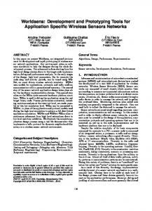
2. Approach 2.1 Mediating geovisualization to potential users Card sorting and user sketching are techniques that can be deployed for establishing user insight into design ideas (Faiks and Hyland, 2000; Tohidi el, 2006). We tested these HCI techniques in a geovisualization context by providing potential users (“users”) with a tutorial on candidate geovisualization tools and interactions. The material was selected from the literature given the divergence in suggestions made during interviews with geovisualization experts (Lloyd, Dykes, Radburn, 2007). 2.1.1 Card sorting Card sorting is frequently used at the beginning of the prototyping process to “discover users‟ mental model of an information space” (Nielsen and Sano, 1995). The technique was evaluated to investigate three factors. Firstly, to identify plausible crime research tasks the users might perform with geovisualization, grouping these according to the users‟ notions of similarity to identify those of greatest importance. Results were consolidated and used as the basis for specific crime tasks in the sketching exercise (see 2.1.2). Secondly, to identify how well potentially useful geovisualization techniques could be elicited. Users grouped the tutorial techniques according to their helpfulness in exploratory research. Thirdly, to understand how well card sorting could establish the extent of user engagement and understanding of geovisualization (Stein, Baxter and Leinhardt, 1990). The users were asked to sort the geovisualization techniques freely (Figure 1). The results were analysed through hierarchical clustering (Dong, Martin & Waldo, 2001).
Figure 1. Free card-sorting of geovisualization tools and interactions 2.1.2 Sketching Enabling users to sketch their ideas can facilitate reflection and encourage deeper interpretation and analysis in human-centred design (Tohidi et al., 2006). To test this HCI approach in the context of geovisualization, users were asked to sketch ideas for specific crime tasks identified from the first card sort (Figure 2). Seven sketches were produced by three people in 30 minutes. The number of elements in each design corresponding to the tutorial was counted. A count was also made of elements not included in the tutorial, and the results analysed by crime task. The sketching counts results and hierarchical card sort analysis were synthesized to quantify the results derived from these methods.
Figure 2. User in course of sketching a “Fear of crime” application
2.2 Low-level prototyping Low-level prototypes are useful in human-centred design as they are simple, cheap and quick to produce (Preece, Rogers, Sharp, 2002) and help with mediation between user and developer. Various techniques exist and were selected according to audience, stage of development, speed, longevity, expression, style, medium and fidelity (Arnowitz, Argent, Berger, 2007). Wireframe prototyping (Tullis, 1998), paper prototyping (Rettig, 1994) and digital interactive prototyping (Arnowitz, Argent, Berger, 2007) are appropriate low-level prototyping techniques to test in a geovisualization context in the early stages of development.
2.2.1 Wireframe prototyping Two outline designs for a geovisualization application were developed from the mediation exercises and from our user understanding (Lloyd, Dykes, Radburn, 2007). These were shown to users in the form of wireframe prototypes that explored subjective reactions (Tullis, 1998). Wireframe prototypes are “intended to provide an early approximation to a software idea” (Arnowitz, Argent, Berger, 2007). The wireframes were created quickly and with minimum resources using office software and dummy data (Figure 3). Individual interviews were conducted where the wireframes‟ scope, structure, layout and interactions were explained. A “think aloud” protocol (van Someren et al., 1994) was employed with pre-generated questions to prompt user responses about the designs, their relevance and potential. Sessions were audio recorded for later transcription and analysis. Each user was asked which of the two wireframes was preferred, and that shown in Figure 3 was favoured by the majority.
Figure 3. The wireframe prototype of the chosen application design combining thematic map, crime treemap and temporal glyphs
2.2.2 Paper and Digital Interactive prototyping Typically, a more realistic prototype is developed from a wireframe before committing resource and emotion to writing code (Cohen et al, 2004). We used two prototyping approaches to compare their performance in the geovisualization context. Both used paper to emphasize the prototypical nature of the applications, one consisting of pre-printed maps, graphics and input sheet – the “paper prototype” (Figure 4). The other used a paper input sheet to control a screen with a far wider selection of digital maps – the “digital interactive prototype” (Figure 5). Both methods involve users performing real tasks with a rudimentary interface. A paper prototype (Rettig, 1994) is manipulated by someone „playing computer‟ (Snyder, 2003). A digital interactive prototype is “similar to a paper prototype ... [that] can range from a more narrative style…to a fully interactive high fidelity coded prototype” (Arnowitz, Arent, Berger, 2007). With paper prototyping, “complex or subtle interaction usually can‟t be simulated perfectly” (Snyder, 2003), but the technique does have the potential to show a range of functionality – for example, our paper prototype included a treemap that could not be included in the digital interactive prototype within the same development time. Our experience with the wireframes indicated that real data must be used in these low fidelity/low cost prototypes and indicated the importance of short but realistic tasks. Both prototypes used a six year data series from an LCC database containing 42,000 crimes for a 5km square urban area, but employed different high-volume crime types to avoid a learning effect (“Assault” for paper; “All Other Theft” for the digital interactive prototype). Approximately the same amount of time was taken to develop both prototypes.
Figure 4. Paper prototype during user testing showing (left to right) treemap with temporal glyphs, thematic map with temporal glyphs and the input sheet for user interface
Both prototypes were tested on individual LCC researchers to explore the functionality/flexibility trade-off when comparing paper and digital prototyping. Sessions lasted 1½-2 hours to avoid overtiring users, with prototype order randomised. Task order was consistent with successive tasks increasing in complexity; tasks followed the taxonomy of Koua, MacEachren and Kraak (2006). Users were asked to “think aloud” during tasks (van Someren, Barnard, and Sandberg, 1994; Marsh, Dykes, and Attilakou, 2006) and were questioned after each task to determine both the extent of their ideation and their experiences of working with the prototype. Tasks were audio recorded and transcribed, the text coded and conceptualised using qualitative data analysis software (Muhr, 2004) to identify usability issues, evidence of how the prototypes performed in a geovisualization context and draw comparisons between them.
Figure 5. Digital interactive prototype showing thematic map and temporal glyphs during potential user testing. The paper input sheet is not shown. Note the absence of treemaps. 3. Findings 3.1 Card sorting Card sorting successfully identified crime task clusters that formed the basis of user sketching and for advancing the application design. Where users sorted geovisualization techniques by usefulness in crime data exploration, the three users found 23, 27 and 29 (out of 29) “most helpful”. This – plus user comment during the card sort - suggests the tutorial did not give users sufficient understanding to apply geovisualization techniques effectively to their exploratory work. However the card sort successfully identified this issue. The “free” card sort of geovisualization techniques produced a subjectively logical, high-level classification using hierarchical cluster analysis indicating that users had grasped a wider geovisualization tool/interaction taxonomy. Clusters corresponded to “mapping tools” (11 tools/interactions in cluster), “advanced/new data analysis” (9), “established data analysis” (5) and “interactions” (4).
3.2 Sketching Seven user sketches of three crime tasks produced 78 elements of which 30 were from the 29 tools/interactions of the geovisualization tutorial. Of these, an average 6.3 elements were found on “night-time economy” sketches compared to 3.5 and 2.0 on sketches relating to other crimes indicating that “night-time economy” represented a good candidate task for a geovisualization application. Ten of the 29 geovisualization techniques were absent from user sketches, eleven were used once and six were mentioned twice. “Star plot/glyph” appeared three times; “line graphs” four times. Sketching appears to be a useful and quick way to determine potentially acceptable techniques with users. Synthesising the results of the high level geovisualization tool/interaction clustering with the element count in user sketching yielded an average element count of 1.50 (interactions); 1.4 (established data analysis); 1.22 (advanced/new data analysis) and 0.55 (mapping tools). The relatively low number for “mapping tools” indicates the importance of non-spatial tools to these users currently. 3.3 Wireframes Design was strongly led by data considerations and during the prototyping, users expected to see patterns that they knew existed in the data. They were puzzled by their absence in the wireframe prototypes and generally did not engage with them until the “discrepancies” had been resolved. A key finding therefore is that the use of real user data is important to attract user engagement in geovisualization prototyping. The complex graphically dense nature of geovisualization interfaces meant that even the data-free wireframes took a significant amount of time to construct in office software. The wireframes contained many individual elements and envisaged interactions and coordinated multiple views. It was time-consuming to explain these possibilities to users. It is possible that along with the “finished” look of the wireframe, this might have inhibited user criticism. 3.4 Paper and Digital Interactive prototyping In both cases users formed hypotheses based on the information in the underlying map image. Users had strong expectations about the patterns they observed in the prototypes and the importance of real data was reinforced many times. Because of the use of real data in the paper prototype, it did not have the flexibility associated with the medium – certainly new, realistic “screens” could not be generated “on the fly” and this limited exploration. The intense engagement of users with both prototypes, their willingness to hypothesise about cause and effect, and the ideation that occurred throughout the prototyping sessions were striking. This contrasted significantly with the data-free wireframing. Constraints on the ability to show interactivity across multiple views with the paper and digital interactive prototypes limit the applicability of results to date to geovisualization. This key aspect of the prototyping process will be addressed when a fully coded prototype is specified, built and tested on users and results compared. Work to date is based upon a case study of a small numbers of users in one domain. The work will be repeated in another domain to draw comparisons between the two cases and to determine whether findings can be generalized.
4. Conclusions This paper details the use of human-centred prototyping techniques to progress the development of a geovisualization application and will be of use to those in the geovisualization community who seek ways in which to create applications that meet the needs of real users. We found card sorting to be a useful technique for task specification and the verification of task credibility, but less effective for establishing user understanding in the context of a multifaceted
subject such as geovisualization. The task of mediation between geovisualization expert and domain expert is relatively difficult (Lloyd, Dykes, Radburn, 2007) and so card sorting and sketching may be beneficial. The positive results from employing a user-centred perspective include high levels of user engagement and evidence of ideation. Our experience suggests that prototyping is a route that geovisualizers could employ successfully to build applications fitted to user needs. It is important to use real data with which expert users are familiar in geovisualization prototyping, both to gain engagement with users, and to help them learn about the nature of geovisualization (exploration and ideation) and geovisualization techniques. The use of paper and digital interactive prototypes with real data seems to help overcome the knowledge gap identified above and to develop and establish user understanding of geovisualization techniques. However, the development of sophisticated prototypes contradicts many of the objectives of low-fidelity prototyping such as speed of deployment, low cost, short longevity, and low fidelity (Arnowitz, Arent, Berger, 2007). Digital interactive prototypes that use high level scripting techniques to provide access to real data may offer a solution in the context of geovisualization and play an important role in the process of human-centred geovisualization design. We may infer that human-centred geovisualization design should expect less of users and developers at the outset than is the case in other forms of human-centred design and rely upon low-level digital prototyping to develop applications and mutual understanding. Equally, we should not underestimate the importance of developing relationships between geovisualization experts and domain experts. In our experience, a series of human-centered activities has developed knowledge and trust in all parties and resulted in much reflection that will have a positive impact upon practice.
5. Acknowledgements This work is supported by EPRSC and Leicestershire County Council through industrial CASE award EP/C547438/1. The help and cooperation of the Crime and Disorder Reduction Team at LCC is acknowledged with gratitude.
References Ahonen-Rainio P and Kraak M-J (2005) Deciding on Fitness for Use: Evaluating the Utility of Sample Maps as an Element of Geospatial Metadata Cartography and Geographic Information Science 32(2) pp101-12. Arnowitz J, Arent M and Berger N (2006) Effective Prototyping for Software Makers. Morgan Kaufmann, San Francisco. Cohen CF, Birkin SJ, Garfield MJ and Webb HW (2004), Managing conflict in software testing Communications of the ACM, 47(1) pp76-81. Dong J, Martin S & Waldo P (2001) A user input and analysis tool for information architecture paper presented to Conference on Human Factors in Computing Systems (CHI 2001) Seattle, WA, USA. Ellis G and Dix A (2006) An explorative analysis of user evaluation studies in information visualisation paper presented to Beyond Time and Errors: Novel Evaluation Methods For Information Visualization (BELIV '06), Venice, Italy. Faiks A and Hyland N (2000)'Gaining user insight: a case study illustrating the card sort technique College & Research Libraries 61 pp349-57. Koua EL, MacEachren A and Kraak M-J (2006) Evaluating the usability of visualization methods in an exploratory geovisualization environment International Journal of Geographical Information Science 2(4) pp425-48.
Lloyd D, Dykes J and Radburn R (2007) Understanding geovisualization users and their requirements – a user-centred approach paper presented to GIS Research UK 15th Annual Conference, National Center for Geocomputation (NCG), Maynooth, Ireland. Marsh SL, Dykes J and Attilakou F (2006) Evaluating a Geovisualization Prototype with Two approaches: Remote Instructional vs. Face-to-Face Exploratory, paper presented to Information Visualization 2006, London, England. Muhr T (2004) User's Manual for ATLAS.ti 5.0 ATLAS.ti Scientific Software Development GmbH, Berlin. Nielsen J and Sano D (1995) SunWeb: user interface design for Sun Microsystem's internal Web Computer Networks and ISDN Systems 28(1-2) pp179-88. Preece J, Rogers Y and Sharp H (2002) Interaction Design: beyond human-computer interaction, Wiley, Chichester. Rettig M (1994) Prototyping for tiny fingers Communications of the ACM 37(4) pp21-7. Snyder C (2003) Paper Prototyping: The Fast and Easy Way to Design and Refine User Interfaces. Morgan Kaufmann, San Francisco. Stein MK, Baxter JA and Leinhardt G (1990) Subject-Matter Knowledge and Elementary Instruction: A Case from Functions and Graphing American Educational Research Journal 27(4) pp639-63. Tohidi M, Buxton W, Baecker R and Sellen A (2006) User sketches: a quick, inexpensive, and effective way to elicit more reflective user feedback, paper presented to 4th Nordic conference on Human-computer interaction: changing roles, Oslo, Norway. Tullis T (1998) A method for evaluating Web page design concepts, paper presented to Human Factors in Computing Systems CHI 98, Los Angeles, CA, USA. van Someren MW, Barnard YF and Sandberg JAC (1994), The Think Aloud Method: A Practical Guide to Modelling Cognitive Processes. Academic Press, London.
Biography David Lloyd is a third year PhD student researching the use of human-centred techniques in geovisualization at City University London in collaboration with Leicestershire County Council. Jason Dykes is a Senior Lecturer in Geographic Information at City University London with interests in geovisualization. He is co-chair of the ICA Commission on Geovisualization, has developed a number of geovisualization software applications and is co-editor of Exploring Geovisualization Dykes, MacEachren and Kraak (2005). Robert Radburn is a Senior Research Officer at Leicestershire County Council working with a variety of partners and agencies to support evidence-based policy. He is a champion of the use of information visualization and geovisualization techniques to inform service delivery within regional and local authorities.