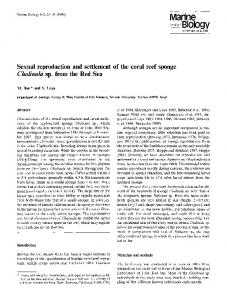
Coral Reefs (2002) 21:43–48 DOI 10.1007/s00338-001-0199-0
R EP O RT
S. Andre´foue¨t Æ P.J. Mumby Æ M. McField C. Hu Æ F.E. Muller-Karger
Revisiting coral reef connectivity
Received: 30 January 2001 / Accepted: 5 July 2001 / Published online: 2 February 2002 Ó Springer-Verlag 2002
Abstract A large river plume generated by anomalous precipitation and oceanic circulation associated with Hurricane Mitch was detected off Honduras in October 1998 using SeaWiFS ocean color images. This event provides the background for analyzing connectivity between coral reefs and land in the Meso-American reef system. We discuss the potential implications of such short-term events for disease propagation and nutrification, and their potential significance in evolutionary processes. Keywords SeaWiFS Æ Disease Æ Phase-shift Æ Meso-American reef system Æ Remote sensing Æ River plume
Introduction The management of coral reef environments, including reef-building and non-reef-building communities (Kleypas et al. 2001), would benefit from greater understanding of the degree of connectivity (or the physical links) between coral reefs or between land and reefs that may exist through the movement of water masses. Such understanding may come through the application of new technologies that help quantify the high temporal and spatial variability that characterizes these environments, and which is needed to design and apply spatially explicit models of coral reef processes (Mumby 1999a).
S. Andre´foue¨t (&) Æ M. McField Æ C. Hu Æ F.E. Muller-Karger University of South Florida, College of Marine Science, 140 Av. South, St. Petersburg, Florida 33701, USA E-mail:
[email protected] Tel.: +1-727-5531186 Fax: +1-727-5531103 P.J. Mumby Department of Marine Sciences and Coastal Management, Centre for Tropical Coastal Management Studies, Ridley Building, University of Newcastle upon Tyne, NE1 7RU, UK
Observations from space-borne sensors have improved spatial information on natural processes. They also provide information on short-term events that are difficult to investigate in situ in real time for logistical reasons. Short-term events can be recurrent and sometimes even predictable (e.g. seasonal river floods during the rainy season), but they may also be catastrophic and unpredictable (e.g. river floods following a hurricane). To date, patterns of coral reef connectivity have been deduced from few observations of oceanic circulation patterns collected over many years to decades (e.g. Roberts 1997), and therefore they do not represent coastal processes well (Cappo and Kelley 2001). Moreover, such studies are generally inadequate to describe the occurrence and variability of short-term climatic events. It is in this area that new observation technologies, including those deployed in space, can provide substantial new insight. The relatively recent availability of ‘‘operational’’ satellite ocean color data provides a unique data set that helps explore spatial and temporal patterns of connectivity between reefs as well as between reefs and land. Historically, coral reef scientists have neglected satellite ocean color data, but a few key publications demonstrate the utility of these data. Using the Coastal Zone Color Scanner (CZCS) sensor aboard the Nimbus-7 satellite, Hallock et al. (1993) concluded that Caribbean Sea coral reefs could be influenced by terrestrial runoff carried within the voluminous Amazon and Orinoco river plumes. Gabric et al. (1990) examined the surface chlorophyll distribution in the Great Barrier Reef (GBR) with CZCS imagery; the connectivity patterns they inferred were confirmed later by Wolanski and Spagnol (2000) using numerical models and in-situ measurements. In this paper, we suggest that pathways for pollutants, pathogens, and larvae within and among coral reef provinces can be inferred or substantiated more realistically using satellite ocean color observations. Such data are particularly useful to assess shortterm critical periods (events). To illustrate the use of such observations, we present a time-series of images
44
acquired with the Sea-viewing Wide Field-of-view Sensor (SeaWiFS; Hooker and Esaias 1993) after the landfall of Hurricane Mitch on the Honduras coast in late October 1998. The time series revealed unsuspected patterns of connectivity along the Meso-American barrier Reef System (MARS). We discuss the implications for transboundary scientific and management aspects.
Material and methods Study area The Meso-American barrier reef system extends over 1,000 km (Fig. 1). It includes Mexican reefs (fringing reefs along the Yucatan coast and Cozumel Island, and Chinchorro Bank atoll), Belizean reefs (three atolls, a large barrier reef, and fringing and rhomboidshaped reefs in the south), and Honduran structures (fringing reefs around the Bay Islands and carbonate islands). Guatemala does not have significant reefs. The three Belizean atolls have been assumed to be outside the general influence of terrestrial runoff. Glovers Reef, the southernmost atoll, is located more than 40 km from the Belize coast and approximately 100 km from the Honduras/ Guatemala coasts. Glovers Reef has been used as a ‘‘control site,’’ based on the assumption that it is ‘‘free’’ of effects from anthropogenic and terrestrial pollutants. For instance, Wilkinson (1987) related sponge biomass to terrestrial runoff on a transect across the Belize barrier reef, and Glovers Reef was used as the ‘‘lowest influence’’ site even though it was found to have an unexpectedly high biomass of sponges. McClanahan and Muthiga (1998) explicitly considered Glovers to lie beyond terrigeneous influence.
c
Fig. 2. Patterns of water quality off the Meso-American barrier reef system as seen in processed SeaWiFS data. The data were used to define spatial patterns described by turbid water plumes. Blue colors indicate clearer water, and green, yellow, orange, and red show increasing turbidity. Regions with no data (land, clouds) were colored black. A Typical dry season conditions: clear ocean and small zones of turbidity near the river mouths. B Last cloud-free SeaWiFS image before Mitch landfall showing typical rainy season conditions (see also part L) with turbid fringing coastal waters and clear ocean waters offshore. C First cloud-free image 3 days after landfall showing a massive plume that covered most of the Bay Islands and reached 18°N, or 200 km from its point of origin. D The plume followed a northwest direction towards 19°N while coastal waters drifted to the north toward Glovers atoll (see also Fig. 3A). E The plume dissipated by dilution. The turbid water front was close to Glovers atoll, where it appeared to remain for a week (see also Fig. 3B). The Bay Islands lie at the edge between the turbid and clear waters. F A new plume appeared after another rainy period. This plume probably carried substantial detritus generated by Mitch on land and that had not washed out previously. G The new plume stopped propagating south of 18°N and was trapped in an eddy. Turbid waters reached Glovers, but not Roatan, Lighthouse and Turneffe atolls. H One day later, Glovers was bathed by turbid waters (see also Fig. 3C). I After 15 November, the area was cloudy but a composite of five images (26 Nov to 3 Dec) illustrates the dilution of the second plume and isolation of the Bay Islands from the influence of the most turbid waters. J The situation returned close to normal, i.e. clear waters around all the islands, but still very turbid coastal waters, probably due to resuspended materials, are observed. K Rain stimulated coastal turbidity and small plumes reached the Bay Islands (see Fig. 3D). L After the 1999 dry season, the situation was back to normal
Ocean color data processing Multispectral ocean color observations are now routinely used to estimate concentration of colored materials suspended near the
Fig. 1. Map of the Meso-American barrier Reef System (MARS). Main reef formations are shown in green, and lake and coastal ponds in light blue. Locations of the major rivers of the region are indicated
surface of the ocean. They are also of great value in following the dispersal of riverine waters (Muller-Karger et al. 1988). Pigment concentrations can be measured by ocean color sensors such as the coastal zone color scanner (CZCS, 1978–1986), the SeaWiFS (launched in August 1997), and the MODerate resolution Imaging Spectroradiometer (MODIS, launched December 1999). SeaWiFS images over the Caribbean can be collected using a high-resolution picture transmission (HRPT) antenna located in St. Petersburg, Florida. Theoretically, 396 images are available for the period of our time-series, from 1 January 1998 to 31 January 1999. However, because of the tilting procedure of the SeaWiFS sensor over tropical areas to avoid sun-glint, cloud cover over our region of interest, and minor interruptions due to technical problems with the spacecraft, only 23 useful images of Glovers Atoll and the Belize Reef system are available for this period. We sought to examine short-term patterns of variability in water quality on a daily scale during the passage of Hurricane Mitch, and therefore refrained from binning the data temporally (to create cloud-free images on a weekly time-scale for example). Each image was processed for cloud masking and bio-optical products using the SeaWiFS processing package distributed by NASA (SeaDAS V3.2), where chlorophyll-a concentration was estimated using the OC2 algorithm of O’Reilly et al. (1998). Chlorophyll-a concentration is likely overestimated in this coastal zone because of elevated concentrations of terrestrial particulate matter and colored dissolved organic matter (CDOM) transported by the rivers or resuspended nearshore sediments (International Ocean Color Coordinating Group 2000). Our objective is to use the water colored by chlorophyll, CDOM, and suspended matter as a tracer of spatial patterns of variation, not to quantitatively estimate chlorophyll-a in these so-called case II waters (Carder et al. 1999; Hu et al. 2000; International Ocean Color Coordinating Group 2000). Further, we define as a water quality index the variable ‘‘OC2 pigment’’ instead of using the term chlorophyll. Finally, the CZCS data between 1978 and 1986, which have been processed for the Caribbean (Muller-Karger et al. 1989, 1991;
45
Muller-Karger and Castro 1994) and archived at the University of South Florida, were re-inspected to determine the frequency with which large river plumes were previously observed in the western Caribbean Sea.
Results In late October 1998, Hurricane Mitch reached the Caribbean coast of Honduras as a category 5 storm, causing severe loss of property and human life as a result
of massive rainfall and flooding (Hellin et al. 1999). After the hurricane, residents and scientists at Glovers Reef noted a decline in water quality (increase in turbidity) and initially attributed this event to storm-induced local upwelling along the atoll slopes and resuspension of sediments associated directly with the atoll. However, the sequence of SeaWiFS images revealed that local reductions in water quality at Glovers Reef were actually due to flood water draining from the land and to plumes of resuspended sediments emanating
46
from the coast of Honduras (Figs. 2 and 3). The very high concentrations of ‘‘pigments’’ observed were mostly associated with a massive turbid plume that formed as the discharge from the Sico, Paulaya, Platano, and Patuca Rivers in Honduras merged with each other and extended offshore (Fig. 2C). Turbid waters from the Honduras/Guatemala coastline reached the Bay Islands in less than 1 day (Fig. 2D) and Belize’s offshore atolls in about 5 days (Fig. 3A–C). The plume extended more than 300 km towards Chinchorro Bank (Fig. 2D). All the islands experienced high sediment and turbid water for 2 weeks (1–15 November 1998; Figs. 2C–H and 3A, B). Turbid waters persisted in the Bay Islands for at least 6 weeks (Figs. 2K and 3D). The scale of the hurricane-induced flooding provides a clear demonstration that terrestrial runoff can reach the offshore coral reefs of the Meso-American Reef System. No other SeaWiFS images prior to Hurricane Mitch (the sensor was launched in August 1997), nor after Mitch to date, exhibited the patterns observed in the days following the hurricane. However, the CZCS time series of monthly mean pigment concentrations collected nearly 20 years earlier showed a large plume extending off Honduras in October 1979, and a plume reaching Lighthouse atoll in December 1981. These data suggest that atolls and inshore reefs of this region have Fig. 3. Patterns of turbidity around Belize atolls. Panel shows the Belize atolls and Honduran Bay Islands for selected instances of the timeseries presented in Fig. 2. The turbid water front is highlighted by arrows. Between A and C, the front of turbid waters is at the same distance from Glovers, suggesting that the atolls were affected by runoff associated with Mitch. In C, Glovers is clearly under the influence of a second plume. In D, clear oceanic waters return to the area, but Bay Island reefs are still affected by small plumes
been periodically influenced by continental runoff in the form of fresh-water pulses lasting 2–4 weeks during the rainy seasons. The CZCS data also show that such plumes are not necessarily associated with hurricanes. None of the recent circulation and river studies in this area (Heyman and Kjerfve 1999; Murphy and Hurlburt 1999; Andrade and Barton 2000) describe such plumes nor the dynamics that may lead to such massive offshore flooding as that generated by Mitch. The satellite observations are unequivocal and less ambiguous than traditional circulation studies, which generally focus on oceanic waters and poorly describe coastal–oceanic exchange, especially during short-term climatic events.
Discussion Understanding the connectivity of coastal areas is fundamental to managing marine biodiversity and resources (Ogden 1997; Roberts 1997). Sediment loading and nutrification leading to changes in community structure (phase shifts) have been recognized as a major threat to coral ecosystems (Rogers 1990; McCook 1999). Innovative research on larval connectivity between coral reefs suggests that fish and coral populations may be less spatially connected than previously thought (Jones et al.
47
1999; Swearer et al. 1999; Ayre and Hughes 2000). Finally, the spreading of lethal pathogens throughout coral reef regions has been increasingly reported (Lessios et al. 1984; Geiser et al. 1998; Richardson 1998; Harvell et al. 1999). We discuss nutrification, gene flow, and disease in the light of the discovery of the fresh-water plumes that sporadically affect the Meso-American coral reefs. A change in domination from corals to macroalgae within lagoonal patch reefs at Glovers Reef and Bay Islands occurred between 1970 and 1997 (McClanahan and Muthiga 1998; Ogden and Ogden 1998). Nutrification may lead to such changes (McCook 1999), but the nutrient enrichment hypothesis was rejected for the Glovers atoll by McClanahan and Muthiga (1998) because of the remoteness of the reef and lack of a clear mechanism for nutrient delivery. Instead, McClanahan and Muthiga (1998) postulated that the phase shift was due to reduced herbivory resulting from overfishing and the 1983 loss of the urchin Diadema antillarum. The importance of the Diadema die-off cannot be discounted. However, the CZCS and SeaWiFS imagery show that terrestrial enrichment is also a possible mechanism for massive smothering of a reef and simultaneous fertilization. The frequency of runoff intrusions onto reefs could be assessed by counting yellow–green fluorescent growth bands in coral skeletons (Susic et al. 1991). If confirmed, recurrent enrichment may have contributed to the coral–algal phase-shift at Glovers atoll, especially since the use of fertilizers and the land area under cultivation have increased over the past 20 years (Rawlins et al. 1998). The connectivity patterns observed after Hurricane Mitch are consistent with studies of gene flow in some Caribbean reef fish. Indeed, Shulman and Bermingham (1995) concluded that gene flow has not been constrained by present-day ocean circulation patterns, and that episodic events may be significant. Since accumulation of fish larvae at river plume fronts has been noted [e.g. during episodic flooding of the Burdekin River (Thorrold and McKinnon 1995)], improved dispersion may occur if runoff increases and winds and currents favor rapid transport of plume fronts offshore (Cowen et al. 2000). The Caribbean hurricane and rainy season (primarily September to November) immediately follows or coincides with the reproductive season during which coral species broadcast their larvae (Szmant 1986). Given the speed with which these plumes move through the region, coral larvae could be transported from inshore to offshore reefs before their energy reserves are depleted. The increase of the gene flow between inshore/ offshore coral populations could be stimulated by sporadic plume invasions, especially since recent experimental studies have suggested that coral larvae which develop in high-nutrient areas have greater survivorship when released and settled in oligotrophic waters (Ward and Harrison 1997). On the other hand, plumes emanating from the ocean margins may also transport materials that do not favor the settlement of larvae.
The spread of lethal pathogens throughout coral reef regions has been increasingly reported. Investigators generally fail to explain the timing and geographic extension of disease outbreaks using classical descriptions of oceanic circulation; knowledge of nearshore or small-scale circulation features such as countercurrents is required to understand possible pathogen dispersal patterns. Unusual patterns associated with short-term events may also be relevant. For instance, intermittent dust clouds from the Sahara carrying the pathogen Aspergillus sydowii were recently evoked to explain disease outbreaks in the Caribbean (Shinn et al. 2000). A combination of processes, such as dust clouds depositing pathogens or nutrients during the dry season, followed by heavy rainfall, runoff, and subsequent transport via river plumes during the rainy season, may be devastating. Corals are more vulnerable to disease and algal overgrowth after being directly damaged by hurricanes (Mumby 1999b) or after reductions in water quality. Therefore, polluted or otherwise low-quality flood waters associated with hurricanes can have significant impact on corals when they are susceptible to infection. An assessment of MARS after Hurricane Mitch found a gradient of disease on fore-reef corals from Honduras (10% of reefs infected) to Belize (5%) and Mexico (3%) (Kramer and Kramer 2000). Within Belize, Glovers Reef, the southernmost atoll, had a consistently higher disease incidence (Kramer and Kramer 2000). These trends could be cautiously interpreted as the more severe consequences of river plumes associated with the disastrous landing of Mitch in Honduras.
Conclusion The spatial patterns of fresh-water dispersal associated with high precipitation over land during Hurricane Mitch suggest connectivity patterns in the Caribbean Sea that were not previously suspected. Long time-series of space observations are critical in monitoring coral reefs, for they allow detection of synoptic-scale unusual events. Such data, when combined with comprehensive field studies, will lead to new insight into the role and impacts of nutrification, gene flow, and disease propagation. Acknowledgments We are grateful to John Ogden, Robert Halley, and Pamela Hallock-Muller for their insightful comments. Daphne Fautin and Robert Buddemeier, as well as two anonymous reviewers, provided significant input and improved the manuscript. We thank Doug Myhre for assisting in the processing of the SeaWiFS data at the University of South Florida, as well as Sean Bailey, Goddard Space Flight Center, for information on SeaWiFS coverage over MARS. This work was supported by NASA’s EOS program, under the SIMBIOS investigation no. NAS5-97128 to F.E. M.-K. SeaWiFS data are the property of the Orbimage Corporation and are used here in accordance with the SeaWiFS Research Data Use Terms and Conditions Agreement of the NASA SeaWiFS project. P.J.M. was supported by a Royal Society Fellowship and M.M. by the Knight Endowed Fellowship, USF.
48
References Andrade CA, Barton ED (2000) Eddy development and motion in the Caribbean Sea. J Geophys Res 105:26191–26201 Ayre DJ, Hughes TP (2000) Genotypic diversity and gene flow in brooding and spawning corals along the Great Barrier Reef. Evolution 54:1590–1605 Cappo M, Kelley R (2001) Connectivity in the Great Barrier Reef World Heritage Area – an overview of pathways and processes. In: Wolanski E (ed) Oceanographic processes of coral reefs: physical and biological links in the Great Barrier Reef. CRC Press, Boca Raton, pp 161–187 Carder KL, Chen FR, Lee ZP, Hawes SK, Kamykowski D (1999) Semianalytic moderate-resolution imaging spectrometer algorithms for chlorophyll a and absorption with bio-optical domains based on nitrate-depletion temperatures. J Geophys Res 104:5403–5421 Cowen RK, Lwiza KMM, Sponaugle S, Paris CB, Olson DB (2000) Connectivity of marine populations: open or closed? Science 287:857–859 Gabric AJ, Hoffenberg P, Broughton W (1990) Spatio-temporal variability in surface chlorophyll distribution in the central Great Barrier Reef as derived from CZCS imagery. Aust J Freshwater Res 41:313–324 Geiser DM, Taylor JW, Ritchie KB, Smith GW (1998) Causes of sea-fan death in the West Indies. Nature 394:137–138 Hallock P, Muller-Karger FE, Halas JC (1993) Coral reef decline. Natl Geogr Res Explor 9:358–378 Harvell CD, Kim K, Burkholder JM, Colwell RR, Einstein PR, Grimes DJ, Hofmann EE, Lipp EK, Osterhaus ADME, Overstreet RM, Porter JW, Smith GW, Vasta GR (1999) Emerging marine diseases – climate links and anthropogenic factors. Science 285:1505–1510 Hellin J, Haigh M, Marks F (1999) Rainfall characteristics of Hurricane Mitch. Nature 399:316 Heyman WD, Kjerfve BJ (1999) Hydrological and oceanographic considerations for integrated coastal zone management in southern Belize. Environ Manage 24:229–245 Hooker SB, Esaias WE (1993) An overview of the SeaWiFS project. EOS 74:241–246 Hu C, Carder K, Muller-Karger FE (2000) Atmospheric correction of SeaWiFS imagery over turbid coastal waters: a practical method. Remote Sensing Environ 74:195–206 (http://paria.marine.usf.edu/errata) International Ocean Color Coordinating Group (2000) Remote sensing of ocean colour in coastal, and other optically complex, waters. Report no 3. IOCCG, Dartmouth, 140 pp Jones GP, Milicich MJ, Emslie MJ, Lunow C (1999) Self-recruitment in a coral reef fish population. Nature 402:802–804 Kleypas JA, Buddemeier RW, Gattuso JP (2001) The future of coral reefs in an age of global change. Int J Earth Sci 90:426–437 Kramer PA, Kramer PR (2000) Ecological status of the MesoAmerican barrier reef: impacts of Hurricane Mitch and 1998 coral bleaching. Final report to the World Bank. RSMAS, University of Miami, 74 pp Lessios H, Robertson DR, Cubit JD (1984) Spread of Diadema mass mortality through the Caribbean. Science 226:335–337 McClanahan T, Muthiga N (1998) An ecological shift in a remote coral atoll of Belize over 25 years. Environ Conserv 25:122–130 McCook LJ (1999) Macroalgae, nutrients and phase shifts in coral reefs: scientific issues and management consequences for the Great Barrier Reef. Coral Reefs 18:357–367
Muller-Karger FE, Castro RA (1994) Mesoscale processes affecting phytoplankton abundance in the southern Caribbean Sea. Cont Shelf Res 14:199–221 Muller-Karger FE, McClain CR, Richardson PL (1988) The dispersal of the Amazon’s water. Nature 333:56–59 Muller-Karger FE, McClain CR, Fisher TR, Esaias WE, Varela R (1989) Pigment distribution in the Caribbean Sea: observations from space. Prog Oceanogr 23:23–64 Muller-Karger FE, Walsh JJ, Evans RH, Meyers MB (1991) On the seasonal phytoplankton concentration and sea surface temperature cycles of the Gulf of Mexico as determined by satellites. J Geophys Res 96:12645–12665 Mumby PJ (1999a) Can Caribbean coral population be modeled at metapopulation scale? Mar Ecol Progress Ser 180:275–288 Mumby PJ (1999b) Bleaching and hurricane disturbances to populations of coral recruits in Belize. Mar Ecol Prog Ser 190:27–35 Murphy SJ, Hurlburt HE (1999) The connectivity of eddy variability in the Caribbean Sea, the Gulf of Mexico, and the Atlantic Ocean. J Geophys Res 104:1431–1453 Ogden JC (1997) Marine managers look upstream for connections. Science 278:1414–1415 Ogden JC, Ogden NB (1998) Reconnaissance survey of the coral reefs and associated ecosystems of Cayos Cochinos, Honduras. Rev Biol Trop 46:67–74 O’Reilly JE, Maritorena S, Mitchell BG, Siegel DA, Carder KL, Garver SA, Kahru M, McClain C (1998) Ocean color chlorophyll algorithms for SeaWiFS. J Geophys Res 103:24937–24953 Rawlins BG, Ferguson AJ, Chilton PJ, Arthurtons RS, Grees JG (1998) Review of agricultural pollution in the Caribbean with particular emphasis on small island developing states. Mar Pollut Bull 36:658–668 Richardson L (1998) Coral diseases: what is really known? Trends Ecol Evol 13:438–443 Roberts CM (1997) Connectivity and management of Caribbean coral reefs. Science 278:1454–1457 Rogers C (1990) Responses of coral reefs and reef organisms to sedimentation. Mar Ecol Progress Ser 62:185–202 Shinn EA, Smith GW, Prospero JM, Betzer P, Hayes ML, Garrisson V, Barber RT (2000) African dust and the demise of Caribbean coral reefs. Geophys Res Lett 27:3029–3032 Shulman MJ, Bermingham E (1995) Early life histories, ocean currents, and the population genetics of Caribbean reef fishes. Evolution 49:897–910 Susic M, Boto K, Isdale P (1991) Fluorescent humic acid bands in coral skeletons originate from terrestrial runoff. Mar Chem 33:91–104 Swearer SE, Caselle JE, Lea DW, Warner RR (1999) Larval retention and recruitment in an island population of a coral reef fish. Nature 402:799–802 Szmant A (1986) Reproductive ecology of Caribbean reef corals. Coral Reefs 5:43–53 Thorrold SR, McKinnon AD (1995) Response of larval fish assemblages to a riverine plume in coastal waters of the central Great Barrier Reef lagoon. Limnol Oceanogr 40:177–181 Ward S, Harrison PL (1997) The effects of elevated nutrients levels on settlement of coral larvae during the ENCORE experiment, Great Barrier Reef, Australia. Proc 8th Int Symp Coral Reef Panama 1:891–896 Wilkinson CR (1987) Interocean differences in size and nutrition of coral reef sponge populations. Science 236:1654–1657 Wolanski E, Spagnol S (2000) Pollution by mud of Great Barrier Reef. J Coast Res 16:1151–1156