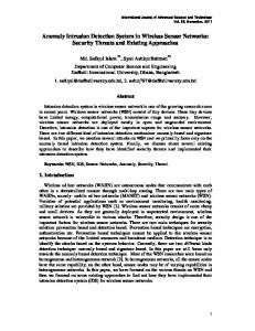
and heartbeats of the survival in any natural disaster zones. The. X2M200 sensor based .... tool provides an electrical suit for single or multi-process simulation.
46
IJCSNS International Journal of Computer Science and Network Security, VOL.18 No.5, May 2018
Sensor Based Survival Detection System In Earthquake Disaster Zones Muhammad Hammad-u-Salam†*, Shahzad Memon†, Lachhman Das†, Atta-ur-Rehmanꜟ Zahoor Hussain†, Raza Hussain Shah†, Nisar Ahmed Memon† †
Institute of Information and Communication Technology, University of Sindh, Jamshoro, Pakistan * University of Kotli Azad Jammu and Kashmir, Pakistan ꜟ CCSIT, Department of Computer Science, Imam Abdulrahman Bin Faisal University, P.O. Box 1982, Dammam, Saudi Arabia Summary The wireless sensors have great attention since the last decades. The different wireless sensor technology renders several advantages over traditional wireless sensor technology such as removal of complexity, costly wiring system, physical security and large courage area. From the last few years, there have been great interest in the development of various application based on wireless sensor networks which leads to minimize the cost, complexity and security of laying sensor networks. This article describes a proposed design approach for a wireless sensor network based on X2M200 respiration sensor module. The module is used to measure and detect the respiration, movements and heartbeats of the survival in any natural disaster zones. The X2M200 sensor based prototype system is used to detect the alive human being from the under-surface and on-surface of earthquake affected areas. Moreover, the design system is also used to sends an early warning message from the remote zones by using different wireless networks.
Key words: Logical Architecture of system, Resilient ICT networks, X2M200 respiration Module, System simulation, Results.
1. Introduction The earthquake adversity retrieval networks were used to deliver alternative networks backing to both the disaster sufferers and the assistance communities which provides assistance to locate the disasters victims [1]. Moreover, also establish a communication network linkage in the pretentious zone of disaster. The earthquake adversity assistance process involves, to locate victims, searching the affected area, detecting the survivors and provides them rescue from the disaster zones [2]. Many researchers develop and proposed various networks based on wireless communication network technology to gather the necessary information from the disaster area through Adhoc networks, mobile applications, flying networks, social networks and satellite communication [3]. These proposed networks have various wireless nodes being deployed in the disaster zones which sends the information from the affected area to base-camp where rescue teams acquired the data and start rescuing the victims through different organizations. Manuscript received May 5, 2018 Manuscript revised May 20, 2018
Moreover, some networks deal with monitoring process and sends the required information along with the locations of disasters areas [4, 5]. In literature, some researcher suggests the Geographic Information System (GIS) based software system to developed the GIS based trustworthy maps to guide the helpers and communities to locates the survivals quickly [6.7]. The GIS maps are amicable, flexible and understandable to provide fast assistance in disaster zones [8]. The GIS-based software maps and multi criteria vulnerability assessment approach is used to compute the effects of thrilling disasters on road linkages. This approach can be beneficial to engineer to evaluate the robustness of different backup in various circumstances to ensure safety of cities situated in seismic zones. It can help to prepare better backup plans to deals with severe disasters. The GIS-based approach was used in two different cities of U.S.A, Los Angeles and San Franciscans both cities were vulnerable to severe seismic deeds [9, 10, and 11]. The objective of researcher was regulating the vulnerabilities by integration of the already available tools, methods and techniques which can be used to proficiently monitoring and progress of disasters recovery of affected zones. The recovery can be monitor by visual analysis method, formulated image based framework and combination of visual and semi-automated interpretations [12, 13, 14, 15]. The rest of paper is divided into seven section. Section elaborates the introduction, section two comprises with logical architecture of sensor based detection technique, section three explain the information flow mechanism of system, section four presents the hardware module of respiration module and its flow and section five demonstrates Proteus simulation of architecture, section six indicates the simulation results of the system and section seven shows the tabular and graphical results and at last section conclusion has been drawn.
IJCSNS International Journal of Computer Science and Network Security, VOL.18 No.5, May 2018
2. Logical Architecture of Sensor Based Detection Technique The objective of logical architecture of sensor based detection techniques is to allow the field operators to monitor the activities in disaster zones. The proposed architecture helps to develop a coordination among affected earthquake zones, field offices and core management to provide the assistance to the victims and survivals of affected area. The logical architecture of sensor based detection methods has various components to provide a resilient network communication to float the information from the disaster zones as shown in fig 1. The architecture components are following as, National Disaster Management Authority, Quick Disaster Management Response Cell,Central Disaster Management cell and Resilient ICT Networks.
47
2.1.2 Quick Disaster Management Response Cell The quick disaster management response cell is responsible to activate the early warning system, rapid response networks and resilient ICT networks installed in the disaster zones or in field stations. The early warning system and rapid response networks are used to retrieve the information from the resilient ICT networks and share that information to quick disaster management cell and central database management cell. 2.1.3 Central Disaster Management Database Cell The central database management cell is responsible to maintain the information about the different disaster zones located at various areas and also provide the information about the available networks in field station such as maintain the geographic information of different regions, available ICT networks and population information of respective disaster zones. The cell shares the required information among the different components of architecture whenever the information is needed. 2.1.4 Resilient ICT Networks
Fig. 1 Logical architecture of Sensor Based Detection Technique
2.1 Components Technique
of
Sensor
Based
Detection
The logical architecture has various network nodes to perform the various activities. 2.1.1 National Disaster Management Authority The national disaster management authority (NDMA) node of architecture is response to coordinate among the national, international and private organizations to provide the technical and financial assistance in disaster zones. The NDMA play a vital role in relief activities being performed by different organizations, Non-Governmental organizations (NGOs) and firms to restore and revived everyday based routines of affected peoples.
Resilient ICT network most important component of the sensors based network. The components consist of various wireless network to maintain the network resiliency. The component is located at field stations of disaster zones and activated the available wireless network whenever any disaster is occurring. Moreover, the ICT network is used to collect the pre disaster information from the field stations. Furthermore, the resilient ICT networks includes, drone based network, GIS/GSM and Sensor based networks [16]. The all wireless networks are used interchangeably when one single wireless network is failed to retrieve the information from the earthquake affected area then another available wireless network is activated automatically.
3. Information Flow Mechnism of Sensor Based Detection Technique The proposed ICT network is used to retrieve the pre disaster information from the field station located in disaster zones and share that information among the different nodes of networks. The figure 2 depicts the information flow mechanism of proposed sensor based detection system where the system components located at field and central network stations. Some networks are deployed at district level which is the composition of field network stations where wireless networks acquired the information from the disaster zones. Once the information
48
IJCSNS International Journal of Computer Science and Network Security, VOL.18 No.5, May 2018
in acquired it will be share to provincial networks and central network station simultaneously. Moreover, the information will be communicated to quick disaster management response center and rapid response networks to activate the assistance activities.
4.1 Respiration Detection Flow Mechanism The figure 4 shows the respiration detection mechanism of the hardware module. Once the module detects any movement or breathe the module takes it as input and send it to frame storage buffer. Further, the buffer sends the movement and breathe to 2-D processing block where the input is sends to another three classifiers (movement detector, breathing pattern estimator and respiration detector). Which are used to distinguish the inputs ether input is movement or breathe. The breathing pattern estimator specify the breathing pattern of survivals and respiration and movement detectors specify the distance, respiration per minutes and state of breathing with the help of state combiner. The state combiner is used to measure the breathing state (low, high) of survivals.
Fig. 2 Information Flow Mechanism of Network Architecture
4. Hardware Module of Respriation Module The respiration X2M200 hardware module has been used in the proposed architecture to detect the movements, presences, and distance and respiration frequency of the survivals. Moreover, the module has capability to capture the live breathing pattern of victim’s on-surface and undersurface in disaster zone. The X2M200 hardware module is also used to monitor the alive things. The figure 3 shown the physical module of the respiration X2M200 module.
Fig. 4 Respiration Detection Mechanism
5. Proteus Simulation The Proteus 8 software is used for simulate the propose sensors based detection module. The Proteus simulation tool provides an electrical suit for single or multi-process simulation. The below figures 5, 6,7,8,9 depicts the various simulation results of sensor based detection system. Where the different scenarios show different survivals detection in adversity environment.
5.1 Simulation Architecture of Sensor Based Detection Technique Figure 5 shows the simulation circuit of the sensor based Fig. 3 Respiration Detection Hardware Module
Detection module. The simulation circuit is consisting of various hardware components such as LCD, LEDs, Resistors, external storage modules, GSM module, X2M200 respiration module ,50VDC level shifter and Arduino mega 2560 microcontroller.
IJCSNS International Journal of Computer Science and Network Security, VOL.18 No.5, May 2018
49
6.2 Heartbeat Tracking Frequency (HBT1) Another simulation shows the detection of heartbeat with the different frequencies as shown by figure 7. The system detects the heart beats as 70, 70 and 30 simultaneously.
Fig. 5 Sensor Base Detection Technique
6. Simulation Results of Proposed System The proposed system was simulated in Proteus simulation environment. Where different simulation scenarios show different results as mentioned below.
6.1 Heartbeat Tracking Frequency (HBT2, HBT3) The figure 6 depicts the survivals detection through system simulation. The simulation of the proposed system shows survivals detection by highlighting the different LEDS. The system has detected three survivals with the different breathing patterns such as Heartbeat Tracking 1, 2, 3 (HBT1, 55, HBT2, 30, HBT3, 30) respectively. Different heartbeat rates indicate different types of genders such as 30-45 heartbeat indicates as child heartbeat frequency, 6070 heartbeat indicates as female frequency and 45-60 rate indicates as male frequency.
Fig 7. HBL1, Respiration Detection
6.3 Heartbeat Tracking Frequency (HBT1, HBT2, HBT3) Similarly another simulation scenario shows different heart beat detection by the simulator such as 0,70,0 respectively. the zero values denoted null detection of servivals shown by figure 8.
Fig. 8 (HBT1,HBT2,HBT3) Respiration Detection
6.4 Heartbeat Tracking Frequency (HBT1, HBT2, HBT3) Fig. 6 HBT2 and HBT3 Respiration Detection
Another simulation scenario represents the different heartbeat detection results detected by the simulator such as initially the system detect zero heartbeat means the
50
IJCSNS International Journal of Computer Science and Network Security, VOL.18 No.5, May 2018
system do not found any survival from the affected area. Once again the system was tested in another affected area then the system detects number of survivals with the frequency of different heartbeat as 70, 70 respectively shown in figure 9.
The figure 10 shows the graphical representation of table-1. where the bar shows different survival detection frequencies.
Fig. 10 Graphical Representation of Table-1
Fig. 9 (HBT1,HBT2,HBT3)Respiration Detection
7. Tabular Results The table 1, 2, 3 shown the different heartbeat of survivals detect through sensor based detection technique. The system performed various attempts to find out the survivals from the affected areas. The table 1, shows the number of attempts of system, detect the number of survivals and identify the different heartbeat rates. The system performed 9 attempts, detect 15 survivals from affected zone with different heartbeat rates.
Table-2 Present the Number of Survivals The table 2 presents the attempts of system to locate the survivals from the disaster zone. The system performed 9 attempts detect 20 survivals from the disaster with different heartbeat rates. Table 2: Respiration Detection Rates
Table-1 Present the Number of Survivals Table 1: Respiration Detection Rates
The figure 11 depicts the graphical representation of table 2. Where the graph bar indicates dissimilar survival detection frequencies.
IJCSNS International Journal of Computer Science and Network Security, VOL.18 No.5, May 2018
51
Fig. 11 Graphical Representation of Table-2 Fig. 12 demonstrates the graphical view of table 3
Table-3 Present the Number of Survivals Simillarly table 3 shows the total attempts of system, number of survivals detection with different heartbeat rates such as system has 9 attempts, detect 20 survivals with various heartbeat frquency. Table 3: Respiration Detection Rates
8. Conclusion The advance nations have high level of preparedness to deal with the human made disaster as well as natural disasters but some disaster cannot be entirely stopped. When the natural or manmade disaster happens in public places, the rescue communities and different wireless based sensor networks need to be deployed. In such circumstances, it is necessary for rescue communities to provides a quick assistance to affected populations and identify the victim areas by utilizing the available networks. The “sensor based survival detection system in earthquake disaster” is a contribution towards to the welfare of the affected communities and provide a quick response to identify the possible locations of disaster victims. Furthermore, the design system sends an early warning alerts to respective offices to immediate activation of rescue operation at adversity zones. Moreover, the rescue communities immediately operate to save the human life and frequently needs to function in risky locations. Hence, the sensor based survival detection system is used to progressively support and faster identification of disaster victims.
References The figure 12 demonstrates the graphical view of table 3. The different bars indicate different detection frequencies of the survivals.
[1] Daniel SR, Coleman TW, Schwartz Y, Wadia ZR, Zander J, inventors; Daniel Simon R, Coleman Timothy W, assignee. Systems, Methods and Devices for the Rapid Assessment and Deployment of Appropriate Modular Aid Solutions in Response to Disasters. United States patent application US 12/870,117. 2011 Jun 2. [2] Rao H, Hsu CH, Hung JN, Lee CK, Wu WJ, Hsiao WH, Chen CK, Chen YF, Chen YC, inventors; Far Eastone Telecommunications Co Ltd, assignee. Alert system and method for geographic or natural disasters utilizing a telecommunications network. United States patent US 6,914,525. 2005 Jul 5.
52
IJCSNS International Journal of Computer Science and Network Security, VOL.18 No.5, May 2018
[3] Zhang J, Li W, Han N, Kan J. Forest fire detection system based on a ZigBee wireless sensor network. Frontiers of Forestry in China. 2008 Sep 1;3(3):369-74. [4] Hall DL, Llinas J. An introduction to multisensor data fusion. Proceedings of the IEEE. 1997 Jan;85(1):6-23. [5] Chaczko Z, Ahmad F. Wireless sensor network based system for fire endangered areas. InInformation Technology and Applications, 2005. ICITA 2005. Third International Conference on 2005 Jul 4 (Vol. 2, pp. 203-207). IEEE. [6] Bala P, Tom S. GIS and Remote Sensing In Disaster Management. Imperial Journal of Interdisciplinary Research. 2017 May 1;3(5). [7] Souissi D, Msaddek MH, Zouhri L, Chenini I, El May M, Dlala M. Mapping groundwater recharge potential zones in arid region using GIS and Landsat approaches, southeast Tunisia. Hydrological Sciences Journal. 2018 Jan 18:1-8. [8] Chehri A, Fortier P, Tardif PM. UWB-based sensor networks for localization in mining environments. Ad Hoc Networks. 2009 Jul 1;7(5):987-1000. [9] Moon H, Kim C, Lee W. A Uav Based 3-D Positioning Framework For Detecting Locations Of Buried Persons In Collapsed Disaster ArEA. International Archives of the Photogrammetry, Remote Sensing & Spatial Information Sciences. 2016 Jul 19;41. [10] Yao Y, Glisic B. Detection of steel fatigue cracks with strain sensing sheets based on large area electronics. Sensors. 2015 Apr 7;15(4):8088-108. [11] Daniel SR, Coleman TW, Schwartz Y, Wadia ZR, Zander J, inventors. Systems, Methods and Devices for the Rapid Assessment and Deployment of Appropriate Modular Aid Solutions in Response to Disasters. United States patent application US 14/633,530. 2015 Jun 25. [12] Islam N, Shaikh GS. Towards a disaster response system based on cognitive radio ad hoc networks. arXiv preprint arXiv:1710.02404. 2017 Oct 3. [13] Tang S, Shu X, Shen S, Li Z, Cao S. Study of portable infrastructure-free cell phone detector for disaster relief. Natural Hazards. 2017 Mar 1;86(1):453-64. [14] Wang S, So E, Smith P. Detecting tents to estimate the displaced populations for post-disaster relief using high resolution satellite imagery. International Journal of Applied Earth Observation and Geoinformation. 2015 Apr 1; 36:8793. [15] Bhangale U, Durbha SS, King RL, Younan NH, Vatsavai R. High performance GPU computing based approaches for oil spill detection from multi-temporal remote sensing data. Remote Sensing of Environment. 2017 Dec 1; 202:28-44. [16] SALAM H, MEMON S, DAS L, HUSSAIN Z. Drone Based Resilient Network Architecture for Survivals in Earthquake Zones in Pakistan. Sindh University Research Journal-SURJ (Science Series). 2018 Mar 7;50(01):175-82.