VOLUME 38
JOURNAL OF APPLIED METEOROLOGY
DECEMBER 1999
Spatial and Temporal Variation in the Mixing Depth over the Northeastern United States during the Summer of 1995 STEPHEN BERMAN Earth Sciences Department, State University of New York College at Oneonta, Oneonta, New York
JIA-YEONG KU Division of Air Resources, New York State Department of Environmental Conservation, Albany, New York
S. TRIVIKRAMA RAO Department of Earth and Atmospheric Sciences, University at Albany, State University of New York, Albany, New York (Manuscript received 17 August 1998, in final form 9 March 1999) ABSTRACT A study of the temporal and spatial variations of mixing layer height over the Ozone Transport Region of the northeastern United States for the summer of 1995 is presented using meteorological data obtained from the North American Research Strategy for Tropospheric Ozone-Northeast (NARSTO-NE) 1995 field program. Rawinsonde balloon soundings made every 4 h during 13 ozone episode days during NARSTO-NE provided the principal source of upper-air data, supplemented by virtual temperature profiles from five radio acoustic sounder system sites. Forty-four weather stations provided surface data. Daytime mixing depths were estimated using a profile-intersection technique. The height of the surface inversion was used as a measure of the depth of the turbulent boundary layer at night. For the 13 ozone episode days, the average maximum mixing depth ranged from less than 500 m offshore to greater than 2000 m inland, with most of the increase occurring within the first 100 km of the coastline. The coefficient of variation of maximum mixing depths averaged over the 13 episode days varied from 0.65 at coastal stations to 0.19 at inland locations. Greater variability at the coast may be caused by the interplay of sea-breeze circulations with synoptic wind patterns there. The rate of growth of the mixing depth between 0600 and 1000 EST (UTC 2 5 h) averaged 165 m h21 for all stations, ranging from 20–60 m h21 at coastal sites to more than 350 m h21 at inland stations. Ventilation coefficients were about 50% lower on ozone episode days than on nonepisode days from 0700–0900 EST. For the ozone episode of 13–15 July a comparison was made of mixing depth estimates from three different methods: rawinsonde virtual potential temperature profiles, C 2n (the atmosphere’s refractive index structure parameter), and output from running the Fifth-Generation Pennsylvania State University–National Center for Atmospheric Research Mesoscale Model (MM5) version 1, a widely used nonhydrostatic mesoscale model. Estimates obtained from the three methods varied by as much as 200 m at night and by up to 500 m during the daytime. Mixing depths obtained from running MM5 were in good agreement with estimates from the other methods at Gettysburg, Pennsylvania, an inland station, but were 10%–20% too low at New Brunswick, New Jersey, a location within 30 km of the Atlantic coast. The discrepancy may be caused by the model’s 12-km grid spacing being too coarse to locate the marine–continental airmass boundary with high precision.
1. Introduction A critical parameter in determining air pollution concentrations near the ground is the depth through which pollutants are vigorously mixed, the so-called mixing depth. Recent analyses with the Urban Airshed Model,
Corresponding author’s address: Dr. S. T. Rao, Office of Science and Technology, New York State Dept. of Environmental Conservation, 50 Wolf Road, Albany, NY 12233-3259. E-mail:
[email protected]
q 1999 American Meteorological Society
Carbon Bond Mechanism IV version (UAM-IV) indicate that ozone concentrations predicted by this model are extremely sensitive to errors and uncertainties in the mixing depth profile (Rao et al. 1994). The selection of appropriate pollution control strategies also depends on the spatial and temporal variability of the mixing depth across the modeling domain (Sistla et al. 1996). Consequently, routine and reliable estimates of mixing depths are needed to improve model performance, to build confidence in assessing the efficacy of emission control strategies, and to assist in the forecasting of pollution episodes.
1661
1662
JOURNAL OF APPLIED METEOROLOGY
On clear, calm nights a stably stratified layer develops at the ground, extending upward for a few hundred meters. In general, only the lowest part of the nocturnal boundary layer is fully turbulent, although weak and sporadic turbulence may extend to the top of the surface temperature inversion in urban locations. This turbulence is caused by increased surface roughness (mechanical turbulence) and heat-island effects (thermal turbulence), which are characteristic of urban areas. Motor vehicle emissions from heavy commuter traffic during the morning hours can produce a large buildup of ozone precursors [nitrogen oxides (NOx) and volatile organic compounds (VOC)] near the ground. The growth rate of the mixing depth in the hours following sunrise is critical to the development of high ground-level ozone concentrations. If an ozone-rich layer is trapped aloft in the nighttime residual layer, vertical mixing from below can increase the ground-level ozone concentration by fumigation during the morning hours (Zhang et al. 1998). As the mixed layer grows larger (typically reaching 2 km in the afternoon), however, its greater volume will tend to reduce ground-level pollutant concentrations through dilution (Zhang and Rao 1999). At coastal stations, the mixing layer is more complex because of the influence of the marine boundary layer. When air flows from the cooler water to the warmer land (sea breeze), a convective internal boundary layer develops at the land–sea interface and tends to grow vertically with the square root of distance from the shoreline (Stull 1988). This situation typically occurs along coastlines in the summer months. The internal boundary layer is marked by a sharp change in the air’s vertical temperature, humidity, and wind structure. Sites located well offshore (e.g., buoys, drilling platforms) largely are unaffected by sea and land breezes and tend to have neutrally stratified temperature profiles at both day and night. In an earlier study, Berman et al. (1997) used radar wind profiler observations and Radio Acoustic Sounder System (RASS) virtual temperature profiles to estimate the evolution of the mixing depth at Schenectady, New York. The current investigation expands the previous study by examining both spatial and temporal variability of the mixing depth over the northeastern United States. The data used for the current study were collected in the summer of 1995 by the North American Research Strategy for Tropospheric Ozone-Northeast (NARSTO-NE) program. NARSTO-NE represents one regional aspect of NARSTO, which is a joint scientific and technological consortium of governmental and nongovernmental organizations located in Canada, the United States, and Mexico. NARSTO’s principal goal is to enhance the understanding of factors governing the occurrence of tropospheric ozone. One of the specific technical issues identified for NARSTO-NE is to study ‘‘the evolution of the mixing height and the transport patterns during ozone episodes.’’ The principal objectives of this paper are: R to study the diurnal and spatial variation of mixing depth across the northeastern United States for the 13 days
VOLUME 38
TABLE 1. 1995 NARSTO-NE intensive rawinsonde sites. Rawinsonde site
Code
Lat (8)
Elev Long (8) (m MSL)
Aberdeen, MD Atlantic City, NJ Buffalo, NY Chatham, MA Eureka (offshore boat) Gray, ME Sterling, VA
APG ATC BUF CHH EUR GYX IAD
39.78 39.35 42.93 41.67 40.32 43.90 38.98
276.12 274.45 278.73 269.97 273.53 270.25 277.42
5 3 218 16 1 125 84
that compose the five ozone episodes that occurred during the summer of 1995: 17–20 June, 12–15 July, 31 July, 2 August, 10 August, and 21 August, using surface and upper-air data collected by the NARSTO-NE 1995 field program; R to examine how the marine layer affects the spatial and temporal variability of mixing depths along the Atlantic coast; and R to identify meteorological conditions conducive to the formation and accumulation of tropospheric ozone. 2. NARSTO-NE 1995 meteorological measurements The NARSTO-NE 1995 field program was conducted from 15 June–9 September 1995 over the part of the northeastern United States designated as the Ozone Transport Region (OTR). The region extends northward along the eastern seaboard from Virginia to Maine. Meteorological measurements included both surface and upper-air observations. Five boundary layer profiler sites were established, each equipped with a three-beam 915-MHz radar to measure winds aloft. A RASS system for obtaining temperature profiles supplemented each radar profiler. The maximum vertical range for RASS-derived temperature profiles was generally below 1.5 km, with a resolution of 60–100 m. Additional observations of air temperature and sea surface temperature were available from 10 meteorological surface buoys located in the Atlantic Ocean. Seven additional sites were designated as intensive rawinsonde monitoring sites. Soundings at these sites were made every 4 h, providing vertical profiles of pressure, temperature, relative humidity, wind speed, and wind direction from the surface up to about 6 km above ground level (AGL). Balloon ascent rate was approximately 150 m min21 with data retrieved every 10 s, yielding a vertical resolution of about 25 m. Winds aloft were computed by tracking the position of the balloons relative to the earth’s surface using radio direction-finding techniques or one of the radio navigation networks such as Loran C. Height was derived from the hypsometric equation. Further details about the rawinsonde equipment used are given by Lehrman et al. (1997). The rawinsonde and RASS profiler sites are listed in Tables 1 and 2, respectively. Figure 1 presents a map view of these sites. During the period of intensive measurements (15 June– 9 September), the national ambient air quality standard for
DECEMBER 1999
BERMAN ET AL.
TABLE 2. 1995 NARSTO-NE RASS profiler sites. RASS site
Code
Lat (8)
Elev Long (8) (m MSL)
Holbrook, PA Gettysburg, PA Redhook, NY Millstone Point, CT New Brunswick, NJ
HBK GBG RHK MSP RUT
39.82 39.80 42.01 41.31 40.45
280.29 277.28 273.81 272.16 274.45
454 143 111 5 16
ozone [0.12 parts per million (ppm) maximum for 1 h] was exceeded (an ‘‘exceedance’’) in the OTR on 26 days, clustered into five episodes. The 12–15 July episode had the single highest 1-h ozone maximum concentration for the summer with 0.184 ppm observed on 15 July at Lums Pond Park in Delaware. During this episode, ground-level ozone concentrations exceeded 0.125 ppm at 6 sites on 12 July, at 12 sites on 13 July, at 37 sites on 14 July, and at 36 sites on 15 July. 3. Estimating the mixing depth The most reliable methods for determining the mixing depth are based on direct measurements of turbulence intensity or pollutant concentration. Such measurements tend to show strong gradients near the top of the mixing layer as the stable capping inversion is penetrated. As an alternative, a number of indirect estimation techniques have been proposed. One such method uses the atmosphere’s refractive index structure function C 2n , which can be cal-
1663
culated from radar profiler reflectivity measurements (Dye et al. 1995). Wyngaard and LeMone (1980) showed that C 2n reached a maximum at the capping inversion, located at the top of the convective boundary layer. Other studies have shown that C 2n is useful for estimating daytime mixing depths in cloud-free convective boundary layers (e.g., White 1993). For the NARSTO-NE 1995 dataset, C 2n values were available for two sites (Gettysburg, Pennsylvania, and New Brunswick, New Jersey) for 6 of the 13 episode days. However, to carry out a comprehensive study of the spatial and temporal distribution of mixing depth, a substantially larger set of data was needed. This need was achieved by analyzing the temperature profiles available from the intensive rawinsonde network, supplemented by the RASS profiler network. Rawinsonde releases to altitudes of ;6 km made at 4-h intervals during episode periods were the principal source of mixing depth estimates for this study. Because of their limited vertical range (,1.5 km), RASS temperature profiles were used mainly for studying mixing depths during the morning growth period (0600–1000 EST; EST 5 UTC 2 5 h). Mixing depths were estimated for daytime convective conditions using a profile-intersection technique first proposed by Holzworth (1967). The procedure involves extrapolating the surface temperature adiabatically upward until it intersects the temperature profile obtained from a representative upper-air sounding. The top of the mixed layer coincides with the base of an elevated inversion, or stable layer, which caps the convective boundary layer.
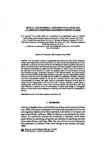
FIG. 1. Location of the intensive rawinsonde and RASS profiler sites used during the 1995 NARSTO-NE field program. Station codes are given in Tables 1 and 2.
1664
JOURNAL OF APPLIED METEOROLOGY
The conventional Holzworth technique does not include the effects of moisture or temperature advection. Consequently, for a given sounding the computed mixing depth is determined completely by the variation of surface temperature. To improve the technique, Benkley and Schulman (1979) proposed an operational model based on Holzworth’s method that incorporates temperature advection based on the difference between two upper-air soundings, one in the morning (0700 EST), and the other 12 h later (1900 EST). Surface synoptic maps showed anticyclonic flow with weak pressure and temperature gradients prevailing throughout the region for the 13 episode days. Winds aloft averaged 10–15 m s21 during this period, resulting in a downstream displacement of the rawinsonde balloons of 20–40 km during their ascent to 6 km. The upper-air soundings, thus, were representative of ambient conditions as far as 40 km from their respective launch sites. Since horizontal temperature advection was estimated to be small during this period, we felt justified in extending the effective range of the soundings out to 100 km (520% of the average spacing between rawinsonde stations) without appreciable error. Use of this approach allowed 47 surface stations to be located, each lying within 100 km of one of the rawinsonde sites. The Buffalo rawinsonde site was not included in this analysis, since the primary interest was in the variation of mixing depth along the Atlantic seaboard. This exclusion reduced the number of rawinsonde sites from 7 to 6 and the number of surface stations from 47 to 44. A list of each intensive rawinsonde site with its cluster of nearby surface stations is given in the appendix. The surface stations are plotted on a regional map in Fig. 2 using the three-letter station codes found in the appendix. In the current study, the Holzworth technique was adopted with several modifications: 1) Virtual potential temperature was used in the profileintersection scheme instead of temperature. Many of the stations in the OTR are located on, or near, the Atlantic coast and typically have high dewpoints during the summer months. Higher moisture content increases the air’s buoyancy, leading to increased thermal turbulence and a greater mixing depth. For example, on 14 July at Aberdeen Proving Ground, Maryland, a 250m increase in the mixing depth at 1400 EST was obtained when temperature was replaced with virtual potential temperature. Virtual potential temperature was computed from upper-air measurements of temperature, pressure, and relative humidity. 2) In his original paper, Holzworth used the morning temperature sounding (0700 EST), obtained from the standard National Weather Service rawinsonde network, as the reference profile for the entire day. Horizontal temperature advection was ignored. In the current study, we have attempted to include the effects of temperature advection, at least partially, by using the six soundings
VOLUME 38
FIG. 2. Location of the surface stations used for obtaining mixing depths. Station codes are given in the appendix.
per day available from the intensive rawinsonde network. 3) Holzworth’s profile-intersection scheme is designed for daytime convective conditions. However, it is of some interest to know what the depth of the turbulent boundary layer is at night, too. A number of profile-derived heights have been proposed for estimating the height of the nocturnal boundary layer, including hu hi hu hRi
height of the low-level wind maximum, height of the surface temperature inversion, height of the adiabatic layer, and height at which the Richardson number reaches a critical value.
Based on field measurements from the Wangara field experiment, Mahrt et al. (1982) showed that hu , hi, and hu had similar values (;250 m) when averaged over 60 nighttime hours. In contrast, hRi averaged only 69 m for the same hours when a threshold value of 0.5 was used for the Richardson number. The authors point out that 0.5 was typical of threshold values used in similar studies surveyed (Mahrt 1981), and that varying the value by a factor of 2 or so did not change the results much because of the steep gradient that exists
DECEMBER 1999
BERMAN ET AL.
at the top of the turbulent layer. Moreover, hu, hi, and hu correlated poorly (correlation coefficient r , 0.5) with friction velocity u* divided by Coriolis parameter f, a diagnostic relation obtained from similarity theory for neutral stability. However, hRi showed a fairly high correlation (r 5 0.8) with u* / f. Under stable conditions a scaling parameter that includes the Monin–Obukhov length L would be more appropriate to use. However, u*/ f and L have been shown to be highly correlated (Mahrt and Heald 1979; Venkatram 1980), and the resulting correlations would be nearly the same if u* / f was replaced with L or (u* L/f)½ (Mahrt et al. 1982). The authors concluded that the weak relationship found with hu, hi, and hu was partly caused by their inability to represent the actual depth of the turbulent layer. Similar results were found in studies by Yu (1978) and Arya (1981). 4) To estimate the mixing depth, each temperature sounding was classified as being in one of three categories: ‘‘unstable,’’ ‘‘stable, without surface inversion,’’ or ‘‘stable, with surface inversion.’’ If the sounding was found to be unstable, the profile-intersection technique, based on Holzworth’s technique, was applied. If the sounding was instead stable, with surface inversion, the mixing depth was taken to coincide with the top of the surface inversion. For the last case, in which the sounding was stable but no surface inversion was present, the temperature profile could not be used to estimate the mixing depth, and the mixing depth was reported as not available. Daytime soundings invariably were unstable, and nighttime soundings normally showed a surface inversion. In the transition between the stable and unstable regimes in the hours around sunrise and sunset, however, a high frequency of ‘‘stable–no inversion’’ cases was found. Such cases were excluded from the mixing-depth summaries. In view of these findings, it is apparent that hu, hi , and hu all tend to overestimate the depth of the nocturnal boundary layer. While hRi appears to be a better estimator, it was not computed here because the vertical resolution of the profiles was judged to be too coarse to obtain meaningful Richardson numbers. Although turbulent mixing at night is confined to a shallow layer near the ground, weak and intermittent turbulence may extend to much higher levels, allowing for the slow dispersion of contaminants through the depth of the stable layer. This dispersion is more likely to happen in an urban setting where anthropogenic heat sources and increased surface roughness can help to sustain turbulence levels, even in a stable atmosphere. Rawinsonde virtual temperature profiles were used to determine hi for the hours between sunset and sunrise to serve as a rough upper boundary on the air’s dispersive ability at night over the highly urbanized OTR. A threepoint parabolic fit of the virtual temperature profile was used to determine this height more precisely.
1665
FIG. 3. Maximum mixing depths (m 3 100), averaged over the 13 episode days.
4. Analysis of mixing depths for the 13 ozone episode days a. Maximum mixing depth Figure 3 displays the maximum afternoon mixing depth (between 1200 and 1600 EST) for each surface station, averaged over all 13 episode days in 1995. Isolines in Fig. 3 represent mixing depths in hundreds of meters (e.g., 25 5 2500 m AGL). The overall pattern shows mixing depths increasing from 300 m over the ocean to about 2500 m at interior locations. Mixing depths at coastal locations are particularly sensitive to the wind direction. When offshore flow dominates, the marine layer does not penetrate far inland and the mixing depth remains high. Conversely, onshore sea breezes carry cool marine air inland, which tends to lower surface temperatures and decrease mixing depths. Some noteworthy features seen in Fig. 3 include the following. R The consistently low mixing depths (500–700 m) in and around Cape Cod. Cape Cod consists of a narrow strip of land jutting 100 km out from southeastern Massachusetts into the Atlantic Ocean. Nearby islands include Nantucket and Martha’s Vineyard. Most of the surface
1666
JOURNAL OF APPLIED METEOROLOGY
VOLUME 38
stations used for analysis from this area lie on or near the coast (Falmouth, Chatham, Hyannis, Provincetown, Martha’s Vineyard, Nantucket, South Weymouth) and all are dominated by the cool marine layer. R The higher mixing depths (1300–1800 m) seen at several stations along coastal Maine (Brunswick, Portland), the northern coast of Massachusetts (South Weymouth), and coastal New Jersey (Atlantic City). Although these stations are all located near the coastline, their higher mixing depths are a result of a combination of higher values during hours having warmer, offshore flow from the interior and lower values during hours when cooler, onshore sea breezes prevail. R The strong mixing depth gradient on Long Island between warmer, more interior stations (Islip, Farmingdale) and those closer to the coast (Westhampton, John F. Kennedy Airport). Mixing depths vary from 1400–1800 m at the interior locations, dropping to 300–800 m along the southern shore. This gradient reflects the contrast between the stronger marine influence along the shoreline and the more heated and populated sections of the interior. R The tendency for somewhat lower mixing depths around Chesapeake Bay. Average midafternoon mixing depths vary from 1200–1600 m at stations near the bay in comparison with values above 2000 m seen at more inland sites. The three sites with lower mixing depths are Aberdeen, Maryland, Baltimore, Maryland, and Quantico, Virginia. Sea breezes originating over the bay waters may be responsible for the lowered mixing depths seen at these stations. FIG. 4. Coefficient of variation (%) of maximum mixing depth, averaged over the 13 episode days.
b. Variation of maximum mixing depth The coefficient of variation of maximum mixing depth (standard deviation divided by the mean) for the 13 episode days is shown in Fig. 4, expressed in percent (e.g., 40 5 40%). The coefficient of variation is a measure of the variability relative to the mean. Larger values indicate greater variability. The coefficient of variation averages 28% for all stations shown in Fig. 4, but is much higher for coastal stations (65%) than for stations located well inland (19%). A strong gradient in the magnitude of the coefficient of variation is seen along the coast, particularly over Long Island. The higher values found at coastal sites may be due to the interplay between the sea-breeze circulation and synoptic-scale wind systems experienced at these locations. As one looks farther inland, the influence of the marine layer tends to decrease and the maximum mixing depth shows less variability as measured by the coefficient of variation. c. Diurnal range of mixing depth Figure 5 shows the diurnal range (daily maximum minus daily minimum) of mixing depth averaged over the 13 episode days, expressed in tens of meters. Lowest values (400–800 m) are found at ocean buoys and on Cape Cod,
Nantucket, and Martha’s Vineyard, reflecting the dominance of the marine layer at these sites throughout the day. The diurnal range increases rapidly inland, however, exceeding 2000 m at many locations. Higher surface temperatures and increased convection result in higher afternoon mixing depths and larger diurnal ranges at these locations. Again, a strong gradient is seen over Long Island where the diurnal range varies from a low of 300 m over the eastern shoreline to values of 1500–2000 m at more interior locations farther west. A similar pattern was noted in the distribution of maximum mixing depths shown in Fig. 3. d. Mixing depth growth rates The rate of growth of the mixed layer during the morning hours is a critical factor in the development of high ozone concentrations at ground level. A slowly growing mixing depth will tend to concentrate ozone precursors (NOx and VOC) emitted by early morning traffic, which can lead to high concentrations of ground-level ozone later in the morning. Figure 6 illustrates the rate of change in mixing depth from 0600 EST to 1000 EST (the morning growth period) for each surface station, averaged over all
DECEMBER 1999
BERMAN ET AL.
1667
FIG. 5. Mixing depth range (m 3 10) for a 24-h diurnal cycle, averaged over the 13 episode days.
FIG. 6. Mixing depth growth rates (m h21 3 10) from 0600 to 1000 EST, averaged over the 13 episode days.
13 episode days. The growth rate is plotted in tens of meters per hour. The average growth rate for all 44 stations is 165 m h21 . The largest growth rates appear inland over Maryland and New Jersey, where they exceed 350 m h21 at some locations. Growth rates over interior Long Island are slightly lower (210–280 m h21 ) and decline rapidly as the coastline is approached, with values of only 20–60 m h21 found over Cape Cod and nearby islands. This pattern is consistent with the influence of the marine layer in depressing surface temperatures and reducing thermal convection. Some ocean stations show zero or slightly negative growth rates, indicating that solar heating has little direct effect on the mixing depth at these locations. West–east cross sections of mixing depth along 408N latitude were constructed for the 13 episode days. The 408 parallel lies 30 km north of the southern border of Pennsylvania. It passes 7 km north of Philadelphia and intersects the New Jersey coast near Point Pleasant. Seventeen land stations in New Jersey, Pennsylvania, and Maryland lie within 75 km of this line. The nearest offshore station is Buoy 44009, located 167 km to the south and 26 km east of the Delaware coast. Since the coastline does not run perfectly north–south, each station’s distance to the coast (measured due east or west) was determined more
precisely from a regional map. Figure 7 shows the position of these stations relative to 408N latitude and to the coastline. Figure 8 shows horizontal cross sections of mixing depth estimates obtained from rawinsonde profiles at 0600, 1000, 1400, and 1800 EST. The 408 parallel is represented by the x axis. The curves in Fig. 8 were fitted to the observations by eye. Offshore and near the coastline, average mixing depths are low (200–250 m) and show little variation with time of day. As one looks inland, the mixing depth rises rapidly and reaches its peak value generally within the first 100 km of the coast. There is little further growth inland. At 0600 EST, just before sunrise, the mixing depth has a fairly uniform value of ;250 m over land and water. As the diurnal heating cycle develops, the mixing depth grows larger over land. By 1000 EST it reaches a maximum of ;1250 m, at 1400 EST ;2000 m, and at 1800 EST ;1500 m. From these curves, one can obtain an estimate of the average growth rate of the mixing depth for interior locations. From 0600 to 1000 EST the growth rate averages 250 m h21 . From 1000 to 1400 EST, it averages 188 m h21 , and from 1400 to 1800 EST it averages 2125 m h21. The degree of scatter about these curves depends on time of day. Little scatter is seen at 0600 EST
1668
JOURNAL OF APPLIED METEOROLOGY
VOLUME 38
FIG. 7. Location of the surface stations used in constructing a horizontal cross section of mixing depth along latitude 408N.
when the air is stable. As expected, more scatter is seen at 1400 EST when the surface temperature is near its maximum. Stations close to Chesapeake Bay may be affected by a local sea-breeze system, which could explain some of the scatter seen at 1400 EST. A much larger amount of scatter is found at 1000 and 1800 EST. These times correspond to the mixing depth’s maximum growth and decay, when the mixing depth may be expected to show increased sensitivity to local influences. These influences include the effects of terrain slope and aspect on the amount of solar radiation absorbed, the development of local wind systems, and the presence of urban heat islands.
FIG. 8. Horizontal cross section of mixing depth (m) along latitude 408N, averaged over the 13 episode days.
5. Mixing depths on ozone episode days and nonepisode days It is of interest to see if mixing depth statistics vary significantly between episode and nonepisode days. Since the release of ozone precursors over a given region is believed to be fairly uniform from day to day, one would expect meteorological factors to have a major impact on ground-level ozone concentrations. The issue of whether mixing depth growth rates and ventilation coefficients show systematic differences between episode and nonepisode days is one that needs to be evaluated. To this end, the hourly virtual temperature profiles provided by the RASS network were used, covering the period from 15 June to 31 August. This network provided a dataset of 13 episode days and 59–65 nonepisode days, the exact number depending on the length of each station’s record. The Millstone Point RASS site was excluded from this comparison because of its coastal location. Millstone Point is situated on a short peninsula about 30 m wide and 100 m long, extending from the southern shore of Connecticut into Long Island Sound. Due to its location and offshore fetch, it is more representative of the marine boundary layer. Its growth rates consistently are lower than those observed at more inland sites. Winds from the radar profiler at Millstone Point show southerly flow of cool marine air from Long Island Sound below 1 km accompanied by northerly flow of warmer air from the mainland between 1 and 2 km aloft. This combination tends to create a strong surface inversion that inhibits growth of the convective boundary layer at this station. Figure 9 contains a plot of hourly mixing depths from
DECEMBER 1999
BERMAN ET AL.
FIG. 9. Average hourly mixing depths for episode and nonepisode days from 0600 to 1000 EST, for 15 June–31 August 1995, obtained from RASS profiles. Number of values used to calculate the average is given for each point.
0600 to 1000 EST for episode and nonepisode days for the four inland RASS sites, averaged over all summer days (15 June–31 August). The number adjacent to each data point indicates the number of values used to calculate the average. As discussed previously, the air’s stability in the hours around sunrise frequently was classified as stable, but without surface inversion. In such cases the mixing depth could not be determined from an analysis of the temperature profile, and the mixing depth was considered to be not available. Thus, the number of values used in determining the averages declines sharply between 0700 and 0900 EST. The curves display similar growth rates throughout the morning hours, growing slowly until 0900 EST and faster from 0900 to 1000 EST. Episode days display a nearly constant mixing depth of 310 m from 0600 to 0800 EST, increasing to 430 m at 0900 EST, and 790 m at 1000 EST. Nonepisode days show mixing depths about 20% higher than those of episode days between 0700 and 0900 EST, but are nearly the same at 0600 and 1000 EST. Standard error bars are drawn for each data point. Standard errors are largest at 1000 EST, indicating the high variability of the time of onset of the convective regime from day to day and from place to place. The flatness of the curves between 0600 and 0900 EST probably is caused by the time lag between the breakdown of the nocturnal surface inversion and the development of fully convective conditions. The ventilation coefficient is defined as the product of the mixing depth and a representative boundary layer wind speed. During the morning rush hours (0600–1000 EST) when the emission of ozone precursors tends to be high and the mixing depth is still low, surface winds are probably more representative of dispersion near the ground. Later in the day when the mixing depth is more fully developed, higher-level winds may be more appropriate. Figure 10 provides a comparison of ventilation coefficients
1669
FIG. 10. Same as Fig. 9, but for hourly ventilation coefficients.
using surface wind speeds from 0600 to 1000 EST for both episode and nonepisode days for the same four RASS sites and days shown in Fig. 9. Large ventilation coefficients are associated with increased dilution of air pollutants. Figure 10 shows a pattern similar to the one seen in Fig. 9, with the ventilation coefficients growing slowly between 0600 and 0900 EST followed by a rapid increase after 0900 EST. From 0600 to 0800 EST, ventilation coefficients average 540 m 2 s21 for episode days, rising to 884 m 2 s21 from 0800 to 0900 EST, to 1700 m 2 s21 at 1000 EST. Nonepisode days show ventilation coefficients about 50% higher than those of episode days between 0700 and 1000 EST but are nearly the same at 0600 EST. Standard error bars are drawn for each data point. Again, standard errors are largest at 1000 EST, indicating the high variability of the time of onset of the convective regime from day to day and from place to place. The larger separation between the curves in Fig. 10 (50% difference) in comparison with Fig. 9 (20% difference) is attributable to the higher surface wind speeds on nonepisode days between the hours of 0700 and 1000 EST. In view of the small data sample used (four RASS stations, 13 ozone episode days) and large standard errors, however, these results must be regarded tentatively. 6. Mixing depths for the 12–15 July ozone episode The 4-day ozone episode period from 12 July through 15 July saw the greatest number of ozone exceedances of the summer. The 13th of July was considered to be a ‘‘ramp-up’’ day with 12 ozone exceedances. The 14th of July had 37 ozone exceedances, and 15 July had 36 exceedances. Peak ozone concentrations of 0.170 ppm and 0.175 ppm were measured on 14 July at sites in New Jersey and Connecticut. Meteorological conditions during the episode were favorable for the development of high ozone concentrations as high pressure systems located over the region produced clear skies, weak winds, high temperatures, and a subsidence inversion (Blumenthal et al.
1670
JOURNAL OF APPLIED METEOROLOGY
VOLUME 38
and estimates from running the Fifth-Generation Pennsylvania State University–National Center for Atmospheric Research (Penn State–NCAR) Mesoscale Model (MM5) version 1, a widely used mesoscale model, were available. 1) ESTIMATES
FROM
C 2n
As discussed in section 3, mixing depths can be estimated from radar reflectivities by computing the atmosphere’s refractive index structure function parameter C 2n. Mixing depths were computed by Blumenthal et al. (1997) for two of the four radar profiler sites (Gettysburg, Pennsylvania, and New Brunswick, New Jersey), using C 2n (with RASS data) during the 3-day period of 13–15 July. 2) ESTIMATES
FIG. 11. Maximum mixing depths (m 3 100) for 14 July 1995.
1997). During the 4-day episode, surface wind flow was predominantly westerly over land, but shifted to a strongly southerly direction over the open ocean. a. Maximum mixing depths Figure 11 contains a plot of maximum mixing depth for 14 July, using the profile-intersection technique discussed in section 3. The pattern in Fig. 11 is similar to the one shown in Fig. 3 for the 13 episode days. This similarity reflects the fact that the episode days were dominated by similar synoptic weather patterns (weak temperature gradients, light winds, clear skies, etc.). Thus, the average pattern for all 13 days tends to resemble that of any individual day. Mixing depths over the ocean are low (;500 m) rising to ;1000 m at the coast, and to ;2500 m or more further inland. The low values around Cape Cod, the southern shore of Long Island, and Chesapeake Bay also are similar to those found in Fig. 3. b. Comparison of mixing depth estimates During the period from 13–15 July, in addition to mixing depths derived from the rawinsonde profile network, estimates based on C 2n measurements at two profiler sites
FROM
MM5
MM5 version 1 is a nonhydrostatic mesoscale model used to investigate meteorological phenomena on a wide range of scales from continental-scale cyclone development to local valley flows. The model is based on a set of equations for a fully compressible atmosphere in a rotating frame of reference. It is designed to be used with data obtained from meteorological observations (i.e., soundings of temperature, moisture, and wind). The model incorporates a terrain-following vertical coordinate, realistic topography, a diurnal heating cycle, and surface fluxes of heat, moisture, and momentum. MM5 version 1 is widely employed to compute boundary layer parameters such as mixing depths and ventilation coefficients for use in air pollution investigations. A full description of the model is given by Dudhia (1993). Figures 12a,b provide a comparison of mixing depth estimates from all three methods: rawinsonde temperature profiles, C 2n, and MM5 version 1. Figure 12a is for New Brunswick, New Jersey, and Fig. 12b is for Gettysburg, Pennsylvania. The time series are plotted every 2 h for the 3-day ozone episode. Rates of growth and decay and times of maxima and minima are similar for all techniques. Values at night varied by ;200 m, with daytime differences as large as 500 m. MM5-based estimates are 10%– 20% lower than those derived from the observational techniques at the New Brunswick site (Fig. 12a), but are in better agreement at Gettysburg (Fig. 12b). New Brunswick is located ;30 km from the Atlantic Coast, while Gettysburg is located ;240 km farther inland. MM5 uses a grid size of 12 km, which may be too coarse for locating the marine–continental airmass boundary precisely. As a consequence, the model may be attributing a greater influence of the marine layer at New Brunswick (i.e., lower surface temperatures and lower mixing depths) than is actually the case. 3) COMPARISON
OF THE ESTIMATION TECHNIQUES
The question of which estimation technique is best is difficult to answer from the limited number of cases used in the comparison shown in Figs. 12a,b. The most accurate
DECEMBER 1999
BERMAN ET AL.
1671
FIG. 12. Hourly mixing depths estimated from C 2n (squares), MM5 (ovals), and rawinsonde profiles (triangles) for 13–15 July 1995 (adapted from Blumenthal et al. 1997) for (a) New Brunswick, New Jersey, and (b) Gettysburg, Pennsylvania.
determination of mixing depth probably would be based on direct measurements of turbulence, which usually are not available. However, turbulence produces fluctuations in the atmosphere’s temperature, humidity, and pressure fields. These fluctuations, in turn, lead to variations in the atmosphere’s refractivity index, which is measured by C 2n. As discussed previously in section 3, a number of studies have demonstrated that C 2n is a good estimator of daytime mixing depths in cloud-free convective boundary layers. The accuracy of the technique falls off at night, however, particularly in the presence of multiple stratified layers. The ability of C 2n to estimate the depth of the nocturnal boundary layer is not well established. On average, mixing depths derived from the profileintersection technique compare favorably with estimates from C 2n, although discrepancies of as much as 25% in the maximum mixing depth are seen on individual days. Though substantial, these discrepancies appear to be unsystematic. At night, neither technique works particularly well. The profile method uses the depth of the surface inversion as an estimate of the mixing depth at night, which, as discussed earlier, is likely to be an overestimate of the nocturnal boundary layer depth. Also, in the hours around sunrise and sunset when the stability of the lower atmosphere is in transition from stable to unstable, or vice versa, the profile-intersection technique breaks down and cannot be used. Preliminary results from MM5 version 1 indicate it is more consistent at night than the other two methods are with mixing depths averaging less than 150 m. During the daytime, mixing depths from MM5 generally agree with the estimates from the other method to within ;25% at the inland site (Gettysburg) but are systematically low by 10%–20% at the more coastal site (New Brunswick). As
mentioned earlier in this section, this discrepancy may be caused by the 12-km grid spacing used by the model, which may not be fine enough to resolve the location of the marine–continental airmass boundary. Use of a smaller grid spacing may be warranted in future studies. 7. Summary Meteorological data from the NARSTO-NE 1995 field program were used to estimate mixing depths throughout the northeast Ozone Transport Region. Balloon soundings from an intensive rawinsonde network of seven stations were used as the principal source of upper-air data. The soundings were made every 4 h throughout the day and night during ozone episodes, providing profiles of height, temperature, dewpoint, relative humidity, wind speed, and wind direction. Forty-four weather stations located within 100 km of each rawinsonde site provided supplementary surface observations. Daytime mixing depths were estimated using a profile-intersection technique based on Holzworth’s (1967) method. At night, the depth of the mixing layer was identified with the top of the surface temperature inversion. Mixing depths were computed in this manner for the 13 days having ozone episodes during the period 15 June to 31 August 1995. Additional virtual temperature profiles were available from five radio acoustic sounder sites. Analysis of the 13 episode days shows that interior land stations tend to develop the highest average daytime mixing depths (.2000 m), with values falling rapidly as the coastline is approached and reaching minimum values less than 500 m offshore. This pattern reflects the decrease in summertime surface temperatures in moving from the heated interior to cooler offshore waters. At night the mix-
1672
JOURNAL OF APPLIED METEOROLOGY
ing layer showed little spatial variability, averaging 250 m over both land and water. The coefficient of variation of the maximum mixing depth averaged over the 13 episode days showed much higher values for coastal stations (65%) than for inland locations (19%). The larger variability along the coast may be reflecting the interplay of sea-breeze circulations with synoptic-scale wind patterns. Morning growth rates averaged 165 m h21 for all stations, ranging from more than 350 m h21 at some interior locations to 20–60 m h21 at coastal stations dominated by the marine layer. A comparison of episode days and nonepisode days shows similar mixing depth growth rates in the morning hours. However, average mixing depths were about 20% lower on episode days than on nonepisode days between 0700 and 0900 EST, indicating slower morning surface winds during these hours. Because of the relatively small sample of data used for this comparison, these results should be regarded as preliminary. Lower ventilation coefficients in the morning hours may promote the buildup of ozone precursors, particularly over urban areas with heavy commuter traffic. As daytime heating progresses, the mixing layer grows rapidly and surface wind speeds increase, helping to dilute ground-level concentrations of air pollutants. The situation becomes more complex if a layer of high ozone concentrations is found aloft. As turbulent mixing reaches this ozone-rich layer, ground-level concentrations would increase as the upper-level ozone is entrained downward. A comparison of mixing depth estimates obtained from the intensive rawinsonde profiles, from C 2n, and from MM5
VOLUME 38
version 1, a widely used mesoscale model, was made at two locations (New Brunswick, New Jersey, and Gettysburg, Pennsylvania) for the 3-day period 13–15 July. Estimates at night varied by as much as 200 m. During the daytime, mixing depths from MM5 generally agreed with the other two methods to within ;25% at Gettysburg, an inland site, but were systematically 10%–20% too low at New Brunswick, a more coastal location. The discrepancy may be attributable to the model’s poor resolution of the marine–continental airmass boundary. Mixing depths estimated from the rawinsonde profiles show large temporal and spatial variability during daytime convective periods. The mixing depth depends strongly on surface temperature, which is determined by a variety of factors ranging in scale from the synoptic scale to the microscale. Coastal stations, in particular, experience large variability in surface temperatures during the summer that result from shifts in wind direction. Onshore winds carry cooler, marine air inland, which depresses surface temperature. Cumuliform clouds developing at the sea-breeze front can lower surface temperature further. On the other hand, wind flow from the interior carries warmer, drier air toward the coast, which tends to raise surface temperature. Local topography and urban heat islands add further complications. A more detailed knowledge of the local wind flow regime is needed to improve understanding of the variability of mixing depth near coastlines. Acknowledgments. The authors wish gratefully to acknowledge support for this study provided by the New York State Energy Research and Development Authority (NYSERDA) under Contract 4914-ERTER-ES-99.
APPENDIX Intensive Rawinsonde Sites with Nearby Surface Stations
Rawinsonde site
Surface station
State
Station code
Latitude (N)
Longitude (W)
Distance from rawinsonde site (km)
Aberdeen, MD (APG)
Aberdeen Lancaster Wilmington Baltimore Reading Middletown Philadelphia Harrisburg Anvle/Muir Willow Grove
MD PA DE MD PA PA PA PA PA PA
APG LNS ILG MTN RDG MDT PHL CXY MUI NXX
39.47 40.13 39.68 39.18 40.38 40.20 39.88 40.22 40.43 40.20
76.17 76.30 75.60 76.67 75.97 76.77 75.25 76.85 76.57 75.15
0.0 41.8 45.8 56.3 67.9 72.4 75.1 79.1 81.8 94.9
Chatham, MA (CHH)
Hyannis Falmouth Nantucket Provincetown Martha’s Vineyard New Bedford So. Weymouth Buoy 44028
MA MA MA MA MA MA MA
HYA FMH ACK PVC MVY EWB NZW 028
41.67 41.65 41.25 42.07 41.40 41.68 42.15 41.40
70.28 70.52 70.07 70.22 70.62 70.97 70.93 71.10
25.7 45.7 47.4 49.1 61.9 83.1 95.7 98.7
DECEMBER 1999
1673
BERMAN ET AL. APPENDIX (Continued)
State
Station code
Latitude (N)
Longitude (W)
Distance from rawinsonde site (km)
Brunswick Portland Buoy 44007 Augusta Lewiston
ME ME ME ME
NHZ PWM 007 AUG LEW
43.88 43.65 43.50 44.32 44.10
69.93 70.32 70.20 69.80 71.22
25.7 28.4 44.7 58.9 80.7
Sterling, VA (IAD)
Dulles Airport Fort Belvoir Wash. Natl. Airport Andrews AFB Quantico Balt.–Wash. Airport Hagerstown Gettysburg
VA VA DC VA VA MD MD PA
IAD DAA DCA ADW NYG BWI HGR GBG
38.95 38.72 38.85 38.82 38.50 39.33 39.70 39.80
77.45 77.18 77.03 76.87 77.30 76.42 77.73 77.28
4.2 35.6 36.7 50.8 54.4 68.4 84.4 92.0
Atlantic City, NJ (ATC)
Atlantic City Millville Wrightstown AFB Philadelphia-NE
NJ NJ NJ PA
ATC MIV WRI PNE
39.45 39.37 40.02 40.08
74.57 75.07 74.60 75.02
15.2 53.3 75.6 94.7
Eureka (EUR; offshore boat)
Newark Islip Teterboro New Brunswick White Plains Lakehurst Caldwell Morristown Bridgeport
NJ NY NJ NJ NY NJ NJ NJ CT
EWR ISP TEB RUT HPN NEL CDW MMU BDR
40.70 40.80 40.85 40.45 41.07 40.03 40.87 40.80 41.17
74.17 73.10 74.07 74.45 73.72 74.35 74.28 74.42 73.13
58.6 61.3 63.8 72.2 75.2 75.8 77.6 82.3 94.3
Rawinsonde site
Surface station
Gray, ME (GYX)
REFERENCES Arya, S. P. S., 1981: Parameterizing the height of the stable atmospheric boundary layer. J. Appl. Meteor., 20, 1192–1202. Benkley, C. W., and L. L. Schulman, 1979: Estimating hourly mixing depths from historical meteorological data. J. Appl. Meteor., 18, 772–780. Berman, S., J.-Y. Ku, J. Zhang, and S. T. Rao, 1997: Uncertainties in estimating the mixing depth: Comparing three mixing-depth models with profiler measurements. Atmos. Environ., 31, 3023–3039. Blumenthal, D. L., F. W. Lurman, N. Kumar, T. S. Dye, S. E. Ray, M. E. Korc, R. Londergan, and G. Moore, 1997: Transport and mixing phenomena related to ozone exceedances in the northeast U.S. (Analyses based on NARSTO-Northeast data). Working Draft 1.1, STI996133-1710-WD 1.1, Ozone Transport Assessment Group, Air Quality Analysis Workgroup, 14 pp. [Available online at http:// capita.wustl.edu/OTAG.] Dudhia, J., 1993: A nonhydrostatic version of the Penn State–NCAR mesoscale model: Validation tests and simulation of an Atlantic cyclone and cold front. Mon. Wea. Rev., 121, 1493–1513. Dye, T. S., C. G. Lindsey, and J. A. Anderson, 1995: Estimates of mixing depth from ‘‘Boundary Layer’’ radar profilers. Preprints, Ninth Symp. on Meteorological Observations and Instrumentation, Charlotte, NC, Amer. Meteor. Soc., 156–160. Holzworth, G. C., 1967: Mixing depths, wind speeds and air pollution potential for selected locations in the United States. J. Appl. Meteor., 6, 1039–1044. Lehrman, D., W. R. Knuth, and N. L. Alexander, 1997: NARSTO-Northeast 1995 rawinsonde measurements. Working Draft V1.0, 1060 pp. [Available from EPRI, 3412 Hillview Ave., Palo Alto, CA 94304.] Mahrt, L., 1981: Modelling the depth of the stable boundary layer. Bound.-Layer Meteor., 17, 247–264.
, and R. C. Heald, 1979: Comment on ‘‘Determining height of the nocturnal boundary layer.’’ J. Appl. Meteor., 18, 383. , J. C. Andre, and R. C. Heald, 1982: On the depth of the nocturnal boundary layer. J. Appl. Meteor., 21, 90–97. Rao, S. T., G. Sistla, J.-Y. Ku, N. Zhou, and W. Hao, 1994: Sensitivity of the Urban Airshed Model to mixing height profile. Preprints, Eighth Joint Conf. on Applications of Air Pollution Meteorology with A&WMA, Nashville, TN, Amer. Meteor. Soc., 162–167. Sistla, G., N. Zhou, W. Hao, J.-Y. Ku, S. T. Rao, R. Bornstein, F. Freedman, and P. Thunis, 1996: Effects of uncertainties in meteorological inputs on Urban Airshed Model predictions and ozone control strategies. Atmos. Environ., 30, 2011–2025. Stull, R. B., 1988: An Introduction to Boundary Layer Meteorology. Kluwer Academic Publishers, 666 pp. Venkatram, A., 1980: Estimating the Monin–Obukhov length in the stable boundary layer for dispersion calculations. Bound.-Layer Meteor., 19, 481–486. White, A. B., 1993: Mixing depth detection using 915-MHz radar reflectivity data. Preprints, Eighth Symp. on Meteorological Observations and Instrumentation, Anaheim, CA, Amer. Meteor. Soc., 248–250. Wyngaard, J. C., and M. A. LeMone, 1980: Behavior of the refractive index structure parameter in the entraining convective boundary layer. J. Atmos. Sci., 37, 1573–1585. Yu, T., 1978: Determining height of the nocturnal boundary layer. J. Appl. Meteor., 17, 28–33. Zhang, J. S., and S. T. Rao, 1999: The role of vertical mixing in the temporal evolution of ground-level ozone concentrations. J. Appl. Meteor., 38, 1674–1691. , , and S. M. Daggupaty, 1998: Meteorological processes and ozone exceedances in the northeastern United States during the 12– 16 July 1995 episode. J. Appl. Meteor., 37, 776–789.