JGeope 6 (1), 2016, PP. 105-116
The effect of estimation methods on fractal modeling for anomalies’ detection in the Irankuh area, Central Iran Mehdi Rezaie, Peyman Afzal* Department of Mining Engineering, South Tehran Branch, Islamic Azad University, Tehran, Iran *Corresponding author, e-mail:
[email protected] (received: 21/12/2015 ; accepted: 04/05/2016) Abstract This study aims to recognize effect of Ordinary Kriging (OK) and Inverse Distance Weighted (IDW) estimation methods for separation of geochemical anomalies based on soil samples using Concentration-Area (C-A) fractal model in Irankuh area, central Iran. Variograms and anisotropic ellipsoid were generated for the Pb and Zn distribution. Thresholds values from the C-A log-log plots based on the estimation methods revealed the presence of various geochemical anomalies within estimation variances which were compared in both methods. The comparison among the estimation variances for different geochemical anomalies based on the C-A fractal model indicated that the estimation variance is less in the OK method especially for extremely and highly Zn-Pb anomalies. The estimated variances for different Zn anomalies via OK and C-A fractal method are lower than fractal modeling obtained by IDW estimation. However, extremely and highly Pb anomalies due to OK method have estimation variances lower than IDW method. Based on the results, main Zn and Pb anomalies are situated in the NW part of the area. Keywords: Concentration Area (C-A) Fractal Model, Estimation Variance, Inverse Distance Weighted (Idw), Irankouh, Ordinary Kriging (OK).
Introduction Fractal/multifractal modeling has been widely applied in different branches of geosciences and mining engineering, especially in spatial modeling of geochemical anomalies and mineralized zones (e.g., Cheng et al., 1994; Agterberg, 1995; Goncalves et al., 2001; Afzal et al., 2010, 2011, 2012, 2013; Agterberg, 1995; Delavar et al., 2012; Heidari et al., 2013; Wang et al., 2011, 2012; Yasrebi et al., 2014; Rahmati et al., 2015). The Concentration-Area (C-A) fractal model by Cheng et al. (1994) has been used to discriminate between geochemical anomalies and background via thresholds’ values (breakpoints). As a result, the CA fractal model is considered as a proper method to describe spatial distributions of different attributes (e.g., ore elements in this scenario) for the various ore deposits (Goncalves et al., 2001; Shamseddin Meigoony et al., 2014; Aramesh Asl et al., 2015). Geostatistical methods are utilized for estimation and interpolation of different regional variables in 1D, 2D, or 3D illustrations. Employment of an accurate estimation method with respect to geometry and geological properties of different ore deposits and also sampling patterns is a problematic issue in reserve estimation (David, 1970; Journel, 1983; Shahbeik et al., 2014). Linear and non-linear Kriging methods, Inverse Distance Weighted (IDW), and interpolating polynomials and splines have been used for
resource estimation. Based on collected data and grid sampling, the proper estimator were chosen (Matheron, 1967; Marechal & Serra, 1971; Laslett et al., 1987; Laslett and McBratney, 1990; Weber and Englund, 1992, 1994; Gallichand and Marcotte, 1993; Laslett, 1994; Brus et al., 1996; Declercq, 1996; Phillips et al., 1997; Zimmerman et al., 1999). Moreover, there are several studies which have compared Ordinary Kriging (OK) and IDW (Zimmerman et al., 1999; Shahbeik et al., 2014). Estimation of ore element distribution is an important aspect of mineral exploration (Moon et al., 2005; Heidari et al., 2013). Determination of an interpolation method is important for decreasing variance estimation and increasing accuracy for 2D and 3D evaluation (Dimitrakopoulos et al., 2007; Juan et al., 2011; Parhizkar et al., 2011). In addition, selection of an estimation method is essential for using fractal modeling, especially in the C-A model (Cheng et al., 1994; Yasrebi et al., 2013; Soltani et al., 2014). Furthermore, accuracy of estimation method and its corresponding variance affect the C-A fractal/ multifractal model. The main purpose of this paper is to separate and compare estimation variances for various Pb and Zn anomalies which were derived by the C-A fractal model based on IDW and OK estimation methods in the Irankuh area, Central Iran. Moreover, classical statistical parameters were described for Pb and Zn.
106 Rezaie & Afzal
Material and method The Concentration-Area (C-A) fractal model by Cheng et al. (1994) is utilized to outline the anomalies and background in order to describe the distribution of ore element concentrations. This model is expressed in the following form: A(ρ≤υ) ρ-a1; A(ρ≥υ) ρ-a2 (1) where A(ρ≤υ) and A(ρ≥υ) show areas (A) with concentration values (ρ) that are, respectively, smaller and greater than contour values (υ) and a1 and a2 are exponents. Log-log plots of concentration values versus areas, certain concentration contours representing breakpoints in the plots are considered threshold values which distinguish the anomalies in the different types of the ore deposit. In the C-A model, breakpoints between straight-line segments in the log–log plots present threshold values separating populations of concentration values to separate geochemical anomalies (Goncalves et al., 2001; Afzal et al., 2010). Threshold values in this are recognized by applying the fractal C-A model to demonstrate the boundaries between different anomalies (Cheng et al., 1994; Shamseddin Meigoony et al., 2014; Aramesh Asl et al., 2015). To calculate A(ρ≤υ) and A(ρ≥υ) enclosed by a concentration contour in a 2D model, the geochemical data of the ore element including corresponding concentrations are interpolated using the IDW and OK estimation methods. Kriging is considered as a geostatistical algorithm for the estimation of different regional variable (e.g., ore element in this case) which is commonly described as a “minimum variance estimator”, especially OK (Journel and Huijbregts, 1978; Davis, 2002; Bayraktar and Turalioglu, 2005; Emery, 2005; Li and Heap, 2008; Hormozi et al., 2012; Shademan Khakestar et al., 2013). The most common geostatistical method is OK which plays a special role because of its compatibility with a stationary model which involves a variogram (Chile's and Delfiner, 1999; Afzal et al., 2011; Soltani Mohammadi et al., 2012). Moreover, the OK estimates, which is a linear model with respect to local neighborhood structure, is based on a moving average of the variable of interest satisfying various dispersion forms of data (e.g., sparse sampling points; Goovaerts, 1997; Tahmasebi and Hezarkhani, 2010). IDW is one of the commonly used methods for interpolation of scatter points in a block model. The
JGeope, 6 (1), 2016
IDW is based on the assumption that the interpolating surface should be influenced most by the nearby points and less by the more distant points. The interpolating surface is a weighted average of the scatter points and the weight assigned to each scatter point diminishes as the distance from the interpolation point to the scatter point increases. In this technique, the values to unknown points are calculated with a weighted average of the values available at the known points IDW. The IDW formula is expressed as follows (Journel and Huijbregts, 1978; Journel, 1983): Wi = 1/d(X, Xi)p (2) where x denotes an interpolated (arbitrary) point, xi is an interpolating (known) point, d is a given distance (metric operator) from the known point xi to the unknown point x, N is the total number of known points used in interpolation, and p is a positive real number, called the power parameter. Discussion Geological setting The Irankuh district includes several sulfide and non-sulfide Zn–Pb deposits located in Irankuh Mountains, 20 km south of Esfahan (Central Iran) and belongs to the Sanandaj-Sirjan zone from the Zagros orogenic belt, as depicted in Figure 1. The Irankuh region comprises several Zn–Pb deposits, especially Goushfil (mainly sulfide ore) and Kolahdarvazeh (predominantly non-sulfide ore: Ghazban et al., 1994; Reichert and Borg, 2008; Mokhtari et al., 2015). The whole area shows an intensive and extensive faulting. Jurassic Shemshak Formation shales have been overlain by a Cretaceous dolomitic and calcareous rocks (Ghazban et al., 1994; Mokhtari et al., 2015: Fig. 2). The Irankuh deposits are identified as Mississippi Valley Type (MVT) by Ghazban et al. (1994) and Reichert (2007), based on their discordant nature, emplacement along the Irankuh Fault, progressive depletion in stable C isotope ratios of the host dolomites, and isotopic characteristics of the ore-stage dolomites and barites. These deposits are stratabound and carbonate-hosted bodies with an ore mineral assemblage consisted of sphalerite, galena, pyrite, marcasite, dolomite, calcite, quartz, rarely barite, fluorite, celestine, gypsum, anhydrite, and pyrrhotite (Ghazban et al., 1994; Reichert and Borg, 2008; Mokhtari et al., 2015).
The effect of estimation methods on fractal modeling for anomalies…
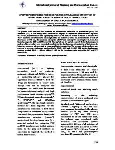
Figu 1. Location of studied area in the map of Iran (Reichert and Borg, 2008)
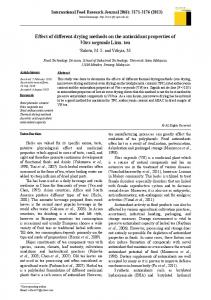
Figure 2. Location of samples within geological map of the studied area (Mokhtari et al., 2015)
107
108 Rezaie & Afzal
JGeope, 6 (1), 2016
Variography and anisotropic ellipsoid Variograms and anisotropic ellipsoids are a set of tools for spatial interpolation which are the critical components for geostatistical modeling (Verhoef and Cressie, 1993; Calder and Cressie, 2009). Based on 804 collected soil samples, the nondirectional and directional variograms for Zn and Pb were generated using RockWorks software package, as shown in Figure 3. Consequently, anisotropic ellipsoids and the axis characteristics were also provided. This reveals that the anisotropic ellipsoids for Zn and Pb are similar in the studied area (Fig. 3).
Estimation by OK and IDW Classical statistical parameters and histograms for Pb and Zn indicate that there are none-normal distributions (near to L distribution) with a positive skewness for both of them, as depicted in Figure 4. Based on the none-normal distributions, their medians are threshold values for Pb and Zn which are low values according to the high amounts of low grades for Pb and Zn (Table 1). Additionally, the classical methods based on summation of mean and standard deviation could not use because there are not normal distribution for Pb and Zn.
Figure 3. Variograms and anisotropic ellipsoid for A: Zn and B: Pb
The effect of estimation methods on fractal modeling for anomalies…
109
110 Rezaie & Afzal
JGeope, 6 (1), 2016
Figure 4. Histograms of A) Zn raw data B) Pb raw data C) Zn estimated data by OK D) Pb estimated data by OK E) Pb estimated data by IDW and F) Pb estimated data by IDW
The effect of estimation methods on fractal modeling for anomalies… Table 1. Statistical characteristics for Zn and Pb raw and estimated data Raw data Statistical parameters
Zn (ppm)
Pb (ppm) 1009
Mean
1470
Median
1902.5
487
Variance
1802.44
2796.35
Zn (ppm)
Pb (ppm)
IDW Method Statistical parameters Mean
1256
753
Median
1169.6
595.2
Variance
344236.46
364970.16
Statistical parameters
Zn (ppm)
Pb (ppm)
Mean
1356
887
OK Method
Median Variance
1355.5
844.7
120529.07
172947.8
Determination of the various cell dimensions within the 2D model is significant for geochemical exploration. David (1970) proposed general method for the operation according to the sampling pattern
111
and ore deposit type. Therefore, cell dimensions are equal to 40 m×40 m for X and Y, respectively. According to variography and anisotropic ellipsoid, the distribution models for Zn and Pb values in the deposit were built up by both OK and IDW methods. Results obtained by the both methods were compared based on their estimation variances and similarity to the used raw data for 804 collected soil samples (Fig. 4). Based on this comparison, variance of estimation derived via OK is lower than this obtained by the IDW method. Furthermore, mean values for Zn and Pb raw data have better correlation with their mean values obtained by the OK method, as depicted in Figure 4 and Table 1. C-A fractal modeling Based on the IDW and OK models for Zn and Pb, areas corresponding to the different grades were calculated to derive a C-A fractal model. Threshold values for Zn and Pb were recognized in the C-A log-log plots for both methods (Fig. 5) which revealed a power-law relationship between their concentrations and areas occupied.
Figure 5. C–A log–log plot for Zn and Pb concentrations based on OK and IDW methods
112 Rezaie & Afzal
The depicted arrows in the log-log plots show five threshold values (breakpoints) corresponding to 912 ppm, 1318 ppm, 1445 ppm, and 2754 ppm for estimated Zn by OK method and three thresholds including 794 ppm, 1380 ppm, and 3467 ppm for estimated Zn via IDW method. However, four and three thresholds were determined due to OK and IDW methods for Pb, respectively. For each method based on the log-log plots, geochemical anomalies
JGeope, 6 (1), 2016
were separated into four distinct categories called extremely, highly, moderately, and weakly anomalies, as depicted in Table 2. Threshold for extremely anomaly are similar for Pb in the both method (≥ 3162 ppm). According to the C-A fractal model, most of the extremely anomalies for Zn are situated in the NW part of the area resulted by both methods (Fig. 6).
Table 2. Separation of anomalies in the Irankuh area based on thresholds of Zn and Pb defined from the C–A fractal model OK Method Anomaly Zn (ppm) Pb (ppm) Extremely ≥ 2754 ≥ 3162 Highly 1318-2754 2754-3162 Moderately 912-1318 724-2754 Weakly ≤ 912 ≤ 724 IDW Method Anomaly Zn (ppm) Pb (ppm) Extremely ≥ 3467 ≥ 3162 Highly 1380-3467 891-3162 Moderately 794-1380 398-891 Weakly ≤ 794 ≤ 398
The effect of estimation methods on fractal modeling for anomalies…
113
Figure 6. Separation of anomalies by the C–A fractal model a) OK method for Zn b) IDW method for Zn c) OK method for Pb and d) IDW method for Pb
Furthermore, Pb extremely anomalies are located in the NW and central parts of the area based on the both method, as depicted in Figure 6. Comparison between OK and IDW variances in the fractal modeling The variances of different Zn and Pb geochemical anomalies derived via fractal modeling demonstrate
that variances obtained by the OK are lower than IDW for Zn (Table 3). Variances derived via the OK are lower than those for IDW in the extremely and highly Pb anomalies, however, the values of variances for other Pb anomalies are lower on the basis of IDW for moderately and weakly Pb anomalies, as depicted in Table 3.
Table 3. Variances of Zn and Pb mineralized zones obtained by the C-V modeling based on the IDW and OK estimation data Mineralized zone OK variance for Zn IDW variance for Zn OK variance for Pb IDW variance for Pb Extremely
34323.20
58071.35
178585.04
288843.63
Highly
59875.33
194838.58
9905.78
245259.33
Moderately
12358.96
26795.06
96152.29
16999.01
Weakly
20564.87
28949.79
19574.97
7622.71
As a result, the C-A fractal modeling based on the estimated data from the OK estimation method has higher accuracy compared to the IDW estimated data.
Conclusion Choosing the appropriate method for estimation with the minimum variance is important in any classical statistics and fractal modeling. Most of the
114 Rezaie & Afzal
classical statistics and fractal/multifractal models are defined based on estimated data. In this study, the 2D grid models from OK and IDW interpolation methods were built up from soil geochemical data. The variances distribution in both methods were examined for the Irankuh area considering the C-A fractal model. Estimation variance for the OK method is less than that in the IDW for extremely, highly, moderately and weakly Zn anomalies. Based on Pb anomalies obtained by the C-A fractal modeling, the moderately and weakly anomalies estimated by the IDW method have better accuracy, however, extremely and highly anomalies resulted
JGeope, 6 (1), 2016
by OK have less variances. Main Zn-Pb prospects are located in the NW part of the area. As a result, none-normal distributions for Pb and Zn and a dense sampling grid show that the fractal modeling is proper for separation of geochemical anomalies in the studied area. Acknowledgments The authors would like to thank Dr. Afshar Zia Zarifi for authorizing the use of the Irankuh exploration dataset.
References Afzal, P., Fadakar Alghalandis, Y., Khakzad, A., Moarefvand, P., Rashidnejad Omran, N., 2011. Delineation of mineralization zones in porphyry Cu deposits by fractal concentration–volume modeling. J Geochem Explor. 108: 220– 232. Afzal, P., FadakarAlghalandis, Y., Moarefvand, P., RashidnejadOmran, N., AsadiHaroni, H., 2012. Application of power-spectrum–volume fractal method for detecting hypogene,supergene enrichment, leached and barren zones in Kahang Cu porphyry deposit, Central Iran.J Geochem Explor. 112: 131-138. Afzal, P., Khakzad, A., Moarefvand, P., Rashidnejad Omran, N., Esfandiari, B., Fadakar Alghalandis, Y., 2010. Geochemical anomaly separation by multifractal modeling in Kahang (GorGor) porphyry system, Central Iran. J Geochem Explor . 104: 34–46. Afzal, P., Harati, H., Fadakar Alghalandis, Y., Yasrebi, A.B., 2013. Application of spectrum–area fractal model to identify of geochemical anomalies based on soil data in Kahang porphyry-type Cu deposit, Iran. Chemie der Erde. 73: 533– 543. Agterberg, F.P., 1995.Multifractal modeling of the sizes and grades of giant and supergiant deposits. Int Geol Rev. 37: 1– 8. Aramesh Asl, R., Afzal, P., Adib, A., Yasrebi, A.B., 2015. Application of multifractal modelling for the identification of alteration zones and major faults based on ETM+ multispectral data. Arab J Geosci. 8: 2997–3006. Bayraktar, H., Turalioglu, F.S., 2005. Kriging-based approaches for locating a sampling site-in the assessment of air quality. SERRA. 19: 301-305. Brus, D. J., de Gruijter, J. J., Marsman, B. A., Visschers, R., Bregt, A. K., and Breeuwsma, A. 1996.The performance of spatial interpolation methods and choropleth maps to estimate propertiesatpoints:A soil survey case study: Environmetrics. 7: 1–16. Calder, C.A., Cressie, N., 2009. Kriging and Variogram Models. Elsevier Ltd. All rights reserved, pp. 49-55. Cheng, Q, Agterberg, F. P., Ballantyne, S. B., 1994. The separartion of geochemical anomalies from background by fractal methods. Journal of Geochemical Exploration. 51: 109–130. Chile's, J.P., Delfiner, P., 1999. Geostatistics: Modeling Spatial Uncertainty. Wiley, New York.695pp. Cressie, N., 1993.Statistics for spatial data. John Wiley & Sons, New York, 900 pp. David, M., 1970. Geostatistical Ore Reserve Estimation, Amsterdam, Elsevier, 283 pp. Delavar, S. T., Afzal, P., Borg, G., Rasa, I., Lotfi, M., RashidnejadOmran, N., 2012. Delineation of mineralization zones using concentration–volume fractal method in Pb–Zn carbonate hosted deposits. J Geochem Explor. 118: 98-110. Declercq, F. A. N., 1996. Interpolation methods for scattered sample data: Accuracy, spatial patterns, processing time: Cartography and Geog Inf Sys. 23: 128–144. Dimitrakopoulos, R., Martinez, L., Ramazan, S., 2007.A maximum upside/minimum downside approach to the traditional optimization of open pit mine design. J Min Sci. 43: 73-82. Emery, X., 2005. Simple and Ordinary Kriging Multigaussian Kriging for Estimating recoverable Reserves. Math Geol. 37: 295-319. Englund, E.J., Weber, D.D., Leviant, N., 1992.The effects of sampling design parameters on block selection. Math. Geol. 24: 29–343. Gallichand, J., and Marcotte, D., 1993. Mapping clay content for subsurface drainage in the Niledelta: Geoderma. 58: 165–179. Ghazban, F.R., McNutt, H., Schwarcz, H.P., 1994. Genesis of sediment-hosted Zn–Pb–Ba deposits in the Irankuh district, Esfahan area, west-central Iran. Econ. Geol. 89: 1262–1278.
The effect of estimation methods on fractal modeling for anomalies…
115
Goncalves, M.A., Mateus, A., Oliveira, V., 2001. Geochemical anomaly separation by multifractal modeling. Journal of Geochemical Exploration. 72: 91-114. Goovaerts, P. 1997. Geostatistics for Natural Resources Evaluation. Oxford University Press, New York. 496 pp. Heidari, M., Ghaderi, M., Afzal, P., 2013.Delineating mineralized phases based on lithogeochemical data using multifractal model in Touzlar epithermal Au-Ag (Cu) deposit, NW Iran. Appl Geochem. 31: 119-132. Hormozi, H., Hormozi, E., Rahimi Nohooji N., 2012. The Classification of the Applicable Machine Learning Methods in Robot Manipulators. Int J of Mach Learning and Computing. 2: 560-563. Journel, A., 1983. Geostatistics: roadblocks and challenges, in A. Soares, ed., Geostatistics-Troia 1, Kluwer, pp. 213-224. Journel, A., Huijbregts, Ch.J., 1978.Mining Geostatistics. The Blackburn Press. 600 pp. Juan, P., Mateu, J., Jordan, M.M., Mataix-Solera, J., Meléndez-Pastor, I., Navarro-Pedreño, J., 2011.Geostatistical methods to identify and map spatial variations of soil salinity. J Geochem Explor. 108: 62-72. Laslett, G.M., 1994.Kriging and splines: An empirical comparison of their predictive performance in some applications. Jour. Am. Stat. Assoc. 89: 391–409. Laslett, G.M., and Mc Bratney, A.B., 1990.Further comparison of spatial methods for predicting soil pH. Soil Sci Soc America J. 54: 1553–1558. Laslett, G. M., Mc Bratney, A. B., Pahl, P. J., Hutchinson, M. F., 1987.Comparison of several spatial prediction methods for soil pH: Jour. of Soil Sci. 38: 325–341. Li, J., Heap, A.D., 2008. A Review of Spatial Interpolation Methods for Environmental Scientists. Geoscience Australia, GPO Box 378, Canberra, ACT 2601, Australia. Marechal, A., Serra, J., 1971. Random Kriging. Geostatistics, D.F. Merriam Editor, Plenum Press, New York. Matheron, G., 1967. Kriging or polynomial interpolation procedures. C.I.M. Bulletin. 60: 1041-1045. Mokhtari, A.R., Roshani Rodsari, P., Cohen, D.R., Emami, A., Dehghanzadeh Bafghi, A.A., Khodaian Ghegeni, Z., 2015. Metal speciation in agricultural soils adjacent to the Irankuh Pb–Zn mining area, central Iran. Journal of African Earth Sciences. 101: 186–193. Parhizkar, A., Ataei, M., Moarefvand, P., and Rasouli, V., 2011. Grade Uncertainty and Its Impact on Ore Grade Reconciliation between the Resource Model and the Mine. Arch. Min. Sci. 56: 119–134. Phillips, D.L., Lee, E.H., Herstrom, A.A., Hogsett, W.E., and Tingey, D.T., 1997.Use of auxiliary data for spatial interpolation of ozone exposure in southeastern forests. Environmetrics. 8: 43–61. Rahmati, A., Afzal, P., Abrishamifar, S.A., Sedeghi, B., 2015. Application of Concentration -Number and ConcentrationVolume fractal models to delineate mineralized zones in the Sheytoor iron deposit, Central Iran. Arab J Geosci. 8: 2953–2965. Reichert, J., 2007. A metallogenic model for carbonate-hosted non-sulphide zinc deposits based on observations of Mehdi Abad and Irankuh, Central and Southwestern Iran, Ph.D thesis, Martin Luther University, Halle Wittenberg, 152 pp. Reichert, J., Borg, G., 2008. Numerical simulation and a geochemical model of supergene carbonate-hosted non-sulphide zinc deposits. Ore Geology Reviews. 33: 134-151. Shademan Khakestar, M., Madani, H., Hassani, H., Moarefvand, P., 2013. Determining the best search neighbourhood in reserve estimation, using geostatistical method: A case study anomaly No 12A iron deposit in central Iran. J Geol. Soci.. India. 81: 581-585. Shahbeik, Sh., Afzal, P., Moarefvand, P., Qumarsy, M., 2014. Comparison between Ordinary Kriging (OK) and Inverse Distance Weighted (IDW) based on estimation error Case study: in Dardevey iron ore deposit, NE Iran. Arabian Journal of Geosciences, Arab J Geosci. 7: 3693–3704. Shamseddin Meigoony, M., Afzal, P., Gholinejad, M., Yasrebi, A.B., Sadeghi, B., 2014. Delineation of geochemical anomalies using factor analysis and multifractal modeling based on stream sediments data in Sarajeh 1:100,000 sheet, Central Iran. Arab J Geosci. 7: 5333–5343. Soltani Mohammadi, S., Hezarkhani, A., Tercan, A.E., 2012.Optimally locating additional drill holes in three dimensions using grade and simulated annealing. J Geol. Soci. India. 80: 700-706. Tahmasebi, P, Hezarkhani, A., 2010. Application of Adaptive Neuro-Fuzzy Inference System for Grade Estimation; Case Study, Sarcheshmeh Porphyry Copper Deposit, Kerman, Iran. Aust J of Basic and Appl Sci. 4: 408-420. VerHoef, J.M., Cressie, N. (1993) Multivariable spatial prediction. Math Geol. 252: 219-239. Wang, G., Carranza, E. J. M., Zuo, R., Hao, Y., Du, Y., Pang, Zh., Sun, Y., Qu, J., 2012.Mapping of district-scale potential targets using fractal models. J Geochem Explor. 122: 34-46. Wang, Q.F., Deng, J., Liu, H.,Wang, Y., Sun, X.,Wan, L., 2011.Fractal models for estimating local reserves with different mineralization qualities and spatial variations. J Geochem Explor. 108: 196–208. Weber, D.D., Englund, E.J., 1992.Evaluation and comparison of spatial interpolators. Math. Geol. 24: 381–391. Weber, D.D., Englund, E.J., 1994.Evaluation and comparison of spatial interpolators, II. Math. Geol. 26: 589–603. Yasrebi, A.B., Wetherelt, A., Foster, P., Coggan, J., Afzal, P., Agterberg, F.P., Kaveh Ahangaran, D., 2014. Application
116 Rezaie & Afzal
JGeope, 6 (1), 2016
of a density-volume (D-V) fractal model for rock characterisation and correlation of RQD and lithological units with density model in the Kahang porphyry deposit, Central Iran. International Journal of Rock Mechanics and Mining Sciences. 66:188–193. Zimmerman, D., Pavlik, C., Ruggles, A., Armstrong, M.P., 1999.An Experimental comparison of ordinary and universal kriging and inverse distance weighting. Math Geol. 31: 375–390.