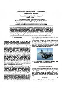
A Framework for Network-based Vehicle Navigation Systems Qingquan Li, Lin Xu, Bijun Li, Bisheng Yang,Yang Yu Transportation Research Center (TRC), Wuhan University, Wuhan, Hubei, China 430079 State Key Laboratory of Information Engineering in Surveying, Mapping and Remote Sensing, Wuhan University, Wuhan, Hubei, China 430079 Telephone: +86-27-68756512 Fax: +86-27-68756661 Email:
[email protected]
1. Introduction A Vehicle Navigation System (VNS) is a driving assist system that combines digital maps, vehicle position, route optimization, route guidance, and other technologies. It is one of the most important components of advanced traffic and traveler information systems in Intelligent Transportation Systems (ITS) and is an important application and research field in Geographic Information Systems for Transportation (GIS-T) (Goodchild 1998, 2000). With the increasing popularity of Global Position Systems (GPS) in the civilian market, automated vehicle navigation systems (AVNS) gradually occupy the market. Nevertheless, a VNS based on static road network has obvious deficiencies, such as 1) lack of up-to-date road network and real-time traffic information, 2) navigation without the consideration of changes of traffic and road network information, and 3) lack of the ability to interconnect with other service networks. In China, the requirements for solving traffic jam are becoming increasing prominent. Therefore, it is necessary to integrate vehicle navigation, wireless communication and network technologies for the development of a network-based vehicle navigation system, called as Network based Vehicle Navigation Systems (NVNS) (Li and Li 2001). In this paper, we propose a framework for NVNS and elaborate two key technologies, namely the incremental updating for navigation data and the integration of real-time traffic information with road network, which are two fundamental functionalities in a NVNS. Finally, a prototype based on the proposed framework is illustrated and discussion is given at the end of this paper.
2. A Framework for Network based VNS We propose a framework for network based VNS as illustrated in Figure 1. Four components are encompassed in the proposed framework, namely, the content supported layer, the service center, the communication layer, and navigation terminals.
Navigation Terminal In-Vehilcle Terminal
PDA、SmartPhone
Approved Traditional Navigation Functions (map display, route, poi search, geocode..) Geometry Data
Topology Data
User Layer/ Present Layer
Cell-phone
Map Update
Traffic Information Service
Extended Service API
Application Layer
Data Transition Layer
POI Data
OS(Wince、Palm、Symbian)
GSM/GPRS/CDMA/UTMS
Communication/ Transmission Layer
FM /WiFi
Service Center Approved Traditional Navigation Functions (map display, route, poi search, geocode..)
Map Update
Traffic Information
Extended Service
Service Layer
Value-added Database
Data Supported Layer
Other Content Provider (e.g. Weather)
Content Supported Layer
Operation Engine
Navigation Geodatabse
Traffic Information DataBase
Map Data Provider
Traffic Information Provider
User Information DataBase
Figure 1. The framework of a network-based vehicle navigation system 1) The Content Supported Layer This layer is the interface between the navigation service center and the content provider. 2) The Service Center The Service Center is a distribution and processing center of all navigation information. Based on a navigation map database, it provides comprehensive navigation services, such as data management, information disseminating, and Location based Services (LBS). It is a "Server" for navigation terminal, and consists of data supported layer and service layer. 3) The Communication Layer This layer is a link between service centers and mobile terminals to provide communications and data transmission channels. 4) Navigation Terminals Navigation terminals are “Customers” for the service center. “Customers” could download necessary data by a "push" or "pull" mode. Therefore navigation terminals can use the latest navigation map data and obtain various navigation services form the service
center. Navigation Terminals have a strong scalability and consist of data transition layer, the application layer, and user / performance layer. The data transition layer represents the navigation map data stored in a navigation terminal. The application layer provides a range of navigation functions and some personalized functions. The User/Presentation Layer combines different modules provided by an application layer to meet the requirements of different users. Why the data layer in the navigation terminal is called "transition" is that under the conditions of the existing wireless technology, only relying on data obtained from the server is unrealistic from the point of view of speed and economy. But with the development of communication technology, this transition layer will disappear, particularly in topology data and Point of Interest (POI) data. Several functionalities were implemented in the proposed system architecture according to ISO/TC204 WG3 standard, such as Route Planning and Route Guidance, Map Display, POI Search, Positioning, Dynamic Update of Digital Map, and Real-Time traffic information service.
3. The implementation of key techniques 3.1 The incremental updating for navigation digital maps An up-to-date navigation digital map is the basis and key component of a navigation system. We propose a new mechanism for the updating of navigation digital map, called the incremental updating (Xu et al 2006). The difference between the incremental updating and the traditional updating is shown in Figure 2.
Complete Update 完全更新
导航 数据库
Changes 外界变化 in the outside world
Navigation Data Producer 导航数据生产中心
Navigation导航终端 Terminal
Navigation Database
增量数据 Incremental Update
Figure 2. The difference between the incremental updating and the traditional updating The so called increments refer to the new changes from the last update to the present data, including new data, deleted data and revised data. Corresponding to the real world, it can be represented as a new road, an expanded road, or removal of an inn. Therefore, whenever the map data are changed, the incremental map data update method would transfer new increments caused by the changes to the end users in wired or wireless networks so as to achieve the updating tasks for the stored navigation data by the mobile user.
To implement the incremental updating for entire map dataset, we design some strategies targeting at the special needs of dynamic updating as well as the characteristics of navigation data. It can be described as follows. Goal
Constraint Limited bandwidth
Diverse terminal On-line Incremental update of Navigation Data
Solutions Splitting maps (layer, partition)
Intermediate standard format based on XML
Different store format Map Consistency
Update Transactions
Service conveniency
Multiple transfer model, Push and Pull service Strategies
Figure 3. Incremental updating strategies 1) Splitting maps: An incremental update of a complete map with one month of changes may also grow in the orders of Megabytes. Size reduction is therefore of vital considering the limited wireless communication channel. One method for size reduction is to split a map in smaller blocks, which can be updated separately. It makes sense to split the map data in parts (layer) that are used by different applications. E.g., the map matching needs only detailed road information around the vehicle, whereas the route planner needs a more global road network for a large area. In most cases the in-vehicle applications only need an up-to-date map for a limited geographic region. Therefore it also makes sense to split the map data into geographic regions (so called partitions), e.g., based on administrative region. 2) Intermediate standard format: Every update supplier and update user has its own proprietary format to organize and store its map-related data. A standard intermediate standard format must be introduced to deal with a multitude of proprietary data formats. GDF (Geographical Data File) 4.0 is a widely used ISO standard which includes navigation data model and data exchange format. We define intermediate standard format defining all kinds of changes based on GDF. Besides, the extensible marked language (XML) can be used to describe and exchange data taking into account the diversity of mobile user terminals. 3) Update Transactions: It is important that, after processing of a set of updates, the invehicle map can be used again by the applications, that it is still consistent.
Corresponding to one change in the real world, there can be a sequence of update operations. (e.g., Adding a new intersection means interrupting the original road data, then inserting a cross point, and re-constructing the road network topology at last.) These operations need to be processed all before the map is consistent again. Learning from DBMS, we can group this sequence into one update transaction. That means all these operations have either done or not done. Updates must be assigned to a layer and a partition. However, there can be dependencies between layers or partitions that make it necessary to update more than one piece of the map to keep the whole map consistent. 4) Multiple Service Models: For the convenience of users, we will provide a wide range of services model. Push model is based on the publish/subscribe/distribute paradigm. In this model, the service center first advertises what it supports, and what notifications it can send; the user then subscribes a client to the data he is interested in, specifies how often this client should receive this data, and disconnects. Then, the data provider takes the initiative to ‘push’ data to that client, either on a regular basis via a scheduler (e.g., for automatic updating) or asynchronously (e.g., to send notifications). Pull model is based on the request/response paradigm, the client sends a request to the server, then the server answers, either synchronous or asynchronously. Therefore, information is sent to the user only if requested, so the client always initiates the data transfer. In addition, it can be seen that the retrieval and receiving of the incremental data in the mobile user terminals are the critical components of the whole updating process. They are related to a set of complex theoretical and technical problems like the data model, data organization, the maintenance of data consistency. Now, our research group is conducting in-depth research on these problems.
3.2 The integration of traffic information and road network Transportation network data can be categorized into two types, namely, static road network data and network-attached dynamic information (e.g. traffic flow, traffic accidents, moving objects et al.). A NVNS needs the support of dynamic information (Miller and Shaw 2001).We propose a transportation network model, which integrates road network data, traffic information and moving objects. The model is able to fulfill the following requirements, the multiple-representation/multi-layer abstraction of a road network, the representation of the temporal dependence on the transportation relations, and a uniform linear geo-reference framework based on node-arc structures. Figure 4 illustrates the basic principles of the data model, and further study is under way.
Traffic Flow
Moving Object
Road Network
Traffic Information
Accident and Event
Road Construction
Figure 4. Integration of moving object, road network and traffic information.
4. The Design of Prototype A prototype system is designed based on the proposed framework as illustrated in Figure 1. Figure 5 illustrates the data flow in the prototype system and the relationship between several subsystems. Navigation Terminal In-vehicle Terminal
Traffic Information
Value-added Info (eg.wheather)
0 PDA、SmartPhone
Cell-phone
GSM/GPRS/CDMA/UTMS
PC
FM/WiFi
Network Navigation Communication Subsystem Monitor Service Map Service Traffic info Service Application Subsystem
Traffic and Multi-media information service subsystem
transaction supporting subsystem GIS and Network -based Navigation service subsystem
Management of navigation digital maps Subsystem
Service Center
Figure 5. The data flow of the prototype system
5. Discussion This paper analyzes the requirements of network-based vehicle navigation systems and explores the functionalities of a network-based vehicle navigation system. Then, a framework for the network based vehicle navigation system is presented and several fundamental functionalities are explored. Particularly, an incremental updating
mechanism and the integration of road network data and real time traffic information are elaborated in detail. Finally, a prototype system is designed according to the framework. A network based vehicle navigation system (NVNS) still faces many challenges. For example, personalized visualization for different users and terminals, dynamic navigation in a strange environment, high performance human computer interaction. We hope to present more progress in this project during the next GISRUK.
6. Acknowledgements Work described in his paper is supported by the National High Technology Research and Development Program of China (863 Program) – “Network-based Vehicle Navigation Services Technology”.
7. References Goodchild, M. F., 1998, The Relationship between Geographic Information Systems and Disaggregate Transportation modeling, Geographic Systems, 5: 9-17. Goodchild, M. F., 2000, GIS and Transportation: Status and Challenges, GeoInformatica 4(2):127-139. Fohl P, Curtin K M, Goodchild M F, et al, 1996, A Non-Planar, Lane-Based Navigable Data Model for ITS, Proceedings of the 7th International Symposium on Spatial Data Handling, Delft, 423-435. Li Deren, Li Qingquan, 2001, The Technique Integration of the Spatial Information and Mobile Communication, Geomatics and Information Science of Wuhan University, 26(1):1-7. Li Qingquan, Zuo Xiaoqing; Trends & Study Status Of Linear Data Model of GIS-T[J]. Geography and Geo - Information Science, 2004,Vol.20 No.3:31-35 Miller, H.J. and Shaw, S.L., 2001, “Geographic Information Systems for Transportation: Principles and Applications” Oxford University Press (ISBN 0195123948) Xu Jinghai, Li Qingquan, Zhen Nianbo, 2006, A Dynamic Update Method for Digital Map Data in Navigation Telematic System, 8th Asia-Pacific Intelligent Transport Systems Forum and Exhibition, HongKong. Zhen Nianbo, Li Qingquan, 2005, dynamic routing based on real-time traffic information in lbs,The 4th International Symposium on Multispectral Image Processing and Pattern Recognition,31 October-2 November. Liu Yuefeng, Zheng Jianghua, 2005, Study on the Real time Navigation Data Model for Dynamic Navigation, IEEE
Biography Dr. Qingquan Li is a full professor of Geoinformatics in Wuhan University, Wuhan China. He obtained his Ph.D in Photogrammetry and Remote Sensing from Wuhan Technical University of Surveying and Mapping in 1998. His research interests include ITS, LBS, laser scanning, and GIS. He has so far published more than 100 journal papers and 3 monographs, and supervised more than 20 Master students and 10 Ph.D students.