292
Future Scenarios for the Pampulha Region: A Geodesign Workshop Michele Campagna1, Ana Clara Mourão Moura2, Júnia Borges2, Chiara Cocco1 1University 2Federal
of Cagliari/Italy ·
[email protected] University of Minas Gerais/Brazil
Abstract: The paper describes the processes, workflow and results of a Geodesign workshop held by the authors in Belo Horizonte, Brazil in 2015. The participants were involved in the design of sustainable future alternatives for the urban district of Pampulha – an area characterized by complex conflicting interests concerning both development and landscape preservation. The scenarios were created on the basis of set objectives and priorities by six stakeholder groups, and assessed on the basis of ten evaluation systems. During the workshop, the use of a collaborative design support system (Geodesign Hub) facilitated the creation of design proposals informed by geographic context operatively enabling the application of the Steinitz’ Geodesign framework. The integration of information technologies in the planning process enabled the collaboration between the various actors involved simplifying the interactive scenario impact simulation and decision-making through real time performance analysis and quick negotiation cycles. Overall the Geodesign framework application with the Geodesign Hub platform proved to be a successful novel approach enabling to address some of the major traditional planning issues such as collaboration and negotiation in design and decision-making. Keywords: Geodesign, Pampulha, future scenarios, Planning Support Systems (PPS)
1
Introduction
It has often been said in the long lasting debate on sustainability of development that manmade transformation of the environment should be carefully evaluated before implementation against the possible impacts on environmental systems in order to preserve natural resources for future generations, while ensuring economic growth and social quality improvement. Agenda 21 (UN 1992) defines an operative program to implement the above principles suggesting the use of methods and tools to involve all relevant societal parties in the decisionmaking process which should be transparent, and responsible, and informed by the best knowledge available. In Europe, Directive 2001/42/EC applied some of the objectives and guidelines found in Agenda 21 in the realm of plans and programs, affecting the practice of spatial planning by the process of Strategic Environmental Assessment (SEA) (FISCHER 2007). In the last decade or less, the EU Member States started to apply SEA to spatial plans to evaluate their impact ex-ante before their adoption and implementation. The adoption of SEA in spatial planning according to the Directive should ensure the decision-making process to be knowledge-based, responsible and transparent. However, as recent studies demonstrated (SHEATE, BYRON & SMITH 2004, FISCHER 2010) SEA in spatial planning is often only done in bureaucratic manner failing to demonstrate why decision were made, to be open to the public, and last but not least, to properly put knowledge into action. Geodesign, and more specifically the Steinitz’ framework for Geodesign, may represent a viable solution to address many of the pitfalls of SEA of spatial planning in practice. This is particularly an actual challenge in Europe where Directive 2007/02/EC established the INfrastructure for SPatial InfoRmation in Europe (INSPIRE), a spatial data infrastructure which unleashes the seam-
Journal of Digital Landscape Architecture, 1-2016. © Herbert Wichmann Verlag, VDE VERLAG GMBH, Berlin/Offenbach. ISBN 978-3-87907-612-3, ISSN 2367-4253, doi:10.14627/537612033. This article is an open access article distributed under the terms and conditions of the Creative Commons Attribution license (http://creativecommons.org/licenses/by-nd/4.0/).
M. Campagna et al.: Future Scenarios for the Pampulha Region
293
less access to public authority spatial data and service resources, representing a fertile background for the diffusion of information systems in spatial planning and decision-making, which was somewhat limited in the past decades. Among recent advances in Planning Support Systems (PSS), Geodesign Hub© (GDH) (www. geodesignhub.com) may be considered an innovative platform for it addresses in an integrated way the core of the design process, namely in Steinitz’ terms the change, impact and decision models. HARRIS (1989) gave an early definition of Planning Support Systems as spatially-enabled information systems integrating Geographic Information Systems (GIS), models, and user-friendly geovisualization interfaces – including sketch planning functions and dynamic dashboards - supporting the planning process. Since then, a number of desktop PSS were created and widely used including the popular – though in a niche market ‒ What if?™ (KLOSTERMAN 1999) and CommunityViz® (KWARTLER & BERNARD 2001). However, the majority of the most popular PSS mostly addressed the knowledge creation part of the planning process (i. e. representation, process, and evaluation model) or the impact assessment part (i. e. the impact model) not fully achieving the objective to link knowledge to action (i. e. the link among the evaluation and the change model) in a truly and explicit collaborative manner. The latter core part of the process is where GDH PSS comes to play offering novel opportunities for planning and design support implementing the core of the Geodesign framework. In order words, GDH has a wider potential than other existing PSS to strongly tie geography and design together in collaborative and participatory processes. The workshop presented in this paper aimed to demonstrate this hypothesis both from the organizers (i. e. researchers, educators, and professionals) and the participants (i. e. professionals, educators, and students) perspectives: the feedback from all the participants eventually confirmed the assumptions.
2
The Pampulha Workshop
The Pampulha Geodesign workshop was held from 12 to 14 August 2015 within the postgraduate Course in Architecture and Urban Planning (NPGAU) at the Universidad Federal de Minas Gerais (UFMG), in Belo Horizonte (BH) as a collaborative effort with the University of Cagliari (UniCA). The workshop focused on the conceptual design of alternative futures for the Pampulha region with the objective to guide urban growth and land use changes, while protecting the environmental, natural and cultural resources of this urban area. The workshop workflow followed the Steinitz’ framework for Geodesign (2012), starting with a pre-workshop planning phase to understand and describe the territorial processes which characterize the geographical context. Using GIS, ten maps were created to assess the locational attractiveness and vulnerability related to the most relevant territorial systems, as detailed in section 2.2. Moreover, the digital evaluation models or requirements were used to analyse the impacts of the range of policies and projects embedded in the scenarios to achieve in a few design cycles an agreed solution by negotiation. One of the distinctive characteristics of this study was the use of the collaborative design support system Geodesign Hub © PSS to collect, analyse, and visualize proposed landscape changes in real time. With remote support of Carl Steinitz and Hrishikesh Ballal, who created and firstly adopted the GDH PSS in a number of experimental case studies, the authors set
294
Journal of Digital Landscape Architecture · 1-2016
up the project in the platform and implemented the planning process. By using the GDH PSS all participants were able to contribute individually and easily to the design process. The great flexibility of this PSS enabled different stakeholder groups to select a set of objectives which best corresponded to their interests, and to move toward the design process using different change models. Therefore, several different ways of design for change ‒ as described by Steinitz in his book (2012) ‒ were combined and applied during the workshop. Depending on the capabilities, experience, and strategy of the various actors involved and on their confidence about how to propose changes for the future, different approaches were applied for the change model ranging from the anticipatory, to the sequential, to the participatory models.
2.1
The Pampulha Region
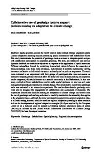
Pampulha is an urban context of strategic relevance in the city of Belo Horizonte, Minas Gerais, Brazil, for it is characterized by significant land use conflicts ‒ locations of high development pressures and high environmental and cultural values ‒ that require careful attention by the local public administrators. At the core of this urban area, the artificial lake and the built landscape surrounding it were originally designed by Oscar Niemeyer and Roberto Burle Marx under the aegis of Juscelino Kubitschek. The area represents a very important example of the early modern urbanism in Brazil. In 2015, Pampulha was identified as one of the select areas with the potential to be a UNESCO World Heritage site. This opportunity is expected to result in initiatives to address its transformation towards environmentally sustainable development in order to fulfill the UNESCO requirements. Exploring possible future alternative scenarios may thus help to gather precious insight for savvy managing its evolution while preserving its cultural values. Since its early days, Pampulha has been supporting high quality of life standards and a healthy environment, as it was designed as the main tourist and leisure pole for the city of Belo Horizonte (Figure 1). It also offers good infrastructure and urban services availability. These conditions provide to make the area interesting to investments; nevertheless, its landscape is still not much affected by the densification processes of volumetric growth (or verticalization) which currently affect many other parts of the city. However, given the existing regulations governing spatial development there is an actual risk to no longer being able to maintain the environmental, cultural, historical, and visual integrity. As a matter of fact, current growth patterns and zoning restrictions risk not only to affect the urban quality level of numerous Pampulha neighbourhoods, but also to cause highly negative consequences for the areas of great significance and consequently for the entire Pampulha urban region (COCCO, FONSECA & CAMPAGNA 2015). Having these issues in mind, the workshop was intended as an attempt to contribute to experiment novel methods and tools to support to the creation of a collaborative long-term master plan. To this end, the workshop was the occasion to test the application of Steinitz’ framework for Geodesign supported by a PSS, enabling collaborative design and interactive impact assessment for informed negotiations and decision-making.
M. Campagna et al.: Future Scenarios for the Pampulha Region
295
Fig. 1: Location of the study area in Brazil and views of the Pampulha region and of the projects of Oscar Niemeyer (photos: courtesy of Jô Moreira ©) As an effort to tackle the complexity of the whole urban district, the Geodesign workshop analyzed the Pampulha urban region in its whole entirety, within which the part designed by Niemeyer is a UNESCO World Heritage candidate. The preliminary assessment of the study area (i. e. the representation, process and evaluation models) was built by the authors prior to the workshop, so that in the limited time of three days, the participants could focus on the intervention part (i. e. change, impact and decision models) of the Geodesign framework as described in more details in the next section.
2.2
Pre-workshop Planning
The workshop preparation started in June 2015. The knowledge building phase was carried on by the authors as members of the coordination team. Carl Steinitz and Hrishi Ballal advised the coordination team in the setting-up the GDH PSS platform along the preparation by several Skype meetings and email communications. Indeed, the Belo Horizonte workshop was the first application of the GDH PSS without the direct coordination of Steinitz and Ballal during the actual workshop. From this perspective, as further discussed later, it was very interesting to conduct a first trial of GDH PSS by third-party experts, which confirmed the usability and the capability of the platform to fruitfully implement the Steinitz’s framework. The knowledge base for the study area assessment was developed by the coordination team according to an expert approach. The primary source of digital information on the Pampulha region was the spatial database of the Municipality (Companhia de Processamento de Dados – PRODABEL). The integration of social media data from Instagram posts was also used to
296
Journal of Digital Landscape Architecture · 1-2016
elicit local values which were then used to produce one of the assessment maps of the evaluation model (BORGES, JANKOWSKI & DAVIS JUNIOR 2015). After the preliminary analyses to understand the area, ten spatial variables were selected and ten evaluation maps were prepared by the team accordingly. The latter were of two main types: attractiveness maps, highlighting spatial patterns of high (i. e. green), intermediate (i. e. yellow) or low (i. e. red) demand for given land uses, infrastructures, or services; and vulnerability maps, highlighting spatial patterns of high (i. e. red), intermediate (i. e. yellow) or low (i. e. green) transformation risk, or cost, in term of environmental, cultural or social resources. According to this scheme, the evaluation maps were prepared to represent vegetation, hydrology, cultural and historical landscape resources, visual quality vulnerability, and building volumetric density, accessibility, transport, commerce and industry, housing and urban dynamism attractiveness. Altogether the ten assessment maps were used to describe and evaluate how the current landscape works and to simulate and assess the potential impacts of each of the possible future landscape change scenarios. The output of each of the evaluation models with their green-yellow-red colour code to be used during the workshop are given in Figure 2. The precise grid colour for assessment maps proposed by Steinitz and Ballal in the GDH PSS version used in the workshop turned out to be helpful in the definition of a shared and unified graphic language among all the participants in order to facilitate their comprehension and dialogue. The final step, before the workshop started, was the generalisation of the data geometry to a relevant scale to feed the GDH platform through upload.
Fig. 2: Evaluation models/ Assessment maps
2.3
The Participants
A total of twenty-one participants were selected by the organizers including ten PhD students from the Universidade Federal de Minas Gerais and six faculty staff members (five from UFMG and one from the Pontificia Universidade Catolica of Belo Horizonte), four technical staff members from the public sector (i. e. Federal Government level, State level and Municipal level), and one from the private sector (i. e. urban planning firm). The participants, the majority of which had previous personal knowledge of the local context of Pampulha, have
M. Campagna et al.: Future Scenarios for the Pampulha Region
297
various backgrounds spanning from architecture and urban planning, to Geographic Information System/Science and Information Technology creating a good mix of competencies for a Geodesign study. The participants were divided into six multi-disciplinary teams each playing the role of a different stakeholder group with various interests with regards to the future of Pampulha (Table 1). Table 1: The six stakeholder groups Group Cultural Heritage conservation Chamber of commerce Developers Green NGO (“friends of earth”) Public Administration Local residents
2.4
CH COM DEV GREEN PA RES
Workshop Process and Workflow
The workshop was developed according to a process informed by the second part of the Steinitz’s Geodesign framework, namely the intervention part, which informs the architecture of the GDH PSS. The participants were asked to define the decision model expressing the relative importance, according to their system of values, of the ten assessment maps of the evaluation model displayed in the online platform. The coordination team ensured to keep on schedule the process workflow (Figure 3) articulating it into clearly defined tasks, each to be accomplished within a fixed and concise time, while offering technical support and advice throughout the process.
Fig. 3: Process model of the Pampulha workshop workflow
298
Journal of Digital Landscape Architecture · 1-2016
During the first day two seminars were given to the participants introducing Geodesign concepts and principles, the Steinitz’ framework, the Pampulha case study area, and the GDH PSS. The participants also had some time for getting familiar with the platform using a simplified test project individually. The first Geodesign working session took place on the second day, when the participants, divided by groups playing the different roles (as in table 1) started to define the change team priorities to the requirements, so defining their own decision models. Once this was completed, the participants started the core design part of the workshop drafting project and policy options, so building a matrix of map-based diagrams. By using the online web-GIS interface of GDH all the participants individually were able to draw lines and polygons representing projects or policies (Figure 4) with the overlay guide of the different assessment maps. About 120 diagrams were created and systematically organized in the matrix, making them available to be used by all the participants. Then, the teams started to assemble the first scenarios (or synthesis) selecting combinations of project and policy diagrams among those available in the matrix according to their preferences. Each group development scenario comes from the combination of different sets of objectives and requirements associated with different stakeholder interests. In this initial round of the design synthesis they defined their priority areas of conservation and/or transformation according to the specific characteristics of the Pampulha region.
Fig. 4: GDH enables two types of feature drawing: project (i. e. solid green on the left side map) and policy (i. e. hatched green on the right side map). The left side diagram shows a project proposal for a urban green corridor, while in the right side diagram a policy to introduce native species is presented. Only projects were used for evaluating quantitative impacts by the systems in the used version. After the first round of synthesis was completed, each scenario in its first version was evaluated (Figure 5) in terms of impacts against each of the assessment maps. The GDH PSS platform provides an interactive impact assessments dashboard for the synthesis and in addition it has the ability to compare the impacts of different syntheses. Therefore, with the support of GDH PSS the groups could analyze and compare their first versions of the design synthesis and their impacts, before starting an informed revision of their designs. Afterwards, a second change-design cycle started. The users could rapidly drop/add change options or modify/create diagrams until they were satisfied with the impacts performance of their design.
M. Campagna et al.: Future Scenarios for the Pampulha Region
299
Fig. 5: Comparative analysis of the six stakeholder change proposals ‒ second synthesis. Impact summary in purple meant the team was doing best among the six alternatives of the Pampulha workshop workflow. At this point in the workshop, a negotiation process started to find consensus among the groups on preferable alternative scenarios. Two tools for negotiation and performance comparison of the designs were utilized: the group syntheses self-assessment matrix and the Sociogram for Negotiating Agreement (as in RIVERO et al. 2015). According to the results of these analyses consensus was rapidly found and three new teams resulted by merging the original groups by couple (i. e. CH&GREEN, DEVCOM and PA_RES). Like-minded groups made coalitions to reach agreement among their members and to find consensus working together up to few final syntheses. At a first glance, from the analysis of these three scenarios, it is possible to note that the DEVCOM alternative affects the whole study area and features a clear set of objectives, considering fewer diagrams as well as systems. Conversely, CH& GREEN proposed a wider variety of diagrams and considered different systems in its solution. The PA_RES scenario, whose change priorities are partially shared by both the other final negotiation groups, would be considered as a sort of compromise solution. Due to time limits the workshop concluded when agreement was found among the group on a total of three syntheses, one for each group, which were presented to all the participants. A final session ended the workshop with a reflexive exercise to evaluate strengths and weaknesses of the overall process and the PSS. A questionnaire survey followed the discussion to collect the results of the discussion in a systematic way from the participants.
300
3
Journal of Digital Landscape Architecture · 1-2016
Outcomes and Feedbacks
The workshop was very successful both from the participants and the organizers perspectives. The Geodesign framework embedded in the GDH PSS architecture supported very well the workshop making tasks easy for the participants and supplying a stimulating collaborative working environment. In only three days, it was possible to build different alternative scenarios for the development of the Pampulha district and to create consensus through negotiations narrowing down the number of possible future alternative designs to few acceptable. A feedback questionnaire survey was distributed to the participants after the workshop. The feedback was overall very positive demonstrating the capability of the method and the PSS to create a collaborative media where all the actors throughout the planning process could design, collaborate, negotiate and create consensus. This is very important because as noted by some of the participants the method and the tool together – unlike it often happens in the practice when communication barriers arise among actors – enables all the stakeholders with their different background, languages, and interests to express themselves, collaborate, and negotiate in a mutual learning and consensus-building process thanks to a common media. One of the participants in the workshop, stated that the GDH PSS tool has a huge potential to improve participatory planning and decision making processes with small data, little resources and in a short time. At the end of a participatory negotiation round, a set of mutually agreed proactive solutions was produced, indicating where future development is envisaged to protect environmental, cultural and visual assets. It was also highlighted by some of the participants involved in planning education the great potential of the Geodesign framework and of the GDH PSS as an effective approach to teaching in planning studio courses.
4
Conclusion
Overall, the paper aims at demonstrating the value of Geodesign as a novel methodology approach in addressing many of the open issues of contemporary planning practice, including collaboration and participation, transparency, and sustainability. The BH workshop, which was the first to apply the Steinitz’ framework with the Geodesign Hub© PSS without the direct coordination of its creators, can be considered a successfully third-party test of its value in term of usability and capability to support the implementation of the Geodesign framework. While good planning demands precision and consideration of policy issues that may not be fully supported by the GDH PSS, the tool is especially effective in the early stages of a complex study or project, when many alternatives must be rapidly created and considered. The design data created in GDH and exported for use in other statistical and geospatial processes acts as a filter, allowing planners to dramatically narrow the range of their investigations to consider scenarios already demonstrated to have social, political and scientific support. In addition, the BH workshop can be considered a first application of the Geodesign approach in Brazil. The involvement of various different-level government representatives in the workshop helped to start transferring the methodology to local institutions and to promote better spatial planning toward a more sustainable future. Combining different design methods and group objectives in a flexible and transparent process, the final alternative solutions resulted in low impact land-use changes and necessary conservation patterns. Eventually, while some issues were identified concerning timing, workflow, data accuracy,
M. Campagna et al.: Future Scenarios for the Pampulha Region
301
and the PSS interface, the workshop represented a good starting point for the authors and all the professionals, researchers, and students involved to approach and deepen the Geodesign methodology.
Acknowledgements This workshop has been organized with the support of CNPq – National Council for the Scientific and Technological Development: Call MCTI/CNPq/MEC/CAPES 43/2013, Process: 405664/2013-3, and Call MCTI/CNPQ/MEC/CAPES 22/2014, Process: 471089/20141. The authors would like to thank the anonymous reviewers for their valuable comments and suggestions. The authors would also like to thank very much Prof. Rogerio Araujo for its valuable feedback to the workshop participation, and Jô Moreira (www.jomoreira.com.br) for the courtesy of the photos in figure 1.
References BORGES, J., JANKOWSKI, P. & DAVIS JUNIOR, C. (2015), Crowdsourced information from Tweets during the World Cup in Brazil: A theme search. In: Proceedings of the International Conference on Changing Cities II, Spatial, Design, Landscape & Socio-economic Dimensions. Grafima Publications, Thessaly. COCCO, C., FONSECA, B. M. & CAMPAGNA, M. (2015), Applying Geodesign in Urban Planning Case Study of Pampulha, Belo Horizonte. In: RCB – Revista Brasileira de Cartografia (Online), 67 (5), 929-940. FISCHER, T. (2007), Theory and Practice of Strategic Environmental Assessment. Earthscan, London. FISCHER, T. (2010), Reviewing the quality of strategic environmental assessment reports for English spatial plan core strategies. Environmental Impact Assessment Review, 30 (1), 62-69. HARRIS, B. (1989), Beyond Geographic Information Systems: computer and the planning professionals. Journal of American Planning Association, 55 (1), 85-86. KWARTLER, M. & BERNARD, R. N. (2001), CommunityViz: an integrated planning support system. Planning support systems, 49. Esri Press, Redlands, CA. KLOSTERMAN, R. (1999), The What If? Collaborative Planning Support System. Environment and Planning B: Planning and Design, 26, 393-408. RIVERO, R., SMITH, A., BALLAL, H. & STEINITZ, C. (2015), Promoting Collaborative Geodesign in a Multidisciplinary and Multiscale Environment: Coastal Georgia 2050, USA. In: BUHMANN, E., ERVIN, S. & PIETSCH, M. (Eds.), Peer Reviewed Proceedings of Digital Landscape Architecture 2015. Wichmann, Berlin/Offenbach, 42-58. SHEATE, W., BYRON, H. & SMITH, S. (2004), Implementing the SEA Directive: sectorial challenges and opportunities for the UK and EU. European Environment, 14, 73-93. STEINITZ, C. (2012), A Framework for Geodesign: Changing Geography by Design. Esri Press, Redlands, CA. UN ‒ UNITED NATIONS (1992), Results of the World Conference on Environmental and Development: Agenda 21. UNCED, Rio de Janeiro. United Nations, New York. A/CONF.151/26.