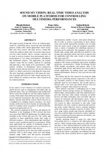
an alternative approach to vision techniques - Infoscience - EPFL
Recommend Documents
This paper presents Sound My Vision, an Android appli- cation for controlling music ... phones, cameras, and various sensors which can serve as a foundation for ... fore, using widely present and relatively affordable de- vices they could be ...
Jul 4, 2016 - Agile locomotion in animals results from a complex interplay of various .... our case bi-planar, is increasingly used to characterize animal ...
The actions taken after detecting that a node misbehaves range from forbid- ... Even if not presented by its authors as an artificial immune system, the reputation ... natural innate immune system (Section 2.2), in the sense that it is hardwired in t
PROGRAMME DOCTORAL EN GÃNIE ÃLECTRIQUE ..... 3.4 Effect of varying parameter β on the diarization error for the development dataset. ..... Speaker diarization consists of detecting number of speakers and speech corresponding to ...
Jun 20, 2004 - As you can see on Figure 2 and 3, the working area is define in yellow1. As in 3D ... This parallelogram is located at a distance of 63,45 from the camera, and lies on the table (at an ..... In fact we don't let the pendulum oscillate.
2.2. FFD properties and practical issues. FFD is a method that involves all the domain, as a lattice created by Bernstein polynomials where all the internal objects ...
a hardware/software approach to synchronize the execution of bio-signal processing ... changed the landscape of health monitoring applications, al- lowing for ...
Aug 8, 2015 - Email addresses: [email protected] (Feng Chen), [email protected] (Jan ... spatial domain decomposition to construct an iterative approach for solving the temporal problem in a ... where MG is cheap to apply.
a convolutive mixture of sources, exploiting the time-domain spar- sity of the mixing filters and the sparsity of the so
May 31, 2005 - To appear in Proceedings of the VIIIth European Conference on Artificial Life ECAL 2005. Lecture Notes in Artificial Intelligence (c) Springer ...
grid friendly flexible loads and distributed energy resources encountered in modern ... of accompanying volt/var control devices (PV inverters, EV chargers and the like). ... energy and technology options, at the levels of extraction, generation, ...
and video-telephony 2, 3 , MPEG-1 for storage on CD-ROM 4, 5 , MPEG-2 for ... tele-medicine, image data retrieval, video-telephony and video messaging,.
loop plant model identification should be used when a criterion for con- troller reduction is given? Keywords: System identification, closed loop identification, ...
Jan 28, 2015 - SPISM makes use of (active) machine-learning techniques, ... proportion of correct sharing decisions of 72% (after only 40 manual decisions). ...... 12the âN/Aâ label corresponds to the case where the user could not reach a ...
Sep 19, 2013 - the supplier-roles of bike-rider and train-passenger also reveal other entities ... roposition. Adopter as a. C ommu te r. Adopter a. s a. C. o-p asse n ge r. Adopter a ..... patterns, e.g. a rock rolling down a hill or an instance of
bespoke technology platforms or supports, as well as a pedagogical designs. Stu- ... tion as a means of guiding students' connection of principles throughout the ..... HÃ¥klev, S. Software for INQ101x. https://github.com/houshuang/survey, 2016.
Experiments show that the mechanical behavior of a single wood fiber under axial tension is .... I also thank Mr. P. Vulliemin, our ingenious technician, for the.
To capture the interaction going on during a method call with an aspect, we .... is highlighted in grey. We will now proceed and make this grey part a first-class .... European Conference on ObjectâOriented Programming. (ECOOP 2001), pp.
PEDESTRIAN NAVIGATION SYSTEM BASED ON DIGITAL MAGNETIC COMPASS AND ... The motivation doesn't come to navigate with a gyroscope heading only, as presented in ... Normalizing the displacement speed of people by these parame- ters, it is ... steps. This approach can be expressed as followed: For a given.
AN ALTERNATIVE APPROACH TO VISION TECHNIQUES: PEDESTRIAN NAVIGATION SYSTEM BASED ON DIGITAL MAGNETIC COMPASS AND GYROSCOPE INTEGRATION Quentin Ladetto, Bertrand Merminod Geodetic Laboratory (TOPO) - Swiss Federal Institute of Technology (EPFL) CH-1015 Lausanne, Switzerland. WWW: http://topo.epfl.ch E-mail: [email protected]
ABSTRACT Over the last few years, research had been conducted on how to develop basic mobility aid for visually impaired and blind people using vision and image processing techniques. However, our research at Geodetic Engineering Laboratory has taken a different view to this problem. We have been looking at some alternative approaches to tackle the navigation problem for the visually impaired and blind people. When satellite signals are available, the localisation of a pedestrian is fairly straightforward. However, in cities or indoors, dead reckoning systems are necessary. Our current research focuses on the development of algorithms for pedestrian navigation in both postprocessing and real-time modes. Experience shows that the main source of error in position comes from the errors in the determination of the azimuth of walk. By coupling a magnetic compass with a decentralized low-cost gyroscope, the advantage of one device compensates the drawback of the other. If we compare the rate of change of both signals continuously while measuring the strength of the magnetic field, it is possible to detect and compensate magnetic disturbances. When these disturbances do not take place, the continuous measurement of the azimuth allows computing and updating the bias and scale factor of the gyroscope. Thus, reliability of indoor and outdoor navigation is, because of the redundancy of information, significantly improved. Numerous tests conducted with different subjects in various environments validate this approach. 1. INTRODUCTION The nice aspect about human displacements is its total and unpredictable freedom of motions. The worst hypothesis when modelling human trajectories is precisely this liberty of movements. Such aspect will play a major role in the filtering of the azimuth of displacement. Sudden rotations measured by a magnetic compass can be caused either by the movement itself or by a magnetic disturbance. Intuitively, if there is a disturbance, the total value of the earth magnetic field must change. Some examples show that this condition might be sufficient but not necessary and that it is not so straightforward as it firstly appears. In order to improve the reliability of the azimuth determination, a gyroscope will be used. The motivation doesn’t come to navigate with a gyroscope heading only, as presented in [Gabaglio, 2002], but to use it to bridge the gaps when the compass is out. Vice versa, the magnetic azimuth will contribute to determine the absolute direction of the gyroscope
as well as a continuous calibration of its errors (bias and scale factor) even when no satellite signals are available. The suggested methodology takes into account the possibility of a non-aligned system, opening therefore the use of a gyroscope that has multiple tasks. Azimuth, however, is only one component in the determination of the trajectory. The step length determination is done here using a occurrential approach rather than a double integration of the acceleration. In order to detect the direction of displacement of the person, we perform pattern recognition on the 3D acceleration. This allows a distinction between forwardsbackwards movements as well as side-stepping, frequently done by the blind to bypass obstacles. This paper will present the occurrential approach capabilities for pedestrian navigation as well as the combination of compass and gyroscope data for this specific application. 2. THE OCCURRENTIAL APPROACH Like fingerprints, the profile of walk uniquely characterizes a person. If the frequency content varies so much between individuals, a general model will require a normalization procedure followed then by an adaptation to each person. The concept of normalization comes from the observation that the step frequency of unconstrained displacement is more or less equal for everybody. The speed differences are therefore a direct consequence of the stride length. The hypothesis that the step length is proportional to the height, or even better, to the leg length of the person, seems to be reasonable. Normalizing the displacement speed of people by these parameters, it is theoretically possible to go from individual to more universal models. Each stride is however, and fortunately, not equal to a fix value. This internal step variability, by the same person and at a given frequency, is simply impossible to predict. The scope will therefore not be the precise modeling of a step occurrence but to reliably reproduce a traveled distance composed by a sample of steps. This approach can be expressed as followed: For a given frequency, the step length of an individual can be considered as constant. The natural variation of the stride follows a normal distribution centered at zero and where the variance is inversely proportional to the step frequency. This means that to a longer step will correspond a shorter one, assuming so a constant distance for a given number of step at a defined frequency. TABLE 1 presents the variation of the step length in function of the kind of walk.
Table 2. Comparison between step frequencies for two free trajectories in residential and downtown areas. The person with view is representative of a group of 13 people who participated to tests. Frequency variability is higher for the blind. This can be explained by the trust towards the instantaneous situation. In case of hesitation, a higher frequency will be adopted to quickly adapt to any unexpected event. Direct consequence will be to shorten the steps.
In opposition to all these intents of modeling, one should stress the almost total freedom of movement of the people as well as the direct influence of the kind of ground. Fatigue, bad training, snow in hiking conditions can make obsolete well calibrated parameters for a different environment. The adaptation of the models to fit the situation will be realized with the use of external information mainly coming from the GPS-NAVSTAR satellites constellation. F IGURE 1 shows the influence of the slope on the step length, simultaneously to the individuality of the approach towards changes in the terrain. In order to check if the developed theory is also applicable to the blind, several tests took place downtown Lausanne. It is important to note that the blind were not guided by anybody but were moving freely, only helped by their walking stick, TABLE 2. Results show that the walking frequency is strongly correlated to the knowledge of the path as well as to the congestion of the sidewalk. The frequency changes are in harmony with the previous theory, and the physiological models, once calibrated, can be
-15
-10
-5
0 Slope [%]
5
10
15
20
Size of the steps vs slope
100 95 90 85
Size of the steps [cm]
Table 1. Variation of the step size relative to different type of walk. On a 1 km track, people were asked to walk at different rhythms. The free walk took place on a 3.6 km trajectory. If the internal step length variability is similar for the normal and rapid walk, slow walking implies an important variation of the stride length. This makes it more difficult to predict.
80 75 70 65 60 55 -20
-15
-10
-5
0 Slope [%]
5
10
15
Figure 1. The influence of the slope on the step frequency (up) and the step length (down). More than every other parameter, the fitness of a person influence in the short time these parameters. The augmentation or maintenance of the step frequency/length by people, express the tentative to maintain a constant speed independently of the slope.
used as for people with view. The different obstacles (advertising plate, display rack) cause lateral movements that have to be detected. This is done by directly analyzing the pattern of the tridimensional acceleration signals. Several movements of interest were discretized in order to get a dictionary of patterns to match [Steiner, 2002, Ladetto, 2002]. Corrections to the measured azimuth of walk will then be applied according to the displacement. F IGURE 2 shows the detection of different ways of walking. 3. COMPASS NAVIGATION The magnetic azimuth is the horizontal component of the Earth magnetic field. Its determination requires implicitly the knowledge of the horizontal or vertical plane. This is commonly done
20
The use of relations (Eq. 1) and (Eq. 3), together with some trigonometric manipulations, leads to
Different step occurences during the walk
4α = −4θ · tan δ · cos α − 4ϕ · tan δ · sin α
0
stepside left
2700
2800
2900
3000
3100 3200 3300 Number of samples
3400
}
forwards
}
forwards
- 0.5
}
}
A [g]
0.5
stepside right
3500
3600
3700
Ax [g]
0.5 0
Ay [g]
- 0.5
2700
2800
2900
3000
3100
3200
2700
2800
2900
3000
3100
3200
3300
3400
3500
3600
3700
0.5 0 - 0.5 3300
3400
3500
3600
3700
Az [g]
1.5 1 0.5 2700
2800
2900
3000
3100 3200 3300 Number of samples
3400
3500
3600
3700
Figure 2. Example of a person walking with different attitudes. The side-stepping displacements are important in applications for the blind. These movements occur mainly when by-passing an obstacle, and concern only one to three step occurrence.
by sensing the gravity vector at rest. To compute then the azimuth of walk, one has to constantly compute the attitude of the sensor in order to correct the measured magnetic values. Using the 3D rotation matrix with the Yaw(ψ)-Pitch(ϕ)-Roll(θ) sequence, the horizontal components Hy and Hx are Hx Hy
= =
bx · cos ϕ + by · sin θ · sin ϕ + bz · cos θ · sin ϕ by · cos θ − bz · sin θ (1)
This relation shows that the error in determining the attitude angles directly affects the azimuth. Its effect strongly depends on the azimuth itself. The same errors will have different effects according to the latitude of displacement. This can be understood considering that the higher the latitude, the weaker the measured horizontal field. Therefore, the secondary component induced by the attitude errors will have a more important influence. For mid-latitude, the average value of 2 for tan δ can be considered. A complete theoretical description can be found in [Denne, 1979]. Independently to these errors, disturbances, divided into soft and hard categories will affect the Earth magnetic field in the three space dimensions. A rigorous approach for calibration and removal of these disturbances would require the determination of 12 parameters at known elevations, which, considering the previous remark, would also be affected by some errors. A simplified 4 parameters calibration [Caruso, 1997] consists of determining only the corrections in the horizontal plane. This is more convenient for this particular application considering that the pedestrian navigation system is generally worn vertical at the belt level. The four parameters are two scale factors (Xsf Ysf ) and two translations (X0 , Y0 ). Applying the corrections to the projected magnetic values, the components of equation (3) become Hx Hy
Simplifying and taking into account that cos(α) He = HH − sin(α) tan(δ) we get the error produced that can be written as 4α =
Hy 4Hx − Hx 4Hy Hx 2 + Hy 2
(2)
Hy/Hy max
=
Xf e · HXmes + X0 Yf e · HYmes + X0
= =
F IGURE 3 illustrates the results of the calibration procedure determining the disturbances caused by the clothes and accessories of a person.
where bi coefficients are the components measured by the sensor. The azimuths (Eq. 2) derived from these values will contain and propagate the errors present in the attitude angles themselves. According to the first order Taylor development of the azimuth computation, it value and uncertainty becomes α
(4)
-1.5
-1
1
No disturbance
0.5
Hard magnetic disturbance 0
-0.5 -0.5
0.5
1
1.5 Soft magnetic disturbance
4Hy -1
Measured disturbance 360° standing
-1.5
Corrected disturbance 360° standing
-2
Hx/Hx max
(3) Figure 3. Description of the different effects of magnetic disturbances. The result of the simplified procedure adapted for pedestrian navigation corrects the disturbances caused by clothes and accessories.
Once walking, magnetic disturbances have an important influence on the quality of the azimuth signal. These are sometimes identifiable thanks to the magnetic field itself, however, the simultaneous use of a gyroscope allows providing a heading when navigating in sensible areas. 4.1. Optimising the magnetic information The Earth magnetic field can be considered as a constant within the area normally covered by a pedestrian. All sudden variation of this field will be logically and indicator of a disturbance. Unfortunately, when someone is moving, the magnetic ambient is always changing and small random variation are caused by the environment. If a low-pass filter and the occurrential approach take care of the majority of these fluctuations, the determination of a threshold is indispensable. Ideally this should be determined in a magnetic neutral area. This stage being unfortunately too constraining, the value of 3mT has been empirically defined as threshold on the root mean square of the magnetic field during three steps. Passed this value, the last good azimuth is held constant until the field variation becomes stable again. The error introduced with such simplification is directly correlated to the sinuosity of the path during the disturbed period. As the effect of a disturbance decreases with the square (even cube) of the distance from the source, the majority of effects are visible only over tens of meters. Considering the way people walk and the strong influence of the cadastre (straight line along sidewalks between buildings), this approach provides a much better result than considering indistinctively disturbed and undisturbed azimuths. 4.2. Using gyroscope Although gyroscopic azimuth is broadly used in dead reckoning navigation, the intention here is to use it only as a back-up system in definite situations when the compass is confused or during quick turns. The exclusive use of the gyroscope during these periods, even if they are reasonably short (one to two minutes maximum), requires its permanent and complete calibration. Bias and scale factor are therefore continuously up-dated by the compass data or/and with GPS data when the satellite signal is available. The use of non-aligned sensors force the gyroscope angles to virtually harmonize themselves with the compass. The misalignment towards the direction of walk can in a second time only be defined if given absolute directions are known or if satellites signals are present. Numerous tests [Moix, 2002, Ladetto and Merminod, 2002] using a low cost vertical gyroscope have shown a scale factor error of 1%. For 90◦ turn, keeping the scale factor to unity would cause an error of 0.9◦ ; that is in the same order of precision as the azimuth we get from the compass. The parameter of a scale factor will therefore be neglected under the hypothesis that the gyroscope is set perpendicularly to the plane of movement. The bias determination, however, is of major importance and requires an initialisation phase before each run. This will be done while standing or along a line because it is important that the gyroscope doesn’t sense any angular velocity (Earth rate is neglected). The simplified model is the following ω ˇ i = ω i − b i + εi
where ω ˇ i is the true angular velocity, bi is the instantaneous bias and εi is a white noise with zero mean. Considering the azimuth from the gyroscope, it is possible to write gyro ϕgyro start − ϕend =
n X (−bi ) · 4t i=1
where n is the number of time interval and 4t is the time interval itself (here 1/30 s). Doing the hypothesis of a constant bias during the initial phase, an approximated bias value is given by n
X ϕgyro − ϕgyro end ¯b = 1 · (bi ) = start n i=1 4T where 4T = n · 4t. The value ¯b is then automatically updated when no magnetic disturbance is detected. This can be done via a Kalman or an exponential filter. F IGURE 4 presents the effects of magnetic disturbances on the compass. 600
Magnetic azimuth Gyroscopic azimuth
500
400
Azimuth [°]
4. HANDLING MAGNETIC DISTURBANCES
300
200
100
0
-100
0
50
100
150
200
250
300
Steps [-]
Figure 4. Comparison of the azimuth computed from both, compass and gyroscope. This shows in evidence the magnetic disturbances.
5. DISPLACEMENT IN TRAVERSE The displacement of a person can be seen as a traverse as it is commonly called in geodesy. The distance between two summits corresponds to a stride and the angle between one point and the other is the azimuth of displacement. The two start and end points that need known coordinates will be either survey points or GPS fixes. The mathematical expression of a trajectory is expressed by Eastf inal N orthf inal
= =
Eastinitial +
n X
di · sin αi
i=1 n X
N orthinitial +
di · cos αi
i=1
where n is the number of steps, d is the computed step length and αi is the measured azimuth.
350
The precision of the final position is computed by applying the variance-covariance propagation law to the previous equation: 2 σEast i
2 2 2 2 2 2 σN orthi−1 + cos α · σdi + di · sin αi · σαi
At this stage we can clearly see the difference in evolution of the precision between the occurrential approach and the 3D inertial navigation. Using the first approach, no degradation of the position occurs if no movement is detected. On the contrary, continuous time integration is sensible to every bias present in the acceleration, even if the person is standing still. F IGURE 5 represents the general flow-chart of the information. Before any azimuth determination, several tests are done to check if the person is moving, and which kind of movement is being done. Once this is done, the dead reckoning solution is computed and compared, if available, to the GPS position. This latter will also help updating the different parameters used in the step and speed estimation, the misalignment as well as the altitude models. When walking downtown cities, satellites signals are generally
It can therefore take the best advantage of the configuration of the previous and present GPS positions. The precision of the satellite solution of navigation (10-20 m) also influences the update. Even if consecutive GPS fixes can be computed, their proximity might not be suitable enough to accurately deduce the azimuth. On counterpart, relative positioning can take advantage of the strong correlation between successive GPS epochs to compute speed and traveled distance. Special care should however be taken concerning multipath and thus, solutions require reliable testing before being used for update. 6. ALTITUDE: THE THIRD COMPONENT The continuous knowledge of the altitude opens not only possibilities for a tri-dimensional positioning but also for physiological and energetical analysis. The trajectory in planimetry is also improved by considering the cosine of the slope for the projection of the different part of the journey. In pedestrian navigation, three main actors will occasion altitude changes. Each of them has its own particularity that allows identification. 1. slopes: small or large, the vertical change will be regular and continuous
Sliding Window on DMC data
N
2. stairs: present a gradient in altimetry of ±1 m for every 5 steps. Var AP>Threshold
3. elevators: no detection of movement is seen on the accelerometers but the barometer sense the changes in pressure.
GPS DATA
Y N
Lateral movement
IS Var AP>Var LAT & pattern F-B ok Y
Indoor navigation: two floors down 430 "Steps" situation detected
Barometer Data
429
Forw-Backw movement Either AP signal or AP&VERT signals considered
LAT scenarios
AP scenarios
427 Altitude [m]
Either LAT signal or LAT&VERT signals considered
428
426 425 424 423
ideal
Distance Traveled
measured 422 8
Azimuth computation
modelised 6
4 East [m ]
2
0
-2
0
3 2 1 ] North [m
2/3D Position+Speed
Figure 5. Flow chart of the developed approach considering each step occurrence instead of a double integration of the acceleration. not continuously available and positions might only be computed at crossroads. The specific update procedure takes this intermittent particularity into account by sequentially updating the parameters.
Figure 6. 3-D representation of downward walking for a stair scenario inside a building. The altitude change of 7.8 m is modeled here after filtering the pression by 7.28 m. The improvement of the sensor resolution is possible here thanks to the detection of the situation and an appropriate pressure treatment. As for planimetry, relative information is more precise than the absolute one and GPS or known altitude updates are necessary.
The resolution of the barometer can be improved by an appropriate treatment of the pressure. As 0.1 mb represents more or less 1 m in height, oscillations between two altitudes, only caused by the sensor resolution, are very common, even on flat ground. A temporal filter takes into consideration the possibility and probability of the 3 kinds of movement described previously before applying different treatment following the situation. An exponential filter is applied afterwards in the case of slopes and elevators. This allows having continuous changes, more precise than the resolution of the sensor itself. In the stairs situation, the step height is mainly normalised (between 16.25 cm and 19.6 cm in Switzerland). Progressive altitude change is modeled as soon as the action is detected. F IGURE 6 presents the typical downward sloping stair inside a building.
7. PNS: A NEW CHALLENGE
m
To measure, synchronize and filter all the necessary data, a system was conceived and realized together with Leica Vectronix. The Pedestrian Navigation System (PNS), F IGURE 7, is composed of a high performance, commercial grade GPS receiver, a barometer, a digital magnetic compass (3 accelerometers & 3 magnetic sensors). The integration of a gyroscope is in progress.
Figure 8. Pure Dead Reckoning Navigation by a blind downtown Lausanne (CH). The different models were calibrated and took into account the sidestepping as well as the snap movements of the blind. Reported on a site plan, the trajectory (1’905 m) shows small discrepancies but determine reliably the real path followed. The power line of the bus as well as the numerous parked cars influence negligibly the computed trajectory.
48. 3m
Acknowledgments Special thanks to Mrs. and Mr. Jean & Jack Runyon from Locametric LLC, Virginia, for the testing and data collection as well as to Dr. Silvio Gnepf and Mr. Josephus van Seeters of Leica Vectronix for their collaboration and encouragement. This research is performed under a collaboration scheme financed jointly by the Swiss Government and Leica Geosystems AG.
73.7
mm
Figure 7. Pedestrian Navigation System (PNS) developed together with Leica Vectronix. A total 3-D positioning capability for less than 50 grams.
8. CONCLUSION This paper showed the achievable accuracy and reliability of the occurrential, stride-dependant, approach that replaces the temporal, double integration, evolution. The development of a Pedestrian Navigation System (PNS) based mainly on a digital magnetic compass was done in order to fulfill the specific ergonomic requirements of the application. In non-magnetically disturbed areas, the errors in position are below the 10 meters. In order to improve the reliability of the system, the addition of a gyroscope helps bridging the gaps when the compass is strongly disturbed. No operational ZUPTs constrain are required by the approach. This new product and approach open the door to a new data capture form in GIS, navigation for the blind, F IGURE 8, as well as projects where individual’s position is of interest.
9. REFERENCES [Caruso, 1997] Caruso, M. J. (1997). Applications of magnetoresistive sensors in navigation systems. Sensor and Actuators, (SAE SP-1220):15–21. [Denne, 1979] Denne, W. (1979). Magnetic Compass Deviation and Correction. Brown, Son & Fergusson Ltd, Scotland. [Gabaglio, 2002] Gabaglio, V. (2002). GPS/INS System Integration for Low-Dynamic Application. PhD thesis, Ecole Polytechnique F´ed´erale Lausanne (EPFL). To be accepted. [Ladetto, 2002] Ladetto, Q. (2002). Capteurs et algorithmes pour la localisation autonome en mode p´edestre. PhD thesis, Ecole Polytechnique F´ed´erale Lausanne (EPFL). To be accepted. [Ladetto and Merminod, 2002] Ladetto, Q. and Merminod, B. (2002). Digital magnetic compass and gyroscope for pedestrian navigation. Proc. of the 9th Saint-Petersburg International Conference on Integrated Navigation Systems. To be published. [Moix, 2002] Moix, S. (2002). Am´eliorer la navigation p´edestre en int´egrant un gyroscope et une boussole. Masters Thesis, EPFL. [Steiner, 2002] Steiner, C. (2002). Reconnaissance de motifs dans le domaine de la navigation p´edestre. Masters Thesis, EPFL.