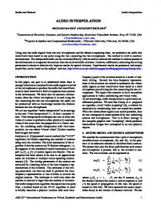
De Montfort University, Leicester, United Kingdom. Summary ... pus of De Montfort University (DMU), Leicester. A ..... It was added to Leicester Castle as.
Audio Tactile Maps (ATM) System for the Exploration of Digital Heritage Buildings by Visually-impaired Individuals - First Prototype and Preliminary Evaluation Liam O’Sullivan, Lorenzo Picinali, Christopher Feakes, Douglas Cawthorne De Montfort University, Leicester, United Kingdom
Summary Navigation within historic spaces requires analysis of a variety of acoustic, proprioceptive and tactile cues; a task that is well-developed in many visually-impaired individuals but for which sighted individuals rely almost entirely on vision. For the visually-impaired, the creation of a cognitive map of a space can be a long process for which the individual may repeat various paths numerous times. While this action is typically performed by the individual on-site, it is of some interest to investigate to what degree this task can be performed off-site using a virtual simulator. We propose a tactile map navigation system with interactive auditory display. The system is based on a paper tactile map upon which the user’s hands are tracked. Audio feedback provides; (i) information on user-selected map features, (ii) dynamic navigation information as the hand is moved, (iii) guidance on how to reach the location of one hand (arrival point) from the location of the other hand (departure point) and (iv) additional interactive 3D-audio cues useful for navigation. This paper presents an overview of the initial technical development stage, reporting observations from preliminary evaluations with a blind individual. The system will be beneficial to visuallyimpaired visitors to heritage sites; we describe one such site which is being used to further assess our prototype. PACS no. 43.90.v
1. Introduction Historic spaces naturally evoke heightened sensory attention from visitors through rich and unfamiliar features. Acoustic and tactile information supplement the dominating visual sense in sighted visitors, but it is these that provide the main sensory experience for blind or visually-impaired individuals. Relying on the tactile/haptic and aural senses for navigation can be problematic, however, if suitably accessible guidance tools are not available. The project presented here attempts to provide a solution in the form of a low-cost, interactive map system focused on tactile and aural sense modalities, for use prior to navigating the environment- an Audio Tactile Map (ATM ). At this early stage, this paper is limited to; (i) placing the work in context and identifying motivations and goals, (ii) detailing the initial technological development and evaluation work and (iii) outlining the future direction of the project.
The paper first reviews the literature for theoretical foundations of navigation for visually-impaired individuals in Section 2, giving examples of existing technologies and similar projects. Section 3 specifies the main aims and objectives of the research, while Section 4 describes the technological implementation of our prototype systems. Section 5 details an initial set of user tests with a visually-impaired subject. Future work is outlined in Section 6, including details of the next candidate site- a heritage building on the campus of De Montfort University (DMU), Leicester. A short conclusion completes the article.
2. Research Context Interactive audio-tactile systems for exploration and navigation by blind people have not been widely applied to digital heritage buildings. Other research informs aspects of our project, however. 2.1. Tactile Maps for the Visually-impaired
(c) European Acoustics Association
Tactile maps are those which have features that can be determined by touch. A comprehensive review of
FORUM ACUSTICUM 2014 7-12 September, Krakow
the adoption of these maps for blind and/or visually impaired individuals [1] studied the qualitative experiences of using them, providing a ranking list of desirable features and guidelines on their implementations. In essence, they support the use of portable tactile maps created using specialised paper (e.g. microcapsule paper) for general navigational purposes. Electronic devices have been used to provide interactive tactile interfaces. Hardware products designed specifically for this purpose include Tactile Graphics Displays (TGD); devices capable of displaying graphical data as ’touchable images’ using mechanical pins. Maps may be displayed on such a device applying suitable styles to aid legibility [2]. Other solutions include a touch screen device over which tactile paper templates may be placed; for example, the Talking Tactile Tablet provides audio information when a user interacts with the tactile overlay1 . Using these types of interfaces is generally more expensive than other available sensing methods such as camera-based tracking systems.
Audio Tactile Maps
has studied how auditory display of environmental information can affect the formation of such cognitive maps [8]. A further study from the same authors showed that information about the configuration of an environment could be gathered by visually-impaired individuals through a virtual reality auditory simulation, using only 3D audio feedback and interacting with a joystick and a head-tracking device [9]. The cognitive map approach has been explored in several projects. AmauroMap is one example, being an on-line map project that lets the user navigate by interactively exploring digital city maps [10]. The authors note the importance of orientation points in way-finding for the visually-impaired, but caution that the points of interest chosen are highly individualistic (particularly in the case of acoustic features). An alternative approach is implemented in a 3D mapanalysis system which produces force-field maps using image processing techniques [11]. However, the use of haptic devices for feedback has been found to be unstable and to have significant usability issues in application to cognitive map learning [12].
2.2. In-navigation Tools Portable electronic devices equipped with Global Positioning System (GPS ) technology allow visuallyimpaired travellers to receive direction while in transit via an auditory or a tactile display. In the case of the former however, research has found that synthesised verbal delivery can be distracting [1]. A review of GPS-based navigation systems for the visuallyimpaired stressed the value of such systems for their navigation in outdoor environments [3]. However, as GPS does not work well in indoor spaces, alternative methods must be considered [4]. Suggested solutions include the Drishti system which combines GPS with ultrasonic sensors for indoor navigation [5]. Another approach is that of Open Street Map for the Blind (OSMB ), an open-source user-maintained map system which is audio-based and delivered via some mobile phones equipped with screen readers2 . OSMB is a well-considered list of established world features and associated audio tags. Indoor navigation aides are less developed than those for outdoors, with research including the identification of indoor way-finding principles and the development of specific indoor routing algorithms [6]. Other systems/projects include the use of augmented reality techniques, such as the NAVIG project [7] 2.3. Pre-navigation Tools In contrast to systems providing navigational information while travelling, research supports the benefits of pre-learning of routes and formation of cognitive maps prior to journeying [1]. Previous work 1
www.touchgraphics.com/research/ttt/ttt.html - May 2014
2
wiki.openstreetmap.org/wiki/blindmap - May 2014
2.4. Audio-Tactile Map Systems The integration of tactile maps and interactive audio feedback has received less attention in the literature than other navigational tools. The Blind Audio Tactile Map System uses auditory icons and text-tospeech synthesis with a keyboard and pointing-device interface [13]; the user explores a large-scale map by moving a cursor, with feedback including environmental sound effects. A more recent study examined how multi-modal maps may be used to provide audio feedback with a tactile map display [14], heat-reactive paper maps being superimposed on a touch-screen tablet for interactivity. A similar approach is used in the Talking TMap project, which aims to develop web-based software tools for rapid production of tactile street maps [15]. The project uses geographical databases (for the USA) and existing technologies; a version is available for the Talking Tactile Tablet previously discussed.
3. Aims and Objectives Important findings of the preceding sections with regards to navigation by visually-impaired individuals may be summarised as follows: • Sequential, route-based strategies are used more than reliance on external frames of reference and landmark-based navigation is learnable and useful. • Blind individuals use acoustic spatial cues and selfproduced sounds to aid navigation through spaces. Additionally, many current tactile map systems are either non-interactive or involve relatively expensive interface technologies. The long-term aim of this project is development of a low-cost computerised system which aids the visually-impaired in navigating a
FORUM ACUSTICUM 2014 7-12 September, Krakow
Audio Tactile Maps
closed or open environment by leveraging these findings to address the shortcomings of existing systems. It is therefore intended to be used in pre-learning the characteristics of a given area, rather than receiving active guidance during navigation. Our approach is to assist spatial learning through provision of suitable acoustic events using a virtual reality device. This is to be achieved by supplementing a paper tactile map with an interactive auditory display of the target environment, featuring verbalised information and simulations of characteristic acoustical features. The focus is on providing such a tool specifically in the area of digital building heritage, where the improved access for visually-impaired visitors will be of benefit due to the rich acoustic and tactile experiences present.
Figure 2. Functional overview of ATM prototype.
the exploration mode of operation. The second is designed as a navigation mode, presenting the user with an interactive, sequential route between two chosen landmarks. Intermediate way-points are provided which describe nearby landmarks and features, helping to create a cognitive map of the route. 4.1. Tactile Map
The goal of this first stage is the implementation of a prototype system with basic functionality to assess its potential. The initial development and preliminary evaluation of our prototype are described next.
To facilitate rapid system prototyping and evaluation, a target environment was chosen which was easily accessible at all times and a decision was taken not to use a heritage building during initial development. The first map used is a portion of the campus of De Montfort University (DMU), including buildings, streets and the nearby river. As shown in figure 1, the map uses various textures to indicate different features and has a key written in Braille at the bottom. The map was printed on micro-capsule swell paper which uses a type of oven called a fuser to produce raised textures at various heat settings3 .
4. Prototype Implementation
4.2. Preliminary Development
A prototype interface system has been developed which provides an auditory display for users interacting with a tactile map. The use of comparatively inexpensive camera technology in place of multi-touch devices and tablets used in other systems will keep the system low-cost. In addition, this technology has the potential for tracking interaction with objects other than low-relief paper tactile maps and of particular relevance to digital heritage. The current software was developed to provide two categories of feedback. The first presents the user with information about specific landmarks and can be used to find out about buildings, roads or other key features of the map- this is
An initial proof-of-concept prototype system, using web-cam-based colour-tracking, was developed using the MaxMSP visual programming language4 . By placing a small coloured marker on a finger of each hand of a user, the system was able to track their positions. A single forefinger returned information associated with the selected location. With the introduction of the second finger the system delivered navigational information, guiding the user from the location of one marker to that of the other with verbalised directions.
Figure 1. Campus map of DMU used to produce a tactile map. The key at the bottom provides Braille descriptions of the various textures used to signify different features
3
www.zychem-ltd.co.uk May 2014
4
www.cycling74.com May 2014
FORUM ACUSTICUM 2014 7-12 September, Krakow
Audio Tactile Maps
The use of colour based tracking was limiting, as issues such as changing ambient light levels greatly affected performance. The need for markers was also undesirable for a system targeted at public use. 4.3. Current System Overview A second prototype has the potential to be developed into the final system over time. This consists of a paper tactile map, a hand tracking device and a computer that runs the system software. Auditory display is provided via headphones or loudspeaker. 4.3.1. Hardware Set-up Figure 4 shows the mounted tactile map portion of the current hardware set-up. A Leap Motion device 5 is used to track the hands on the tactile map (not shown). This device has a pair of cameras and illumination technology contained within a small form factor enclosure, making it unobtrusive and well-suited to the current application. The coordinates and orientations of hands, fingers and tools in view of the device are transmitted to a computer. Due to the robust nature of the tracking, multi-platform Application Programming Interface and the low cost of the device, it was seen as a viable sensor for our experimental prototype. 4.3.2. Software Architecture To facilitate rapid-prototyping while maintaining flexibility, the current software was developed in the Java language and consists of a number of modules, as illustrated in figure 2. A digitised map and data files are loaded and the map is analysed using an image processing module to automatically extract regions of interest of arbitrary shape. In the present example, each of the campus buildings is segmented and labelled. Building labels are combined with associated metadata such as the building name and audio files for that map location. At run-time, a software zone is specified for each building; tracking data is projected onto the map coordinates and a zone returns its information when selected. The system graphical user interface (GUI) (figure 3) displays information for sighted individuals and also provides access to some settings. The current system tracks hands over the map and selection is implemented via a push-button switch in exploration mode. However, the navigation mode requires both hands to be used to select departure and arrival points, so the system is switched into this mode of operation when two hands are detected.
Figure 3. The GUI for the ATM of DMU, showing tracked finger location (red circle) and display window in foreground.
synthesis of map meta-data and through sounds of characteristic acoustical features of spaces. Interaction with the map produces audio feedback in both exploration and navigation modes and the nature of sounds produced is context sensitive. When a user selects a map feature, the information contained in the associated map zone is rendered using a basic text-to-speech engine. For example, when a building is selected on the ATM of DMU, its name is synthetically spoken first, followed by any additional stored information. Audio is also provided as environmental and self-produced sounds. 4.4.1. Environmental Sounds Certain map features have environmental sounds associated with them; for example the river to the top left of the DMU campus map triggers sounds of flowing water when selected. These sounds were recorded using binaural microphones at the associated locations on campus, as this allows for the reproduction of realistic 3D soundfields using a pair of headphones [16]. 4.4.2. Self-produced Sounds Observations in previous experiments [9] highlighted that blind individuals often make use of self-produced noises, such as finger-snapping and footsteps, to determine the position of an obstacle, wall, and/or object in a space. During exploration or navigation, the user can activate the playback of binaural recordings of self-produced noises, reproduced in specific locations within the environment.
4.4. Auditory Feedback The ATM system delivers spatial audio over headphones (but with mono-compatibility for loudspeaker playback) and uses audio in two ways; text-to-speech 5
www.leapmotion.com/ May 2014
5. Preliminary Evaluation In order to assess the performance of the system prototype (physical set-up and software implementation), a preliminary evaluation was carried out with a visually-impaired individual.
FORUM ACUSTICUM 2014 7-12 September, Krakow
5.1. Test Set-up The test system used the set-up shown in figure 4. The subject was a visually-impaired male staff member of DMU not directly involved in the project. In a semistructured interview, the subject was first asked to give their subjective opinion on various paper tactile maps, before then being introduced to the interactive version with hand-tracking and auditory display. The interactive map was used in a semi-automated
Figure 4. ATM test set-up. The subject is making a distinct pointing gesture that is more robustly tracked by the system.
’Wizard of Oz’ experiment; hands were tracked by the system but a building was selected by the tester pressing a key on the computer keyboard. This was to test the tracking system only, rather than a combination of tracking and selection gesture. Audio feedback was limited to a basic text-to-speech rendering of building information. These preliminary tests were designed to assess the physical set-up and basic functionality of the prototype, so only the exploration mode of the system was evaluated. The test was video recorded and the subject’s qualitative comments were transcribed manually.
Audio Tactile Maps
Without giving any instruction, he was asked to specify what gesture he would choose to select a building. The suggestion received was the application of additional pressure to the raised map areas; ’to push harder on the buildings’. To test the tracking system, the subject was asked to select a random building from the map and verbally indicate when it was selected. In the first trial, no additional direction was given to the subject, so he used his natural hand posture for exploring a tactile map and indicated a location of interest with a forefinger. In this use-case, finger-tracking was not successful; for 10 selected locations, only 1 successfully returned the correct auditory information, indicating that tracking had been lost for the other 9 locations. A second trial was then undertaken, with the subject having received a short instruction to on how to make a more distinctive pointing gesture towards a feature of interest (figure 4). The system correctly returned information on 7 out of 10 randomly chosen locations for this set of actions, with performance increasing after initial efforts. While this is still not an entirely satisfactory detection rate, it does show that a suitable gesture is quickly learned and easily replicated. The subject suggested that a better text-to-speech library be used to improve clarity. He was also asked if additional acoustic information including environmental sounds and characteristic architectural sounds would be beneficial to navigation using the map. He had not used an interactive map with this type of audio but responded that this would be of benefit, particularly to totally blind users who relied more on the acoustic qualities of spaces.
6. Future Work
The subject was asked to score various paper tactile maps for aesthetics and legibility of the 7 distinct features. Observations were made regarding the efficacy of various textures for varying heat settings of the fuser between 0-10. For example, the water texture was found to be indiscernible at settings of 5 and lower and the dotted texture at 6 and lower. However, at a heat setting of 8 the buildings seemed to have a ’noisy’ texture which was distracting due to similarities with the dotted areas. The subject therefore favoured maps produced with a heat setting of 7. As the subject was partially-sighted, he also highlighted that higher fuser settings reduced the black/white contrast of the map and therefore the visibility for users with similar levels of visual-impairment.
Further interactive tests are being carried out with multiple subjects and with extended system features, as the natural interactions of users with the ATM must be assessed so that it may be iteratively improved. More sophisticated treatment of audio content is being implemented, including: • Addition of realistic reverberation to an improved text-to-speech generator. • Dynamic, real-time acoustical rendering of sounds reproduced by the user during map exploration. • Integration of head-tracking facilities for a more realistic binaural rendering Features to be added to the software include the ability to zoom/pan and highlight different layers of information, as well as an administrator mode for dataentry and zone-editing.
5.3. Interaction with the System
6.1. ATM and Digital Building Heritage
The prototype system was introduced to the subject, who was encouraged to experiment with it.
The system will next be used at a heritage site; The Magazine is a medieval gateway on the campus of
5.2. Paper Tactile Map
FORUM ACUSTICUM 2014 7-12 September, Krakow
Audio Tactile Maps
improvement is under-way including deployment at a building heritage site. References
Figure 5. The Magazine, a medieval gateway on the campus of DMU (top), and its digital reconstruction (bottom) (Image: Mr. Jonathan Gration).
DMU (figure 5). It was added to Leicester Castle as part of the defensive wall built around the Newarke area ca. 1410 in a building programme by the Third Earl of Leicester (later King Henry IV of England). It is a Grade I Listed building constructed in soft Dane Hills sandstone and has three floors. The topmost floor has rooms which have ceilings open to the roof space; the combination of stone walls and large high internal volumes gives these spaces a long reverberation time. Features include the windows and a piscine (washbasin) which drained through a gargoyle on the outside wall. The building has a number of other smaller rooms, such as spiral staircases and garderobes (toilets), many of which visitors are able to access and explore and which have rich tactile and sensory qualities. Visually-impaired visitors can experience the spatial environment through touch. In the past, tactile features including the many graffito inscriptions left by prisoners and users of the building could also be touched, but conservation has meant that this is now not permitted. DMU has an ongoing project to digitally reconstruct this medieval building to show how it would have looked when first completed and in an authentic state of surface and sculptural decoration. The acoustic and tactile affordances the building offers will be presented using the ATM technology, to bring the existing building and its new digital reconstruction to a wider nonsighted audience.
7. Conclusion A low-cost prototype ATM system providing interactive auditory feedback for paper tactile maps was presented, addressing key aspects of navigation for the visually impaired. Following initial testing, iterative
[1] J. Rowell, S. Ungar: Feeling our way: tactile map user requirements - a survey. Proc. 21st Int. Cartogr. Conf., 2003, 651-659. [2] B. Schmitz, T. Ertl: Interactively Displaying Maps on a Tactile Graphics Display. In Proc. 2012 Workshop on Spatial Knowledge Acquisition with Limited Information Displays, 13-18. [3] J.M. Loomis, R.G. Golledge, R.L. Klatzky: GPS-based navigation systems for the visually impaired. In Fund. of Wearable Comp. and Aug. Reality. W. Barfield, T. Caudell (eds.), Lawrence Erlbaum Associates Publishers, Mahwah, NJ, 2001. [4] J.M. Loomis, J.R. Marston, R.G. Golledge, R.L. Klatzky: Personal guidance system for people with visual impairment: a comparison of spatial displays for route guidance. J. Vis. Impair. Blind 99 (2005), 219232. [5] L. Ran, S. Helal, S. Moore: Drishti: an integrated indoor/outdoor blind navigation system and service. Proc. 2nd Int. Conf.on Perv. Compu. and Comm., 2004, 23-30. [6] M. Swobodzinski, M. Raubal: An indoor routing algorithm for the blind: development and comparison to a routing algorithm for the sighted. Int. J. Geogr. Inf. Sci. 23 (2009), 1315-1343. [7] B. Katz, S. Kammoun, G. Parseihian, O. Gutierrez, A. Brilhault, M. Auvray, C. Jouffrais: NAVIG: augmented reality guidance system for the visually impaired. In Virtual Reality 16(4) (2012) 253-269. [8] B. Katz, L. Picinali: Spatial audio applied to research with the blind. In: Advances in Sound Localization. Pawel, Strumillo (eds.), InTech Publishing, 2011. [9] L. Picinali, A. Afonso, M. Denis, B. Katz: Exploration of architectural spaces by blind people using auditory virtual reality for the construction of spatial knowledge. Int. J. Human-Computer Studies, 72 (2014) 393407. [10] W. Wasserburger, J. Neuschmid, M. Schrenk: AmauroMap- Interactive Online City Map for Blind and visually-impaired People. Proc. REAL CORP 2011, 1429-1432. [11] K. Moustakas, G. Nikolakis, K. Kostopoulos, D. Tzovaras, M. Strintzis: Haptic Rendering of Visual Data for the visually-impaired. IEEE Multimedia 14(1) (2007) 62-72. [12] D. Brown, L. Evett: Evaluation of Haptic RIA Maps. http://www.epr.eu/aegis/wp-content/uploads/ 2011/12/47-Haptic-Maps_NTU.pdf May 2014. [13] P. Parente, G. Bishop: BATS: The Blind Audio Tactile Map System. Proc. 2003 ACMSE. [14] A. Brock, P. Truillet, B. Oriola, C. Jouffrais: Usage of multimodal maps for blind people: why and how. Proc. 2010 ACM Int. Conf. on Tabletops and Surfaces, 247. [15] J. Miele, Talking TMAP: Automated generation of audio-tactile maps using Smith-Kettlewell’s TMAP software. Br. J. of Visual Impairment 24(2) (2006) 93100. [16] D. Hammershoi, H. Moller: Binaural technique - Basic methods for recording, synthesis, and reproduction. Comm. Acoust. Springer Berlin Heidelberg, 2005. 223254.