Tactile Wayfinder : Comparison of Tactile Waypoint Navigation with Commercial Pedestrian Navigation Systems Martin Pielot1 , Susanne Boll2 OFFIS Institute for Information Technology, Germany
[email protected],
[email protected] http://www.offis.de
Abstract. In this paper we report on a field study comparing a commercial pedestrian navigation system to a tactile navigation system called Tactile Wayfinder. Similar to previous approaches the Tactile Wayfinder uses a tactile torso display to present the directions of a route’s waypoints to the user. It advances those approaches by conveying the location of the next two waypoints rather than the next one only, so the user already knows how the route continues when reaching a waypoint. Using a within-subjects design, fourteen participants navigated along two routes in a busy city centre with the Tactile Wayfinder and a commercial pedestrian navigation system. We measured the acquisition of spatial knowledge, the level of attention the participants had to devote to the navigation task, and the navigation performance. We found that the Tactile Wayfinder freed the participants’ attention but could not keep up with the navigation system in terms of navigation performance. No significant difference was found in the acquisition of spatial knowledge. Instead, a good general sense of direction was highly correlated with good spatial knowledge acquisition and a good navigation performance.
Key words: Tactile Displays, Pedestrian Navigation, Wayfinding, Tactons
1
Introduction
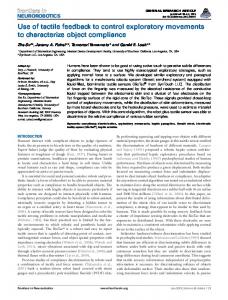
With the success of the iPhone and similar platforms the navigation software known from our cars has become available in our pocket (see Fig.1). Offering routing modes for pedestrians we can have these applications guide us to unknown places, turning them into personal navigation devices (PND). The interaction with those applications has not changed much: our position is displayed on an interactive map and the route to the destination is highlighted. Additionally, we are given route instructions by speech, text, and visual cues. Pedestrians, however, use these applications in different contexts than car drivers. No cage of steel is protecting them from environmental interferences, such as sun, rain, or noise. While walking it is hard to read a visual display and
2
Martin Pielot, Susanne Boll
Fig. 1. Using a PND for (pedestrian) navigation in an urban environment.
pay attention to the environment at the same time. In addition, if e.g. sunlight reflects from the screen it can become difficult to identify anything. Using speech and sound can help, but auditory information via speakers can be missed (due to noise) or be socially inappropriate (if the user does not want to stand out). Headphones can solve both problems but cut the user off from the only sense that allows sensing potential threats all around the user, such as a car approaching from behind. Thus, audio-visual displays can be unsuited in many situations that pedestrians typically face when navigating. Utilizing the sense of touch for navigation as a solution has been proposed by several groups [24, 28, 27, 10]. These groups used tactile displays to convey the direction of the next waypoint or the destination. It has been shown that such systems can decrease the cognitive workload [6], and support the interpretation of geographic maps [22, 18]. However, it has yet to be shown that tactile waypoint navigation can outperform traditional PNDs. In this paper we report from a field study comparing this tactile waypoint navigation concept to a commercial PND. While we confirmed that waypoint navigation with tactile displays can free the users’ attention, the navigation performance was worse compared to the PND. Beyond the navigation system we found that the user’s sense of direction was a major factor for the navigation performance. We argue that therefore good navigation systems should support the sense of direction.
2
Related Work
Presenting route instructions on mobile devices has received a lot of attention in the community already. Kray et al. [13] discussed means for providing route instructions on mobile devices, including 2D and 3D maps. In a pilot study they
Tactile Wayfinder
3
found that females prefer 3D maps, while males prefer 2D maps, which could, however, be attributed to the fact that the male participants had a higher level of experience with 2D maps. Ishikawa et al. [11] investigated the wayfinding behaviour depending what method was used to learn the route. They compared PNDs, paper maps, and learning the route by self-experience, i.e. being guided along it. PNDs performed significantly worse in terms of spatial knowledge acquisition, navigation performance, and subjective difficulty rating. While recent PNDs present distances to inform the user’s about the location of waypoints (e.g. enter round-about in 200m), humans tend to use landmarks instead [17]. Photos of landmarks combined with route instructions outperforms paper maps and reduces the mental workload [7]. Still this approach requires interacting with a tiny display. Rukzio et al. [21] therefore proposed presenting route instructions on public displays instead of the mobile device. The public display is used to point into the direction the pedestrian has to proceed. In a follow-up study [20] they could show that such public navigation displays can reduce the mental workload and the frustration level. In order to overcome the problems with auditory and visual display Tan and Pentland [23] proposed the use of tactile display for navigation. Bosman et al. [2] showed that providing turning directions by two vibrotactile actuators worn at the wrists outperformed follwing signposts in an indoor navigation task. Tsukada et al. [24] proposed a tactile torso display called ActiveBelt for - amongst other things - waypoint navigation. The display consists of an array of vibrotactile actuators attached to a belt. When it is worn around the waist, the actuators get equally distributed around the torso. The vibrotactile signals produced around the torso can intuitively be interpreted as horizontal directions [25]. Field studies [28, 27] showed the feasibility of such tactile belts for waypoint navigation. It could also be shown that the tactile modality reduces the overall cognitive load and improves situation awareness compared to visual user interfaces [6, 22]. It has yet to be shown that tactile displays can overcome the issues of audiovisual interfaces regarding pedestrian navigation systems in urban environments. Existing studies either lack a baseline [24, 28, 27], compare tactile waypoint navigation with other aids than route-instructions [2, 22], or were conducted in nonurban environments [6].
3
Limitations of Today’s Navigation Systems for Pedestrian Navigation
Navigation systems for pedestrians still employ the same visual interaction metaphor as car navigation systems. Figure 2 shows an example of a commercial navigation application with a pedestrian mode. The user’s position is shown on a street map. The route to the destination is highlighted. The map is aligned so the forward direction of the user’s movement corresponds to ”up” in the display. Speech output is used to announce the distance to the waypoint and the proposed turning direction in regular intervals. To overcome the positioning technologies’ inherent inaccuracy, the user’s position is approximated by a tech-
4
Martin Pielot, Susanne Boll
nique called map matching. Assuming that cars typically will not leave the road the technique maps the GPS position onto the nearest street, in cases where the satellite signal is inaccurate. While these systems are quite successful in cars, recent user studies have highlighted limitations that arise due to the situational context of pedestrians. Spatial Knowledge Acquisition Good navigation systems not only guide user to a destination, but also support them in understanding the environment, so they ultimately become able to reach the destination on their own. Understanding the environment also allows identifying alternative routes, e.g. shortcuts or along places worth seeing. This is only possible if users can acquire spatial knowledge about the environment when using a PND. Providing route instructions has, however, been shown to disengage the users from the environment [15] and make it difficult to understand the spatial layout of the environment [1, 11]. Workload and Attention According to theories and models about human cognition, such as the Multiple Resource Theory [30] or the Prenav model [26], the capacity of cognitive processing is a limiting factor when interacting with mobile devices. If a sense is already under high workload, it becomes difficult to process additional information through that sense. When walking Fig. 2. CoPilot for iPhone through e.g. a crowded city centre the visual and as an example for a pedesauditory senses can be heavily occupied. There- trian navigation system fore, navigation information conveyed through (http://www.alk.com/copilot/ visual and auditory displays might not be pro- with courtesy of ALK Techcessed by the user. Studies with paper maps indi- nologies). cate that people can get very distracted by their navigation aid when navigating in unfamiliar environments [18]. Consequently, the users focus less attention on the environment. This is especially dangerous when passing through places with a high level of traffic, for example busy streets or crowded pedestrian zones. Navigation Performance Providing directions by navigation systems is usually quite effective in guiding travellers to their destinations. In particular, previous research indicates that people lose their orientation frequently when navigating in unfamiliar environments [11, 18]. Recent studies suggest that people prefer paper maps over PNDs and navigate more efficiently with them [11, 20]. Also,
Tactile Wayfinder
5
interacting with a mobile device is known to reduce the average walking speed [12], in general. Thus, navigating with a PND still offers room for improving the navigation performance.
4
Design of the Tactile Wayfinder
In this section we address the limitations of PNDs by advancing the concept of waypoint navigation with a tactile torso display. The basic idea is to convey the direction of the waypoint in relation with the user’s heading. Previous groups have shown that this concept can effectively be used for waypoint navigation. [28, 27, 6, 10]. In this work we employed this concept in a prototype called Tactile Wayfinder. While being known that tactile waypoint navigation can reduce the cognitive workload, it conveys less spatial information than PNDs. Instead of showing a map that the user can use to learn how the route continues up ahead, the previously employed concept of tactile waypoint navigation just provides the location of the next waypoint. This reduced amount of spatial information might render it difficult to efficiently acquire spatial knowledge about the route. Thus, we investigated to enrich the spatial knowledge about the route presented by the tactile display. Our idea was to not only display the next waypoint, but the location of the subsequent waypoint as well. The subsequent waypoint then serves as a look-ahead, giving the user a cue about how the route will continue once the next waypoint has been reached (see Fig. 3). However, to realise this concept, we had to design a way of presenting the locations of the next waypoint and the look-ahead waypoint through different tactile cues.
Fig. 3. Route visualisation through a tactile look-ahead: in alternating order the current waypoint and the subsequent waypoint are displayed. The user can anticipate how the route will continue beyond the current waypoint.
6
4.1
Martin Pielot, Susanne Boll
Tactons for Designing Tactile Cues
By introducing the notion of tactile icons (Tactons) Brewster and Brown [3] offered a concept to systematically design tactile cues. Tactons are abstract messages that can encode multidimensional information. In the case of the Tactile Wayfinder we aimed at creating two two-dimensional Tactons where one information dimension encodes the direction of the waypoint and the other information dimension encodes the waypoint’s type (next or look-ahead). Six different tactile parameters can be used to encode information dimensions: amplitude, frequency, duration, waveform, rhythm, and body location. These parameters can then be combined to compose multidimensional messages where each parameter is mapped to one information dimension, e.g. the body location encodes the direction and rhythm encodes the type. Tactons composed of two or three different parameters can be encoded with a fairly high recognition rate of 70%, 81% [4, 5]. However, in these studies the parameter space was limited to three levels of body location and rhythm, and two levels of waveform. Which parameters can be used for Tacton design depends on the tactile actuators. For our work, we used a tactile belt with 12 vibration motors using offcentred weights to generate vibrotactile stimulations (see Fig. 4). These actuators are sewn into flexible fabrics, distributing themselves equally around the torso when worn. In order to indicate the location of a waypoint, the actuator which points most accurately into the waypoint’s direction is activated. A built-in compass allows displaying absolute positions (e.g. North) independent from the user’s orientation. Due to the off-centred weights the parameter space is limited. Changing the stimulus waveform is not possible with such actuators. Frequency and amplitude cannot be altered independently from each other, as they both depend on the applied voltage level, i.e. how fast the motor rotates. In the this paper we refer to this combined parameter as intensity. This leaves us with four parameters for designing waypoint Tactons: intensity, duration, rhythm, and body location.
Fig. 4. The tactile belt we used for the Tactile Wayfinder.
Tactile Wayfinder
4.2
7
Design of the Waypoint Tactons
For presenting several waypoints to the user we needed to encode the waypoints direction and make them identifiable by encoding some form of waypoint type. Thus, we decided not to display distances in favour of a simpler Tacton design, since Veen et al. [28] have shown displaying the distance to a waypoint does not affect navigation performance. As mapping body location to directions has shown to be intuitive and easy to understand [19, 25] we incurred this concept. However, as we aimed at presenting two waypoints, we had to decide whether to present them simultaneously or successively. While presenting directions simultaneously has successfully been used [16] we decided against it, as distinguishing more than one waypoint in the same direction would not be possible. Instead, we chose to present the waypoints alternately. Rhythm was used as parameter for encoding the waypoint type (next or look-ahead) since the study by Veen et al. [28] showed that different rhythms can be distinguished well when walking. In a set of informal tests we tested several rhythm patterns outdoors to ensure that the patterns could be easily identified when walking. The rhythm pattern that were finally used to encode the waypoint type are illustrated in Figure 5. The next waypoint is encoded by a heartbeat-like pulse which is repeated five times. The look-ahead waypoint is presented with a single pulse. Both Tactons are repeatedly presented with a duration of approximately four seconds per cycle.
Fig. 5. The used Tactons: the heartbeat-like pulse (left) indicated the direction of the next waypoint. A single pulse (right) is used for the look-ahead waypoint.
4.3
Tactile Wayfinder Implementation
The tactile route visualisation with the waypoint look-ahead was integrated into the Tactile Wayfinder prototype. It was implemented using the open source Companion Platform for rapid mobile application prototyping [29]. As hardware
8
Martin Pielot, Susanne Boll
platform we used a HTC Windows Mobile PDA. The belt was connected to the PDA via Bluetooth. A G-Rays 2 GPS receiver was used for obtaining the user’s geo location. It was connected via Bluetooth as well.
5
Evaluation Method
To investigate if the concept of tactile waypoint navigation can overcome challenges of commercial PNDs we conducted an experimental field study. Participants had to use the Tactile Wayfinder and a commercial PND to reach a destination in an urban environment (see Figure 6). The study took place on three consecutive Saturdays in May 2009. It took place in the city centre of Oldenburg. With its narrow, winding alleys the layout is rather complex and even residents sometimes have their problems in orienting themselves. Saturdays were chosen, as the city centre is most crowded on weekends. A complex layout and a crowded environment were suspected to increase the general cognitive load. In particular we investigated the effect of the navigation systems on the acquisition of spatial knowledge, the attention and cognitive workload, and the navigation performance. Our hypotheses were that: – (H1) The Tactile Wayfinder will allow a better understanding of the environment in terms of landmark and survey knowledge than the PND, – (H2) Users navigating with the Tactile Wayfinder will pay more attention to their environment compared to the PND, and – (H3) The navigation performance of the Tactile Wayfinder will at least not be worse compared to the PND.
Fig. 6. A participant familiarises himself with the Tactile Wayfinder.
Tactile Wayfinder
5.1
9
Material
Two routes were created for the field study. Each route was about 800m long and contained six decision points. Both routes did not represent the shortest path to the destination and included awkward detours. Thus, good knowledge about the city centre was not privileged as the participants could not anticipate how the route would proceed beyond what the navigation system showed. As PND, we chose TomTom1 since it belongs to the state-of-the-art of pedestrian navigation systems. In a pilot test we investigated how to configure the PND most optimal. We found that map matching worked well in most cases. Sound was however turned off, as the pilot testers found it embarrassing and too hard to perceive. We configured TomTom to make use of the same type of bluetooth GPS receiver that the Tactile Wayfinder used. This ensured that the quality of the user position information was similar for both navigation systems. 5.2
Participants
Fourteen participants, seven female and seven male, took part in the study. The age ranged from 20 to 30 with a mean age of 25.33 (SD 4.51). In average, they rated their familiarity with the city centre to be slightly above average (2.71, SD 1.38 on a scale from 1=very good to 5=very bad). We also assessed their sense of direction through the SBSOD questionnaire by Hegarty et al. [9]. In average, our participants showed a neutral sense of direction (50.57, SD 17.62). However, there was a wide variability in the SBSOD scores. All participants signed an informed consent prior to the study. They were not paid for their participation. 5.3
Design
The navigation system served as independent variable. The Tactile Wayfinder represented the experimental condition while TomTom was used as control condition. The study used a within-subjects design. Thus, all participants contributed to both conditions. The order of conditions was counter-balanced to avoid sequence effects. The following dependent measures were taken in order to evaluate the acquisition of spatial knowledge, workload & attention, and the navigation performance: Spatial Knowledge Acquisiton The acquisition of spatial knowledge was measured by two tests that have been reported by Aslan et al. [1]. While the photo recall test is more focussed on landmark knowledge the route drawing test examines the survey knowledge. The photo recall test requires participant to recall how they turned at different decision points along route. These decision points are presented on photos and participants have to mark if they turned left, right, or went straight (if applicable). The score is taken by summarising the number of wrong answers. In the route drawing test the participants had to reproduce the 1
http://www.tomtom.com/
10
Martin Pielot, Susanne Boll
route they just walked on a sheet of paper. As a reference, the sheet showed the starting point, the destination, and the outer bounds of the city centre. To determine the score for this test, we measured how accurate in terms of centimetres the waypoints of the route were drawn compared to a map of the city centre. Workload and Attention The level of attention was measured by assessing the subjective workload and counting how often the participants experienced nearaccidents. Near-accidents were defined as situations where a participant nearly collided with another person or an obstacle. The participant had to be closer than 1 metre and perform a visible evasive manoeuvre. The subjective workload was assessed through self-report using the Nasa Task Load Index (TLX) [8]. Navigation Performance The performance of the navigation task was measured in terms of completion time, disorientation time, and number of navigation errors. Disorientation events were counted when a participant explicitly mentioned to have lost orientation or when the participant stood still for more than 10 seconds. The event was considered ongoing until the participant continued to walk into the correct direction. Navigation errors were counted when the participants entered a street they were not supposed to. The completion time was the time it took the user to reach the destination.
5.4
Procedure
For each session the experimenters and the participants met near the starting point of the first route at a well known place. Before starting the actual evaluation, the participants had to fill out a questionnaire providing demographic information, judging their familiarity with the city centre, and answering the SBSOD items. The participants also learned that they had to complete spatial knowledge tests so they should pay attention to the route. The experimenters then explained the Tactile Wayfinder to the users and demonstrated the use of TomTom. The participants tested both devices before the measurements started. In alternating order, one of the navigation systems was then chosen for the first route. During the navigation task, the participants were asked to hold the GPS receiver in their hands during the evaluation. This was done to avoid the GPS signal being further distracted by being inside a pocket close to the body. Two experimenters followed the participants in some distance and noted near-accidents, navigation errors, and the number and length of disorientation events. When the participants arrived at the end of the first route they were asked to perform the two spatial knowledge tests (photo recall and route drawing) and rate the subjective workload. Then, the navigation system was changed and the participants started with the second route. Arriving at the second route’s destination, the participants performed the spatial knowledge tests and filled out the Nasa TLX again.
Tactile Wayfinder
6
11
Results
Spatial Knowledge The score for the photo recall test was calculated by counting the number of wrong turning directions in the participants’ responses. If the participants did not remember how they turned at an intersection shown on a photo we counted an error as well. If participants approached the decision point from an unexpected direction due to a previous navigation error, we compared the participants’ answers to how they actually had turned. The results of the photo decision point recall test are shown in Figure 7. In average, TomTom users made 0.79 errors per route while Tactile Wayfinder users made 0.64 errors per route. There was no significant difference (p = .34). Figure 8 shows one of the route drawings of the participants. The quality of these reproduced routes was quantified by comparing it with the actual route. We therefore scanned the drawings, printed them on transparent material, and put in on a map with the same scale. The distance in cm between each drawn waypoint and its correct counterpart served as error score. Figure 7 shows the average drawing error for both conditions. It was 8.02cm for TomTom and 9.25cm for the Tactile Wayfinder users 9.25cm. There was no significant difference (p = .27).
Fig. 7. The results of the spatial knowledge tests. The average errors in the photo recall test are shown on the left. The error score in cm from the participants’ route drawing are shown on the right. In both tests there were no significant differences.
The participants’ scores in the spatial knowledge tests had a small/medium correlation with the sense of direction SBSOD score (r = −.21 and r = −.30). This means that participants with a good sense of direction also had higher scores in both spatial knowledge tests. Workload and Attention Workload and attention were measured by self-report through the NasaTLX score and the number of near-accidents. Figure 9 shows the average scores for both measures. As suggested in [8] we asked the participants to rate importance of each NasaTLX item for the navigation task. All possible pairs of items were presented and the participants had to choose the more important one. Mental demand and frustration were rated most important. Physical and temporal demands were rated least important. In average,
12
Martin Pielot, Susanne Boll
Fig. 8. One of the routes drawn by a participant after the evaluation. How accurate the participants could reproduce the routes were used to compare the spatial knowledge between the two conditions.
TomTom users rated the workload with 2.78 and Tactile Wayfinder with 2.65. A higher score indicates a higher workload and seven was the highest score possible. There was no significant difference (p = .40). Figure 9 shows the number of near accidents. In average, TomTom users experienced 0.79 near-accidents/route while Tactile Wayfinder users had 0.14 near-accidents/route. Thus, significantly less near-accidents occurred with the Tactile Wayfinder (p < .01).
Fig. 9. Subjective workload rated by a Nasa TLX questionnaire (left). Number of near accidents (right).
There was also a noteworthy correlation between the sense of direction and the number of near-accidents. The seven participants with the lowest SBSOD score had 1.43 near accidents while those seven with the highest SBSOD only ex-
Tactile Wayfinder
13
perienced 0.14 near accidents. Comparing the results of those groups statistically revealed a significant difference (p < .001). Navigation Performance The navigation performance was measured by the completion time, the number of navigation errors, and the time the participants were disoriented. Figure 10 shows the average results for both conditions. The average completion time was 763s/route with TomTom and 840s/route with the Tactile Wayfinder. There was no significant difference (p = .09). The number of navigation errors was 0.29/route for TomTom and 0.79/route for the Tactile Wayfinder. Participants with the Tactile Wayfinder made significantly more navigation errors (p < .05). The loss of orientation was measured in terms of how often and how long participants were disoriented. However, since both results are highly correlated (r = .78) we only report the disorientation time. The average disorientation time was 23.71s/route for TomTom and 36.00s/route for the Tactile Wayfinder. There was no significant effect (p = .22).
Fig. 10. The average performance measures for both conditions: completion time in seconds (left), navigation error count (right), disorientation time in seconds (bottom).
Completion time and loss of orientation count were highly correlated (r = .77). Thus, participants who often lost orientation were very likely to need more time to complete the route. The number of navigation errors and the waypoint position errors while re-drawing the route were highly correlated (r = .73). Therefore, participants who made many navigation errors were also more likely to draw the walked route more inaccurately.
14
Martin Pielot, Susanne Boll
Gender Differences In the experimental condition there were significant differences in the navigation performance between the genders. In average, female participants took longer to complete the routes (p < .01), made more navigation errors (p < .05), and lost their orientation more often (p < .05), as shown in table 1. However, this could only be observed with the Tactile Wayfinder. The navigation performance in the control condition was not significantly different. Completion Navigation Disorientation Time (s) Errors Count Female 925 2.43 3.29 Male 754.29 0.71 1.29 Table 1. The navigation performance with the Tactile Wayfinder split by gender.
Comments and Observations Regarding TomTom the participants mainly concentrated on the route and their position shown on the map to navigate. To our surprise, none of the participants seemed to follow the turning instructions. This was a good idea since GPS was sometimes considerably inaccurate. It even occurred that TomTom’s map matching algorithm located people in the wrong street. Since the tactile belt employed a compass while TomTom depended on the GPS positioning update, there was a notable delay in updating the route. This turned into a problem for some of the participants as they turned into a new street but it took TomTom a few seconds to reflect that new situation. So, beyond each turning point there was a short period of ”blind navigation”. Most errors with the tactile belt occurred at a y-formed junction of the second route where two paths continued almost in parallel direction. The tactile direction cueing combined with GPS inaccuracies was sometimes to coarse for the participants to clearly decide for one of the path. In some cases this caused the participants to choose the wrong path. This did not cause too much delay, since there was a connection between the two paths later on. Regarding the subjective workload, the participants had divergent opinions: one half expressed that they found it exhausting to focus on the tactile cues. The other half stated that they could pay more attention to the environment. Many participants missed a map to get an overview about their environment. Some felt to be ”bossed around” by the Tactile Wayfinder. Participants complained quite often that wearing the belt was uncomfortable due to the constant tactile feedback. Some suggested a tactile volume control or a pause function in order to be able to reduce the amount of feedback.
7
Discussion
In summary, both navigation aids enabled the participants to reach the given destinations. No difference in the participants’ spatial knowledge acquisition could be found between the Tactile Wayfinder and TomTom. Using the Tactile Wayfinder the participants experienced fewer near-accidents but made more
Tactile Wayfinder
15
navigation errors. Having a better sense of direction correlated with fewer nearaccidents and better spatial knowledge acquisition. Male participants had a better navigation performance with the Tactile Wayfinder than female participants. Hypothesis H1 (the Tactile Wayfinder will allow a better understanding of the environment in terms of landmark and survey knowledge than the PND) could not be confirmed. Both spatial knowledge tests were insignificant. Thus, the tactile visualisation of the two upcoming waypoints could not improve the spatial knowledge acquisition compared to the PND. Instead, having a good sense of direction went along with better spatial knowledge scores. The sense of direction might therefore play a more important role in understanding the spatial layout of an environment than the actual navigation aid. Therefore, navigation aid designers should consider how to improve the general sense of direction along with the navigation instructions. Hypothesis H2 (users navigating with the Tactile Wayfinder will pay more attention to their environment compared to the PND) could be confirmed. The Tactile Wayfinder allowed participants to spend significantly more attention to the environment so they were less likely to (nearly) collide with other people or obstacles. These findings confirm the predictions by Wickens’ Multiple Resource Theory [31] or van Erp’s Prenav model [26] that conveying information via different senses reduces the overall cognitive workload. They also go conform with the results of Duistermaat et al. [6]. The subjective workload did however not decrease significantly. One explanation could be that the participants had to focus on the tactile output every now and then as there was no other source of directions. This goes along with the complaint that some participants felt to be ”bossed around” by the Tactile Wayfinder. This could be countered by giving the participants a better overview of their situation, e.g. by combining tactile feedback with maps, as proposed in [22, 18]. There was also a high correlation between a good sense of direction and few near-accidents. Thus, participants with a bad sense of direction paid less attention to the environment. It therefore seems important to specifically consider the group of users with a bad sense of direction in navigation system design. Hypothesis H3 (navigation performance of the Tactile Wayfinder will at least not be worse compared to the PND) was refuted. The participants made significantly more navigation errors with the Tactile Wayfinder. The high correlation between completion time and disorientation events suggest that the participants lost most of their time when they were disoriented. On the other hand, this suggests that both navigation systems performed similar when the participants were well oriented. The results also indicate that female participants had more problems navigating with the Tactile Wayfinder. Since the experimenter cannot assign the gender to the participants, gender-related results have to be analysed carefully. A simple explanation might be that the male participants were more tech-savvy in average. Another more interesting explanation can be found in the use of different wayfinding strategies reported in the literature. According to Lawton [14] women prefer a wayfinding strategy based on route-knowledge (e.g. at the
16
Martin Pielot, Susanne Boll
shop turn left) while men prefer a survey-knowledge strategy (e.g. keep track of the own position on a map). Assuming our participants applied the respective wayfinding strategies, tactile waypoint navigation might not be compatible with route-knowledge-based strategies.
8
Conclusions
In this paper we investigated an approach to overcome existing limitations in commercial pedestrian navigation systems by advancing the concept of tactile waypoint navigation. To improve the spatial knowledge acquisition we conveyed two instead of a single waypoint at the same time. In a field study conducted in an urban environment, a commercial PND was compared with our Tactile Wayfinder in a navigation task. We could replicate previous findings that tactile information presentation can reduce cognitive load. On the other hand, the Tactile Wayfinder was outperformed by the commercial navigation system in terms of navigation errors. The users’ sense of direction turned out to be closely related to most of our results. A better sense of direction correlated with better spatial knowledge acquisition and a positive effect on the users’ cognitive workload. In addition, a better completion time was highly correlated with less disorientation events. The results also let us suggest that wayfinding based on survey knowledge (keeping track of the own location in related to reference points) is correlated to a more successful navigation performance. Thus, being well oriented is important for spatial knowledge acquisition, cognitive workload, and navigation performance. Hence, future navigation systems should be designed to support the users’ sense of orientation. In summary trying to replace the traditional audio-visual interaction by tactile cues might not be the best idea. Instead we should look at how to combine the advantages of the tactile display’s reduced required attention and the audiovisual systems’ superior navigation performance. One fruitful approach therefore seems to be complementing those interactions, as e.g. proposed by [22, 18].
9
Acknowledgments
The authors are grateful to the European Commission which co-funds the IP HaptiMap (FP7-ICT-224675). We like to thank Sren Samadi for preparing and conducting the study as well as our colleagues for sharing their ideas with us.
References 1. I. Aslan, M. Schwalm, J. Baus, A. Kr¨ uger, and T. Schwartz. Acquisition of spatial knowledge in location aware mobile pedestrian navigation systems. In MobileHCI ’06: Proceedings of the 8th conference on Human-computer interaction with mobile devices and services, pages 105–108, New York, NY, USA, 2006. ACM.
Tactile Wayfinder
17
2. S. Bosman, B. Groenendaal, J. W. Findlater, T. Visser, M. de Graaf, and P. Markopoulos. Gentleguide: An exploration of haptic output for indoors pedestrian guidance. In MobileHCI ’03: Proceedings of the 5th conference on Humancomputer interaction with mobile devices and services, 2003. 3. S. Brewster and L. M. Brown. Tactons: structured tactile messages for nonvisual information display. In AUIC ’04: Proceedings of the fifth conference on Australasian user interface, pages 15–23, Darlinghurst, Australia, Australia, 2004. Australian Computer Society, Inc. 4. L. M. Brown, S. A. Brewster, and H. C. Purchase. A first investigation into the effectiveness of tactons. In WHC ’05: Proceedings of the First Joint Eurohaptics Conference and Symposium on Haptic Interfaces for Virtual Environment and Teleoperator Systems, pages 167–176, Washington, DC, USA, 2005. IEEE Computer Society. 5. L. M. Brown, S. A. Brewster, and H. C. Purchase. Multidimensional tactons for non-visual information presentation in mobile devices. In MobileHCI ’06: Proceedings of the 8th conference on Human-computer interaction with mobile devices and services, pages 231–238, New York, NY, USA, 2006. ACM. 6. M. Duistermaat, L. R. Elliot, J. B. F. van Erp, and R. E. S. Human factor issues in complex system performance, chapter Tactile land navigation for dismounted soldiers, pages 43–53. Shaker publishing, Maastricht, The Netherlands, 2007. 7. J. Goodman, P. Gray, K. Khammampad, and S. Brewster. Using landmarks to support older people in navigation. In S. Brewster, editor, Proceedings of Mobile HCI 2004, number 3160 in LNCS, pages 38–48. Springer-Verlag, Sept. 2004. 8. S. Hart and L. Staveland. Human Mental Workload, chapter Development of NASA-TLX (Task Load Index): Results of empirical and theoretical research, pages 139–183. Amsterdam: North Holland, 1988. 9. M. Hegarty, A. E. Richardson, D. R. Montello, K. Lovelace, and I. Subbiah. Development of a self-report measure of environmental spatial ability. Intelligence, 30:425–447, 2002. 10. W. Heuten, N. Henze, S. Boll, and M. Pielot. Tactile wayfinder: A non-visual support system for wayfinding. In NordiCHI, 2008. 11. T. Ishikawa, H. Fujiwara, O. Imai, and A. Okabe. Wayfinding with a gps-based mobile navigation system: A comparison with maps and direct experience. Journal of Environmental Psychology, 28(1):74–82, March 2008. 12. S. K. Kane, J. O. Wobbrock, and I. E. Smith. Getting off the treadmill: evaluating walking user interfaces for mobile devices in public spaces. In MobileHCI ’08: Proceedings of the 10th international conference on Human computer interaction with mobile devices and services, pages 109–118, New York, NY, USA, 2008. ACM. 13. C. Kray, C. Elting, K. Laakso, and V. Coors. Presenting route instructions on mobile devices. In IUI ’03: Proceedings of the 8th international conference on Intelligent user interfaces, pages 117–124, New York, NY, USA, 2003. ACM. 14. C. A. Lawton. Gender differences in way-finding strategies: Relationship to spatial ability and spatial anxiety. Sex Roles, 30(11–12):765–779, Jun 1994. 15. G. Leshed, T. Velden, O. Rieger, B. Kot, and P. Sengers. In-car gps navigation: engagement with and disengagement from the environment. In CHI ’08: Proceeding of the twenty-sixth annual SIGCHI conference on Human factors in computing systems, pages 1675–1684, New York, NY, USA, 2008. ACM. 16. R. W. Lindeman, J. L. Sibert, E. Mendez-Mendez, S. Patil, and D. Phifer. Effectiveness of directional vibrotactile cuing on a building-clearing task. In CHI ’05: Proceedings of the SIGCHI conference on Human factors in computing systems, pages 271–280, New York, NY, USA, 2005. ACM.
18
Martin Pielot, Susanne Boll
17. A. J. May, T. Ross, S. H. Bayer, and M. J. Tarkiainen. Pedestrian navigation aids: information requirements and design implications. Personal and Ubiquitous Computing, 7(6):331–338, 2003. 18. M. Pielot, N. Henze, and S. Boll. Supporting map-based wayfinding with tactile cues. In MobileHCI ’09: Proceedings of the 11th International Conference on Human-Computer Interaction with Mobile Devices and Services, pages 1–10, New York, NY, USA, 2009. ACM. 19. D. A. Ross and B. B. Blasch. Wearable interfaces for orientation and wayfinding. In Assets ’00: Proceedings of the fourth international ACM conference on Assistive technologies, pages 193–200, New York, NY, USA, 2000. ACM. 20. E. Rukzio, M. M¨ uller, and R. Hardy. Design, implementation and evaluation of a novel public display for pedestrian navigation: the rotating compass. In CHI ’09: Proceedings of the 27th international conference on Human factors in computing systems, pages 113–122, New York, NY, USA, 2009. ACM. 21. E. Rukzio, A. Schmidt, and A. Kr¨ uger. The rotating compass: a novel interaction technique for mobile navigation. In CHI ’05: CHI ’05 extended abstracts on Human factors in computing systems, pages 1761–1764, New York, NY, USA, 2005. ACM. 22. N. J. J. M. Smets, G. M. te Brake, M. A. Neerincx, and J. Lindenberg. Effects of mobile map orientation and tactile feedback on navigation speed and situation awareness. In MobileHCI ’08: Proceedings of the 10th international conference on Human computer interaction with mobile devices and services, pages 73–80, New York, NY, USA, 2008. ACM. 23. H. Z. Tan and A. Pentland. Tactual displays for wearable computing. In ISWC ’97: Proceedings of the 1st IEEE International Symposium on Wearable Computers, page 84, Washington, DC, USA, 1997. IEEE Computer Society. 24. Tsukada and Yasumura. Activebelt: Belt-type wearable tactile display for directional navigation. In UbiComp ’04: Sixth International Conference on Ubiquitous Computing, 2004. 25. J. B. F. van Erp. Presenting directions with a vibrotactile torso display. Ergonomics, 48:302–313, 2005. 26. J. B. F. van Erp. Tactile Displays for Navigation and Orientation: Perception and Behavior. PhD thesis, Leiden, The Netherlands, 2007. 27. J. B. F. van Erp, H. A. H. C. V. Veen, C. Jansen, and T. Dobbins. Waypoint navigation with a vibrotactile waist belt. ACM Trans. Appl. Percept., 2(2):106– 117, 2005. 28. H. A. H. C. van Veen, M. Spap, and J. B. F. Van Erp. Waypoint navigation on land: Different ways of coding distance to the next waypoint. In Proceedings of the 4th International Conference EuroHaptics 2004, 2004. 29. D. Wichmann, M. Pielot, and S. Boll. Companion platform - modular software platform for rapid development of mobile applications. it - Information Technology, 51(2):72–78, 2009. 30. C. Wickens. Multiple resources and performance prediction. Theoretical Issues in Ergonomics Science, 3(2):159–177, 2002. 31. C. D. Wickens. Processing resources in attention. In Processing resource in attention. London: Academic, 1984.