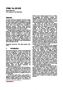
Building “Huys Hengelo” in VRML D. Reidsma, M. Kragtwijk and A. Nijholt University of Twente, Department of Computer Science, Enschede, the Netherlands E-mail:
[email protected] ABSTRACT
In this paper we report about our attempts to rebuild a historical building, ‘Huys Hengelo’, its interior, a farm built next to it and other parts of its environment (including a draw-bridge and a gate) using the Virtual Reality Modeling Language (VRML). This castle building played an important role in the history of its region. The main issues we deal with in this paper are: the unreliability of available sources − forcing us to show alternatives rather than ‘the building as it was’, the possibility to allow users to make changes and to experiment with different geographies, animations showing how parts of the wooden buildings were constructed during that time, the interface with the user and, as the project started as a student project on the request of some local historians and architects, some of our experiences with the co-operation between them and computer science students and researchers. KEYWORDS: virtual reality, source unreliability, histori-
cal buildings, archaeological fragments, animation INTRODUCTION
January 1646 some envoys of the then United Provinces of the Netherlands were on their way to Muenster to negotiate a Spanish-Netherlands peace treaty. They stayed a few nights in Huys Hengelo, a simple castle near the Dutch town Hengelo, not far from the German border. Few is known of this castle itself. Remnants of a simple wooden storage house from the 14th century have been found on the location of Huys Hengelo. This so-called ‘spieker’ has been rebuild a few times until the castle was build. Only a few drawings exist of the castle in its environment, unfortunately historians consider them as unreliable. Around the castle was a canal; there were bridges and a separate farm. In 1821 the castle was demolished and the area was used for industry buildings. During 1993-1995 these building were pulled down and the foundations of the castle were excavated. In this paper we report about our attempts to rebuild the house (including its interior), the farm that was built next to it and the environment (including a draw-bridge and a gate) using VRML (Virtual Reality Modeling Language). The main issues we deal with are the unreliability of the sources, forcing us to show alternatives rather than ‘the building as it was’, the possibility to allow users to make changes and experiment with different geographies, animations showing how parts of the wooden buildings were constructed in reality, the interface with the user and, as this project started as a student project on request of local historians and architects, some of our experiences with the cooperation between students and between (computer science) students and historians.
Huys Hengelo is one of the projects of our research group where we experiment with virtual reality environments and especially to add different interaction possibilities for users (or visitors) of these environments. One of the larger projects is the so-called Virtual Music Centre (VMC) in which we have designed interior and exterior of a large existing building according to the design drawings of the architect (see e.g. Nijholt [6]). However, unlike such projects, when we try to model historical buildings, such design drawings are generally not available and sometimes the buildings are only known from descriptions or from paintings. There have already been a lot of projects in which virtual reality techniques are used for historical-preservative documentation of buildings. In the Eurographics '99 proceedings (Alberti, Gallo, Jelinek [1]), for example, we can find discussions about suitable techniques for restoring buildings like the Camposanto Monumentale of Pisa, the “Kaiserpfalz” (the lost palace of Otto the Great in Madeburg, Germany), the Danteum in Rome, the Vatican, parts of Pompeii, the Teatro alla Scala di Milano or the Mogao Grottoes near Dunhuang in Northwest China. How to deal with missing data and nevertheless show realistic visualizations is a theme that pops up in many of these projects. Do we have to extrapolate, do we have to show all possible interpretations or should we select one or two most agreed upon interpretations of the experts. How did the building look like, where exactly was it located, what building materials were used? Sites of historical buildings are never undisturbed, excavations may destroy parts of a building's structures, not everything can become uncovered, etc. Simulating archaeological hypotheses is an explicit goal in Blaise et al. [2]. They have a simple manipulation language that is used to describe scripts in which we can define and modify dimensions, positions and orientations of objects and their geographical relationships. As mentioned in Mausch et al [4], “people tend to take a depicted reconstruction as established scientific truth.” For that reason we think that it is important to take a research position that does support discussions about the design decisions in the virtual world rather than aiming at a visualization style that forces experts to agree upon all visible details. BACKGROUND OF THE “HUYS HENGELO” PROJECT A Short History
In the years between 1993 and 1995 a large factory was taken down in Hengelo in the east of the Netherlands. It had already been known for a long time that the factory had been built on the site of a historically important building (Huys Hengelo), so the opportunity was seized to excavate the foundations of the house and the remnants of
the moat and the gardens. After the factory has been taken down, a residential quarter will be built on and around this site. Since Huys Hengelo has been central to local history for hundreds of years, and the site has been the location of different kinds of houses and buildings for some thousand years, it was decided that the history of Huys Hengelo would be given a place in the new quarter. Part of these plans was the project described in this paper, which had as goal the modeling of a virtual version of the house. The building site of Huys Hengelo has housed some kind of building at least as early as the 13th century. The first building was probably some kind of storage shed (a socalled ‘spieker’). Somewhere after 1500 the spieker was probably extended to house the owner of the land around the place after he had been hunting there. In later years the building was subsequently extended several times and even partly rebuilt until it became a large mansion. The owners of the mansion were from a few important and influential families in that part of the Netherlands, including landgraves and counts and such. Some owners used it as a lodging for special occasions, other owners lived there all the time. All in all, the place has been central to local politics for a very long time. Sometimes, as we mentioned, it even comes up in stories of national politics, as when in 1646 a delegation from the Netherlands, headed for the ratification of the Covenant of Munster stayed there for some time. The presence of Huys Hengelo caused the nearby village Hengelo to grow until it became one of the mayor cities in the east of the Netherlands. In the year 1821 however the house was torn down, after it had fallen in disuse. Compared with Huys Hengelo, much more is known about the farm that was built next to it (Nijhuis [7]). It existed until 1916 and a few photographs have been taken. Furthermore, the archives of Hengelo contain a detailed description of a renovation of the farm. Back then, it was a building of only 5×10 meters. In Hesselink [3] an expert explains from recollection how this type of farms used to be built until the beginning of the 20th century. This expert has worked on one of the last farms that were completely built in this traditional way. Horses dragged the timber to the site, and many craftsmen were involved in building the wooden framework. No other sources containing this knowledge are known. In a following we show how we visualize this expert knowledge and make it accessible to a wider audience.
in every step of the building process. They were so helpful as to provide the students with constant feedback. But the experts were even more than average illiterate on the subject of computers. This meant that they had difficulty understanding the implications of many design decisions until they could see actual implementations of parts of the house. Furthermore the experts couldn't agree on many subjects. This all meant that, though the experts were very enthusiastic and willing to do almost anything to help, the students had to make many decisions on what was to be used in modeling the house on their own. A next section about handling lack of information addresses part of these problems. BUILDING ‘HUYS’ AND ENVIRONMENT The Actual ‘Huys
In Figure 1 we have a drawing made in 1860 by Jacobus Craandijk, based on stories of a child who used to go there often.
Figure 1: Huys Hengelo by Jacobus Craandijk, 1860
Other known drawings, for example one made in 1700 by Stellingwerf (1666-1727), show a slightly different house, but also a floor map and a map of the site. Experts disagree which drawings are correct and give different interpretations to the other sources, decryptions and excavations. Some drawings are known to be made when the building didn’t exist any more. In Figure 2 we have the virtual reality version that we came up with after studying the sources (Nijhof [5], Reynders [8,9]) including an inventory from which an interior could be reconstructed. Here we will not dwell on the design and details of implementation (in VRML) of the Huys Hengelo building.
Unreliable Sources and How to Make Decisions
The project to rebuild Huys Hengelo, the spieker and the direct environment, including the farm, was completed in cooperation between students in computer science and experts on architecture and archaeology. Of course the students hardly knew anything about those issues, so they had a lot explained to them by the experts. Even then however, they usually didn't know what decisions to make, what to model, which written sources to believe (the most important sources contradicted each other vehemently) and what to make of the two existing drawings (very much unalike and considered uninformed and incorrect by all experts in any case). Therefore the experts were included
Figure 2: Virtual ‘Huys Hengelo’ and Environment Handling a Lack of Information
In this project many things had to be modeled based on
partial information. It might not known whether a stone fragment had been part of a window or a door, how large some element had been, where the gate to the island had been or what kind of glass the house used to have in the windows. Besides, there had been many versions of the house. Some stone fragments were probably from an earlier version of the house. And the experts often couldn’t agree on interpretations. So it was decided to make it possible to visualize all kinds of different possibilities. That way it would be possible to assemble the house on several properties, giving a version from a certain era or presenting the views of a certain expert. However, the viewers of the model were supposed to be computer illiterates, so it would never do just to model all separate parts and let the user assemble them, placing them together in a coordinate system. Instead a console was made in Java, which presented the user with simple properties that could be switched on or off. The different options were parameterized: the VRML-modeler only had to name the different objects and versions state a few properties like the number of versions of the object and whether the object could be switched off. For example: when the house of 1850 was presented, the windows could be set to a version with square glass panes and a version with diamond-shaped glass panes but the windows could not be switched off. However, the shutters for example could be switched off, when it was not certain whether there had been any shutters. Certain configurations of everything could be saved to a file for later reviewing.
ornamental vases or pillars. One simple way to define an extrusion is by a polygon base, a 3D path and a scaling function. The resulting extrusion is then the volume that can be obtained by moving the polygon along the path, scaling it along the way according to the scaling function (see Figure 3).
Figure 3: Modeling Vases and Pillars
The polygon editor makes it possible to define the polygon that is to serve as the base for the extrusion. The user can load an image into the editor and then draw the points of the polygon’s outline over this image. The line editor makes it possible to define a two-dimensional path for the extrusion. Though this path could be three-dimensional, in this project only paths in one plane were needed. The extrusion scaler finally can be used to graphically draw the scaling function using a photo of a pillar base or ornamental vase and tracing the outline. Figure 4 shows how this works.
MODELLING HOUSE PARTS AND ARCHAEOLOGICAL FRAGMENTS USING TOOLS Building the Walls and Windows of a House
When modeling a house in 3D, it is necessary to build walls and to place doors and windows in them. And sometimes those doors and windows need to be moved later in the modeling process. However, most modeling programs don’t give the possibility to build a wall with some general properties and then define a hole in it, which can be moved around. Therefore a small and simple tool was developed in which a wall with holes in it could be defined. The holes could be manipulated even later in the process, when all kinds of other objects had been added to the model. The Modeling of Archaeological Fragments
Figure 4: Different Phases in Modeling: Photo of Vase, Scaling Function, Base Polygon and Virtual Vase
It may be clear that such simple tools offer the speed as well as the flexibility in modeling the fragments. The user can make side and front view photos of the fragments and then use them to quickly model the fragments in the editors. When that is done the resulting objects can easily be extrapolated into complete windowsills, pillars and staircase and such, for example by drawing a longer path in the line editor (see Figure 5 for an example).
Part of the modeling process consisted of modeling the many fragments that had been found at the excavation site. Those fragments ranged from parts of windowsills and steps to sandstone ornaments. We wanted to be able model many of them in a fast and flexible way. This meant that simply modeling them by hand was not an option, since that takes too much time. 3D-scanners can be very fast and accurate but are far too expensive for this kind of project. Furthermore, a model as produced by such a scanner is not easily modified. For example when the user wants to produce a complete windowsill, extrapolating from a small fragment, this would still need a lot of work. To achieve this, a handful of simple tools were developed in the project. The tools are all based on the concept of an extrusion, with which it is very easy to model things like
Figure 5: Extrapolating a Stone Fragment to a Complete Window Sill MODELLING THE TWENTE FARM
We have constructed an interactive application that takes
the user on a guided tour around the building site of a traditional Twente farm like the one next to Huys Hengelo. All information in this application is taken from Hesselink [3]. The user is able to walk through different phases in the construction of the farm, ranging from the stones that are put in the ground to form the foundation (Figure 6) via the skeleton (Figure 7) to the construction of the roof (Figure 8). The building process is made clear through animations, and the user can get more information on building elements by clicking on them.
Roof and the Walls is Shown
The building of the farm is divided into ca. 10 phases that can be viewed by the user in any order. Each building phase consists of a 3D scene, accompanied by a short explanatory text. VRML allows the user to walk through the scenes using the mouse. Animations that show how the wooden building elements are put together can be started on the user's demand. A lot of effort has been put in showing a truthful, detailed view of the wood connections that were used, all according to [5]. If the user clicks on a building element, a short explanation of that object appears below the 3D scene. Moreover, a separate 3D scene (containing only this object) is shown, and the user can rotate the object with the mouse to view it from all sides (see Figure 9).
Figure 6: First Phase of the Building Process, only the Foundation is Visible
Figure 9: Interface to the 3D Building Site CONCLUSIONS
Figure 7: The Skeleton of the Farm, Almost Completed
Modeling the Huys itself resulted in three things. The first result is the virtual model of the house, which can for example easily be incorporated in some kind of museum exhibition showing also photos, drawings and building fragments. The second result is a set of simple tools that make it very easy to model stone fragments in VRML and to manipulate them into complete pillars, ornaments and other objects. The third result is the Java tool. This tool provides a framework that makes it possible to present the uncertainty inherent in this kind of project to the user in a flexible way. With the farm we have presented an application to demonstrate how these farms used to be build in our region. This application helps to preserve this valuable knowledge and pass it on to our descendants, through a series of interactive VRML scenes. It requires no specialist technical knowledge, and is therefore very suitable to teach school children about how people from their region lived 200 years ago. ACKNOWLEDGMENTS
Figure 8: Almost Finished: the Construction of the
We gratefully acknowledge the work of some other students that helped in this project: Maartje van Hardeveld,
Ilja Clabbers and Alexander Broersen. The ‘Wetenschapswinkel’ of the University of Twente initiated the contacts with H. Reynders and E. Jans who taught us about historical and architectural issues. They don’t bear responsibility for the final outcome of the project.
7.
Nijhuis, G.A.B. Reconstructie schoolmeestershuis en schuur bij Huys Hengelo. Jaarboek Twente, 1995.
8.
Reynders, H. Historie en opgraving Huys Hengelo, 1996.
REFERENCES
9.
Reynders, H. De bouwfases van Huys Hengelo. Oald Hengel, February 1999, 5-7.
1.
2.
3.
Alberti, M.A., Gallo, G. & Jelinek, I. (eds.). EuroGraphics 1999. Short Papers and Demos. 20th Annual Conf. of the European Association for Computer Graphics, Milano, 7-11 September, 1999. Blaise, J.-Y, Drap, P.& Florenzano, M. A distributed interface for archaeological restitutions. In: Nîmes 1998: Virtual Reality Proceedings Applications, I3 Conference, LLIA Nr. 134-135-136, May-June-July-August 1998, 168-175. Hesselink van der Riet, M.L.M. De Bouw van de Twentse Boerderij, Stichting Matrijs, Utrecht, 1984.
4.
Masuch, M., Freudenberg, B., Ludowici, B., Kreiker, S. & Strothotte, T. Virtual reconstruction of Medieval architecture. In Alberti et al. [1], 87-89.
5.
Nijhof, H. De tekening van Stellingwerf. Oald Hengel, February 1999, 8-9.
6.
Nijholt, A. Virtual Cultural Environments: Exploration of Information. In: Cybernetics and Systems 2000. Proc. EMCSR 2000 (15th European Meeting on Cybernetics and Systems Research), Vol. 2, R. Trappl (ed.), Vienna: Austrian Society for Cybernetic Studies, 2000, 530-535.
10. Roberts, J.C. & Ryan, N. Alternative archaeological representations within virtual worlds. In: R. Bowden (ed.), Proc. of the 4th UK Virtual Reality Specialist Interest Group Conference, Brunel University, November 1997, 179-188. 11. Weierink, A. Een droom die uitkwam: Jan Stevelink brengt historisch boerenerf in Agelo terug in oorspronkelijke staat. In: De Twentsche Courant Tubantia, 27 October 1999. ABOUT THE AUTHORS Dennis Reidsma and Martijn Kragtwijk were students when this project was started. Presently both of them have temporary research positions at the Department of Computer Science of the University of Twente, where they work on natural language processing and virtual reality, respectively. Anton Nijholt is full professor of computer science at the University of Twente. At this university he is coordinating the research and education in the areas of humancomputer interaction, speech and natural language processing and virtual reality. Presently he is especially
interested in research issues that deal with interacting embodied agents in virtual environments. E-mail:
[email protected].