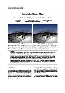
COOPERATIVE PUBLIC WEB MAPS Kolbe, T.H., Steinrücken, J. and Plümer, L. Institute for Cartography and Geoinformation University of Bonn, Meckenheimer Allee 172, 53115 Bonn, Germany. E-mail:
[email protected],
[email protected] and
[email protected] ABSTRACT Collaboration on spatially related tasks like navigation and planning is typically based on the usage of maps. For example, planned transportation routes are pointed out from group members in a map. The specific information is marked in the map by map annotations or map modifications. If the group members are at the same place, they can use the same map and everything is fine. If they stay at different places, however, there are only two possibilities to communicate about web maps: 1) print the map or make a screenshot and annotate the hardcopy resp. screenshot and send it to the others; 2) use an internet map server that allows the annotation and modification of the stored geo data. Both approaches have big disadvantages: the first implies a media break, which means that the map is extracted from the system and cannot be used by the others in conjunction with the web map system again. If one of the others wants to edit annotations or modifications he cannot use the functionality of the web map system but has to work on the hardcopy resp. screenshot. The second approach makes user accounting on the server side necessary, since only group members should have specific rights to modify certain maps. This makes this approach unfeasible for public web maps like city plans and route planning systems, because no provider of public accessible information would deal with the costly overhead of a user management on his side. Above, user annotations would have to be checked regularly, because in most countries the service provider is liable for the server´s content.
. Figure 1. Cooperative web map with user specific comments, pictures and a planned bike route.
Proceedings of the 21st International Cartographic Conference (ICC) ‘Cartographic Renaissance’ ISBN: 0-958-46093-0
Durban, South Africa, 10 – 16 August 2003 Hosted by The International Cartographic Association (ICA) Produced by: Document Transformation Technologies
1062
We propose a new concept for cooperative web maps, that stores and handles map augmentations and modifications on the client side rather than on the server. It employs smart clients that can be implemented using JavaScript or Java. The client fetches a map from a server and then modifies the map according to locally stored map annotations. The functional schema for making local map annotations persistent is discussed in detail. It is based on the encoding of annotations and map modifications into the URL. This way, modifications can be made persistent by simply bookmarking the current URL of the map. Collaboration is realized by sending the URL via email to discussion partners who simply have to click on the link to open the augmented map. The URL can also be used in a hyperlink on a web page. Although the length of the URL is limited in most web browsers, this schema already allows the storage of a sufficient number of map annotations to describe and annotate a travel route. The proposed concept offers the possibility to initiate spontaneous discussions of the spatial facts presented in web maps. Finally, the description of a prototype implementation within the existing web site "Ruhrtal a la Karte" is given, a multimedia interactive bicycle route planner. 1.
INTRODUCTION
In the last years, web maps have established themselves as an important source for spatial information which is widely used. Many municipalities offer access to city maps on their homepages. These maps include topographic objects and thematic information on sights, venues and urban institutions. In some respect internet maps are superior to traditional paper maps. On the one hand an internet map server offers access to geoinformation to users distributed over many places. Thus the same resource is used by several people at the same time. On the other hand in most cases internet maps provide the opportunity of interactive exploration, which includes the definition of sector, scale, kind of map (topographic map, city map, aerial image), interactive queries and specific thematic information [1,2]. An important disadvantage compared to paper maps stems from the fact that internet maps in most cases may not be augmented by additional information or comments by the user. Even if the specific way how internet maps present information may be stored, this kind of personalisation only affects the specific way how the web server visualises its own data. The fact that most internet maps only provide an interface between human and computer is another disadvantage. Interaction, communication and cooperation between several people is not supported. The preparation of space-oriented decision, however, demands the cooperation of several people including the cooperative usage of spatial information. If nowadays several members of a group distributed on several places try to discuss and prepare a space-oriented decision, they only have two options: ! Print the internet map (or even print a screenshot from the map) and augment it by additional comments and informations. Use paper and pencil instead of the functionalities of the web map system. Scan it, and then attach it to an email. Or distribute it by snail mail to the other members of the group. ! Use an internet map server which allows the persistent augmentation and modification spatial data and information. Both options have important disadvantages both for the user and the provider. With the first option a change in format is caused: the map is extracted from the actual system and may not be used again within the same system. The second option requires writing access on the data for the user. The grant of writing access to different people requires administration of different users and groups since only specific group members may carry out specific modifications. This option is not feasible for most providers of city maps, route planners and similar services. No provider will be prepared to install such a cost expensive administration, and only few users will be prepared to undergo the time expensive process of registration and authentification. Legal issues complicate the situation even more. As a rule the provider of a map service is liable for the content of its pages. As with guestbooks the provider would have to search the server for illegal entries and to remove them where necessary [3]. This paper presents a new concept for interactive and cooperative web maps which allows to augment and comment internet maps without leaving the respective software system and which avoids the disadvantages mentioned above. The rest of the paper is organised as follows. The next paragraph shortly discusses related concepts on cooperative work with internet maps and Web GIS. The third paragraph addresses technical and implementation aspects. The fourth paragraph describes a prototype “Ruhrtal à la Karte”, a multi-media based route planner for bicycle tours through the valley of the German river Ruhr and the incorporation of cooperative elementes in this prototype. The last paragraph discusses open questions, possible solutions and prospects for future research.
1063
2.
COOPERATIVE WEB MAPS
In cooperative spatial planning, whether professionally motivated or when planning leisure activities, the possibility of pointing out specific map areas is needed. Above, users should be able to modify maps and discuss these modifications with others. In this context modification means the attachment of comments or drawings as well as the addition, change and deletion of map objects. 2.1 Collaborative planning with GIS The aspects of computer-aided cooperation are subject of the research area of Computer Supported Cooperative Work (CSCW). Collaborative Spatial Decision-Making (CSDM) focuses CSCW on spatial issues. Systems, developed in this environment, concentrate basically on the support of professional planning processes, for instance in the context of citizen participation in urban development. Geoinformation systems, which were extended for this purpose by collaborative functionalities, are often referred to as Public Participation GIS (PPGIS) [4]. Al-Kodmany describes a technique which enables citizens to assess the quality of life in their city [5]. The system provides access to a map over the internet. Any grid square of this map can be selected and commented by users. The comments are collected by a server for later evaluation - they are not incorporated into the map. Therefore, such a system is characterized by collaboration between users and planners. Communication between users does not take place. In his dissertation Rinner proposes the concept of argumentation maps [6]. This concept describes spatial discussions via the explicit linkage of arguments with geo objects. Comments are associated with spatial objects by the user and transmitted to the server. In contrast to the system above all comments are represented in the map – visible to all users. This procedure enables a discussion between individual participants. The system GroupARC [7] develops a network of GIS clients which allows a synchronous discussion of spatial topics. Only one client needs to have access to a GIS, visualisation of geodata and georeferenced comments is distributed between the clients without further server access. The client software comes as a separate application which must be installed on the computer of every participant. The solutions described above exemplify different concepts and technical implementations for collaborative planning with GIS. All realisations focus on complex planning scenarios. However, maps are also needed for short-term planning in leisure and everyday situations. Public web maps permit fast access to spatial information, but the possibility of spontaneous arrangements with several people on the basis of these maps is still lacking. Two substantial problems inhibit such a public and spontaneous use. The first and second concept are based on a server-centered communication (see Fig. 2). They need write access on the server implying appropriate user account administration. The third concept requires the installation of special software on the client and does not allow adhoc use on arbitrary computer systems.
Figure 2. Data flow in cooperative web GIS: a) Server-centered: all communication is handled by a server. b) Cooperative elements (arguments, comments) are directly exchanged between clients.
1064
2.2 Cooperative Web Maps In the following a new concept for collaboration on spatial issues, called cooperative web maps, will be introduced. A cooperative web map is an internet map (service), that allows any user at anytime to initiate spontaneous communication about the map with other users. As explained above, such a system has to take into account, that write access on the web map server is not allowed and no extra software should have to be installed on the client side. Therefore, the system has to completely rely on standard web techniques. Since user comments and map modifications cannot be stored on the map server, the only possibility of preservation is to keep them locally within the client browser. In the following, we distinguish between server sided information, i.e. static maps that cannot be modified, and dynamic information on the client side comprising the current discussion items. While maps resp. geo data still are delivered by (public accessible) servers, the corresponding dynamic information is kept and managed inside each user’s web browser. The dynamic information consists of the set of map modifications, that are rendered into the map image locally by the web client. Map modifications are defined as augmentations, modifications, and deletion of map objects. Augmentations may be e.g. georeferenced comments or thematic map additions. Personal configuration options also may be included. Please note, that modification does not mean the alteration of the original geo data on the server. It only affects their visualization on the client. This ensures, that no anonymous user on the internet corrupts the integrity of the underlying geo data. The concatenation of both the static and the dynamic part is a complete representation of the current state of discussion and is called map situation. In order to allow the subsequent restoration of a map situation, a way has to be found to make dynamic information persistent within the client web browser. Otherwise, dynamic information would be lost when the browser terminates. The technique how this can be achieved will be explained in the next section. Discussion of a spatial topic can be initiated by the transmission of the corresponding map situation to other users. Since the static part is shared on the internet, only the dynamic information has to be distributed individually. This approach enables an asynchronous mode of communication, i.e. the discussion evolves by mutually modifying and transferring the dynamic information content (see Figure 2b). The advantage of this concept is that the user decides who takes part in the conversation. He is not restricted to predefined groups on a server. Above, further participants can be introduced at any time without negotiation for group extension with an administrator. In the following section we describe the realization of this concept, which also allows to share map situations with the public on the internet. Besides the described advantages, a potential drawback arises from the separation of server located maps and client sided dynamic information. When the geo data resp. maps are updated, locally stored dynamic information may become outdated without notification of the user. If a part of a map is modified the corresponding user augmentations or modifications might not be appropriate any longer. However, this will only lead to problems if the geo data are updated frequently or in long-term discussions. Thus, cooperative web maps are characterized by the integration of server sided (static) maps with dynamic information managed and stored inside the client, which also can be distributed to other users. The possibility to add own comments to public web maps can be compared with the widespread use of the small yellow sticky notes (Post-It notes) for annotating paper documents. 3.
TECHNICAL REALIZATION
In this section we will show how cooperative web maps can be implemented using standard internet techniques. The interactive presentation and modification of web maps are the main tasks of the client software. Since it runs inside a web browser, all map modifications of the current session are volatile, because they are only kept in the main memory of the web browser. All dynamic information will be lost, when the browser program terminates. Thus, a way to make the dynamic information persistent and to send them to other users had to be found. The practical, but unconventional solution is to encode the dynamic information into the URL of the web map. 3.1 Using the URL as an information container The URL is an identifier for a physical or abstract resource in the internet. Independently from the original purpose, the URL meets all requirements stated above. It can be stored locally in the web browser as a bookmark or internet favorite and it can be sent to other users as a hyperlink within an email. The structure of a URL is defined by the internet standard RFC 2396 [8]: ://? specifies the underlying protocol (e.g. http for most WWW connections), contains authentification parameters like user name and password (none for public accessible web pages), and consists of the server’s internet address (e.g. www.ruhrtal.de) and the document name including the path name (e.g. docs/index.html).
1065
The part is optional and is used to pass variable query parameters to the addressed web service. It is separated from the previous parts of the URL by a question mark. It has no influence on the addressing of web documents or services. It only affects the resulting document if it is interpreted by an evaluation program. This evaluation is done by a service hosted on the web server, which takes the parameters into account when generating the requested document. Typical applications are, for example, the passing of user specific search terms to internet search engines. In contrast to server sided processing, the evaluation of query parameters can also be done by the client. This approach, which has been rarely used before in internet applications, allows that a web map can be statically referenced by the component of the URL, whereas a variable part represents the belonging dynamic information. The document, that is referenced by , must – beside the raster image of the specific web map portion – include an evaluation program written in Java or JavaScript. This program will be transferred together with the web map to the client and contains methods for the interpretation of the part. These methods run inside the web browser. They extract the dynamic information from the URL and carry out the appropriate map modifications and augmentations (e.g. displaying comments) in the web map image. Figure 3 shows the visualization process for cooperative web maps. In the first step the web browser requests the web map with the belonging client software from the referenced server (1). Only the component of the URL will be used for the determination of the web map portion (2). Then the server transfers the map image together with software modules to the client (3). Finally the received client program augments resp. modifies the retrieved map image according to the dynamic information contained in the part of the URL (4). Beside the method for the evaluation of the part, the received Java resp. JavaScript program has to contain methods for the creation and modification of the local dynamic information. This includes code for attaching, editing and deleting georeferenced map comments. Due to the fact, that all necessary information for the representation of a map situation is encoded into the URL, any map state can be stored permanently by invoking the web browser function set bookmark resp. add to favorite. With the same ease the map state can be transferred to other users. Every web browser has a function send link to, that typically opens a mail client in which the current URL is already included as a hyperlink. If the recipient of such a mail clicks on the link, the stored map situation will be immediately reconstructed in his web browser window (Figure 2).
Figure 3. Steps for the visualization of a cooperative web map. URLs can not only be disseminated by mail, but can also be broadcasted in internet newsgroups (usenet), chat systems or included as a normal hyperlink on the own home page. Thus, cooperation on map augmentations and modifications is achieved by the use of traditional internet services. Application examples will be given below in section 4. Encoding the dynamic information content into the part may produce very long URLs. Although the internet standard RFC 2616 [9] explicitly sets no limit on the length of an URL in the http protocol, in most web browsers the maximum length of the URL is restricted to a few thousand characters (Microsoft Internet Explorer: 2048 bytes; Mozilla/Netscape: at least 4k bytes). This restriction constrains the maximum number and lengths of comments and map augmentations. However, since cooperative web maps are mainly designed for spontaneous, short-lived communications with and about maps, this limit is unlikely to be reached. Therefore, usability is practically not affected.
1066
3.2 Implementation of the web client software In this section the implementation of a web client based on JavaScript, HTML and Cascading Stylesheets (CSS) will be sketched [10,11]. An implementation in Java is also possible though often a plug-in must be installed in current browser versions. In our approach all objects (map, own comments and additions) are presented using HTML and CSS exclusively. Different types of objects are positioned in different layers.
Figure 4. Stacking of map layers in DHTML. Figure 4 shows the stacking of several layers in the system “Ruhrtal à la Karte” which will be described in the following section. The lowest layer contains the map background as a raster image and the highest layer contains comments and pictures added by the user. The intermediate levels show further integrated spatial information (e.g. a network of roads). The grey fields in the layers mark transparent areas. By overlaying all levels the user sees the complete map picture containing all information. Layers are accessed by means of JavaScript and can be turned visible resp. invisible individually. The content of each layer can be modified (objects may be added, deleted or changed in their position). Thus, JavaScript offers the possibility of dynamically writing and positioning comments or additions in the highest layer. For the realization of interaction JavaScript offers a variety of so-called event handlers which associate different user actions (e.g. clicking and mouse movement) with corresponding program routines. The use of event handlers is described in [10,11]. 4.
APPLICATION SCENARIO: A MULTI-MEDIA BASED, INTERACTIVE ROUTE PLANNER FOR BICYCLES
The concept described above was implemented and evaluated as part of the multi-media based, interactive route planner “Ruhrtal a la Karte”. Before we describe the implementation of the “cooperative elements” we shortly discuss the underlying system. 4.1 Ruhrtal à la Karte (www.ruhrtal.de) First note that in German language the noun “Karte” refers both to a (topographic) map and a (dinner) menu. The “Ruhrtal” (Ruhr valley) is a scenic landscape in the midst of the Ruhr basin. The Ruhr basin has long been amongst the largest and most important economic centres in Europe and was well-known for its collieries and steel works. The core focus of economic activities has now shifted from industry to the service sector, and the image of smoking chimneys is no longer true. Even within Germany only few people are aware of the attractiveness and the charme of the Ruhr valley which offers many opportunities for walkers, bicyclists and water sportsmen.
1067
The Kommunalverband Ruhrgebiet (KVR), an association of local authorities, is – among others – responsible for for the preservation of the environment and landscape, but also documenting and mapping the whole of the Ruhr area. “Ruhrtal a la Karte” is an internet service at no charge which is provided by the KVR since July 2001. It was designed and implemented in cooperation with the Institute for Cartography and Geoinformation at the University of Bonn. Aim of this project was the multi-media based presentation of cycling routes and sightseeings alongside the Ruhr (Fig. 5). The potential of traditional paper maps is enhanced by the purposeful usage of multimedia effects and interactive elements [12,13] in order to ! advertise the attractiveness of the Ruhr valley, ! present the spatial information and the content of the paper maps of the KVR in a new way, and ! invite internet surfers to ! become acquainted with the recreation areas of the Ruhr basin, ! enquire a customized cycling route, ! visualise this route in an illustrative map on the screen, and ! print it in a format which is appropriate for his specifice purposes (usable during the tour on the handle bar). The implementation is based on DHTML, i.e. HTML, JavaScript and Cascading Stylesheets. While the maps of the smallest scale consist of images prepared in advance, the maps of larger scales are dynamically produced by the WebGIS system ArcIMS of ESRI.
Figure 5. Route planning, interaction and multimedia in "Ruhrtal à la Karte". 4.2 Collaboration in Ruhrtal à la Karte The original system “Ruhrtal à la Karte” was prototypically extended by four cooperative elements which will be described in the following. The prototype demonstrates the practical feasibility and the use of cooperative web maps. It can be tested at the URL http://www.ikg.uni-bonn.de/ruhrtal 4.2.1 Planned bike route A planned route is saved locally as a cooperative element and can be transmitted, e.g. by email to other participants. The recipient of such a route has the possibility to amend it within his client. In this way a group of users is able to elaborate jointly a bicycle tour using the WWW. 4.2.2 Georeferenced comments Users can add their own comments to the maps. For example a planned route is annotated or augmented by further information such as date and time. Since the comments are stored locally, this function is also suitable for realizing a kind of “spatial bookmarks”. These bookmarks refer to geographical places instead of documents.
1068
A user makes a comment by placing a marker in the map and entering a text, which will be displayed beside the marker. Words beginning with “http://” are recognized as hyperlinks and converted into clickable hyperlinks. Due to the fact, that comments refer to real places, the position of the marker is not stored using screen coordinates but in GaussKrüger-coordinates. In this way comments are independent from changes of the map scale – they will always be displayed at their correct place. 4.2.3 Georeferenced pictures In addition to textual comments pictures also can be inserted into the map. These pictures may originate from an arbitrary web server on the internet. Thus, a user has the possibility of incorporating pictures into the map coming from his own homepage. This function enables for example a bike club to offer pictures of recommendable tours on its website by setting the corresponding hyperlink (comments and picture references included) to Ruhrtal à la Karte. When a user follows this link, Ruhrtal à la Karte will be loaded first. Then the system retrieves the external pictures and displays them together with the comments in the map. Inserting a picture is similar to setting a comment. A marker is placed in the map and the URL of the image file must be entered. The image is represented as a thumbnail beside the marker. If it is clicked a new window opens which shows the image in its original size. The position of the marker is also saved in Gauss-Krüger-coordinates. 4.2.4 Combination of georeferenced text and picture A further option is the addition of a picture together with a caption. This option combines the two cooperative elements described before. Please refer to Figure 1 for a screenshot of a map in which different cooperative elements were used. All elements are rendered slightly transparent, so the map is not completely occluded. Furthermore, the layer containing the comments and pictures may be switched on and off by the user anytime. 4.3 Encoding of the information into the URL The different cooperative elements are encoded into the query part of the URL as described in section 3. The general structure is given by http://www.ruhrtal.de?route=...&anno=...&anno=...&... All elements (a route on the one hand, textual comments and pictures on the other hand) are attached behind the question mark, which separates the document path from the query part. Single elements are divided by ampersands (&). If a bike route was planned, it is encoded into the URL behind the parameter name “route=”. A user defined route is specified by the starting point, a free number of intermediary points, and the end point. The fixed order of the points in combination with the determination of the shortest paths between successive point pairs specify a route unambiguously. Since the route planner stores points as nodes of a graph together with their coordinates, it is sufficient to provide only the (numeric) point identifiers: route=start point |intermediate point 1 |...|intermediate point n | end point Comments and pictures are encoded in a similar way. Since markers can be freely placed in a map, their absolute position is given by Gauss-Krüger-coordinates. Apart from these coordinates the system needs to know the type of the comment (1 = pure text, 2 = pure picture, 3 = text + picture), the annotation content, and/or the URL of a picture: anno=1|easting|northing|text anno=2|easting|northing|image-url anno=3|easting|northing|text|image-url 5.
or or
CONCLUSIONS AND PERSPECTIVES
Cooperative web maps add new functionality to traditional web maps. They enable spontaneous and quick communication about spatial issues based on the usage of public map servers. Users can comment and modify maps which normally is not allowed for publicly accessible web maps. Current map situations are encoded into URLs and are stored locally inside the user’s web browser by setting a bookmark. Asynchronous discussion between multiple users is realized by the mutual modification and transmission of such URLs as hyperlinks. The concept does not need writing server access and thus is especially suited for extending the functionality of publicly accessible web maps (server). For example, citizens may use the city map of their hometown in new ways: they could mark their personal points-of-interest and send them to their friends and colleagues. Due to the fact that comments are included in the hyperlink and these comments are incorporated into the web map image on the client side, the server provider cannot be held responsible for questionable content.
1069
We have shown how cooperative web maps can be implemented using standard internet techniques that do not require the installation of special software. The concept was integrated into the existing internet bicycle route planning system “Ruhrtal à la Karte”, demonstrating the potential use. Whereas the presented prototype focuses on cooperative planning of leisure activities, the concept is not limited to this field of application. A further scenario may be the incorporation into web mapping systems that are employed in the intranets of municipal administrations. The described functionality of cooperative web maps already would allow every staff member to point out spatial issues, observations and could help in spatially related planning processes. Further possibilities arise in conjunction with web maps that are based on scalable vector graphics (SVG). New map objects could be defined by the addition of line strings and polygons inside the SVG viewer. Above, existing objects could be manipulated or even be deleted. 6. [1] [2] [3] [4] [5] [6] [7] [8] [9] [10] [11] [12] [13]
REFERENCES Z.R. Peng, M.H. Tsou: Internet GIS. John Wiley & Sons, Inc., Hoboken, New Jersey (2003) J. W. Crampton: Interactivity Types for Geographic Visualization. Cartography & Geographic Information Science, 29(2), pp. 85-98 (2002) T. H. Strömer: Online-Recht: Rechtsfragen im Internet. 3. Auflage, (in German, transl.: legal issues in the internet), dpunkt-Verlag, Heidelberg (2002) M. MacEachren: Cartography and GIS: Extending collaborative tools to support virtual teams. Progress in Human Geography, Vol. 25, No. 4 (2001) K. Al-Kodmany: Using Web-Based Technologies and Geographic Information Systems in Community Planning. Journal of Urban Technology, Vol. 7, No. 1 (2000) C. Rinner: Argumentation Maps: GIS-based discussion support for online planning. Dissertation, GMD Research Series, No. 22. (1999) C. Churcher, N. Churcher: Realtime Conferencing in GIS. Transactions in GIS, Vol. 3, No. 1 (1999) T. Berners-Lee, R. Fielding, U. C. Irvine, L. Masinter: Uniform Resource Identifiers (URI): Generic Syntax, Internet Society Standard RFC 2396 (1998) R. Fielding, U. C. Irvine, J. Gettys, J. Mogul, H. Frystyk, L. Masinter, P. Leach, T. Berners-Lee: Hypertext Transfer Protocol – HTTP/1.1, Internet Society Standard RFC 2616 (1999) D. Goodmann: JavaScript & DHTML Cookbook, O’Reilly & Associates (2003) S. Münz, W. Nefzger: SelfHTML 8.0. http://selfhtml.teamone.de (in German) (2001) J. Steinrücken: (in German) Multimediales GIS mit den Mitteln des Internet am Beispiel der Routenplanung. Diploma thesis, Institute for Cartography and Geoinformation, University of Bonn (2001) L. Plümer, J. Steinrücken, T. H. Kolbe: (in German) Multimediale Visualisierung von Geoinformationen im Internet. In: Kartographie als Baustein moderner Kommunikation, Tagungsband des Symposiums Praktische Kartographie 2002 in Königslutter, Nr. 6 der Reihe Kartographische Schriften, Kirschbaum Verlag, Bonn (2002)
1070
COOPERATIVE PUBLIC WEB MAPS Kolbe, T.H., Steinrücken, J. and Plümer, L. Institute for Cartography and Geoinformation University of Bonn, Meckenheimer Allee 172, 53115 Bonn, Germany. E-mail:
[email protected] ,
[email protected] and
[email protected] Biography Dr. Thomas H. Kolbe is senior researcher and lecturer at the Institute for Cartography and Geoinformation at the University of Bonn, Germany, where he has been working since 1999. Before, he worked for about two years at the Institute for Environmental Sciences of the University of Vechta and for four years at the Computer Science Department III of the University of Bonn. He studied computer science at the University of Dortmund starting from 1988 and finishing in 1993. His Ph.D. thesis is on the automatic extraction of buildings from aerial images using constraint solving techniques. The main research interests are (web) geoinformation systems, 3D city models, mobile GIS, spatial data infrastructures, computer vision, constraint solving, and information theory.
1071