Detail-Preserving Segmentation of Polarimetric SAR Imagery A. Andreadis, G. Benelli, A. Garzelli School of Engineering, University of Siena, via Roma, 56, 1-53100 Siena, ITALY Phone: +39-577-263616; Fax: +39-577-263602; E-mail:
[email protected]
Abstract -- Polarimetric SAR data help researchers understand and quantify the scattering properties of natural scenes, and their variability under different conditions, better than single polarization SAR data. In this paper, we propose two detailpreserving segmentation algorithms for multiband images and evaluate their performance using real multi-frequency multipolarization SAR complex data. Adaptive neighborhood structures are selected for modeling the polarimetric complex amplitudes and the region labels, and for acheving detail preservation. Experimental results obtained from multi-band and multi-polarization SIR-C data, selected for archaeological applications studies, show that the novel schemes produce significant visual improvements for detail preservation, and exhibit equivalent or hgher classification performance with respect to the classical classification schemes. INTRODUCTION Automatic segmentation of polarimetric SAR images is less time-consuming than visual interpretation and can facilitate the inference of geophysical parameters from the surface and the near surface. The information about the scattering properties of real scenarios is essential and it can be uniquely acquired by means of advanced processing techniques working on full polarization data. When dealing with the unsupervised classification of multipolarization and multi-frequency images, the main objectives to be reached are the preservation of fine structural details and the smoothing of homogeneous regions, together with an efficient classification at the region boundaries. A very interesting solution of this problem is given by the unsupervised polarimetric classifier by Rignot, Chellappa and Dubois [ 1J which provides a maximum a posteriori estimate of the region labels, given, for each label, the circular Gaussian model for the conditional distribution of the polarimetric complex measurement vector X = [HH, HV, W ] . This classifier uses contextual information to derive appropriate image models for segmentation purposes, as neighboring surface elements of natural scenes usually have similar polarimetric characteristics that locally define homogeneous regions of similar physical attributes. In that sense, a neighborhood structure N, and a parameter 13 are selected for modeling the polarimetric complex amplitudes and the region labels. These choices produce some undesirable effects: 0-7803-3068-4/96$5.0001996 IEEE
1. small structural details are lost when data smoothing is obtained; 2. the classification error rate is high at the region boundaries; 3. excessive smoothing and leaking of region labels result when 13 is high (B > 1); 4. a poor Maximum Likelihood estimate is approximately obtained when B is small (B < 1). A higher degree of adaptivity is thus required to solve these problems. We propose two segmentation schemes, called MICM (Modified Iterative Conditional Modes) and DPICM (DetailPreserving ICM). The novelty of these schemes resides in the choices of N and 13 which allow to define an edge-preserving classifier. These novel schemes are included into a complete processing system and they are tested on real multi-look multi-polarization SIR-C SAR complex images. The paper describes the complete system and it is structured as follows. First, the problem of efficiently filtering the original data is considered as a key point for the correct behavior of the following phase of fuzzy pre-classification. The final classification is then performed by using the two alternative novel approaches. The experimental results, carried out on important archaeological sites, are finally illustrated.
FLLTERING Speckle noise affects the amplitude variance of the signal data which drives many clustering techniques, such as the Fuzzy C-Means (FCM) algorithm used for pre-classification and described in the next Section. Therefore, the reduction of speckle in SAR imagery can significantly improve the global performance of an automatic classification system. Polarimetric SAR data sets make it possible to reduce the speckle effect by using the correlations among the copolarized and cross-polarized images. In [2], an efficient filtering algorithm is proposed, which do not combine HH, HV, and VV images into one image, but produces speckle-reduced HH, HV, and VV images. Moreover, for multifrequency polarimetric SAR, frequency diversity can be incorporated in addition to polarization diversity by extending the algorithm to n dimensions. Based on a multiplicative noise model, the algorithm achieves speckle reduction by defining a linear combination of the three polarizations HH, HV and VV, thus providing an
377
unbiased estimation:
iHV=&iHH i w'y:2HH where z is the original data, A the filtered data,
and a,,% are chosen such that the mean square error is minimized. In this way, speckle-reduced HH, HV, and VV imaj,res are obtained, which retain the radiometric characteristics of the original signals. FUZZY PRE-CLASSIFICATION In this phase, the filtered set of multifrequency, multipolarization images is processed to obtain a preliminary segmentation of the scene. First a feature vector is defined, whose five components are ten times the logarithm of the parameters composing the polarimetric covariance matrix, i.e. the intensities of the linear polarizations and the amplitude and phase of the complex normalized component HHVV*. Then the Fuzzy C-Means (FCM) algorithm [3] is applied to the feature vector, choosing k = 5 and m = 2, where k is the number of classes and m is the parameter which modulates the fuzzy partition function (note that the minimum value m = 1 corresponds to a hard partition, that is a binary logic). Finally, k output images I,, 12,..., I, are obtained, which provide, for each pixel, the fuzzy memberships ill, E!,..., pk to the k classes, respectively. These images are combined into another image F which is the final and only output of the fuzzy pre-classification. The value of a given pixel P of F is the class label i if, for pixel P, is verified p, 2 cr, for j=1, 2, ..., k. The pre-segmented image does not provide a very accurate classification, but it represents a good starting point for the iterative polarimetric classifier.
neighboring surface elements of natural scenes usually have similar polarimetric characteristics that locally define homogeneous regions of similar physical attributes. In that sense, a neighborhood structure N, is selected for modeling the polarimetric complex amplitudes and the region labels. In [I] N, is a second order neighborhood window W, i.e. a 3x3 square box, and 13 is a positive value which is kept constant for every pixel of the window. The energy function U, is defined as:
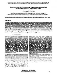
where 6,is the Kroneker delta function, N=ll, and the other parameters are defined in [I]. The energy term U, takes into account the conditional distribution of the region labels. To avoid loss of fine details, high classification error rate at the region boundaries, excessive smoothing and leaking of region labels result when 13 > 1, and poor Maximum Likelihood estimate when 13 < 1, we propose two segmentation schemes, called MICM (Modified Iterative Conditionial Modes) and DPICM (Detail-Preserving ICM). The choices of N and 13 are re-defined to achieve edge preservation. In MICM the value of I3 is not kept constant over the local window W (5x5), but it varies linearly with the maximum number n of pixel in W which have the same label. Therefore, the constant value 13 in (3) is substituted by a linear function IJ(n). In DPICM the neighborhood structure N is a 5 x 1 window whose orientation is determined by the local degree of homogeneity of the original polarimetric data. Let N, i=1,2,3,4 denote the four windows with different orientations in Fig. 1. The algorithm uses the modified energy term U,:
where n,=4 and N, is the window corresponding to the minimum value m
min {varN,(zHH)l.
=
(5)
i=1,2,3,4
POLARIMETRIC CLASSIFIER As in the original scheme by Rignot, Chellappa and 13ubois [I], we use the Iterative Conditional Modes (ICM) algorithm to obtain a fast and close approximate to the MAP estimate which conversely requires several hundred iterations to converge. Moreover, contextual information is used to derive appropriate image models for segmentation purposes, as
N1
N2
N3
N4
Fig. 1 Neighborhood structures for the DPICM algorithm
RESULTS AND COMPARISONS Experimental results obtained from multi-band and multipolarization SIR-C data (the test sites have been chosen for archaeological applications studies) show that the two novel schemes produce significant visual improvements for detail preservation, and exhibit equivalent or higher classification performance with respect to the classical scheme. Moreover, both approaches do not need additional topological information based on fuzzy connectivity, as in [4],for preservation of small structures. Table 1 summarizes some results about the classification accuracy on five classes, detected with unsupervised approach, on polarimetric SAR data of the Angkor test site (Cambodia). Data available are SIR-C full complex images acquired during the Space Shuttle Endeavour mission in April and October 1994.
Table 1 Classification accuracy comparisons.
class 0 class 1 class 2 class 3 class 4 average ML ICM MICM DPICM
0.817 0.850 0,900 0,972
0.676 1 0,988 0,988
0.555 0.840 0,840 1
0.800 0.910 0,895 0,985
0.983 0.990 0,990 0,990
0.766 0.918 0.923 0.987
Fig. 2 illustrates the original L-band HH-polarized amplitude image of the Angkor-Wat site (Cambodia). Fig. 3 shows that both extended regions and linear structures are well preserved by the proposed DPICM algorithm and it confirms the numerical results in Table 1. Also the Maximum Likelihood (ML) solution is reported for comparison.
Fig. 3 Classification maps obtained by M L (top-left), ICM (top-right),MICM (bottom-left), DPICM (bottom-right).
DPICM outperforms all other techniques because it strongly reduces the problem of over-segmentation without introducing additional loss of details. Regular structures and thin lines are retained by DPICM, thus helping the process of detection of significant classes that, in this case, mainly consist of temples, artificial channels and ancient streets.
References
Fig.2 Original W H H amplitude image of the Angkor- Wat site (Cambodia)
[l] E. Rignot, R. Chellappa, P. Dubois, "Unsupervised segmentation of polarimetric SAR data using the covariance matrix", IEEE Trans. Geosc., vo1.30, pp. 697705, July 1992. [2] J.S. Lee, M.R. Grunes, S.A.Mango, "Speckle reduction in multipolarization, multifrequency SAR imagery", IEEE Trans. Geosc., vol. 29, pp. 535-544, July 1991. [3] J.C. Bezdek, R. Ehrlich, W. Full, "FCM: The fuzzy cmeans clustering algorithm", Comp. Geosc., vol. 10, pp. 191-203, 1984. [4] P.C. Smits, S. Dellepiane, "Processing of SAR data exploiting spatial, polarimetric and topological information", Proc. IEEE IGARSS'95, Firenze, July 1014 1995, pp.1147-1149. 379