Chapter 2: Mapping and Quantifying Seascape Patterns - UNH-CCOM
Recommend Documents
Each design pattern in this book is created ..... . First section
heading. ... The core structural elements are , , and <
body>.
SAILDRIVE 330 inboard. • Saildrive 330 engine. • Folding propeller Flex-o-Fold. •
Installation. NOTICE: Specifications are subject to change without prior notice ...
1700 Bayview Dr., Arcata, CA 95521 USA. Abstract.âWe measured offshore Marbled Murrelet (Brachyramphus marmoratus) abundance from April through ...
Jul 20, 2012 - monitoring ecosystem services. Therefore, exploring historical, present, and future development of remote sensing applications is useful within ...
Jan 28, 2017 - This study performs a spatially explicit participatory mapping of the complete range ...... and Leader-Williams, 2003) or cultural landscape (Plieninger and ... back and to Chris Hank for improving the language of the paper. The.
Nov 11, 2015 - Citation: Leidig M, Teeuw RM (2015) Quantifying .... Satellite imagery is widely accepted as the best source of data for mapping and ... Modern desktop and laptop computers are powerful enough to run software for geospatial.
54 PUBLICATIONS 837 CITATIONS. SEE PROFILE. All content following this page was uploaded by Tobias Plieninger on 28 January 2017. The user has ...
ABSTRACT: Microporous aggregates of kaolin minerals and illite are common products filling the intergranular volume (IGV) of deeply buried sandstones.
Jun 5, 2006 - land cover, and soil degradation that localizes human impact on ecosystems. ... a major component of earth's biogeochemical cycles (1). Human alterations of ... on the best available global databases and integrates them in a ... represe
May 8, 2013 - We present evidence in line with the intriguing suggestion that data on ... related Wikipedia pages were viewed may have contained early ... but has opened up new avenues for scientists to investigate the ... p(t 1 2) at the end of the
anthropogenic origin of the spatial pattern of a land cover class in Lubumbashi. ...... Road and railway corridors, even in well-managed forests, provide access to previously ...... of 79 km2 (rectangles A1/A5 respectively B1/B5) contains three subzo
Richard Olson, MD, MPH ...... Zipf G, Chiappa M, Porter K. National Health and Nutrition Examination Survey: ... Dietary Reference Intakes for Vitamin A, Vitamin K, ...... Canfield MA, Mai CT, Wang Y, O'Halloran A, Marengo LK, Olney RS, et al.
harbouring low numbers of parasites, but a few individuals playing host to many (Shaw .... parasite datasets best described by the negative binomial distribution ...
A total of 1590 species of arthropods alien to Europe have already established on the continent, including. 226 more .... 2009), and Hungary (Ripka 2010). ... the former list, and a much better coverage of taxonomic groups other than insects and ....
representations or warranties with respect to the accuracy or completeness of the ... No warranty may be created or extended by sales representatives, written.
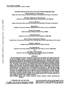
Jun 18, 2009 - galaxy. Two pairs match the properties of known Virgo structures. Using models of .... We call two stars that are within a certain ... Note that pairs 2 and 3 are ...... Astronomical Society of the Pacific Conference Series, 396, 187.
The Sacred Space group (2016) posts a languid poem to the Facebook group without ... By the same token, losing one's way could bring about an acceler- ation of ... For instance, figure 2.3 is a graph produced by the 'religion' group in 2014.
Jun 18, 2009 - Research School of Astronomy and Astrophysics, ANU, Private Bag, Weston ... set from the Spaghetti project, a pencil-beam high-latitude sky survey. ... halo shape, as demonstrated by Newberg et al. using the Sloan Digital.
bInfant Perception Laboratory, California Institute of Technology, Pasadena, CA, USA. cInstitute for Signal Processing, University of L ubeck, Germany.
Jun 18, 2009 - Thirupathi Sivarani. Department of Astronomy, University of Florida, Gainesville, FL 32611-2055. John E. Norris and Kenneth C. Freeman.
Apr 7, 2014 - interest in the growing field of engineering nanostructures for the control of spontaneous emission. arXiv:1404.1369v1 [physics.optics] 7 Apr ...
hen I wrote Analysis Patterns, I hoped to have UML versions of my diagrams
available soon after publication. However the pressure of time, and of other
projects ...
Vegetation Adjusted NTL Urban Index. (VANUI). NDVI. China. a b s t r a c t. Quantifying the spatiotemporal patterns of impervious surfaces (ISs) is crucial for ...
Chapter 2: Mapping and Quantifying Seascape Patterns - UNH-CCOM
in the application of landscape ecology to the seas and provides guidance for future research priorities. The first book devoted exclusively to this rapidly.
Seascape Ecology provides a comprehensive look at the state-of-the-science in the application of landscape ecology to the seas and provides guidance for future research priorities. The first book devoted exclusively to this rapidly emerging and increasingly important discipline, it is comprised of contributions from researchers at the forefront of seascape ecology working around the world. It presents the principles, concepts, methodology, and techniques informing seascape ecology and reports on the latest developments in the application of the approach to marine ecology and management. A growing number of marine scientists, geographers, and marine managers are asking questions about the marine environment that are best addressed with a landscape ecology perspective.
Seascape Ecology represents the first serious effort to fill the gap in the literature on the subject. Key topics and features of interest include: • The origins and history of seascape ecology and various approaches to spatial patterning in the sea • The links between seascape patterns and ecological processes, with special attention paid to the roles played by seagrasses and salt marshes and animal movements through seascapes • Human influences on seascape ecology—includes models for assessing humanseascape interactions • A special epilogue in which three eminent scientists who have been instrumental in shaping the course of landscape ecology offer their insights and perspectives Seascape Ecology is a must-read for researchers and professionals in an array of disciplines, including marine biology, environmental science, marine management, and environmental protection. It is also an excellent supplementary text for university courses in those fields.
The book can be purchased through the academic publisher Wiley or through Amazon
Chapter 2: Mapping and Quantifying Seascape Patterns Bryan Costa, Brian Walker and Jennifer A. Dijkstra Abstract Seascape maps describe the spatial and temporal distribution of physical and biological structure and conditions in the marine environment. Mapping these patterns enhances our ability to understand and sample the seascape efficiently. Seascape maps also enable us to bridge the gap between in situ and remotely sensed information, and explore the effect of changing scales on species and communities. While seascape maps are crucial data types in seascape ecology, they are often difficult to derive. Gaps in our knowledge about species distributions and behaviors make it challenging to choose environmental variables and scales that are ecologically relevant. No one sensor can map all seascape patterns under all environmental conditions, requiring that the sensors and platforms are chosen carefully. A growing number of analytical techniques make it challenging to determine how to characterize and apply seascape maps and metrics efficiently and accurately. We present a stepwise operational framework discussing key considerations when mapping seascapes to help seascape ecologist characterize, quantify and analyze spatial patterning in the seascape. This framework can be used to help evaluate seascape maps, determine best-fit for specific project goals, and to discern seascape patterns at scales that are ecologically relevant.