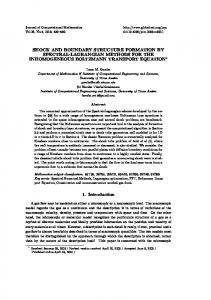
Journal of Archaeological Science 35 (2008) 1673e1682 http://www.elsevier.com/locate/jas
Exchange patterns, boundary formation, and sociopolitical change in Late Bronze Age Southern Caucasia: preliminary results from a pottery provenance study in northwestern Armenia Ian Lindsay a,*, Leah Minc b, Christophe Descantes c, Robert J. Speakman d, Michael D. Glascock e a
Department of Sociology and Anthropology, Purdue University, 700 West State Street, West Lafayette, IN 47907-2059, USA b 100 Radiation Center, Oregon State University, Corvallis, OR 97331-5903, USA c Archaeological Research Facility, 2251 College Building, University of California, Berkeley, CA 94720, USA d Smithsonian Museum Conservation Institute, 4210 Silver Hill Road, Suitland, MD 20746-2863, USA e Research Reactor Center, University of Missouri, Columbia, MO 65211, USA Received 3 August 2007; received in revised form 13 November 2007; accepted 14 November 2007
Abstract In the South Caucasusdroughly the territory of today’s Armenia, Georgia, and Azerbaijandthe transition from the Middle Bronze Age (MBA) to the Late Bronze Age (LBA) is equated with fundamental shifts in settlement patterns, subsistence economy, and political strategies. During the mid-2nd millennium BC, nomadic pastoral societies that had dominated the region began to settle down and construct stone fortresses along the foothills of the Lesser Caucasus; these fortifications largely replaced the expansive and often opulently adorned kurgan burials as the most prominent expression of political dominance on the landscape. After a decade of intensive archaeological study at various fortifications, very little remains known about the political and economic relationships among fortresses on a regional scale that might improve our understanding of the roots of these sociopolitical transformations. In this paper, we highlight the results of a recent neutron activation analysis (NAA) of ceramics from elite and non-elite contexts at a selection of LBA fortresses on the Tsaghkahovit Plain in northwestern Armenia, and offer some preliminary interpretations about political and economic organization and boundary formation. Most strikingly, the NAA data suggest that the fortresses on the Tsaghkahovit Plain appear to have isolated themselves economically from surrounding valleys, perhaps in an attempt to forge boundaries and legitimating ideologies attendant to new political formations that were quite distinct from their nomadic predecessors in the MBA. Ó 2007 Elsevier Ltd. All rights reserved. Keywords: NAA; Ceramics; Political economy; Late Bronze Age; Caucasus
1. Introduction The LBA in the South Caucasus (alternatively Caucasia, and in Soviet times Transcaucasia), was a period of pronounced sociopolitical transition that left indelible marks on the archaeological landscape in portions of what are now Armenia, Georgia, and Azerbaijan. After nearly eight centuries of nomadic
* Corresponding author. E-mail address:
[email protected] (I. Lindsay). 0305-4403/$ - see front matter Ó 2007 Elsevier Ltd. All rights reserved. doi:10.1016/j.jas.2007.11.010
pastoralism, socially-stratified warlike societies of the MBA began to settle down and construct heavily fortified sites overlooking fertile agricultural valleys and plains of the Lesser Caucasus (Table 1); this archaeological transition is particularly visible in southern Caucasia, a province of Caucasia along the middle course of the Araks River drainage system in the central and northern portions of the Republic of Armenia (see Smith, in press, for a recent detailed treatment of toponymic conventions for the region’s physical and political geography). The dramatic change in settlement patterns coincided with monumental architecture in the form of hilltop cyclopean
I. Lindsay et al. / Journal of Archaeological Science 35 (2008) 1673e1682
1674
Table 1 Abbreviated chronology of the Bronze Age in Southern Caucasia (i.e., middle highland Arax River drainage), after Badalyan et al. (in press: Fig. IV.1) Period
Phase
Horizon style
Dates BC (approx.)
Early Iron Age
EI II
LchashenMetsamor 5 LchashenMetsamor 4 LchashenMetsamor 3 LchashenMetsamor 2 LchashenMetsamor 1 Karmir-Vank; Karmir-Berd; Sevan-Uzerlik Trialeti-Vanadzor Early Kurgan Karnut-Shengavit; ShreshblurMokhrablur Elar-Aragats
1000e800
EI I Late Bronze Age
LB III LBA II LB I
Middle Bronze Age
Early Bronze Age
MB III
MB II MB I KuraAraxes II KuraAraxes I
1150e1000 1300e1150 1400e1300 1500e1400 1750e1500
2150e1750 2400e2150 2900e2400
3500e2900
fortress constructions, new forms of sociopolitical institutions, and new suites of material culture assemblages comprising the Lchashen-Metsamor stylistic horizon. Lchasen-Metsamor horizon vessels characteristic of the LBA and subsequent Early Iron Age (EIA) consist largely of gray wares with incised, nail-impressed, and polish ornamentation, which replaced the black punctate and black-on-red painted wares common during the Middle Bronze Age. Within the Tsaghkahovit Plain of northwestern Armenia, as many as 11 known fortresses and fortified outposts were built during the LBA, and it is the intra- and inter-regional relationships of these forts that are the foci of ongoing investigations. In this paper, we offer some initial impressions about the organizing principles of LBA political economics in the region through an examination of ceramic circulation patterns between the Tsaghkahovit Plain and neighboring valleys and how these patterns are represented among differing social strata on the plain. Our provisional interpretations are founded on results from an ongoing sourcing study based on NAA. One important issue shaping the methodological parameters of our study is that there are no morphological or decorative elements among Lchashen-Metsamor ceramics that can be used to definitively tie the origins of vessels to particular territories; nor are surface treatments useful in differentiating high status from low status wares. As a result, sourcing techniques that establish the chemical and mineralogical properties of ceramics are particularly valuable in southern Caucasia to see beneath the macro-level homogeneity of the assemblages and access how they are moving across the landscape. The results of our NAA study lead us to two preliminary conclusions with implications for our understanding of political authority in southern Caucasia during the LBA. First, NAA results from ceramic sherds and the raw material survey indicate that almost none of the ceramics sampled originated from
outside the Tsaghkahovit Plain, suggesting at least some level of economic insularity and boundary formation on the plain during the LBA. While ceramic sourcing is our primary line of evidence thus far, future studies illustrating the movement of humans and non-ceramic archaeological materialsdfaunal and artifactualdacross the landscape will certainly be needed to determine whether this pattern holds for goods other than pottery. Second, at the site of Tsaghkahovit the local scale of production and consumption appears to characterize ceramic distribution at both elite (citadel) and non-elite (lower town) contexts; in other words, sociopolitical status does not appear to predict access to exchange networks outside the plain. Before detailing the methods and results of the raw material survey and chemical characterization study, we first introduce the archaeological and geographic context of the study area and provide background information on previously reported ceramic sourcing results in the Tsaghkahovit Plain.
2. The Tsaghkahovit Plain, Armenia: Geographic and archaeological context The Tsaghkahovit Plain (2000 m.a.s.l.) is situated in Armenia’s northwestern uplands (Aragatsotn marz), one of numerous fertile plains and valleys nestled between the granitic mountain ranges of the Lesser Caucasus (see Fig. 1). The plain is bordered by the basaltic northern foothills of Mt. Aragats (the highest point in Armenia at 4090 m), the southern slopes of the rugged Pambak Range to the north, the northwestern end of the Tsaghkunyats Range to the east, and the uplift surrounding Mt. Kolgat (2474 m) to the west. These formations frame an area of approximately 190 km2 that comprise the Tsaghkahovit Plain. The enclosed landscape of the plain can be accessed via three geographic approaches, from the Aparan Valley along Mt. Aragats’ eastern flank, from the west through a gap between Mt. Kolgat and Mt. Aragats, and from the north through a windy passage across the Pambak Range. The region’s complex geological history and composition make it a particularly useful place for chemical characterization studies that rely on the identification of distinct chemical signatures of raw material sources. The southern boundary of the plain is comprised of the large massifs of the Aragats stratovolcano represented by a cenotypal basalteandesiteedacite succession dating to 0.3e0.5 million years ago. The northern border of the plain, the Pambak Range, is formed by the Gegharot intrusion dated to approximately 127 million years ago (upper Jurassicelower Cretaceous) and built up by clinopyroxene-amphibole diorites, tonalites, quartz diorites, and granites. Along the Spitak fault and the adjacent areas of the Saralanj and Tsilkar Valleys stretches the Aparan suite dated to 122 million years ago and consisting of paleotypal lavas (basalt, andesite, rhyolite) and pyroclastic rocks. Over the course of its geological history, the Tsaghkahovit Plain depression was filled in by lava flows during the Middle Quaternary and riverine and glacial deposits in the Middle Pleistocene and Holocene, with Holocene riverine alluvial and glacial deposits
I. Lindsay et al. / Journal of Archaeological Science 35 (2008) 1673e1682
1675
Fig. 1. Map of Late Bronze Age fortress sites in and around the Tsaghkahovit Plain.
distributed across the central part of the plain (Karakhanian, 2000; Mnatsakanyan, 2005; Zograbyan, 1979). One of the most important markers of the MBA-LBA transition in southern Caucasia is how social difference was manifested on the landscape, a factor that we view as marking an important shift in the projection of authority from individual elites during the MBA to sociopolitical institutions in the LBA. A paucity of settlements dating to the MBA (in contrast to earlier and later periods) has meant that attempts at periodization and interpretation of archaeological complexes have rested almost solely on mortuary data. The dearth of recorded settlements has led to a general interpretation of MBA highland settlement patterns in terms of an increased reliance on nomadic pastoralism (Burney and Lang, 1971: 86; Kohl, 1992: 125), though detailed studies on population movement, faunal remains, etc., are still needed to confirm these interpretations. During the MBA, large, ostentatious kurgans (burial mounds) akin to those documented throughout the Eurasian Steppe were laden with intricate metalwork, weaponry, and wheeled vehicles such as chariots and wagons. The size of the largest kurgans near Tsnori in Georgia’s Alazan Valley (Dedabrishvili, 1979), reach 140 m in diameter, peak at 11 m above the surface, and contain burial chambers approaching 170 m3. Grave goods provide evidence for advances in tin bronze metallurgy and metal working, fluorescing in the Trialeti horizon (i.e., MBA II, c. 2050e1700 BC) when jewelry, hammered bronze belts, and inlaid gold bowls appear as offerings within the richest kurgans. Some of the most striking finds
include elaborately crafted silver goblets (Oganesyan, 1992) and a bucket dating to the Trialeti horizon and exhibiting formal artistic styles that Rubinson (2003) attributes to interaction between the peoples of Caucasia and Anatolia. All of these traitsdfrom the disposal of precious goods to the imposing dimensions of the kurgans themselvesdcombine to broadcast the social singularity of the MBA warrior-chief, whose basis of authority appears to have rested at least in part on prestige garnered through successful combat (though the meaning and context of conflict during the MBA is still unclear) (Badalyan et al., 2003: 150). Around 1500 BC, important transformations in settlement and subsistence patterns at the beginning of the LBA are accompanied by changes in the way that political authority was monumentalized, such that hilltop fortresses replace expansive burial mounds as the most prominent materialization of power on the landscape (Smith et al., 2004). The ability to marshal the resources needed to construct cyclopean fortresses presumes the continuation of dramatic social difference and militarization during the LBA, but these labor effortsdwhile clearly directed by powerful leadersdwere summoned for the construction of monumental institutional spaces rather than tombs glorifying the individuality and singularity of those leaders. Archaeologists have documented the remains of LBA cyclopean fortresses in Armenia since the turn of the 20th century and the early decades of the Soviet era (Adzhyan et al., 1932; Kalantar, 1937; Khachatryan, 1974; Lindsay and Smith, 2006; Smith, 2006; Toramanyan, 1942, 1948), but only
1676
I. Lindsay et al. / Journal of Archaeological Science 35 (2008) 1673e1682
recently have systematic survey and excavations at Late Bronze Age fortress sites begun to address the social, political, and economic consequences of these new settlement systems (Avetisyan et al., 2000; Badalyan et al., 2003; Lindsay, 2006; Smith et al., 2004). In 1998, Project ArAGATS (Archaeology and Geography of Ancient Transcaucasian Societies) initiated a long-term research program to investigate the emergence of these fortress polities, including the political and economic relations between the forts. The first phase of research in 1998 and 2000 included a settlement survey of about 85 km2 of the plain, documenting 11 hilltop fortresses and fortified outposts as well as adjacent cemeteries (see Fig. 1). In 2002, 2003, and 2005, intensive excavations were conducted at the sites of Tsaghkahovit and Gegharot on opposite sides of the plain. The discovery in 2003 of a Late Bronze Age shrine or temple complex at the Gegharot fortress on the north side of the plain offers evidence for the establishment of new ideological and ritual traditions including a large altar, several large storage jars from the earliest phases of the LBA, a censor with traces of ephedra, and evidence for the production of ornamental metalwork (Badalyan et al., 2005). Radiocarbon dates from burn layers at both Tsaghkahovit and Gegharot demonstrate that the Late Bronze occupation at the fortresses came to a fiery end sometime around the 13th century BC, but the context of their destruction is still unclear. In addition to investigations of institutional complexes on the fortress citadels and shrine, one of us (Lindsay) has begun excavating an LBA settlement at the base of the Tsaghkahovit hill’s southern slope, an area designated the South Lower Town, with the aim of providing the first detailed description of an LBA lower town and elucidating the impact of sociopolitical developments in the Tsaghkahovit Plain on grassroots populations (Lindsay, 2006). Thus far, remains of several distinct constructions have been uncovered within the lower town complex offering a rare glimpse of domestic life during the Late Bronze Age (and subsequent reuse of the site during the Middle Iron Age). The LBA occupants of the lower town were engaged in a mixed agro-pastoral economy based on cereal grain farming and herding sheep, goats, and cattle. A wide variety of Lchashen-Metsamor horizon pottery forms have been collected and catalogued from the South Lower Town representing a broad spectrum of domestic processing and consumption activities including jars, bowls, cookpots, cups, pithoi, bread moulds, and fragments of thick clay ovens (Lindsay, 2006: pp. 189e242). Although investigations into domains of the political elite at the LBA fortresses (i.e., citadel and upper terrace contexts) have begun to yield important insights into the general structure of LBA political systemsdthat is, what fortresses within the Tsaghkahovit Plain actually did and how they related to one anotherdwe know surprisingly little about how fortress elites governed during the LBA and the nature of political authority during this period. As a means of approaching this problem, excavations at the Tsaghkahovit South Lower Town were complimented by a provenance study and clay source survey of clay beds inside and outside of the
Tsaghkahovit Plain. An important aim of the study has been to determine if access to routes of trade and communication outside the Tsaghkahovit Plain differed between sociopolitical strata, which may be reflective of political strategies during the LBA (Lindsay, 2006). This paper reports on the first phase of the sourcing studydthe results of an NAA study of LBA ceramics from the Tsaghkahovit South Lower Town and a comparison of circulation patterns between non-elite and elite archaeological contexts. Two assumptions stemming from the archaeologically observable changes dividing the MBA and LBA are emphasized here because they are fundamental to the current research problem relating to boundary formation and political strategies. We are careful to reiterate that the evidence for population mobility during the MBA is at present circumstantial as noted above; until future studies confirm or contradict this characterization of MBA settlement and subsistence strategies, we propose as an operating assumption that the transition from nomadic to settled life during the mid-2nd millennium BC would have had important consequences for the social networks of populations in the region. If political elites sought to establish settled farming communities, the annual cycles of tribal interaction, economic transactions, and activities that follow the season patterns of movement and inform the social and ritual lives and identities of nomadic groups, would have been a formidable obstacledone familiar to the leaders of 19th and 20th century nation-states whose attempts to forcibly settle pastoral nomads within their borders met with varying degrees of success. The second important assumption is that as populations abandoned their mobile lifestyle for agro-pastoral settlements tied to LBA fortresses, the means of political integration and legitimacy would have undergone important revisions. As the most visible manifestations of these new regimes, fortresses need to be viewed within the context of shifting political strategies; it would seem easy to interpret the LBA fortifications simply as a product of an escalating Bronze Age arms race, but a strictly military account of the forts is inadequate if we recall that warfare had endured in the MBA eight centuries prior to fortress construction. Why were they not built in prior centuries? We certainly do not deny the militaristic functions of the forts, but it remains to be seen whether a settled agricultural economy led to new territorial commitments that drove the construction of defensive fortifications, or conversely, the need to establish bounded fortified territories precipitated the emergence of agricultural production. It certainly seems possible that the new LBA settlement and subsistence system may have offered ambitious leaders more sustainable opportunities to establish an extractive political economy based on agricultural production, countervailing the centrifugal forces often inherent to nomadic mobility. 3. Chemical characterization study Below we examine the results of NAA and petrographic analyses subjected to a sample of ceramic sherds from the Tsaghkahovit South Lower Town and raw clay material. We
I. Lindsay et al. / Journal of Archaeological Science 35 (2008) 1673e1682
compare these results to sourcing data derived from elite contexts at the Tsaghkahovit fortress as well as the neighboring fortresses of Hnaberd and Gegharot in order to view the Tsaghkahovit lower town within general patterns of ceramic circulation on the Tsaghkahovit Plain and beyond. We do not focus on the circulation of pots with the assumption that finished pots themselves were a commodity for exchange. Raw materials for pottery production are hardly scarce and there are plenty of workable clay sources in the northern Mt. Aragats region; craftsmen in the LBA would seldom need to travel further than the 5 km radius that Arnold (1985) sees as the limit traditional potters are willing to travel to collect raw material for ceramic production. Rather, the flow of ceramics was more likely a byproduct of seasonal social, ritual, and economic activities, carried with people as they moved across the landscape. Ceramics in this sense serve as a proxy for interaction on a large spatial scale that can be used to model the construction of social boundaries. To be sure, a comprehensive study of regional interaction needs to account for the broad suite of materials circulating in and through a given study area; as a growing number of obsidian sourcing studies remind us (e.g., Badalyan, 2002; Molyneaux, 2002; Vaughn and Glascock, 2005), we are often too quick to assume that ‘‘ceramics are THE data set most sensitive to unraveling the complexity of exchange’’ (Shackley, 2002). Nevertheless, for a variety of reasons chemical characterization studies of pottery have become increasingly common in addressing how political economies were organized in early complex societies and reflect the negotiation of group identity and social power (e.g., Bartlett and McAnany, 2000; Vaughn, 2004). Through an exploratory analysis of ceramic sourcing data in the Tsaghkahovit Plain, what insight can we gain into the structure of political economy on the plain? First, we briefly review results from a prior NAA study on the Tsaghkahovit Plain and then continue with a presentation of chemical characterization data from the Tsaghkahovit South Lower Town. Using the flow of ceramics as a proxy for access to intraand inter-regional exchange, we address the evidence for how contact with areas outside the plain compare along socioeconomic lines at Tsaghkahovit, and what preliminary conclusions we can draw about the formation of sociopolitical boundaries during this period of intense transition. 3.1. Prior chemical characterization studies in the Tsaghkahovit Plain The results of a pilot NAA study conducted by Project ArAGATS at the University of Michigan’s Ford Nuclear Reactor (FNR) have been partially reported (Smith et al., 2004: pp. 35e39) and form the basis of comparison for the current study (these samples are currently curated by Minc at Oregon State University’s Radiation Center). The prior study included 308 pot sherds sampled from Late Bronze Age fortress citadel/ upper terrace (what we refer to here as ‘‘elite zone’’) contexts as well as clay samples from seven clay sources within the Tsaghkahovit Plain. Two clay deposits near Gegharot and
1677
three near Hnaberd and Norashen were found to have workable clay and form two compositional groups referred to as the ‘‘Northern Flank’’ (Group 3) and the ‘‘Southern Flank’’ (Group 2) sources, respectively (Fig. 2). A third compositional group was detected that has not been pinpointed geographically, but shares geochemical similarities with deposits near the Pambak Range on the north side of the plain. Petrographic analyses indicate a mix of lithoclasts from ancient granites and recent andesites, a combination found to the west of Gegharot on the northern flank. The unidentified northern source, compositional Group 1, is referred to as an ‘‘Unidentified Northern Flank’’ source. Since that study, 10 other clay sources were sampled in regions neighboring the Tsaghkahovit Plain to capture the range of variability found in the chemical signatures of the clay sources previously sampled within the plain (Fig. 3). Clay beds were identified in the Armenian geological literature (Mkrtchyan et al., 1966; Navasardyan, 1997; Petrosov, 1983) and through conversations with village potters in the northern Aragats region. Three of the sampled sources, (Harich (a and b), Sarnaghbyur, and Aparan) demonstrate similarity of composition with the ‘‘Southern Flank’’ group (Smith et al.’s Group 2) based on discriminate function analysis, likely due to the shared geological origin of clays eroding off of Mt. Aragats. Further sampling is needed to define natural clay subgroups between these geologically similar, but geographically distinct, sources. Clay sources also were sampled to the north and west of the plain; the Jrashen source offered a close compositional affiliation with the ‘‘Unidentified Northern Flank’’ source (i.e., Smith et al.’s Group 1), offering support for a source location within the Pambak Range. Although the Karnut source also showed affiliation with Group 1, it was ultimately assigned to the ‘‘Northern Flank’’ source (Smith et al.’s Group 3), near the site of Gegharot, by discriminant function analysis. This may suggest a geological origin for Group 1 in the Pambak Range, with a depositional history in common with Gegharot. The remainder of workable sources outside the Tsaghkahovit Plain (including Jrarad, Jajur, and Azatan) was not related to any of the compositional groups formed by archaeological ceramics on the plain. The Jajur and Azatan clay are of particularly high quality in terms of workability, and local informants claimed that potters had been using the Azatan source up until the past 20e30 years. If ancient potters residing in the Shirak Plain and Pambak Valley also were using these sources, as seems likely, the lack of pottery from these sources in the ceramic assemblages on the Tsaghkahovit Plain supports the argument that there was indeed limited economic contact between the Shirak and Tsaghkahovit Plains (at least in the sorts of contexts that would include the exchange of goods transported in ceramic vessels). The next phase of this study will source sample sherds from LBA sites in the Shirak Plain, Pambak Valley, and Aparan Valley to further test these patterns. In terms of site proveniences, all three compositional groups contained sherds from Gegharot, whereas only Southern Flank sources are well represented by sites on the south side of the
1678
I. Lindsay et al. / Journal of Archaeological Science 35 (2008) 1673e1682
Fig. 2. Map of compositional groups of LBA pottery and clay sources based on analysis reported in Smith et al. (2004).
plain (Smith et al., 2004: pp. 37e38, Figs. 19 and 20, Table 14). This led Minc to suggest that circulation of ceramics within the plain was primarily south to northdin the direction of an extraordinary LBA shrine that has since been discovered on the upper terrace of Gegharot (Badalyan et al., 2005). Differences in the range of ceramic wares between the compositional groups do not appear to be strong, suggesting that ceramic production was not well centralized or tightly controlled within the Tsaghkahovit Plain (Smith et al., 2004: p. 39). These data provide useful impressions about the flows of ceramics within the Tsaghkahovit Plain based on sherds consumed in contexts occupied by elite members of the fortress settlement system. But a number of unanswered questions remain from the prior study: (a) a clay source has not yet been definitively identified with FNR compositional Group 1; (b) we know little about economic relations between the Tsaghkahovit Plain and neighboring valleys; and (c) more specifically, we have little indication about how these relations may have differed between social classes, data that might help inform us about the structure of LBA political economics and the formation of political boundaries between fortress polities. The current study was designed in part to redress these gaps by analyzing clay sources outside of the Tsaghkhovit Plain; to position the Tsaghkahovit Plain within the economic and political spectrum of inter-polity circulation patterns; and
to help establish the place of non-elites in the regional political economy. 3.2. Analysis of Tsaghkahovit South Lower Town samples Building on the results of the earlier study, samples of 150 LBA (Lchashen-Metsamor horizon) sherds from the South Lower Town excavations and 12 clay sources from outside the Tsaghkahovit Plain were submitted to MURR for neutron activation analysis. The ceramics were prepared for neutron activation analysis using standard MURR procedures (Descantes et al., 2005). Elemental concentration values from two irradiations and three gamma counts were assembled for 33 elements and transformed to base-10 logarithms. The MURR analysis of the South Lower Town ceramic samples identified three distinct compositional groups (Fig. 4), which show strong agreement with the compositional groups identified by Minc in the FNR analysis discussed above. To integrate data from the two INAA studies, concentration values derived at MURR were ‘‘converted’’ to FNR values by Minc to minimize the effects of conducting analyses at two different facilities. Inter-lab calibrations were based on accumulated data generated for New Ohio Red Clay at MURR and FNR, and these two labs generally show a high degree
I. Lindsay et al. / Journal of Archaeological Science 35 (2008) 1673e1682
1679
Fig. 3. Map of compositional groups of LBA pottery based on clay sources analyzed to date.
of correspondence. Subsequently, the multivariate probability of membership in each of the FNR groups was determined for each of the South Lower Town samples based on concentrations for the 15 elements originally used to define these groups (Ce, Co, Cr, Cs, Eu, Fe, Hf, La, Lu, Rb, Sc, Sm, Ta, Tb, Th). Only ‘‘core group’’ members were used in this
comparison; the inclusion of non-core members would result in greater inclusivity and group spread. Posterior classification based on discriminate function analysis was employed to suggest the closest group affiliation, for those samples not showing a significant multivariate probability of group membership. 4. Results and discussion
Fig. 4. Bivariate plot of principal components 1 and 3 showing compositional groups identified at MURR for pottery in the Tsaghkahovit South Lower Town.
A comparison of group affiliation by archaeological context is summarized in Table 2 and Fig. 5. Based on the Mahalanobis distance statistic, only 1.3% of the sherds (i.e., two sherds in 150) from the Tsaghkahovit South Lower Town sample were considered extreme outliers likely representing specimens from a yet unidentified clay source likely outside the Tsaghkahovit Plain, and provisionally considered ‘‘non-local’’ (though additional analysis targeting tempering agents and other inclusions is needed to conclusively rule out the possibility of inclusion in identified compositional groups within the plain). Petrographic analysis of a sub-sample of 50 sherds from the South Lower Town NAA sample (and conducted prior to NAA analysis) offers compositional information that complements the neutron activation findings (Mnatsakanyan, 2005). Analysis of the pottery thin-sections established that clay and tempering materials were derived from three mineralogically
I. Lindsay et al. / Journal of Archaeological Science 35 (2008) 1673e1682
1680
Table 2 Source comparison of LBA pottery from elite and non-elite contexts at fortress sites on the Tsaghkahovit Plain based on NAA Group site
Local source (%) Unclass
Citadel/terrace (‘‘Elite Zone’’) Gegharot 1 (0.55) Hnaberd 1 (3.03) Horom South 0 (0) Tsaghkahovit 0 (0) Total 2 (0.65) South Lower Town (‘‘Non-Elite Zone’’) Tsaghkahovit 1 (0.67)
Mixed
1
11 1 0 0 13
65 1 0 8 76
(6.04) (3.03) (0) (0) (4.22)
3 (2.00)
2 (35.71) (3.03) (0) (17.02) (24.68)
(30.77) (75.76) (97.22) (76.60) (50.65)
132 (88.00)
distinct sources: (1) the young, cenotypal lavas of the Aragats massif; (2) the altered paleotypal lavas of the Aparan suite to the east; and (3) the older granitic formations of the Gegharot intrusion. The results of mineralological characterization therefore corroborate the chemical characterization data pointing to a local origin for nearly all of the South Lower Town ceramics. The exotic materials that were noted during petrographic observation probably originate in the metamorphic Arzakan complex to the southeast of the Aragats massif, which may signify an area that warrants intensified raw material sampling. NAA data from the Tsaghkahovit citadel and upper terraces reveal a strikingly similar pattern to that of the lower town. Only 2.1% of sherds (one sherd in 47 sampled) from the elite sector were classified as outliers to the core compositional group (i.e., what we provisionally consider here as ‘‘non-local’’ (cf. 1.3% in the lower town)). Although the extremely low frequencies make finer interpretations untenable, it is clear that of the pottery sampled from both elite and nonelite contexts at the fortress of Tsaghkahovit, almost none were produced outside the plain, and the vast majority was produced near the fortress itself from the ‘‘Southern Flank’’ clay sources.
Total
14 2 0 1 19
182 33 36 47 308
3
56 25 35 36 156
7 (4.67)
Non-local outlier
35 3 1 2 42
(19.23) (9.09) (2.78) (4.26) (13.65)
5 (3.33)
2 (1.33)
Gegharot Fortress (n=182) Hnaberd Fortress (n=33) Tsaghkahovit Fortress (n=47) Tsagh. Lower Town (n=150)
90 80 70 60 50 40 30 20 10 0 Group 1 (N. Flank?) Group 2 (S. Flank)
(100) (100) (100) (100) (100)
150 (100)
When we consider the case of the Hnaberd citadel/upper terrace sample, the non-local sherds comprise a greater proportion of the sample (6.1%) than at the Tsaghkahovit citadel; but again, non-local sherds in the sample consist of a statistically underwhelming frequency of two. The Hnaberd sample size (n ¼ 33) was the smallest of the sites sampled and should ideally be increased to better evaluate these results. Overall, the very low frequency of pottery in absolute terms originating outside the Tsaghkahovit Plain suggests a level of economic insularity in the plain during the LBA following what many have interpreted as a period of high mobility that characterized the previous eight centuries of regional settlement history in the MBA. There are currently no comparable NAA data on MBA assemblages that would aid in reconstructing exchange patterns during this period and allow a more direct a comparison to circulation patterns in the LBA, a lacuna that we plan to redress in future phases of this study. In the meantime, this rather straightforward comparison of NAA results between differing social contexts among two neighboring LBA fortresses suggests that, although variability exists in access to foreign goods between fortresses and social strata within fortresses, elites did not have overwhelming access to supra-regional markets relative to their subordinates, and
100
Frequency
(7.69) (6.06) (0) (2.13) (6.17)
Group 3 (N. Flank)
unassigned
outlier
Compositional Group (Source Affiliation) Fig. 5. Frequencies of ceramic sherd membership within NAA groups by site.
I. Lindsay et al. / Journal of Archaeological Science 35 (2008) 1673e1682
therefore monopolization of long-distance exchange may not have been an important source of political power. However, another dimension of political economics on the Tsaghkahovit Plain is unveiled when we consider the NAA results from the fortress site of Gegharot on the northern side of the plain. At Gegharot we find the highest frequency of non-local sherds (14 sherds, or 7.7% of the sample) of the fortresses sampled thus far on the Tsaghkahovit Plain. Circulation patterns of locally made vessels within the plain, as demonstrated by Minc in Smith et al. (2004: pp. 37e38), showed that Gegharot was attracting more ceramics from the south side of the plain than it gave in return. The disproportionate quantity of vessels at Gegharot that likely originated outside the plain also suggests that the fortress, perhaps related to its ritual status as host of the LBA shrine, may have also been the focus of extra-regional tribute. Further excavation of the Gegharot shrine will refine our understanding of its role as a political, ritual, and economic force; similarly, future NAA studies are necessary to determine whether Gegharot’s place at the center of asymmetrical circulation patterns within the Tsaghkahovit Plain extends to neighboring plains. However, a preliminary analysis of samples from a fortress at the southeastern edge of the Shirak Plain suggests that this may be the case; of 36 sherds sampled from the upper terrace at Horom South and submitted to MURR for NAA, only one sherd (2.8%) originated from clay sources near Gegharot (‘‘Northern Flank’’ group), whereas the remainder of sampled vessels were produced from Southern Flank clays presumed to originate from the base of Mt. Aragatsda pattern similar to that identified at both Hnaberd and Tsaghkahovit. 5. Conclusions NAA data from the Tsaghkahovit lower town demonstrate that 99% of the LBA (Lchashen-Metsamor horizon) sherds analyzed from the settlement were produced within the Tsaghkahovit Plain, and 89% of those originated from nearby sources on the north slope of Mt. Aragats. A comparison of sourcing data from other fortress assemblages indicates that only Gegharot had access to any substantial quantity of pottery originating outside the Tsaghkahovit Plain. From the above discussions, we propose some early conclusions about the organizing principles of the LBA political economy manifested in the ceramic circulation data. The general dearth of non-local sherds at the lower town (and everywhere else except Gegharot) illustrates two important points. First, if we use the flow of ceramics as a proxy for interregional exchange, we may be seeing the forging of new political and economic boundaries that attended the transition from nomadism to sedentism with the settlement of the Tsaghkahovit Plain. Of course, there are caveats regarding the various social contexts of exchange, and these circulation patterns need to be tested in the future with other potential exchange materials in addition to pottery. Second, the interpretations of the Gegharot shrine are still in their early phases (e.g., Badalyan et al., 2005), but, as Minc has demonstrated in Smith et al. (2004), it is clear thus far that an asymmetrical exchange relationship was present in which
1681
Gegharot received goods from surrounding sites in the plain. Eliciting tribute may have been part of a legitimizing ideology targeting the South Lower Town occupants and their fellow settlers on the plain, a pattern that may well have coincided with the need to create new forms of political legitimacy and legibility of power distinct from the previous period. The circumscription of economic activity within the Tsaghkahovit Plain during the LBA is perhaps thrown into sharpest relief by the settlement history of the plain itself; the intensive occupation of the plain during the LBA is bracketed chronologically by extended hiatuses in settlement during the MBA and EIA. What made the Tsaghkahovit Plain suitable for strategies of authority in the LBA and not in previous or subsequent periods is a question that will continue to shape future research. In particular, further work on the movement of both goods and human populations during the MBA are in the planning stages that will provide further context for the broad outlines of social transformation sketched out in this paper. In the meantime, what we note in the circulation data may be a reflection of the need to create new boundaries distinguishing regional political domains that were integral to these emerging political formations. Acknowledgements The authors wish to express their appreciation to Adam Smith who offered valuable comments on a previous draft of this article. We are also grateful to four anonymous reviewers whose thoughtful observations helped refine its content and organization. Any errors of fact or interpretation remain our own. Portions of this research were conducted with grants from the National Science Foundation (#BCS-0327043), Wenner-Gren Foundation for Anthropological Research (#7194), and the Fulbright Student Program. References Adzhyan, A.A., Gyuzalyan, L.T., Piotrovskii, B.B., 1932. Tsiklopicheskii kreposti Zakavkaz’ya. Soobshchenia Gosudarstvennoi Akademii Istorii Material’noi Kultury 1/2, 61e64 (in Russian). Arnold, D.E., 1985. Ceramic Theory and Cultural Process. Cambridge University Press, New York. Avetisyan, P.S., Badalyan, R.S., Smith, A.T., 2000. Preliminary report on the 1998 archaeological investigations of Project ArAGATS in the Tsakahovit Plain, Armenia. Studi Micenei ed Egeo-Anatolici XLII, 19e59. Badalyan, R.S., 2002. Obsidian Kavkaza: Istochniki i Rasprostranenie Siria v Epokhu Neolita e Rannego Zheleza (Po Resultatam Analizov Neutronnoy Aktivatzii). Institute of Archaeology and Ethnography, National Academy of Science of the Republic of Armenia, Yerevan (in Russian). Badalyan, R.S., Smith, A.T., Avetisyan, P.S., 2003. The emergence of sociopolitical complexity in Southern Caucasia: an interim report on the research of Project ArAGATS. In: Smith, A.T., Rubinson, K.S. (Eds.), Archaeology in the Borderlands: Investigations in Caucasia and Beyond. The Cotsen Institute of Archaeology at UCLA, Los Angeles, pp. 144e166. Badalyan, R.S., Avetisyan, P.S., Smith, A.T., 2005. Svyatilishche pozdnego bronzovogo veka gekharota. Kul’tura Drevney Armenii XIII, 109e115 (in Russian). Badalyan, R.S., Avetisyan, P., Smith, A.T., in press. Periodization and chronology of southern Caucasia: from the Early Bronze Age through the Iron IV period, In: Smith, A.T., Badalyan, R.S., Avetisyan, P. (Eds.), The
1682
I. Lindsay et al. / Journal of Archaeological Science 35 (2008) 1673e1682
Archaeology and Geography of Ancient Transcaucasian Societies I: Regional Survey in the Tsaghkahovit Plain, Armenia 1998e2000. Oriental Institute Publications. University of Chicago Press, Chicago, IL, in press. Bartlett, M.L., McAnany, P.A., 2000. ’Crafting’ communities: the materialization of formative Maya identities. In: Canuto, M.A., Yaeger, J. (Eds.), The Archaeology of Communities: A New World Perspective. Routledge, New York, pp. 102e122. Burney, C.A., Lang, D.M., 1971. The Peoples of the Hills: Ancient Ararat and Caucasus. Weidenfeld and Nicolson, London. Dedabrishvili, S.Sh., 1979. Kurgany Alzanskoy Doliny [Kurgans of the Alazan Valley]. Metsniereba, Tbilisi. Descantes, C., Speakman, R.J., Glascock, M.D., 2005. Instrumental Neutron Activation Analysis of Bronze Age Pottery from the Tsaghkahovit Plain, Armenia. Unpublished report. Missouri University Research Reactor, Columbia. Kalantar, A., 1937. Mi hnaguyn jrabashkakan sistem Khor’hrdayin Hayastanum, in Teghekagir. Kit’hrati Tparan, Yerevan. 171-194 (in Armenian). Karakhanian, A., 2000. Remote Sensing and Geological Studies of the Bronze Age Monuments of the Tsaghkahovit Depression: Probabilistic Model of Spatial Distribution and Functionality of Archaeological Monuments. Unpublished report. Georisk Scientific Research Company, Yerevan. Khachatryan, T.S., 1974. Iz istorii izucheniya drevneyshikh pamiatnikov sklonov gori Aragats. In: Muradyan, P.M. (Ed.), Hayagitakan Hetazotutyunner. Izdatelstvo Erevanskogo Universiteta, Yerevan, pp. 83e114 (in Armenian). Kohl, P.L., 1992. The Transcaucasian ‘‘periphery’’ in the Bronze Age: a preliminary formulation. In: Schortman, E.M., Urban, P.A. (Eds.), Resources, Power, and Interregional Interaction. Plenum Press, New York, pp. 117e137. Lindsay, I., 2006. Late Bronze Age Power Dynamics in Southern Caucasia: A Community Perspective on Political Landscapes, Dissertation, University of California. Lindsay, I., Smith, A.T., 2006. A history of archaeology in the Republic of Armenia. Journal of Field Archaeology 31, 165e184. Molyneaux, B.L., 2002. Exploring the landscapes of long-distance exchange: evidence from Obsidian Cliffs and Devils Tower, Wyoming. In: Glascock, M.D. (Ed.), Geochemical Evidence for Long-Distance Exchange. Bergin & Garvey, Westport, CT, pp. 133e151. Mkrtchyan, S.S., Gabrielyan, A.A., Vardanyants, L.A., Magakyants, I.G., Paffengolts, K.N., 1966. Nemetallicheskie Poleznye Iskopaemye. Izdatelstvo AN Armyanskoy SSR, Yerevan (in Russian). Mnatsakanyan, A., 2005. The Petrographic Description of Thin-Sections of Ceramic Petrofabrics from Tsagkhkahovit Region (Armenia). Unpublished
report. Institute of Geological Sciences, National Academy of Sciences of the Republic of Armenia, Yerevan. Navasardyan, K.O., 1997. Tekhniko-Teknologicheskie Osobennosti Kermiki Armenii III e I tys. do N.E. Institute of Archaeology and Ethnography, National Academy of Science of the Republic of Armenia, Yerevan (in Russian). Oganesyan, V.E., 1992. A silver goblet from Karashamb. Soviet Anthropology and Archeology 30, 84e102. Petrosov, I.K., 1983. Glinistye Porody Armyanskoy SSR. Izdatelstvo AN Armyanskoy SSR, Yerevan (in Russian). Rubinson, K.S., 2003. Silver vessels and cylinder sealings: precious reflections of economic exchange in the early second millennium BC. In: Smith, A.T., Rubinson, K.S. (Eds.), Archaeology in the Borderlands: Investigations in Caucasia and Beyond. The Cotsen Institute of Archaeology at UCLA, Los Angeles, CA, pp. 128e143. Shackley, M.S., 2002. More than exchange: pre-ceramic through ceramic period obsidian studies in the greater North American Southwest. In: Glascock, M.D. (Ed.), Geochemical Evidence for Long-Distance Exchange. Bergin & Garvey, Westport, CT, pp. 53e87. Smith, A.T., 2006. Prometheus unbound: Southern Caucasia in prehistory. Journal of World Prehistory 19, 229e279. Smith, A.T., in press. Archaeology in Armenia: an introduction to Project ArAGATS, In: Smith, A.T., Badalyan, R.S., Avetisyan, P. (Eds.), The Archaeology and Geography of Ancient Transcaucasian Societies I: Regional Survey in the Tsaghkahovit Plain, Armenia 1998e2000. Oriental Institute Publications. University of Chicago Press, Chicago, IL, in press. Smith, A.T., Badalyan, R., Avetisyan, P., Zardaryan, M., Hayrapetyan, A., Minc, L., Monahan, B., 2004. Early complex societies in Southern Caucasia: a preliminary report on the 2002 investigations of Project ArAGATS on the Tsakahovit Plain, Republic of Armenia. American Journal of Archaeology 108, 1e41. Toramanyan, T., 1942. Nyuter Haykakan Jartarapetutyan Patmutyan. In: Izdatelstvo ArmFAN, vol. 1. Yerevan (in Armenian). Toramanyan, T., 1948. Nyuter Haykakan Jartarapetutyan Patmutyan. Izdatelstvo AN Armyanskoy SSR, vol. 2. Yerevan (in Armenian). Vaughn, K.J., 2004. Households, crafts, and feasting in the ancient Andes: the village context of early Nasca craft consumption. Latin American Antiquity 15, 61e88. Vaughn, K.J., Glascock, M.D., 2005. Exchange of Quispissa obsidian in Nasca: new evidence from Marcaya. Andean Past 7, 93e110. Zograbyan, L.N., 1979. Orografiya Armyanskogo Nagorya: Opit Orograficheskovo Analiza Morfostrukturi. Izdatelstvo Akademii Nauk Armyanskoy SSR. Yerevan (in Russian).