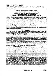
Near-Surface Permafrost Distribution Mapping Using Logistic Regression and Remote Sensing in Interior Alaska S. K. Panda1 and A. Prakash
Geophysical Institute, University of Alaska Fairbanks, Fairbanks, Alaska 99775
M. T. Jorgenson
Alaska Ecoscience, Fairbanks, Alaska 99709
D. N. Solie
Baseline Geoconsulting, LLC, Fairbanks, Alaska 99708
Abstract: A combination of binary logistic regression (BLR) and remote sensing techniques was used to generate a high-resolution spatially continuous near-surface (< 1.6 m) permafrost map. The BLR model was used to establish the relationship between vegetation type, aspect-slope, and permafrost presence; it predicted permafrost presence with an accuracy of 88%. Near-surface permafrost occupies 45% of the total vegetated area and 37% of the total study area. As less than 50% of the study area is underlain by near-surface permafrost, this distribution is characterized as “sporadic” for the study area.
INTRODUCTION Permafrost or perennially frozen ground is defined as “ground (soil or rock and included ice and organic material) that remains at or below 0°C for at least two years, for natural climatic reasons” (van Everdingen, 1998, p. 48). Permafrost and permafrost-affected regions underlie ~22% of the exposed land in the Northern Hemisphere (Brown et al., 1997) and ~80% of Alaska (Jorgenson et al., 2008). Knowledge of the nature (geologic materials and ground ice content) and distribution of permafrost is critical for the stability of engineering structures and for understanding ecological responses to changing permafrost conditions (Johnston, 1981). The melting of ground ice in the degrading permafrost can cause differential thaw settlement that may lead to the failure of buildings or infrastructure located on the permafrost-affected ground. Degrading permafrost also affects surface hydrology by impounding water in subsiding areas and enhancing drainage of upland areas 1
Corresponding author; email:
[email protected]
346 GIScience & Remote Sensing, 2012, 49, No. 3, p. 346–363. http://dx.doi.org/10.2747/1548-1603.49.3.346 Copyright © 2012 by Bellwether Publishing, Ltd. All rights reserved.
permafrost distribution mapping
347
(Woo, 1992). The resulting changes in soil drainage can alter the decomposition and accumulation of soil carbon (Schuur et al., 2008), shift habitat composition for vegetation and wildlife (Jorgenson and Osterkamp, 2005), and increase emission of greenhouse gases (Christiansen et al., 2004; Turetsky et al., 2007). Thus, improved methods for mapping permafrost distribution are vital to designing structures (e.g., roads, pipelines, buildings, etc.) and to model the future ecosystems dynamics in Interior Alaska. The construction of a new pipeline to transport natural gas from Alaska’s North Slope to the mainland U.S. through Canada has been proposed along the Alaska Highway corridor, which runs from Dawson Creek (British Columbia) to Delta Junction (Alaska). In this corridor, permafrost distribution is reported as discontinuous, implying that 50–90% of the area is underlain by permafrost (Brown et al., 1997; Jorgenson et al., 2008; Reger et al., 2008; Reger and Hubbard, 2010). Because the presence or absence of permafrost at a site would affect the engineering design, construction cost, and maintenance of the pipeline, it is crucial to have detailed and current knowledge of permafrost distribution in the corridor. Oil industries developed permafrost maps in the past for the Trans-Alaska Pipeline alignment (Kreig and Reger, 1982) in the 1970s and for the Northwest Alaska Gas Pipeline project in the 1980s. However, a low-resolution permafrost map (scale 1:63,360) interpreted from false-color infrared aerial photographs taken in August 1980 is the only permafrost map publicly available for this corridor (Reger and Hubbard, 2010). Thus, a detailed and up-to-date near-surface permafrost map of the Alaska Highway corridor is required to avoid or mitigate potential engineering problems associated with permafrost-affected terrain. It will also help to identify areas for further investigation so that permafrost areas can be avoided or if necessary, engineering solutions can be designed to maintain the physical and thermal state of permafrost. As with any ground-based research in logistically challenging areas, permafrost mapping using ground temperature measurements and/or ground-based geophysical techniques is expensive, time-consuming, and restricted to small areas (King et al., 1992; Rune et al., 1996; Etzelmuller et al., 2001). So we need to rely on airborne or satellite remote sensing, which can provide efficient and cost-effective techniques for regional-scale permafrost mapping and monitoring. Imagery and elevation data acquired by remote sensing systems can be used to identify geomorphological features (e.g., patterned grounds, pingos, palsas, solifluction lobes, slope failures, thermokarst features) or surface characteristics (e.g., topography, surface hydrology, vegetation, snow cover, and surface condition) that are correlated with or control the presence of near-surface permafrost in Interior Alaska (Smith, 1975; Goodrich, 1982; Panda et al., 2010). Several studies have demonstrated the usefulness of this approach to permafrost mapping in discontinuous permafrost settings (Morrissey et al., 1986; Jorgenson and Kreig, 1988; Leverington and Duguay, 1997; Frauenfelder et al., 1998; Etzelmuller et al., 2006; Panda et al., 2008, 2010; Nguyen et al., 2009). However, once the permafrost disappears from the topsoil and is present only at deeper soil horizons, either due to disturbance or climate warming, the vegetation-permafrost relationship ceases to exist. Therefore, only near-surface permafrost can be mapped using surface variables as indirect evidence.
348
panda et al.
Morrissey et al. (1986) initiated the use of remotely sensed data in permafrost mapping and evaluated models predicting the occurrence of permafrost using environmental information derived from the Landsat Thematic Mapper. Jorgenson and Kreig (1988) used vegetation, terrain units, equivalent latitude, and heat balance at the ground surface to map permafrost distribution. They calculated the heat balance, the ratio of the amount of heat entering the soil in summer when the ground was seasonally thawed to the amount of heat lost in winter when the ground was seasonally frozen, at the surface using the thawing and freezing degree-day sums and soil thermal conductivities. Leverington and Duguay (1997) exploited the correlative relationship between surface properties and permafrost to determine effective combination of data sources for permafrost prediction within the top 1.5 m of the ground surface using neural networks. Panda et al. (2010) combined vegetation and topography mapped from remotely sensed data with field measurements of permafrost presence/absence to predict permafrost distribution within the top 1.6 m of the ground surface in a pilot study area along the Alaska Highway. In this study we undertook permafrost mapping for a large section of the Alaska Highway corridor by using a logistic regression model linking the probability of nearsurface (< 1.6 m) permafrost presence to surface variables derived from the remote sensing data that included vegetation type, topographic aspect and slope. We carried out extensive field sampling in the study area to record surface and shallow sub-surface variables including the presence or absence of permafrost. Most of the field data were used to develop the logistic regression model that we subsequently integrated with remote sensing techniques to generate a high-resolution spatially continuous probabilistic permafrost map of the study area. We processed the remote sensing data to derive the surface variables that could be input into this model. The results of probabilistic permafrost mapping were validated by comparison with the observations from the remaining field sites. STUDY AREA The study area is located in east-central Alaska and encompasses a ~110 km long and 18 km wide section of the Alaska Highway corridor extending from Mile Post 1329 to 1397, bounded by latitude 63.3– 63.9°N and longitude 143.5–145.1°W (Fig. 1). It stretches through the Tanana Lowland bordered by the Yukon-Tanana Upland in the north and the eastern Alaska Range in the south. It is a part of the only land transportation route to Interior Alaska that connects the mainland U.S. to Alaska through Canada. In the future, this corridor is likely to become a locus of many developmental projects because construction of a natural gas pipeline and an Alaska railroad extension are proposed along this route. Some parts of the study area were affected by Delta (penultimate) and Donnelly (late Wisconsin) glaciations. The surficial deposits are mostly glacial, glacio-fluvial, and fluvial in origin (Reger et al., 2008). Permafrost distribution in this corridor was mapped as discontinuous using direct and indirect indicators. Limited borehole temperature and water-well records served as direct indicators, whereas a combination of vegetation, topography, soil, geology, and hydrology served as indirect indicators of permafrost presence in these studies (Brown et al., 1997; Jorgenson et al., 2008; Reger et al., 2008; Reger and Hubbard, 2010). The mean annual air temperature and precipitation range from –2.0°C and 289 mm at Big Delta
permafrost distribution mapping
349
Fig. 1. Study area map. A. The white rectangle shows the location of the study area in Alaska. B. A hillshade model of the study area that covers ~110 km of the Alaska Highway corridor between Mile Post 1329 to 1397.
near Delta Junction to –4.7°C and 245 mm at Tok, 40 km east of the eastern end of the study area (Western Region Climate Center, 2005). METHODS Field Work We sampled vegetation and soils at 330 locations, during July 2007 and August 2008–2010, in different vegetative, topographic, and geologic settings (Table 1). The sampling locations were selected so that all the vegetation classes in different topographic settings were adequately sampled to allow statistical modeling, and each
panda et al.
350
Table 1. Summary of Field Data Collected in Different Vegetation and Topographic Settingsa Permafrost Vegetation
Aspect Present
Absent
Surface organic layer Active layerb thickness (cm) thickness (cm)
Open Spruce (50)
45 – Low plain 3 – North 1 – West 1 – Northwest
50
0
25 ± 9
46 ± 12
Aspen (23)
10 – Low plain 3 – East 3 – Southeast 4 – South 2 – Southwest 1 – West
0
23
Very thin patchy moss or absent
–
Deciduous (31)
17 – Low plain 3 – North 4 – Northeast 1 – East 1 – Southeast 1 – South 1 – West 3 – Northwest
0
31
14 ± 5 (at 7 stations), Very thin patchy moss or absent at other stations
–
Wetland Meadow (16)
16 – Low plain
0
16
19 cm at two stations, absent at other stations
–
Closed Spruce (116)
109 – Low plain 3 – North 1 – Southwest 1 – Northwest 2 – Northeast
91
25
20 ± 6
60 ± 14
Mixed Spruce and Deciduous (94)
69 – Low plain 5 – North 3 – Northeast 3 – East 4 – Southeast 4 – South 3 – Southwest 2 – West 1 – Northwest
19
75
14 ± 7
69 ± 12
a The number in the parentheses in the first column represents the number of stations sampled in that vegetation class. b The layer of the ground above permafrost that thaws in summer and freezes again in winter (Muller, 1947).
permafrost distribution mapping
351
Fig. 2. Vegetation map derived using the maximum likelihood classification on a seven-band composite image. White spaces within the vegetation map are masked out areas composed of water bodies, barren surfaces, clouds, and recent burns.
vegetation class was homogeneous at the pixel scale (2.5 m) at the sampled location. At each sample location, we recorded the vegetation class, surface organic layer thickness (organic layer above mineral soil), topographic position, and surface microtopographic features, as well as the presence or absence of surface water. We used a 1.6 m long soil auger to record soil type, presence or absence of ice, and frozen soil. Areas of bedrock and blocky regolith with thin veneers of soil, mostly present on high slopes with little or no alpine vegetation cover, were avoided because we could not auger at those locations. Because permafrost presence or absence was difficult to determine for the rocky soils, these areas were excluded from our analysis by masking out unvegetated and alpine vegetation cover from a vegetation map derived from the SPOT remote sensing data (Fig. 2). Statistical Model Statistical modeling of the relationships among surface variables and permafrost presence or absence in the study area was carried out using the binary logistic regression (BLR) model in SPSS 16.0, a commercially available statistical software package (SPSS, 2007). BLR is a form of regression that can be used when the response variable is a dichotomy and the explanatory variables are continuous and/or categorical
panda et al.
352
(Hosmer and Lemeshow, 2000). It applies maximum likelihood estimation after transforming the response variable into a logit variable (the natural log of the odds of the event of interest occurring or not). The specific form of logistic regression model we used is: 1 Π i = ----------------–Z i 1+e
(1)
where Z is the propensity towards the event of interest (log-odds) and П is the probability that the i-th case experiences the event of interest. The model assumes that Z is linearly related to the predictors Z i = b 0 + b 1 x i1 + b 2 x i2 + … + b j x ij + … + b p x ip
(2)
where Xij is the j-th predictor for the i-th case, bj is the j-th coefficient, and p is the number of predictors. The predictors relate to the probability of interest by substituting Z in the equation (1): 1 Π i = -----------------------------------------------------------------------------– ( b 0 + b 1 x i1 + b 2 x i2 + … + b p x ip ) 1+e
(3)
Remote Sensing Inputs Satellite data included multispectral pan-sharpened scenes acquired on June 30 and July 1, 2003 by the SPOT 5 satellite. Pan-sharpening for SPOT 5 is the process of merging the 2.5 m spatial resolution panchromatic band with the relatively low 10 m spatial resolution multispectral bands—Band 1 (green), 0.50–0.59 µm; Band 2 (red), 0.61–0.68 µm; Band 3 (near infrared), 0.78–0.89 µm)—to obtain the best characteristics of both panchromatic and multispectral bands (Zhang, 2002, 2004; Colditz et al., 2006). Airborne data included a digital elevation model (DEM) interferometrically derived from Airborne Synthetic Aperture Radar (AIRSAR) data collected under NASA’s Pacific Rim 2000 mission and initially processed at the Jet Propulsion Laboratory (JPL) in Pasadena, California. The Alaska Satellite Facility (ASF) processed the AIRSAR C-band data to generate the 5 m spatial resolution DEM. Vegetation Mapping. The Normalized Difference Vegetation Index (NDVI), a ratio of the difference between near infrared and red bands to the sum of these two respective bands, is one of the most widely used indices applied to mapping vegetation from remote sensing images (Rouse et al., 1974; Jensen, 2000). The NDVI map was generated using SPOT band 2 and band 3 and used to delineate vegetated and unvegetated pixels by applying a simple threshold to the NDVI map (NDVI >0 is vegetated). The unvegetated pixels (NDVI < 0) representing barren floodplains, landslides, exposed bedrock, and man-made structures were excluded from subsequent analysis as these land covers in the study area are usually underlain by rocky soils where determination of permafrost is difficult with a hand-held auger.
permafrost distribution mapping
353
Image texture, defined as the function of the spatial variation in pixel intensities (grey values), was also used as a means for discriminating different vegetation types. For SPOT band 3 we produced a texture map using a variance operator (ERDAS Field Guide, 2008). Analysis of this texture map shows that different vegetation canopies display different textural characteristics. For example, the Mixed Spruce and Deciduous vegetation class shows higher variance values compared to either Spruce or Deciduous vegetation classes; Open Spruce in low-lying valleys shows lower variance compared to Closed Spruce forest on upland areas. Field observations also suggested that vegetation distribution depends on topography (elevation and slope). Therefore, we created an image composite of seven layers that included bands 3, 2, and 1 from the SPOT scene, NDVI map, texture (variance) map, elevation, and slope maps from AIRSAR DEM to achieve the best vegetation classification result. We used the maximum likelihood decision routine in ERDAS Imagine (ERDAS Field Guide, 2008; ESRI Developer Network, 2009) to classify vegetation. This routine considers both the variances and covariances of the class signatures when assigning each cell to one of the classes represented in the signature file. With the assumption that the distribution of a class sample is normal, a class can be characterized by the mean vector and the covariance matrix. Given these two characteristics for each cell value, the statistical probability is computed for each class to determine the membership of the cells to the class. With equal probabilities for each class defined in the signature file, each cell is assigned to the class to which it has the highest probability of being a member (ERDAS Field Guide, 2008; ESRI Developer Network, 2009). We mapped six vegetation classes from the seven-layer image composite with an overall classification accuracy of 86.5% (Fig. 2 and Table 2). We estimated the classification accuracy by comparing vegetation at 290 sampled locations and on the vegetation map (Table 2). The classification statistics revealed that vegetation covers 81% of the study area. Open Spruce, Closed Spruce, and Mixed Spruce and Deciduous vegetation classes are the dominant vegetation type, representing 82% of the total vegetation cover (Table 3). Aspect-Slope Mapping. The AIRSAR DEM was used to derive the aspect-slope map of the study area using the Spatial Analyst tool in ArcMap 9.3. We reclassified the aspect map into eight aspect classes using 45° aspect intervals (Table 4). Analysis of field data showed 8° slope as the boundary between retransported deposits and upland loess. Jorgenson et al. (1999) also found the 8° slope as the frequent boundary between frozen retransported deposits and unfrozen upland loess at Fort Wainwright, Interior Alaska. This 8° cut-off may also correspond to the margin where slope-wash and rill erosion can shift from erosion to deposition. The deposition of fine-grained soil changes the thermal characteristics and makes the soil more prone to permafrost development. Also, low-lying areas and valley bottoms in Interior Alaska are more likely to be underlain by near-surface permafrost than upland areas due to the presence of a thicker surface organic layer and winter temperature inversion (Panda et al., 2010). Hence, we extracted all the pixels with slope value less than 8° (which occupies 57% of the study area) from the slope map and added them to the aspect map as a low-lying surface class. Probabilistic Permafrost Mapping We applied the established relationship (i.e., logistic coefficients of each input variable class) to the vegetation and aspect-slope classes mapped from remotely sensed
panda et al.
354
Table 2. Vegetation Classification Accuracy Mixed Wetland Open Closed Total Percent Vegetation Aspen Spruce and Deciduous a Meadow Spruce Spruce correct correct class Deciduous Aspen (21)
20
1
–
–
–
–
20
95.2
Wetland Meadow (15)
1
14
–
–
–
–
14
93.3
Mixed Spruce and Deciduous (78)
1
1
65
5
–
6
65
83.3
Open Spruce (45)
–
–
2
42
–
1
42
93.3
Deciduous (26)
5
1
4
2
14
14
53.8
Closed Spruce (105)
–
–
7
2
–
96
91.4
251
86.5
Total (290)
96
a The number in the parentheses in the first column represents the number of stations sampled in that vegetation class.
Table 3. Percentage of Mapped Vegetation Classes and Percentage of Each Vegetation Class Underlain by Near-Surface (< 1.6 m) Permafrost in the Study Area Vegetation class
Vegetation class (%)
Permafrost (%)
Aspen
8.1
0.0
Closed Spruce
34.0
87.0
Deciduous
7.2
0.0
Mixed Spruce and Deciduous
36.3
11.0
Open Spruce
11.4
100.0
Wetland Meadow
3.0
0.0
data. The Raster Calculator tool in ArcMap 9.3 was used to estimate the permafrost probability for each pixel in two steps. In the first step, we calculated the log-odds or Z (Equation [2]) for every pixel in the input maps using the coefficients obtained from the BLR model for the input variable classes (Table 4). In the second step, we calculated the probability of permafrost presence by applying this Z-value in equation (1)
permafrost distribution mapping
355
Table 4. Variables in the Binary Logistic Regression Model and Their Coefficients Class Vegetation
Aspect-slope
Description
Coefficients
Aspen
Distinct patches of aspen trees
–19.4
Wetland Meadow
Open grass fields in drained lake beds and inactive flood plain
–3.0
Mixed Spruce and Deciduous
Dominantly mixed vegetation type (white spruce, black spruce, and different types of deciduous trees)
0.0
Open Spruce
Scattered, usually short and stunted black spruce found in low-lying valleys and plains
34.5
Deciduous
Dominantly one or more types of –19.65 deciduous vegetation (birch, balsam poplar, dwarf birch, resin birch, alder, aspen,etc.)
Closed Spruce
Densely populated spruce tress (white spruce, black spruce,or a mix of both)
2.85
North
Aspect: (337.51–22.50 )
–3.38
North East
Aspect: (22.51–67.50)
–0.18
East
Aspect: (67.51–112.50)
0.82
South East
Aspect: (112.51–157.50)
0.43
South
Aspect: (157.51–202.50)
–18.63
South West
Aspect: (202.51–247.50)
–20.61
West
Aspect: (247.51–292.50)
–16.05
North West
Aspect: (292.51–337.50)
Low-Lying Plain
Slope < 8°
Constant
0.02
0.0
–1.55
(Fig. 3). In this study, pixels with probability less than 0.5 are classified and mapped as devoid of near-surface permafrost (“permafrost absent”) and pixels with probability greater than 0.5 are classified and mapped as underlain by near-surface permafrost (“permafrost present”). RESULTS Field Observations Analysis of field data showed that vegetation classes were strongly related to soilpermafrost characteristics. Vegetation where permafrost was absent (0%) included Aspen, Deciduous and Wetland Meadow (Table 1). In contrast, permafrost was found with intermediate frequency in Closed Spruce (87%) and at high frequency in Open Spruce (100%) (Table 3). These values are similar to permafrost frequency for different
Fig. 3. Schematic layout of data processing and analytical methods. Pixels with probability < 0.5 are classified and mapped as devoid of near-surface permafrost (permafrost absent) and pixels with probability > 0.5 are classified and mapped as underlain by near-surface permafrost (permafrost present) (modified after Panda et al., 2010).
356 panda et al.
permafrost distribution mapping
357
ecosystems within Fort Wainwright, Interior Alaska, where frequencies of occurrence were 0% for Upland Moist Broadleaf Forest, 0% for Lowland Fen Meadows, 17% for Upland Moist Needleleaf Forest (white spruce), 84% for Lowland Wet Needleleaf Forest (black spruce), and 100% for Lowland Tussock Bogs (Jorgenson et al., 1999). Structure alone is not a strong indicator, however. For example, permafrost occurrence for Needleleaf forests on Fort Wainwright varied greatly for riverine (0%), upland (17%), lowland gravelly (50%), and lowland (84%) physiographies (Jorgenson et al., 1999). Thickness of surface organic layers (including live mosses) was inversely related to active-layer thickness in different vegetation classes. For example, on low-lying plains (slope < 8°) the organic layer was thickest (26 cm) and the active-layer was thinnest (47 cm) for the Open Spruce vegetation class. In the Closed Spruce and Mixed Spruce and Deciduous vegetation classes, organic-layer thicknesses were 20 cm and 13 cm, and the active-layer thicknesses were 60 cm and 70 cm, respectively (Table 1). The difference in active-layer thickness among vegetation classes was not only due to the difference in organic layer thickness, but may also have been due to the difference in winter snow depths. The winter snow cover, which acts as an insulator and retards the amount of heat flux from the ground, is generally shallower in densely populated Closed Spruce vegetation class compared to less dense Mixed Spruce and Deciduous vegetation class, because of the interception and holding of snow by coniferous tree canopies (Viereck, 1970; Sturm et al., 2001; Jorgenson et al., 2003). Statistical Permafrost Probability Modeling To avoid a chance occurrence of anomalous model performance, we ran the BLR model 10 times, each time with approximately two-thirds of the randomly selected sampled data to train the model (training data) and the remaining one-third to validate the model (testing data). The minimum and maximum classification accuracies achieved with the training data ranged from 87.3% to 90.6%, while those for testing ranged from 80.8% to 89.5% (Table 5). The average overall classification accuracy (i.e., the arithmetic mean of 10 runs) achieved for training and testing data were 89% and 85%, respectively. For all 10 model runs, the significance levels using the HosmerLemeshow goodness-of-fit statistics were well above 0.05, suggesting the models adequately fit the input data. The 10 model runs with randomly selected training and testing data validated model performance and stability. We then ran the BLR model with all the sampled data to get the best possible coefficients for input variable classes to produce the permafrost probability map of the study area. The model correctly classified 145 data points out of 169 as permafrost absent and 146 out of 161 data points as underlain by permafrost (Table 6). The overall classification accuracy achieved was 88%. Because this model does not account for the sub-surface hydrology, it could perform poorly at locations where permafrost has been removed by sub-surface water flow and the surface vegetation is in the process of adapting to the new ground thermal and hydrologic conditions. Locations near water bodies are typical target sites for poor performance of our model. Probabilistic Permafrost Map The high-resolution, spatially continuous near-surface (< 1.6 m) permafrost map produced through BLR modeling shows 45% of the vegetated area (which corresponds
panda et al.
358
Table 5. Classification Statistics of BLR Model Runs with Training and Testing Data Model run
Training data (%)
Testing data (%)
Classification accuracy (%) Training data
Testing data
1
71.2
28.8
87.7
83.2
2
71.8
28.2
88.2
88.2
3
68.8
31.2
89.4
85.4
4
73.9
26.1
87.3
89.5
5
74.2
25.8
89.4
83.5
6
67.9
32.1
90.6
82.1
7
69.7
30.3
88.3
87.0
8
71.5
28.5
88.6
87.2
9
73.0
27.0
90.5
82.0
10
70.0
30.0
90.5
80.8
89.0
85.0
Average classification accuracy
Table 6. Classification Statistics from BLR Model Run Using All Sampled Data Points Observed
Predicted
Correct (%)
No permafrost
Permafrost
No permafrost
145
24
85.8
Permafrost
15
146
90.7
Overall (%)
88.2
to 37% of the total study area) as underlain by near-surface permafrost (Fig. 4). As less than 50% of the study area is underlain by near-surface permafrost, the distribution of permafrost is “sporadic” (10–50% of the area underlain by permafrost). Previous studies have reported permafrost distribution in the study area as discontinuous (50–90% of the area underlain by permafrost) based on few borehole temperature measurements and water-well records along with indirect surface signatures of permafrost (Brown et al., 1997; Ferrians, 1998; Jorgenson et al., 2008; Reger et al., 2008; Reger and Hubbard, 2010). However, those previous studies were not limited to the study of near-surface permafrost. Comparison of permafrost and vegetation maps revealed that 100% of the Open Spruce, 87% of Closed Spruce, and 11% of Mixed Spruce and Deciduous vegetation classes are underlain by permafrost, whereas the Aspen as well as the Deciduous and Wetland Meadow vegetation classes are likely to be devoid of near-surface permafrost in the study area (Table 3).
permafrost distribution mapping
359
Fig. 4. Permafrost map based on probability threshold of 0.5. The BLR model mapped 45% of the vegetated area (which corresponds to ~37% of the total study area) as underlain by nearsurface permafrost. White spaces in the permafrost map are masked-out areas composed of water bodies, barren surfaces, clouds, and recent burns.
Because ground sampling was conducted up to a maximum depth of 1.6 m, the permafrost map shows permafrost distribution in the top 1.6 m of the ground surface. We do not rule out the possibility of permafrost at lower depth for areas mapped as devoid of permafrost. Nonetheless, the field data suggest no near-surface permafrost under Deciduous, Aspen, and Wetland Meadow vegetation classes in the study area. The areas mapped as devoid of permafrost in the Closed Spruce and Mixed Spruce and Deciduous vegetation classes may have permafrost at lower depth, which can be confirmed only by drilling deeper bore holes. Absence of permafrost on south-facing slopes and presence on north-facing slopes in favorable vegetation settings makes permafrost mapping straightforward. However, in flats it can be more problematic due to the influence of sub-surface hydrology. In addition, identifying permafrost under Spruce forest is difficult in contrasting fluvial, colluvial, and glacial deposits. CONCLUSIONS High-resolution, spatially continuous near-surface permafrost maps can be generated by developing logistic regression models from limited field data and integrating the logistic models in a GIS framework to predict permafrost distribution from remotely sensed data. Analysis of field data showed strong correlations between vegetation and
360
panda et al.
soil-permafrost characteristics. Vegetation covers 81% of the study area. Near-surface permafrost occupies 45% of the total vegetated area and 37% of the total study area. As less than 50% of the study area is underlain by near-surface permafrost, this distribution is characterized as “sporadic.” By using the correlative relationships between permafrost and surface variables in the study area, the logistic coefficients of input surface variables can be used to generate probabilistic permafrost maps for other parts of Interior Alaska. However, care must be taken to ensure that the relationship between permafrost and surface variables in the new study area is similar to the relationship between permafrost and surface variables presented in this study. New BLR coefficients should be calculated if the correlation between permafrost occurrence and surface variables is vastly different in the new study area. The probabilistic permafrost map produced in this study will be useful for planning pipeline or railroad routes and identifying areas for more detailed ground investigations. Along with the vegetation map, it will also serve as a baseline map to identify areas of permafrost degradation, changing vegetation, and expanding wetland in the future if the climate continues to warm. ACKNOWLEDGMENTS Field support and partial funding for this research were provided through the Alaska Division of Geologic and Geophysical Surveys (ADGGS). We acknowledge the additional financial support from the Alaska Space Grant Program (ASGP) and the Center for Global Change and Arctic System Research. The authors acknowledge Dr. Richard D. Reger and De Anne S. P. Stevens for their guidance and help in taking field measurements, Dr. Vladimir Romanovsky for explaining the permafrost characteristics in the study area, and Dr. Ron Barry for help with statistical modeling. REFERENCES Brown, J., Ferrians O. J., Jr., Heginbottom, J. A., and E. S. Melnikov, 1997, CircumArctic Map of Permafrost and Ground-Ice Conditions, Washington, DC: U.S. Geological Survey, Circum-Pacific Map Series CP-45. Christensen, T. R., Johansson, T., Malmer, N., Åkerman, J., Friborg, T., Crill, P., Mastepanov, M., and B. Svensson, 2004, “Thawing Sub-arctic Permafrost: Effects on Vegetation and Methane Emissions,” Geophysical Research Letters, 31:L04501. Colditz, R. R., Wehrmann, T., Bachmann, M., Steinnocher, K., Schmidt, M., Strunz, G., and S. Dech, 2006, “Influence of Image Fusion Approaches on Classification Accuracy: A Case Study,” International Journal of Remote Sensing, 27(15): 3311–3335. ERDAS, 2008, ERDAS Field Guide, II:132–133, Norcross, GA: ERDAS, Inc. ESRI Developer Network, 2009, “How Maximum Likelihood Classification Works” [http://edndoc.esri.com/arcobjects/9.2/NET/shared/geoprocessing/spatial_ analyst_tools/how_maximum_likelihood_classification_works.htm], last accessed June 7, 2011. Etzelmuller, B., Heggem, E. S. F., Sharkhuu, N., Frauenfelder, R., Kaab, A., and C. Goulden, 2006, “Mountain Permafrost Distribution Modeling Using a
permafrost distribution mapping
361
ulti-criteria Approach in the Hovsgol Area, Northern Mongolia,” Permafrost M and Periglacial Processes, 17: 91–104. Etzelmuller, B., Hoelzle, M., Heggem, E. S. F., Isaksen, K., Mittaz, C., Vuhll, D. V., Odegard, R. S., Haeberli, W., and J. L. Sollid, 2001, “Mapping and Modeling the Occurrence and Distribution of Mountain Permafrost,” Norwegian Journal of Geography, 55(4):186–194. Ferrians, O., 1998, Permafrost map of Alaska, Boulder, CO: National Snow and Ice Data Center/World Data Center for Glaciology, Digital Media. Frauenfelder, R., Allgower, B., Haeberli, W., and M. Hoelzle, 1998, “Permafrost Inves tigations with GIS—a case study in the Fletschhorn area, Wallis, Swiss Alps”, in Proceedings of Seventh International Permafrost Conference, Yellowknife, Canada, 291–295. Goodrich, L. E., 1982, “The Influence of Snow Cover on the Ground Thermal Regime,” Canadian Geotechnical Journal, 19:421–432. Hosmer, D. W. and S. Lemeshow, 2000, Applied Logistic Regression, New York, NY: John Wiley and Sons, 375 p. Jensen, J. R., 2000, “Remote Sensing of Vegetation,” in Remote Sensing of the Environment: An Earth Resources Perspective, Englewood Cliffs, NJ: Prentice Hall, 333–378. Johnston, G. H. (Ed.), 1981, Permafrost: Engineering Design and Construction, New York, NY: Wiley. Jorgenson, M. T. and R. A. Kreig, 1988, “A Model for Mapping Permafrost Distribution Based on Landscape Component Maps and Climatic Variables,” in Proceedings of Fifth International Permafrost Conference, Trondheim, Norway: 176–182. Jorgenson, M. T. and T. E. Osterkamp, 2005, “Response of Boreal Ecosystems to Varying Modes of Permafrost Degradation,” Canadian Journal of Forest Research, 35(9): 2100–2111. Jorgenson, M. T., Roth, J. E., Raynolds, M., Smith, M. D., Lentz, W., Zusi-Cobb, A., and C. H. Racine, 1999, An Ecological Land Survey for Fort Wainwright, Alaska, Hanover, NH: U.S. Army Corps of Engineers Cold Regions Research and Engineering Laboratory, CRREL Report 99-9. Jorgenson, M. T., Roth, J. E., Schlentner, S. F., and T. C. Cater, 2003, Ecological Land Evaluation for the Yukon Training Area on Fort Wainwright: Permafrost and Disturbance, Fairbanks, AK: U.S. Army, Alaska Biological Research. Jorgenson, M. T., Yoshikawa, K., Kanevskiy, M., and Y. Shur, 2008, Permafrost Characteristics of Alaska, Fairbanks, AK: University of Alaska Fairbanks, Institute of Northern Engineering, 1 sheet, scale 1: 7,200,000. King, L., Gorbunov, A. P., and M. Evin, 1992, “Prospecting and Mapping of Mountain Permafrost and Associated Phenomena,” Permafrost and Periglacial Processes, 3(2): 73–81. Kreig, R. A. and R. D. Reger, 1982, Air-Photo Analysis and Summary of Landform Soil Properties along the Route of the Trans-Alaska Pipeline System, Fairbanks, AK: Alaska Division of Geological & Geophysical Surveys, Geologic Report, 66, 149. Leverington, D. W., and C. R. Duguay, 1997, “A Neural Network Method to Determine the Presence or Absence of Permafrost near Mayo, Yukon Territory, Canada,” Permafrost and Periglacial Processes, 8:205–215.
362
panda et al.
Morrissey, L. A., Strong, L., and D. H. Card, 1986, “Mapping Permafrost in the Boreal Forest with Thematic Mapper Satellite Data,” Photogrammetric Engineering and Remote Sensing, 52:1513–1520. Nguyen, T.-N., Burn, C. R., King, D. J., and S. L. Smith, 2009, “Estimating the Extent of Near-Surface Permafrost Using Remote Sensing, Mackenzie Delta, Northwest Territories,” Permafrost and Periglacial Processes, 20(2):141–153. Panda, S. K., Prakash, A., and D. N. Solie, 2008, “Remote Sensing–Based Study of Vegetation Distribution and its Relation to Permafrost in and around George Lake Area, Central Alaska,” Proceedings of Ninth International Conference on Permafrost, June 29–July 3, 2008, University of Alaska Fairbanks, Vol. II, 1357–1362. Panda, S. K., Prakash, A., Solie, D. N., Romanovsky, V. E., and M. T. Jorgenson, 2010, “Remote Sensing and Field-Based Mapping of Permafrost Distribution along the Alaska Highway Corridor, Interior Alaska,” Permafrost and Periglacial Processes, 21(3):271–281. Reger, R. D. and T.H. Hubbard, 2010, Reconnaissance Interpretation of 1978–1983 Permafrost, Alaska Highway Corridor, Robertson River to Tetlin Junction, Alaska, Fairbanks, AK: Alaska Division of Geological and Geophysical Surveys Preliminary Interpretive Report 13 p., 4 sheets, scale 1:63,360. Reger, R. D., Stevens, D. S. P., and D. N. Solie, 2008, Surficial-Geologic Map, Delta Junction to Dot Lake, Alaska Highway Corridor, Fairbanks, AK: Alaska Division of Geological & Geophysical Surveys Preliminary Interpretive Report 2008-3A, 48 p., 2 sheets, scale 1:63,360. Rouse, J. W., Haas, R. H., Schell, J. A., and D. W. Deering, 1974, “Monitoring Vegetation Systems in the Great Plains with ERTS”, Proceedings of Third Earth Resources Technology Satellite-1 Symposium, Greenbelt, MD: NASA SP-351, 301–317. Rune, S., Hoelzle, M., Johansen, K. V., and J. L. Sollid, 1996, “Permafrost Mapping and Prospecting in Southern Norway,” Norwegian Journal of Geography, 50(1):41–53. Schuur, E. A. G., Bockheim, J., Canadell, J. G., Euskirchen, E., Field, C. B., Goryachkin, S. V., Hagemann, S., Kuhry, P., Lafleur, P. M., Lee, H., Mazhitova, G., Nelson, F. E., Rinke, A., Romanovsky, V., Shiklomanov, E. N., Tarnocai, C., Venevsky, S., Vogel, J. G., and S. A. Zimov, 2008, “Vulnerability of Permafrost Carbon to Climate Change: Implications for the Global Carbon Cycle,” Bioscience, 58(8):701–714. Smith, M. W., 1975, “Microclimatic Influences on Ground Temperatures and Permafrost Distribution, Mackenzie Delta, Northwest Territories,” Canadian Journal of Earth Sciences, 12:1421–1438. SPSS, 2007, SPSS Base 16.0 User’s Guide, Chicago, IL: SPSS Inc., 527 p. Sturm, M., McFadden, J. R., Liston, G. E., Chapin, F. S., III, Racine, C. H., and J. Holmgren, 2001, “Snow-Shrub Interactions in Arctic Tundra: A Hypothesis with Climatic Implications,” Journal of Climate, 14(3):336–344. Turetsky, M. R., Wieder, R. K., Vitt, D. H., Evans, R. J., and K. D. Scott, 2007, “The Disappearance of Relict Permafrost in Boreal North America: Effects on Peatland Carbon Storage and Fluxes,” Global Change Biology, 13(9):1922–1934.
permafrost distribution mapping
363
van Everdingen, R. O., 1998, Multi-language Glossary of Permafrost and Related Ground Ice Terms, Boulder, CO: National Snow and Ice Data Center, University of Colorado at Boulder, Version 1.0 (CD-ROM). Viereck, L. A., 1970, “Forest Succession and Soil Development Adjacent to the Chena River in Interior Alaska,” Arctic and Alpine Research, 2(1):1–26. Western Region Climate Center, 2005, “Alaska Climate Summaries” [http://www .wrcc.dri.edu/summary/climsmak.html], last accessed April 3, 2011. Woo, M., 1992, “Consequences of Climatic Change for Hydrology in Permafrost Zones,” Journal of Cold Region Engineering, 4(1):15–20. Zhang, Y., 2002, “Problems in the Fusion of Commercial High-Resolution Satellite as Well as Landsat 7 Image and Initial Solutions,” International Archives of Photogrammetry and Remote Sensing (IAPRS), 34, Part 4, ISPRS, CIG, SDH Joint International Symposium on “Geospatial Theory, Processing and Applications,” Ottawa, Canada. Zhang, Y., 2004, “Understanding Image Fusion,” Photogrammetric Engineering & Remote Sensing, 70(6):657–661.