15th Bled Electronic Commerce Conference eReality: Constructing the eEconomy
Bled, Slovenia, June 17 - 19, 2002
On the Potential Use of Mobile Positioning Technologies in Indoor Environments George M. Giaglis University of the Aegean, Department of Financial and Management Engineering, Greece
[email protected]
Ada Pateli Athens University of Economics and Business, Department of Management Science and Technology, Greece
[email protected]
Kostas Fouskas Athens University of Economics and Business, Department of Management Science and Technology, Greece
[email protected]
Panos Kourouthanassis, Athens University of Economics and Business, Department of Management Science and Technology, Greece
[email protected]
Argiris Tsamakos Athens University of Economics and Business, Department of Management Science and Technology, Greece
[email protected]
Abstract A great deal of attention is recently being paid to the potential of mobile communication technologies to redefine and extend the world of traditional eBusiness by rendering its applications available to mobile users. The term Mobile Business (mBusiness) has been coined to denote the ways in which mobile 413
George M. Giaglis, Ada Pateli, Kostas Fouskas, Panos Kourouthanassis, Argiris Tsamakos
communication technologies can be applied to address the requirements of mobile users that need to access a varied range of applications and services through wireless access devices. However, the ongoing discussion on mBusiness is restricted almost solely to ‘macro’ applications in outdoor settings. In this paper we extend the definition of mBusiness to include a complementary set of ‘micro’ applications in indoor environments (such as museums, exhibitions, hypermarkets, and others), where location awareness can become a crucial parameter of valueadded service provision. We contend that a wide number of indoor environments can benefit from location-based applications and services, albeit only after overcoming a number of technological and application challenges that exist today. The paper identifies such challenges through the discussion of ongoing research work investigating the potential applicability of indoor location services in the exhibition industry.
1.
Introduction
The term ‘Mobile Business’ (or mBusiness, for short) is being increasingly used as a reference to a broad spectrum of applications, ranging from communication and infotainment to consumer transactions and corporate services (Vos & de Klein, 2002). Such applications, despite their individual differences, share a common characteristic that differentiates them from their ‘traditional’ eBusiness counterparts: they can be accessed by mobile users through wireless access devices. Such applications do not only address the whole spectrum of traditional eBusiness applications, such as business-to-business (B2B) and business-to-consumer (B2C), but they also introduce new ones, such as the device-to-device (D2D) relationship (PWC, 2001). The majority of the ongoing discussion on mBusiness refers to the execution of commercial transactions, hence the terms mBusiness and mCommerce are often used interchangeably (May, 2001). However, Mobile Business is much more than mobile transactions, since it aims at creating a converged network for communication, collaboration and co-operation. According to some authors, Mobile Business can be defined as “the application infrastructure required to maintain business relationships and sell information, services, and commodities by means of the mobile devices” (Kalakota & Robinson, 2001).The introduction of thirdgeneration mobile networks is expected to increase the added value of mBusiness through the provision of location specific information, personalization, immediacy, and service availability (Durlacher, 2001). These characteristics will enable the development of advanced applications in both the business-to-consumer (B2C) and the business-to-business (B2B) markets. According to Durlacher (2001), mBusiness applications can be classified into seven categories, as illustrated in Table 1.
414
CATEGORY
APPLICATIONS Information
Business-toConsumer (B2C)
Communication
Entertainment
Transaction Mobile Supply Chain Management (mSCM) Business-toBusiness (B2B)
Mobile Customer Relationship Management (mCRM) Mobile Workforce Applications
INDICATIVE EXAMPLES !
Mobile Yellow Pages
!
Assisted Navigation
!
Mobile Advertising
!
Emergency Services
!
Mobile Games
!
Mobile Audio / Video
!
Mobile Retailing
!
Mobile Payments
!
Goods Tracking
!
Continuous Replenishment
!
Mobile Sales
!
Mobile Customer Support
!
Mobile Collaboration
!
Field Personnel Support
Table 1: A Taxonomy of mBusiness Applications The common attribute of the aforementioned applications is, of course, mobility. However, another characteristic is also crucial in order to transform mBusiness applications into value adding services: Location Awareness. Location-awareness refers to the ability of mobile hosts to determine the current physical location of wireless access devices (Tseng et al, 2001). Location-based services (LBS) have recently attracted much interest, since they represent a core enabling technology for a continuously increasing number of mBusiness applications (Mennecke & Strader, 2001). A taxonomy of such applications by Giaglis et al. (2002) is illustrated in Table 2.
415
George M. Giaglis, Ada Pateli, Kostas Fouskas, Panos Kourouthanassis, Argiris Tsamakos
SERVICES
EXAMPLES
ACCURACY NEEDS
APPLICATION ENVIRONMENT
EMERGENCY SERVICES
Emergency calls
Medium to High
Indoor/Outdoor
Automotive Assistance
Medium
Outdoor
Directions
High
Outdoor
Traffic Management
Medium
Outdoor
Indoor Routing
High
Indoor
Group Management
Low to Medium
Outdoor
Travel Services
Medium to High
Outdoor
Mobile Yellow Pages
Medium
Outdoor
Infotainment Services
Medium to High
Outdoor
Banners, Alerts, Advertisements
Medium to High
Outdoor
People Tracking
High
Indoor/Outdoor
Vehicle Tracking
Low
Outdoor
Personnel Tracking
Medium
Outdoor
Product Tracking
High
Indoor
Location-sensitive billing
Low to Medium
Indoor/Outdoor
NAVIGATION SERVICES
INFORMATION SERVICES MARKETING SERVICES
TRACKING SERVICES
BILLING SERVICES
Table 2: A Taxonomy of Mobile Location Services Although much attention has been paid on the development of location-based applications for ‘macro’ outdoor environments, relatively less work has been devoted to date to the potential applicability of similar services for ‘micro’ indoor settings, despite the fact that at least some location services have a ‘natural’ indoor application scope as shown in Table 2. One may argue that indoor location awareness is not significant but this is hardly true: in large indoor environments, such as libraries, museums, exhibitions, and hypermarkets, location awareness can become a crucial determinant of superior quality of service, deriving from the ability to locate the co-ordinates of a person or an object with reasonable accuracy at all times, and thus provide spatially-aware services. Based on this premise, this paper is concerned with a detailed investigation of the potential use and usefulness of mobile communication technologies to support indoor location-based mBusiness applications. In the next section, mobile communication technologies are briefly reviewed in order to identify enabling technologies that can support indoor location-based services. This is followed by a exploratory discussion of potential application areas where indoor mobile location services can be beneficial. Following that, we illustrate the potential benefits and challenges associated with such services by describing an ongoing research 416
investigation on the applicability of mobile location services in the exhibition industry. The paper concludes by discussing limitations as well as future research challenges that need to be overcome in order to exploit the business opportunities provided by mobile communication technologies in indoor environments.
2.
A Review of Mobile Positioning Technologies
A complex, interconnected set of technologies provides the basis on which mobile location services can be built. A subset of these technologies refers either to network technologies for mobile communications (such as GSM, GPRS, or UMTS) or to technologies addressing the interface between mobile networks and dynamic content (such as the WAP protocol for mobile internet access). As such, these technologies do not directly enable the provision of location awareness, therefore they will not concern us in the context of this paper. However, during the last few years, a new type of mobile technologies, widely known as location-aware or positioning technologies, has emerged, enabling the design of applications with the capability to identify a user’s location and modify their settings, interfaces, and functionality accordingly. The way in which location identification is achieved can be quite different in outdoor and indoor environments (Tseng et al., 2001). The following section will discuss in brief the spectrum of available outdoor positioning technologies, while the indoor positioning technologies are dealt with in section 2.2.
2.1
Outdoor Positioning Technologies
There are quite a few research and commercial technologies that are used for providing location-aware services in outdoor environments, each one with its own advantages and disadvantages. These technologies can be divided into networkbased and handset-based ones (Burnham, 2002). The network-based, also referred to as network dependent, technologies depend on the ability of a mobile device to receive signal from a mobile network covering its area of presence. The most popular technologies of this category are CellIdentification (Cell-ID) and Enhanced Cell-ID, Time Of Arrival (TOA), Observed Time Difference (OTD) and Enhanced-OTD, Time Difference of Arrival, and others. A more detailed analysis and comparative evaluation of these technologies is provided by Giaglis et al. (2002) Conversely, the handset-based, also known as network independent, technologies can provide location identification information even in the absence of mobile network coverage. The prevalent solution in this category is the Global Positioning System (GPS). GPS is the worldwide satellite-based radio navigation system, consisting of 24 satellites, equally spaced in six orbital planes 20,200 kilometres 417
George M. Giaglis, Ada Pateli, Kostas Fouskas, Panos Kourouthanassis, Argiris Tsamakos
above the Earth, that transmit two specially coded carrier signals, one for civilian use and one for military and government use (Djuknic & Richton, 2001). The system’s satellites transmit navigation messages, which a GPS receiver uses to determine its position. GPS receivers process the signals to compute position in 3D – latitude, longitude, and altitude – with an accuracy of 10 meters or less. To operate properly, GPS receivers need a clear view of the skies and signals from at least four satellites, requirements that exclude operation in indoor environments. However, indoor GPS systems have also been developed, that can compute the position of a mobile device in a closed environment, such as a building, taking information from pseudo-satellites. Such systems are discussed in the following section. A slightly different version of GPS, called Assisted Global Positioning System (AGPS), combines features of both network-based and handset-based technologies, and hence it can be considered as a hybrid solution. Assisted GPS helps to overcome some of the drawbacks of pure GPS such as cost, power consumption, speed to determine location, and the line-of-sight requirement, by shifting much of the processing burden from the handset to the mobile network. In A-GPS, the network keeps track of location, so that when satellites are obstructed, a good estimate of location can be obtained based on last reading (Burnham, 2001). A-GPS is accurate within 50 meters when users are indoors and 15 meters when they are outdoors. Although A-GPS is less costly than GPS from a handset perspective, it requires additional investment on behalf of the network. Nevertheless, its performance in terms of speed, coverage and accuracy is considered to be superior. That is why that A-GPS, augmented with elements from other location technologies, is expected to become the solution to which most wireless systems will ultimately converge (Djuknic & Richton, 2001).
2.2
Indoor Positioning Technologies
In contrast to the aforementioned technologies that are capable of identifying the location of an object or person in open areas, indoor positioning technologies set the constraint of a limited coverage range, such as a building or other confined spatial area (for example, a stadium or an exhibition). These technologies are therefore not dependent on any ‘external’ network. However, they are dependent on a set of technologies used for transmitting wireless data in closed environments, such as radios, infrared sensors, wireless local area networks (WLANs), and Bluetooth (Held, 2000). These technologies will be briefly reviewed in this section. The first indoor positioning systems that were developed used infrared sensors (Tseng et al., 2001). In these systems, several infrared transmitters, which can automatically send their own IDs, hang from various places on a building, such as walls, doors, rooms, and corridors. A computing device with an infrared receiver uses these signals to determine its current position. However, as intervening objects can easily block infrared signals, radio-based positioning has emerged as a more attractive alternative. 418
Today, a number of indoor positioning systems that are based on short-range radios and infrared technology have been developed. The most important of them are Active Badge, Active Bat, and Cricket. The Active Badge location system, which was developed at Olivetti Research Laboratory, now AT&T Cambridge, is the first and arguably archetypal indoor badge sensing system (Hightower & Borriello, 2001). It consists of a cellular proximity system that uses infrared technology. Persons wear small infrared badges which emit a globally unique identifier every ten seconds or on demand. The Active Badge system can provide absolute location information, albeit in a range of several meters. To counter this drawback, AT&T researchers have developed the Active Bat location system, which uses an ultrasound time-of-flight technique to provide more accurate physical positioning than Active Badges. The system can locate objects within 9cm of their true position for 95 percent of the measurements (Hightower & Borriello, 2001). The disadvantages of this approach include scalability, ease of deployment, and implementation cost. Complementing the Active Bat system, the Cricket location support system uses ultrasound emitters to create the infrastructure and embeds receivers in the object being located. Most recent research in location-based computing has emphasized on newer rapidly developing technologies, such as wireless local area networks (WLANs), Bluetooth, and their associated positioning methods for the identification of objects and persons in limited-range areas. As an example of WLAN-based implementation, RADAR, a building-wide tracking system developed by Microsoft Research Group, is based on the IEEE 802.11 wireless networking technology (Hightower & Borriello, 2001). RADAR measures the signal strength and signal-to-noise ratio of signals sent by wireless devices, and computes their 2D position within a building. This approach has the advantages of requiring only a few base stations, and using the same wireless networking infrastructure of the building. Its disadvantages include the difficulty in applying this system to multi-floor buildings. Bluetooth, the short-range radio standard for connecting devices and enabling pointto-multipoint voice and data transfer, provides higher proximity accuracy than WLANs. Therefore, future state-of-the-art location-based systems are expected to make use of Bluetooth technology, and several companies have already announced Bluetooth location-based services and positioning technology (Want & Schilit, 2001). Another relatively new technology used for identifying and tracking objects within a few square-meters is Radio Frequency Identification (RF-ID). An RFID system integrates an antenna with electronic circuitry to form a transponder that, when polled by a remote interrogator, will echo back an identification number. The advantages of the wireless RF-ID system include identification at a distance, handsfree operation, versatile memory and processing requirements, and high accuracy due to the very short operating range (Brewer et al., 1999). RF-ID technology has been successfully used in a wide range of markets and is expected to play a primary role in future mobile location applications since it enables the automated data collection and tracking of objects as they move across a limited geographical area. 419
George M. Giaglis, Ada Pateli, Kostas Fouskas, Panos Kourouthanassis, Argiris Tsamakos
Finally, the Indoor GPS location identification system focuses on exploiting the advantages of GPS for developing a location-sensing system for indoor environments. It should be noted that the GPS signal does not typically work indoors because the signal strength is too low to penetrate a building (Chen et al, 2000). Nevertheless, Indoor GPS solutions can be applicable to wide space areas where no significant barriers exist. Indoor GPS takes into account the low power consumption and small size requirements of wireless access devices, such as mobile phones and handheld computers. The navigation signal is generated by a number of pseudolites (pseudo-satellites). These are devices that generate a GPS-like navigation signal. The signal is designed to be similar to the GPS signal in order to allow pseudolite-compatible receivers to be built with minimal modifications to existing GPS receivers. As in the GPS system, at least four pseudolites have to be visible for navigation, unless additional means, such as altitude aiding are used. The signal generated by the pseudolites is monitored by a number of reference receivers. Latest innovations in this area have delivered receivers to the size of a stamp. The small footprint combined with ultra-low power consumption and low cost make it feasible to apply indoor GPS positioning technology in mass-market applications for the first time. Table 3 summarizes the aforementioned review of existing technologies for indoor location identification. APPLICATION ENVIRONMENT
CATEGORY
!
Cell-ID
!
Time of Arrival (TOA)
!
Observed Time Difference (OTD)
Handset-based (Network independent)
!
Global Positioning System (GPS)
Hybrid
!
Assisted GPS (A-GPS)
!
Infrared sensors
!
Ultrasound technologies
!
Wireless LANs (WLANs)
!
Bluetooth
!
RF-ID
!
Indoor GPS
Network-based (Network dependent) OUTDOOR
INDOOR
MAJOR TECHNOLOGIES
Network-dependent
Device-dependent
Table 3: A Taxonomy of Mobile Positioning Technologies
420
3.
Applications of Indoor Mobile Location Services
As mentioned earlier, several application areas exist where indoor mobile communication technologies can be potentially beneficial. These areas include, for example, supermarkets, museums, libraries, exhibitions, warehouses, and generally any confined spatial area in which there is added value in knowing the absolute or relative location of a person or an object. These environments can be referred to as information-rich environments, since they are characterized by a plethora of information that is not easy to locate and capture. In this section we briefly discuss some example information-rich environments in order to illustrate the need for and the benefits of indoor mobile location services.
3.1
Supermarkets and Hypermarkets
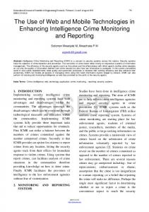
Grocery retailing constitutes a rapidly growing and highly competitive industry in all western economies (Helms et al., 2000). In order to attract consumers and increase their profit margins, retailers are constantly seeking ways to increase supply chain efficiency through the adoption of innovative applications (Chandra & Kumar, 2000). An example of such an application is MyGrocer (Kourouthanassis et. al., 2001), which addresses some of the inefficiencies of the retail grocery supply chain through mobile shopping of electronically referenced grocery products. The system combines RF-ID, Bluetooth, and WLAN technologies to create an enhanced shopping experience for the consumer. Amongst the innovations of the system are: the elimination of checkout queues, the personalized shopping trolley with built-in data display, the ability to launch personalized product promotions based on consumer profile and current location, and others. Figure 1 illustrates an example application scenario of the system.
421
George M. Giaglis, Ada Pateli, Kostas Fouskas, Panos Kourouthanassis, Argiris Tsamakos
1.
2.
An RF id sensor in the cart can identify on a going basis the cart contents
1.
At the cashier, the products are re-scanned, the total amount of the cart is displayed and the shopper selects his desired payment method
1.The shopper selects/alters a previous shopping list or a suggested shopping list (based on historical shopping habits) on the screen
2.
1. 2.
1.
While the shopper adds products in the shopping cart, he can see on the screen the product description, price as well as the total amount
2.
Moreover, useful information on the specific product (ingredients, expiration date, nutrition table) becomes available on the screen
The Shopper picks up a shopping cart with a PDA screen
The shopper pays via credit card or cash at a cashier who issues the receipt
The shopper can activate or deactivate this feature
The shopper receives promotional messages while shopping based on product associations, profile, and/or rules set by supplier/retailer
1.While the shopper is moving in the store, can request and/or receive navigation data on where in the store specific products can be found
2.A map of the store appears on screen indicating product location
Figure 1: An Application Scenario of MyGrocer The application of indoor location services in an area such as a supermarket will most probably benefit both retailers and consumers. Consumers will be able to navigate through vast hypermarkets with ease, locate the products that interest them effortlessly, and receive real-time information based both on personal preferences and current position within the supermarket area. For example, by registering his shopping list in advance (through home, office, or mobile access), the system should be able to provide, upon entering the supermarket, a suggested route that will guide him directly to the products he wishes to buy. Additionally, the retailers will benefit by knowing the exact position of the consumers, so that they can allocate workforce accordingly, manage shelf replenishment more efficiently, and avoid out-of-stocks. Last, but not least, suppliers will also benefit in terms of more personalized promotions (based both on personal profile and location of the consumer), statistics on route patterns, and analysis of consumer behaviour.
3.2
Museums and Galleries
A museum is also a highly suitable application area for deploying indoor location services. Large museums occupy vast areas filled with numerous exhibits that are almost impossible to assimilate in a single visit. Therefore, museums are always 422
seeking ways to ease the experience of the visitors through, for example, guided tours and personalized audio devices. However, a number of more innovative location-aware applications have also started to emerge. Oppermann and Specht (1998) describe such a service. Visitors may prepare their excursion to a museum at home, by logging on to the system through the Internet and selecting the exhibits they are mostly interested in. Upon entering the museum, users are provided with a mobile device that is connected to a server through WLAN and Bluetooth technology. By being location-aware, the device can provide the visitor with a personalized guided tour. Additionally, the navigation through the museum becomes a superior experience altogether, since description and comments in audio and video format can be delivered to the visitor, based on position and personal interests. For example, a visitor that stands in front of a painting can be provided with information about work itself, the painter, the artistic style of the era, and so on. Similarly, by monitoring visitors’ navigation patterns and by instantly becoming aware of congestion spots within the museum, management will be able to organize exhibits more effectively and even make real-time decisions regarding employee allocation to sections where additional needs emerge.
3.3
Libraries
In a similar fashion to the museums, libraries are vast indoor environments where information is abundant but not necessarily easy to identify and locate. A typical scene in a busy day of a library would involve people waiting in queues in order to use a computer or ask the librarian in order to obtain information about a particular book or a certain thematic area. Such problems can be overcome, or at least be significantly reduced, through the introduction of an indoor mobile location tracking system. Visitors will be able to specify requests to a personal hand-held mobile device in order to query the library database and identify the exact position of a given title, as well as a possible route to it. Moreover, visitors will be able to express requests regarding similar books (for example, on the same thematic area or by the same writer), and the information will be delivered to them during their navigation through the library, thereby alleviating them from the burden to walk back and forth to an information kiosk or a library desktop computer.
3.4
Exhibitions and Conferences
The exhibition and conference industry constitutes another information-rich environment where indoor mobile location services can be deployed. The growing size of exhibitions (for example, CeBIT 2001, which is the leading event in the IT industry, occupied 432,000 square meters of space and attracted more than 830,000 visitors in eight days) naturally creates the need to develop new applications that will benefit visitors, exhibitors, and exhibition organizers alike. The development of applications based on indoor mobile communication technologies will probably 423
George M. Giaglis, Ada Pateli, Kostas Fouskas, Panos Kourouthanassis, Argiris Tsamakos
transform the modus operandi of the exhibition industry in fundamental ways. Visitors will be able to register their personal preferences before visiting the exhibition (for example, through home or work access to an exhibition server). Upon entering the exhibition premises, they will receive a personal hand-held wireless device through which they will be able to obtain information about a particular stand or a product, receive personalized notifications by the exhibition organizers (for example, notifications about events that are about to start), navigate along a predefined route generated by the system (based on expressed interests), schedule appointments with exhibitors, and so on. Exhibitors will also benefit by arranging and distributing marketing material more effectively, and by achieving personalized service, thus paving the ground for more efficient customer relationship management (CRM). Finally, the exhibition organizers will be able to organize their work force according to events that might occur, provide announcements for specific target groups in a ‘silent’ mode (through the hand-held device), and provide ex post statistics to their clients (i.e., the exhibitors). Several applications already exist that partially support such environments. For example, Conference Assistant, employs context information to assist conference attendees (Dey et al., 1999). The assistant automatically processes the conference schedule, topics of presentations, user’s location, and user’s research interests to suggest the presentations to attend. When the user enters a presentation room, the assistant displays the name of the presenter, the title of the presentation, and other related information. Available audio and video equipment automatically record the slides of current presentation, comments, and questions for later retrieval. However, the development and provision of such services is not trouble-free. Alternative technologies exist that need to be carefully assessed in order to identify the most promising ones and design a robust and user-friendly system. Moreover, the preferences and interests of all stakeholders (visitors, exhibitors, and exhibition organizers) need to be taken into account, for example to ensure the privacy of visitors’ personal data. In the next section, we will discuss an ongoing research project investigating such challenges in order to evaluate the efficacy of mobile location services in the indoor environment of the exhibition industry.
4.
An Investigation into Indoor Location Services for Exhibitions
As argued earlier, the opportunities associated with full-scale deployment of mobile location services in indoor environments are significant. However, the technological immaturity of most existing solutions and the lack of documented real-life application cases render the further investigation of the matter a necessary and worthwhile research endeavour. In this section, we will briefly discuss ongoing research work aiming at providing a deeper understanding and a pragmatic investigation of the real-life implications of indoor mobile location services. 424
The principal goal of our research is to exploit the technological opportunities arising from evolution in the areas of wireless networks and positioning mechanisms in order to support and facilitate the professional exhibition industry in a context-aware manner. The main driver influencing our research perspective is the relative lack of documented practical works in the area of indoor positioning applications, hence a combination of the case study (Bensabat et al., 1987) and the action research (Wood-Harper, 1992) methods are being employed. The wellestablished case study method is, according to Yin (1994), ‘an empirical inquiry that investigates a contemporary phenomenon within its real-life context, especially when the boundaries between phenomenon and context are not clearly evident’. In a similar vein, the action research method allows the researcher, instead of taking the observer point of view, to be an active participant in the research process, seeking practical results while at the same time evaluating the intervention technique used within the research process (Wood-Harper, 1992). A combination of case study/action research methods is especially suited for acquiring an in-depth, firsthand understanding of organizational phenomena in cases where previous detailed studies and elaborate theoretical understanding are missing (Bensabat et al., 1987). Based on these premises, our research intends to explore the technological, managerial, and business model challenges associated with the implementation of indoor positioning applications in the exhibition industry. Using this industry as our case study setting, we aim at formulating theoretical instruments, as well as practical guidelines, regarding the suitability of location-aware applications in indoor and information-rich environments in general. The innovation of the proposed approach can be identified in three different, yet complementary, research perspectives (the associated scientific disciplines are mentioned in the brackets): Technological (mobile positioning and networking), Business Model (management and inter-organizational dynamics), and Digital Marketing (context-aware marketing and consumer behaviour).
4.1
Technology Innovation
The implementation of the technological infrastructure required for the research relies heavily on emerging mobile and networking schemes and architectures. To this end, a set of innovative technologies will be explored and utilized in order to support the core objectives of the research, i.e. location-sensitive and context-aware content provision and operation in indoor environments. These technologies will be comparatively evaluated and put in real-life pilot operation in order to identify the advantages and disadvantages, the interdependencies, and the potential synergies between the following technologies: 1. Bluetooth & Wireless LAN interconnectivity architectures. Wireless networks of small range will be utilized in order to provide information in various bandwidth ranges and to ensure compatibility with existing terminal devices. The use of Bluetooth for local positioning will also be explored. 425
George M. Giaglis, Ada Pateli, Kostas Fouskas, Panos Kourouthanassis, Argiris Tsamakos
2. Layout mapping (geo-coding) and navigation tracking technologies will be used in order to facilitate the navigation planning and routing services within the exhibition area. 3. Indoor GPS will be used to support accurate indoor positioning and tracking. Indoor GPS will be used to support very accurate low-power, low-cost indoor positioning, which is otherwise impossible to achieve with complementary indoor positioning technologies.
4.2
Business Model Innovation
The research will also explore new modes of interaction among the stakeholders involved during all phases of the exhibition: ex ante (prior to the event), during, and ex post (after the event). One of the technical objectives of the project will be to introduce and empirically validate an integrated location-aware mediation platform for exhibitions. This platform will be based on the aforementioned technologies and will be evaluated against the following set of criteria (each one referring to the interests and stated preferences of each set of stakeholders in the exhibition industry): a) The degree to which it will succeed in enhancing and facilitating the visitors’ experience in terms of interaction and functionality in an information-rich environment such as an exhibition show. This will be evaluated through a reallife experiment involving the implementation of the platform in two real exhibitions in Greece and Finland. The degree of visitor satisfaction will be measured through focus groups, quantitative and qualitative questionnaires, and laboratory-based observations. b) The degree to which it will improve business communications and promotions within the exhibition, and extend promotional effectiveness during and after the exhibition. This will be evaluated through measuring the degree of satisfaction of exhibitors. The research instruments here will involve questionnaires and semi-structured interviews. c) The degree to which it will assist and support exhibition management and operations by offering real-time location information of persons within the exhibition. This will be measured through questionnaires and semi-structured interviews with exhibition organizers in the two exhibitions where the platform will be implemented.
4.3
Digital Marketing Innovation
Finally, the project will contribute to state-of-the-art research on digital marketing by providing the results of further investigation in the following areas: a) Design of location-sensitive profiles, taking into consideration the spatial behaviour of the visitor. 426
b) c)
5.
Impulse content delivery, since the visitors will have the opportunity to receive material related to their location and context. New interactive and highly personalized context-aware marketing schemes utilizing both visitors’ profiles and surrounding environment characteristics.
Conclusions
In this paper we have argued for the potential applicability of mobile positioning technologies and applications in indoor environments. Based on a review of the issue from a technological, as well as an implementation perspective, we have developed the hypothesis that context-aware applications can prove beneficial for all stakeholders in a number of application areas, such as hypermarkets, museums, and exhibitions. At the same time, our analysis has shown that the road to full-scale development and application of such services is full of challenges and still unanswered research questions. A first set of such challenges involves the technological aspects of indoor positioning. Existing technologies have been developed with a macro perspective and, although some work has started to emerge in micro applications as well, significant customisation and new technology development will also be required. Another set of challenges involves the potential transformation of industry value chains (for example, in supermarkets) and inter-party relationships (for example, in exhibitions). The introduction of context-aware services may result in a significant shift of the relative bargaining power between stakeholders, and hence have a considerable impact on future business models and market structures. Although such changes are expected to favour the end customer (shopper, visitor, and so on) in all cases, further research will undoubtedly be required to explore the dynamics of context-aware service provision and investigate the likely impact on the viability of future business ventures. Acknowledging the above, we have embarked on an empirical investigation that will complement our theoretical insight to provide a robust and holistic approach to the research problems of indoor mobile positioning. Despite the relatively early stage of the empirical aspects of our research, the results so far suggest strong indications to support our hypotheses. In any case, we have shown that the theoretical investigation alone provides ample space on which to base the prediction that the future of mBusiness holds significant potential for indoor environment applications that will complement and integrate basic outdoor location service provision.
427
George M. Giaglis, Ada Pateli, Kostas Fouskas, Panos Kourouthanassis, Argiris Tsamakos
Acknowledgement The research described in this paper has been partially funded by the European Commission under the Information Society Technologies (IST) Programme. The research is a joint effort between: Intracom SA., Pouliadis Associates Corporation, Ericsson Corporation, Elisa Communication Corporation, Space Systems Finland, Helsinki University of Technology, Finnish Fair Corporation, Rota Ltd. and the Research Centre of the Athens University of Economics & Business.
References Day, A.K., Salber, D., Futakawa, M. and Abowd, G.D. (1999) An Architecture to Support Context-Aware Applications. Technical Report GIT-GVU-99-23, Georgia Institute of Technology, College of Computing, June. Bensabat, I., Goldstein, D.K. and Mead, M. (1987) The Case Research Strategy in Studies of Information Systems, MIS Quarterly, 11, 3, pp. 369-386. Brewer A., Sloan, N. and Landers, T.L. (1999) Intelligent Tracking in Manufacturing, Journal of Intelligent Manufacturing, 10, 3-4, pp. 245-250. Burnham, J.P. (2002) The Essential Guide to the Business of U.S. Mobile Wireless Communications, Prentice-Hall PTR, Upper Saddle River, NJ. Chandra, C. and Kumar, S. (2000) Supply Chain Management in Theory and Practice: A Passing Fad or a Fundamental Change?, Journal of Industrial Management & Data Systems, 100, 3, pp. 100-113. Chen, G. and Kotz, D. (2000) A Survey of Context-Aware Mobile Computing Research, Dartmouth Computer Science Technical Report TR2000-381. Djuknic, G. M. and Richton, R.E. (2001) Geolocation and Assisted GPS, IEEE Computer, 34, 2, pp. 123-125. Durlacher Research Ltd. (2001) UMTS Report, available online from www.durlacher.com. Giaglis, G.M., Kourouthanassis, P. and Tsamakos, A. (2002) Towards a Classification Framework for Mobile Location Services. In Mennecke, B.E. and Strader, T.J. (Eds.), Mobile Commerce: Technology, Theory, and Applications, Idea Group Publishing. Held, G. (2000) Data over Wireless Networks: Bluetooth, WAP, and Wireless LANs, McGraw-Hill Publishing Company, New York. Helms, M.M., Ettkin, L.P. and Chapman, S. (2000) Supply Chain Forecasting: Collaborative Forecasting Supports Supply Chain Management, Journal of Business Process Management, 6, 5, pp. 392-407. Hightower, J. and Borriello, G. (2001) Location Systems for Ubiquitous Computing, IEEE Computer, 34, 8, pp. 57-66. 428
Kalakota, R. and Robinson, M. (2001) mBusiness: The Race to Mobility, McGrawHill Publishing Company, New York. Kourouthanassis, P., Koukara, L., Lazaris, C. and Thiveos, K. (2001) Last-Mile Supply Chain Management: MyGROCER Innovative Business and Technology Framework. In the Proceedings of the 17th International Logistics Congress: Strategies and Applications, Thessaloniki, Greece, pp. 264-273. May, P. (2001) Mobile Commerce: Opportunities, Applications, and Technologies of Wireless Business, Cambridge University Press, Cambridge. Mennecke, B.E. and Strader, T. (2001) Where in the World the Web Does Location Matter? A Framework for Location Based Services in mCommerce. In the Proceedings of the Seventh Americas Conference on Information Systems, Boston, Massachusetts, 3-5 August, pp. 450-455. Oppermann, S. and Specht, M. (1998) Adaptive Support for Mobile Museum Guide. In the Proceedings of the Interactive Applications on Mobile Computing Conference, Rostock, Germany, 24-25 November. PriceWaterhouseCoopers (2001), mBusiness and the Wireless World: Understanding and Exploiting the Mobile Revolution, available online from: www.pwcconsulting.com/mbusiness. Tseng, Y., Wu, S., Liao, W. and Chao, C. (2001) Location Awareness in Ad Hoc Wireless Mobile Networks, IEEE Computer, 34, 6, pp. 46-52. Vos, I. and de Klein, P. (2002) The Essential Guide to Mobile Business, PrenticeHall PTR, Upper Saddle River, NJ. Want, R. and Schilit, B. (2001) Expanding the Horizons of Location-Aware Computing, IEEE Computer, 34, 8, pp. 31-34. Wood-Harper, A.T. (1992) Viewpoint: Action Research, Journal of Information Systems, 2, 3, pp. 235-236. Yin, R.K. (1994) Case Study Research: Design and Methods, 2nd edition, SAGE Publications, Thousand Oaks, CA.
429