feedback delivered via a text-to-speech engine. ... fallback solution if no other positioning system is available and is not .... the search location is on the map.
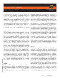
Putting Location-Based Services on the Map Michael Grossniklaus, Moira C. Norrie, Beat Signer and Nadir Weibel Institute for Information Systems ETH Zurich 8092 Zurich, Switzerland {grossniklaus,norrie,signer,weibel}@inf.ethz.ch
Abstract Location-based services for users on the move provide a convenient means of filtering information based on current geographical position. However users also often want to retrieve or capture information associated with past or future locations. We show how new technologies for interactive paper can be used to augment conventional paper maps with location-based services using a combination of user tracking and pointing to the map to specify location.
1
Introduction
Location-awareness is an important aspect of context-awareness and can thus be exploited to reduce the information bandwidth in mobile systems by delivering only information relevant to the current user situation. This is important due to not only limitations of mobile devices, but also the fact that users may be involved in parallel activities or need to react quickly to a given situation. However, users in mobile environments often want to retrieve or capture information relevant to a particular location either before or after the visit, possibly as part of a planning or decision-making process. For example, tourists may use time in a cafe to enquire about restaurants near the next location that they plan to visit or to write entries in their travel journal. Tasks that involve the planning and reviewing of routes and visits within a city require an overview of the spatial layout of a city rather than just localised maps, together with the ability to easily view areas other than the current location. A well-known disadvantage of current mobile devices is the fact that the small screen size makes it awkward to perform such tasks. While some projects have used Tablet PCs to increase available screen size, this clearly restricts mobility. Conventional paper maps, on the other hand, satisfy the requirements of mobility as well as providing the required spatial overview. In addition, they have advantages in terms of readability in outdoor environments, especially by users collaborating, and can be easily annotated. We show how digital pen and paper solutions can be used to provide a range of location-based services based on interactions with a paper map and audio feedback delivered via a text-to-speech engine. Our system offers flexible positioning modes as locations can be specified either implicitly based on current user
location obtained from a position sensor, explicitly by having the user point to the map with the pen or by using coordinates stored in an application database. In previous work, we have developed a general framework that enables digital pen and paper solutions to be used not only for the digital capture of handwriting, but also for real-time interaction with a vast range of digital services. In this paper, we show how the resulting concept of interactive paper can be used to augment a paper map with four well-known types of location-based services that provide information about places of interest, events and also help the user find locations on the map. As an additional location-based service, handwritten information can be captured and associated with either the user’s current location or a location pointed to on the map. For each of these services we will examine in detail the kinds of positioning modes that they support by describing the functioning of selected tasks a user can accomplish with our system. In Sect. 2, we motivate the use of interactive paper maps as an interface to location-based services in mobile environments and discuss related work. Section 3 presents the underlying technologies for interactive paper and Sect. 4 then describes the location-based services accessible through the map. Details of the system implementation are presented in Sect. 5 and concluding remarks are given in Sect. 6.
2
Motivation and Related Work
Tourists make extensive use of maps before, during and after city visits. Tasks performed during a visit have been categorised as locator, proximity, navigation and event tasks [1]. Locator tasks are concerned with questions such as “Where am I?” and “Where is X?”. Proximity tasks deal with finding objects or people located near to the user’s current location. Navigation tasks involve route finding either from the user’s current location to a given location or object, or between any pair of specified objects/locations independent of the current location. Event tasks deal with finding information about what happens at a given place. Early digital maps tended to focus on navigation, but recent ethnographic studies on the use of maps by tourists emphasise the need to support a much wider range of tasks [2]. Large maps provide a tourist with an overview of the features of a city and the spatial relationships that help tourists locate themselves, identify potential areas of interest and keep track of places visited. Various forms of annotation are often used to highlight locations and routes and note names of facilities such as restaurants. Tourism is a domain with considerable potential for the use of mobile technologies and a number of projects have developed PDA-based tourist guides, with Cyberguide [3] and GUIDE [4] among the earlier examples. While some projects have focussed on navigation, others have addressed issues such as context-awareness, interaction, visualisation or collaboration. Studies show that tourists spend a lot of time comparing and combining information, but it is difficult to support these activities on small digital mobile devices. Also interaction is often awkward as it is tedious to input large amounts of information. For this reason,
some projects have opted for the use of Tablet PCs [4,5], enabling them to provide much richer information displays and services to the user. Clearly the problem with these devices based on current technologies is that they are relatively large and heavy. Another approach is to investigate means for accessing supplementary and dynamic information as well as advanced digital services in a more natural way. The use of pen and paper as an interface can be seen as a natural interaction and various projects have investigated the use of paper maps either for accessing digital information [6,7] or for the capturing of information [8]. Digital pen and paper functionality offered by the Swedish company Anoto [9] provides an easy-to-use solution for the digital capture of handwriting on paper and several projects have used these to build annotation systems, such as for example in ButterflyNet [10]. These systems are much more convenient for users than inputting annotations digitally, even when using handwriting on digital devices. For all four categories of map-based tasks defined at the beginning of this section, location plays a key role and hence location-awareness based on user tracking is an important feature of many mobile tourist information systems. Some systems allow tourists to specify an arbitrary location on the map [11], or to select a location from a list of the last recorded positions [4,12]. However, in many cases, the specification of the location is only meant to be used as a fallback solution if no other positioning system is available and is not supported as a real feature of the system. Other systems such as Rasa [13] or NISMap [8] support explicit positioning on a map, but they do not provide implicit tracking of positions, since they are not meant to be used in a mobile environment. Nevertheless, pointing to map positions is a very convenient way of specifying, not only where one wishes to go in seeking directions, but also past and future locations. For example, in planning activities for the evening ahead, a tourist may want navigation information from their hotel to a restaurant or information about events close to the hotel without them actually being located at the hotel. It is therefore important that user location can be specified either explicitly, implicitly or through coordinates stored in an application database. If implicit positions from a location sensor are used, it has to be possible to use several alternative tracking technologies that are combined seamlessly. Another desirable feature of mobile tourist information systems is the possibility to capture information. The Graffiti system [14], for instance, allows tourists on the move to create electronic notes and associate them with a location. In [15], mobile phones equipped with RFID receivers were used to track user positions and publish location-based pictures, videos or annotations. Our goal was to develop a complete solution that could support all four categories of map-based tourist tasks, exploiting the advantages of the combination of implicit, explicit and database-driven position tracking, as well as providing means for tourists to record their travel experiences. In the next sections, we describe how this can be achieved through the implementation of interactive paper maps based on a general cross-media content publishing system that we have developed.
3
Interactive Paper
A number of digital pens are now commercially available based on Anoto functionality. These technologies are able to track the position of a pen on paper through a combination of a special dot pattern printed on paper that encodes position information and a camera inside the pen as illustrated in Fig. 1(a). The dot pattern, which is almost invisible, encodes (x,y) positions in a vast virtual document space. Camera images are recorded and processed in realtime giving up to 100 (x,y) positions per second. The technology was originally developed for the digital capture of handwriting and several pages of handwriting can be captured and stored within the pen before being transferred to a PC via a Bluetooth or USB connection. Hitachi Maxell and Logitech have recently released pens based on Anoto functionality that can also be used in streaming mode where position information is transmitted continuously. This enables the pens to be used for real-time interaction as well as writing capture.
The Meadows Theatre Big Tops housing the Chinese State Circus ...
Battery Ink Cartridge
Memory Processor Camera
0.3 mm
(a) Anoto technology
(b) Pointing to the map
Figure 1. Interactive paper maps We have developed a general link service for interactive paper [16,17], which enables active areas to be defined on paper and bound to digital resources such as images, videos or web pages, or to services such as a text-to-speech engine, a database system or an application such as Microsoft PowerPoint. Thus, the digital pen on paper can be used in much the same way as a mouse would be used during web browsing to activate links to static documents as well as trigger specific application calls. Using these technologies, we have developed interactive paper maps to support tourists on the move based on a text-to-speech output channel. Interaction with the map provides access to a range of location-aware services and users can also annotate the map or link annotations written in a separate document to positions on the map. Maps have been developed both for general tourist information in the city of Zurich and, specifically, to support visitors to the Edinburgh Festivals based on a map showing festival venues as presented in Fig. 1(b). We use the latter example in the rest of this paper to describe the functionality, operation and implementation of the system in detail.
4
Location-Based Services
In this section, we detail the various types of location-based services and interactions that can be supported by interactive maps. Figure 2 shows part of a map developed for visitors to a festival, where services can be accessed by touching the pictograms at the top. In addition, certain services may be accessed by directly pointing to a location on the map. For example, in the case of the festival system, pointing to a location anywhere on the map accesses information about the venue closest to that location.
What’s on at...?
Get comments on...
Where am I?
Get me to...
Figure 2. Accessing location-based services on the map
Table 1 shows the services offered by our system grouped under the four categories described earlier. In addition to these services we added annotation functionality that will be described later in this section. A main contribution of our system is its support to acquire positional context information in different ways and the seamless transition between these input modalities. A first method to provide input for a location-based service involves real-time positional information provided by a sensor such as a Global Position System (GPS) device. This implicit tracking of positional information and its application for accessing location-based services represents the most common input form in existing location-aware applications. However, in our system a user can also provide location information explicitly by pointing with the digital pen to a specific location on the interactive map. Finally, positions that are stored in the application database can be used. Note that our architecture not only supports these three positioning modes for providing location information, but based on the actual service, the user can also freely combine them. To give an example, let us have a look a the navigation service Get me (from X) to Y shown in Tab. 1. If a user does not explicitly provide information about X, the current GPS position is taken as input parameter. However, the user can also specify X by pointing to the map with the digital pen or it can be derived from information currently accessed from the application database. The same mechanism can be applied to define the target Y for this specific navigation service. We will now examine in Stop! Repeat Help more detail the positioning modes used in the services our system offers. www.globis.ethz.ch
Service Where am I? Where is X? What is near X? Proximity Who is near X? Navigation Get me (from X) to Y. Event What is going on at X? Annotations
Explicit
Implicit X
X X X X X
X X X X X
Locator
Stored X X X X X X
Table 1. Positioning modes for location-based services
Locator tasks enable tourists to find the current position of people or objects on the map. To find their own position, location is specified implicitly by a tracking sensor. On the other hand the position of another person or the location of a sight could be stored in the database and retrieved from it. For example, in the festival system, the coordinates of all festival venues are stored in the application database. When the map locator service is activated to find the position where an event is taking place, the application queries the festival database and retrieves the position of the location associated to this event. Proximity is defined as the task of locating objects or people nearby. The use of three distinct positioning modes allows us to extend this definition to locate entities either in proximity to the user, a location pointed to on the map or an object stored in the application database. For this task, our system supports all three kinds of location modes. As an example, after touching the pictogram of the What’s on at...? service, a user can explicitly specify a position on the map with the pen and then the system retrieves all events nearby based on the venue coordinates stored in the database. Most mobile navigation systems provide functionality to guide tourists from their current position provided by a sensor to an explicitly specified location or attraction. Moreover they normally adapt the directions if tourists do not follow the indications. Our system supports the Navigation task, by allowing tourists to get directions based on coordinates from the database as well as implicit and explicit positioning modes. To plan future activities, a tourist may specify both the starting point and destination on the map. On the other hand, if tourists want directions to a location, the current position will be used as the starting point. Navigation may even be useful in the other direction to provide a route from a specific point on the map to the tourist’s current position in order to give directions to someone else. In the festival system that service is based on landmark navigation since this was considered to be appropriate for tourists in an unknown city [18]. Of course, it is also possible to integrate other navigation services into our framework. Accessing information about what is going on at a particular location is defined as an Event task. Information about events may be accessed in very different ways. One tourist may be interested in what is going on right now or what is on at a given theatre in the evening. Our location-based services may be
used to find events happening close to the current location or a location specified on the map and to answer questions like “What is nearby?” or “What is going on at the location X?”. Such services were central to our festival system and our interactive map provided an easy and natural means of accessing them and could be used on its own or together with other interactive documents such as the event brochure. As described earlier, a novel feature of our system is the use of audio feedback to guide users when working with pen and paper. As an example of such an interaction based on paper-based pen input and audio output, let us look at the locator process. The locator algorithm first checks whether the position of the search location is on the map. If this is the case, the locator computes the quadrant on the map which contains the location based on the physical size of the map and the coordinate system used to express the position of the location. It is important to note that our system supports maps of any size and in the case of the festival system we offered both A3 and A4 maps as well as a minimap printed on a paper bookmark. A series of iterative steps is then used to direct the user’s pen to the correct position on the map. Whenever the user touches the map with the pen, the locator computes the distance D between the current position of the pen’s nib and the desired destination. It then indicates to the user how to get the pen closer to the desired location by telling them the corresponding offset in terms of how many centimetres they have to move up, down, left or right. Once the distance D between the pen’s position and the position of the desired location falls below a specific threshold P , the system switches over to the nearness mode where the exact distance is no longer told to the user, but they are guided using the approximate “You are close! Move a little bit to the right”. Once the tourist has successfully moved their pen to the search location on the map, the locator process informs the user that they have found it and then terminates. Since our system is basically composed of a map and a pen, annotations are a simple way of integrating comments and notes. In order to highlight interesting locations or activities, tourists may write comments on the map, annotating directly the area of the city or the specific sight of interest. Tourists may insert notes or comments and link them with a particular area or location on the map. The comment added is stored in XML for later retrieval, either by the same tourist or by another tourist interested in the same location. As shown in Tab. 1, linking handwritten notes to a position on the map is in fact another location-based service offered by our system. The annotations may be either automatically linked to the current tourist’s position provided by the GPS sensor or explicitly bound to a specific location on the map. Once annotations have been inserted into the system, the interactive paper map also allows tourists to later retrieve the written comments by pointing to the Get comments on... pictogram. If the user also specifies a position on the map, the system retrieves comments bound to locations within a certain range from it. Otherwise the system gets the current position as specified by the GPS sensor, retrieving comments linked to the locations nearby.
The services and interactions presented so far have primarily focused on information that is delivered by the system to the user. However, by offering the functionality to store annotations made on paper in digital form, our system supports a different kind of interaction that provides the user with the possibility to input and store information from the map directly in the system.
5
Implementation
To support the provision of location-based services, our system uses three distinct information sources to track positions of the users and objects—a GPS sensor, positions coming from the map and coordinates stored in the application database. The GPS sensor defines positions by means of latitude, longitude, elevation and time, whereas the positions on the map are defined as a set of (x,y) coordinates. The use of maps of different sizes and formats does not allow the definition of a clear and unique system, but rather encodes positions in many different scales. Moreover, the position of locations, sights, buildings and people could be stored in an database using different application-specific coordinate systems. The architecture of our system, shown in Fig. 3, takes the different coordinate systems into consideration and enables the delivery of location-based information using a seamless switching between the implicit and explicit positions, as received by the sensors, or application-specific positions from the Application Database.
(x,y)
application-specific position
Position Transformer Map
Application DB Content Publishing Service
- Sights - Theatres - Restaurants
Navigation Service
- Streets - Buildings - Public Transport
Client
(lon,lat,h,t) Location DB
GPS
Figure 3. General architecture of the interactive map system
The Client is connected to a GPS sensor, to a Bluetooth digital pen and to the application database through a Position Transformer component. In order to use the implicit current position of the user, explicit positions whenever
the pen touches the map or the application-specific positions coming from the database, the position transformer acts as a proxy and transforms the positions into a unique coordinate system, which may vary depending on the application. For the festival application the standard Universal Transverse Mercator (UTM) system was used, as it is currently a good approximation of spatial coordinates on a two-dimensional plane. The GPS position is retrieved when needed by the different location-based services. When receiving an (x,y) position from the map, depending on the requested functionality, the Client may contact either the Content Publishing Service or the Navigation Service. The Content Publishing Service is responsible for retrieving information from the Application Database. Depending on the user’s preferences, it then publishes the location-based information by means of special templates which define how to present the output to the user. In our festival system, the Content Publishing Service is responsible for delivering VoiceXML output, which is then interpreted by a text-to-speech engine present on the client device. In other applications, we used visual output channels such as PDAs, wall-mounted displays and also head-mounted displays. If the Navigation Service is invoked, the system generates routing information based on the positions specified by the tourist (implicit, explicit or stored) and on the landmarks stored in the Location Database. The information returned is then processed by the Content Publishing Service which generates the appropriate output format. The control flow of the application is depicted in Fig. 4. The interaction is started by the pen which touches the map in order to select a location-based service. If a position on the map is directly selected and no specific service is active at the moment, the default service will be selected, which returns information about the nearest location. Otherwise, if the user first selects a specific service (e.g. What’s on at...? ), the context will be set to this service and a second interaction with the map is needed in order to specify a location. Alternatively, if the user does not select any explicit location, the implicit current position will be retrieved from the GPS sensor. After transforming the positions received by the sensors, the system selects the right service and forwards the positions to it. If needed the system will then contact the application database in order to retrieve stored positions. Finally the system informs the user about the results of the issued request. To handle the capture of handwritten notes, capture areas may be defined anywhere within the document. In the case of the map, it is possible to define a capture area that covers the entire map. If a user starts to write within a capture area, the system is able to detect from the prolonged contact of the pen and paper that it is a writing rather than a pointing gesture and switches automatically to capture mode. A general capture component collects all positional information coming from the pen and generates an XML representation of the captured data which can be processed by an Intelligent Character Recognition (ICR) engine to get its textual representation or transformed to a JPEG image. In the case of annotating the map to link a comment with a specific location, the bounding box of the captured strokes is computed and the physical location represented
START
Timeout expired?
NO
Point to the map YES
Map position
END
Transmit (x,y) position via Bluetooth
User pointing to the map?
NO
Wait for user input
Analyse (x,y) position
Linked to a service?
YES
Activate the service
YES
GPS position
Get GPS position
Feedback to the user NO Navigation Service
Contact the required service
Transform position YES Is a service active?
Stored position Content Publishing Service
Contact the default service
Get active service
Active service
NO
Figure 4. Application control flow by the centre of the bounding box is associated with the comment. However, if a user is writing a comment in a capture area that is not located on the map and does not select an explicit position on the map within a given amount of time, the user’s current position provided by the GPS sensor is automatically associated with the captured note.
6
Conclusions and Future Work
We have shown how technologies for interactive paper can be used to provide a range of location-based services in mobile environments based on interaction with printed maps together with user positioning systems. Our system supports three positioning modes—explicit, implicit and stored—that can be combined depending on the type of location-based service. To interact with users, we compensate for the static nature of the printed map by using audio feedback to guide the usage of pen on paper. Although, in this paper, we have focussed on the use of interactive maps in mobile environments, clearly they may also be of use in other settings, especially to support forms of collaboration and flexible annotation that are difficult to mimic in digital worlds.
References 1. Reichenbacher, T.: Adaptive Concepts for a Mobile Cartography. Journal of Geographical Sciences (2001) 43–53
2. Brown, B., Laurier, E.: Designing Electronic Maps: An Ethnographic Approach. In Meng, L., Zipf, A., Reichenbacher, T., eds.: Map Design for Mobile Applications. Springer Verlag (2004) 3. Abowd, G., Atkeson, C., Hong, J., Long, S., Kooper, R., Pinkerton, M.: Cyberguide: A Mobile Context-Aware Tour Guide. Wireless Networks 3 (1997) 421–433 4. Cheverst, K., Davies, N., Mitchell, K., Friday, A., Efstratiou, C.: Developing a Context-Aware Electronic Tourist Guide: Some Issues and Experiences. In: Proceedings of CHI 2000, ACM Conference on Human Factors in Computing Systems, The Hague, The Netherlands (2000) 17–24 5. Brown, B., Chalmers, M., Bell, M., MacColl, I., Hall, M., Rudman, P.: Sharing the Square: Collaborative Visiting in the City Streets. In: Proceedings of CHI 2005, ACM Conference on Human Factors in Computing Systems, Portland, USA (2005) 6. Fitzmaurice, G.W.: Situated Information Spaces and Spatially-aware Palmtop Computers. Commun. ACM 36(7) (1993) 39–49 7. Grasso, A., Karsenty, A., Susani, M.: Augmenting Paper to Enhance Community Information Sharing. In: Proceedings of DARE 2000, Conference on Designing Augmented Reality Environments, Elsinore, Denmark (2000) 51–62 8. Cohen, P.R., McGee, D.R.: Tangible Multimodal Interfaces for Safety-Critical Applications. Commun. ACM 47(1) (2004) 41–46 9. Anoto: Pen and Paper Solutions. (http://www.anoto.com) 10. Yeh, R.B., Liao, C., Klemmer, S.R., Guimbreti`ere, F., Lee, B., Kakaradov, B., Stamberger, J., Paepcke, A.: ButterflyNet: A Mobile Capture and Access System for Field Biology Research. In: Proceedings of CHI 2006, ACM Conference on Human Factors in Computing Systems, Montr´eal, Canada (2006) 11. Baus, J., Krueger, A., Wahlster, W.: A Resource-Adaptive Mobile Navigation System. In: Proceedings of IUI 2002, 7th International Conference on Intelligent User interfaces, San Francisco, USA (2002) 15–22 12. Pospischil, G., Umlauft, M., Michlmayr, E.: Designing LoL@, a Mobile Tourist Guide for UMTS. In: Proceedings of MobileHCI 2002, 4th International Symposium on Human Computer Interaction with Mobile Devices and Services, Pisa, Italy (2002) 140–154 13. McGee, D.R., Cohen, P.R., Wu, L.: Something from Nothing: Augmenting a PaperBased Work Practice via Multimodal Interaction. In: Proceedings of DARE 2000, International Conference on Designing Augmented Reality Environments, Elsinore, Denmark (2000) 71–80 14. Burrell, J., Gay, G.K.: Collectively defining Context in a Mobile, Networked Computing Environment. In: Proceedings of CHI 2001, ACM Conference on Human Factors in Computing Systems, Seattle, USA (2001) 231–232 15. Cheng, Y.M., Yu, W., Chou, T.C.: Life is Sharable: Blogging Life Experience with RFID Embedded Mobile Phones. In: Proceedings of MobileHCI 2005, 7th International Symposium on Human Computer Interaction with Mobile Devices and Services, Salzburg, Austria (2005) 295–298 16. Norrie, M.C., Signer, B.: Information Server for Highly-Connected Cross-Media Publishing. Information Systems 30(7) (2005) 526–542 17. Signer, B.: Fundamental Concepts for Interactive Paper and Cross-Media Information Spaces. PhD thesis, ETH Zurich (2005) 18. Raubal, M., Winter, S.: Enriching Wayfinding Instructions with Local Landmarks. In: Proceedings of GIScience 2002, 2nd International Conference on Geographic Information Science, Boulder, USA (2002) 243–259