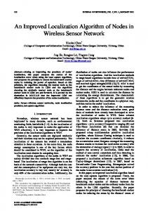
coordinate system where every node in the network identifies others nodes by ... monitoring, oceanic profile measurements, distributed surveillance, and ...
This full text paper was peer reviewed at the direction of IEEE Communications Society subject matter experts for publication in the IEEE ICC 2011 proceedings
Surface Based Anchor-Free Localization Algorithm for Underwater Sensor Networks Lloyd Emokpae and Mohamed Younis Department of Computer Science and Electrical Engineering University of Maryland Baltimore County Baltimore, MD 21250 {lemokp1,younis}@cs.umbc.edu Abstract—Localization in underwater environments has been constrained by the dependencies on the line of sight (LOS) due to the challenging variability's of the environment. This dependency hinders node discovery and ad-hoc formation in underwater networks and limits the performance of routing protocols. Most proposed algorithms in the literature rely on anchor nodes that are at fixed positions to serve as reference points, which is not practical in many applications. This paper introduces a novel approach to the localization problem that allows for node discovery without depending on the LOS and any fixed reference nodes. In the proposed surface-based reflection anchor-free localization (SBRAL) algorithm all nodes will apply homomorphic deconvolution to establish a water-surfacereflected communication link. SBRAL then creates a relative coordinate system where every node in the network identifies others nodes by increasing the SBRAL transmit angle and using the reflection points on the water surface as temporary reference points. The simulation results confirm the effectiveness of the proposed SBRAL algorithm. Keywords—localization, underwater sensor networks, ad-hoc networks
I. INTRODUCTION Underwater applications have grown over time, mainly using underwater sensor networks to carry out environmental state monitoring, oceanic profile measurements, distributed surveillance, and navigation [1]. These applications require sensors to work cooperatively to achieve the desired goal [2]. It is also common to find autonomous underwater vehicles (AUVs) acting as mobile sensor nodes in search-and-rescue missions and coastal patrol, these AUVs will need to corporate in an ad-hoc manner to be able to establish and sustain communication links to ensure a sustainable quality of service (QoS) [3]. This requires each node to adapt to environmental changes and be able to overcome broken communication links due to external noise affecting the communication channel and due to node mobility. It is common to find most underwater applications relying on acoustic channels instead of radio channels since radio waves tend to get absorbed in the water for long range communications. Acoustic waves travel faster in water than in air, with varying speed that depends on the temperature, density, and salinity of the water. In shallow water, transmitted acoustic waves will take multiple paths by reflecting from the surface and the bottom before arriving at the receiver. To mitigate the multipath effect, directional
transmission techniques have been adapted for underwater communications [1][4][5]. Therefore, node mobility becomes a challenge when directional communication constraints are placed. Even nonmobile nodes tend to change positions over time due to the water current and drift. This poses a challenge for localization techniques that depend on fixed reference nodes, often referred to as anchors, for estimating the positions of sensor nodes. In addition, establishing a relative topology using measured received-signal-strength (RSS), the time-of-arrival (TOA), the time-difference-of-arrival (TDOA) or the angle-ofarrival (AOA) requires establishing communication line of sight (LOS) links which is not always feasible for mobile nodes. Moreover, these measurements (especially TOA and TDOA) can have errors due to multipath signals arriving sooner than expected, which decreases the accuracy of the measurement [6]. To overcome the limitations of present systems, this paper employs the surface-based reflection (SBR) scheme [10], which uses the reflections from the water surface to establish communication links. The receiver only accepts signals that are reflected at the surface by checking the RSS and comparing it to the calculated reflection coefficients. This is done by applying a homomorphic deconvolution process to the received signal to obtain the impulse response (IR) of the acoustic channel containing the RSS information. A surfacebased reflection anchor free localization (SBRAL) algorithm is proposed to establish a coordinate system relative to the water surface. Advantages of the SBRAL method include node discovery, ad-hoc formation, source signal tracking avoidance and network link extensions, where additional communication paths are made available. Simulation experiments are provided to validate the SBRAL approach. The paper is organized as follows. In section II, we discuss related work in the literature. Section III briefly describes the SBR method. Section IV explains the proposed SBRAL algorithm. The validation results are presented in section V. Section VI concludes the paper. II. RELATED WORK Node localization has been studied extensively over the years with most algorithms requiring pre-determined reference nodes in the localization process [7][8][11]. These algorithms work by requiring a node to acquire range measurements from known reference nodes to solve a system of linear equations in
978-1-61284-231-8/11/$26.00 ©2011 IEEE
This full text paper was peer reviewed at the direction of IEEE Communications Society subject matter experts for publication in the IEEE ICC 2011 proceedings
order to determine its position. An optimal way of solving the system of equations was shown in [7], where a ClosestNeighbor with TOA grid (CN-TOAG) localization algorithm minimizes the following least squared (LS) objective function in order to obtain an accurate estimate for the position of a sensor node: ,
∑
Due to the complex nature of the objective function, the CNTOAG algorithm tries to solve the problem numerically by using the concept of a TOA grid. The algorithm uses multiple reference points (or sensor nodes) arranged in a grid to determine the location of the unknown-node. Each reference and is spaced at a distance of “h” , node is at location from each other. A major drawback to this algorithm is the dependency on the reference nodes and the topology requirement; in most indoor and underwater environments it will not be feasible to establish many reference nodes (especially in a grid topology) due to cost, energy and operational requirements. On the other hand, in [8] the AOA assisted NLOS approach was able to use a fixed reference node and a reflected wall to determine the location of a moving receiver by using the AOA and TOA of the reflectedpath to reconstruct the lost LOS due to an obstacle interfering with the LOS communication. A drawback to this approach is that the transmitter and receiver must be initially connected through a LOS connection before an obstacle interferes with the connection causing the receiver to use the AOA of the reflected path to reconstruct the LOS connection. A Phero-Trail Location service protocol was demonstrated in [11], where the path of the mobile sink node is projected onto a 2D plane on the water surface consisting of sensor nodes. The nodes on the water surface keep track of the projected path of the underwater mobile node (i.e. UAV) which can be used to trace the location of the mobile sink node if communication is lost at any point. This is different from the proposed SBRAL algorithm since the SBRAL algorithm uses the temporary intersection points on the water surface to locate mobile sensor nodes, these intersection points will change over time and will be used to fine-tune the position estimates of the sensor nodes. SBRAL also does not require the intersection points on the water surface to be forwarded to neighboring nodes (as with Phero-Trail). Most importantly, SBRAL does not rely on the presence of floating sensor nodes on the surface. Relative localization was studied in [9] where the local positioning discovery (LPD) method first uses triangulation to establish a base structure (local coordinate system) centered around a “gateway” node. All other nodes in the network are later identified by applying multilateration while using the identified nodes as reference nodes. With SBRAL each node performs the localization independently by using the temporary reference points on the water surface to locate its neighbors. In addition, SBRAL algorithm does not depend on a LOS connection to perform the localization process.
III. OVERVIEW OF SURFACE-BASED REFLECTION METHOD SBR inherits the ray propagation model which is a widelyaccepted method for modeling signal propagation in shallow water. Instead of relying on the directed eigenray from the source to the receiver, SBR works by using the reflected eigenray from the water surface to establish a communication link, where an eigenray is a ray (traveling wave) that connects a transmitter to a specified receiver. There are typically four basic types of eigenrays that are of interest as shown in Figure 1, namely: direct-path (DP), refracted-surface-reflected (RSR), refracted-bottom-reflected (RBR), and the refracted-surfacereflected-bottom-reflected (RSRBR).
Figure 1: Illustrating the four eigenray types as well as the underwater geometry. The normal vector is shown at the intersection point to the water surface.
The received signal at the node B can be determined by convolving the transmitted signal with the channel's impulse response . Thus for the geometry shown in Figure 1, we have the following received signal: ∑ Where,
(1) . The values of
and correspond to the attenuation factor and the time delay is the speed of sound in water. The respectively, while propagation delay is dependent on the eigenray length , which is reflected at the surface first before being reflected i times during the entire propagation. The coefficients and ; 1 1 0 are expressed as, 1 . The noisy signal is assumed to be and uncorrelated to the noise-free signal and could be modeled as a white noise. The transmitted signal can be represented as a vector in R3 as described in (2). ̂ (2) (3) 2 Where, the “*” operation represents the dot product operator and is the normal vector that is normal to the water surface. Hence, using the laws of reflection we can determine the reflected vector (3) if we know the normal vector to the water , , . We can solve for surface at the intersection point the normal vector by solving for the gradient of the water , , | , , . The surface , , as shown: water surface can also be expressed as a 3D surface equation , , Where , , is the intersection of the form point of the normal vector with the surface. Thus, for a known
This full text paper was peer reviewed at the direction of IEEE Communications Society subject matter experts for publication in the IEEE ICC 2011 proceedings
, , the receiver will be able to determine surface function the reflected vector as shown in (3). A homomorphic deconvolution process is also provided in [10] for the receiver to recover the RSR eigenray. In this paper, we presents an , , which is assumed to be approach for determining known in [10]. IV.
SURFACE-BASED REFLECTION ANCHOR FREE LOCALIZATION ALGORITHM
As mentioned earlier, traditional relative localization algorithms work by using LOS range measurements. Due to the unavailability or instability of the LOS links in underwater setups, a new localization algorithm is needed. In this section we present the SBRAL algorithm which will create a relative coordinate system using the RSR range measurements and the SBR-based position estimates. In SBRAL each sensor node (Si) will create a relative coordinate system where the node Si will assume a center position. SBRAL consists of five phases, namely, water surface function estimation, node discovery and range estimation using signals reflected from the water surface, temporary reference nodes selection, triangulation, and optimization to minimize the localization errors. A. Estimating the water surface function Assuming the direction of the water surface is known ( ), a node can obtain a 2D sample of the surface by looking up, retransmitting to the water surface and measuring the round-trip ) at intervals of ∆ with a sampling frequency TOA ( . This is illustrated in Figure 2, where the measured of ∆ / depth at each interval can be expressed as 2 . Here, the dotted lines represent the sampled depth measurement from the water surface to the node S0. Thus, we are assuming that each node will have two acoustic transducers sending ping signals to the water surface and listening for the echoed signal.
Here the highest frequency component is 4 and the sampling frequency is . Due to the direction of the water wave and the size of the sampling space , for 0,1, . . and 0,1, . . we will only obtain a limited view of the water surface as it passes by. Also, we cannot assume that the water surface function is periodic due to the nondeterministic nature of the environment. Hence we need to know the direction and speed of the water wave, and the parameters of the water (density, pressure, permittivity, and permeability) to determine the effect of the sampled water surface on the entire water surface space (within the specified geo-located boundary). This can be translated into a finitedifference time-domain (FDTD) problem that solves Maxwell's wave propagation equation as shown in [12]. Thus , we to recover the continuous water surface function convolve the FDTD transformed sampled water surface measurement with the low-pass filter with impulse , .Where both the mth and the nth samples are response based on the sampling period ∆ . Using a 2-pole Butterworth low-pass filter design with normalized cut off frequency of 2 for , and a sampling frequency of 80 Hz, the estimated water surface function of (4) after 6 seconds using FDTD is shown in Figure 3. Here we see the effect of a sampled moving water surface for a [40m, 40m] sample space on the entire geo-located boundary [80m, 80m] after applying FDTD and the low-pass filter.
Figure 3: An illustration of the recovery of the water surface function by using FDTD and a two pole Butterworth low pass filter on a water wave moving at 10 m/s.
Figure 2: Sampling process showing the sensor node measuring its depth of a moving water surface
Suppose we have the following continuous water surface function with multiple frequency components as shown: , sin 2 2 4 sin 2 4 (4) 2 sin 2 The sampled water surface function becomes: ,
sin 2 sin 2
sin 2
B. Node discovery To discover all adjacent nodes, Si will have to increase the angle θ in all directions and retransmit the SBR message. Given the 3D environment, the interesting question is how to determine the direction and the increment in θ value given the infinite number of choices. To determine a set of discrete values, SBRAL implements a grid that is essentially a 2D map of the water surface where each cell in the grid corresponds to the depth of the node relative to the 2D plane that contains the will be scaled by node Si. Each intersection point , , the grid cell size ( ) which will affect the transmission angle at that point. The transmission angle can be expressed by relating the base of the cone projected onto the water surface with the following expression:
This full text paper was peer reviewed at the direction of IEEE Communications Society subject matter experts for publication in the IEEE ICC 2011 proceedings
sin
, ,
, ,
1
sin
1
originating node (S0). Thus we can define the range
0
, ,
Such
that
where
, ,
the
line-of-sight
transmission range is . Given the expression for the transmission angle, we can determine the value at each level in within surface grid. The maximum transmission angle at each level 0,1,2, … , is the maximum of all the possible vector (this will transmission angles resulting from each occur at the extreme intersection points). By picking out the four corners at each level we can write the following expression for the maximum transmission angle for that level: , , , , , ,, ,, , , We now define ∆ as the change in angle as we iterate through as the levels and the maximum achievable angle shown: 1 ; 0 ∆ (5) sin
1
0
(6)
Node Si will increase its transmission angle by ∆ at each . iteration to attempt to locate new nodes until reaching C. Triangulation based localization After the node discovery phase concludes, each node Si will have a list of intersection points on the water surface grid that will reflect onto the node we are trying to locate. In a standard triangulation problem we have reference nodes positions (X1, Y1, Z1); (X2, Y2, Z2); (X3, Y3, Z3); (X4, Y4, Z4) such that to locate the sensor node at the unknown position (Ux, Uy, Uz) we have the setup shown in Figure 4.
measurements {d1, d2, d3, d4} as . The position of the unknown node (S1) is then obtain via triangulation and is added to the position matrix "P" as shown: 0 0 ..
..
..
..
..
..
D. Minimizing the Localization Error To determine the localization error from SBRAL we define the vector (1 × m) ( ) which represents the RSR estimates between the node Si and its identified neighbors given a set of node position estimates (P matrices). Recall from section III that the length of the RSR eigenray can be represented as: ̌
. Where
0,
1
for the RSR eigenray, and is the estimated LOS distances between two nodes , . Then, the estimated RSR range and its neighbor can be expressed between the node as: ̌ ,
,
. The RSR estimate vector is
given to be: ̌ , ̌ , . . , ̌ . Thus we are interested in minimizing the error between the RSR estimates (from localization) and the true RSR measurements between the node Si and its identified neighbors. To do that, we define the vector as an (1 × m) vector representing the true RSR range measurements between the node Si and its neighbors as: , ,.., . Where , and is the RSR TOA between the node and its neighbor . Thus we can express the least square error between and as: ∑
1,
1,
(7)
A gradient descent has been proposed as a suitable method for performing the minimization of E(P) [9]. V.
Figure 4: Standard Triangulation problem with the reference nodes (as shown in the left). On the right we have the equivalent problem using the water surface intersection points as temporary reference nodes.
Thus we can obtain the position of the unknown sensor node "S" by solving the following system of equations:
.. Given that we know the water surface function and have a grid that contains the reflection points to the unknown sensor node , this can be for a given maximum transmission angle translated into a triangulation problem by using the intersection points to the water surface as reference nodes {R1, R2, R3, R4} whereby the water surface is centered around the
SBRAL ALGORITHM EVALUATION
This subsection reports the performance of the SBRAL algorithm as we vary the critical parameters. In short, we study ) and the the effect of the maximum transmission angle ( water grid scale ( ), which reflects the increment ∆ until , on the localization error defined in equation reaching (7). The simulation environment consists of 30 nodes that are randomly placed in an underwater cube with dimensions 50m × 50m × 50m with a varied water surface. The simulated water surface functions are flat surface, SIN(X), SIN(2X), SIN(3X), SIN(4X) and SIN(5X), which enable studying the effect of the frequency of the water surface on the localization error. The simulations were performed using MATLAB. A. Effect of Varying the Transmission Angle In this subsection we study the effects of varying the on the localization error E(P). maximum transmit angle The grid cell size for this experiment is set to (0.5m × 0.5m). The SBRAL ranging localization error effect is shown in
This full text paper was peer reviewed at the direction of IEEE Communications Society subject matter experts for publication in the IEEE ICC 2011 proceedings
Figure 5. The localization error is scaled by the LOS 50 and the transmission range which is taken to be . The plot also number of nodes N = 30, i.e., / show the confidence intervals of the data (deviation) for each , where we observe that with a 99% confidence value of level the ranging localization error stays within 1% of the sample mean. The results indicate that as we increase the transmission angle we locate more nodes. Recall that SBRAL locates nodes by obtaining range measurements from the intersection points to the water surface. The extra measurements that are obtained will be used to fine-tune the position estimates and reduces the localization errors. We should note that increasing the frequency of the sine wave decreases the number of intersection points since high frequency sine waves tend to appear like a flat wave (due to an under-sampling based on the current grid cell size), resulting in fewer reference points. This effectively increases the total error. Thus by decreasing the cell size for high frequency water waves the SBRAL algorithm will obtain more intersection points; this is shown in the next subsection
VI. CONCLUSION In this paper we have introduced a novel approach to the underwater localization problem by removing the dependencies on the LOS. The presented SBRAL approach starts by requiring each node to transmit towards the water surface to discover its neighbors. All receiving nodes will use the homomorphic techniques to establish the RSR link to other nodes and forward the measured TOA estimates to its neighbors to use in error minimization. Each node then locates its neighbors by selecting intersection points on the sampled water surface as temporary reference points for the triangulation process. The simulation experiments show that the frequency of the water surface affects the localization error due to the decrease in the number of reference points obtained for high frequency water waves. The results show that the acoustic transmitter resolution, i.e., increment in the transmission angle, can be scaled to increase the number of identified nodes and lower the localization errors for high frequency water waves by creating more intersection points. REFERENCES [1]
Figure 5: As we increase the transmit angle we notice the localization error decreases due to the added range measurements from neighboring nodes.
B. Impact of SBRAL GRID Scale In this section we study the effect of varying the SBRAL grid scale ( ) on the localization error. Recall from section IV that the transmission angle will be limited by the resolution of the acoustic transmitter at each intersection point within the SBRAL grid. The intersection point will be scaled by the resolution which will determine the change in angle ∆ as we iterate between levels. From Figure 6 we notice that as we decrease the grid scale from (3.0m × 3.0m) to (0.5m × 0.5m) the localization error decreases for the sine (with 150°). This is mainly due to the fact that we are obtaining more unique samples (rb values) for smaller grid sizes which will yield more intersection points to use in the triangulation process, thus reducing the total error.
Figure 6: The plot shows that for low grid scales the localization error increases for all sine waves. The error for the flat surface remains the same regardless of the grid scale.
M. Stojanovic, “Underwater Acoustic Communications,” in Encyclopedia of Electrical and Electronics Engineering, Vol. 22, John G. Webster, John Wiley & Sons, pp. 688–698, 1999. [2] I. F. Akyildiz, D. Pompili, and T. Melodia, "Underwater Acoustic Sensor Networks: Research Challenges," Ad Hoc Networks, 3 (3), pp. 257-279, March 2005. [3] B.M. Howe, T. McGinnis, H. Kirkham, “Sensor networks for cabled ocean observatories,” Geophysical Research Abstracts, Vol. 5, pp. 113120, 2004. [4] A. Jarrot, C. Ioana, and A. Quinquis, “Denoising Underwater Signals Propagating through Multi-path Channels,” Proc. IEEE/OES OCEANS`05 EUROPE Conf., Brest, France, June 2005. [5] F. Shulz, R. Weber, A. Waldhorst and J.F. Bohme, “Performance Enhancement of Blind Adaptive Equalizers Using Environmental Knowledge,” Proc. of the IEEE/OES OCEANS Conference, Vol. 4, pp. 1793-1799, San Diego, CA,2003. [6] G. Carter, "Coherence and Time Delay Estimation," Proceedings of the IEEE, Vol. 75, No. 2, pp. 236-255, 1993 [7] R.E. Kanaan, and Pahlavan, K, "CN-TOAG: A New Algorithm for Indoor Geolocation," PIMRC 2004 IEEE International Symposium, Vol. 3, pp. 1906-1910, 2004. [8] Akgul, F. Ozan, Pahlavan and Kaveh, “AOA Assisted NLOS Error Mitigation for TOA-based Indoor,” MILCOM 2007, pp. 1-5, 2007. [9] A. Youssef, M. Younis, M. Youssef and A. Agrawala, “On the Accuracy of Multi-hop Relative Localization Estimation in Wireless Sensor Networks”, in the Proceedings of the 3rd ACM International Conference on Wireless Communication and Mobile Computing (IWCMC’07), Honolulu, Hawaii, August 2007. [10] L. Emokpae, M. Younis, “Surface Based Underwater Communications”, Proc. of the IEEE Global Communications Conf. (GLOBECOM’10), Miami, FL, December 2010 (to appear). [11] L.F.M. Vieira, U. Lee and M. Gerla, "Phero-trail: a bio-inspired location service for mobile underwater sensor networks", IEEE Journal on Selected Areas in Communications, Vol. 28, No. 4, pp. 553-563, 2010. [12] H. Raedt, K. Michielsen, J.S. Kole, M.T. Figge, “Solving the Maxwell equations by the Chebyshev method: a one-stop finite time-domain algorithm,” IEEE Tran on Antennas and Propagation, Vol. 51, No. 11, pp. 3155-3160, 2003.