The first case study deals with the assessment of the area affected by the fireworks explosion in the city of Enschede, the. Netherlands, on 13 May 2000. Old and ...
7. Fernerkundung und Naturkatastrophen
442
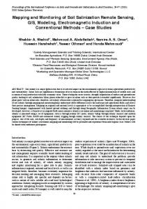
The role of remote sensing and GIS in risk mapping and damage assessment for disasters in urban areas C. J. van Westen, P. Hofstee International Institute for Aerospace Survey and Earth Sciences (ITC)
Zusammenfassung Die zunehmende Vulnerabilität vieler städtischer Gebiete, v.a. in Entwicklungsländern, stellt ein Hauptgrund zur Beunruhigung dar. Der Schwerpunkt sollte auf die Verminderung der Vulnerabilität städtischer Gebiete gelegt werden. Die meisten der für Katastrophenmanagement benötigten Daten haben eine räumliche Komponente und ändern sich auch im Laufe der Zeit. Die Verwendung von Fernerkundung und Geographischen Informationssystemen wurde somit für ein städtisches Katastrophen Management unabdingbar. Dieses Dokument präsentiert drei Fallstudien für städtisches Gefahren management, die sich sowohl mit der Vorbeugung, als auch der Unterstützungsmassnahmen nach der Katastrophe sowie der Wiederherstellungsphase für unterschiedliche Katastrophenarten beschäftigen. Die erste Fallstudie widmet sich der Einschätzung des von der Feuerwerksexplosion betroffenen Gebietes der Stadt Enschede, Niederlande am 13. Mai 2000. Alte und neue vertikale und schräg aufgenommene Luftbilder wurden, kombiniert mit Karten und räumlichen Datenbanken, verwendet. Das zweite Beispiel beschäftigt sich mit der Schadenseinschätzung des Erdbebens vom 25. Januar 1999, das die Provinzen von Risaralda und Valle de Cauca in Kolumbien getroffen hat. Die Schadensaufnahme besteht aus einer Abschätzung des Schadens an Häusern und anderen Bauwerken. Für dieses Vorhaben wurden Luftbilder der beschädigten Gebiete angefertigt und Experten schätzten den Schaden und die Art der Bauwerke die am Grund sichtbar waren ein. Die Schadensaufnahme wurde digitalisiert und die Luftbilder wurden, in Kombination mit einem digitalen Geländemodel, genutzt, um eine Reihe von Orthophotos zu entwickeln. Die dritte Fallstudie beschäftigt sich mit einer Multi-Gefahren und Risiko Bewertung der Stadt Turrialba, Costa Rica. Überflutungen, Hangrutschungen und Erdbeben betreffen dieses Gebiet regelmässig. Ausserdem befindet sich die Stadt nahe einem aktiven Vulkan. Um die lokalen Behörden bezüglich der Entwicklung von Planungs und Notfall Management zu unterstützen wurde eine Datenbank auf Parzellen-genauem Niveau errichtet, welche sowohl Katasterinformationen als auch Informationen über Gefahren und Verwundbarkeit beinhaltet. Großmaßtäbige Orthophotos wurden verwendet um die Parzellen der Stadt zu digitalisieren und Daten, die durch Interviews und Bodenhebungen gewonnen wurden, wurden gesammelt. Die resultierende Datenbank kann zur Analyse von Risikoszenarien und zur Kalkulation potentieller Schäden verwendet werden.
Abstract The increased vulnerability of many urban areas, especially in developing countries is a major reason of concern. Emphasis should be given to the reduction of vulnerability in urban areas. Most of the data required for disaster management has a spatial component, and is also changing over time. Therefore the use of Remote Sensing and Geographic Information Systems has become essential in urban disaster management. This paper briefly presents three case studies of urban disaster management, dealing with the prevention as well as the disaster relief and rehabilitation phases, for different types of disasters. The first case study deals with the assessment of the area affected by the fireworks explosion in the city of Enschede, the Netherlands, on 13 May 2000. Old and new vertical and oblique airphotos were used, combined with maps and spatial database data. The second example deals with the damage assessment of the earthquake of 25 January 1999 that hit the departments of Risaralda and Valle de Cauca in Colombia. The inventory of the damage consisted of an appraisal of the damage to houses and other structures. For this purpose aerial photographs were made of the damaged areas and experts assessed the damage and the type of structure visually on the ground. The damage inventory was digitised, and the aerial photographs were used, in combination with a Digital Elevation Model, to generate a series of orthophotos. The third case study deals with a multi-hazard and risk evaluation for the city of Turrialba, Costa Rica. Floods, landslides and earthquakes regularly affect the area. The city is also located close to an active volcano. In order to assist the local government in the development planning and emergency management, a database was constructed at parcel level, containing cadastral information as well as hazard and vulnerability information. Large-scale orthophotos were used to digitise the
Van Westen und Hofstee
443
parcels in the city, and data was collected by means of interviews and sidewalk surveys. The resulting database can be used to analyse risk scenarios, and calculate potential damage.
Introduction The impact of disasters on modern day society is rapidly increasing. Over the past four decades, the frequency of natural catastrophes has tripled, and inflation-adjusted economic losses have multiplied by a factor of nine (MunichRe, 2000). The main causes are increased urbanisation, the settlement in and industrialisation of highly exposed regions, the vulnerability of modern technologies and also anthropogenic changes of the environment (Ingleton, 1999). After September 11, 2001 nobody in the world can still ignore the large vulnerability of our urban areas, either to natural, technological or terrorist disasters. Mitigation of disasters can be successful only when detailed knowledge is obtained about the expected frequency, character, and magnitude of hazardous events in an area, as well as the vulnerability of the people, buildings, infrastructure and economic activities in a potentially dangerous area. Many types of information that are needed in disaster management have both an important spatial as well as temporal component. Remote Sensing combined with Geographic Information Systems have proven to be of large importance for the different phases of disaster management. This paper presents three case studies of urban disaster management, dealing with the prevention as well as the disaster relief and rehabilitation phases, for different types of disasters: • • •
The use of high-resolution imagery in the aftermath of the firework explosion in Enschede, the Netherlands, on May 13, 2000; The use of oblique- and vertical air-photos for the damage assessment of the Quindio earthquake (of 25 January 1999 in Colombia) , in combination with data storage and analysis in a GIS; The integrated use of air-photos and GIS for the generation of a vulnerability database, including damage assessment reports of earlier events for the city of Turrialba, Costa Rica;
The common aspect in all case studies is the use of high-resolution imagery of urban areas. The three examples are shown in such a way that they demonstrate an increasing integration of Remote Sensing and Geographic Information Systems, and an increasing emphasis on the use of these tools for the prevention of disasters.
Example 1: the firework explosion in Enschede, The Netherlands – legal impacts of spatial information On 13 May 2000 at 15.35 a firework storage exploded in the centre of the city of Enschede, located in the East of the Netherlands along the border with Germany. The firework company, which was specialised in professional fireworks for large events, was located in the middle of a residential area (See figure 1). The affected area covered more than 40 ha with 6500 inhabitants. Direct consequences included 22 persons killed, more than 900 wounded, and at least 290 dwellings damaged beyond repair (see table 1). After the disaster a great demand for geo-information emerged.
444
7. Fernerkundung und Naturkatastrophen
Size of the disaster area Number of inhabitants in most affected zone Number of completely destroyed houses Number of completely damaged business and industrial buildings Number of houses declared “inhabitable” Number of damaged houses outside mostly affected zone Number of persons killed Number of persons injured Number of homeless persons Number of persons that had to be evacuated Total material damage
40 ha 4163 205 ± 50 293 ca. 1500 22 947 1250 ± 10.000 1 billion guilders
Table 1: Damage statistics of the firework explosion in Enschede (Source: Commissie Onderzoek Vuurwerkramp 2001).
Figure 1: Left: Mosaic of vertical colour aerial photos of the disaster area, taken on March 30, 1998. Annotated with firework storage area in red, and two rings of affected areas. The so-called “inner ring”, with complete desctruction indicated in white, and the “outer-ring”, with large damage in gray. (Source: Municipality of Enschede, Bouw en Milieudienst). Right: Oblique aerial photo of disaster area one day after the explosion. (Source: KLPD, Korps Landelijke Politie Diensten). A distinction was made between the “inner ring” area (40 ha and quickly completely closed for nonauthorized persons by a wooden fence) and the “outer ring” area (about 1 km², the less severely damaged area) (see Figure 1). Immediately after the disaster the media and the public showed a keen interest in pre- and post-disaster imagery. However, to avoid disaster tourism, flying above the area was restricted by the authorities for a few weeks. Only three weeks after the explosion the first post-disaster oblique aerial photo was published in the newspapers (See figure 1). This photo was made, however, the day after the explosion by the police, then distributed and used by municipal officials. In the initial stage of the rescue and fire-fighting operations after the explosion, thermal-infrared video images were made from a police helicopter. Some of these images were included in a “disaster reconstruction” video, that was included in the final report of the Firework Disaster Investigation Committee (Commissie Onderzoek Vuurwerkramp, 2001). It is not clear whether these images were used in the actual rescue operations.
Van Westen und Hofstee
445
Post-disaster operations and damage assessment Printed maps were readily available for all rescue and support personnel. Probably because of the necessity to provide maps very quickly, not all maps used were up-to-date. Some 24 families living in dwellings constructed in 1994, were initially not considered as victims because their street did not appear on the map made in 1993. The police investigation team requested software to handle the registration of missing persons. Within the KPLD (National Police Services) the BOOGIS (GIS for operational and policy support) was quickly planned. With this system different data sets, e.g. the list of missing persons, municipal population administration and cadastral data, should be linked and visualized on a map or on aerial photos. Unfortunately, the application was not able to actually support the rescue and relief work, because of the large amount of time needed to develop the application. Further development of the BOOGIS is planned to support disaster and large scale police operations. Twelve days after the explosion a series of 9 vertical aerial photos (scale 1:1000) was made of the disaster area, ordered by the municipality, showing fine details of the area. The explicit purpose of these images, forming a photo mosaic of the total area, was to document (or “freeze”) the situation at the date of transfer of the responsibility for the disaster area from the RIT (disaster identification team) to the municipality (see figure 2). For the damage assessment by municipal authorities, public housing corporations, and insurance companies these aerial photos were hardly used. Instead the damage assessment was made by detailed field surveys in the “inner ring” (including e.g. video registration from a moving vehicle) and on the basis of damage claims in the “outer ring” (damage was reported up to a distance of 1 km from the explosion site). The various post-disaster images were not used to update the municipal basis registration (maps of parcels and buildings) for more than a year. The reason was that the municipal basis registration is accessible to the public and the post-disaster situation was considered to be a very sensitive (emotional) subject for a long time. The existing spatial database, maps and aerial photographs will be used as standard tools in the reconstruction projects and the land reallocation that will be part of it.
Figure 2: The firework storage site. Left: Vertical 23 black&white aerial photo (scale 1:18.000) taken 4 hours before the explosion (Source: Topografische Dienst Emmen). Right: Vertical colour aerial photo (scale 1:1000) taken on 25 May (Source: Municipality of Enschede).
7. Fernerkundung und Naturkatastrophen
446
Judicial investigations Remote sensing data became important after the disaster in the judicial investigations regarding the cause of and responsibilities for the explosion. All holders of an aerial-photography permission (issued by the Ministry of Defense) were requested to submit any aerial photographs (or videos) of the disaster area between 1 Jan 1998 and 14 May 2000. Moreover, the general public was requested through newspapers to submit any aerial images, if available, of the area. The aim was to establish proof of compliance or non-compliance with the permission to store firework materials, issued by the municipality to the company. Some of the pre-disaster aerial imagery included: • •
•
Vertical color aerial photos scale 1 : 10,000, date 3 April 2000 (made every two years for the municipality for urban management applications) An IKONOS image of 5 April 2000, panchromatic 1-meter and multispectral 4-meter resolution, cquired by the International Institute for Aerospace Survey and Earth Sciences, ITC, located near the disaster area, for teaching purposes. The IKONOS image has a sufficiently large resolution to map the spatial aspects of the various buildings, but is not good enough for the detailed mapping and classification, as compared to the available airphotos. Vertical black & white aerial photos, scale 1: 18,000, date 13 May 2000 (made every 5 years for updating topographic maps). This set of photos was as usual planned in springtime and was coincidentally made just 4 hours before the explosion (see figure 2). The photos were used in particular to count the number of seacontainers and boxes used to store firework materials, because the storage system and the maximum quantities stored are specified in the legal permission of the company.
One of the important aspects in the judicial investigations was the evaluation of the municipality in issuing an environmental control permission to the firework company. The municipal authorities stated that spatial planning aspects are not considered to be relevant within the environmental control law. Further it was remarked that formally the firework storage is not located in a residential area, but in an industrial area and that the impact on the surroundings is limited to an acceptable level. As is clearly visible on the aerial photos (see Figure 1), the residential area in fact starts on the other side of a 6-meter wide street. The municipal authorities concentrated fully on the environmental control aspect, and completely disregarded the spatial aspects. This approach has lead to a disregard as well of any information on the spatial aspects of hazards and risks that could have been available in a GIS. The national government has announced now to include spatial aspects of hazards and risks in new environmental legislation. The environmental and building regulations and the issue of permissions will be checked against spatial policies and plans. With a GIS, maps and aerial photos, the spatial aspects of hazards and risk could have been analysed. However, there must be a political will and corresponding procedures and regulations to implement this.
Example 2: the Quindio earthquake, Colombia On 25 January 1999, an earthquake occurred in Quindío, Colombia. With a magnitude of 6.2 on the Richter scale, it destroyed and damaged approximately 45,000 houses and thousands of people were killed or injured. Armenia (population around 250,000) and Pereira (population around 400,000) were the main cities that were severely damaged by the earthquake (EERI, 1999; INGEOMINAS, 1999). In order to make a rapid assessment of the damage inflicted by this earthquake and to make recommendations for the reconstruction of the damaged areas, the Dutch government offered assistance to the Colombian authorities in the “Rapid Inventory of Earthquake Damage (RIED)” project. In the context of this cooperation project between the Colombian Ministry of Environment and several organizations, such as INGEOMINAS, CARDER, CRQ, and IGAC, the International Institute for Aerospace Survey and Earth Sciences (ITC) and the Delft University of Technology (TUD) were subsequently requested to carry out this task.
Van Westen und Hofstee
447
Shortly after the earthquake a team of Dutch experts from ITC and the TUD visited Pereira and Armenia. They made a first inventory of the damage, acquired all relevant geographic, and geologic information, and established cooperation arrangements in Colombia with the organisations mentioned before. An aerial survey was conducted during which several series of high-resolution aerial photographs were taken, both vertical and oblique. The vertical aerial photos had scales ranging from 1:6,000 to 1:8,000. Furthermore pre-earthquake aerial photos were used (scale 1:10,000 from 1995) to carry out a rapid damage assessment in the city of Armenia. Aerial photograph interpretation was carried out in order to find the buildings, which were affected by the earthquake and had different levels of damage. The following damage classes were used: total collapse, roof collapse, roof partly damaged, and no visible damage, but rubble in street. The damaged buildings were drawn by hand on transparent sheets as points with different colours according with the level of damage. The points were digitised afterwards in GIS to create a point map, which was used in combination with a set of orthophotos and a cadastral vector database (see figure 3). The damage inventory made from aerial photographs clearly showed that the damage was concentrated in a more or less triangular area bounded by the Armenia fault on the East side and by a topographical alignment on the West side, which could be mapped from aerial photographs. The coincidence of this alignment with the boundary of the most damaged areas may indicate that the alignment in the topography is in fact a fault trace. The damage inventory showed further that topographical effects have been of major influence on the damage inflicted on the buildings. The a-priory assumed influence of the presence of landfills on the damage patterns is less obvious from the damage inventory by aerial photointerpretation. The city of Armenia is constructed on top of a heavily incised alluvial fan, and most of the stream incisions have been filled up by landfill. This indicates that the influence of the landfills for the characteristics of the earthquake shockwave of January 1999 is less severe than was assumed. The damage inventory from aerial photographs has been correla ted with the results of ground surveys of the damage by various organizations in Armenia, which were made later. A reasonable correlation exists for the highly damaged structures such as structures that completely collapsed or for structures of which roofs and partially the walls collapsed. The correlation is less clear for structures with less severe damage. This is understandable because cracks in facades and sidewalls of structures are not observed in aerial photographs because of the angle of observation and the resolution of the photographs. Generally, the results of the damage inventory by aerial photographs shows that for reconstruction purposes the inventory gives a reasonable impression of the damage. Major geological, geotechnical, and morphological features that have influenced the damage inflicted on surface structures are generally easily recognizable. The presence of such features can then be considered in the planning for reconstruction. The results of an inventory of damage by aerial photographs can be available more rapidly after an earthquake, as compared to a ground survey. This is of great benefit for relief operations and for reconstruction planning.
448
7. Fernerkundung und Naturkatastrophen
Figure 3: Left: Orthophoto made with aerial photographs of 1999, taken few days after the earthquake, overlain by the city blocks and point map indicating damaged buildings of Barrio Brasilia in Armenia. Upper right: Oblique aerial photo of the same area. Lower right: Field-photo showing example of roof collapse. By combining the aerial photographs with existing cadastral and topographic information, a comprehensive GIS database was set up in a short amount of time. The damage information was introduced into the large database (with more than 33,000 observations) for Armenia. This database was subsequently used for an analysis of the influence of the topographic and geological characteristics of the area on the damage distribution. The hypothesis was that specific topographic relief, in combination with certain geological conditions (the spatial model and geotechnical characteristics of the subsurface), could result in a significant amplification of the seismic signal, causing increased intensity of earthquake damage at these locations. If those locations can be identified and mapped in micro-hazard zonation maps, additional measures can be taken to reinforce the buildings in those areas.
Example 3: Turrialba, Costa Rica Whereas the previous two examples were dealing more with the use of GIS and remote sensing in post-disaster work, the objective of the third case study was the production of a large-scale city database with GIS which should be used as the basis for hazard, vulnerability and risk assessment. In the framework of the UNESCO sponsored project on “Capacity Building for Natural Disaster Reduction” a “Regional Action Programme for Central America” was established. Within this project a number of case studies throughout Central America are carried out. The first of these is the multihazard and risk assessment of the city of Turria lba, located in the central part of Costa Rica. The city with a population of 33,000 people is located in an area which is regularly affected by flooding, landslides and earthquakes (Wesselman, 1998). The city is also near the Turrialba volcano, which had its last eruption about 100 years ago. In Costa Rica, disaster management is the responsibility of the National Emergency Commission (CNE). The commission also has regional and local bodies, which act with its coordination and
Van Westen und Hofstee
449
support. The Local Emergency Commission is responsible for disaster management at a municipal and canton level, but all activities are directed by the National Commission. In order to assist the local emergency commision and the municipality, a series of color aerial photographs has been used with a scale of 1:40,000, which were scanned with high resolution and combined with a Digital Elevation Model and a series of ground-control points for the generation of an orthophoto-map (see Figure 4). On the orthophoto all buildings within the city and its direct surroundings were digitized, as well as the land parcels, and the roads and other infrastructures. This resulted in a digital parcel map, consisting of 7800 polygons. Each polygon was described in the field by a team of investigators, making use of checklists for the collection of data on hazard and vulnerability. For each parcel the following attributes were described: • • • • • • • •
Use: landuse of the parcel, with main division in residential, institutional, commercial, industrial, recreational, agricultural and others Material: material of the building, in order to estimate the vulnerability Age: age of the building, obtained through interviews Value_building: estimation of value of building Value_contents: estimation of value of contents of building Number of floors Hazard: the hazard as observed or inferred by the experts in the field Damage: reported damage due to natural or human-induced hazardous events
Figure 4: Different views of the large-scale database for the city of Turrialba. A: orthophoto, B: vector overlay of parcels, C: polygons displaying landuse type, D: reading information from the attribute database. Historical information on the occurrence of previous disastrous events has been given much emphasis in this study. This was done through interviewing elderly people, newspaper searches, and through the damage reports available in the INS (National Insurance Institute). Based on this information a database was generated, which is linked to the parcel database in GIS, and which allows for the generation of thematic maps on each of the above-mentioned parameters.
450
7. Fernerkundung und Naturkatastrophen
The database was used to generate vulnerability maps for the city. In the case of flooding, vulnerability functions were used to relate flooding depths with expected degrees of damage, using information for the construction of the buildings and for the contents of each building separately. On the basis of historical information, flood depth maps were generated for different return periods. These were combined with the vulnerability values and the cost information for the generation of cost maps. These were combined with the probability information in order to derive at annual risk maps. For the vulnerability reduction in the city by different hazards, the city map will be very much helpful for the preparedness and disaster management. Besides this the map will be of great use for the municipality for finding suitable areas for the further expansion of the settlement areas and also to relocate the people living in hazard prone areas. As the system is not only designed for disaster management, but serves as a multi-purpose tool, the municipality is using the orthophoto and the database for updating its land-ownership database in order to improve the tax collection system.
Discussion and conclusions The three case studies presented here, although different in many aspects (type of disaster, phase of disaster management, large or small city, developed or less developed country) demonstrate the importance of the availability of adequate spatial information for cities in order to be able to prevent disasters through better landuse and emergency planning. Remote sensing plays a very important role in this respect. Although the recently available high-resolution satellite imagery (such as IKONOS) has a sufficiently large resolution to map the spatial aspects of buildings, it is not yet good enough for the detailed mapping and classification, as compared to large-scale aerial photos. There is a clear need for the development of Municipal Disaster Management Information Systems, which make use of orthophotomaps and parcel databases. Such systems should be linked to data providers of hazard and risk data, and should have a multi-purpose design (allowing more applications than only disaster management, but also cadastral information, waste management, etc.) thus giving the municipalities themselves more control of the planning process.
References Commissie Onderzoek Vuurwerkramp, Feb 2001: De vuurwerkramp: Eindrapport, http://www.minbzk.nl/ and http://www.co-vuurwerkramp.nl/. EERI, 1999: Special Earthquake Report. The Quindío (Colombia) Earthquake of January 25, 1999, by the EERI Earthquake Reconnaissance Team in Colombia. http://www.eeri.org/Reconn/Colombia/Colombia99.html Ingleton, J. (ed), 1999: Natural disaster management. A presentation to commemorate the international decade for natural disaster reduction IDNDR 1990-2000. Tudor Rose, Leicester, 320 pp. INGEOMINAS, 1999: Terremoto del Quindío, Enero 25 de 1999, Informe Técnico Científico, Santa Fe de Bogotá. Munich Reinsurance Company, 2000: Topics 2000. Natural Catastrophes - the current position. Special Millenium Issue. Munich Re Group, Munich 126pp. Wesselman, S. L., 1998: Diagnóstico del sistema socio-ambiental que caracteriza a las regiones de Turrialba y Jiménez Provincia de Cartago, Costa Rica. PROIGE-UCR, CNE.