Upwelling Detection in SST Images Using Fuzzy Clustering with Adaptive Cluster Merging Ayoub Tamim, Khalid Minaoui, Khalid Daoudi, Abderrahman Atillah, Hussein Yahia, Driss Aboutajdine
To cite this version: Ayoub Tamim, Khalid Minaoui, Khalid Daoudi, Abderrahman Atillah, Hussein Yahia, et al.. Upwelling Detection in SST Images Using Fuzzy Clustering with Adaptive Cluster Merging. ISIVC 2014, Nov 2014, Marrakech, Morocco. The eighth edition of International Symposium on signal, Image, Video and Communications (ISIVC). .
HAL Id: hal-01078670 https://hal.inria.fr/hal-01078670 Submitted on 29 Oct 2014
HAL is a multi-disciplinary open access archive for the deposit and dissemination of scientific research documents, whether they are published or not. The documents may come from teaching and research institutions in France or abroad, or from public or private research centers.
L’archive ouverte pluridisciplinaire HAL, est destin´ee au d´epˆot et `a la diffusion de documents scientifiques de niveau recherche, publi´es ou non, ´emanant des ´etablissements d’enseignement et de recherche fran¸cais ou ´etrangers, des laboratoires publics ou priv´es.
Upwelling Detection in SST Images Using Fuzzy Clustering with Adaptive Cluster Merging Ayoub Tamim1∗ , Khalid Minaoui1 , Khalid Daoudi2 , Abderrahman Atillah3 , Hussein Yahia2 , Driss Aboutajdine1 1 LRIT Associated Unit to the CNRST-URAC n°29, Mohammed V-Agdal University, Rabat, Morocco 2 INRIA Bordeaux Sud-Ouest (GEOSTAT team), Talence, France 3 Royal Centre of Remote Sensing (CRTS), Rabat, Morocco
[email protected],
[email protected],
[email protected],
[email protected],
[email protected],
[email protected]
Abstract—The current paper explores the applicability of the Fuzzy c-means (FCM) clustering, using an adaptive cluster merging, for the problem of detecting the Moroccan coastal upwelling areas in Sea Surface Temperature (SST) Satellite images. The process is started with the application of FCM clustering method to the SST image with a sufficiently large number of clusters for the purpose of labelling the original SST image, which constitute the input of the proposed approach. Then, the number of clusters is reduced successively by merging clusters that are similar with respect to an adaptive threshold criterion. The algorithm is applied and validated using the visual inspection carried out by an oceanographer over a database of 30 SST images, covering the southern Moroccan atlantic coast of the year 2007. The proposed methodology is shown to be promising and reliable for a majority of images used in this study. Index Terms—Upwelling, Sea Surface Temperature, AVHRR, Clustering, Adaptive cluster merging.
I. I NTRODUCTION In Moroccan Atlantic coast, and under the influence of northeasterly wind, the upwelling phenomenon take place, which characterized by the presence of cold and nutrient rich waters near the coast. The knowledge of upwelling activity is very important, not only to study the ocean dynamic but also in the fisheries management and aggregation [7]. The rapid expansion and the increasing demand of satellite remote sensing data, have allowed the investigators to move from the labor intensive manual interpretation of satellite data toward an automatic interpretation [14]. In particular, the infrared images of the ocean obtained from Advanced Very High Resolution Radiometer (AVHRR) sensor onboard NOAA satellite have proven to be valuable tools for the analysis of the oceanographic structures [14] [6] [21]. Indeed, the visual interpretation made by the oceanographers, for automatic detection of upwelling area in SST images, is often subjective and will vary from day-to-day and operator-to-operator. Consequently, an automated algorithms are a demand in order to overcome the subjectivity made by the oceanographers and in order to process a large number of images daily processed. Several previous studies have been developed to automated detection of upwelling region in SST images which generally include the use of the neural networks [8] in order to
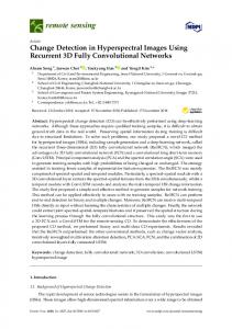
labeling and finding the regions of homogenous and uniform temperatures in the original satellite images; histogram based separation [6] [19], based on the fact that the fronts are usually defined as thin contours separating two waters masses of distinct temperatures. In the work described in [21], the Fuzzy c-means algorithm is used to generate a labelled images with homogenous and non overlapping temperatures. The latter has demonstrated an effectiveness to detect the thermal upwelling fronts in SST satellite images. In this paper we present an upwelling segmentation methodology using a Fuzzy c-means algorithm with adaptive cluster merging. The approach revealed to be a promising technique for the automatic detection of upwelling areas on infrared satellite images. The outline of the paper is as follows. Section II provides a description of the data and geographic study area used throughout the study. The algorithm for the segmentation of the original SST images is described in Section III. Section IV highlights the analysis of the segmentation results with the final conclusion. II. S TUDY AREA AND DATA In this study 30 AVHRR SST images of the year 2007 covering the southern Moroccan Atlantic coast are used. The images have been acquired and processed at the Royal Centre for Remote Sensing (CRTS) of Morocco including calibration and geometric correction. A cloud mask is generated using the multispectral radiance measurements [20] tested over the AVHRR satellite images. The size of each SST images is 770 × 990 pixels, with spatial resolution of 1.1 × 1.1 km and each pixel present a temperature in degrees Celsius. A colour scale of 26 levels is applied to each original SST images in order to help the users or oceanographers for visual inspection of upwelling areas. Fig. 1(a), (b) and (c) shows three SST images selected from our database of 30 images, which illustrate all the situations of upwelling variability: well-defined upwelling areas in terms of sharp boundaries and strong upwelling gradient between the upwelling classes (Fig. 1(a)); images with smooth transitions
25 C
24 C
24 C
23 C
23 C
22 C
22 C
21 C
21 C
20 C
C7
C7
C6
C6
C5
C5
C4
C4
20 C
C3 19 C
19 C
18 C
18 C
17 C
17 C
16 C
16 C
15 C
15 C
Cloud
Cloud
Land
Land
(a)
(b)
C3
C2
C2
C1
C1
La&Clo
La&Clo
(a)
Clusters
>=26 C
25 C
Clusters
>=26 C
(b)
>=26 C
C7 25 C
24 C
C6
23 C
C5 22 C
21 C
Clusters
C4 20 C
C3 19 C
18 C
C2 17 C
C1
16 C
15 C
La&Clo
Cloud Land
(c)
(c)
Fig. 1: SST images obtained on (a) 2007-09-15, (b) 2007-1109 and (c) 2007-11-04 showing different upwelling scenarios.
Fig. 2: Classification of the original SST images in Fig. 1 using the FCM method with C = 7 clusters.
zones between the upwelling areas (Fig. 1(b)); and SST images where the presence of cloud regions, mask the true underlying structures of upwelling (Fig. 1(c)). The gray color region on the right side of each SST images (Fig. 1) corresponds to Moroccan land, whereas the white pixels in the ocean correspond to cloud pixels.
A. Fuzzy c-means clustering method
III. P ROPOSED METHODOLOGY Clustering [1], [9], [13] is an unsupervised classification method when the only data available are unlabelled, and no structural information about it is available [22]. The main aims of cluster analysis is the classification of objects according to similarities among them, and organizing data into groups. Clustering techniques can be considered as either hard [12], [18] or fuzzy [5], [17], [2] according on whether an object in data belongs exclusively to a one cluster or to several clusters with different degrees of membership. In particular, the fuzzy clustering techniques are widely used to detect the boundaries between several classes which are not forced to fully belong to one of the classes. In this sense, the presented paper uses the Fuzzy c-means clustering for the purpose of labelling the original SST images followed by an adaptive cluster merging method to merge the homogenous regions in the labeled image to obtain a suitable partitioning.
the Fuzzy c-means (FCM) algorithm [4] is based on the minimization of an objective function : c
N
∑ (µik )m ||xk − vi ||2 ,
J(X;U,V ) = ∑
(1)
i=1 k=1
where vi is a vector of cluster prototypes, and ||xk − vi ||2 is the Euclidean distance norm. The cluster centroids and the respective membership functions that solve the constrained optimization problem in Eq. 1 are given by the following equations : vi =
µik =
∑Nj=1 (µi j )m x j ∑Nj=1 (µi j )m
1 ||x −v ||
2
,
,
1 6 i 6 c,
16i6c ,
1 6 k 6 N.
(2)
(3)
∑cj=1 ( ||xkk−v ij || ) (m−1)
The goal of FCM algorithm is to iteratively improve a sequence of sets of fuzzy clusters in Eq. 1 by a simple iteration through the Eq. 2 and Eq. 3. For this study, we are applied the FCM algorithm to the 30 SST images with an over-estimation of the maximum number of clusters (Cmax = 7). Fig. 2 show the application of the Fuzzy c-means clustering respectively to the SST images in Fig. 1 with the number of clusters fixed to 7.
B. Determining the Number of Clusters C5
C4
∑Nk=1 min(µik , µ jk ) Si j = min(∑Nk=1 µik , ∑Nk=1 µ jk ))
(4)
where N is the total number of patterns in a data, and µik is the membership of pattern Xk to clusters Ci . This measure takes into account the contribution to similarity from all data points. The threshold parameter α ∈ [0, 1], defined above which are used to merge the clusters in a given c-partition, should be adjusted to obtain the best image segmentation, and it depends on the characteristics of the data. For the case where the selection of the threshold is problematic, the authors in [15] used an adaptive threshold which depend on the number of clusters in the c-partition at any time. [15] claim that it has been observed empirically that the adaptive threshold works best when the expected number of clusters in the data is relatively small (less than ten). The adaptive threshold used in this study is defined by [15]: α (l) =
1 M (l) − 1
(5)
The clusters are merged when the changes of maximum cluster similarity (Eq. 4) from iteration (l − 1) to iteration (l) is above the threshold α. Fig. 3 shows the results of the cluster merging algorithm applied to the labeled images in Fig. 2. The optimal number of clusters calculated over the images in Fig. 2 are respectively 4, 5 and 5 (Fig. 3). IV. A NALYSIS OF THE RESULTS AND CONCLUSIONS The performance of our algorithm has been tested by an oceanographer. This evaluation was based on the scientific and technical knowledge of the coastal ocean of Morocco.
C4 C3
Clusters
C3 C2
Clusters
C2
C1 C1
La&Clo
La&Clo
(a)
(b) C5
C4
C3 Clusters
The determination of good number of clusters in data is important for the successful application of any clustering methods. In fact, if the number of clusters is larger, one or more good compact clusters should be broken or if it is smaller, one separate cluster may be merged. In the literature two main approaches for determining the good number of clusters in data can be distinguished: 1) starting with a large number of clusters, and successively reducing this number by merging clusters that are similar, according to some predefined criteria [11], [3]; 2) evaluating a complete c-partitions and extract the good partition using the validity measures. In this study we used the first category with the similaritybased cluster merging approach defined in [15]. The method initializes the clustering algorithm with an over-estimation of the number of clusters (Cmax = 7), and then, similar clusters are merged if the similarity between clusters is higher than a threshold α ∈ [0, 1]. Given two fuzzy clusters µik and µ jk , of an object Xk , the fuzzy inclusion similarity measure between two fuzzy clusters is defined as [10], [16]:
C2
C1
La&Clo
(c) Fig. 3: Segmentation results using the FCM method with the cluster merging approach applied to the labelled images in Fig. 2.
Throughout this evaluation, we used 4 grades : ”Bad”, ”Poor”, ”Good” and ”Excellent”, to check if the proposed segmentation yield to a satisfactory results without losing any significant upwelling information. ”Excellent” was attributed when the upwelling areas are correctly identified, and ”Bad” was assigned when the upwelling areas is not well delimited. Regarding the segmentation results of the SST images, Fig. 4 shows that the grade ”Bad” is not attributed at all. For the grade ”Poor” the value of 8 % was reached, demonstrating the robustness of our algorithm in terms of detection the upwelling areas in SST images. Fig. 3 also reveals that respectively 46 % and 44 % of the grades ”Good” and ”Excellent” was achieved. Overall, 90 % were reached by the two grades ”Good” and ”Excellent” together. After the evaluation of the FCM method with the adaptive cluster merging over this representative database, we can conclude that the proposed methodology has provided a satisfactory and promising results. More importantly, the quality obtained by this very simple and well-known method suggest that it can be used as an input to a subsequent step in the analysis of the SST images of the ocean. R EFERENCES [1] M.R. Anderberg. Cluster Analysis for Application. Academic Press, New York, 1973. [2] H. Arefi, M. Hahn, and F. Samadzadegan. Comparison of clustering techniques applied to laser data. In Geo-imagery Bridging continents xx- th ISPRS congress, Istanbul, Turkey, 2004.
[19] K. Nieto, H. Demarcq, and S. McClatchie. Mesoscale frontal structures in the canary upwelling system: New front and filament detection algorithms applied to spatial and temporal patterns. Rem. Sens. Environ., 123:339–346, 2005. [20] Larry L. Stowe, Paul A. Davis, and E. Paul McClain. Scientific basis and initial evaluation of the clavr-1 global clear/cloud classification algorithm for the advanced very high resolution radiometer. Journal of Atmospheric and Oceanic Technology, 16(6):656, 1999. [21] A. Tamim, K. Minaoui, K. Daoudi, H. Yahia, A. Atillah, M.F. Smiej, and D. Aboutajdine. A simple and efficient approach for coarse segmentation of moroccan coastal upwelling. In Signal Processing Conference (EUSIPCO), 2013 Proceedings of the 21st European, pages 1–5, Sept 2013. [22] Weina Wang and Yunjie Zhang. On fuzzy cluster validity indices. Fuzzy Sets and Systems, 158(19):2095 – 2117, 2007.
30 sea surface temperature images 50 FCM with adaptive merging 45
40
Number of occurrences (%)
35
30
25
20
15
10
5
0
Bad
Poor
Good
Excellent
Scale grades
Fig. 4: Qualitative evaluation made by the oceanographer of segmentation results produced by the FCM method with the adaptive merging applied on the 30 SST images.
[3] E. Backer and Anil K. Jain. A clustering performance measure based on fuzzy set decomposition. Pattern Analysis and Machine Intelligence, IEEE Transactions on, PAMI-3(1):66–75, Jan 1981. [4] James C. Bezdek. Pattern Recognition with Fuzzy Objective Function Algorithms. Plenum Press, New York, USA, 1981. [5] G.L. Carl. A fuzzy clustering and fuzzy merging algorithm. Technical Report, CS-UNR-101, 1999. [6] J. F. Cayula and P. Cornillon. Edge detection algorithm for SST images. Journal of Atmospheric and Oceanic Techology, 9:67–80, 1992. [7] E. Chassot, S. Bonhommeau, G. Reygondeau, K. Nieto, J. J. Polovina, M. Huret, N. K. Dulvy, and H. Demarcq. Satellite remote sensing for an ecosystem approach to fisheries management. Ices Journal of Marine Science, 68(4):651–666, 2011. [8] S. Chaudhari, R. Balasubramanian, and A. Gangopadhyay. Upwelling detection in AVHRR sea surface temperature (SST) images using neuralnetwork framework. IEEE International Geoscience Remote Sensing Symposium, II:926–929, 2008. [9] P.A. Devijver and J. Kittler. Pattern Recognition: A Statistical Approach. Prentice-Hall, London, 1982. [10] D. Dubois and H. Prade. in fuzzy sets and possibility theory: Recent developments, r. r. yager, ed. new york: Pergamon. A unifying view of comparison indices in a fuzzy set-theoretic framework, pages 3–13, 1982. [11] Hichem Frigui and Raghu Krishnapuram. A robust algorithm for automatic extraction of an unknown number of clusters from noisy data. Pattern Recognition Letters, 17(12):1223 – 1232, 1996. [12] Vicente P. Guerrero-Bote, Cristina Lopez-Pujalte, Felix de MoyaAnegon, and Victor Herrero-Solana. Comparison of neural models for document clustering. International Journal of Approximate Reasoning, 34(23):287 – 305, 2003. [13] J.A. Hartigan. Clustering Algorithms. Wiley, New York, 1975. [14] R. J. Holyer and S. H. Peckinpaugh. Edge detection applied to satellite imagery of the oceans. IEEE Transactions on Geoscience and Remote Sensing, 27(1):46–56, 1989. [15] U. Kaymak and M. Setnes. Fuzzy clustering with volume prototypes and adaptive cluster merging. Fuzzy Systems, IEEE Transactions on, 10(6):705–712, Dec 2002. [16] B. Kosko. Neural Networks and Fuzzy Systems. NJ: Prentice-Hall, 1992. [17] J. Leski. Towards a robust fuzzy clustering. Fuzzy Sets and Systems, 137(2):215–233, 2003. [18] A. Likas, N. Vlassis, and J. Verbeek. The global k-means clustering algorithm (technical report). Computer Science Institute, University of Amsterdam, The Netherlands. ISA-UVA-01-02, 2001.