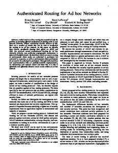
Efficient Hop ID based Routing for Sparse Ad Hoc Networks Yao Zhao1, Bo Li2, Qian Zhang3, Yan Chen1, Wenwu Zhu3 Abstract
Routing in mobile ad hoc networks remains as a challenging problem given the limited wireless bandwidth, users’ mobility and potentially large scale. Recently, there has been a thrust of research to address these problems, including on-demand routing [1-2], geographical routing [68], virtual coordinates [15], etc. In this paper, we focus on geographical routing, which was shown to achieve good scalability without flooding, but it usually requires location information and can suffer from the severe dead end problem especially in sparse networks. Specifically, we propose a new Hop ID based routing protocol, which does not require any location information, yet achieves comparable performance with the shortest path routing. In addition, we design efficient algorithms for setting up the system and adapt to the node mobility quickly, and can effectively route out of dead ends. The extensive analysis and simulation show that the Hop ID based routing achieves efficient routing for mobile ad hoc networks with various density, irregular topologies and obstacles.
1.
Introduction
Routing remains as a challenging problem, particularly in mobile ad hoc networks due to the limited spectrum, user’s mobility and power constrains. There are several challenges: scalability, routing efficiency, ad hoc network of various density and topology. For instance, scalability poses considerable challenges for ad hoc environment because it lacks the inherent hierarchy in the address structure. That is, in an ad hoc network, two neighboring nodes might have completely different address or/and identifiers. There are mainly two types of proposals specially designed for ad hoc routing to improve scalability: on-demand routing protocols [1-2] and geographical routing schemes [6-8]. The on-demand routing does not require any prior-processing for route establishment, instead uses route request flooding to all nodes in the network in order to establish the route ondemand. This often relies on the computation of the short path between a source and a destination, and tends to work well for small or moderate size system with relatively stable routes. However, such scheme does not scale well due to the significant overheads in terms of both delay and flooding in large networks. The basic idea in geographical routing to use a node's location as the address, and forward packets based on a predefined routing metric, usually the geographic distance. The greedy nature comes from the fact that such algorithms usually forward packets only based on the decrease of this metric in each step without considering complete topological information. The geographical routing achieves good 1
scalability in that each node only needs to be aware of the neighbors’ location information, and does not rely on the flooding to exploit network topology. However, there is one serious limitation for geographical routing: the dead end problem, especially under low density environment or scenarios with obstacles or holes. The dead end problem is caused by the inherent greedy nature of the algorithm in that a packet may get stuck at a local optimal node that appears closer to the destination than any of its known neighbors under the pre-defined routing metric. Recently, virtual coordinates was proposed for geographic routing without location information [15], which, however, suffers the same dead end problem. In this paper, we aim to design new routing protocols to solve the dead end problem without sacrificing routing efficiency, even for sparse ad hoc network with various topologies and obstacles. For routing efficiency, we seek for the shortest path route performance as that of the on-demand routing. To the best of our knowledge, we are among the first to achieve all these properties in one system with small overhead. We propose a novel routing algorithm, utilizing a new virtual coordinate, called Hop ID. Each node maintains a Hop ID, a multi-dimensional coordinates, which are assigned based on its distance to some landmark nodes randomly selected from the ad hoc network. With a predefined distance function, two nodes can calculate the “distance” between them. Based on this Hop ID metric, the routing algorithm performs greedy forwarding, similar to the geographic forwarding, i.e., a node forwards the packet to a neighbor which is “nearest” to the destination in the Hop ID space. But in contrast to traditional geographical routing, such schemes effectively avoid the dead ends, even for very sparse network. In addition, we designed efficient landmark selection algorithm which takes even less than one second for a sparse network of more than 10K nodes. These landmarks are random nodes in the ad hoc network. The number of landmarks remains constant even for very large ad hoc network. We further propose a novel landmark-guided detour scheme which can effectively route out of a small number of remaining dead ends. The extensive analysis and simulation in Section 5 shows that the Hop ID based routing achieves both the simplicity and scalability of the geographical routing and good routing performance of on-demand routing, for mobile ad hoc network with various density, topologies and obstacles. The rest of the paper is organized as follows. In Section 2, we discuss the related works. We present the design of Hop ID routing in Section 3, and evaluate its performance in
Department of Computer Science, Northwestern University, Email: {yzhao,
[email protected]} Department of Computer Science, The Hong Kong University of Science and Technology, Email:
[email protected] 3 Wireless and Networking Group, Microsoft Research Asia, Email: {qianz, wwzhu}@microsoft.com 2
Section 4. We conclude the paper and highlight several possible avenues for further study in Section 5.
2.
Related Works
Before we proceed to present the Hop ID routing algorithm, we first describe the main motivations and put them in the proper context with the related works. Routing is a recursive procedure to forward packets “closer” and “closer” to the destination. The most critical component in any routing algorithm is how to measure the “distance” between two nodes. This distance metric to a large degree determines the route performance, yet how to select this metric is non-trivial. Hop count or the shortest path distance is a natural candidate, since packets are forwarded on a hopby-hop basis. But this poses considerable difficulty in ad hoc networks in that it incurs significant overhead to find and maintain the shortest path. On-demand routing algorithm [12] and proactive routing protocol [3-4] are typical examples using hop distance (i.e., the length in hops of the shortest path between a pair of nodes) as the routing metric. There have been other metrics proposed to measure the “distance” between two nodes such as geometric distance, last encountered time [13], and ID space distance [14]. Geographic routing uses geometric distance as the distance metric, and it is greedy in that each node forwards a packet to a neighbor with shorter distance to the destination. Geographic routing does not incur explicit route discovery using flooding; instead it only requires obtaining the position of the destination and neighbors. Geographic routing in general composes of three parts: 1) greedy routing algorithm; 2) dead ends resolution, and 3) location service. The existence of dead end is a well-known problem for geographic routing, in which pure greedy algorithms hardly work in sparse networks or scenarios with obstacles or holes. Many protocols, such as GPSR/GFG [6][7] used face routing technique to overcome dead end problem, but usually is at the expense of much longer routing path. GOAFR+ [8] made an attempt in enhancing face routing performance. In sparse networks, the fundamental problem in geographic routing is that geometric distance can hardly reflect the true hop distance between two nodes, thus often lead to dead end problem. Face routing mitigates this problem at the cost of longer routing path. In fact, the routing path can be several times longer than that of the shortest path length [8]. Another well-known limitation of geographic routing is that it requires GPS or other location devices to obtain relatively precise location information. For geographic routing, exact location might not be required and imprecise virtual coordinates accordant to the network topology may perform better than the real coordinates system. Under such motivation, recently Rao et al. made a first attempt for geographic routing without location information [15]. They proposed a virtual coordinate construction algorithm, which achieves comparable performance with the real geometric coordinates in dense networks. It was also shown in [15] that the virtual ordination has potential in the environment with obstacles or holes, as virtual coordinates can better reflect the connectivity than real coordinates. But [15] performs badly in sparse network because its greedy success rate drops quickly and the dead end problem becomes more and more serious.
3.
Efficient Routing with Hop ID
To design a scalable and efficient routing scheme for mobile ad hoc network, we observed that a pre-defined distance metric in geographical routing is the key to obtain scalability, in that it does not require any flooding or requires minimum flooding to explore the route discovery. On the other hand, the accuracy of the pre-defined distance metric representing the hop distance determines the route performance. In another word, if the greedy metric can more accurately reflect the hop distance, the route performance will be closer to that of the shortest path routing. This is precisely the problem in the existing geographical routing algorithms, where in sparse networks or scenario with obstacles or holes, the correlation between the geometric distance and hop distance subdues, thus it results in signify-cantly more dead ends and unnecessarily longer route paths. To address these problems, in this Section, we present the Hop ID based routing. Basically, we construct a multidimensional coordinates system, called Hop ID system, and use corresponding distance function to calculate the Hop ID distance between a pair of nodes. A node’s position, i.e. its Hop ID, is a vector, in which each dimension is the hop distance from the node to a pre-selected landmark node. Hop ID distance (vector) between two nodes is calculated from the relative hop distances to the set of landmarks. The results demonstrate that the Hop ID distance closely resembles the hop distance. In addition, Hop ID construction has no requirement for the density of the network, thus the routing protocol works well under both high and low density environments. Comparing to existing proposals, in particular the virtual coordinates in [15], our proposed Hop ID system obtains comparable performance under dense environment, and performs significantly better in sparse networks. Hop ID routing is also one type geographic routing, thus it requires the careful design of the three parts identified in Section 2. Firstly, this needs a routing algorithm based on a pre-specified distance metric; we construct a multidimensional virtual coordinates, Hop ID system, which relies on the elected landmark nodes to compute the Hop ID distance between a pair of nodes. Secondly, dead end problem still occurs, but this is considerably less severe than the existing geographic routing scheme due to its insensitivity to the network density. We present effective techniques to solve this problem. Finally, a location service is needed for the source node to get the Hop ID of the destination. This is not the focus of our paper, partly because the location service has been extensively studied [9-12], in which many known techniques such as [9][10] can be used in Hop ID system. But we can use a simple location service as follows: each node n randomly use a pre-defined hash functions to hash its IP address to one of the landmarks, which will serve as the location server for n. The routing to landmark nodes is always known to all nodes. Each node updates its Hop ID with its location server when necessary as discussed in Section 3.4.
3.1.
Hop ID Description
We use the example in Fig. 1 to illustrate the basic ideas in Hop ID system. We assume that some nodes have already been selected as landmark nodes by the landmark selection
algorithm introduced in Section 3.3 and each node knows its hop distance to all the landmarks. In Fig. 1, L1, L2 and L3 are three landmarks. Following a predefined order, the hop distance of a node to all the landmarks is combined into a vector, i.e. the node’s Hop ID. For example, L2’s Hop ID is 305 in Fig. 1, representing that L2 is 3 hops away from L1, 0 hop away from itself and 5 hops away from L3.
Fig. 1 Example of Hop ID. A node N’s Hop ID xyz means N is x, y, z hops away from landmark L1, L2 and L3 respectively. Intuitively, the Hop ID can reflect the proximity of the network to some extent. Take two nodes N1 and N2 for example, we define the hop distance between N1 and N2 as Lh. Assume there are m landmark nodes, and the Hop ID of N1 is H (1) ( H 1(1) , H 2(1) , " , H m(1) ) , the Hop ID of N2 is the following triangulation H ( 2 ) ( H 1( 2 ) , H 2( 2 ) , " , H m( 2 ) ) , inequality holds:
Max(| H k(1) − H k( 2) |) ≤ Lh ≤ Min( H k(1) + H k( 2) ) (1) k
k
Apparently, for each k from 1 to m, Lh is no more than the sum of H k(1) and H k( 2 ) , since there exists a path from N1 to N2 via landmark k and the hop count of this path is H k(1) + H k( 2 ) . For the left part of the inequality, without losing the generality, we assume H k(1) is no more than H k( 2 ) , H k( 2 ) is no more than the sum of Lh and H k(1) , because there is a path from landmark k to N2 via node N1 and H k( 2 ) is the shortest hop distance from landmark k to N2. These inequalities yield a lower bound L and an upper bound U of Lh. More landmark nodes can make the lower and upper bounds even tighter, but as we can see from the discussion in Subsection 3.2, the number of landmarks needed in reality will be a constant which is determined by the precision requirement other than number of nodes in the network.
3.2.
Distance Function
One of the key problems is what distance function is most efficient for greedy routing. We seek for a distance metric calculated by Hop IDs, and such distance is an accurate estimation of the hop distance. Recently, Jon et al. studied this problem in a theoretical manner and introduce the following theorem [22]: Theorem: In any s-doubling metric M, a constant number of randomly selected landmarks achieve an (ε,δ)- triangulation with probability 1-γ, where the constant depends on δ, ε, γ, and s. The (ε,δ)-triangulation means for all but an ε fraction of the
pairs (u,v), we have U/L