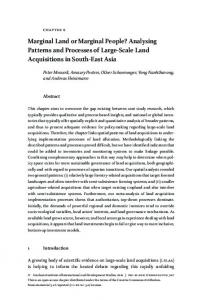
Environment, agriculture, and settlement patterns in a marginal Polynesian landscape P. V. Kirch*†, A. S. Hartshorn‡, O. A. Chadwick‡, P. M. Vitousek§, D. R. Sherrod¶, J. Coil*, L. Holm*, and W. D. Sharp储 *Department of Anthropology, University of California, Berkeley, CA 94720; ‡Department of Geography, University of California, Santa Barbara, CA 93106; §Department of Biological Sciences, Stanford University, Stanford, CA 94305; ¶U.S. Geological Survey, Hawaii National Park, HI 96718; and 储Berkeley Geochronology Center, Berkeley, CA 94709 Contributed by P. V. Kirch, May 15, 2004
Beginning ca. A.D. 1400, Polynesian farmers established permanent settlements along the arid southern flank of Haleakala Volcano, Maui, Hawaiian Islands; peak population density (43–57 persons per km2) was achieved by A.D. 1700 –1800, and it was followed by the devastating effects of European contact. This settlement, based on dryland agriculture with sweet potato as a main crop, is represented by >3,000 archaeological features investigated to date. Geological and environmental factors are the most important influence on Polynesian farming and settlement practices in an agriculturally marginal landscape. Interactions between lava flows, whose ages range from 3,000 to 226,000 years, and differences in rainfall create an environmental mosaic that constrained precontact Polynesian farming practices to a zone defined by aridity at low elevation and depleted soil nutrients at high elevation. Within this productive zone, however, large-scale agriculture was concentrated on older, tephra-blanketed lava flows; younger flows were reserved for residential sites, small ritual gardens, and agricultural temples.
A
rchaeologists have long regarded the ‘‘determinants’’ of preindustrialized human settlement patterns to be multifactorial and complex (1, 2). In addition to environmental variables such as water availability, soil fertility, and natural food and other resources, the distributions of human settlements are influenced by level of technology, sociopolitical and economic factors, and even ritual practices and ideological beliefs (3). Such complex, hierarchically nested determinants influenced the location of habitations, fields and farms, resource extraction facilities, administrative centers, religious sites, and communication networks. For agrarian societies, however, environmental constraints on crop productivity arguably formed the base of such a hierarchy of determinants. The pre-European-contact (i.e., before A.D. 1778) Polynesian society of the Hawaiian Islands represents a highly stratified, complex sociopolitical structure, with an economy based on intensive agriculture, aquaculture, and marine exploitation but lacking metallurgy, the wheel, or draft animals (4–6). At European contact, the isolated Hawaiian Islands were divided into four polities, each supported by irrigated and dryland forms of intensive field agriculture, based largely on the root crops of taro and sweet potato (Ipomoea batatas), supplemented by secondary crops (7). Hawaii offers an exemplary opportunity to investigate the environmental constraints on human settlement patterns in an intensive agrarian economy, because of both its rich archaeological and ethnographic records, and its usefulness for understanding ecosystem development in an environmental context (8). The Kahikinui, Maui, Study Area Rising from sea level to 3,055 m on the arid, southeastern slopes of Haleakala Volcano, Kahikinui is one of 12 wedge-shaped political units formerly constituting the indigenous Maui Island polity (Fig. 1). Kahikinui has been spared modern landscapealtering activities that have transformed other parts of the archipelago, offering one of the few regions where intact ancient
9936 –9941 兩 PNAS 兩 June 29, 2004 兩 vol. 101 兩 no. 26
settlement patterns are preserved on a district-wide level. Kahikinui is also significant because the arid and geologically youthful landscape is marginal for Polynesian agricultural crops (9). Understanding how the prehistoric Hawaiians sustained a permanent and sizeable human population in Kahikinui illuminates key aspects of the adaptability of preindustrial agrarian systems. Since 2001 as part of a multidisciplinary ‘‘biocomplexity in the environment’’ research program, we have explored a range of environmental variables that influenced agricultural systems and settlement patterns in Kahikinui, including (i) geologic substrate age and composition; (ii) the climate gradient and hydrologic regime; and (iii) properties of soils formed on these substrates, including nutrient status. Here we describe Kahikinui settlement patterns and then focus on how geology and soils, through their interactions with climate, constrained these patterns through the creation of an environmental mosaic with great spatial variability. Archaeological Findings More than 3,000 individual archaeological features have been recorded (10, 11) in sampling areas covering ⬇11 km2 (Fig. 1). Archaeological excavations in residential, agricultural, and ritual sites have elucidated site chronology and function (10–13). Archaeological features associated with prehistoric habitation consist of dry-stone masonry enclosures, shelters, walls, and similar features, which were the foundations for functionally differentiated houses with perishable pole-and-thatch superstructures. In the Kipapa-Naka’ohu study area, we identified 117 residential household complexes, with a pronounced distributional peak at an elevation between 400 and 600 m (Fig. 2). Most coastal sites date to ⬇1820–1860, and they relate to a shift in settlement after construction of a circum-island roadway and schoolhouse. Noncoastal sites are restricted to elevations ⬍900 m. Our archaeological surveys have also identified numerous agricultural features (such as soil-filled terraces, stone boundary alignments, stone mounds, and soil retention walls) showing a similar distribution with respect to elevation (Fig. 2). A suite of 169 radiocarbon dates indicates that Kahikinui settlement commenced ca. A.D. 1400, and that population peaked between A.D. 1700 and 1800 at a density (estimated on archaeological evidence) of between 43 and 57 persons per km2 for the main zone of human land use (⬍900 m; total area ⫽ 72 km2). After European contact and the introduction of continental diseases, the population of the district declined to 517 persons (7.2 persons per km2) by 1831–1832 (14). In Kahikinui, there are minimal archaeological indications of water control for wet taro cultivation, limited to small, ephemeral drainages. Regional agriculture, therefore, focused on dryland cropping, primarily of sweet potato, supplemented by dryland taro, bananas, yams, and ki (Cordyline fruticosum). Abbreviation: ky, thousand years. †To
whom correspondence should be addressed at: Department of Anthropology, 232 Kroeber Hall, University of California, Berkeley, CA 94720. E-mail:
[email protected].
© 2004 by The National Academy of Sciences of the USA
www.pnas.org兾cgi兾doi兾10.1073兾pnas.0403470101
Excavations in residential sites have yielded carbonized parenchyma from sweet potato tubers and carbonized ki roots, confirming these as important crops (13). Sweet potato is noted for its high degree of adaptability to soil and climate conditions (15), although yields generally decline with elevation (16). Sweet potato prefers a well-distributed annual rainfall of ⬇760–1,270 mm and an abundance of solar radiation (17, 18). Components of the Kahikinui Landscape Mosaic Geologic Substrate Age and Composition. Two major stratigraphic units are exposed: the older Kula Volcanics and younger Hana Volcanics (refs. 19–21; names modified slightly from the older publication to correspond to modern conventions). The Kula Volcanics have been interpreted as post-shield-stage lava, and the Hana Volcanics were thought to represent a rejuvenated stage of volcanism (19). The lava flows of both units, chiefly ⱊaⱊa, are compositionally and lithologically similar, ranging from basanite to hawaiite (essentially variants of basalt but with higher concentrations of the alkali elements Na2O and K2O and lower
SiO2). These ⱊaⱊa flows have highly irregular surfaces and serve as natural dust and tephra traps. Our mapping and dating has resulted in a detailed geologic map of the Kahikinui District (Fig. 3). Kahikinui’s eastern part consists of moderately incised Kula Volcanics (Table 1), whereas the western part is underlain by Hana Volcanics composed of unincised, porous lava flows and scattered cinder cones (Pu’u Pane, Manukani, and Luala’ilua cones). The whole-rock, 40Ar兾 39Ar incremental heating isochron method was used to date the older flows [⬎90,000 years (90 ky)]; for younger flows, 14C from carbonized wood charcoal was used to date overlying surfaces. The oldest surface, on the Kula Volcanics (unit kman, Fig. 3), dates to 226 ky (sample no. S02-HC1926), whereas a younger, early Hana flow (unit hpane) emanating from the Pu’u Pane cone dates to 91 ky (S02-HC1927). Emplacement ages of the Hana lava flows range from 53 ky, a minimum age for the unit hkah, to 3 ky for the Kamole Gulch basanite (unit hkmole). Importantly, tephra deposits (fine ash and coarse cinder) blanket older (⬎17-ky) stratigraphic units. The younger flows lack such tephra deposits, are minimally weathered, and hence support rocky soils. Climate Gradient and Hydrologic Regime. Typically, elevation gain
Fig. 2. Household complexes and agricultural features with elevation. Triangle approximates distribution (see Fig. 4).
Kirch et al.
on the leeward side of Hawaiian volcanoes leads to increasing rainfall and decreasing evapotranspiration (22); on Haleakala, there is evidence of an inversion at ⬇2,000 m elevation. Data derived from five meteorological stations were used to interpolate 250-mm annual isohyets (23). Up to 2,000 m, elevation and rainfall are strongly correlated, with average annual rainfall across the district ranging from ⬇500 mm at the coast to ⬎1,000 mm above 1,200 m. Pending further studies of the orographic rainfall patterns in this area, we use elevation as an easily measured proxy for rainfall. In Hawaiian rainforests, fog-drip augments rainfall inputs to soils (24), which in Kahikinui would have been greater before late 19th-century clearing of native forests in association with cattle ranching (25). Soil moisture across Kahikinui therefore reflects differences in precipitation, PNAS 兩 June 29, 2004 兩 vol. 101 兩 no. 26 兩 9937
ANTHROPOLOGY
Fig. 1. The Kahikinui region, showing areas of intensive archaeological survey and the zone of highest density of habitation complexes and agricultural features.
Fig. 3.
Geological map of a portion of the Kahikinui area. The solid rectangle in the Inset shows the location of the Kahikinui area.
evapotranspiration, and water-holding capacity, which is largely controlled by rock content (26, 27). Soil Variability. We hypothesized that the areas best suited to dryland farming would be those representing an optimal combination of soil depth, soil fertility, and low rock content. Here we report depth-weighted averages (to 30 cm) for soil properties that index agricultural potential: base cation saturation, resinextractable phosphorus (P), and rock content. Base saturation is the fraction (expressed as a percent) of the cation exchange capacity occupied by exchangeable base cations (Ca2⫹, Mg2⫹, K⫹, and Na⫹) and is determined by ammonium acetate extraction (28); resin P measures readily available P (29); we estimated rock fragment (⬎2 mm) content in the field (30). Recent work along a Kohala Peninsula climate gradient on Hawaii Island (27) has linked sharp reductions in base saturation to the balance between incoming precipitation, soil pore volume, and the abundance of weatherable minerals. Agricultural po9938 兩 www.pnas.org兾cgi兾doi兾10.1073兾pnas.0403470101
tential as measured by base saturation and resin P are higher within an adjacent dryland field system (31, 32). To test whether a comparable productive zone underlies the Kahikinui landscape mosaic, we sampled soils at nine elevations each on the 53-ky hkah flow and the 226-ky kman flow (Fig. 3). Base saturation and resin P show significant declines on the 226-ky flow (Fig. 4 c and d). Across the shorter elevational gain of the younger 53-ky flow (due to burial by more recent flows; Fig. 3), declines are not significant (Fig. 4 a and b). The difference between these two lava flows reflects the time-dependent process of climate imprinting: the greater variability in soil properties for the 53-ky flow contrasts with the clearer climate signature of the 226-ky flow. Both lava flows support soils that are ⬎45 cm deep with ⬍30% rock. For dryland farming in Kahikinui, declining base saturation and resin P at elevations ⬎800 m likely imposed an upper boundary on farming productivity; a lower boundary would have been imposed by aridity (23, 24, 26). The location of these boundaries should vary across the different lava flows (Fig. 3, Table 1). Kirch et al.
Table 1. Stratigraphy and ages of key substrates in Kahikinui study area Map code* kman hpane hkah hkpapa-1 hnaw halena-1 halena-2 hkhau-10 hkmole
Lava flow
Age, ky
Tephra
Manawainui interfluve Pu’u Pane basanite Kahikinui basanite Kipapa-1 ankaramite Nawini ankaramite Oldest Alena lava Middle Alena lava Kanahau-10 ankaramite Kamole Gulch basanite
226 ⫾ 91 ⫾ 9† 52.9 ⫾ 1.8‡ ⬇30§ 17.1 ⫾ 0.035‡ 10.1 ⫾ 0.04‡ ⬇9§ 8.2 ⫾ 0.04‡ 3.04 ⫾ 0.04‡
X X X X
4†
*All map codes designate Hana Volcanics with the exception of kman (Kula Volcanics). †40Ar兾39Ar incremental heating isochron age (reported at ⫾2). ‡14C age, analysis by accelerator mass spectrometry (reported at ⫾1). §Relative age inferred from stratigraphy.
Fig. 4. Soil properties (to 30 cm) and household兾agricultural complexes (large triangles; see Fig. 2) along the 53-ky [a, base saturation (%); b, resin P (mg䡠kg⫺1)] and 226-ky [c, base saturation (%); d, resin P (mg䡠kg⫺1)] climate gradients. We used linear regression (PROC REG in SAS) to assess changes in soil properties with elevation; we transformed variables to meet assumptions of normality and homoscedasticity of error terms (36).
Kirch et al.
Fig. 5. Soil properties (to 30 cm) along the lava flow age gradient. (a) Rock fragment content (%). (b) Base saturation (%). (c) Resin P (mg䡠kg⫺1). Data were analyzed as in Fig. 4.
Discussion Based on observations of ⬎3,000 architectural features, the distribution pattern of household complexes indicates that the precontact population of Kahikinui situated the majority of their residential sites away from the coast and where adequate soil nutrients and soil water created an optimum zone for the cultivation of dryland crops, especially sweet potato. The concentration of household complexes decreases with declining base saturation (Fig. 7), and the absence of residential sites ⬎900 m is spatially coincident with low agricultural potential (Fig. 4). The lower altitudinal limits to settlement and farming appear to have been set by the aridity common to coastal, leeward locations across the archipelago (23). In short, the spatial pattern of settlement in Kahikinui reflects the mosaic created by younger and older lava flows cutting across a zone of favorable rainfall. Archaeological evidence confirms the utilization of specific patches within the Kahikinui landscape mosaic for farming. Two kinds of patches have produced evidence for intensive farming: (i) naturally formed swales or depressions within the surface of the 17-ky (hnaw) flow and (ii) areas of the older (⬎53-ky) hkah and hkpapa flows. The hnaw swales display structural evidence such as terrace retaining walls and agricultural shrines, as well as subsurface evidence such as reworked cultivation layers and digging-stick impressions. As residential sites are typically situated on the immediate uphill margins of these swales, residential
Fig. 6.
Soil properties (to 30 cm) at 17-ky swale and ridge sites. PNAS 兩 June 29, 2004 兩 vol. 101 兩 no. 26 兩 9939
ANTHROPOLOGY
We also investigated the role of lava flow age in determining land-use practices by sampling five flows (17, ⬇30, 53, 91, and 226 ky) within a narrow altitudinal range (585–700 m) to minimize climatic differences. As these ⱊaⱊa flows weather over time and as tephra deposits accumulate, soil depth increases from 23 to ⬎70 cm and rock fragments decrease from 65 to ⬍5%, with the sharpest reduction occurring on substrates older than the 17-ky hnaw unit (Fig. 5). In contrast, the nutrient content of the soil showed minimal change (Fig. 5 b and c). Lava flows up to 17 ky in age at Kahikinui have high local relief, not muted by tephra falls. These flows are composed of closely spaced ridges and swales; the ridges support shallow soils, whereas the swales support deeper, nutrient-rich soils (Fig. 6). The swales provide rocky soils that were nonetheless deep enough to be used for small gardens. In summary, prehistoric household complexes and agricultural features in Kahikinui are concentrated between 400 and 600 m; within this elevational band, the older lava flows have developed extensive, deep, nutrient-rich soils that store enough moisture to support intensive agriculture. In contrast, the younger flows could support intensive gardening within swales only. This complex environmental mosaic provided early settlers with a range of land use choices across the Kahikinui landscape: habitation and temples could be positioned on the younger flows immediately adjacent to the farmable older flows.
Fig. 7. Relationship of household complexes and predicted base saturation (BS) for elevations ⬎400 m [arcsin(sqrt(BS)) ⫽ 1.1978 ⫺ (0.0007 * elevation); R2 ⫽ 0.72, P ⬍ 0.01]. Data were analyzed as in Fig. 4.
wastes may have been transferred (purposefully or indirectly) into the farmed depressions, adding nutrients to the already high nutrient status of the hnaw substrate (Fig. 6). Excavations and soil profiles within the hkah substrate reveal evidence of intensive gardening, especially numerous conicalshaped depressions (15–40 cm in diameter and 15–30 cm deep) that penetrate from the upper fine-grained tephra through a gravelly horizon dominated by cinder, into a deeper, fine-grained tephra. These features represent the impressions left by digging sticks, the principal Hawaiian agricultural tools. Also revealed in hkah soil profiles are subsurface earth ovens containing charcoal, fire-altered stone, and carbonized roots of ki, a secondary crop. Indigenous Hawaiian agriculture was ritually controlled by an ideological system (33) centered on the cults of Lono, god of dryland agriculture and sweet potato, and Kane, god of irrigation and taro. Rituals to ensure agricultural productivity were carried out in temples associated with these deities. In Kahikinui, we have identified the stone platform and terraced foundations of 30 temples, whose orientations indicate associations with specific deities (34). As seen in Fig. 8, these agricultural temples tend to concentrate at the interfaces between the hnaw flow (on which many temples were actually constructed) and the hkah and hkpapa-1 substrates. Because these substrates were intensively cultivated, because of their optimum combination of workability and nutrient status, the temple sites presumably served as territorial markers for local groups using specific portions of these flows. Thus, the spatial distribution of Hawaiian agricultural temples exhibits a pattern linked to soil properties.
Fig. 8. Distribution of temple sites in the Kipapa-Naka’ohu survey area. Temples are situated primarily on the young hnaw substrate, but close to the interface with the older, tephra-covered hkah and hkpapa-1 substrates. The location of the survey area is shown in the Inset (dashed rectangle).
ary of the settlement zone is related to excess rainfall via a decline in soil nutrient availability. Above this, agricultural potential is limited by leaching. In short, indigenous Hawaiian cultivators identified and adapted their agricultural system to an optimal zone for sweet potato cropping within a landscape that was on the marginal limits for tropical root crop production (31). Agriculture was nonetheless probably always a risk-prone endeavor (11). Recurrent drought events, especially those commencing in winter months when Kahikinui receives most of its annual rainfall, may have had severe impacts on the resident human population (35). The fact that a sizeable population did permanently use Kahikinui’s resources, despite its marginality for agriculture, testifies to the demographic and economic pressures building within Hawaiian sociopolitical systems in the centuries immediately before European contact. The Kahihinui case is of particular interest in demonstrating the adaptability of Polynesian settlement systems to environmental constraints, which would have severely challenged indigenous agricultural production.
Conclusions Prehistoric Polynesian settlement on the arid, southern flank of Haleakala Volcano in Kahikinui district was concentrated between 400 and 600 m. This settlement zone, with a peak population density estimated by dated residential sites at 43–57 persons per km2, depended on a dryland agricultural economy. Analysis of a suite of environmental variables strongly suggests that the distribution of human settlement was primarily determined by a few key parameters affecting the productivity of sweet potato and other dryland crops. The rapid drop-off in settlement density ⬍400 m elevation is directly related to the aridity and low water-holding capacity of the soil: this combination would have reduced soil moisture to levels below that required for sweet potato growth. The upper altitudinal bound-
All radiocarbon ages reported herein, including those from Bergmanis et al. (20), were produced by John P. McGeehin, U.S. Geological Survey (Reston, VA). Permission to conduct archaeological research in Kahikinui was granted by the Department of Hawaiian Home Lands, State of Hawaii. For logistical support and assistance, we thank Ka ’Ohana o Kahikinui, ’Ulupalakua Ranch, the State of Hawaii Historic Preservation Division. For laboratory assistance, we thank Nathalie Boes, Val Bullard, Doug Turner, Sarah Robinson, and Dot McLaren. This research was supported by National Science Foundation (NSF) Grant BCS-0119819, with additional support from NSF Grants SBR-9600693 and SBR-9805754.
1. Trigger, B. G. (1968) in Settlement Archaeology, ed. Chang, K. C. (National Press Books, Palo Alto, CA), pp. 53–78. 2. Parsons, J. R. (1972) Annu. Rev. Anthropol. 1, 127–150. 3. Weisler, M. & Kirch, P. V. (1985) New Zealand J. Archaeol. 7, 129–158. 4. Kirch, P. V. (1984) The Evolution of the Polynesian Chiefdoms (Cambridge Univ. Press, Cambridge, U.K.).
5. Earle, T. K. (1997) How Chiefs Come to Power: The Political Economy in Prehistory (Stanford Univ. Press, Stanford, CA). 6. Hommon, R. J. (1986) in Island Societies: Archaeological Approaches to Evolution and Transformation, ed. Kirch, P. V. (Cambridge Univ. Press, Cambridge, U.K.), pp. 55–68. 7. Handy, E. S. C. & Handy, E. G. (1972) Native Planters in Old Hawaii: Their Life,
9940 兩 www.pnas.org兾cgi兾doi兾10.1073兾pnas.0403470101
Kirch et al.
8. 9. 10. 11. 12. 13. 14. 15. 16. 17. 18. 19. 20. 21.
23. Giambelluca, T. W., Nullet, M. A. & Schroeder, T. A. (1986) Rainfall Atlas of Hawaii (Division of Water and Land Development, Honolulu). 24. Juvik, J. O. & Hughes, K. (1997) Climatology and Water Resources at Kahikinui, Maui (Pacific Environmental Planning, Hilo, HI). 25. Stock, J., Coil, J. & Kirch, P. V. (2003) Quat. Res. 59, 12–24. 26. Nullet, D., Ikawa, H. & Kilham, P. (1990) Geoderma 47, 171–184. 27. Chadwick, O. A., Gavenda, R. T., Kelly, E. F., Ziegler, K., Olson, C. G., Crawford, W. & Hendricks, D. M. (2003) Chem. Geol. 202, 195–223. 28. Kuo, S. (1996) in Methods of Soil Analysis: Part 3 Chemical Methods, ed. Sparks, D. L. (Soil Sci. Soc. Am., Madison, WI), pp. 898–899. 29. Lavkulich, L. M. (1981) Methods Manual: Pedology Laboratory (Univ. of British Columbia, Vancouver). 30. Schoeneberger, P. J., Wysocki, D. A., Benham, E. C. & Broderson, W. D. (2002) Field Book for Describing and Sampling Soils, Version 2.0 (Natural Resources Conservation Service, U.S. Dept. of Agriculture, National Soil Survey Center, Lincoln, NE). 31. Vitousek, P. M., Ladefoged, T. N., Kirch, P. V., Hartshorn, A. S., Graves, M. W., Hotchkiss, S. C., Tuljapurkar, T. & Chadwick, O. A. (2004) Science 304, 1665–1668. 32. Ladefoged, T. N., Graves, M. W. & McCoy, M. D. (2003) J. Archaeol. Sci. 30, 923–940. 33. Valeri, V. (1985) Kingship and Sacrifice: Ritual and Society in Ancient Hawaii (Univ. of Chicago Press, Chicago). 34. Kirch, P. V. (2004) Antiquity 78, 102–114. 35. Giambelluca, T. W., Nullet, M. A., Ridgley, M. A., Eyre, P. R., Moncur, J. E. T. & Price, S. (1991) Drought in Hawaii (Department of Land and Natural Resources, Honolulu). 36. SAS Institute (2000) SAS兾STAT User’s Guide (SAS Institute, Cary, NC), Release 8.1.
ANTHROPOLOGY
22.
Lore, and Environment, Bernice P. Bishop Museum Bull. 233 (Bishop Museum Press, Honolulu). Vitousek, P. M. (2004) Nutrient Cycling and Limitation: Hawaii as a Model System (Princeton Univ. Press, Princeton). Kirch, P. V. (1991) in Islands, Plants, and Polynesians: An Introduction of Polynesian Ethnobotany, eds. Cox, P. A. & Banack, S. A. (Dioscorides Press, Portland, OR), pp. 113–133. Kirch, P. V., ed. (1997) Na Mea Kahiko o Kahikinui: Studies in the Archaeology of Kahikinui, Maui (Archaeological Research Facility, Univ. of California, Berkeley). Dixon, B., Conte, P. J., Nagahara, V. & Hodgins, W. K. (1999) Asian Perspect. 38, 229–255. Kirch, P. V. & O’Day, S. (2002) World Archaeol. 34, 484–497. Coil, J. & Kirch, P. V. (2004) in Sweet Potato in the Pacific, eds. Ballard, C., Brown, P. & Bourke, M. (Oceania Monographs, Sydney), in press. Schmitt, R. C. (1973) The Missionary Censuses of Hawaii. (Bishop Museum Press, Honolulu). Yen, D. E. (1974) The Sweet Potato and Oceania: An Essay in Ethnobotany, Bernice P. Bishop Museum Bull. 236 (Bishop Museum Press, Honolulu). Ngeve, J. M., Hahn, S. K. & Bouwkamp, J. C. (1992) Trop. Agric. 69, 43–48. Purseglove, J. W. (1968) Tropical Crops, Dicotyledons, I (Wiley, New York). Newman, T. S. (1970) Hawaiian Fishing and Farming on the Island of Hawaii in A.D. 1778 (Div. State Parks, Dept. Land and Natural Resources, Honolulu). Stearns, H. T. & Macdonald, G. A. (1942) Geology and Ground-Water Resources of the Island of Maui, Hawaii (Division of Hydrography, Honolulu). Bergmanis, E. C., Sinton, J. M. & Trusdell, F. A. (2000) Bull. Volcanol. 62, 239–255. Sherrod, D. R., Nishimitsu, Y. & Tagami, T. (2003) Geol. Soc. Am. Bull. 115, 683–694. Giambelluca, T. W. & Schroeder, T. A. (1998) in Atlas of Hawaii, eds. Juvik, S. P. & Juvik, J. O. (Univ. of Hawaii Press, Honolulu), 3rd Ed., pp. 49–59.
Kirch et al.
PNAS 兩 June 29, 2004 兩 vol. 101 兩 no. 26 兩 9941