Mar 5, 2014 - endorsement by the U.S. Government. ... Michigan State University Extension programs and materials are open to all without regard to ..... 61 points surveyed in 2011 within the Saginaw Bay watershed (Monfils unpublished ...
EVALUATING MARSH BIRD HABITAT USE AT MULTIPLE SCALES TO INFORM CONSERVATION DESIGN
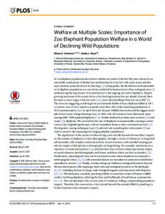
Prepared By: Michael J. Monfils Michigan Natural Features Inventory Michigan State University Extension P.O. Box 30444 Lansing, MI 48909-7944 Daniel B. Hayes Department of Fisheries and Wildlife Michigan State University 334C Natural Resources East Lansing, MI 48824-1222 Benjamin M. Kahler and Gregory J. Soulliere Upper Mississippi River and Great Lakes Region Joint Venture U.S. Fish and Wildlife Service 2651 Coolidge Road, Suite 101 East Lansing, MI 48823-6316 Prepared For: U.S. Fish and Wildlife Service Great Lakes Fish and Wildlife Restoration Act 5600 American Blvd. West, Suite 990 Bloomington, MN 55437-1458 MNFI Report Number 2014-03 March 5, 2014
Partial funding for this program is supported by a Grant Agreement from the U.S. Department of Interior, Fish and Wildlife Service. The views and conclusions contained in this document are those of the authors and should not be interpreted as representing the opinions or policies of the U.S. Government. Mention of trade names or commercial products does not constitute their endorsement by the U.S. Government. Suggested Citation: Monfils, M. J., D. B. Hayes, B. M. Kahler, and G. J. Soulliere. 2014. Evaluating marsh bird habitat use at multiple scales to inform conservation design. Michigan Natural Features Inventory, Report Number 2014-03, Lansing, USA. Copyright 2014 Michigan State University Board of Trustees. Michigan State University Extension programs and materials are open to all without regard to race, color, national origin, gender, religion, age, disability, political beliefs, sexual orientation, marital status, or family status.
TABLE OF CONTENTS INTRODUCTION ...........................................................................................................................1 STUDY AREAS ..............................................................................................................................2 METHODS ......................................................................................................................................4 Bird Surveys...............................................................................................................................4 Fine-scale Wetland Characteristics ............................................................................................5 Remotely Sensed Variable Estimation.......................................................................................7 Analysis......................................................................................................................................8 RESULTS ......................................................................................................................................13 Multivariate ..............................................................................................................................13 CART and Logistic Regression ...............................................................................................18 Occupancy Modeling ...............................................................................................................24 Patterns in Variable Inclusion ..................................................................................................28 Predicted Marsh Bird Distributions .........................................................................................30 DISCUSSION ................................................................................................................................31 Important Areas for Marsh Bird Conservation ........................................................................34 Refining Biological Models .....................................................................................................35 Research Needs ........................................................................................................................35 ACKNOWLEDGMENTS .............................................................................................................37 LITERATURE CITED ..................................................................................................................37 APPENDIX A ............................................................... Description of Remotely Sensed Variables APPENDIX B ......................................................Process Used to Classify Color Infrared Imagery APPENDIX C .................................................................................... Occupancy Modeling Results APPENDIX D ......................................... Classification and Regression Trees Using All Variables APPENDIX E ...................Classification and Regression Trees Using Large-scale Variables Only APPENDIX F ................................................................................... Marsh Bird Distribution Maps
i
LIST OF TABLES Table Page 1 Descriptions of fine- and large-scale variables estimated via quadrat sampling and remote sensing that were used in analyses of marsh bird occurrence in Michigan and Ohio with restricted (n=414) and full (n=993) data sets. ...............................................................................................................................6 2
Percent occurrence for the ten bird species analyzed within the restricted and full data sets used in analyses. The restricted data set included those Michigan points having both fine- and large-scale independent variables, whereas the full set included all survey points ..................................................................18
3
Proportion of sites correctly classified as having non-detection by classification and regression tree (CART) models with all variables, large-scale variables only, and fine-scale variables only, and with logistic regression using all variables .............................................................................................19
4
Proportion of sites correctly classified as having detection by classification and regression tree (CART) models with all variables, large-scale variables only, and fine-scale variables only, and with logistic regression using all variables .............................................................................................................................20
5
Variables included in logistic regression analyses conducted using all variables for marsh birds detected during surveys in Michigan, 2006—2013 ..................21
6
Variables included in classification and regression tree (CART) analyses conducted using all variables for marsh birds detected during surveys in Michigan, 2006—2013 ......................................................................................................22
7
Variables included in classification and regression tree (CART) analyses conducted using only fine- or only large-scale variables for marsh birds detected during surveys in Michigan, 2006—2013 ...........................................................23
8
Naïve occupancy and model-estimated occupancy (ψ) and detection probability (p) for 10 marsh bird species recorded at 518 points surveyed in Michigan during 2006—2013. Estimates of ψ and p were obtained using the best-approximating model for each species and detectability estimates are listed by survey period (p1, p2, and p3) .......................................................25
9
Occupancy covariates included in best-approximating occupancy models for marsh birds detected during surveys conducted in Michigan during 2006—2013. Positive and negative signs indicate direction of association between probability of occupancy and variable.................................................................27
ii
10
Variable patterns associated with greater proportion of sites occupied by marsh birds during surveys in Michigan, 2006—2013. Thresholds were obtained from classification and regression tree analyses conducted using all variables ........................................................................................................................29
LIST OF FIGURES Figure Page 1 Locations of marsh bird survey sites surveyed during 2005—2013 in Michigan and Ohio from which data were analyzed to evaluate the influence of wetland and land cover variables at fine and large scales on marsh bird occupancy ..........................................................................................................3 2
Biplot of first and second axes scores from non-metric multidimensional scaling (NMDS) of relative abundance of marsh bird species at 79 sites in Michigan during 2006—2013. Sites (open triangles) are overlaid by explanatory variables (labeled arrows) that were correlated with NMDS axes (r2>0.20). Arrow length indicates strength of correlation with site scores of marsh bird use .....................................................................................................15
3
Biplots of first and second axes scores from nonmetric multidimensional scaling (NMDS) of relative abundance of marsh bird species at 79 sites in Michigan during 2006—2013. Sites (triangles) are proportionally scaled with regard to relative abundance of eight marsh bird species (larger triangles indicate greater abundance).................................................................................16
iii
INTRODUCTION The long-term decline of waterbird populations and the need for conservation actions directed at these species has been recognized at continental (Kushlan et al. 2002), regional (Soulliere et al. 2007), and state levels (e.g., Eagle et al. 2005). The Upper Mississippi River and Great Lakes Region Joint Venture (hereafter JV) is implementing waterbird conservation following an adaptive framework referred to as Strategic Habitat Conservation. This framework is a process consisting of four equally important components: biological planning, conservation design, implementation or program delivery, and evaluation (National Ecological Assessment Team 2006, JV 2007). The identification of limiting factors and development of models describing population-habitat relationships are core activities of biological planning, and essential to developing habitat conservation objectives that achieve population goals. The JV Waterbird Habitat Conservation Strategy (Soulliere et al. 2007) contains population-habitat models for focal waterbird species based on each species’ biology and habitat requirements. However, biological information was lacking for many marsh birds when the JV models were developed, which resulted in the use of planning assumptions that require testing. Our goal for this project was to investigate relationships between marsh bird occupancy and fine- and large-scale habitat variables in Michigan and Ohio wetlands through analyses of existing and newly collected data in an effort to reduce planning uncertainty. We focused our study on breeding use of wetlands by two “JV focal species” (Wilson’s Snipe [Gallinago delicata] and Black Tern [Chlidonias niger]) and eight additional marsh bird species of management concern (Pied-billed Grebe [Podilymbus podiceps], American Bittern [Botaurus lentiginosus], Least Bittern [Ixobrychus exilis], Virginia Rail [Rallus limicola], Sora [Porzana carolina], Common Gallinule [Gallinula galeata], American Coot [Fulica americana], and
1
Forster’s Tern [Sterna forsteri]). Three other JV focal species, Yellow Rail (Coturnicops noveboracensis), King Rail (Rallus elegans), and Black-crowned Night-Heron (Nycticorax nycticorax), were not detected often enough to facilitate statistical analyses. All of our 10 focal species were considered species of greatest conservation need in one or more states within the JV region (e.g., Eagle et al. 2005, Wisconsin Department of Natural Resources [DNR] 2005, Ohio DNR 2006). Our objectives were to (1) explore relationships between marsh bird occupancy and habitat variables at fine and large scales for 10 marsh bird species using multiple statistical techniques; and (2) using the information gained from these analyses, develop GIS models to predict marsh bird distributions in Michigan and Ohio.
STUDY AREAS We combined data from several studies conducted in Michigan and Ohio spanning 2005—2013 in our analyses (Figure 1). We used the following data sets in our analyses: 1) 192 points surveyed in coastal wetlands at St. Clair Flats (Lake St. Clair) and Saginaw Bay (Lake Huron) during 2005—2007 (Monfils et. al 2014); 2) 455 points sampled in 2009 and 2010 as part of a statewide marsh bird study of glaciated portions of Ohio (Kahler 2013); 3) 32 points sampled in 2010 as part of an inventory of Waterloo State Recreation Area (Kost et al. 2010); 4) 61 points surveyed in 2011 within the Saginaw Bay watershed (Monfils unpublished data); and 4) 253 points sampled during 2010—2013 for this study as part of the Michigan Marsh Bird Survey. The combined data set represented over 2,200 point counts conducted during 2005— 2013 at 993 points in Michigan and Ohio.
2
Figure 1. Locations of marsh bird survey sites surveyed during 2005—2013 in Michigan and Ohio from which data were analyzed to evaluate the influence of wetland and land cover variables at fine and large scales on marsh bird occupancy.
3
METHODS Bird Surveys Marsh bird occurrence data were collected using a standardized point-count method (Conway 2011), with avian survey stations selected randomly within emergent wetlands and spaced ≥ 400 m apart. Bird species recorded during surveys varied among the data sets used for our study. Monfils et al. (2014) recorded all wetland bird species detected, whereas Kahler (2013) focused on those species targeted by the Conway (2011) protocol (i.e., Pied-billed Grebe, American Bittern, Least Bittern, King Rail, Virginia Rail, Sora, Common Gallinule, and American Coot) and Black Tern. In addition to the species surveyed by Kahler (2013), Michigan Marsh Bird Survey participants recorded Yellow Rail, Sandhill Crane (Grus canadensis), Wilson’s Snipe, Forster’s Tern, Sedge Wren (Cistothorus platensis), Marsh Wren (Cistothorus palustris), Le Conte’s Sparrow (Ammodramus leconteii), Swamp Sparrow (Melospiza georgiana), and Yellow-headed Blackbird (Xanthocephalus xanthocephalus). Point counts consisted of a five-minute passive listening period followed by an audio broadcast period of secretive marsh bird calls (one-min broadcast series per species). Calls of five species were broadcasted during Michigan surveys resulting in a 10-min point count. In southern Michigan, calls of five species were played in this order: Least Bittern, Sora, Virginia Rail, King Rail, and American Bittern. In northern Michigan, calls of Least Bittern, Yellow Rail, Sora, Virginia Rail, and American Bittern were broadcasted. Calls of Least Bittern, Sora, Virginia Rail, King Rail, Pied-billed Grebe, American Bittern, and a second Least Bittern (in this order) were broadcasted during Ohio surveys, resulting in a total survey time of 12 min (Kahler 2013). We recorded all marsh birds seen or heard during each point count. Surveyors estimated distances from count stations to birds using ocular/aural estimation and/or a laser rangefinder;
4
distances to primary study species (i.e., grebes, bitterns, rails, coots, gallinules) were estimated to the nearest five meters, whereas detections of all other (secondary) species were placed in one of three distance categories (≤50 m, >50-100 m, and >100 m). We used only detections recorded within 100 m of stations in our analyses.
Fine-scale Wetland Characteristics We conducted quadrat sampling to estimate several fine-scale vegetation and physical variables to be included in analyses (Table 1). In addition to the sampling done during marsh bird surveys conducted in Michigan as part of this study, we used data collected with the same methodology as part of other studies (Monfils et al. 2014, Monfils unpublished data). Three randomly selected 0.25-m2 quadrats were sampled near each point count station. Quadrat frames were situated randomly between 1 m and 25 m along 3 compass bearings (120°, 240°, and 360°). We estimated percent cover of six plant taxa (cattail [Typha spp.], bulrush [Schoenoplectus spp.], sedge [Carex spp.], rush [Juncus spp.], common reed [Phragmites australis], and grass [other than common reed]) and several vegetation structural categories, plus measured water depth, depth of organic sediments, and maximum height of standing live or dead vegetation, and counted live and dead shrub and tree stems > 2 m tall within 2.5 m of the quadrat center (Riffell et al. 2001). Depth of organic sediments was estimated to the nearest cm by pushing a 1.2-m wooden rod (2-cm diameter, graduated in cm) to the bottom of the organic layer and measuring the depth of the sediments minus water depth. We also counted the number of cattail, bulrush, and common reed stems present within each quadrat. Percent cover was also estimated for the following structural groups: persistent deep-water emergents (e.g., Typha spp., Schoenoplectus
5
Table 1. Descriptions of fine- and large-scale variables estimated via quadrat sampling and remote sensing that were used in analyses of marsh bird occurrence in Michigan and Ohio with restricted (n = 414) and full (n = 993) data sets. An “X” indicates the variable was used in a given analysis: classification and regression tree (CART), logistic regression, and occupancy modeling.
Variable Description
6
Quadrat Sampling Maximum height of live or dead vegetation Water depth Organic sediment depth % cover emergent plants % cover floating plants % cover nonpersistent shallow-water emergent plants % cover grass % cover Typha spp. % cover Schoenoplectus spp. % cover Phragmites australis % cover Carex spp. % cover woody vegetation Remotely Sensed Vegetation to water edge density within 100 m Ratio of emergent:open water/aquatic bed wetland within 100 m Number of vegetation patches within 100 m % open water/aquatic bed wetland within 1 km % emergent wetland within 1 km % unsuitable anthropogenic cover within 1 km Distance to nearest open water/aquatic bed wetland Distance to nearest unsuitable cover Distance to nearest road Distance to nearest river
Restricted Data Set Full Data Set Logistic Occupancy CART Regression Modeling CART
Name
Scale1
height depth organic EM float non_shal grass Typ_spp Sch_spp Phr_spp Car_spp wood
fine-25 m fine-25 m fine-25 m fine-25 m fine-25 m fine-25 m fine-25 m fine-25 m fine-25 m fine-25 m fine-25 m fine-25 m
X X X X X X X X X X X X
ED
fine-100 m
X
X X
X X
X
X
X X X X X
X X X X X
X X
X X
X X
X X
X
X
X X X X X X X X X X X X X X X X X X X X X X X X X X X X X X X X 1 Variable categorization (fine or large scale) and buffer distance from marsh bird survey points within which variables were estimated. ratio nveg abow1km emnofor1km anhab1km dist2abow dist2nhab dist2rd dist2river
fine-100 m fine-100 m large-1 km large-1 km large-1 km large-unlimited large-unlimited large-unlimited large-unlimited
X X
spp.), persistent shallow-water emergents (e.g., P. australis, Carex spp.), nonpersistent deepwater emergents (e.g., Sagittaria spp., Zizania spp.), nonpersistent shallow-water emergents (e.g., Eleocharis spp., Polygonum spp.), floating-leaved and free-floating vegetation (e.g., Nuphar spp., Lemna spp.), and submersed aquatic species (e.g., Potamogeton spp., Chara spp.).
Remotely Sensed Variable Estimation We hypothesized that several remotely sensed variables (Table 1) could function as predictors of marsh bird occupancy during the breeding period based on our understanding of species life-history requirements, species habitat associations, and expert opinion. These remotely-sensed variables were generated by creating ModelBuilder workflows in ArcGIS 10.0 (ESRI, Redlands, CA) and resulted in 30 m resolution raster surfaces across a 12 km full, rounded buffer of Michigan and Ohio. See Appendix A for a detailed description of the process used for each variable. We measured interspersion variables for all Michigan sites from 1 m resolution color infrared photos obtained from the State of Michigan Imagery Solution. Interspersion variables were not estimated for Ohio sites, because appropriate aerial imagery was not available. All photos were National Agriculture Imagery Program (NAIP) county mosaics derived from original digital orthophoto quarter quads produced for the U.S. Department of Agriculture Farm Service Agency Aerial Photography Field Office taken in summer of 2009 or 2010. We classified the photo pixels into two classes (water and vegetation) using an interactive supervised classification routine in ArcGIS 10.0. All emergent vegetation was categorized as one class because we wanted to analyze effects of interspersion of water and vegetation on bird use (see Rehm and Baldasarre 2007), not the response to variation in types of emergent/submergent
7
vegetation. A supervised classification routine was necessary due to variation in photograph color. During a supervised classification, we “trained” a computer to recognize values of infrared light reflectivity for each class (water or vegetation) based on pixel values at defined sites. We used two training sites (water and vegetation) for each individual photo and each site consisted of at least one million pixels distributed throughout the image. Training sites with selected pixels were verified from aerial photographs and entered into the computer as one of the two classes. The computer assigned all remaining pixels to one of the two classes based on values defined by the training sites. A detailed description of the supervised image classification process is found in Appendix B. We analyzed classified images in ArcGIS 10.0 to obtain values for cover-to-water ratio (RATIO), number of vegetation patches (NVEG), and edge density (ED) within a 100-m radius centered at Michigan survey points. We calculated the percent open-water surface area at each site, subtracted the value from 50, and multiplied the absolute value by two to obtain a RATIO measurement. Consequently, wetland with cover-to-water ratios approaching 1:1 were given values close to 0, and wetlands moving away from 1:1 ratios (e.g., 0 or 100% open water) were given values closer to 1. A detailed description of the process used to generate interspersion variables is provided in Appendix A.
Analysis We investigated relationships between marsh bird occurrence and variables characterizing potential habitat surrounding survey stations at fine and large scales. Fine-scale variables consisted of those physically gathered within 25 m of points during quadrat sampling and remotely sensed variables collected within 100 m of points. Large-scale variables were all
8
estimated via remote sensing within 1-km buffers surrounding points or using unlimited boundaries (i.e., distance variables). We examined overall marsh bird community structure and association with explanatory variables using multivariate analysis. We investigated relationships between individual species’ occupancy and fine- and large-scale variables using three techniques: classification and regression tree (CART) analysis, logistic regression, and occupancy modeling. Prior to conducting analyses, we excluded variables highly correlated (R ≥ 0.60) with other variables, as well as several fine-scale variables occurring on a low proportion (0.20). Arrow length indicates strength of correlation with site scores of marsh bird use.
15
3
PBGR
3
1
Axis 2
Axis 2
1
2
0.4
VIRA
-1
-1
-3
-3
0.6
-2
0
0.0
20.4
0.8 4
-2
0
3 0.4
Axis 1 r = -.458 tau = -.428 Axis 2 r = .042 tau = -.001
AMCO
0.8 3
MCO_X
Axis 1 417 tau = -.538 Axis 2 270 tau = -.208
1
1
0.0
0.0
Axis 2
Axis 2 3.0
-1
-1
-3
-3
4.0
-2 4.0
4
FOTE
0.4
0.2
2.0
2
VIRA_X
0.6
Axis 1 439 tau = -.438 Axis 2 256 tau = -.186
4
Axis 1
Axis 1
BGR_X
2
0
0.0 0.5 2 1.0 Axis 1
1.5
42.0
-2
0 Axis 1
2.0
FOTE_X
Figure 3. Biplots of first and second Axis 1 axes scores from nonmetric multidimensional scaling 3.0 1.5 r = -.382 tau = -.416 (NMDS) of relative abundance of marsh bird species at 79 sites in Michigan during 2006— Axis 2 2013. Sites (triangles) are proportionally scaled with r = -.202 tau = -.209 2.0 1.0 regard to relative abundance of eight marsh bird species (larger triangles indicate greater abundance). Species abbreviations: 1.0 AMCO = American Coot, FOTE = Forster’s Tern,0.5 PBGR = Pied-billed Grebe, SACR = Sandhill Crane, SEWR = Sedge Wren, VIRA = Virginia Rail, and WISN = Wilson’s Snipe. 0.0
0.0
16
3
MAWR
3
1
1
Axis 2
Axis 2 4
SACR
-1
-1
-3
-3
6
-2
0
0.0
0.22
0.4
0.64
-2
0
Axis 1
Axis 2
43
0.4
SEWR
0.2
1
1 0.0
0
-1
-1
-3
-3
-2
0
0.0
0.2 2
0.4
0.64
Figure 3. Continued. 0.4
0 Axis 1
WISN_X
0.6
4
WISN
-2
Axis 1
WISN_X
Axis 1 46 tau = .252 Axis 2 64 tau = .140
3 0.4
2
0.6
2
0.6
Axis 1 r = .288 tau = .285 Axis 2 r = .089 tau = .073
Axis 2
Axis 1 739 tau = -.792 Axis 2 065 tau = -.068
4
SACR_X
6
MAWR_X
2 Axis 1
0.6
Axis 1 r = .246 tau = .252 Axis 2 r = .164 tau = .140
0.4
0.2
0.2
0.0
0.0
17
CART and Logistic Regression Percent occurrence was low for all ten species examined, and we observed similar patterns of occurrence in both the restricted and full data sets (Table 2). Virginia Rail was the most commonly detected species, being recorded at about one quarter of the points. Pied-billed Grebe, American Bittern, Least Bittern, American Coot, Common Gallinule, and Sora were detected at 10-14% of points. The remaining three species, Wilson’s Snipe, Black Tern, and Forster’s Tern, were even less common and occurred at 3-8% of points.
Table 2. Percent occurrence for 10 marsh bird species analyzed within the restricted and full data sets used in analyses. The restricted data set included Michigan survey points having both fine- and large-scale independent variables, whereas the full set included all survey points. Percent Occurrence Restricted Data Set Full Data Set Common Name Abbreviation (n = 414) (n = 993) Pied-bill Grebe PBGR 6.4 10.9 American Bittern AMBI 10.7 10.8 Least Bittern LEBI 12.8 8.8 Virginia Rail VIRA 26.1 22.1 Sora SORA 12.5 13.8 Common Gallinule COGA 4.2 9.7 American Coot AMCO 9.6 11.6 Wilson’s Snipe WISN 4.0 2.9 Black Tern BLTE 8.1 6.2 Forster’s Tern FOTE 3.8 6.3
18
Classification tree analysis with cross-validation resulted in trees for all focal species except Least Bittern, and we produced logistical regression models for all 10 species. In general, all models did an excellent job of predicting non-detection (i.e., no birds recorded at a site) with an average of 97% correct classification (Table 3). However, performance of the models in predicting points at which a species was detected varied across models (Table 4). As expected, CART models including all available variables performed best, correctly predicting an average of 47% of points where a species was present. Logistic regression on the same data did much worse, correctly predicting only 28% of points at which a species was present. The percentage of correct predictions by CART models with large-scale (average 36%) and fine-scale (average 40%) variables only did not perform as well as CART models with the full data set but still performed better than logistic regression (Table 4).
Table 3. Proportion of Michigan marsh bird survey sites correctly classified as having “nondetection” by classification and regression tree (CART) models with all variables, large-scale variables only, and fine-scale variables only, and with logistic regression using all variables. CART Logistic Large-scale Fine-scale Regression – Species All Variables Variables Only Variables Only All Variables Pied-billed Grebe 0.96 0.98 0.98 0.98 American Bittern 0.98 0.94 0.97 0.97 Virginia Rail 0.95 0.89 0.95 0.87 Sora 0.96 0.97 0.96 0.99 Common Gallinule 0.98 1.00 0.97 0.99 American Coot 0.96 0.97 0.97 0.96 Wilson’s Snipe 0.98 1.00 0.99 0.99 Black Tern 1.00 0.99 0.96 0.97 Forster’s Tern 0.98 0.98 0.98 0.99 Average
0.97
0.97
19
0.97
0.97
Table 4. Proportion of Michigan marsh bird survey sites correctly classified as having “detection” by classification and regression tree (CART) models with all variables, large-scale variables only, and fine-scale variables only, and with logistic regression using all variables. CART Logistic Large-scale Fine-scale Regression – Species All Variables Variables Only Variables Only All Variables Pied-billed Grebe 0.51 0.43 0.39 0.18 American Bittern 0.52 0.51 0.23 0.15 Virginia Rail 0.34 0.58 0.34 0.45 Sora 0.36 0.31 0.31 0.05 Common Gallinule 0.60 0.20 0.65 0.38 American Coot 0.51 0.44 0.44 0.40 Wilson’s Snipe 0.38 0.00 0.38 0.27 Black Tern 0.33 0.27 0.50 0.19 Forster’s Tern 0.70 0.54 0.39 0.43 Average
0.47
0.36
0.40
0.28
The variables included in each model differed (Tables 5, 6 and 7), but some general patterns were apparent. In the logistic regression analyses, final models contained 2 to 9 variables, with an average of 5.6 variables being significant at the 0.05 level. In the final models constructed by stepwise variable selection, the most frequently included fine-scale variables were ED, depth, EM, and Sch_spp (Table 5). Among the large-scale variables, dist2nhab, anhab1km, and dist2river were the most commonly selected variables (Table 5). In the CART analysis using all variables, the final classification trees also contained 2 to 9 variables but on average had 4.8 variables included in the final tree. Note that a test of significance is not applicable to CART analyses and that trees frequently contained multiple splits based on a single variable. As with logistic regression, depth was among the most commonly included fine-scale variable, but height, organic, and Typ_spp were also regularly selected variables in CART models. Among the large-scale variables, dist2nhab, anhab1km, and dist2river were more commonly included (as they were in logistic regression), but abow1km was also frequently chosen. 20
Fine-scale Variables height depth organic EM float non_shal grass Typ_spp Sch_spp Phr_spp Car_spp ED ratio nveg wood
X
X X
X X
X
X X
X X X
X
X X
X X X
X
X
X X
X
X
X X X
X
X X
X
X X
X
X
X
X X X
X X X
8
X
X X
X
X
X
9
6
6
4
5
5.6
X X
X
X X
X
4
8
21
4
1 5 0 4 1 1 1 1 4 3 3 6 1 2 0
3 5 5 3 1 1 5
X X
2
Total
Forster’s Tern
Black Tern
Wilson’s Snipe
American Coot
Common Gallinule
Sora
Virginia Rail
Least Bittern
X
Large-scale Variables emnofor1km dist2nhab anhab1km abow1km dist2abow dist2rd dist2river No. variables
American Bittern
Pied-billed Grebe
Table 5. Variables included in logistic regression analyses conducted using all variables for marsh birds detected during surveys in Michigan, 2006—2013. Variable names are as in Table 1.
Large-scale Variables emnofor1km dist2nhab anhab1km abow1km dist2abow dist2rd dist2river No. variables
X X
X X X X
X
X
X
X
Forster’s Tern
X
X
X X
X
X X X X
X
X X
X X X
X X X
X X
X
X X
X
X
5
6
4.8
X X 4
9
X 3
7
22
4
3
2
4 4 3 2 2 0 0 3 1 0 2 2 1 0 0
2 3 3 4 2 1 4
X X X
Total
Black Tern
Wilson’s Snipe
American Coot
X
Common Gallinule
X
Sora
Virginia Rail
Fine-scale Variables height depth organic EM float non_shal grass Typ_spp Sch_spp Phr_spp Car_spp ED ratio nveg wood
American Bittern
Pied-billed Grebe
Table 6. Variables included in classification and regression tree (CART) analyses conducted using all variables for marsh birds detected during surveys in Michigan, 2006—2013. Variable names are as in Table 1.
Large-scale Variables emnofor1km dist2nhab anhab1km abow1km dist2abow dist2rd dist2river
X X X
X
X
X X X
X
X
X X
X
X X
X
X X
X X
X X X
X
X X
X X X X X
X X X
X X
X X X X X X
X X X X X X
23
X X
X X X
X X X X
X X X X X
X X
X
X X X
X X
Total
X X
Forster’s Tern
X X
Black Tern
Wilson’s Snipe
Common Gallinule
Sora
Virginia Rail X
American Coot
Fine-scale Variables height depth organic EM float non_shal grass Typ_spp Sch_spp Phr_spp Car_spp ED ratio nveg wood
American Bittern
Pied-billed Grebe
Table 7. Variables included in classification and regression tree (CART) analyses conducted using only fine- or only large-scale variables for marsh birds detected during surveys in Michigan, 2006—2013. Variable names are as listed in Table 1.
5 6 4 2 2 1 0 4 1 0 2 4 4 3
6 2 6 5 6 4 8
CART models based only on local-scale or landscape-scale variables showed a somewhat different pattern of variable inclusion (Table 7). For fine-scale variables, ED and depth were commonly included, as they were in the CART using all variables, but height, organic, Typ_spp, and ratio were also frequently selected. Among the large-scale variables, dist2river was chosen in 8 of the 9 CART models, and all other variables were frequently included except for dist2nhab.
Occupancy Modeling We modeled detection and occupancy probabilities for all 10 marsh bird focal species. There was considerable variation in detection probability by species and survey period (Table 8), but the probability of detecting marsh bird species when present was low, with an overall average of 0.28 for the 10 species combined. Least Bittern had the lowest detection probability (0.12—0.22), whereas greatest detection probabilities were estimated for Sora (0.62) during the first survey period and American Coot (0.52) during the second survey period. Despite having loud, resounding calls, Pied-billed Grebe and American Bittern detectability estimates were about 0.14—0.32 across the three survey periods. Detection probability appeared to vary by survey period for eight of the 10 species examined. Probability of detecting Pied-billed Grebe and Sora was greatest in the first period. American Bittern detection probabilities for the first two periods were similar and greater than the third. Least Bittern and American Coot detectability was greatest during the second survey period. Common Gallinule and Black Tern detectability estimates were greater in the later two periods compared to the first. Height was the detection covariate included most often in best-supported models. Detection probability for American Bittern, Least Bittern, Virginia Rail, Black Tern, and Forster’s Tern was negatively
24
related to vegetation height. Pied-billed Grebe and Common Gallinule detectability was negatively associated with percent cover of emergents. Wilson’s Snipe was negatively related to noise level, whereas American Coot showed a positive association.
Table 8. Naïve occupancy and model-estimated occupancy (ψ) and detection probability (p) for 10 marsh bird species recorded at 518 points surveyed in Michigan during 2006—2013. Estimates of ψ and p were obtained using the best-approximating model for each species and detectability estimates are listed by survey period (p1, p2, and p3). Occupancy1 Detection2 Species Naïve ψ SE p1 SE p2 SE p3 SE Pied-billed Grebe 0.097 0.187 0.057 0.322 0.087 0.196 0.063 0.189 0.062 American Bittern 0.168 0.336 0.081 0.269 0.066 0.304 0.070 0.142 0.040 Least Bittern 0.106 0.276 0.078 0.122 0.042 0.226 0.063 0.115 0.038 Virginia Rail 0.270 0.380 0.051 0.398 0.038 0.390 0.039 0.381 0.040 Sora 0.143 0.244 0.046 0.618 0.098 0.214 0.048 0.049 0.021 Common Gallinule 0.081 0.112 0.031 0.244 0.078 0.425 0.110 0.378 0.108 American Coot 0.158 0.196 0.032 0.378 0.066 0.523 0.070 0.360 0.060 Wilson’s Snipe 0.050 0.108 0.050 0.292 0.157 0.094 0.055 0.244 0.113 Black Tern 0.100 0.204 0.054 0.052 0.024 0.235 0.054 0.316 0.068 Forster’s Tern 0.102 0.171 0.044 0.334 0.056 0.303 0.057 0.278 0.056 Average 0.128 0.221 --- 0.303 --- 0.291 --- 0.245 --1 Naïve occupancy is the observed proportion of sites occupied, whereas ψ is the model-estimated proportion of sites occupied after accounting for imperfect detection. 2 Model-estimated probability of detecting species when present.
25
The observed proportion of points occupied (i.e., naïve occupancy) was low for all species, with a mean of 0.13 and a range from 0.05 for Wilson’s Snipe to 0.27 for Virginia Rail (Table 8). Model-estimated occupancy averaged 0.22 for all 10 species combined. After accounting for imperfect detection, model-estimated proportion of sites occupied was lowest for Common Gallinule and Wilson’s Snipe at 0.11 and greatest for Virginia Rail (0.38) and American Bittern (0.34). Best-supported models for most species contained a mix of fine- and large-scale variables, whereas the best-approximating models for Pied-billed Grebe, Least Bittern, and American Coot only included fine-scale covariates. Depth was the covariate most often included in best-supported models, being present in models for five species. Four species had anhab1km as a covariate in the best-approximating model (Table 9). Three variables, non_shal, grass, and ED, were included in the best-supported models of three species. For Sora, Wilson’s Snipe, and Black Tern, there was not strong support for any particular model and goodness-of-fit tests indicated overdispersion (see Appendix C for detailed occupancy modeling results).
26
Fine-scale Variables height depth organic EM float non_shal grass Typ_spp Sch_spp Phr_spp Car_spp ED ratio nveg wood Large-scale Variables emnofor1km dist2nhab anhab1km abow1km dist2abow dist2rd dist2river
+
+
+
+
0 5 0 0 0 3 3 2 0 0 2 3 1 0 1
+
+
+ +
+
+
+ +
+
+ + +
27
No. Species
Forster’s Tern
Black Tern
Wilson’s Snipe
American Coot
Common Gallinule
Sora
Virginia Rail
Least Bittern
American Bittern
Pied-billed Grebe
Table 9. Occupancy covariates included in best-approximating occupancy models for marsh birds detected during surveys conducted in Michigan during 2006—2013. Positive and negative signs indicate direction of association between probability of occupancy and variable. Variable names are as listed in Table 1.
2 1 4 1 0 1 1
Patterns in Variable Inclusion The results of analyses including all variables suggest that both fine- and large-scale variables are important in predicting marsh bird occurrence. For both CART and logistic regression, models for all but one species included both fine- and large-scale variables. Bestapproximating occupancy models for seven of 10 species included both fine- and large-scale variables. Although each analytical technique resulted in at least one species having a model containing only fine-scale variables, no models contained only large-scale variables. Water depth was a commonly included fine-scale variable among all three techniques. Edge density was the fine-scale variable selected most often by logistic regression models. Height was regularly included in CART models but not in the other analyses. Dist2nhab and anhab1km were the large-scale variables selected most often in logistic regression models. Best-supported occupancy models often included anhab1km. We found that abow1km was the large-scale variable selected most often in CART models, but anhab1km and dist2nhab were regularly included as well. The models created by CART analyses are represented by “trees” (see Appendices D and E) that provide numerical “threshold” values at each node for independent variables, above and below which greater or lesser rates of occurrence were observed for that species. Variable threshold or node values could provide guidance for management or conservation planning by identifying conditions associated with greater occupancy by marsh bird species. We examined the node values identified in CART models created using all variables (Appendix D) for the seven variables (3 fine-scale, 4 large-scale) regularly included in models across all three techniques (Table 10). Greater rates of occurrence of some species were associated with shorter vegetation (< ~0.4 m), greater water depths (> ~0.2 m), greater edge density (> ~0.2), lower
28
proportions of anthropogenic development within 1 km, greater proportions of open water within 1 km, and shorter distances to rivers. However, patterns in variable thresholds were not always consistent among species and often conflicted (Table 10). For example, greater American Bittern occurrence was associated with vegetation > 0.15 m and Common Gallinule had greater occurrence rates with proportions of open water within 1 km that were > 31.0 and < 3.5.
Table 10. Variable patterns associated with greater proportion of sites occupied by marsh birds during surveys in Michigan, 2006—2013. Thresholds were obtained from CART analyses conducted using all variables. Variable names are as in Table 1. Fine-scale Variables Large-scale Variables 1 1 2 3 Species Height Depth ED anhab1km abow1km3 dist2nhab1 dist2river1 Pied-billed Grebe ≥ 0.185 ≥ 34.5 American Bittern ≥ 0.145 < 16.5 < 15 < 685 Virginia Rail < 0.445 ≥ 0.025
Sora Common Gallinule American Coot Wilson’s Snipe Black Tern
< 59.0
≥ 0.235
≥ 20.8
≥ 0.235
≥ 19.0
≥ 13.5
< 129
< 469
< 3.5 or ≥ 31.0
< 15 ≥ 26.5
< 0.185
< 1734
Forster’s Tern < 0.390 ≥ 19.5 < 2690 1 Variable expressed in meters. 2 Variable expressed as km of shared water-vegetation border per km2. 3 Variable expressed as the average percent of the area within 1 km of points represented by the particular land cover category.
29
Predicted Marsh Bird Distributions We conducted CART analyses using all points and large-scale variables only to identify variables that could be used in GIS models to spatially depict the probability of occurrence for eight focal species (see Appendix F). We did not produce distribution maps for Least Bittern and Sora. Least Bittern was not detected often enough to allow CART analysis and only one variable was chosen in the Sora CART model, so a useable distribution map could not be developed. Based on survey effort and associated estimates of occupancy, predictive models appeared to overestimate distributions of some species (Virginia Rail, American Coot, Wilson’s Snipe), underestimate some distributions (Pied-billed Grebe, American Bittern, and Common Gallinule), and more accurately represented Black Tern and Forster’s Tern. Several areas were consistently highlighted in distributional maps as having greater likelihood of marsh bird occurrence across all species. Regardless of species and variables used, areas having concentrations of large emergent marsh/wet meadow wetlands were pronounced as having greater probability of marsh bird occupancy. The following areas overlapped among several models: 1) coastal wetlands of western Lake Erie, St. Clair River Delta, Saginaw Bay, northern Lake Huron, St. Mary’s River, and northern Lake Michigan; 2) inland wetlands of the east-central Upper Peninsula (e.g., greater Seney NWR area); 3) large inland wetland complexes within the Saginaw Bay watershed (e.g., Shiawassee NWR, Shiawassee River State Game Area, Crow Island State Game Area); and 4) inland wetland complexes near Houghton Lake, Michigan.
30
DISCUSSION We used three approaches (CART, logistic regression, and occupancy) to model relationships between marsh bird occurrence and fine- and large-scale covariates. There was substantial variation in results among the three statistical methods, but some general patterns emerged. Models containing both fine- and large-scale variables were better supported by the data in most cases. Other authors have observed that variables at multiple spatial scales can influence predictions of marsh bird use (e.g., Rehm and Baldassarre 2007, Bolenbaugh et al. 2011), but Valente et al. (2011) suggested local variables were most important in predicting occupancy of three common breeding species in Louisiana. Our fine-scale variable only models were slightly better on average than large-scale variable only models, suggesting the local-scale habitat characteristics may have a somewhat greater degree of control on overall marsh bird occurrence. However, our results also indicate variables at both spatial scales are influencing marsh bird occupancy. Both CART and logistic regression models did well at predicting nondetection, but CART models were better at predicting species occurrence compared to logistic regression for eight of the nine species for which both techniques could be applied. Better performance of the CART models is likely related to fewer constraints on the relationships between variables and species occurrence, indicating the non-linear, flexible CART models may be more biologically realistic than logistic regression. We observed considerable variation in variables chosen among the three modeling techniques, but a few variables were consistently selected by two or three of the analyses. We found many of the variables selected overlapped between logistic regression and CART, but logistic regression models tended to contain more variables. Edge density was the most commonly included variable in logistic regression models, but was used less often in CART and
31
occupancy models. Water depth was a commonly included fine-scale variable among all three techniques. Height was regularly selected in CART models but not in the other analyses. Two variables, non_shal and grass, were regularly included in best-approximating occupancy models, but were rarely selected with CART or logistic regression. In logistic regression models, dist2nhab and anhab1km were the large-scale variables selected most often. Similarly, anhab1km was included most often in occupancy models; CART models also regularly selected anhab1km and dist2nhab, but abow1km was the large-scale variable included most often. Although there was some consistency in the variables included most often in models among the three techniques, there often was variation in the species for which the variable was associated. For example, depth was a variable in models of six species, but only three species were consistent across all three analyses. Given the variation we observed in three analyses of the same data, we suggest employing multiple analytical techniques may be a valuable approach to identifying ecological relationships with the most support. Although comparing our results to other research is difficult due to differing variables, spatial scales, and statistical techniques, we observed similarities with several studies. Water depth was one of the most regularly used fine-scale variables among all three modeling techniques and was consistently a part of Pied-billed Grebe, Common Gallinule, and American Coot models. Jobin et al. (2009) found a positive association between Least Bittern abundance and water depth and Tozer et al. (2010) observed similar relationships between water depth and abundances of both Least Bittern and Common Gallinule. Murkin et al. (1997) observed an association between American Coot abundance and area of wetland