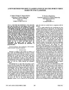
MC-FUME: A new method for compositing individual reflective channels Gil Lissens, Frank Veroustraete, Jan van Rensbergen Flemish Institute for Technological Research (VITO) Centre for Remote Sensing and Atmospheric Processes (TAP) Boeretang 200, B-2400 Mol, Belgium.
Abstract The objective was to develop 10-day composite images of Vegetation's spectral bands. The developed method is called MC-FUME (Median Composite of FUzzy Multispectral Estimate) in the rest of this document, and attempts to make 10-day composite images out of a sequence 10 single day images. The methodology departs from the concept of building blocks (artificial surfaces), which on their own do not represent real vegetation, but in combination can mimick the behaviour of real vegetation with respect to reflectance of incoming sunlight. Introduction The objective of compositing remotely sensed images is to eliminate as much as possible all factors, disturbing the pure Top-of-Canopy signal at a certain observation geometry from the surface, such as clouds and cloud shadow, anisotropy of the surface, composition of the atmosphere etc. Within a 10-day period, changes in ground cover are assumed to remain stable (except of course in case of phenomena that change dramatically the face of the earth in a very short time, such as floodings, snowfall or wildfires). In the case where stability of the surface can be assumed, we can use 10 images to extract a reference image for the period considered. The ten-day period also gives us a fair chance of at least one cloud free image over most regions of the world. If the study area is somewhere near the tropics, a longer period may be preferable. The innovative approach of the project is in the fact that where the usual way to proceed is to combine the spectral information into a vegetation index, and select on the basis of that criterion a certain image, we try first to select an image for a certain spectral band, after which a vegetation index may be constructed. Methodology 1. Construction of a database of 'artificial surfaces'. As mentioned earlier, the idea is to depart from a number of artificial surfaces, with known spectral behavior, simulated by a radiative transfer model called SATCO. This model is used to generate reflectances for a large number of geometric setups (observation/illumination), under a set of conditions which characterise atmospheric turbidity. The resulting database will eventually be used to assign the membership probabilities of real vegetation to belong to a certain artificial surface.
The scheme for the development of such a database is given in Figure 1. Definition of a set of artificial vegetation classes CSAR triplets for artificial vegetation classes
Set of geometries
Set of atmospheres
SATCO Database of Artificial Vegetation classes Class Geometry Atmosphere
TOCnadir
TOA
Figure 1: Development of the database
It is assumed that every real surface type can be composed of 'fractions' of the artificial classes. A satellite signal is thus decomposed into fractions of the signal of different artificial surface types. With these fractions and the database, we can estimate the TOC of a pixel at a reference geometry, according to the scheme in Figure 2. Observed TOA
Observed geometry Calculate nearest viewing and illumination geometry Retrieve distribution of TOA at nearest geometry for every artificial class
Calculate distance of observed TOA to TOA of artificial classes Assign ‘degree of belief’ of the observed TOA belonging to every artificial vegetation class Retrieve TOCnadir for every artificial class Calculate TOCnadir estimate
Figure 2: Calculation of TOCnadir
When this is done for each of the 10 days, a robust way (median) to pick one of the results to represent the pixel in the composite image is chosen. Experiments In a first instance we worked on simulated vegetation classes, in which we were able to control all relevant parameters and tune the models accordingly. In order to test the models on their performance on real satellite images, we used in a first instance NOAA-AVHRR data over Belgium, Germany and the Sahel region in the prelaunch phase of the VEGETATION, always keeping in mind the applicability of the developed methodology to VEGETATION images later, when the sensor had been launched. As a follow up to the project, when VEGETATION images were available, we applied the methodology to several VEGETATION images. The results were comparable to those we obtained using NOAA-AVHRR data, be it a little better, apparently due to the improved co-registration of VEGETATION images compared to NOAA-AVHRR images.
Conclusion and Results The output of the method consists of estimates of TOC values of the earth's surface at a reference observation geometry over a period of 10 days for the RED and the NIR channel of the Vegetation sensor. These are produced from cloud masked, VGT-P products. The method was first tested on AVHRR data, and when images from the VEGETATION sensor became available, also on these images. The developed MC-FUME methodology was compared to the most commonly applied compositing method, known as the MVC-NDVI. This latter method still exhibits a large amount of correlation between the observation geometry and the reflectance in the individual reflective channels of the Vegetation sensor in the composite image. With the new method, this correlation is removed to a very large extent, which means that the reflectances in each of the spectral bands of the composite image, are free of effects occurring due to changing observation geometry in the 10 day period, and thus can more easily be compared. If maps of the individual reflective channel were to be made, MVC-NDVI would introduce a fairly large amount of 'speckle', due to its dependence on observation geometry, while MC-FUME maps have been proven nearly speckle free. A first indication of this can be found in the correlation matrices between the different bands and the angles characterising the observation/ illumination geometry, found in Table 1a and 1b for the MVC-NDVI and the MC-FUME method respectively. RED
NIR
View zenith
0.224
0.363
Solar zenith
0.087
0.275
-0.108
-0.275
Relative azimuth
Table 1a : Correlation coefficients of RED and NIR bands with geometry : MVC-NDVI method
RED
NIR
View zenith
-0.044
0.030
Solar zenith
-0.091
-0.098
Relative azimuth
-0.011
0.031
Table 1b : Correlation coefficients of RED and NIR bands with geometry : MC-FUME method
These tables show the reduction in correlation between the angles of observation and illumination and the individual reflective bands. Further, more elaborated methods for quantification of speckle were developed and implemented, but this would lead us far beyond the purpose of this paper. Suffises to say, that the MC-FUME method consistently performed better on all of these criteria. The images below, showing the NIR reflectance of different surfaces on a single day (cloud free) image, and the composits with the MC-FUME and MVC-NDVI methods give the effect of the speckle reduction on real composit images. Single day image (NIR)
MC-FUME composite (NIR)
MVC-NDVI composite (NIR)
References G. Lissens, E. Brems, F. Veroustraete, Towards a fuzzy vegetation classifier and an optimal compositing strategy for simulated data on land cover, Proceedings of the European symposium on aerospace remote sensing, image processing, signal processing and synthetic aperture radar for remote sensing, Vol. 3217, 1997. E. Brems, G. Lissens, F. Veroustraete, MC-FUME: a new method for compositing individual reflective channels, IEEE Transactions on Geoscience and Remote Sensing, Vol.38, Nr.1, 2000.
Contract and financing Contract no. SP67008 is financed by the Belgian Federal Office for Scientific, Technical and Cultural Affairs (OSTC) in the framework of the SPOT4 - VEGETATION preparatory programme and under the Fourth Framework of the European Commission’s Directorate General XII convention with CNES No. 95/CNES/0449. The project is performed in collaboration with the Université Catholique de Louvain (UCL). Contact Email :
[email protected]