Aug 4, 2011 - 2007] and to open new perspectives of development. CartAGen is a component-based research platform dedicated to generalisation and built ...
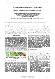
P-115 AUTOMATED GENERALISATION RESULTS USING THE AGENT-BASED PLATFORM CARTAGEN RENARD J.(1), GAFFURI J.(2), DUCHÊNE C.(1), TOUYA G.(1) (1) IGN France, SAINT MANDé, FRANCE ; (2) Joint Research Center, ISPRA, ITALY BACKGROUND AND OBJECTIVES Cartographic generalisation aims at adapting the content of geographic data depending on their scale, to ensure the legibility of a map while preserving its main characteristics. Generalisation automation is a complex issue which has been studied by many researchers for twenty years and resulted in several different models and algorithms. A crucial problem is now to be able to gather all processes to perform global generalisation [Edwardes & al. 2007] and to open new perspectives of development. CartAGen is a component-based research platform dedicated to generalisation and built on top of these processes that has been developed to face this problem of capitalisation. The main interface of the platform is on figure 1. As the core architecture has already been presented and discussed [Renard & al. 2010], the aim of this paper is to present the first cartographic results of CartAGen.
APPROACH AND RESULTS One of the aims of CartAGen is to gather three agent-based generalisation models developed in the past ten years : AGENT, CartACom and GAEL, each of them dedicated to different types of conflicts [Duchêne & Gaffuri 2008]. These three models imported in CartAGen already gave satisfying results, nevertheless they needed to be partly re-engineered to improve their efficiency and their quality. The results automatically computed on CartAGen are quite interesting, some examples being shown on figure 2.
Then many software components have been integrated to help generalisation, for instance geometric transformation algorithms, spatial analysis treatments or new generalisation methods. A knowledge revision component is also currently added. To perform components interoperability, a generic geographic data schema dedicated to generalisation has been created, covering a wide set of spatial objects needed for generalisation, including meso level objects.
As examples of generalisation treatments that have been added to the platform, we should talk about dual carriageway collapsing, using a method adapted from hydrographical generalisation [Regnauld & Mackaness 2006] and described on figure 3. This method opens perspectives for further research on road interchanges generalisation. On another hand, generalisation of a whole city is also almost performed, including street selection in the city centre and typification through the detection and the contextual simplification of building alignments. CONCLUSION AND FUTURE WORK After a first step of building and completing the core of the platform architecture in order to have a strong basis, now we are able to concentrate on the development of new processes based on CartAGen, and we can see that it offers new ranges of technical possibilities. The imported processes allow performing generalisation on many cases, but other treatments could be considered to solve new original issues. The future improvements then consists in :
- importing new models and algorithms to open perspectives, e.g. the elastic beams for network generalisation [Bader 2001], - improving past results to enhance generalisation level, e.g. the achievement of a perfect urban generalisation, - integrating the concept of collaborative generalisation [Touya & al. 2010], - deploying CartAGen as generalisation web services [Edwardes & al. 2007]. With such components, CartAGen progressively becomes a complete platform to solve a wide set of generalisation problems with a high quality level. REFERENCES Bader M. (2001), Cartographic displacement in generalization : Introducing elastic beams, 4th ICA Workshop on Generalisation and Multiple Representation, 2-4 August 2011, Beijing (China) Duchêne C., Gaffuri J. (2008), Combining three multi-agent based generalisation models: AGENT, CartACom and GAEL, 13th International Symposium on Spatial Data Handling (SDH'08), 23-25 June 2008, Montpellier (France) Edwardes A., Burghardt D., Neun M. (2007), Experiments in building an open generalisation system, in Ruas A., Mackaness W., Sarjakoski T., Generalisation of Cartographic Information: Cartographic Modelling and Application Regnauld N., Mackaness W.A. (2006), Creating a hydrographic network from its cartography representation : a case study using Ordnance Survey MasterMap data, International Journal of Geographic Science (IJGIS), Volume 20 Number 6 Renard J., Gaffuri J., Duchêne C. (2010), Capitalisation problem in research – Example of a new platform for generalisation: CartAGen, 13th ICA Workshop on Generalisation and Multiple Representation, 12-13 September 2010, Zurich (Switzerland) Touya G., Duchêne C., Ruas A. (2010), Collaborative generalisation: Formalisation of generalisation knowledge to orchestrate different cartographic generalisation processes, 6th international conference on Geographic Information Science (GIScience’10), 14-17 September 2010, Zurich (Switzerland)