TELKOMNIKA Indonesian Journal of Electrical Engineering Vol.12, No.2, February 2014, pp. 872 ~ 878 DOI: http://dx.doi.org/10.11591/telkomnika.v12i2.4007
872
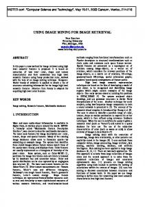
The Raster Image Splicing of Using Oracle Spatial Technology to Research the GeoRaster Data Jingbo Wang International School of Software, Wuhan University, Wuhan, China #37 Luoyu Road, Wuhan, China, 430079 e-mail:
[email protected]
Abstract GeoRaster is a feature of Oracle Spatial that let you store, index, query, analyze, and deliver GeoRaster data, that is raster image and gridded data and its associated metadata. Using geographic information system GeoServer, we can release the raster map data, and allow users to update, delete, and insert the characteristic data. Then, it can be easier to share the space geographic information by GeoServer between users. In fact, due to the enormous data size of the remote sensing image information, so that the same region of image information can be divided into many grids data blocks, and stored into sheets of raster images. To facilitate GeoServer to publish map data, based on the Oracle Spatial GeoRaster architecture, which provided by Oracle database, as well as the “SampleCode_For_Loader” project sample provided by the website, georaster_tools.jar toolkit, we do the secondary development. We splice the region of the same grid data block raster images, and import them into the Oracle database, then make the data as a whole. Keywords: georaster, oracle spatial, raster image, splicing Copyright © 2014 Institute of Advanced Engineering and Science. All rights reserved.
1. Introduction GeoRaster is a general grid data model that is component-based, logical layering and multidimensional. The core data in the grid is a multidimensional matrix composed of grid units (or pixels), and the nuclear grid data sets can be partitioned, then used to optimize the storage, retrieval and processing. Among that, the implementation of the storage which is in the shape of remote sensing image pyramid, and based on Oracle GeoRaster, provides the powerful data storage management mechanism, and has a very flexible data query, access mechanism, and provide strong support for the mass remote sensing image information storage and management [1, 2]. GeoRaster could be used in management of the image data which is captured and generated by remote sensing, photogrammetry and theme drawing and other techniques. It can be used in many fields, such as location-based services, geographic image archiving, environmental monitoring and assessment, geological engineering and exploration, natural resource management, nation defense, emergency response, telecommunications, transportation, urban planning, and homeland security. GeoRaster is aimed at providing the enterprise-level data management functions for large image processing and GIS solutions. Now, developers can integrate the powerful data management technology and the leading image processing and grid analysis tools [3]. Using GeoRaster, you can manage the geographic reference raster data and the spatial vector data in a single Oracle database. This means that the same storage, spatial reference, index and spatial operators can be used to store, query, and retrieve the raster or vector data. In addition, all Oracle tools and utilities now support for the management of grid data and the related data sets in the data servers. For customers, this means that the cost for building and deploying the applications which use the data is down, and the security, scalability and reliability of the application will be greatly improved [4, 5].
Received June 25, 2013; Revised August 19, 2013; Accepted September 16, 2013
TELKOMNIKA
ISSN: 2302-4046
873
2. GeoRaster Data Type 2.1. Basic Data Structure The Basic data structure of raster data is pixel matrix, which have 6 basic element. Pixel, spacial scale, space,time, wave band, attribute of pixel, metadata, processing data and map support data. GeoRaster supports two kinds of basic raster data types: the data based on grid and image data. GeoRaster adopt an integrated raster data model to deal with these data types, and in the documentation, Oracle says that the GeoRaster model is a component-based, logically layered and multidimensional general grid data model. Every pixel in the matrix has one exclusive value which specifies the length of data of each single pixel. This basic data structure determines the raster data sets can be used to optimize the storage, retrieval, and processing [6]. 2.2. SDO_GeoRaster Metadata GeoRaster metadata consists of the following six kinds of information. Object information, raster information, spacial reference system, time reference system, wave band reference system and information of every layer. Based on the data model, GeoRaster object can be described by the metadata XML schema in which there are a lot of components and children components, some of these are crucial while some of them are alternative. So if anybody tries to develop an application based on GeoRaster, such as loader, exporter, the developer needs understand the XML schema [6, 7]. 2.3. Space Coordinates System Pixel coordinate system is the position of the pixel in the pixel matrix, and it contains rows, columns, and bands, three components in proper order. Ground coordinate system is the geodetic coordinates of the actual location which corresponds to pixel. Geographic coordinate system is not the only one, may be the latitude, or may be other kind coordinate which can correspond to the value of Oracle SRID, which contains X and Y, two coordinate components in turn. The X and Y of geographic coordinates separately correspond to the column and row in the pixel coordinate system, and the logic layer corresponds to the wave band [8].
Figure 1. Show the Relationship between the Raster Image and its Associated Geographic Range and the Relationship between Each Part Image and its Related Geographic Entity
The right big rectangle represents the actual geographical area, and the left rectangle is the image of the geographical area on the right side. Each pixel in the image can be confirmed by a unit in the coordinate system (associated with raster image). The diagram clearly expresses the relationship between their coordinate systems and elements. The Raster Image Splicing of Using Oracle Spatial Technology to Research… (Jingbo Wang)
874
ISSN: 2302-4046
For geographic coordinate, GeoRaster now supports only two-dimensional data. The mapping between the pixel coordinate system and the geographic coordinate system is released by three kinds of reference frames (Spatial reference system, SRS; Temporal reference system, TRS; Band reference system, BRS) defined by GeoRaster [6].
3. GeoRaster Physical Storage The core of GeoRaster is to design the physical model used to promote the data storage and management of the raster or grid-based data in database. In the GeoRaster engine, it defines the native data type named SDO_GEORASTER, and each image and raster grid is stored as this native type. GeoRaster table is a table which is defined by users, and contains at least one SDO_GEORASTER data column. SDO_GEORASTER object contains how to retrieve the metadata and information of GeoRaster unit data which is stored in other table named raster data table which is user-defined. SDO_RASTER type contains one BLOB column called RASTERBLOCK, and it stores the actual raster block.
Figure 2. GeoRaster, the Data in Oracle Database
A raster data (image or grid), as an object of SDO_GEORASTER data type, is stored in Oracle. SDO_GEORASTER data type has five attributes, rasterType (NUMBER), spatialExtent (SDO_GEOMETRY), rasterDataTable (VARCHAR), rasterID (NUMBER) and metadata (XMLType). Actual raster unit data is divided into smaller data block subset, in order to achieve large-scale GeoRaster object storage and optimal searching and processing. All of the data block is stored in the tables with SDO_RASTER type, and the type has seven attributes, rasterID (NUMBER), pyramidLevel (NUMBER), bandBlockNumber (NUMBER), columnBlockNumber (Number), blockMBR (SDO_GEOMETRY) and rasterBlock (BLOB). The figure below as an example illustrates the storage of the GeoRaster object.
Figure 3. The Physical Storage of GeoRaster Data
TELKOMNIKA Vol. 12, No. 2, February 2014: 872 – 878
TELKOMNIKA
ISSN: 2302-4046
875
The rasterDataTable and rasterID attribute of SDO_GEORASTER object provide the information needed by storing and retrieving the grid unit data in the raster data table. Internally, GeoRaster uses the system dictionary (called GeoRaster sysdata table) to maintenance the GeoRaster object and the relationships among the raster data tables. Even stored in the different RDT tables, the grid unit data of GeoRaster object will be handled by GeoRaster function automatically [8]. Between the GeoRaster Table and raster data table, there is a one-to-many relationship, that is, all of the data blocks which a raster data table contains must be derived from a GeoRaster Table.
4. Research Method 4.1. Project Sample There are three main class files that realize the import function of a single raster image. “GeoRasterMetadata.java”, this class defines all the attributes information of GeoRaster metadata, and provides some basic operating functions of metadata, such as obtaining the metadata information of this image based on the RenderedOp image object, generating the metadata attributes information into the XML document object with the specified format, and so on [9]. “JGeoRasterSRS.java”, this class defines all the attributes information of the spatial reference system information, including the SRID, and X, Y, Z direction-resolution and scaling, etc. Also it provides the reading and processing methods of the georeferenced ESRI World File. “SampleGeoRasterLoader.java”, this class mainly consists of a main function, which used to perform the whole process of reading raster images and importing them into the database. There are another function, writeRasterData, which used to store the grid blocks in the form of a binary stream, into the BLOB object of the Oracle database [9]. 4.2. The Relationship of each Grid Block Grid blocks are stored in the raster data table in the form of a record, and its type is sdo_raster. BandBlockNumber, rowBlockNumber and columnBlockNumber, three columns identify the (band dimension, row dimension, column dimension) of the grid block in raster images; and the blockMBR property shows the minimum boundary rectangle of the data block, the SDO_GEOMETRY type data whose SRID property is NULL, shows that the space coordinate system of the space object is the image coordinate system, at the same time, all coordinates are integers [10]. According to the attribute information, we can judge the location of the relationship between grid blocks.
Figure 4. Raster Data Table-A Grid Block Record
While importing many raster data blocks, you need to consider the access and write-in operation of the other properties of each raster block. At the same time, you must judge clearly the relationship of the location between each grid block. 4.3. Required Attributes in Metadata In metadata attributes, there are three kinds attributes, “dimensionSize”(row, column, band), “ULTCoordinate”(row, column, band), “blocking”(totalRowBlocks, totalColumnBlocks, totalBandBlocks...). While importing many raster images data, you need dynamically update these attributes.
The Raster Image Splicing of Using Oracle Spatial Technology to Research… (Jingbo Wang)
876
ISSN: 2302-4046
Figure 5. Metadata
4.4. Process First, obtain an Oracle database Connection, then, query the GeoRaster object with the specified rdtID, rdtName and has been initialized in the database. Accroding to the SQL statement, create the GeoRaster Table and the RDT Table manually. 1) Create raster table: CREATE TABLE geor(id NUMBER, img MDSYS.sdo_georaster); 2) Invocation process, create DML trigger for the grid table: call sdo_geor_utl.createDMLtrigger('geor','img') 3) Create raster data table: CREATE TABLE geor_rdt OF MDSYS.sdo_raster(primary key(rasterid, pyramidlevel, bandblocknumber, rowblocknumber, columnblocknumber)); 4) Establish a link between the raster table and the raster data table INSERT INTO geor VALUES(1, MDSYS.SDO_GEOR.init ('geor_rdt',1)); Obtain the SDO_GEORASTER type object and the values of its five attributes (rasterType, spatialExtent, rasterDataTable, rasterID, metadata) from the results of that query; Then, read the raster image, and obtain the RenderedOp object, write the raster blocks data of this object into the RDT Table; Of course, while obtaining the raster blocks, you must obtain (rasterId, pyramidLevel, bandBlockNumber, rowBlockNumber, columnBlockNumberm, blockMBR) these six attributes information, and then to write that into the records in the RDT Table. After inserting the data into the RDT Table, you need to update the metadata of GeoRaster. Because you initialize the sdo_georaster object in the GeoRaster Table with a NULL value, then when you insert new raster blocks data records into the raster data table, you need to update the sdo_georaster object and its metadata attributes in the GeoRaster Table. Based on the implementation before, we will continue to improve the function. Modify the reading of a single raster image to the reading of all the specified raster format images from the specified directory; modify the write-in operation of a single raster block data to that, iterating over all grid data block, in a unified way, and according to the location information of each raster block, write them into the raster data table in turn; while updating the SDO_GEORASTER object in the GeoRaster Table, not only to update the basic metadata attributes, but also to update the attribute information which mentioned in Figure 5 [11].
5. Results and Analysis In this thesis, we adopt three raster images data as shown in the figure below for experiment, and use the function that realize importing a single raster image data in sample
TELKOMNIKA Vol. 12, No. 2, February 2014: 872 – 878
TELKOMNIKA
ISSN: 2302-4046
877
project, and study what attributes are associated with multiple pieces of raster image. Then, do some modification and testing accordingly.
Figure 6. Raster Image Data Directory
The results as shown in the figure below:
Figure 7. The Result of Import Three Adjacent Raster Image Data
6. Conclusion In this paper, we just import three adjacent raster images into database, and the row and column numbers all start from zero. From the results and analysis of part 5, we got that this particular situation can be realized and shown completely. In the futue, we will continue to study more general situation, such as importing the nonadjacent grid image, and ranking the row and column numbers not start from (0,0). We need to solve a series of problems when studying these problems.
References [1] Changyong Gu. The Authoritative Guide of Oracle 11g. 2011; Version 2. [2] Xie Jeffrey, Li Zhun, Xu Weisheng. American Society for Photogrammetry and Remote Sensing[C] Annual Conference of the American Society for Photogrammetry and Remote Sensing. Prospecting for Geospatial Information Integration. 2006; 3: 1626-1633. [3] Families Yuri. The Spatial Information Management of Oracle Spatial: Oracle Database 11g. 2009. [4] Xiaochun Wu, Kai Wang, Zixuan Su, Yanjun Liu. Research and implementation of the high-availability spatial database based on oracle. Proceedings International Conference on Computer Science and Service System, CSSS. 2012; 1713-1716. [5] Chengzhi Deng, Saifeng Hu, Wei Tian Min Hu, Yan Li, Shengqian Wang. Total Variation based
The Raster Image Splicing of Using Oracle Spatial Technology to Research… (Jingbo Wang)
878
[6] [7] [8] [9] [10]
[11]
ISSN: 2302-4046
Multivariate Shearlet Shrinkage for Image Reconstruction. TELKOMNIKA Indonesian Journal of Electrical Engineering. 2013; 11(1): 40-47. Guangshi Li, Quansheng Xu, Xinhui Shi. The Spatial Raster Data Storage and Management Based on Oracle 10g Spatial. 2007. Guangshi Li, Computer center, Anshan Normal University, Anshan Liaoning. Research on Management Method of Raster Data based on Oracle 10g Spatial. 2011. Guangshi Li. Research on method of encrypting raster data on Oracle 10g spatial. 2011 IEEE 3rd International Conference on Communication Software and Networks. ICCSN. 2011; 353-356. Yuanrong He. The Development and Application Guidelines of Oracle Spatial Spatial Database. 2008. Qin, Jingtao, Wu, Sheng. Studies on multi-source image data management based on GeoRaster. 2010 2nd IITA International Conference on Geoscience and Remote Sensing. IITA-GRS. 2010; 1: 487-491. Yang Wang, Guofeng Qin. A Multicore Load Balancing Model Based on Java NIO. TELKOMNIKA Indonesian Journal of Electrical Engineering. 2012; 10(6): 1490-1495.
TELKOMNIKA Vol. 12, No. 2, February 2014: 872 – 878