J.L. Gonzfilez-Rebollar, A. Garcia-Alvarez and J.J. Ib~,fiez. Centro de Ciencias ... This evaluation is carried out for each CR,W hypothesis. Data P from each ...
Climate Change Research: Evaluation and Policy Implications S. Zwerver, R.S.A.R. van Rompaey, M.T.J. Kok and M.M. Berk, (Eds.) 9 Elsevier Science B.V. All rights reserved.
757
A mathematical model for predicting the impact of climate changes on Mediterranean plant landscapes J.L. Gonzfilez-Rebollar, A. Garcia-Alvarez and J.J. Ib~,fiez Centro de Ciencias Medioambientales, CSIC, Serrano 115 bis, 28006 Madrid, Spain
Abstract
The main properties of a phytoclimatic model are explained. It is a technique for theoretic simulation but a field work verification is essential. The methodology involves the transformation of a territory's general phytoclimate data into particular phytoclimate estimates. We are dealing with a simple mathematical climate-soil-relief-vegetation model offering the possibility of predicting changes in vegetation liable to occur at any point in the Iberian peninsula's territory, when the climate data values of a site change as compared with data currently estimated. It consequently enables both alterations and sensitivity of potential plant communities to possible climate changes to be detected and predicted at a certain point in the territory. Using this methodology, it is possible to analyze the repercussions which it is assumed the green house effect would cause according to General Circulation Models (GMCs). A representative case for Le6n province in the NW of the Iberian peninsula is analyzed. 1. INTRODUCTION In addition to the direct influence of the climate on vegetation (the macroclimate) it also exerts an indirect influence via the soil and other environmental factors (the meso/microclimates). The vegetation in the Mediterranean region results from the complex interaction between the climate and other environmental factors. Mathematical models however, cannot accurately represent these interactions and can only identify and simulate general patterns of behaviour. The model presented here has been used in a number of studies to interpret Mediterranean vegetation of the Iberian peninsula [ 1-4]. This study focuses on the variation in vegetation resulting from temperature increases of 1 and 2.5 degrees, guided by predictions resulting from the application of General Circulation Models (GMCs). One must bear in mind however, that edapho-topo-climatic variations in the Mediterranean region are based on a wide range of situations that reflect great diversity and complexity. This study was carried out in Leon province in the NW of the Iberian peninsula. This province is situated on the border between the temperate regions of West Europe (in the N and NW of Spain) and the Mediterranean region. In this study we collected mean monthly precipitation and temperature data from 47 sampling sites distributed over the whole province. This model enabled us to work with different hypotheses that attempt to reproduce distinct geomorphological and edaphic situations. In this case however we have only considered the effects of an increase in temperature.
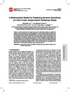
758 2. M E T H O D O L O G Y The mathematical model used for prediction was described some years ago by one of our team [1] and used to model phytoclimatic-vegetation relationships. The methodology consists of different stages (Fig. 1): 2.1. Phase 1.
The climatic data (precipitation, temperature and evapotranspiration) are transformed to: A)postdictive estimates, B)predictive estimates or C) remain unchanged. This phase allows us to simulate macroclimatic modifications in time in the fight ofpaleoclimatic territorial studies, predictive models or using current data. 2.2. Phase 2.
Transformation of climatic data to phytoclimatic estimates by means of a theoretical simulation of the conditions of the biotope. These are simulations of A) exposure (N or S), B) water loss due to drainage and C) hydric retention in soil. Variations in exposure affect the temperature (T) and the evapotranspiration data; lateral drainage is estimated by means of a runoff coefficient (W), and hydric retention by means of the retention capacity (CR). Monthly precipitation (P), evapotranspiration, runoff" and retention capacity are integrated into the water balance in each location, which allows us to evaluate the monthly availability of water in the soil (D). This evaluation is carried out for each CR,W hypothesis. Data P from each location "i" are thus transformed to estimates D. But D is a parameter that depends on which hypothesis (CK, W) is being considered, there is therefore the same number of monthly estimates of D as there are formulated hypotheses CR, W (Fig. 2). D = DO + P - W P - E
where:
D = Available water P - Precipitation W = Rate of runoff DO = Available water retained CR = Retention capacity E = Evapotranspiration After the water balance, the direct bioclimatic repercussion of the temperature will be evaluated: IBP = f (T - t) where: IBP-- Potential Bioclimatic Intensity T = Temperature t = Minimum vegetative temperature
759
[
DATA BASE
DISCIIIMINANT SIMULATION ANALYSIS ~ DATA " ~ TRANSFORMATION
]
MeteorologicalH ~ ! Potential Variables ] [ ~ '1 'h~l-;-cl)m"-lir
CLIMATE
j[
~_~ 1~ - - ~
~.~
eo,..,,.,
,
~
Figure 1. General scheme of the model
i
I
":
,"~ I
t .,
'.
'>
I '~
:.,
1 i '
~o=
,:,(c r)
D=
Do+P--coP--E
[ w~.TER8ALA.cE!
,,.m
Biologically
15o
o p e n A v a i l a f h a s eIb tDe ~>~ EE> ~> ~E~ >e e water
.
_
2>~E"' r
~
/
~
/Rechargephase
Percolation
/ 1 sO i e c h a Soil moisture storage
cr ] F M A M ]
]
" ~ o A S 0 N D
Figure 2. Basis of the model
rge
Deficit of water
760 Attempts to measure the degree of vegetative activity/inactivity taking into account the double concept of temperature and hydric availability: IBR = Cp * IBP
where:
IBR = Real Bioclimatic Intensity Cp = f (D - e / E - e) e = Minimum vegetative evapotranspiration The general formulas of this hygro-thermic process of bioclimatic estimation can be found in [ 1]. For each hypothesis CR, W, the data P, T and E of a site are transformed into a phytoclimatic vector (F). The vector F obtained from the climatic data of a location "i", using the hypothesis CR = "J" and W - "K", will be called F (i,[J,K]). Likewise we can assume the hypothesis CR, W (eg. CR = Maximum and W = 0) and modify the T values as we have shown here. In this case an increase or decrease in temperature will change the phytoclimatic vector F (in this case F [i, Max CR/W=0]). 2.3. Phase 3. This analyzes the answers of the test. We try to identify the sequential phytoclimatic answers in different temperature hypotheses ( F [i, Max CR/W=0], by means of its degree of similarity (probability) to reference phytoclimatic types: F (Tactual), which are correlated with the potential vegetation Vp. As a consequence, this phase includes two different aspects: - The obtention of reference phytoclimatic types - Identification/classification of hypothetical F (i, Max CRAV=0). We consider that both aspects can be solved using Discriminant Analysis. By means of this analysis, we can establish the zonal phytoclimatic typology in the territory and its Discriminant Functions, and we can refer the rest of the simulated phytoclimates to this typology (mathematically represented by the centroids of the zonalphytoclimatic group). In conclusion: - The methodology involves the transformation of a territory's general phytoclimatic estimates (in time and in space). The transformation is carried out by means of a theoretical simulation of site conditions (precipitation, temperature, geomorphology, soil, etc.) For each location, one must differentiate the theoretical phytoclimatic environment, which is similar to the zonal conditions, from the other estimates, obtained by nonzonal simulation (eg. increase in temperature, from the perspective of climatic change) - The vectors F (i, Max CRJW=0) are grouped according to the type of zonal vegetation to which the location '~ belong. Each group configures a numerical environment "type" (Discriminant analysis). - The intrazonal phytoclimates F (T1, T2 .... Tn) are classified/identified by their similarity to the zonal phytoclimatic typology which is discriminated numerically in the last phase. -
-
=
~
4
~ e
o
9
k a
o
9
Z
9
9
o
o
~
0
II
O,,r
,
~e
"~
@,.,
0